
FSX EGBE Coventry UK Scenery
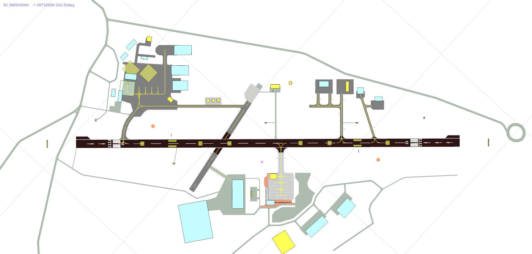
Coventry Airport EGBE scenery refreshes the Baginton airfield with custom buildings, perimeter roads, and realistic ground clutter for more convincing operations in Microsoft Flight Simulator X. It models runway 05/23 with accurate displaced thresholds, closes runway 17/35, and improves approach cues with repositioned PAPIs; optional touchdown zone markings require rwy_mark.zip.
 United Kingdom
 - File: coventryfsx.zip
- Size:659.5 KB
- Scan:
Clean (30d)

- Access:Freeware
- Content:Everyone
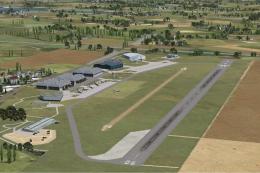
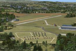
Positioned in the Baginton area of Warwickshire, Coventry Airport (EGBE) offers this freeware enhancement by John Ball for Microsoft Flight Simulator X. This release adds a broad range of improvements around the original airfield layout, including refined perimeter roads, static clutter, and numerous structures suited to realistic flight operations. It aims to retain the local atmosphere while incorporating helpful navigation aids and enhanced visual cues.
Regional Details and Architectural Touches
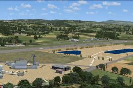
Coventry Airport lies near the city of Coventry and has historically supported various aviation services. Although the real-world airfield once accommodated commercial flights, this particular scenery aims to capture the facility’s overall vibe while introducing fictional details that complement the sim environment. The main runway 05/23 remains the focal point, stretched to its actual length of approximately 6,600 feet (about 2,010 meters). Displaced threshold zones of 600 feet for runway 05 and 700 feet for runway 23 are accurately depicted, matching the real measurement data. Runway 17/35 is completely shut in this package, reflecting many real-world closures that happen over time.
Overview of EGBE Coventry UK Scenery.
Flight Deck Enhancements and Runway Data
Recognizing that the basic representation of Coventry Airport in the simulator can seem sparse, John Ball integrated custom buildings, ground layouts, and perimeter roads. These updates are fictional in some respects but honor the general airfield arrangement. Extra turning areas have been placed at both runway ends for better maneuverability with larger aircraft, even though these do not match the real field precisely. Additionally, the Precision Approach Path Indicators (PAPIs) were adjusted to reside about 1,000 feet from both thresholds, improving visual alignment when setting up final approaches.
Optional Runway Numbering and Markings
For extended immersion, Lance Tucker’s freeware runway marking library (identified as rwy_mark.zip) is recommended. When installed, touchdown zone markings appear on runways under 6,000 feet, a feature that Microsoft Flight Simulator X typically omits at shorter airfields. If you prefer not to add these extra objects, the package will still run smoothly without them—just be aware that you’ll miss out on fully detailed touchdown zone markers.
Primary Changes at a Glance
- Enhanced runway 05/23 with realistic length and displaced thresholds.
- Closed runway 17/35, consistent with the project’s fictional approach.
- Additional buildings, static objects, and ground traffic elements.
- Redesigned perimeter roads to emulate the airport’s distinctive layout.
- Resited PAPIs and hand-placed runway markings for improved visuals.
Installation Steps
- Place all four EGBE_ADEX files into your “Addon Scenery/Scenery” directory under the main FSX folder.
- If desired, acquire and insert “rwy_mark.zip” to enable the custom touchdown zone markings (instructions included within that download).
- Launch Microsoft Flight Simulator X and select EGBE (Coventry) to load into your newly upgraded airport environment.
This scenery has been tested on a standard setup without additional terrain add-ons. It is designed specifically for stock FSX installations, so performance and compatibility should remain stable as long as the stated instructions are followed. John Ball has endeavored to capture the essence of Coventry Airport’s operational feel for simmers who appreciate a more immersive flying experience in the West Midlands region.
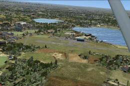
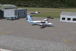
Images & Screenshots

Finding the Scenery
- FSX/Prepar3D Coordinates:
-
52.36940000,-1.47860000
Use the downloaded flight plan file by launching FSX/P3D, selecting "Load Flight Plan" in the flight planner, and choosing the .pln file. Your aircraft will be positioned directly at the add-on’s location. - Decimal Degrees (DD):
-
Latitude: 52.369400°
Longitude: -1.478600° - Degrees, Minutes, Seconds (DMS):
-
Latitude: 52° 22' 09.840" N
Longitude: 1° 28' 42.960" W
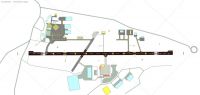
Map Location
The archive coventryfsx.zip has 8 files and directories contained within it.
File Contents
This list displays the first 500 files in the package. If the package has more, you will need to download it to view them.
| Filename/Directory | File Date | File Size |
|---|---|---|
| EGBE 33.jpg | 01.29.11 | 95.61 kB |
| Coventry Readme.txt | 01.29.11 | 2.62 kB |
| EGBE_ADEX_JB_CVX.bgl | 01.29.11 | 1.55 kB |
| EGBE_ADEX_JB.ad2.ad2 | 01.29.11 | 554.65 kB |
| EGBE_ADEX_JB.BGL | 01.29.11 | 25.31 kB |
| EGBE_ADEX_JB.xml | 01.29.11 | 207.96 kB |
| flyawaysimulation.txt | 10.29.13 | 959 B |
| Go to Fly Away Simulation.url | 01.22.16 | 52 B |
Installation Instructions
Most of the freeware add-on aircraft and scenery packages in our file library come with easy installation instructions which you can read above in the file description. For further installation help, please see our Flight School for our full range of tutorials or view the README file contained within the download. If in doubt, you may also ask a question or view existing answers in our dedicated Q&A forum.

0 comments
Leave a Response