FSX Mojave Boneyard Scenery
Mojave Boneyard scenery brings KMHV in California to life with aircraft storage areas laid over MegaScenery Earth California photoscenery, using only default airport elements and stock objects for a clean, compatible look in FSX. Choose Normal, Dense, or Really Dense layouts to control how fully the yard is populated.


 United States of America
 - File: kmhvboneyard.zip
- Size:1.49 MB
- Scan:
Clean (2d)

- Access:Freeware
- Content:Everyone
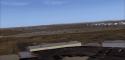
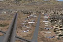
Mojave Boneyard (KMHV). This Mojave Airport, California (CA) scenery file is based on MegaScenery Earth California and builds on their photoscenery of KHMV Mojave. The airport is the default and all scenery objects are from the FSX and Acceleration default objects folders. Tested in both DX9 and 10 By Chuck Bosn.

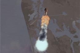
Screenshot of Mojave Boneyard Scenery.
This is a scenery file only, no traffic. This scenery file is based on MegaScenery Earth California and builds on their photoscenery of KHMV Mojave. I also have the FSG Mesh installed but it should work fine without it.
The airport is the default Microsoft FS airport and all scenery objects are from the FSX and Acceleration default objects folders.
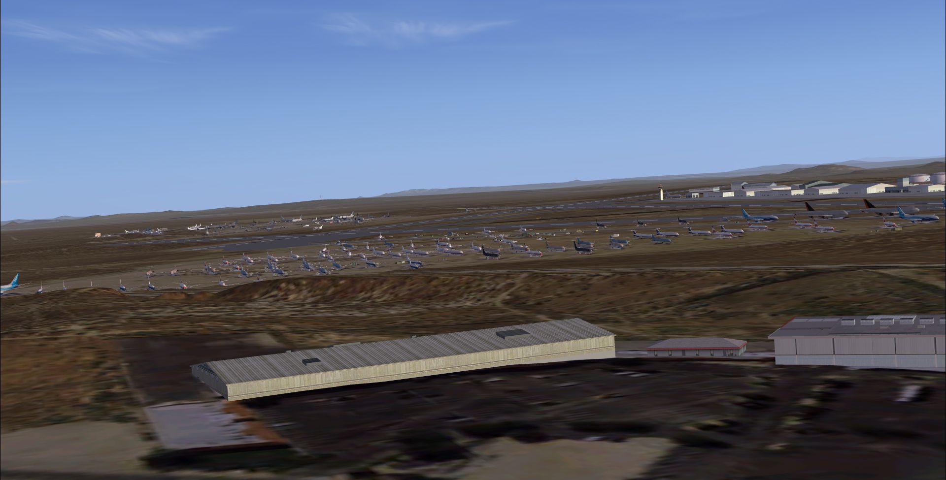
3 levels of population, Normal, about half the yard is populated. Dense, about three fourths of the yards show. Really Dense, the yard is full.
Install:
Unzip to a temp file, Cut and paste the file "MSEUSCA Mojave Boneyard.bgl" into your: Addon Scenery/Scenery folder. Start FSX.
Tested in standard FSX and DX10 preview.
Once again, use at your own risk, no warranty or returns implied. No assumption of fault or guilt assumed.
Happy flying!
Chuck Bosn

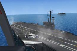
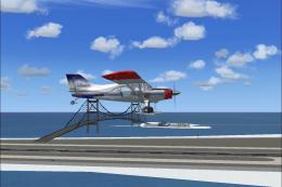
Screenshot of Mojave Boneyard Scenery.
Images & Screenshots

Finding the Scenery
- FSX/Prepar3D Coordinates:
-
35.06540000,-118.15160000
Use the downloaded flight plan file by launching FSX/P3D, selecting "Load Flight Plan" in the flight planner, and choosing the .pln file. Your aircraft will be positioned directly at the add-on’s location. - Decimal Degrees (DD):
-
Latitude: 35.065400°
Longitude: -118.151600° - Degrees, Minutes, Seconds (DMS):
-
Latitude: 35° 03' 55.440" N
Longitude: 118° 09' 05.760" W
Map Location
The archive kmhvboneyard.zip has 7 files and directories contained within it.
File Contents
This list displays the first 500 files in the package. If the package has more, you will need to download it to view them.
| Filename/Directory | File Date | File Size |
|---|---|---|
| KMHV BoneYard | 01.31.11 | 0 B |
| MSEUSCA Mojave Boneyard.bgl | 01.31.11 | 15.65 kB |
| Readme.txt | 01.31.11 | 922 B |
| Untitled-1.jpg | 01.31.11 | 802.14 kB |
| Untitled-2.jpg | 01.31.11 | 785.95 kB |
| flyawaysimulation.txt | 10.29.13 | 959 B |
| Go to Fly Away Simulation.url | 01.22.16 | 52 B |
Installation Instructions
Most of the freeware add-on aircraft and scenery packages in our file library come with easy installation instructions which you can read above in the file description. For further installation help, please see our Flight School for our full range of tutorials or view the README file contained within the download. If in doubt, you may also ask a question or view existing answers in our dedicated Q&A forum.


0 comments
Leave a Response