 FSX Scenery
KERI 2012 Runway Extension
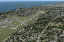
KERI 2012 Runway Extension. Scenery of Erie, Pennsylvania (PA), Erie Internat…
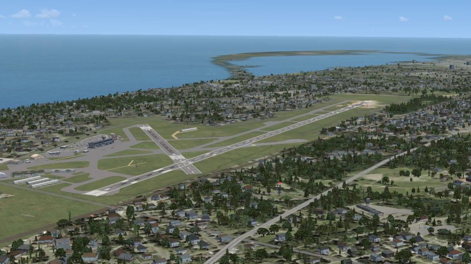
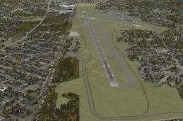
Erie International Airport / Tom Ridge Field (KERI) in Pennsylvania gets a detailed 2012-style runway 6-24 extension, depicting the planned 8,350-foot layout alongside refined taxiways and corrected field details. Built with stock objects for FSX, the scenery enhances realism while keeping performance-friendly visuals and a faithful airport footprint.

KERI 2012 Runway Extension. Scenery for Erie, Pennsylvania (PA), Erie International Airport / Tom Ridge Field (KERI). This is an update to the previously issued 2012 runway 6-24 extension project simulation. This simulation depicts the expected appearance of the runway extension at Erie International Airport when it is complete. By Richard O. Finley.
-Scenery-fsx1_medium.jpg)
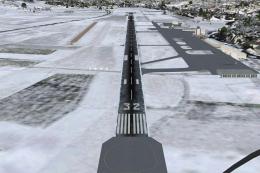
Screenshot of KERI 2012 Runway Extension.
Erie International Airport began as Griswold Field in the early 1920s. It has grown steadily since then.
Erie has been well positioned for innovation. It is large enough to give new equipment a fair test but small enough not to cause a major problem if it does not work. Erie got one the first ILS installations in the 1940s. In the early 1970s it was one of the first ASR-7 radar installation sites. In the 1980s It was the first site in the nation to get The ARTS-IIA automation system.
While this is not really an innovation, Erie in now in the process of adding approximately 1850' (ADE9X measures new runway to 8350') to runway 6-24.
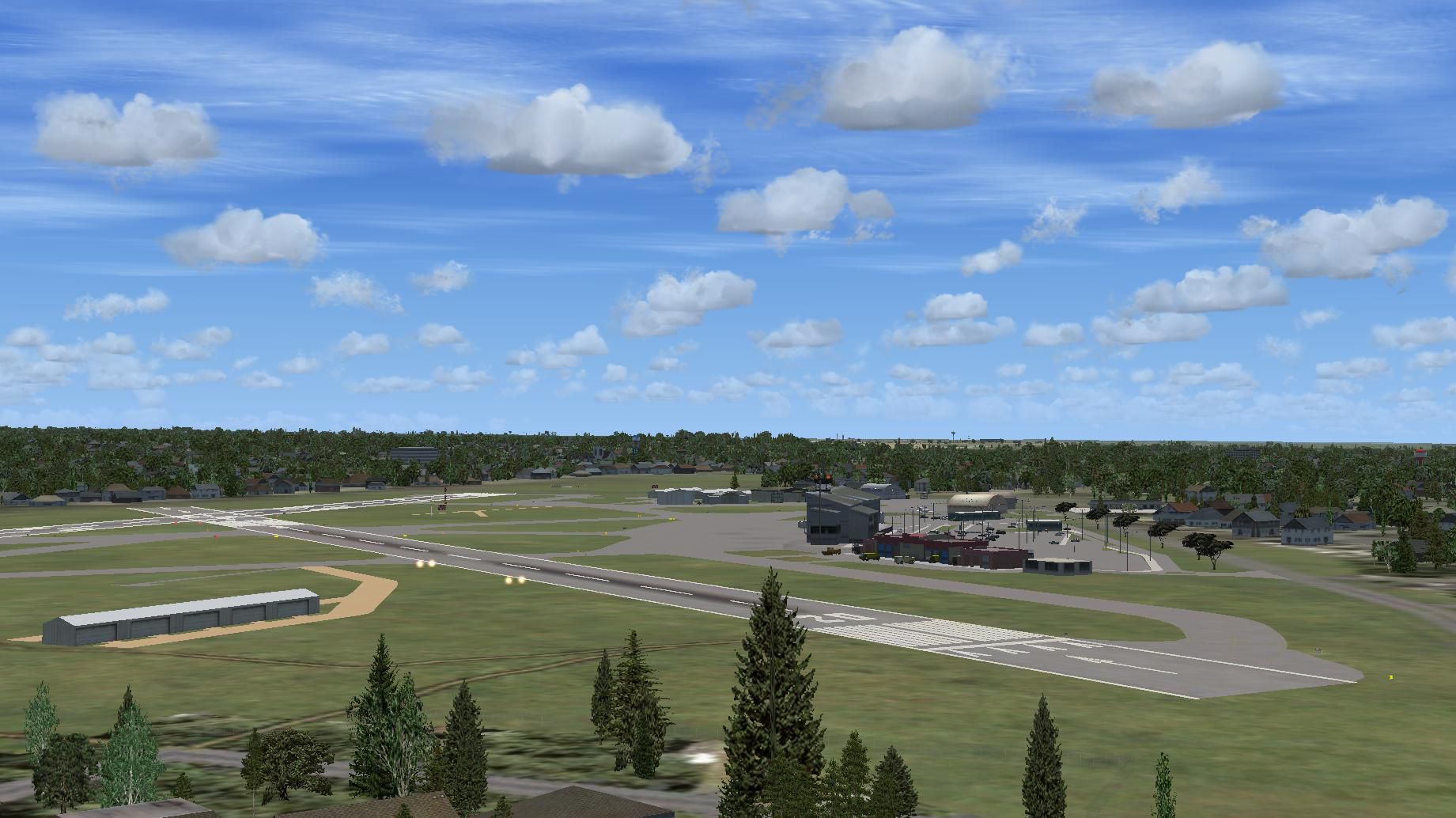
It appears that the parallel taxiway for the new extension is misalligned. Well, it is and that is the way it was designed! Use caution, men & equipment working between rwy 6-24 and the parallel taxiway in the area of the new extension. Feel free, Mrs Robinson, to stroll around the grounds until you feel at home. There is an couple of Easter eggs to be found.
The stock incarnation of KERI leaves much to be desired in FSX. A lot of detail has been added or corrected using a Google Earth and Erie International Airport's own drawing as an overlay. There are no photo-real buildings used here. This simulation uses all stock buildings and features available in ADE9X so a little imagination is required.
Installation:
This scenery is for FSX only. Put the two .bgl files from the downloaded Zip file into the folder~~microsoft flight simulator X\addon scenery\scenery. If you already have the construction phase version installed, it will ask you if you want to ovwerwrite the existing files. If you want to preserve the old version, you will need to store the two .bgl files with KERI in their filename somewhere that FSX cannot find them.
Hope you enjoy it.
Richard O. Finley
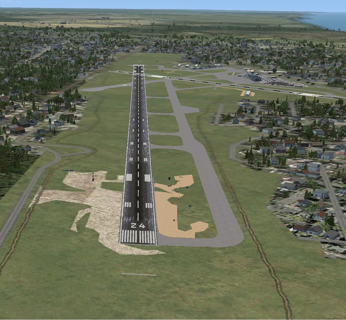
-Scenery-fsx2_large.jpg)
Screenshot of KERI 2012 Runway Extension.
Free for all simmers · 671.53 KB · Scanned clean Jul 2026
Download speed: Free tier is capped at 0.5 Mbps. PRO members download at full line speed.
FSX\Addon Scenery\ containing scenery and texture sub-folders.readme.txt or README file. It tells you exactly where files go, what dependencies are needed, and any quirks specific to this add-on.Use these coordinates to fly directly to this location once the mod is installed.
42.08000000,-80.18000000
Launch FSX or Prepar3D and use Flights → Load to open the downloaded .pln file. Your aircraft will be positioned at this location.
The archive eri_ext_finished.zip has 8 files and directories contained within it.
This list displays the first 500 files in the package. If the package has more, you will need to download it to view them.
| Filename/Directory | File Date | File Size |
|---|---|---|
| KERI_ADEX_ROF.BGL | 03.14.12 | 51.18 kB |
| ERI 2012.jpg | 03.14.12 | 257.48 kB |
| ERI Airport Update.jpg | 03.08.12 | 214.59 kB |
| ERI Runway Extension.jpg | 03.14.12 | 184.56 kB |
| Readme.txt | 03.14.12 | 3.12 kB |
| KERI_ADEX_ROF_CVX.bgl | 03.14.12 | 3.94 kB |
| flyawaysimulation.txt | 10.29.13 | 959 B |
| Go to Fly Away Simulation.url | 01.22.16 | 52 B |
Only PRO members can place votes.
More FSX & P3D add-ons hand-picked based on this download.
FSX Scenery
KERI 2012 Runway Extension. Scenery of Erie, Pennsylvania (PA), Erie Internat…
 FSX Scenery
Runway Extension Bern Belp (LSZB), Switzerland. Extends the runway, updates I…
 FSX Scenery
(KERI) Tom Ridge Field, Pennsylvania (PA), USA. This is an update to fully in…
 FSX Scenery
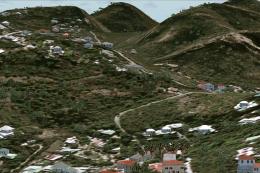
St Barthelemy island (TFFJ) is situated in the Caribbean Sea. It's small slop…
 FSX Scenery
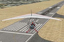
Princess Juliana Airport (TNCM) runway fix; changes runway 9/27 to 10/28. By …
FSX Scenery
Zadar Airport ILS Runway 14. The standard airport shipped with FSX does not s…
 FSX Scenery
Runway Fix For SKCG, Rafael Nunez Airport. Adds more realistic runway marking…
FSX Scenery
Lahr Air Base Runway Fix (EDTL), Germany. This file solves the problem with t…
Be the first to leave a comment on this download.
Be the first to share your thoughts on this download.