Page 2
Searches the whole library — filter by sim & category on the results page
Autogen spans the globe with a three-dimensional effect and a broader range of surface finishes. AutoGen3D.JPG appears as the accompanying image by Valentin Casares, reinforcing the worldwide scope…

An upgrade for KSEA in Washington refines the airport’s building visuals by using imagery captured on-site at Seattle-Tacoma, drawing on authentic on-location perspectives to better represent the f…
By Mick Posch, replacement visuals for trees may work in earlier versions. They replace default tree appearances without altering size, placement, or quantity, and they add variety and realism acro…
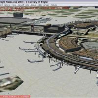
Las Vegas McCarran Airport, identified by the KLAS code in Nevada, undergoes a complete rework that reshapes Las Vegas’s airfield layout. By Jaxan Prier and Jose Gutierrez of Mach-1 Design Group, t…
Recognisable ground visuals cover Hampshire and neighbouring counties in southern England, Europe, with towns and the New Forest shaping the landscape. It uses EZ-Landclass by Russel Dirks, no extr…
An extensive upgrade to the default airport at Dallas/Fort Worth International Airport (KDFW) in Texas marks version 3 and adds the new Terminal D, integrating it with the surrounding airfield layo…
An all-new Hilo airport layout features an open-air terminal without windows and doors, a rental car area outside the main entrance, an inter-Island terminal, parking, a heliport for volcano tours,…
Logan International Airport spans about 2,400 acres in East Boston and operates five runways plus a 237-acre concrete and asphalt apron. The airfield includes five terminals, A through E (Internati…

The demo features the USS Enterprise model and a landing area near Puerto Rico with a hard surface. The payware version from AlphaSim includes ten locations worldwide and deck configurations with A…
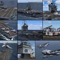
The USS Enterprise carrier model shows a complete surface detailing and a single landing area near Puerto Rico. The complete version spans ten locations worldwide, with deck configurations includin…
 Base Model
Jeff Higgins revises Groom Lake, Nevada, presenting a tighter portrayal of the location and tying the revision to a specific geographic reference. Area512006Sa.JPG appears as the corresponding imag…
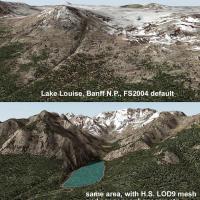
Across Banff National Park from Canmore to Lake Louise, coordinates N49-53, W112-116 adjust lake elevations to fit the mesh. The work adds new lakes, roads and landclass in the region, while some e…
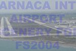
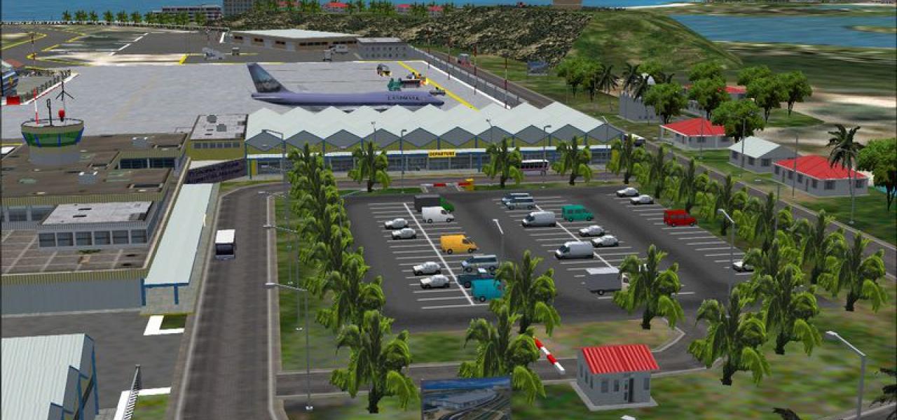
Antonis Antoniou and Marios Anastasiou present Larnaca International Airport (LCLK) in Cyprus, identifying its IATA code and noting the location near the city of Larnaca, with two authors collabora…
Presented as a small zip with four files totaling 6.59 MB, this asset is compatible with the flight sim of the era and provides animations for vehicles and birds plus hand-placed objects around Pia…
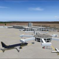
Version 4.0 depicts Tocumen International Airport MPTO with runways, taxiways, a control tower, detailed gates, and ground vehicles, complemented by night lighting for buildings. Copa Airlines oper…
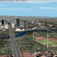
An accurate depiction of Adelaide's central business district, this add-on places helicopter landing pads at the Royal Adelaide Hospital and Chanel 7, while detailing more than 100 buildings and st…
By Rafael Garcia Sanchez, graphics support control taxiing aids such as docking systems, odometers, approach progress bars, and marshallers. It replaces all content from the NOVATXT2.ZIP file for c…

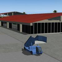
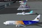
Version 1 of NOVA Gold Visuals, by Rafael Garcia Sanchez, comprises 24 photorealistic visuals with night effects depicting hangars, finger gates and terminals, reflecting the kinds of common object…
Myanmar-based AI-Traffic coverage delivers flight plans to, from, and within Myanmar, covering carriers such as Thai Air, Bangkok Air, Mandarin Airlines, Air India, Air China, and Silkair, plus Mya…
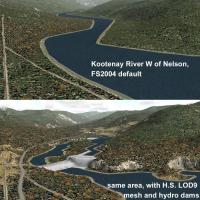
Coordinates N49-53, W116-120 anchor a regional mesh that adjusts lake elevations for best fit and adds new shorelines, transportation network, and landclass between Nelson and the U.S. border. Some…