Page 5
Searches the whole library — filter by sim & category on the results page
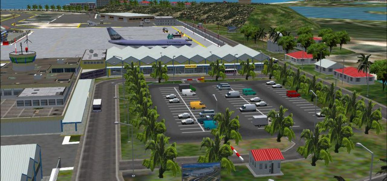
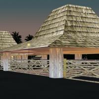
Greystone airfield anchors the Jumbolair estate, with extensive redevelopment and detailed representation of John Travolta's house. Files include DBWsimGreystone05.zip (or DBWGRS5.zip) and the Grey…
Changi airfield sits at the eastern tip of Singapore, spanning 1,300 hectares and dating from 1975, with its location about 20 kilometres from the city centre. Credit goes to Arjuna Chiththananda f…

Bremen airport (EDDW) presents a realistic layout with dynamic operation featuring wind-sensitive aircraft, passenger gates, catering and fuel trucks, and follow-me cars. The dynamic objects animat…
Includes a trans-highway ground portion with Kisarazu and Kawasaki man-made islands floating on Tokyo Bay, Japan. Long Visual Range Tool provides long visibility, letting faraway objects remain vis…
A remake of an earlier Lanai project, this update brings a quaint, rustic island styling to a local airstrip and adapts the layout for newer flight-sim environments. Landscaping changes and refresh…
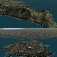
Designed with srtm waterbodies data, it adds Ireland-wide water features including rivers, lakes, and shorelines for the entire island, all derived from the srtm waterbodies data source, and uses d…
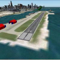
Meigs Field in Chicago hosts fantasy objects, including a T-Rex at the end of the runway named Ogelthorpe, and a pier with covered parking for boats or float planes and two large hangers for invert…
Version two for Edmonton International Airport (CYEG) in Alberta, Canada, replaces the main terminal and cargo area, updates apron layouts, and adds a smaller cargo taxiway. Based on aerial and gro…
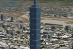
The Taipei 101 tower stands one mile south of RCSS, rising 1667 feet with 101 floors. By John Townsend, it adds night lighting, dynamic shine, and a custom landclass for the city of Taipei, Taiwan.
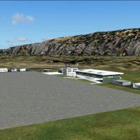
On Samos Island in Greece, the airfield carries IATA code SMI and ICAO designation LGSM, and features a single 2030-meter runway at 6 meters elevation, located at 37.7000 north, 26.9000 east, situa…
A complete replacement of the default landscape in the Columbia River region and adjacent Washington and Oregon areas, spanning N45.2-46.4 W120.9-122.4, integrates lakes, rivers, roads and railways…
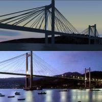
Rubén Castiñeiras delivers Version 1.1 in October 2003. It places the Rande Bridge over the Bay of Vigo near Vigo airport LEVX at roughly 42°18'N 8°38'W in Galicia, Spain, and removes the original …
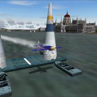
Budapest edition of the 2007 Red Bull event unfolds in Hungary, focusing on the Red Bull race track and presenting two accompanying image files named redbull_gate_breitling.jpg and redbull_chain_br…
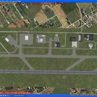
Four Michigan military and joint-use airfields include Selfridge ANGB KMTC, Battle Creek ANGB KBTL, Alpena CRTC KAPN, and Grayling AAF KGOV. Selfridge ANGB KMTC, Battle Creek ANGB KBTL, Alpena CRTC…
The second version for Meyenheim base in Alsace updates the area around two French air force squadrons, adding a helipad, rebuilding roads, and introducing 3D trees. A major effort raises frame rat…
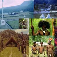
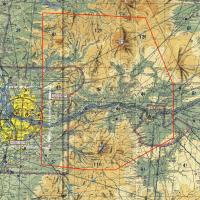
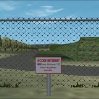
Located in the Western Province of Papua New Guinea, the canyons present a great flying challenge to all flight simmers. Credit goes to David Ricketts, and concan_approach.JPG appears as a visual r…

Three locations anchor the presentation, including Bass Harbour Light House and Cranberry Field, along with Tom's Lobster House from the lobster festival, and an accompanying adventure. The selecti…
Located between Royal Albert dock and King George V dock, the small air facility serves mainly short flights. It is used by BAE's and Folkers, and the A318 may join the group; the file EGLC12882743…
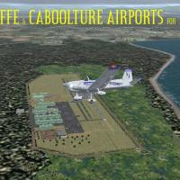
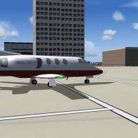
Two small general aviation airports anchor this Brisbane-area pair, with Redcliffe hosting two flying schools and a GA and sport aircraft presence, while Caboolture sits on a WWII-era grass strip n…
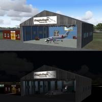
The kit places the Eaglesoft FBO Office and Hangar worldwide, and the hangar door animates to open and close when 112.00 on the NAV2 radio is dialed. Signs accept a custom company name to personali…