FSX Omarama Airfield Scenery
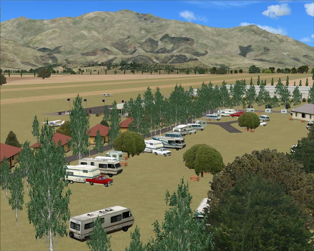
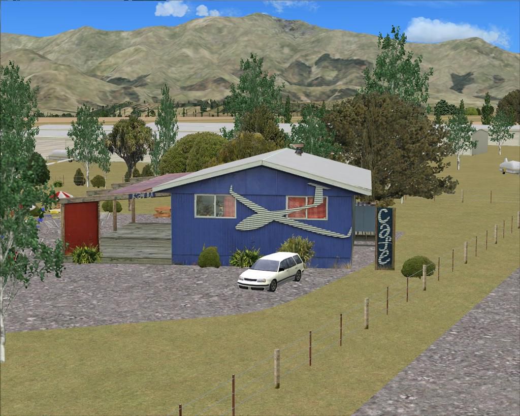
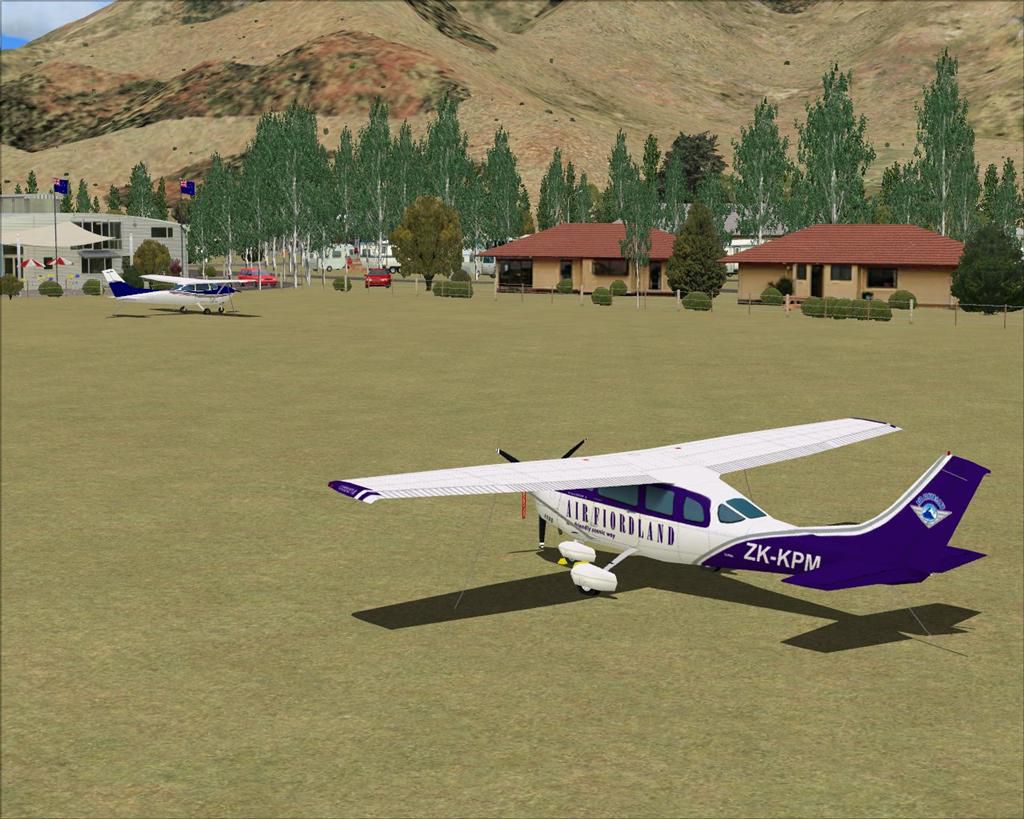
Omarama Airfield (NZOA) brings New Zealand’s gliding capital to life with custom club and cafe buildings, hangar rows, signage, and detailed object placement near the McKenzie Country township. Built for Microsoft Flight Simulator X SP2 without Acceleration, it requires VECTOR LANDCLASS for the intended ground detail and surroundings.
 New Zealand
 - File: nzoa_omarama-4x.zip
- Size:2.87 MB
- Scan:
Clean (26d)

- Access:Freeware
- Content:Everyone
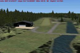
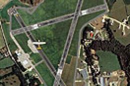
New Zealand (NZOA). Welcome to Omarama Airfield, situated 10 nautical miles west-northwest of the Benmore Hydro Dam, in the beautiful McKenzie Country region of the South Island of New Zealand. Situated about 1km fom the small township of Omarama, the airfield is also known as the Glider Capitol of New Zealand. By Lawrie Roache.
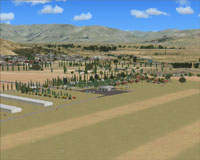
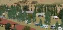
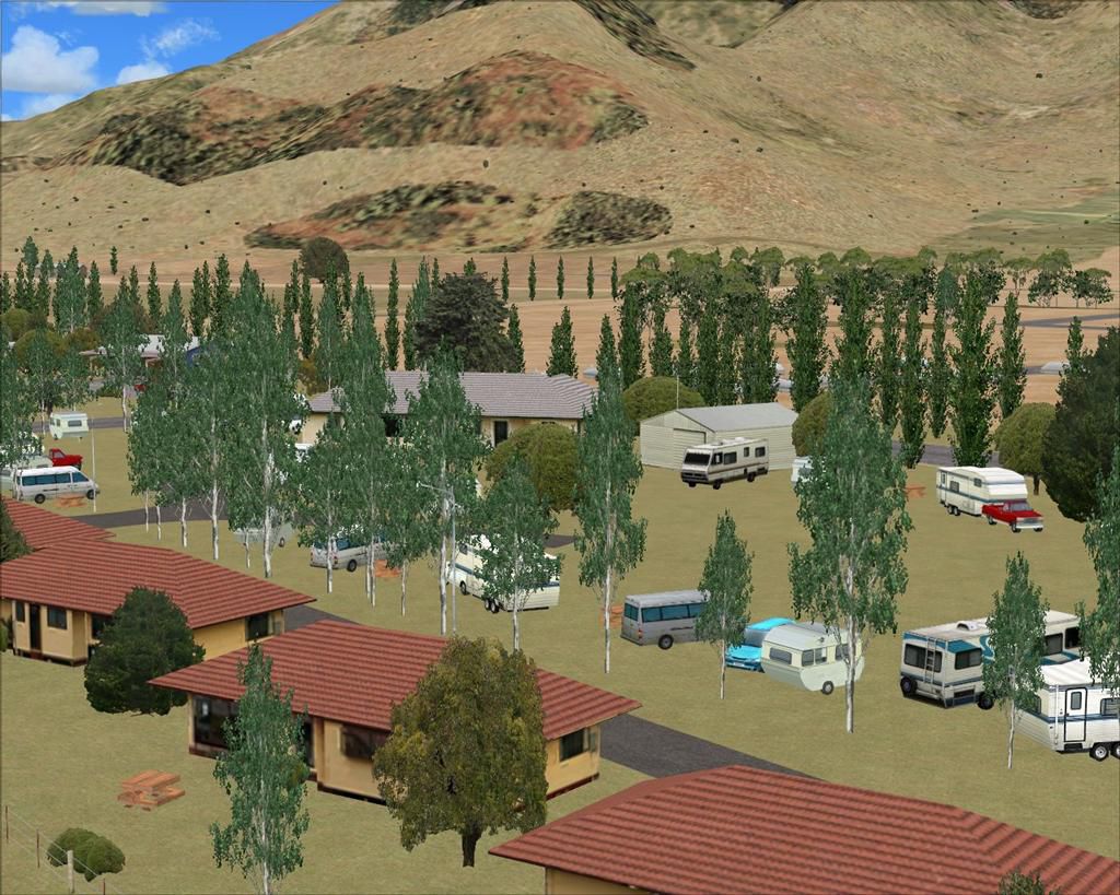
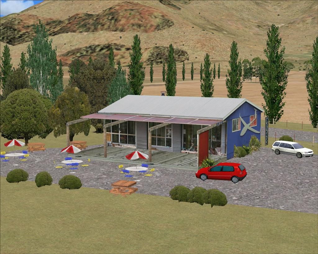
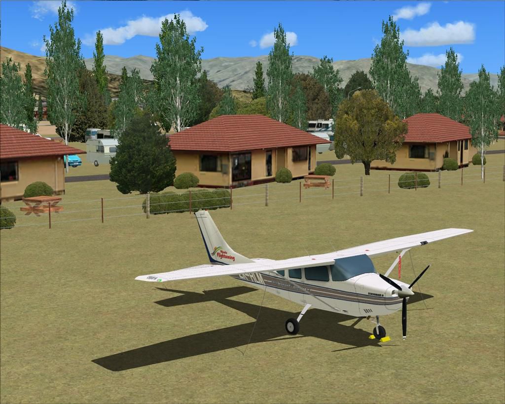
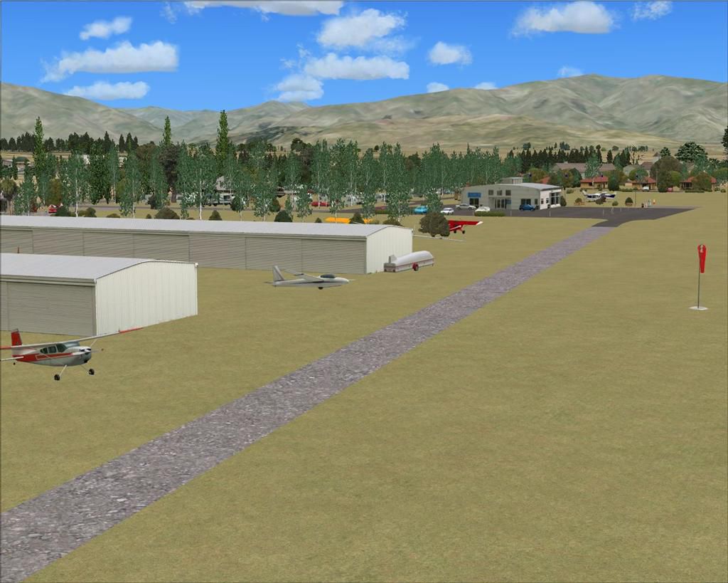
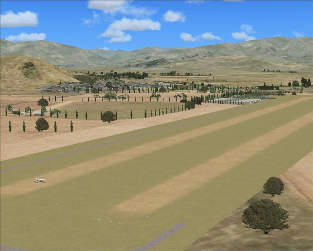
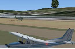
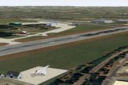
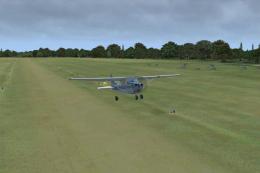
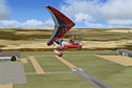
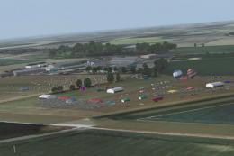
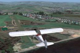
Screenshot of Omarama Airfield scenery.
This scenery was made for FSX SP2, without Acceleration, and with VECTOR LANDCLASS (VLC) (Payware) installed.
Flight1 Software, INSTANT SCENERY Object Placer, and AIRPORT FACILITATOR X (AFX), were used in the making of this scenery.
CREDITS:
ROBIN CORN for the custom Glider Club building, the Cafe building and the 3 Hanger Rows.
GODFREY TIER for the custom signs and small caravans.
LAWRIE ROACHE for the Afcad, Flattens, Excludes, and placement of all objects in the scenery.
ROBIN CORN for the free VLC Object Libraries.
This is FREEWARE. These files are strictly for your own personal, non-commercial use. Any redistribution, repackaging or reselling of these files in any form is expressly prohibited without the permissions of the authors.
DISCLAIMER:
These files are used at your own risk. They should not harm your computer in any way, but there is always an exception in the wonderful world of computers.
Images & Screenshots


Finding the Scenery
- FSX/Prepar3D Coordinates:
-
-44.49000000,169.97000000
Use the downloaded flight plan file by launching FSX/P3D, selecting "Load Flight Plan" in the flight planner, and choosing the .pln file. Your aircraft will be positioned directly at the add-on’s location. - Decimal Degrees (DD):
-
Latitude: -44.490000°
Longitude: 169.970000° - Degrees, Minutes, Seconds (DMS):
-
Latitude: 44° 29' 24.000" S
Longitude: 169° 58' 12.000" E
Map Location
The archive nzoa_omarama-4x.zip has 68 files and directories contained within it.
File Contents
This list displays the first 500 files in the package. If the package has more, you will need to download it to view them.
| Filename/Directory | File Date | File Size |
|---|---|---|
| Omarama-4X INSTALL.doc | 11.17.12 | 245.50 kB |
| Read Me.txt | 11.17.12 | 4.11 kB |
| AFX_NZOA.bgl | 07.27.12 | 9.07 kB |
| Alternative AFX (No Grass) | 11.17.12 | 0 B |
| Scenery | 11.17.12 | 0 B |
| AFX_NZOA.bgl | 11.17.12 | 14.41 kB |
| ez-flags.bgl | 01.02.06 | 289.45 kB |
| goff_nzhscaravan.BGL | 03.30.09 | 13.15 kB |
| goff_nzhsmetbox.BGL | 03.26.09 | 6.08 kB |
| NZOA_AprFce.bgl | 07.25.12 | 1.45 kB |
| NZOA_BdyFce.bgl | 11.17.12 | 22.50 kB |
| NZOA_Cafe.bgl | 07.25.12 | 284 B |
| NZOA_CafFce.bgl | 07.27.12 | 1.59 kB |
| NZOA_CmpCab.bgl | 07.27.12 | 764 B |
| NZOA_CmpCvn.bgl | 11.16.12 | 1.92 kB |
| NZOA_FuePmp.bgl | 07.25.12 | 428 B |
| NZOA_GenBsh.bgl | 11.15.12 | 4.12 kB |
| NZOA_GenHse.bgl | 11.16.12 | 908 B |
| NZOA_GenSig.bgl | 11.17.12 | 572 B |
| NZOA_GenTre.bgl | 07.30.12 | 12.28 kB |
| NZOA_GenVeh.bgl | 11.16.12 | 812 B |
| NZOA_GldClb.bgl | 07.22.12 | 140 B |
| NZOA_GstLdg.bgl | 11.16.12 | 236 B |
| NZOA_HngRow.bgl | 07.22.12 | 236 B |
| NZOA_HseFce.bgl | 11.15.12 | 2.06 kB |
| NZOA_MscTrmObj.bgl | 11.16.12 | 284 B |
| NZOA_PicTbl.bgl | 11.17.12 | 2.53 kB |
| NZOA_RwyMkr.bgl | 07.21.12 | 4.40 kB |
| NZOA_StcAft.bgl | 07.30.12 | 2.29 kB |
| NZOA_StrLgt.bgl | 11.16.12 | 908 B |
| NZOA_TrmFlg.bgl | 09.19.08 | 284 B |
| NZOA_WndSck.bgl | 07.21.12 | 476 B |
| OA_FrmBdg.bgl | 07.27.12 | 716 B |
| OA_GenBdg.bgl | 07.21.12 | 428 B |
| OA_GenTre.bgl | 11.17.12 | 22.64 kB |
| omaramaLib.bgl | 07.21.12 | 138.57 kB |
| signs_nzoa.BGL | 07.23.12 | 4.16 kB |
| tui_picnic.BGL | 01.25.12 | 8.95 kB |
| Texture | 11.17.12 | 0 B |
| goff_nzhscaravan.bmp | 03.30.09 | 42.75 kB |
| goff_nzhsmetbox.bmp | 03.26.09 | 10.75 kB |
| lfgld.bmp | 01.27.05 | 42.74 kB |
| lfgld_lm.bmp | 01.27.05 | 42.74 kB |
| lfsteel.bmp | 01.16.05 | 42.74 kB |
| NZ1-2.BMP | 12.31.05 | 42.74 kB |
| NZ1-2R.BMP | 12.31.05 | 42.74 kB |
| omarama01.dds | 07.21.12 | 1.33 MB |
| signs_nzoa.bmp | 07.23.12 | 170.75 kB |
| tui_picnic.bmp | 01.25.12 | 42.75 kB |
| NZOA_Omarama-4X | 11.17.12 | 0 B |
| AFX_NZOA_ALT.bgl | 07.23.12 | 522 B |
| NZOA-4X (0).jpg | 11.17.12 | 126.31 kB |
| NZOA-4X (1).jpg | 11.17.12 | 106.92 kB |
| NZOA-4X (2).jpg | 11.17.12 | 123.76 kB |
| NZOA-4X (3).jpg | 11.17.12 | 151.88 kB |
| NZOA-4X (4).jpg | 11.17.12 | 138.02 kB |
| NZOA-4X (5).jpg | 11.17.12 | 116.58 kB |
| NZOA-4X (6).jpg | 11.17.12 | 146.42 kB |
| NZOA-4X (7).jpg | 11.17.12 | 163.71 kB |
| NZOA-4X (8).jpg | 11.17.12 | 109.68 kB |
| NZOA-4X (9).jpg | 11.17.12 | 137.97 kB |
| NZOA-4X (10).jpg | 11.17.12 | 175.27 kB |
| NZOA-4X (11).jpg | 11.17.12 | 148.54 kB |
| NZOA-4X (12).jpg | 11.17.12 | 133.86 kB |
| NZOA-4X (13).jpg | 11.17.12 | 88.95 kB |
| NZOA-4X (14).jpg | 11.17.12 | 148.00 kB |
| flyawaysimulation.txt | 10.29.13 | 959 B |
| Go to Fly Away Simulation.url | 01.22.16 | 52 B |
Installation Instructions
Most of the freeware add-on aircraft and scenery packages in our file library come with easy installation instructions which you can read above in the file description. For further installation help, please see our Flight School for our full range of tutorials or view the README file contained within the download. If in doubt, you may also ask a question or view existing answers in our dedicated Q&A forum.


0 comments
Leave a Response