 FSX Utilities
Yet Another Google Earth Tool
FSX Yet Another Google Earth Tool v0.93 (YAGET). Tested with FSX Deluxe. A ut…
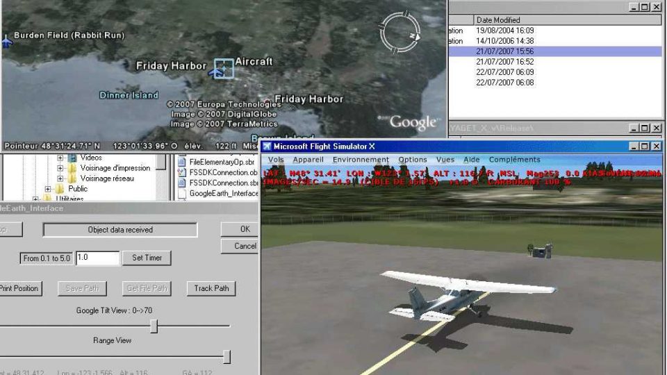
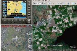
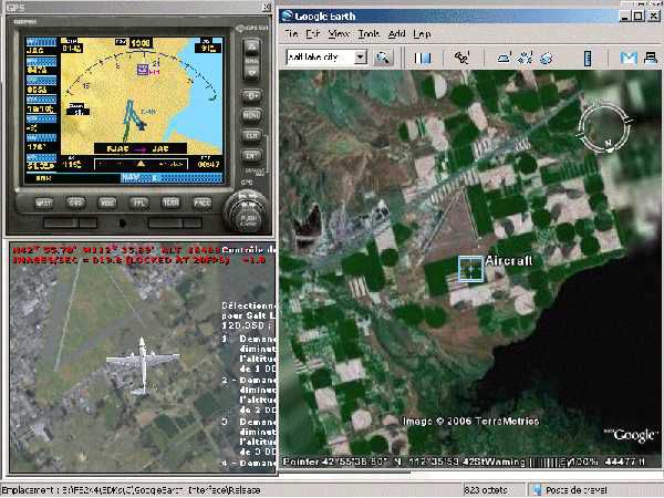
Yet Another Google Earth Tracking Tool connects FSX to Google Earth, letting flights appear on real-world imagery in near real time or as saved KML snapshots and full route traces. It exports single positions or leg-by-leg paths, supports live follow mode with camera range control, and requires Microsoft SimConnect.dll for data access.
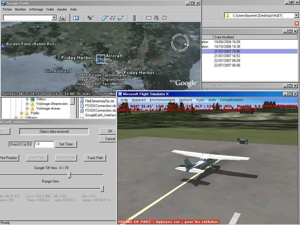
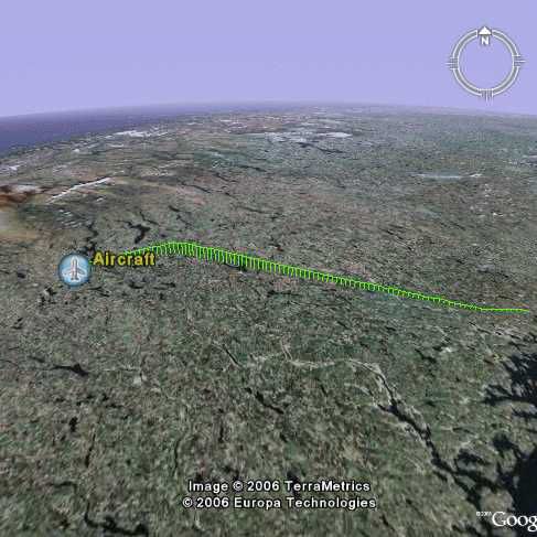
(YAGET). A utility to interface FSX data with Google Earth. It allows FSX to save either a single position or a complete flight path that Google Earth can then display. You can also use it to follow your position with Google Earth. By Laurent Claude.
![]()
Screenshot of Yet Another Google Earth Tracking Tool.
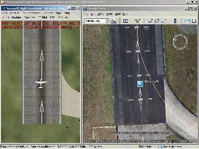
Version updated for adjustments with Google Earth release from May 24th 2007 and above (had to add a view "range" slider). This little program for FSX allows to save two types of files. A single position file and a complete path file for Google Earth program (Each leg of the path is ~1NM long). It also allows to create a direct link between a Google Earth window and an instance of FSX and to follow your position on the Google view (track mode).
NB: It uses MS SimConnect.dll.
History:
Installation (Ensure you have the most up-to-date version of Google Earth by selecting Check for Updates Online in the Help menu):
Install YAGET_X_vn.n.exe, SimConnect.dll, MFC42.dll and test_earth_link.kml in a folder of your choice.
Notes: In the test_earth_link.kml file there's the file target path (test_track_path.klm). In a LAN you should be able to launch Google Earth in a client PC and open the target file from the server PC (maybe adjusting this target path ... haven't done myself. See Google Earth documentation).
With W98 you may be required to install also:
Usage (no track feature):
Having close FS (or not) launch Google Earth and open the saved files (test_.kml or test_path.kml) (note that you can also double-click on the files and have Google Earth opened automatically)
Usage (FSX user following track feature):
NB: You can adjust both sizes of FSX and Google Earth to match the screen size and have a common look or let them work on the backstage and see them one by one.
SPECIAL NOTES :
Free for all simmers · 1.11 MB · Scanned clean Jul 2026
Download speed: Free tier is capped at 0.5 Mbps. PRO members download at full line speed.
SimObjects\Airplanes\, Addon Scenery\, Effects\, or Gauges\.readme.txt or README file. It tells you exactly where files go, what dependencies are needed, and any quirks specific to this add-on.The archive yagetx94.zip has 21 files and directories contained within it.
This list displays the first 500 files in the package. If the package has more, you will need to download it to view them.
| Filename/Directory | File Date | File Size |
|---|---|---|
| YAGET_FSX_v094 | 07.21.07 | 449.96 kB |
| YAGET_v094 | 07.21.07 | 449.96 kB |
| picture.jpg | 07.22.07 | 34.73 kB |
| examples | 07.21.07 | 449.96 kB |
| install_files | 07.21.07 | 449.96 kB |
| ReadMePlease.txt | 07.22.07 | 5.83 kB |
| 3w.jpg | 07.22.07 | 48.88 kB |
| yaget_094.jpg | 07.22.07 | 95.82 kB |
| sidetoside.jpg | 07.22.07 | 21.14 kB |
| test_.kml | 09.07.06 | 735 B |
| test_path.kml | 09.07.06 | 4.02 kB |
| mfc42.dll | 08.19.04 | 1004.00 kB |
| SimConnect.dll | 10.14.06 | 37.00 kB |
| test_earth_link.kml | 07.22.07 | 342 B |
| YAGET_X_v0.9.4.exe | 07.22.07 | 64.00 kB |
| W98_extra_dll | 07.22.07 | 449.96 kB |
| msvcr80.dll | 09.23.05 | 612.00 kB |
| msvcp80.dll | 09.23.05 | 536.00 kB |
| FILE_ID.DIZ | 07.31.07 | 348 B |
| flyawaysimulation.txt | 10.29.13 | 959 B |
| Go to Fly Away Simulation.url | 01.22.16 | 52 B |
Only PRO members can place votes.
More FSX & P3D add-ons hand-picked based on this download.
FSX Utilities
FSX Yet Another Google Earth Tool v0.93 (YAGET). Tested with FSX Deluxe. A ut…
 FSX Utilities
A very simple application allowing you to connect a moving map to FSX, chiefl…
 FSX Utilities
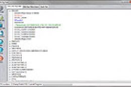
With "Module Tool X" you can edit the module config files (exe.xml and dll.xm…
AFTS (Advanced Flight Tracking System) allows you to track your aircraft move…
 FSX Utilities
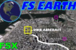
FSX FS Earth Demo. This program acts as an interface between Flight Simulator…
 FSX Utilities
This program acts as an interface between Flight Simulator X and Google Earth…
 FSX Utilities
A utility to allow the editing your FSX.CFG file. Gives the user full editing…
 FSX Utilities
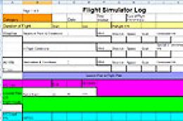
This file contains data logs in the Excel format. It is intended to supplemen…
Read what other simmers think, or add your own.
A big thank you for this work; I had a little trouble figuring out how it works, but the result is conclusive and very interesting...
I had been looking for this type of software for several months... A big bravo for this work of great interest...