FSX Mesh Of New Zealand And Islands
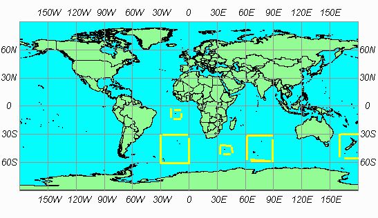
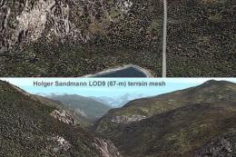
SRTM 3 Version 2 terrain mesh brings New Zealand and its surrounding islands to life in FSX with sharper elevation data, improved ridgelines, and more convincing coast-to-mountain transitions for VFR and IFR flying alike. It delivers full regional coverage as part of the worldwide SRTM 3 v2 freeware mesh project.
 New Zealand
 - File: srt2isls.zip
- Size:15.43 MB
- Scan:
Clean (6d)

- Access:Freeware
- Content:Everyone
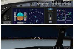
Images & Screenshots

Finding the Scenery
- FSX/Prepar3D Coordinates:
-
-41.28650000,174.77620000
Use the downloaded flight plan file by launching FSX/P3D, selecting "Load Flight Plan" in the flight planner, and choosing the .pln file. Your aircraft will be positioned directly at the add-on’s location. - Decimal Degrees (DD):
-
Latitude: -41.286500°
Longitude: 174.776200° - Degrees, Minutes, Seconds (DMS):
-
Latitude: 41° 17' 11.400" S
Longitude: 174° 46' 34.320" E
Map Location
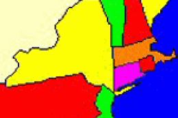
The archive srt2isls.zip has 5 files and directories contained within it.
File Contents
This list displays the first 500 files in the package. If the package has more, you will need to download it to view them.
| Filename/Directory | File Date | File Size |
|---|---|---|
| ilands.bgl | 11.18.06 | 16.47 MB |
| coverage.gif | 12.13.06 | 12.96 kB |
| README.txt | 12.13.06 | 587 B |
| flyawaysimulation.txt | 10.29.13 | 959 B |
| Go to Fly Away Simulation.url | 01.22.16 | 52 B |
Installation Instructions
Most of the freeware add-on aircraft and scenery packages in our file library come with easy installation instructions which you can read above in the file description. For further installation help, please see our Flight School for our full range of tutorials or view the README file contained within the download. If in doubt, you may also ask a question or view existing answers in our dedicated Q&A forum.


0 comments
Leave a Response