Preview

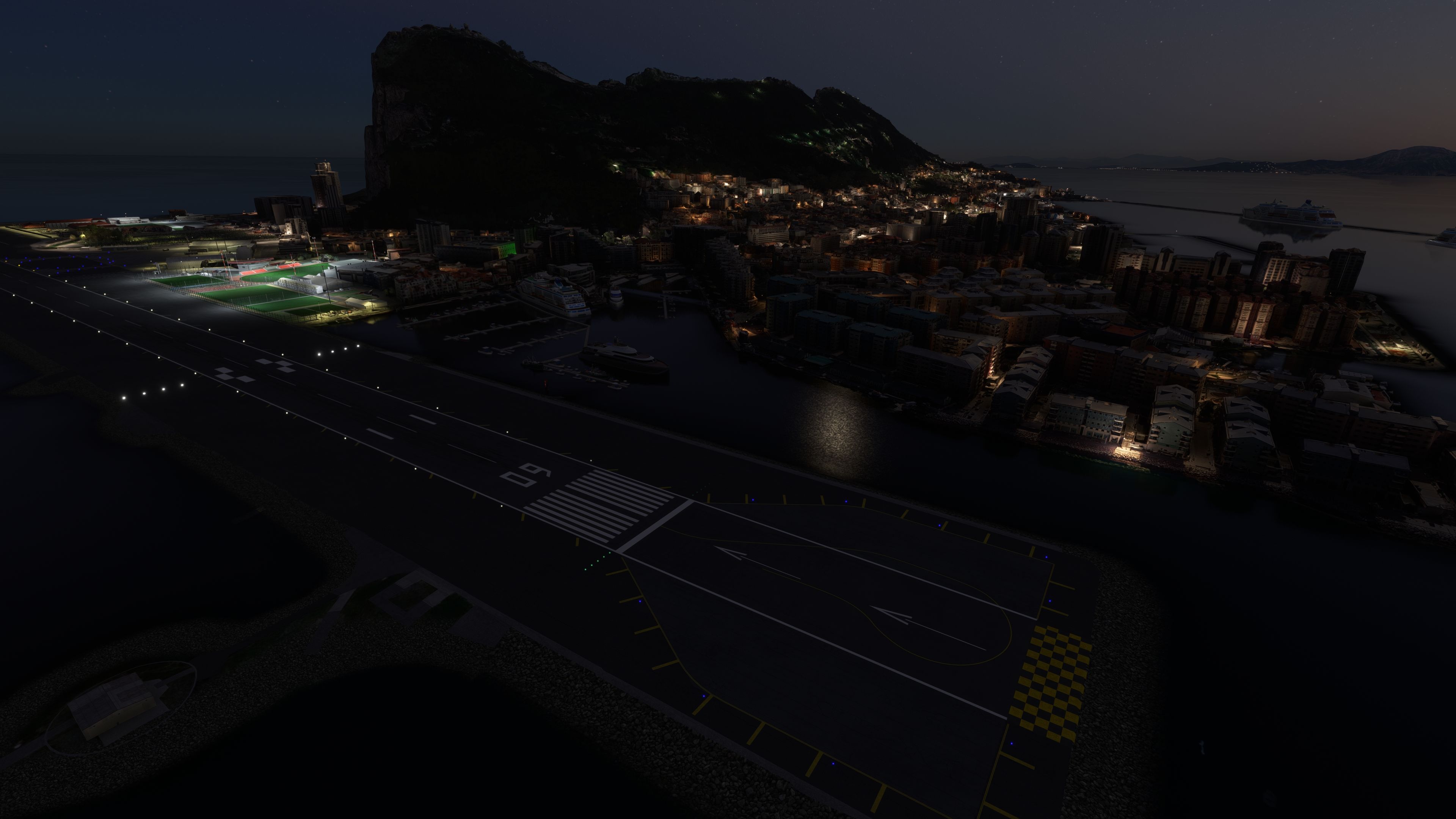
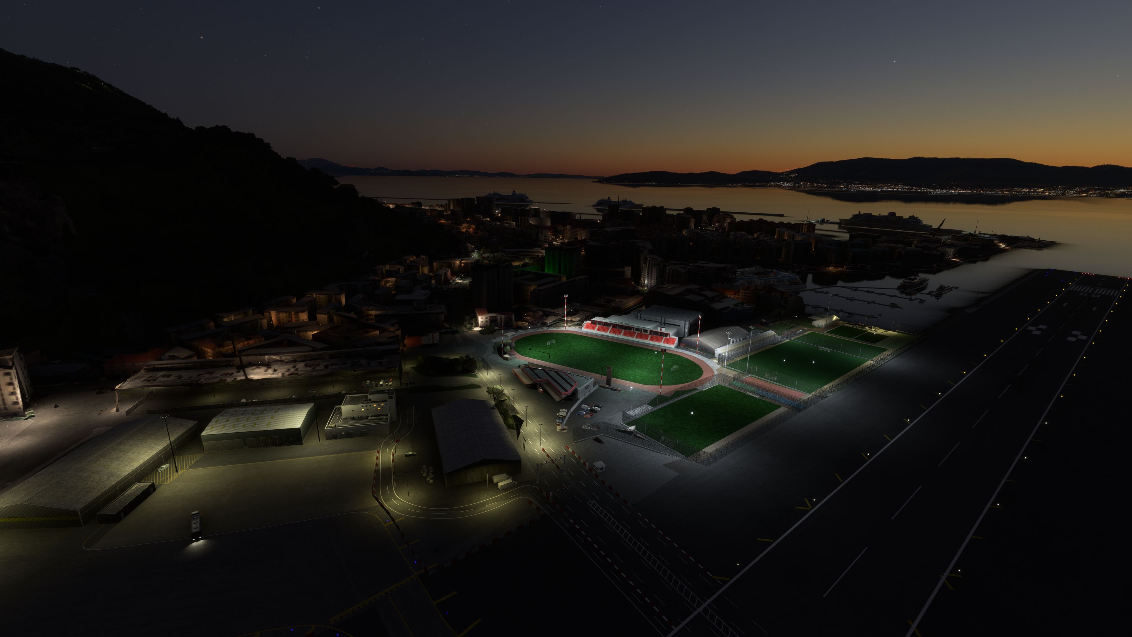
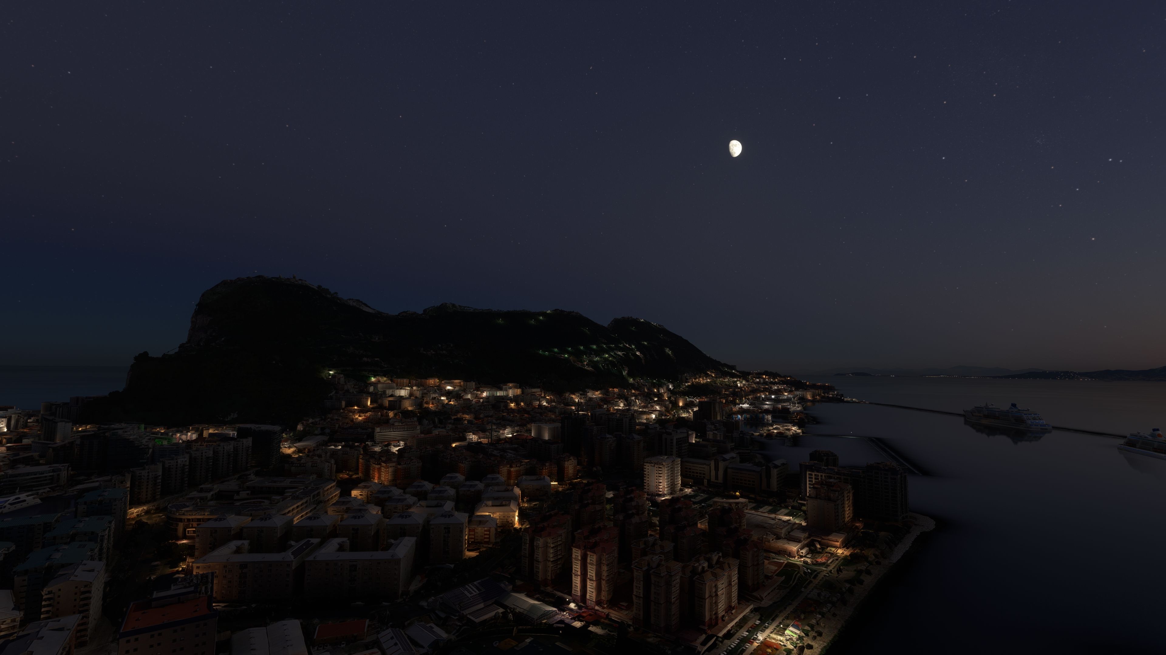
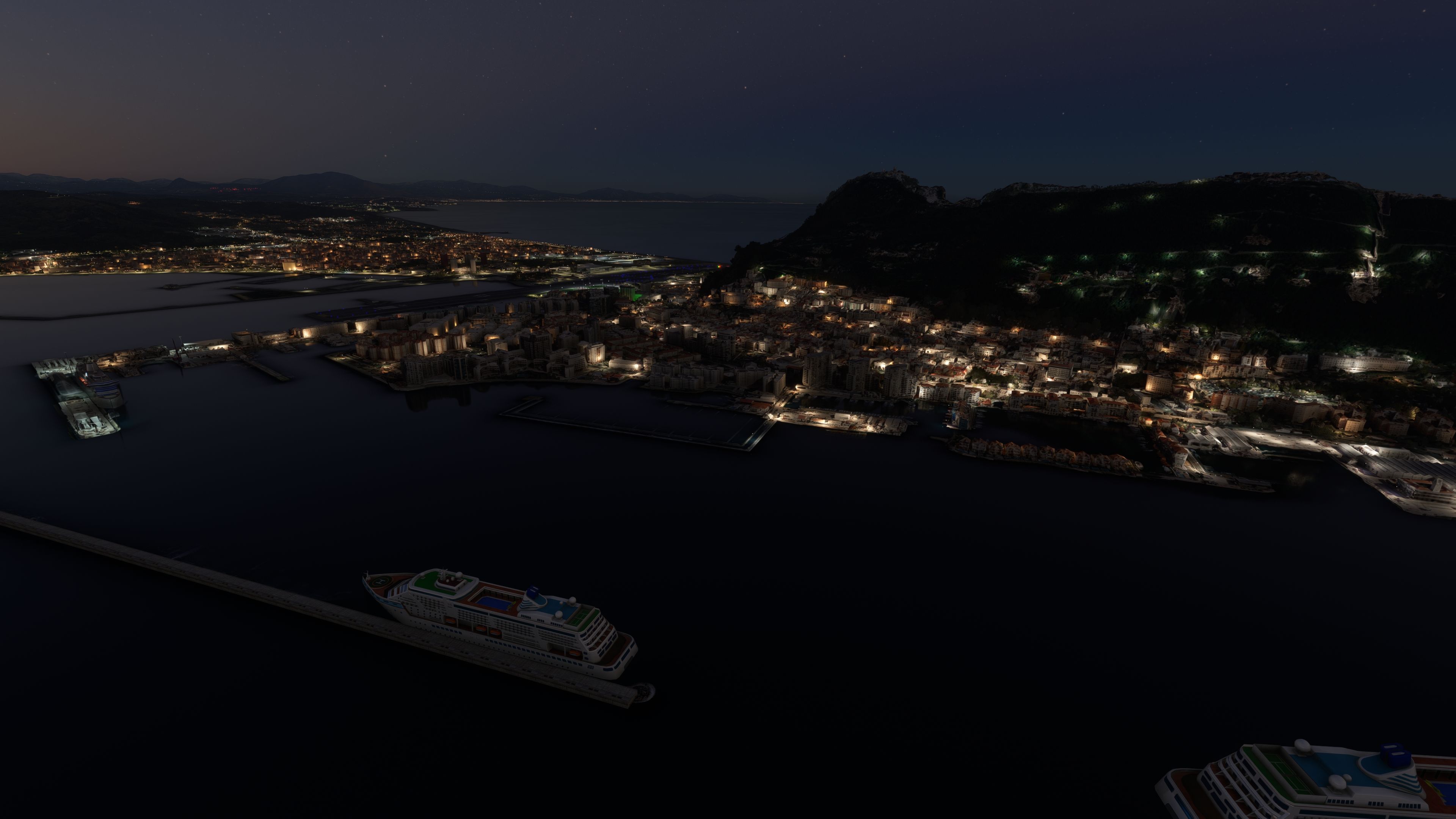
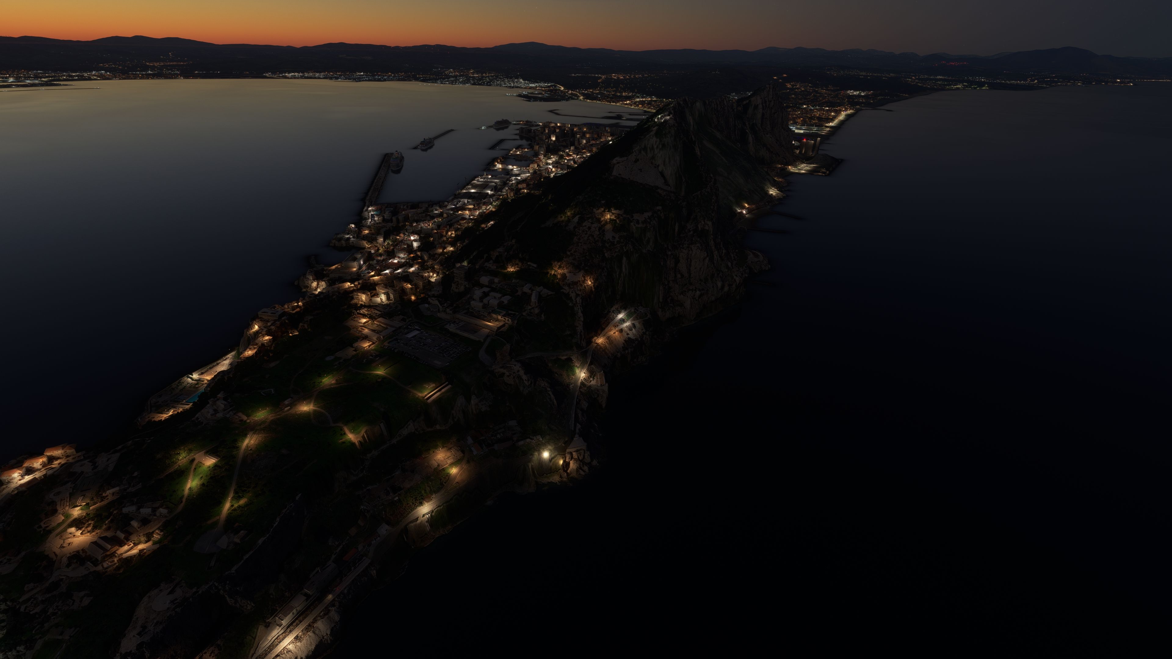
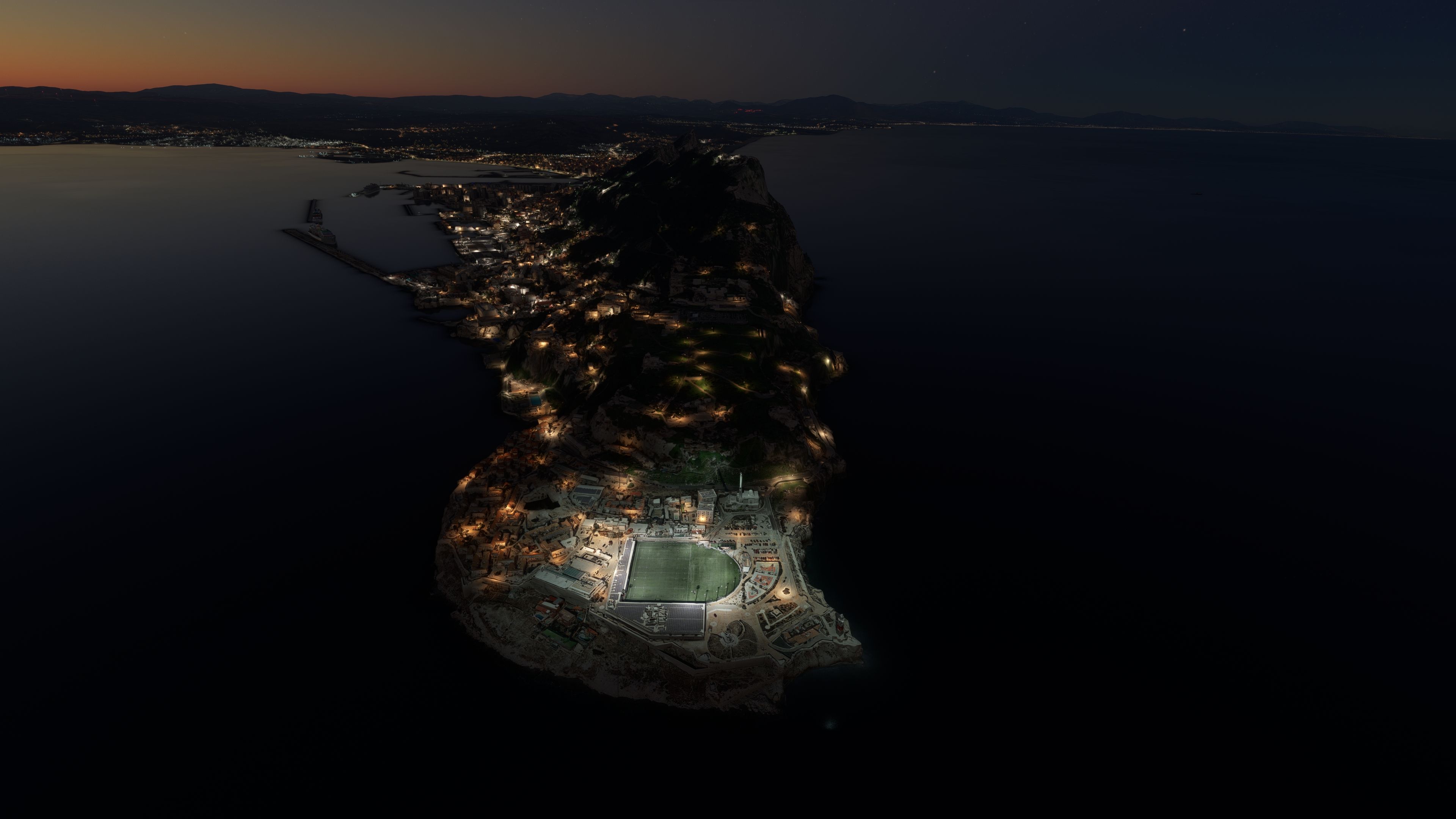
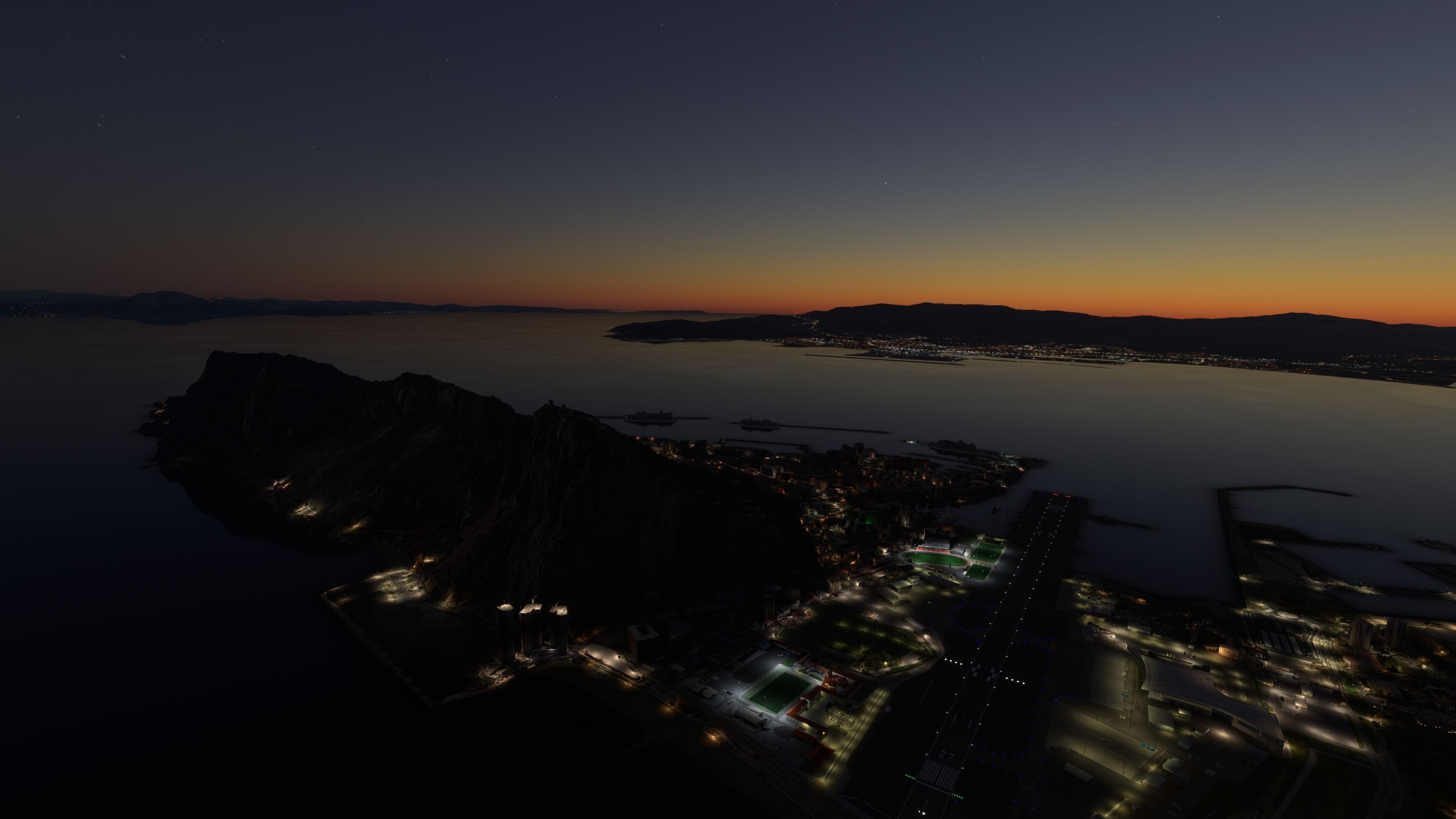
MSFS Gibraltar Photogrammetry Scenery

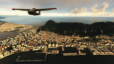
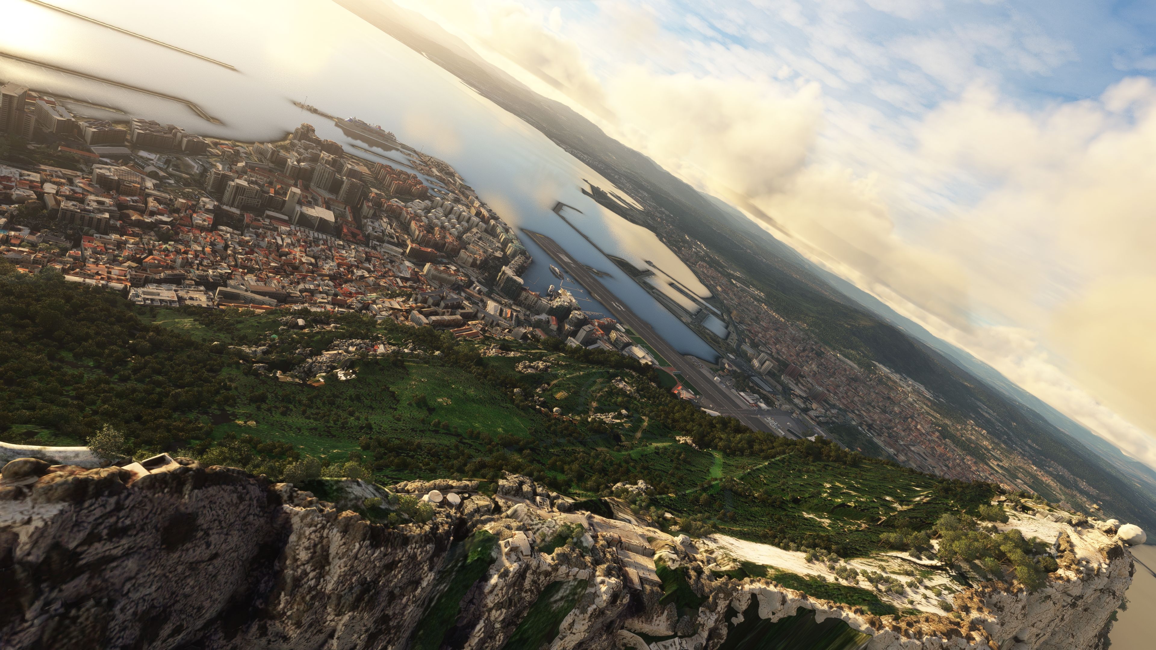
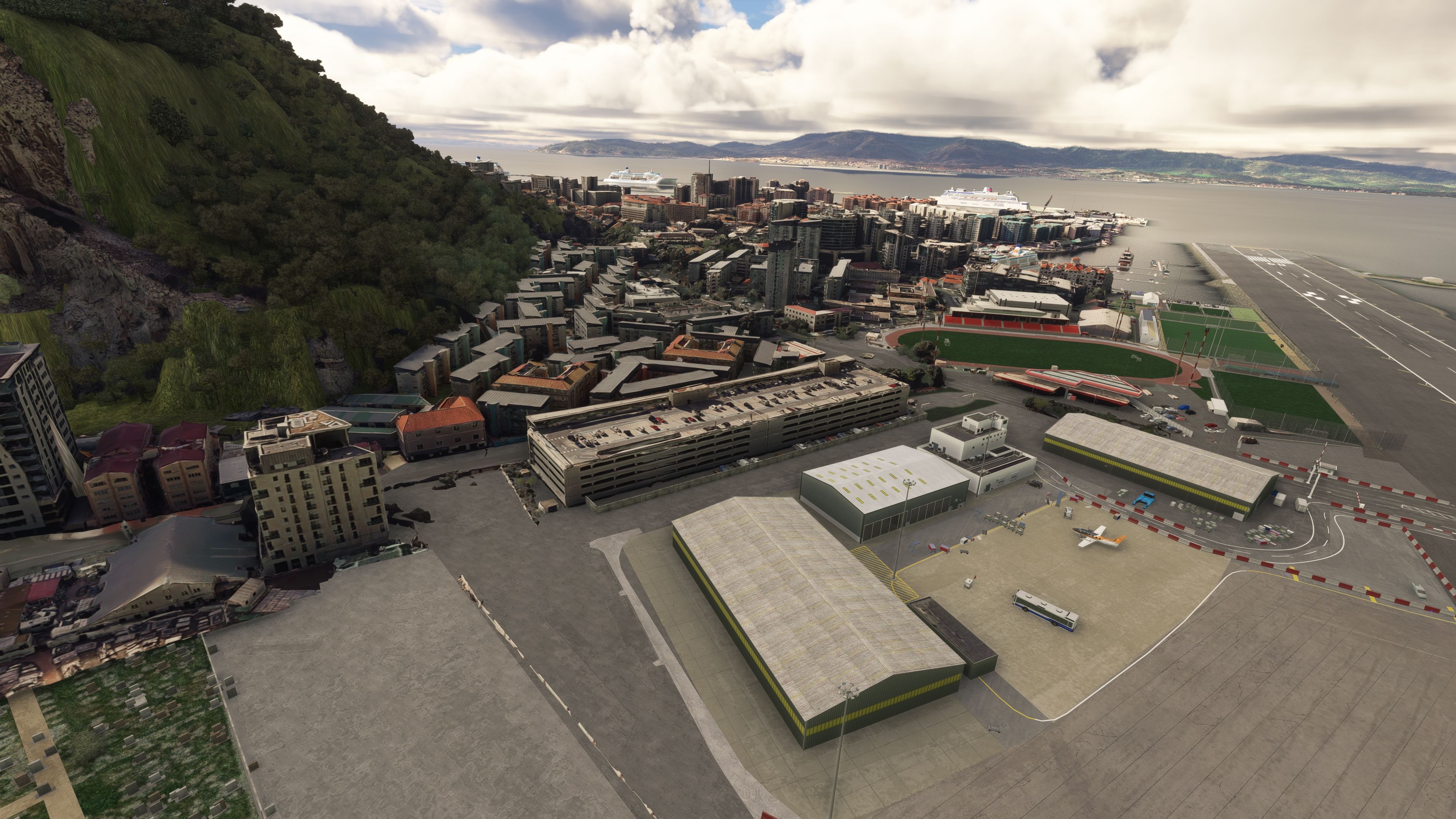
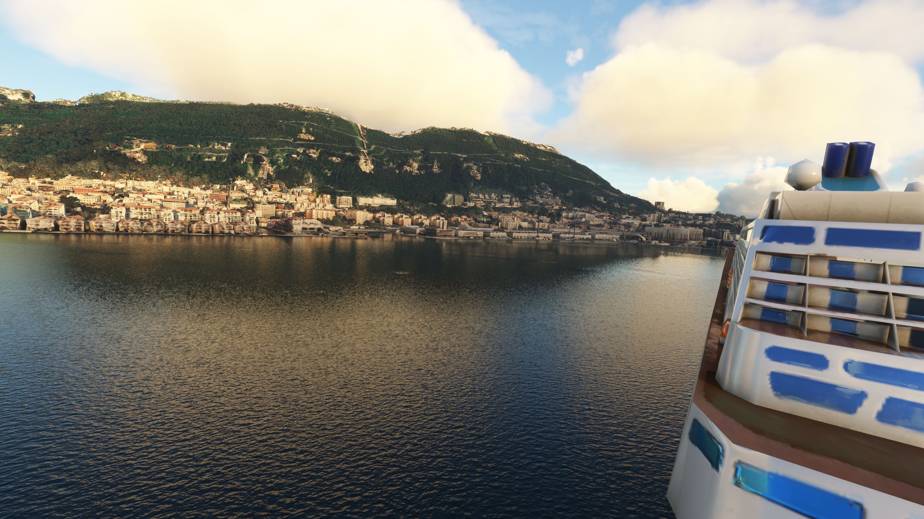
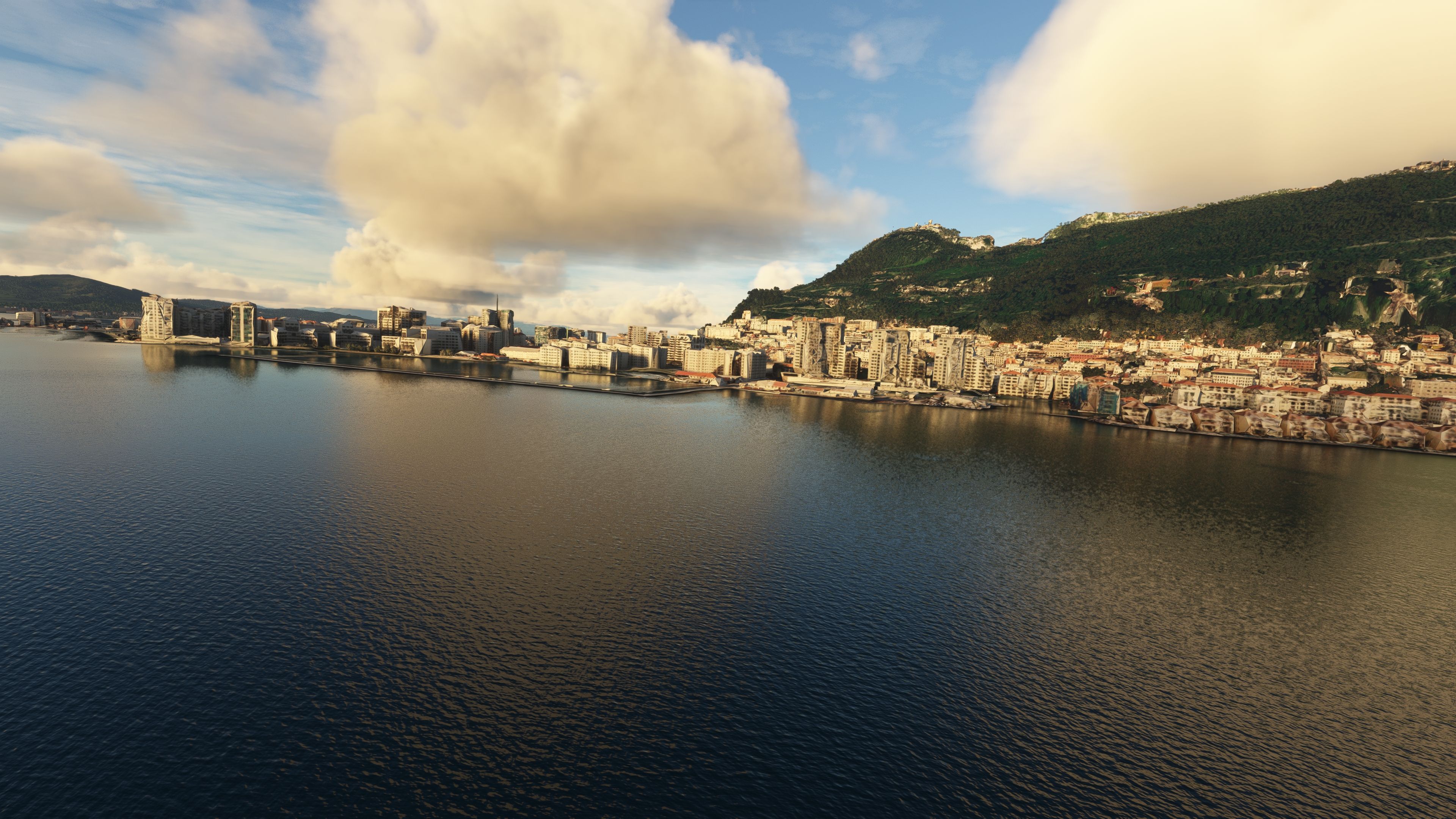
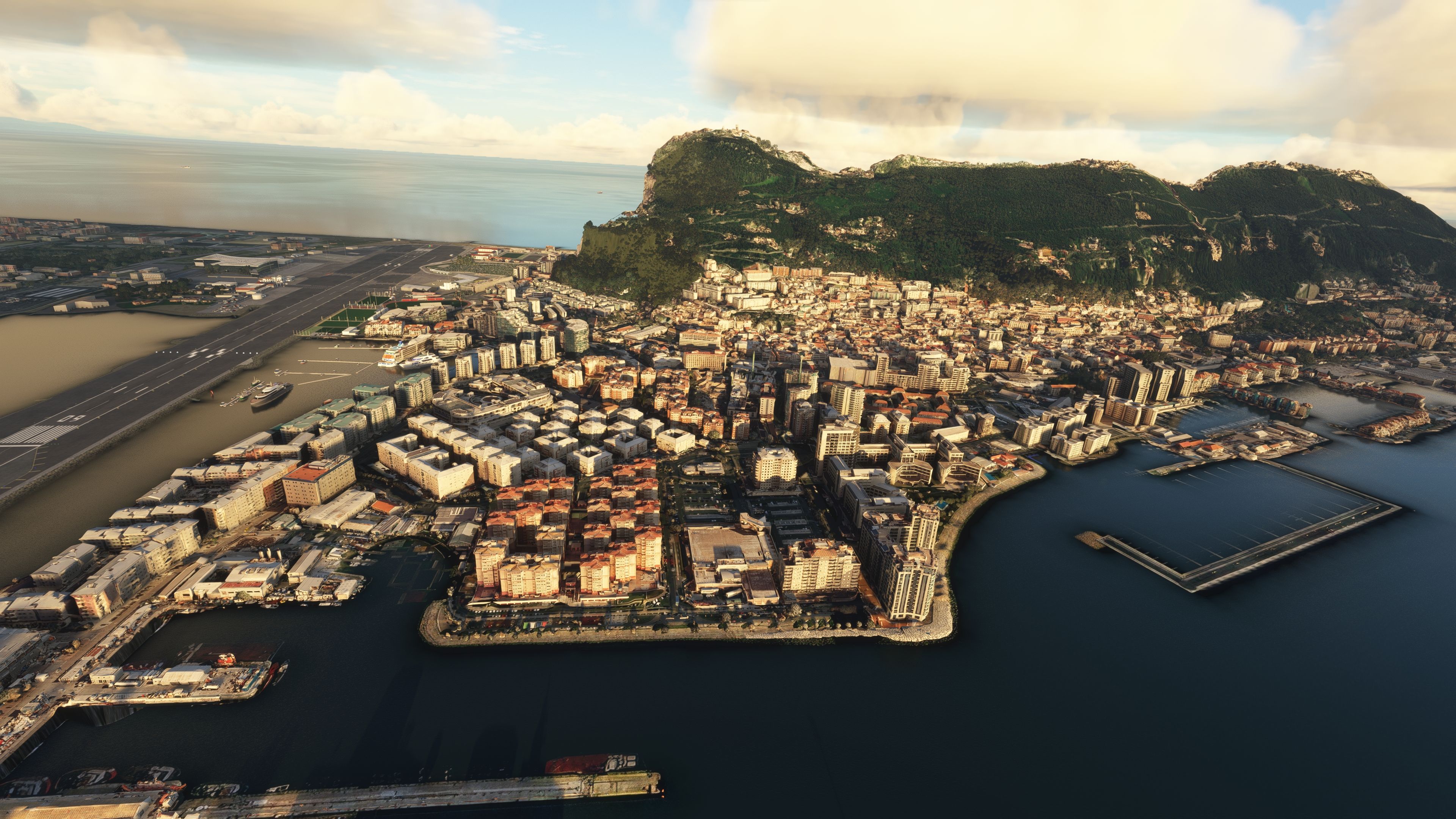
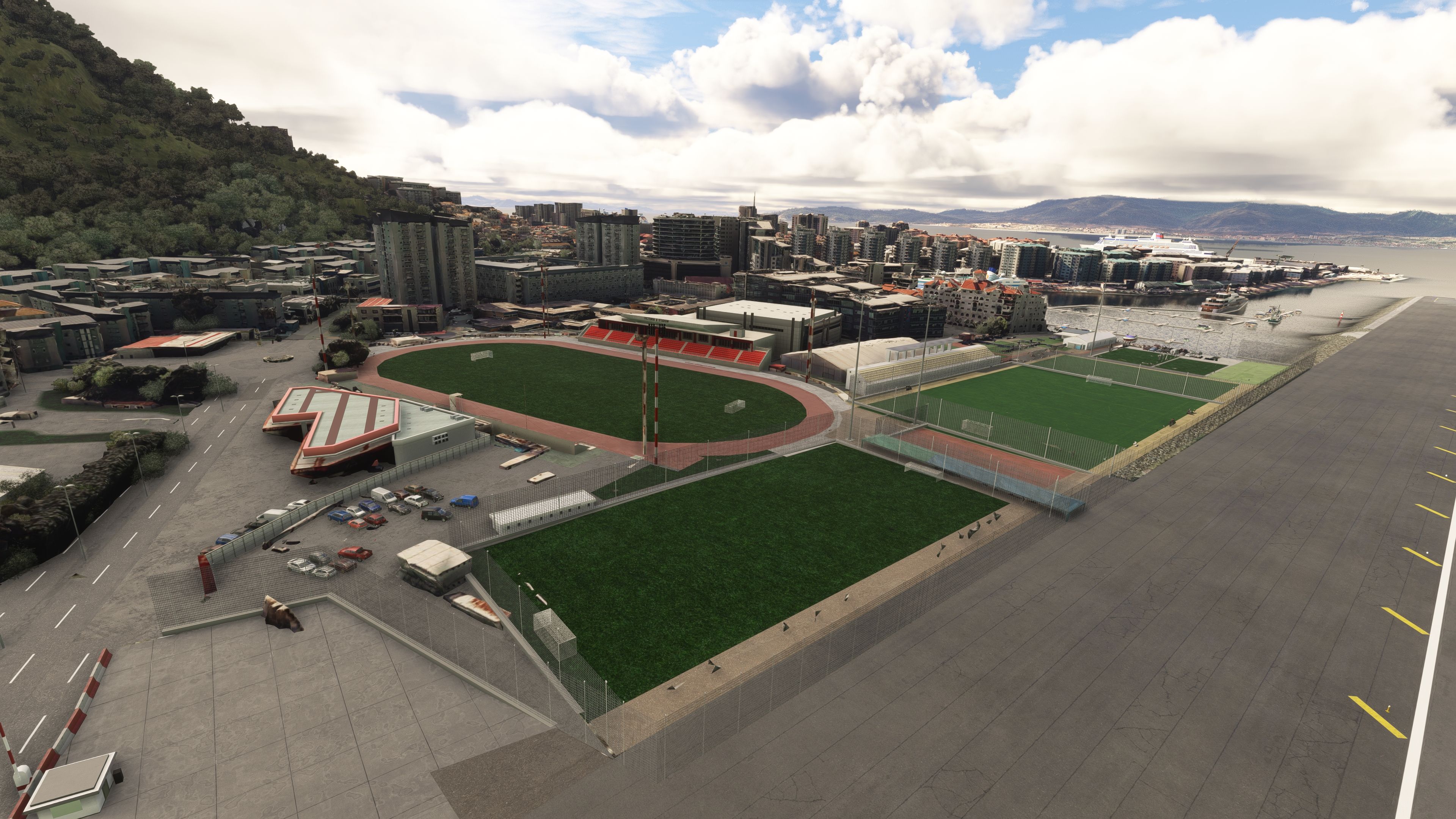
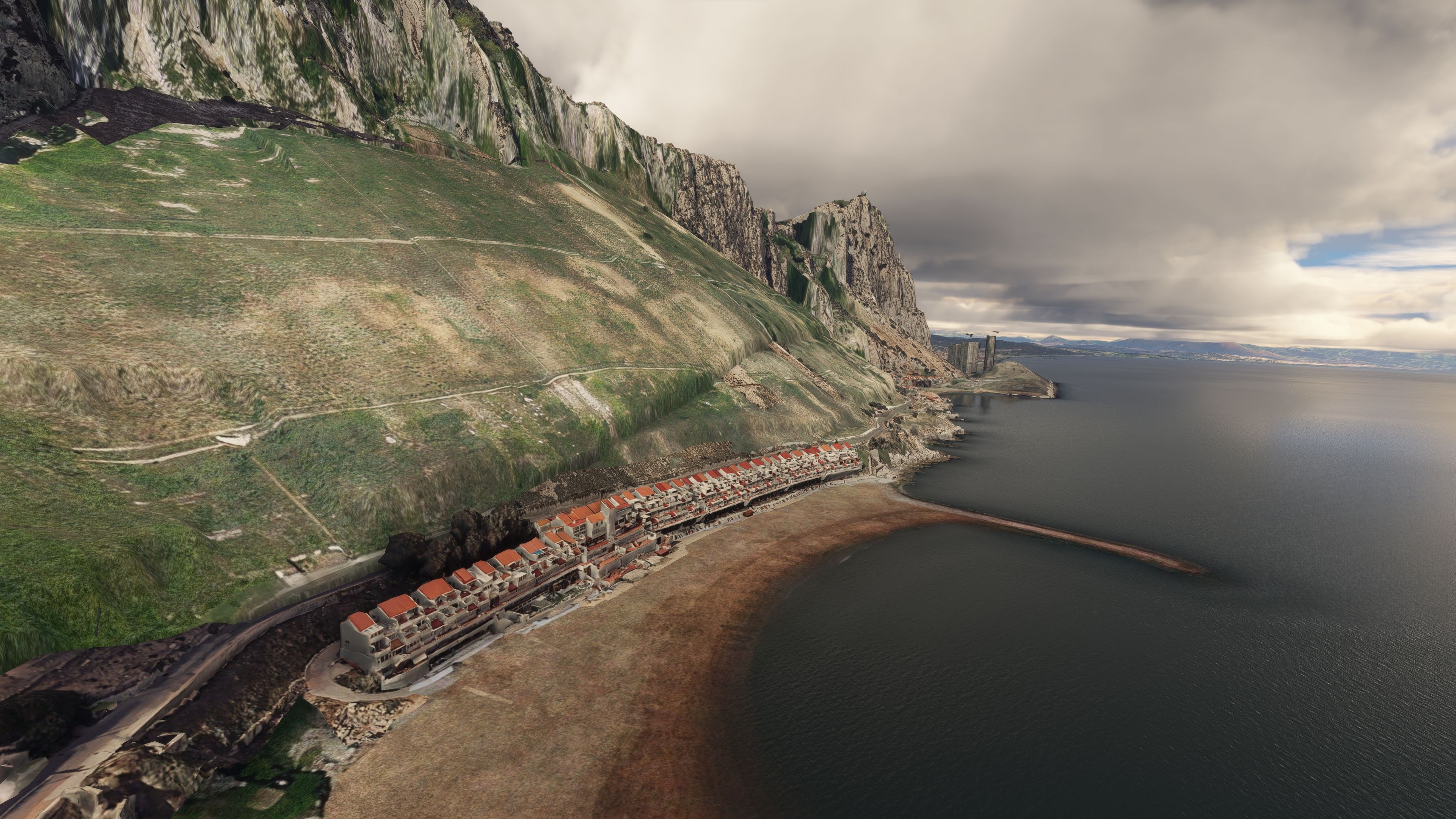
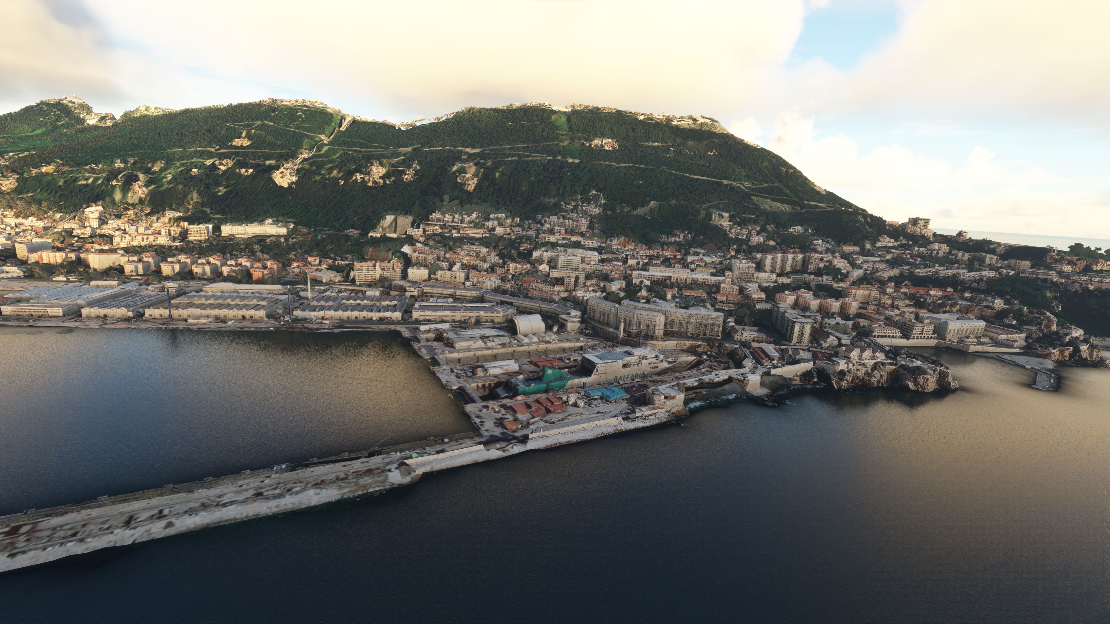
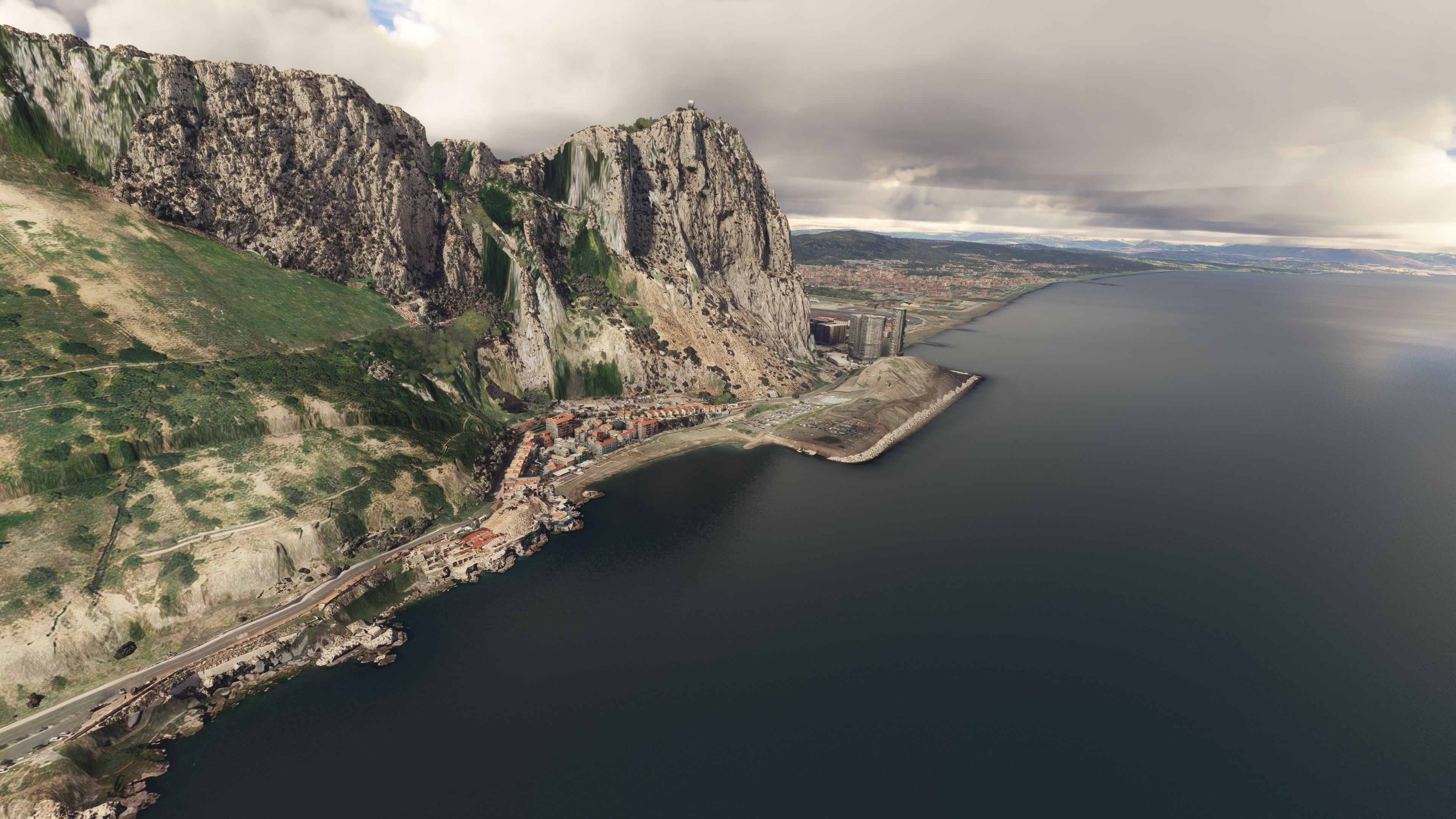
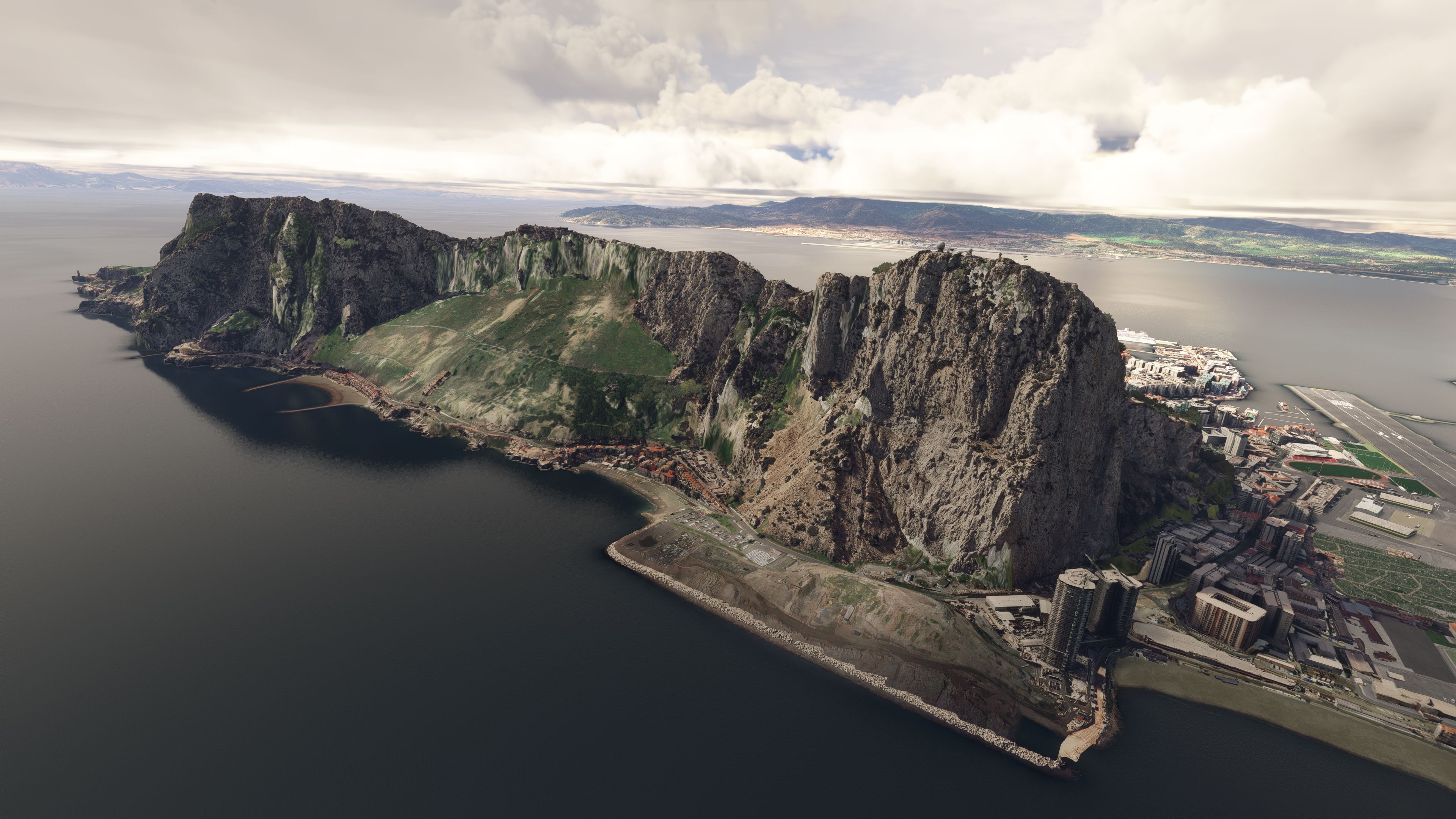
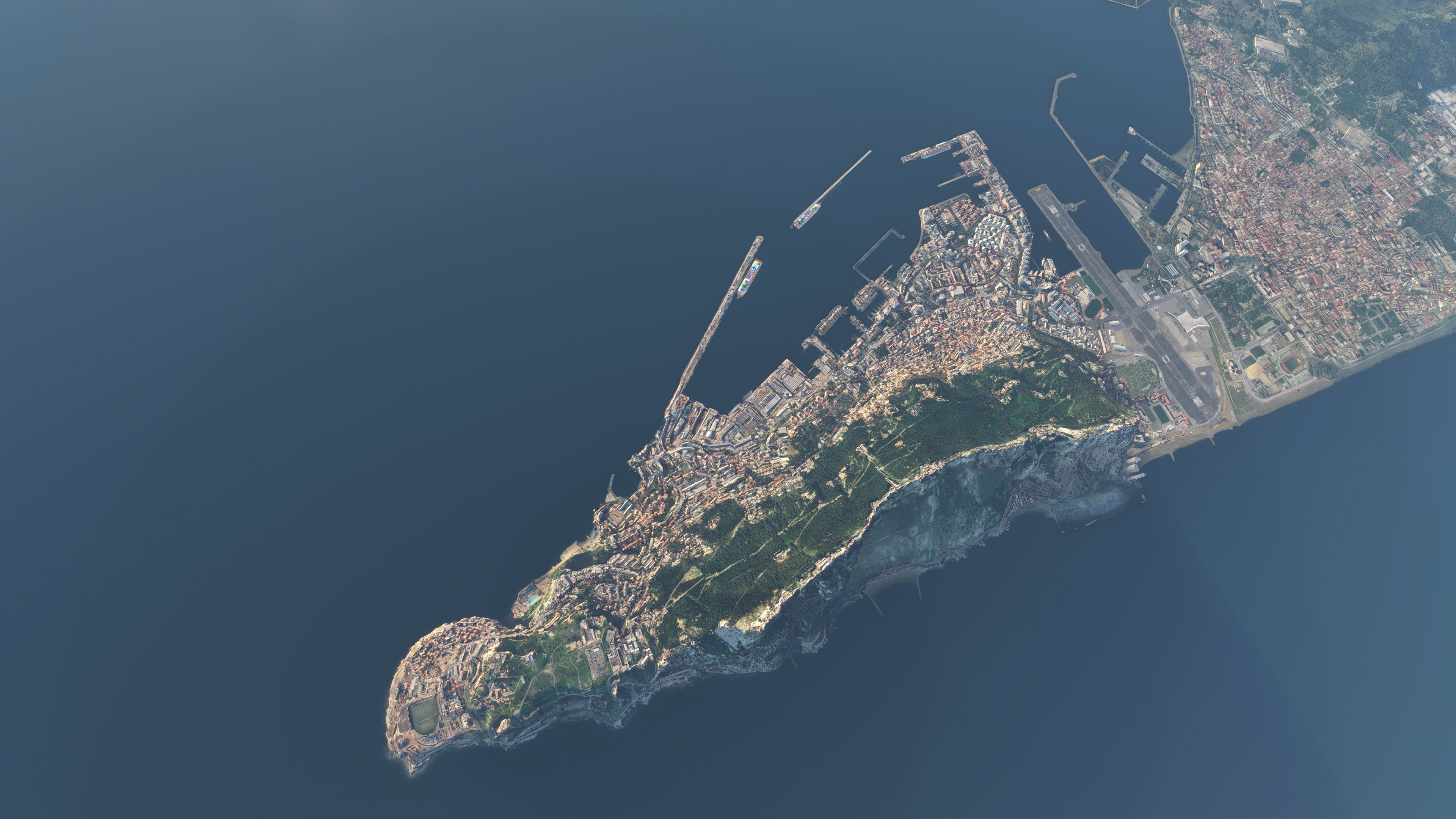
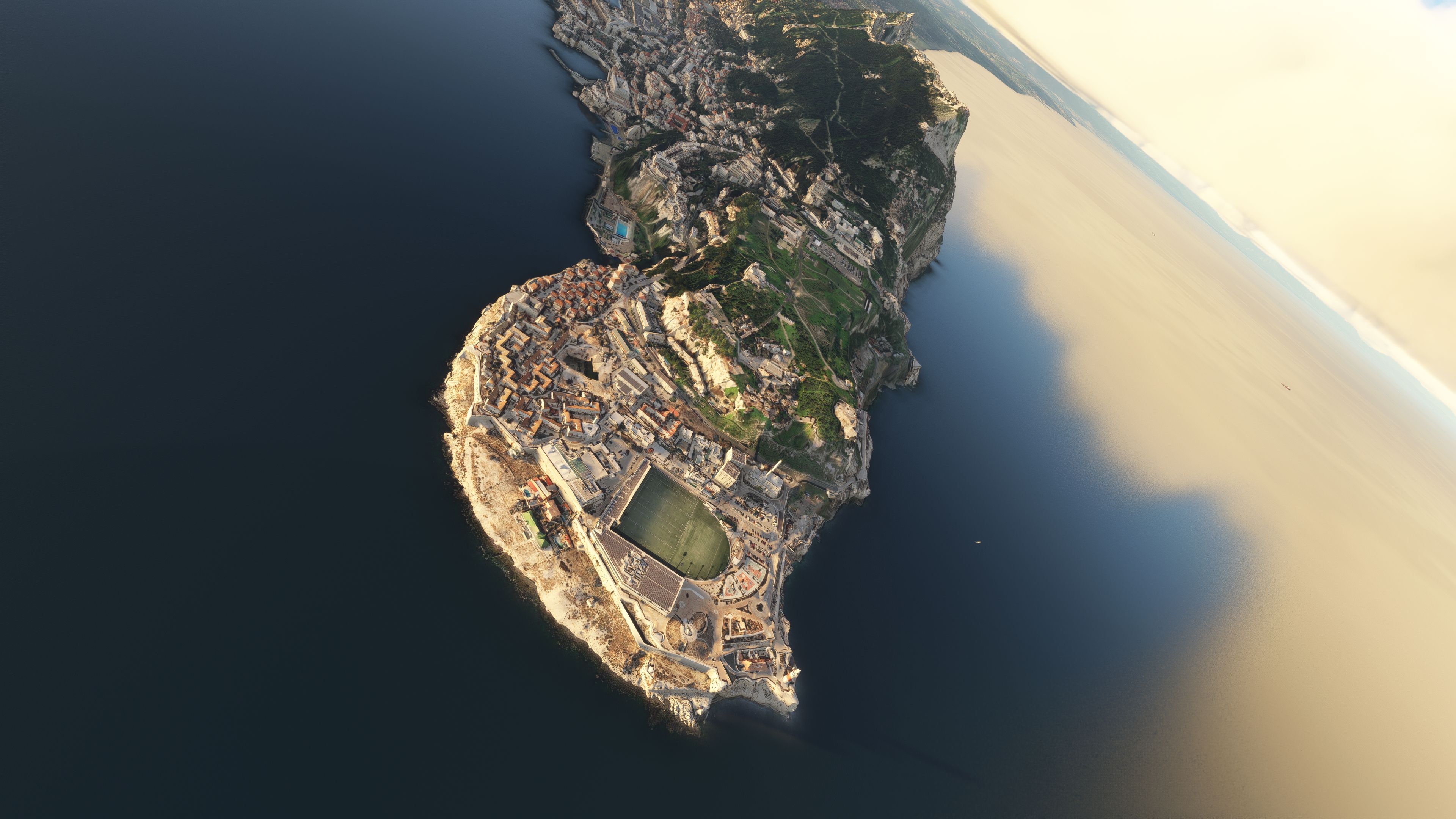
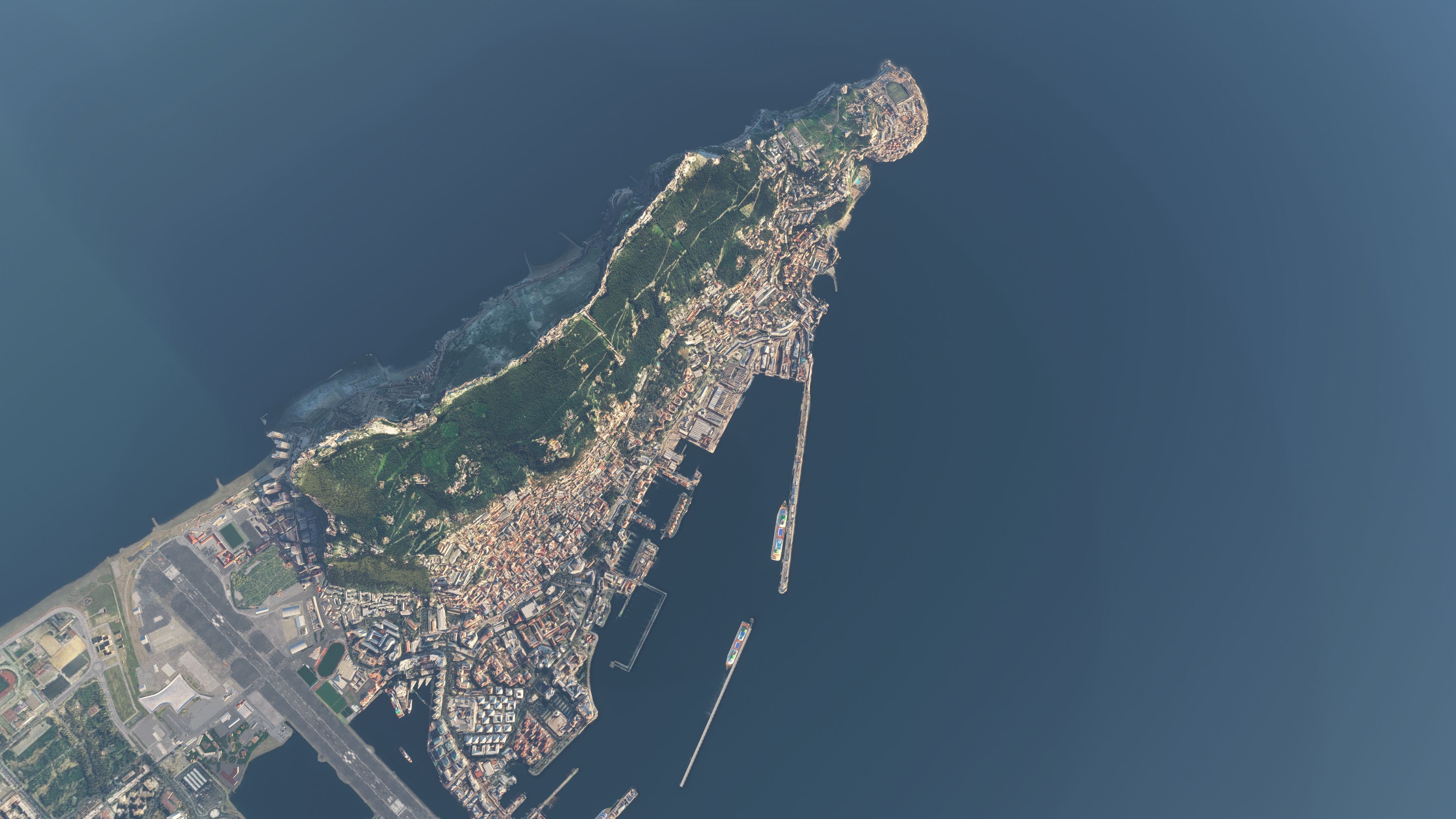
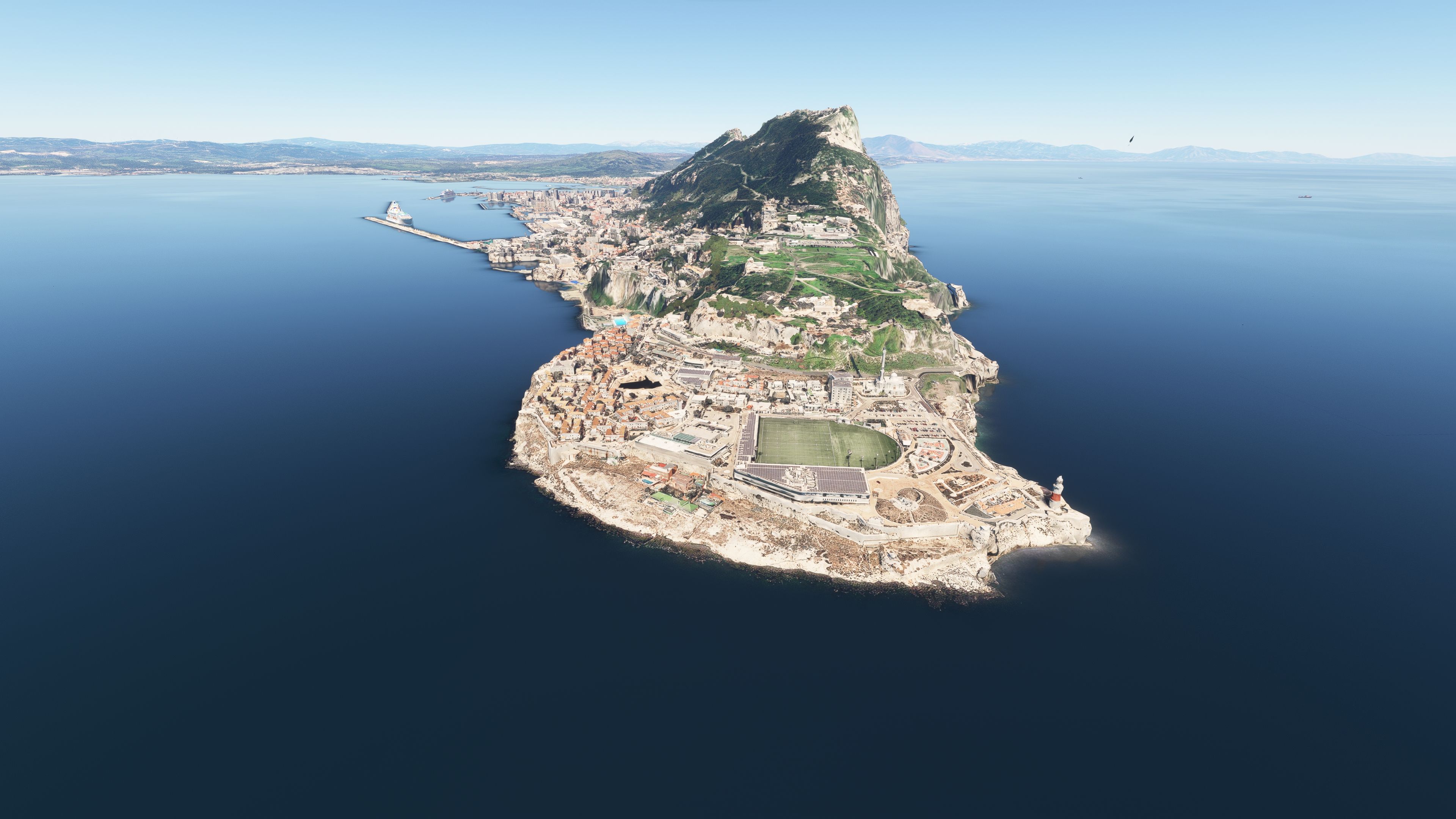
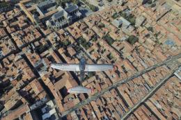
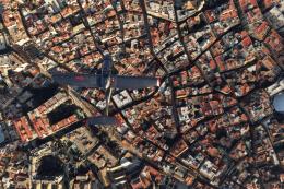
Gibraltar’s Rock, cityscape, and airport environs gain crisp photogrammetry detail with a true-to-life 3D layout that strengthens VFR landmark spotting and low-level approaches in Microsoft Flight Simulator. The scenery uses high-resolution Google Maps-derived data, includes accurate georeferencing, and refines terrain elevation around the RAF base for smoother realism.

5 star rating 5/5 (3) 1K downloads Flight Simulator 2020 CompatibleFlight Simulator 2024 Compatible Gibraltar
  • File: msfs-gibraltar-photo-scenery.zip
  • Size:1.38 GB
  • Scan: Clean (4d) Verified clean
  • Access:Freeware
  • Content:Everyone
Adam McEnroe

Expert Overview

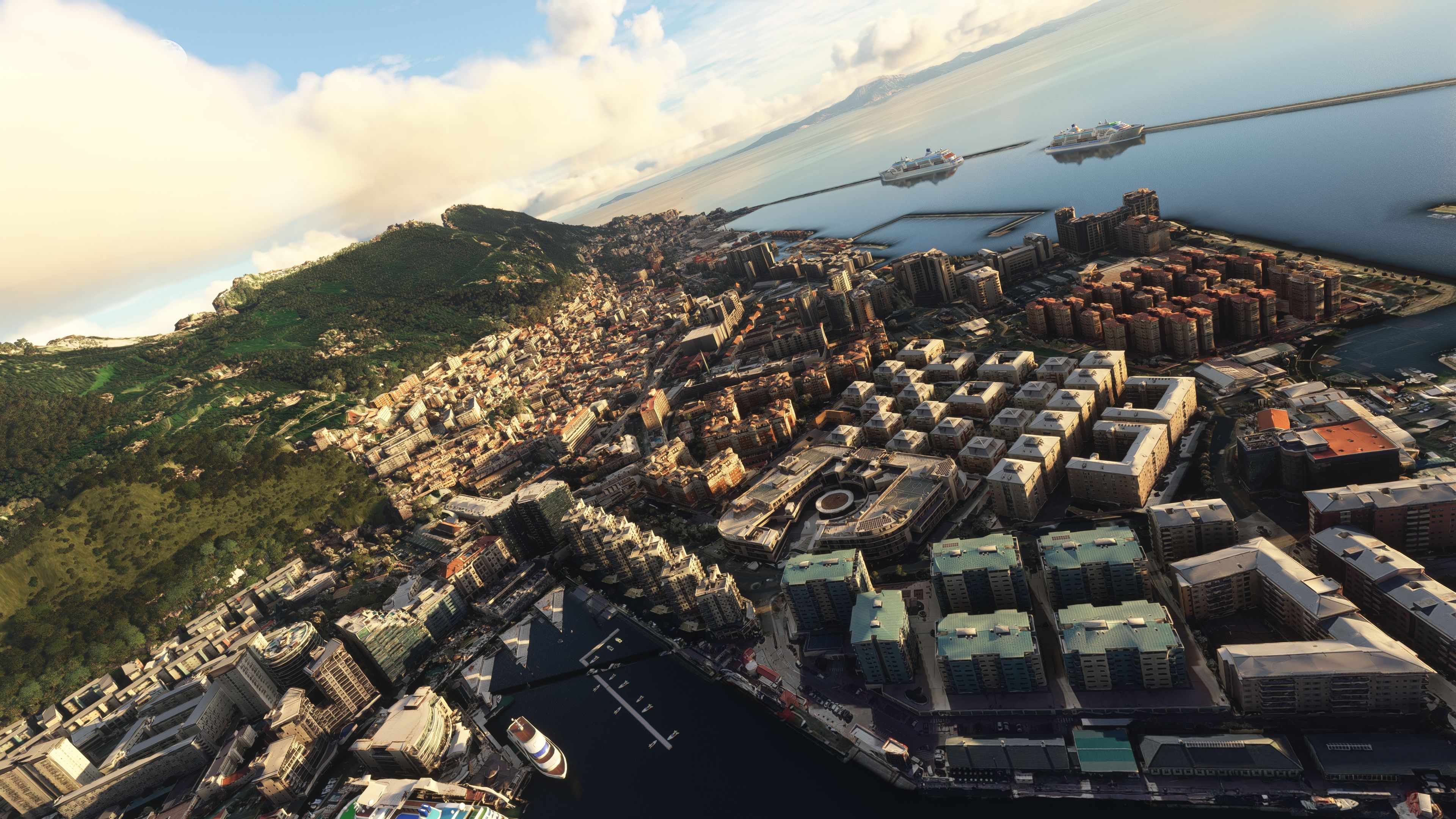
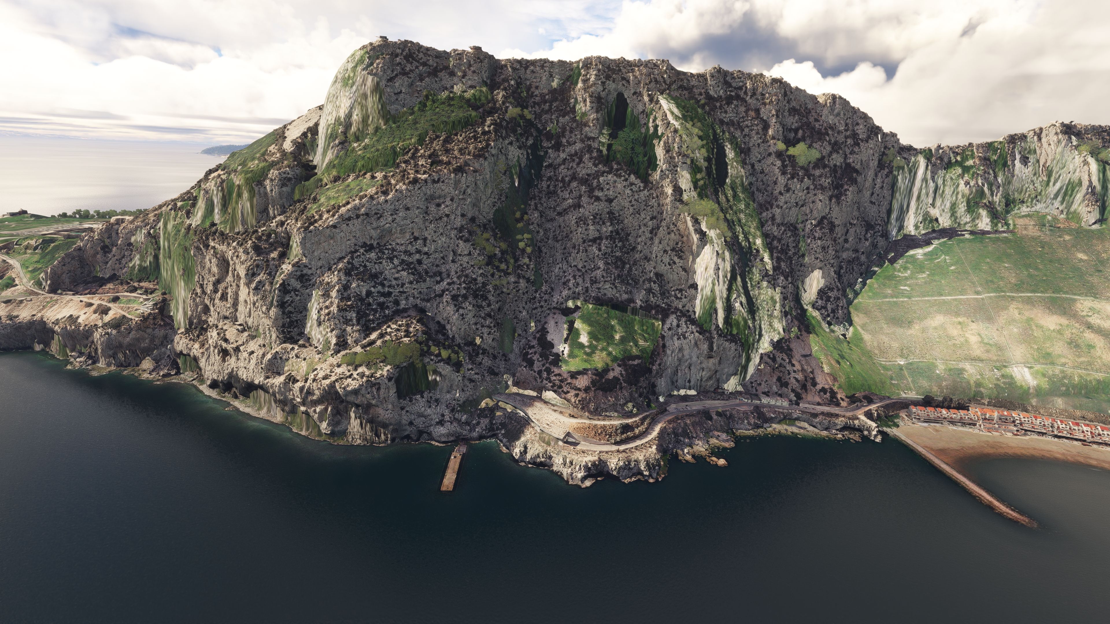
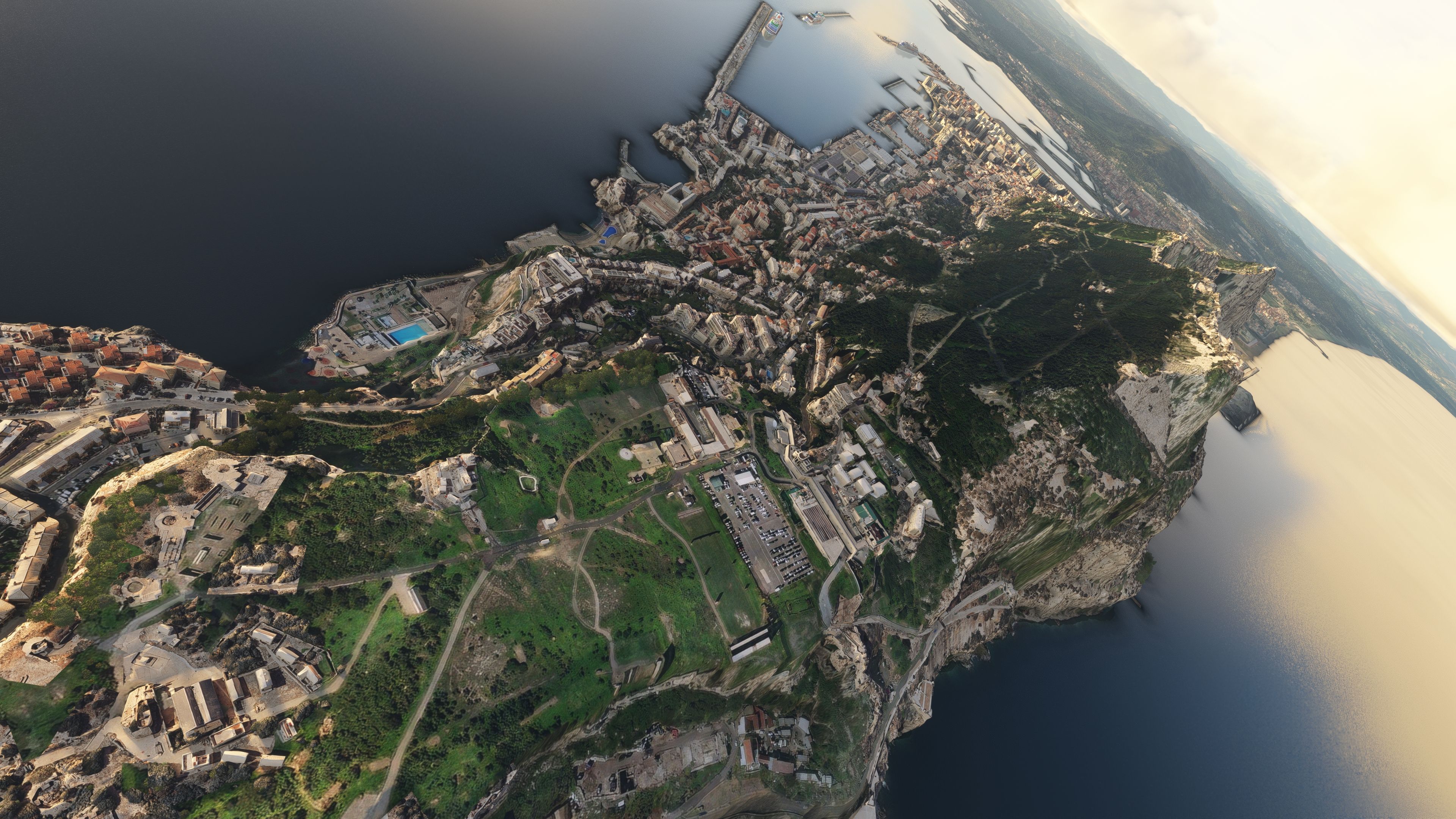
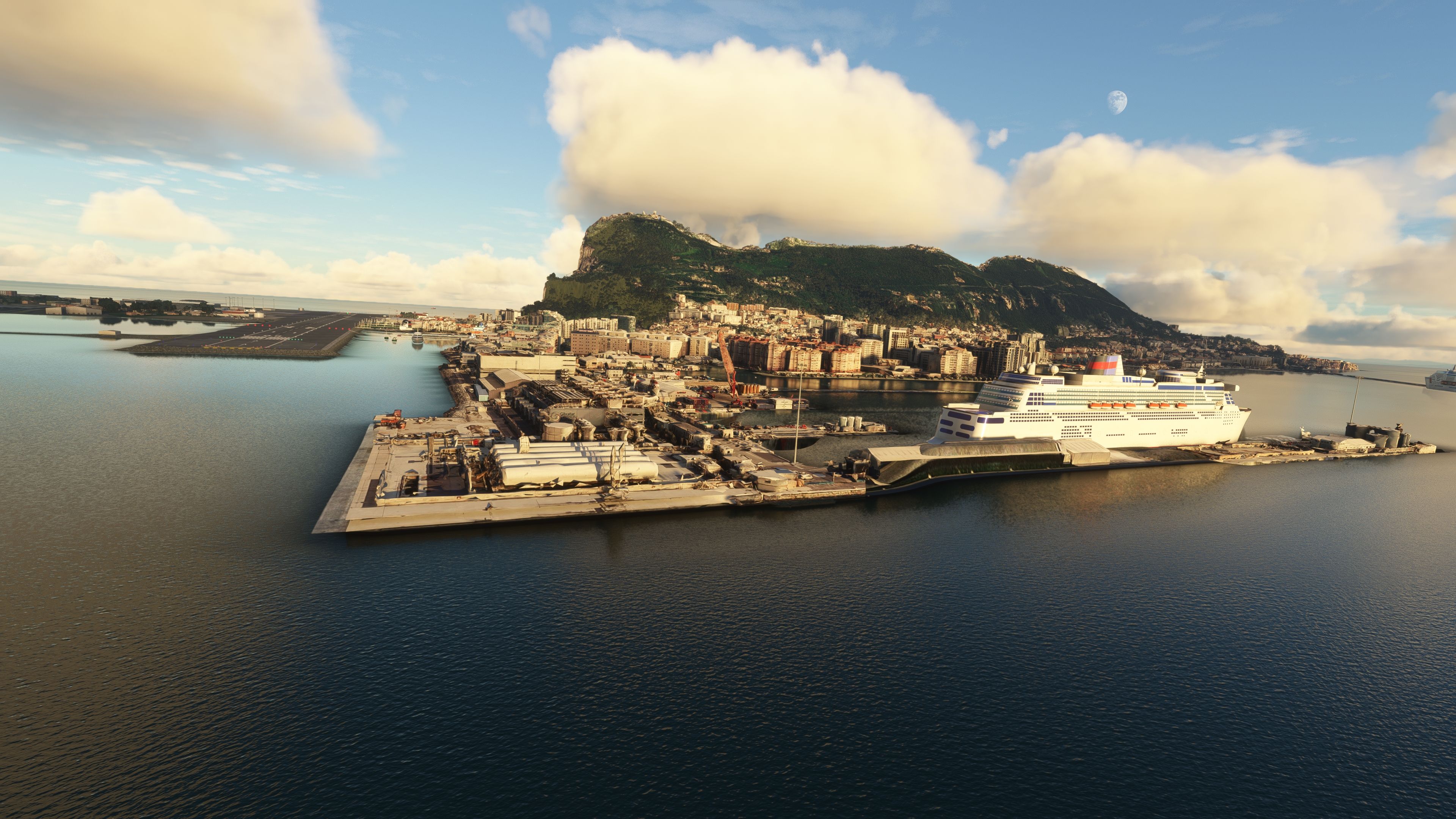
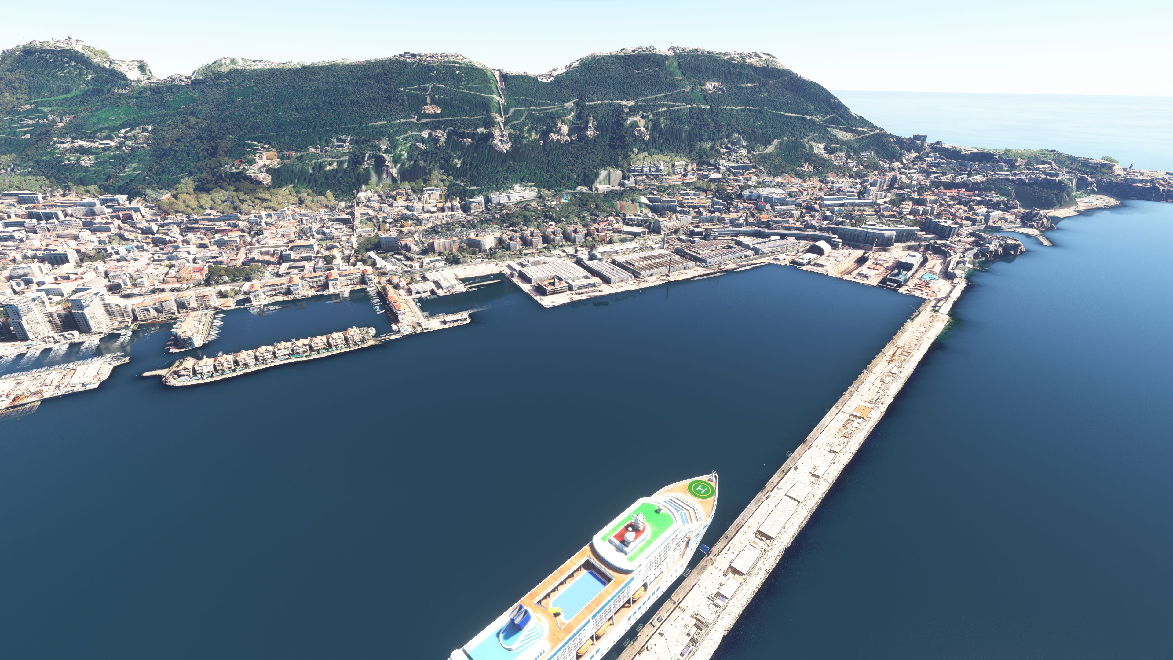
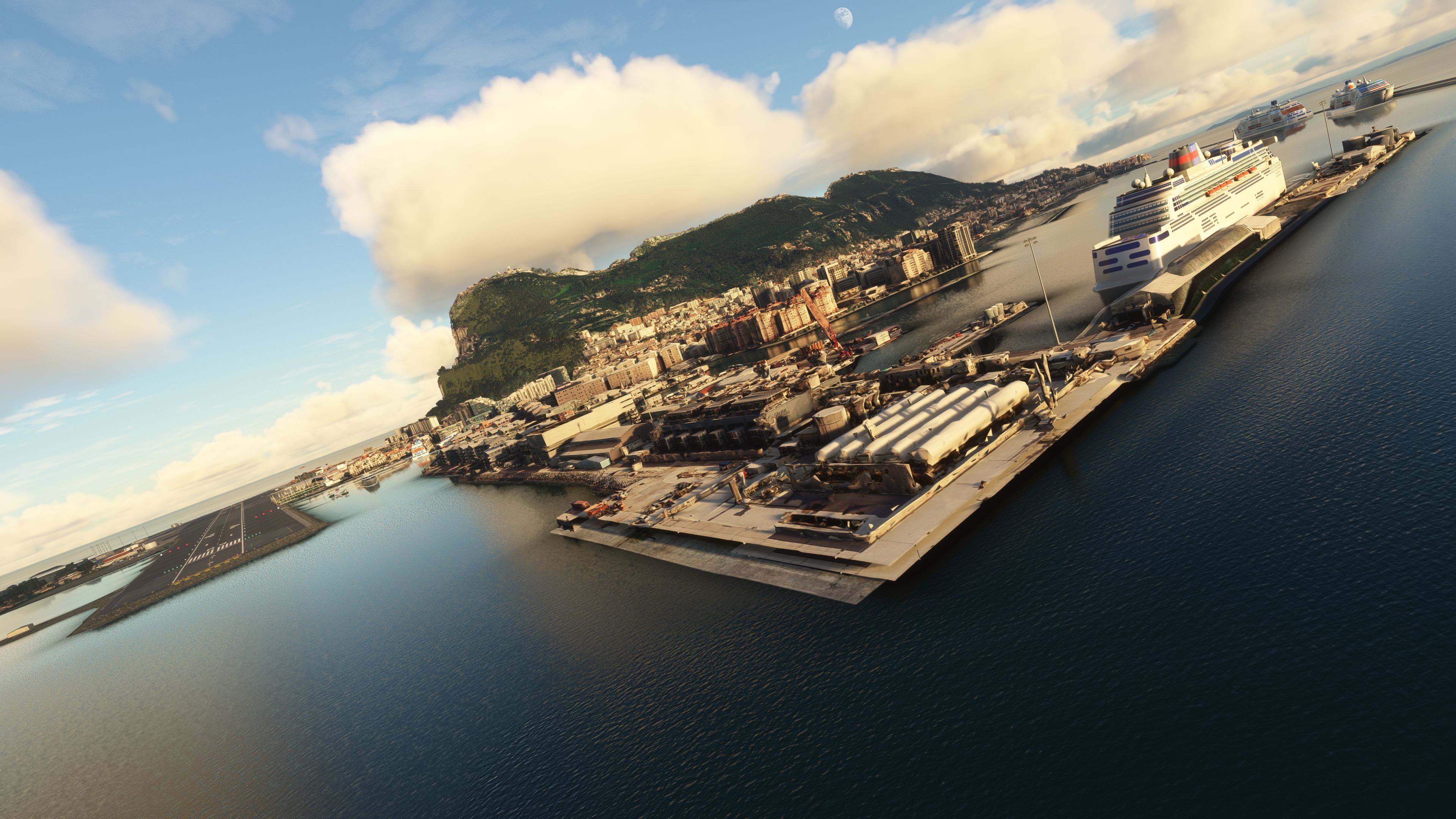
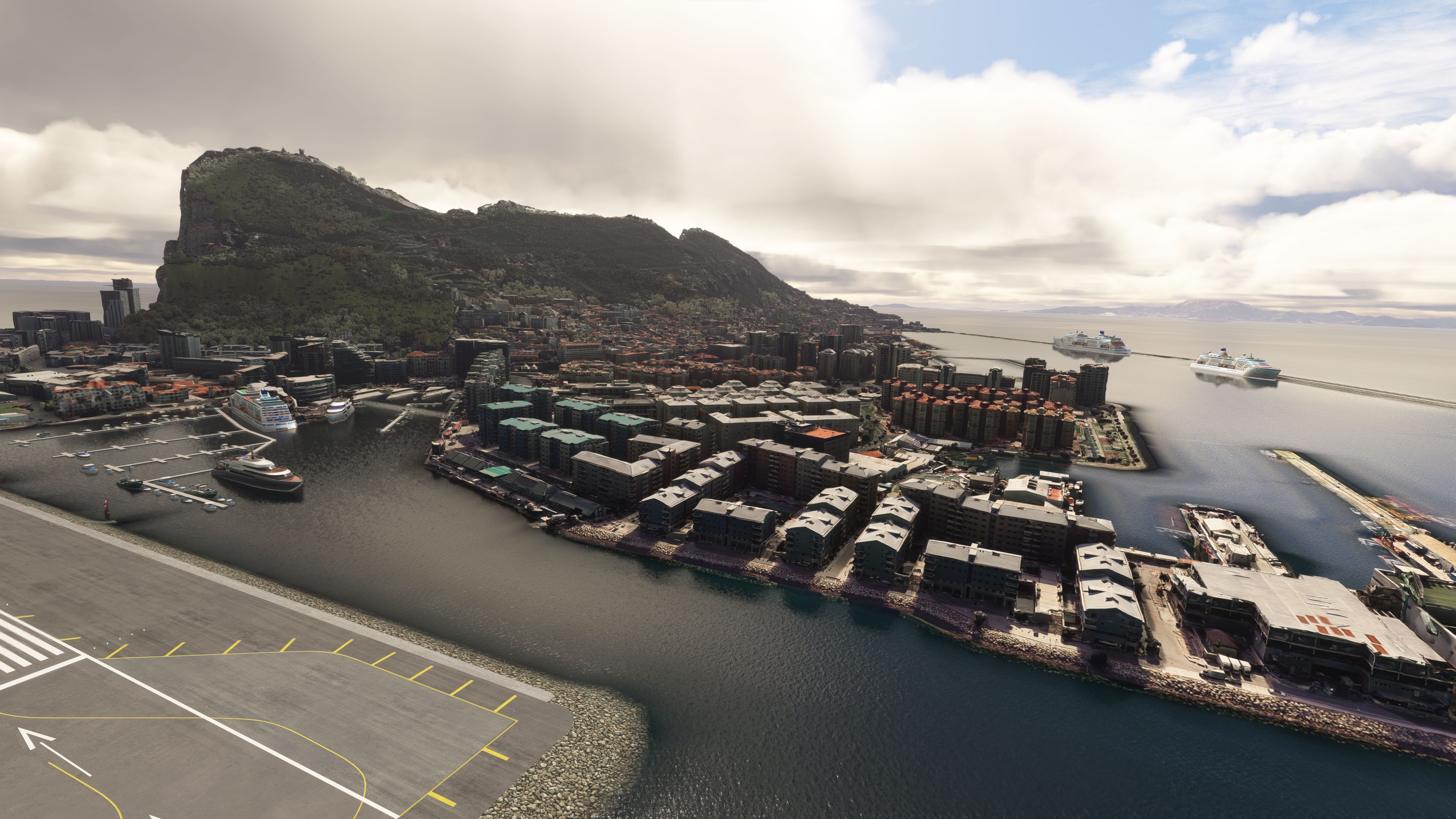
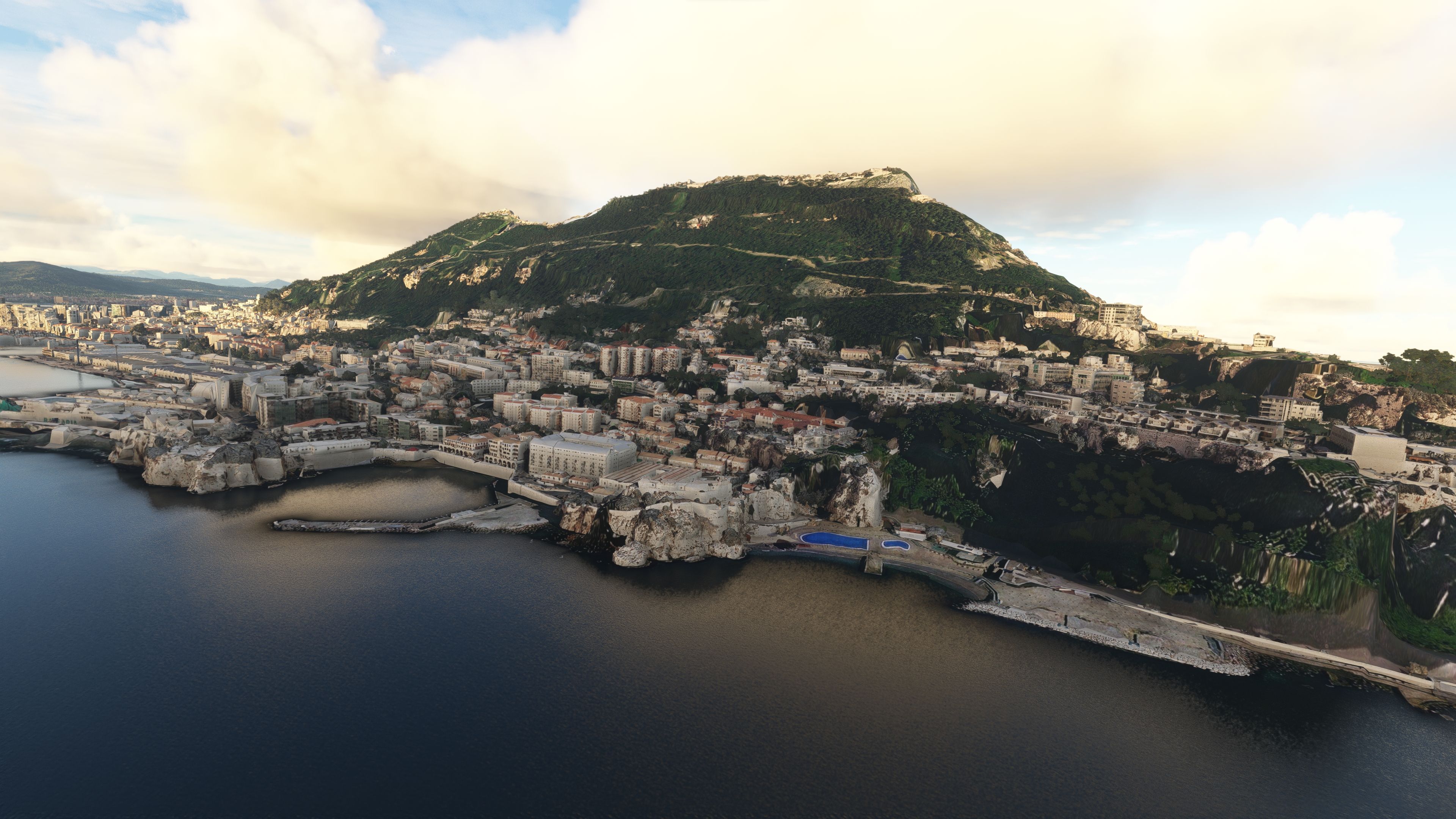
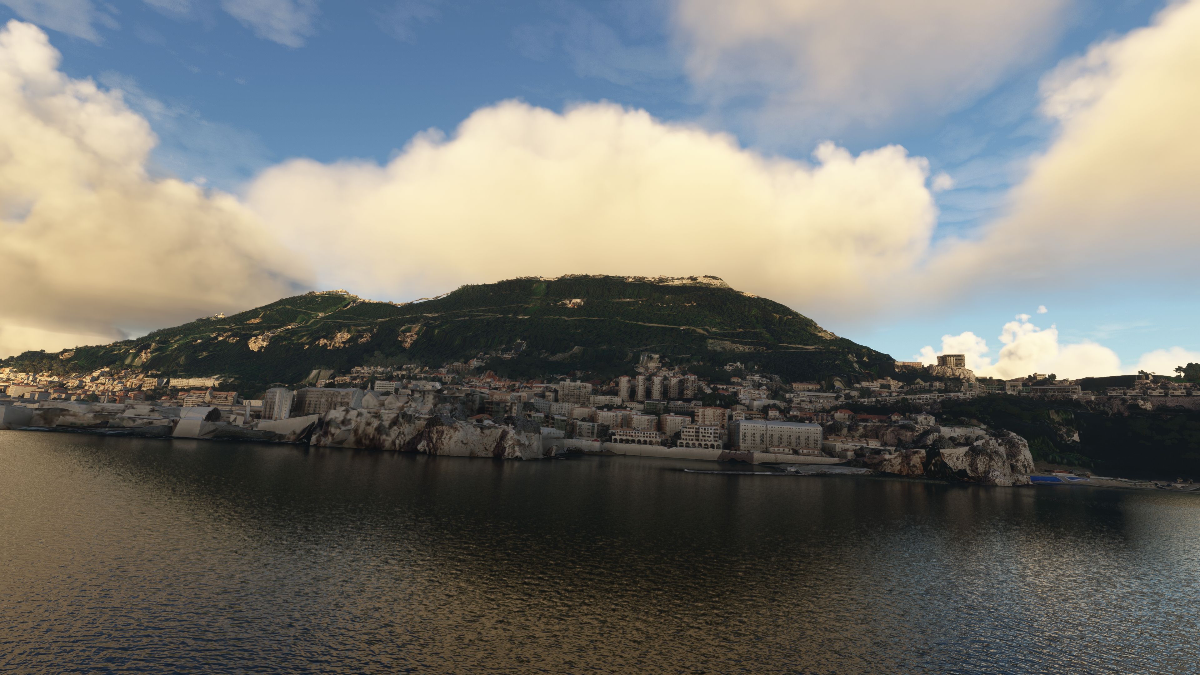
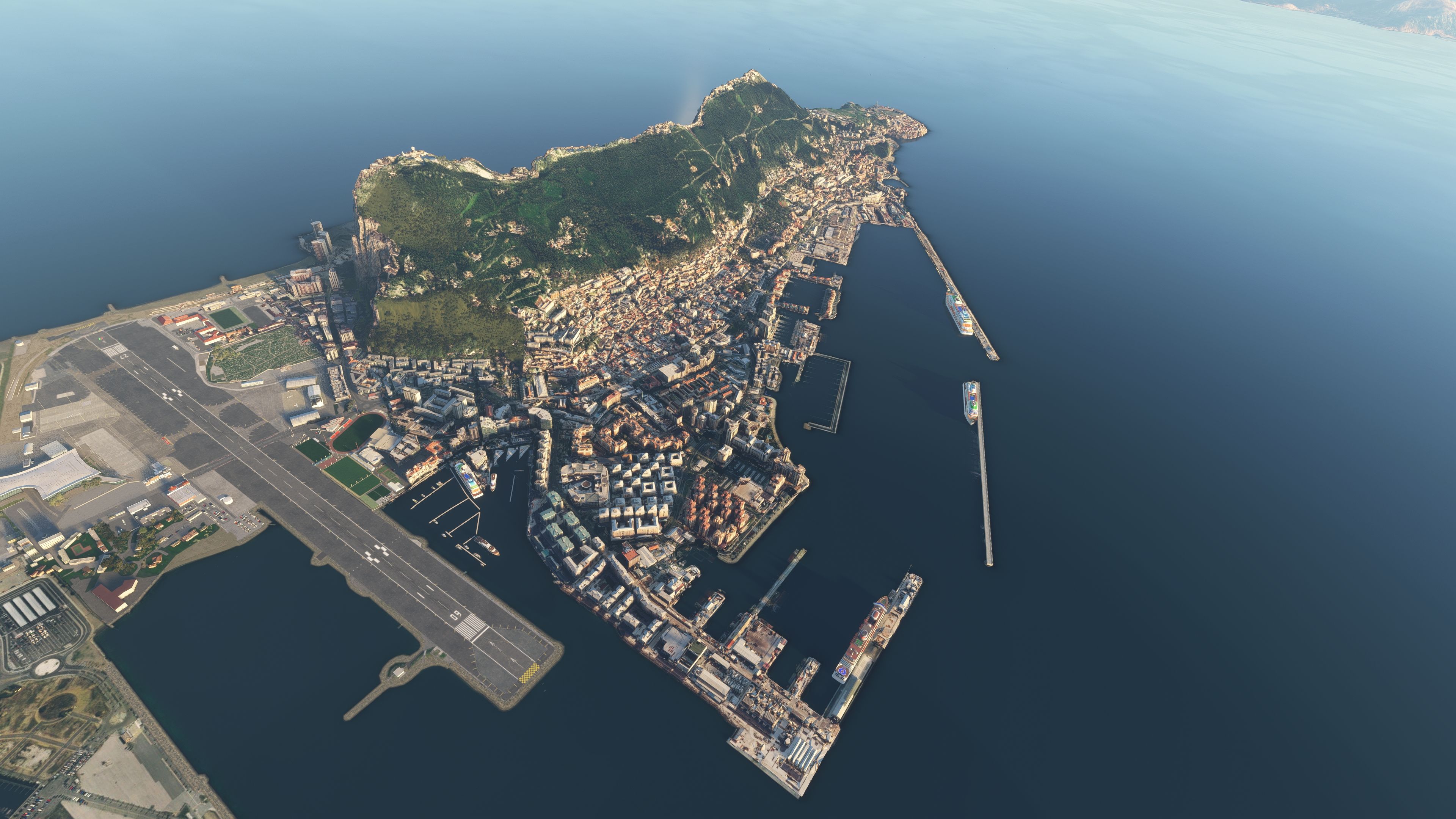
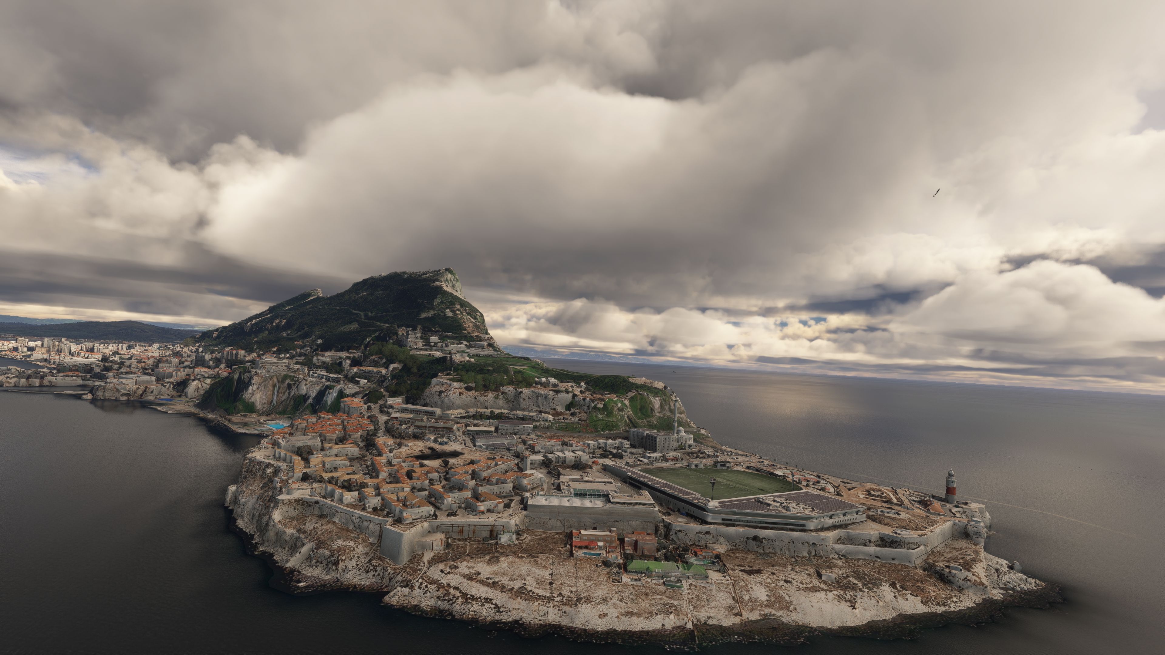
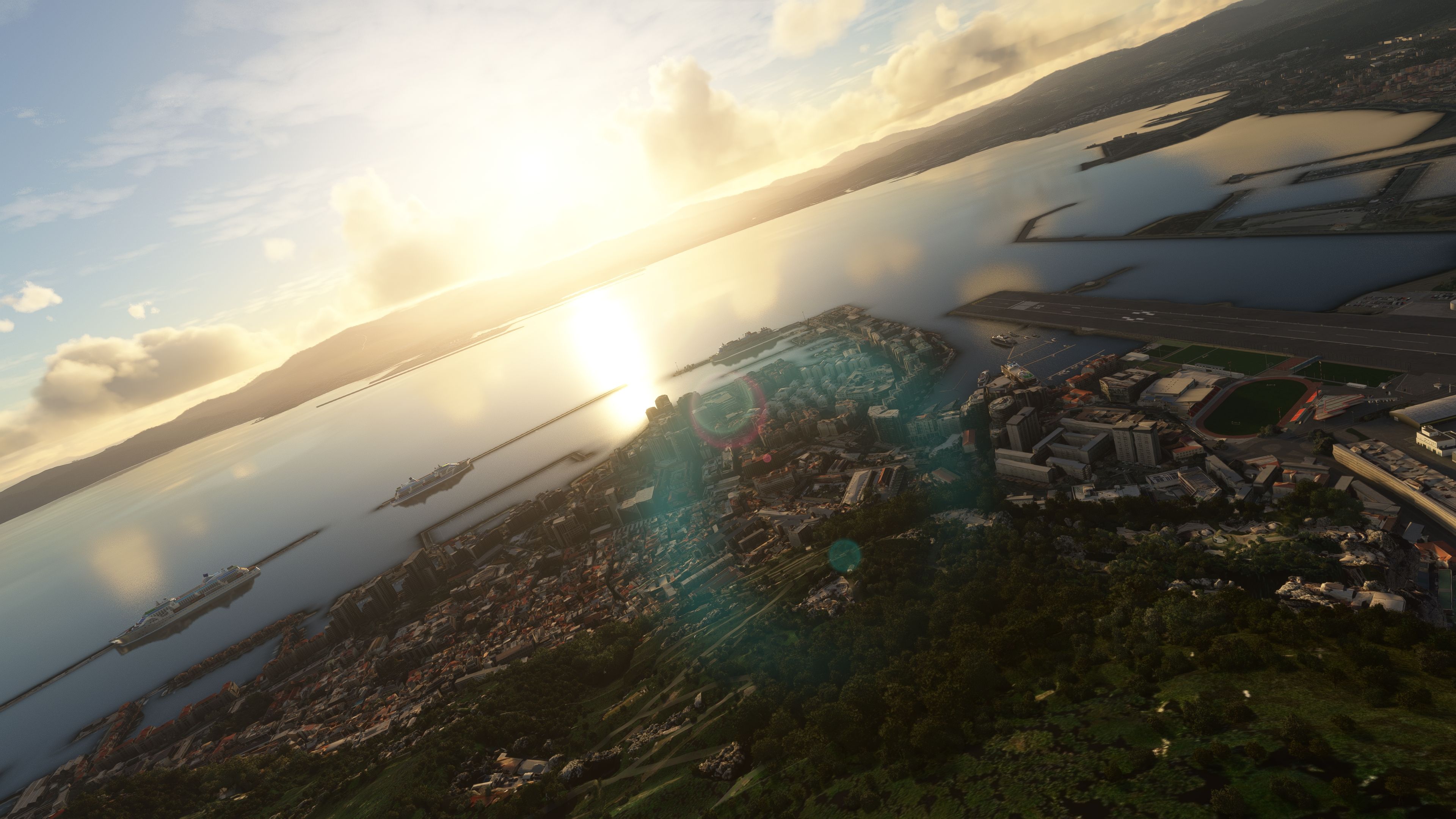
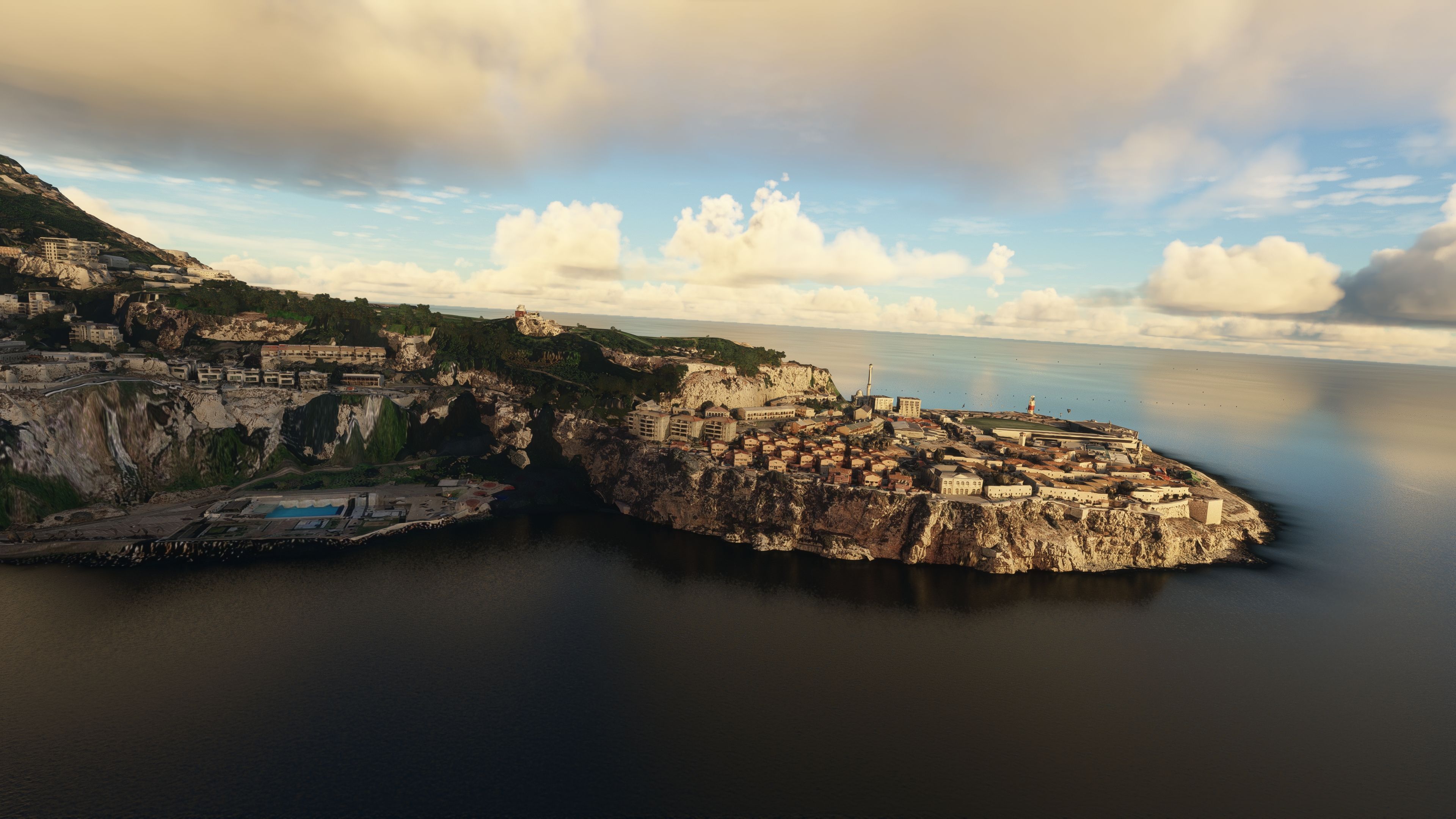
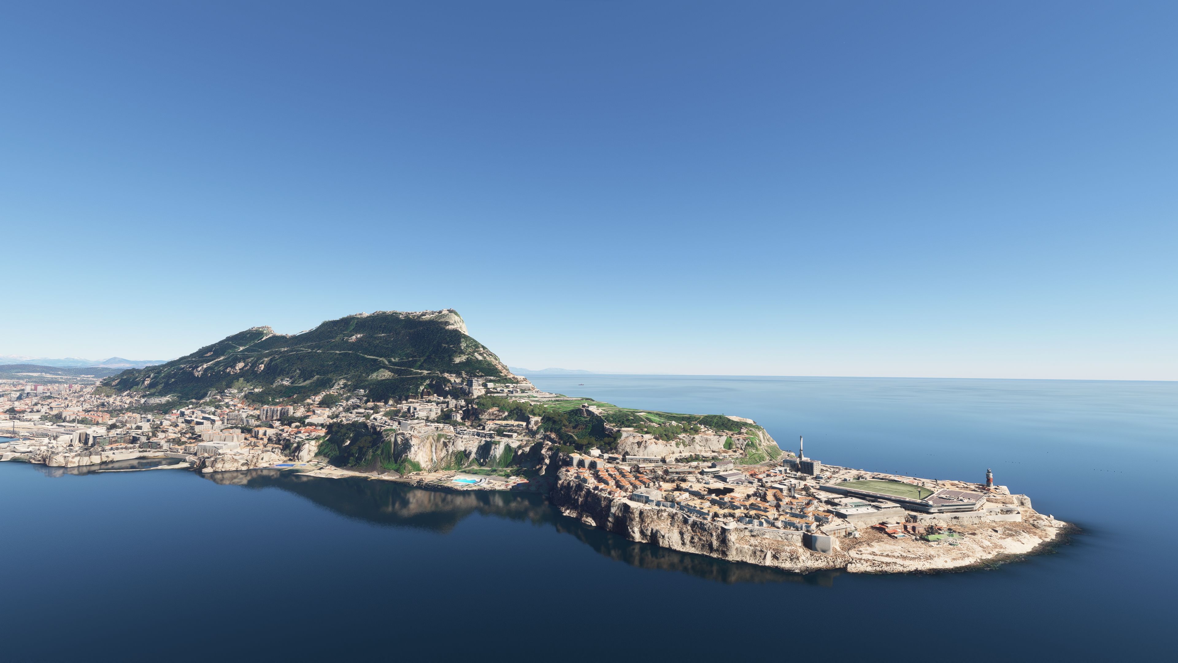
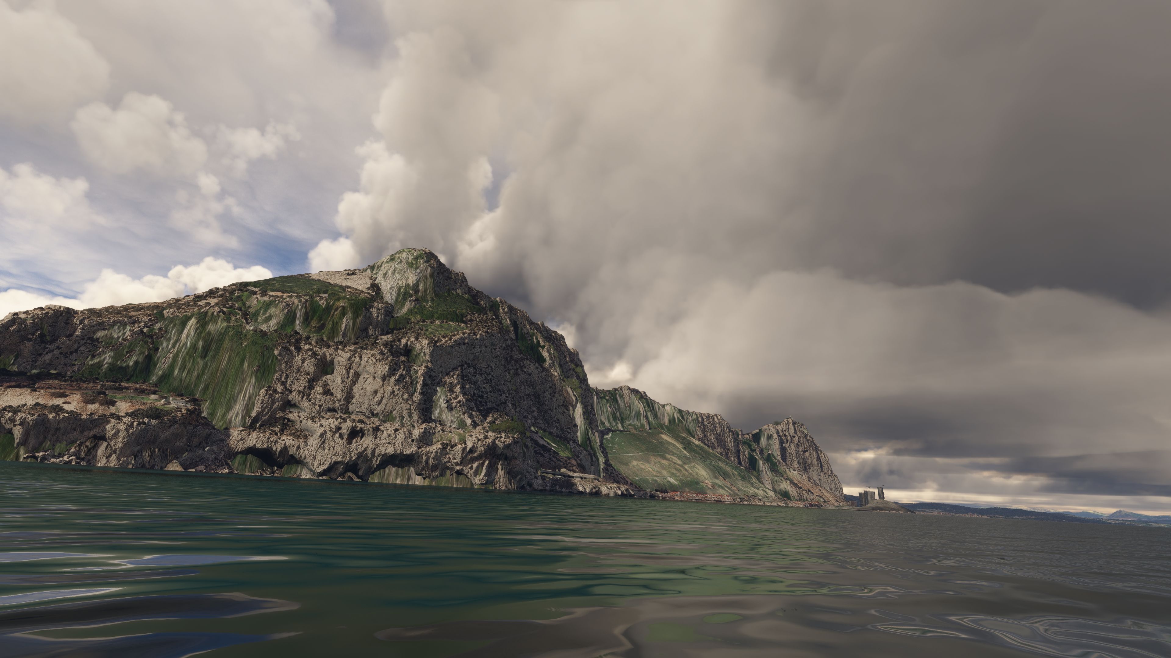
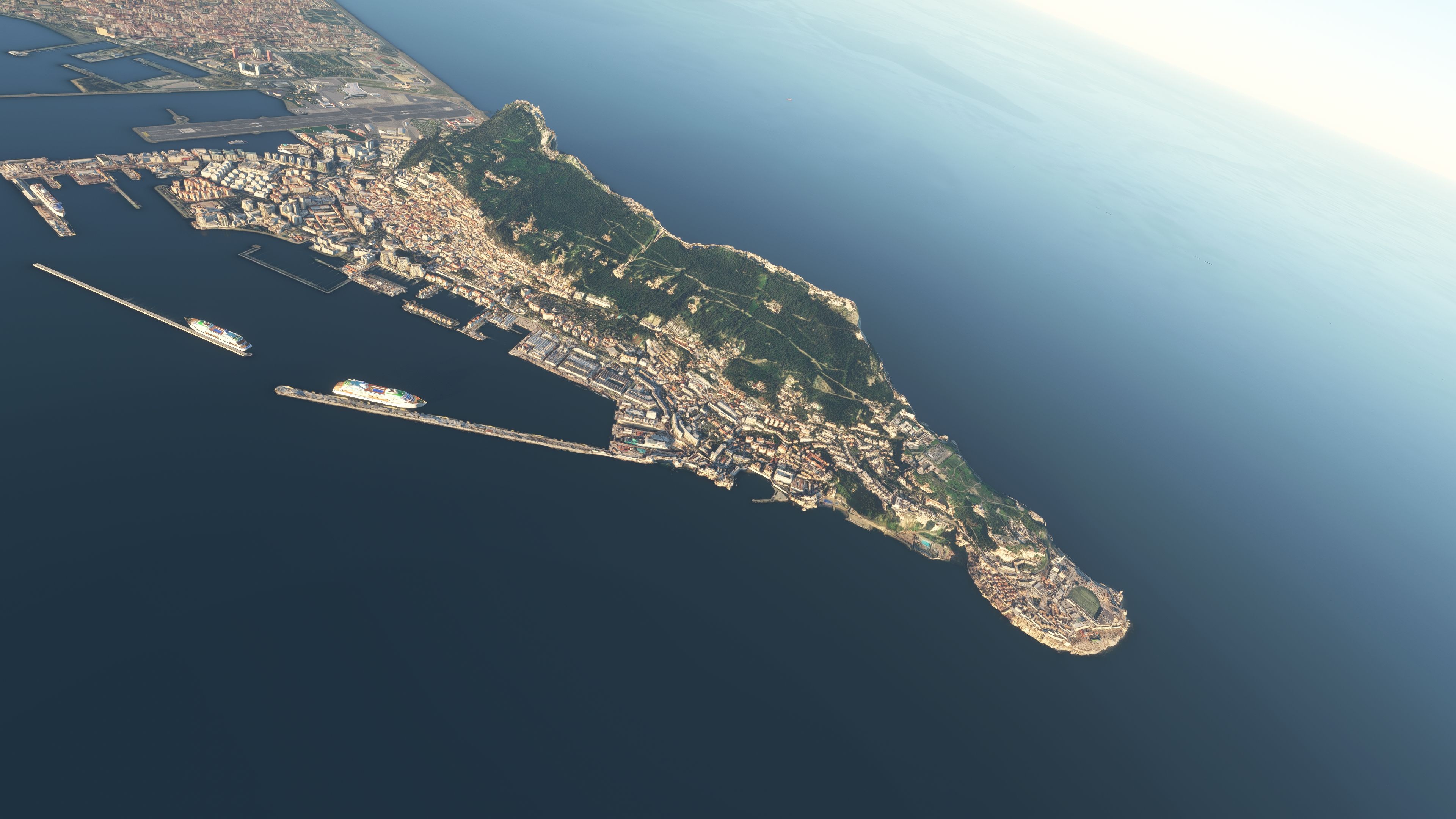
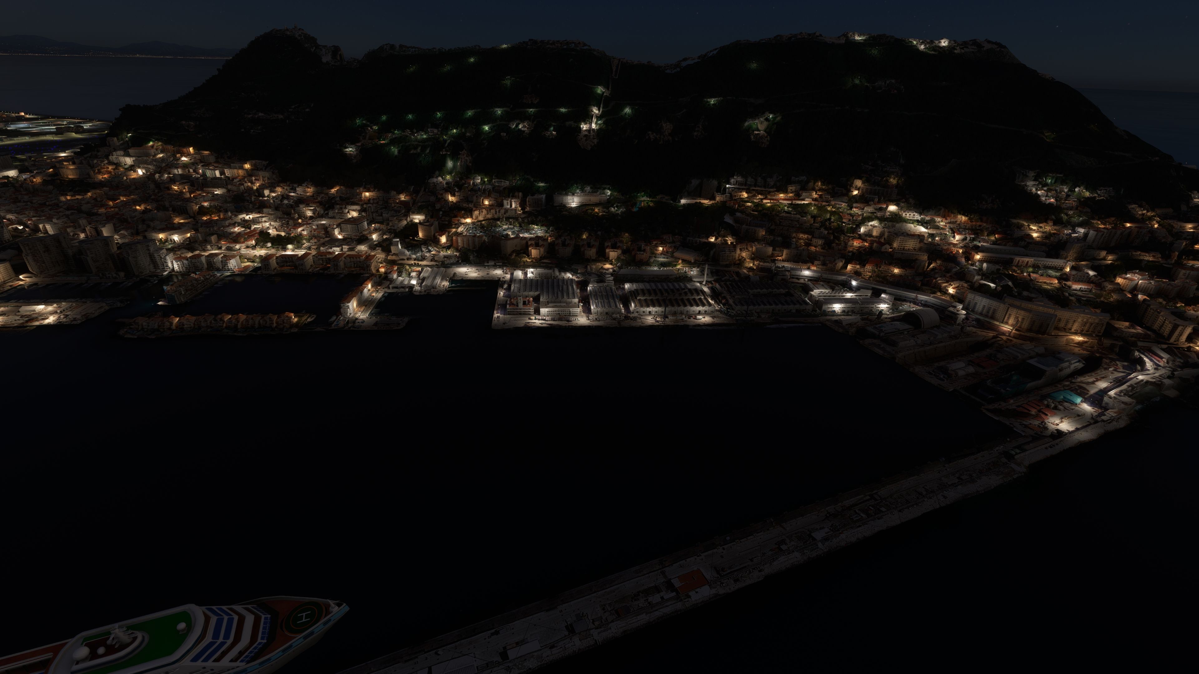
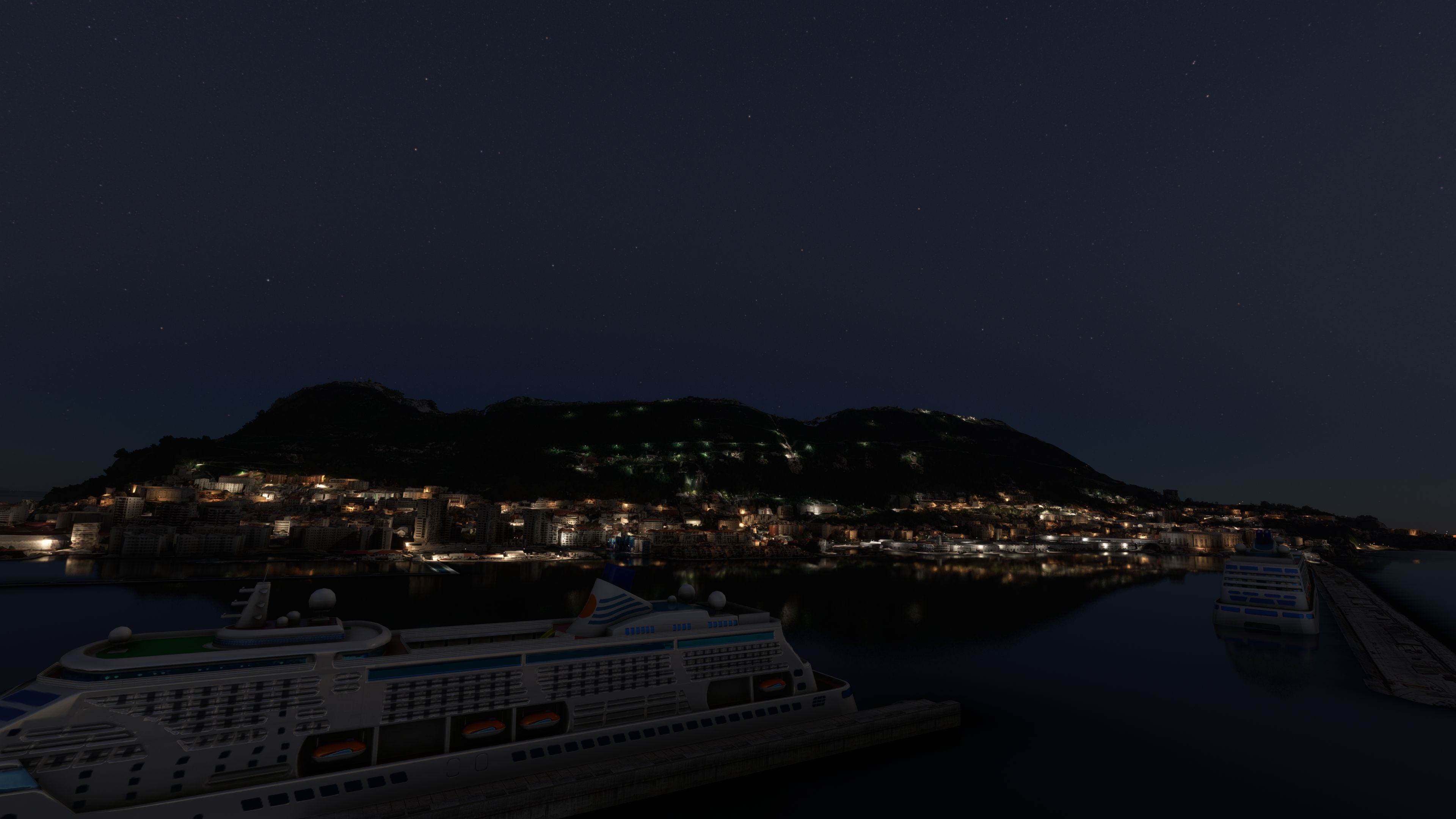
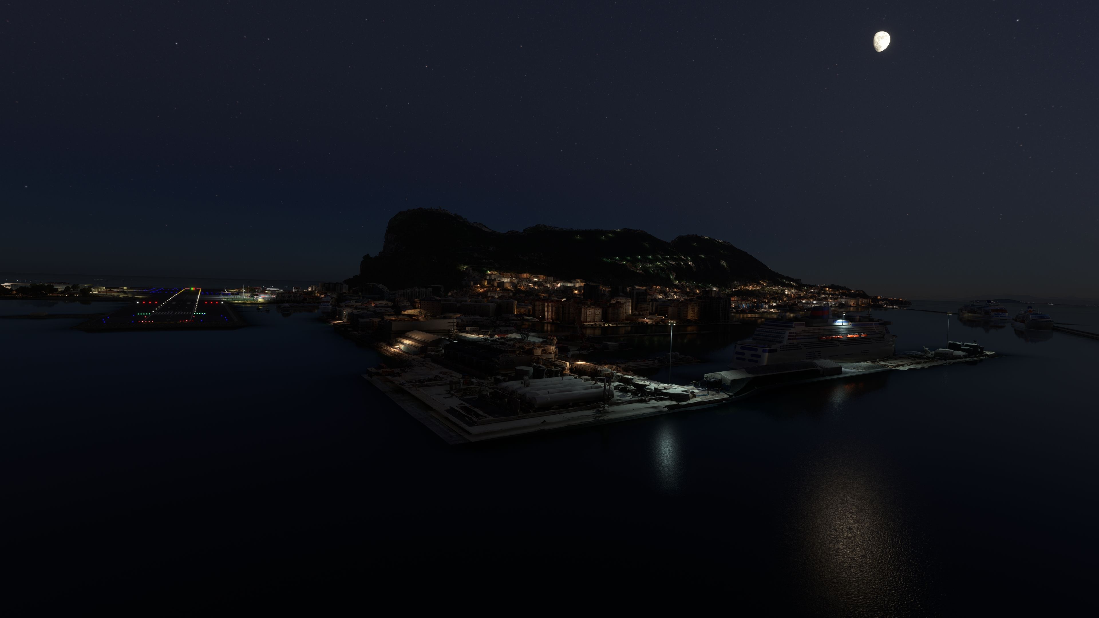
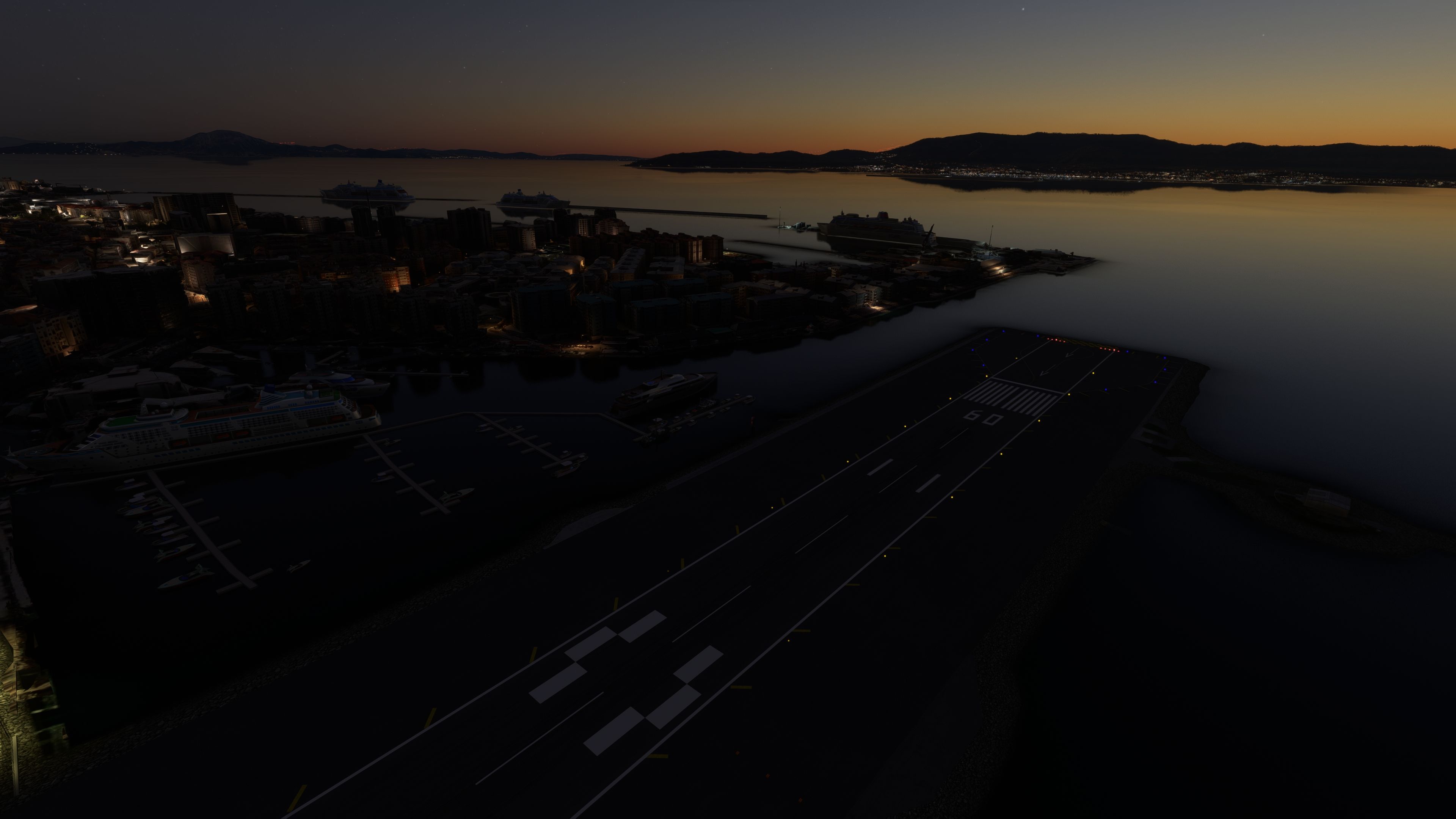
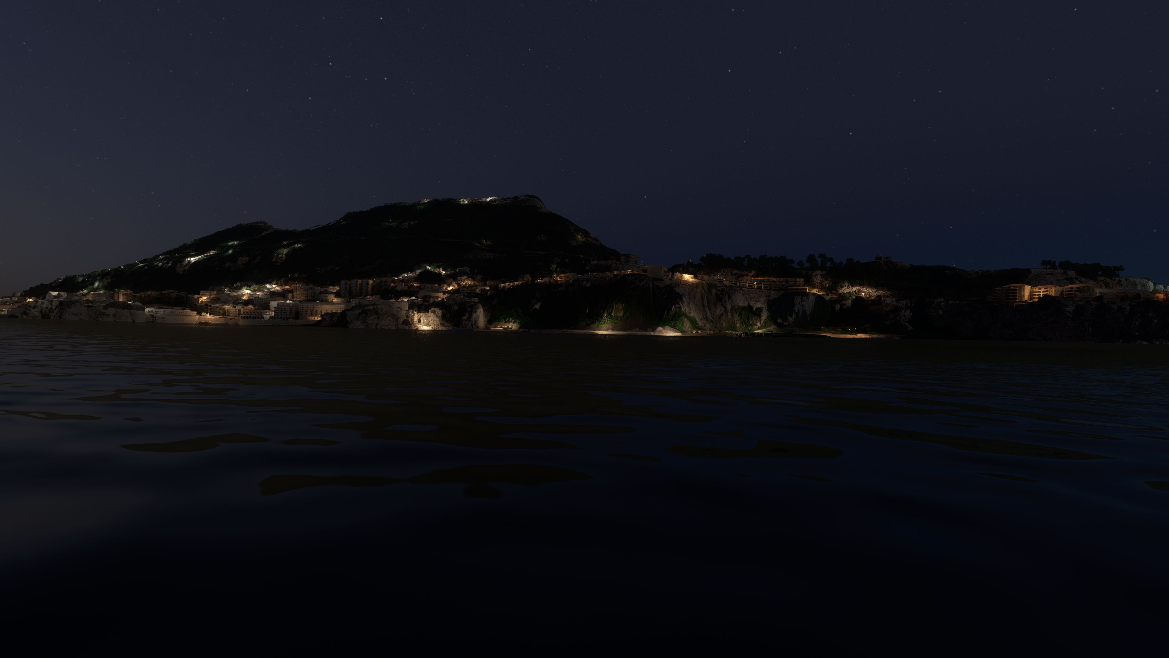
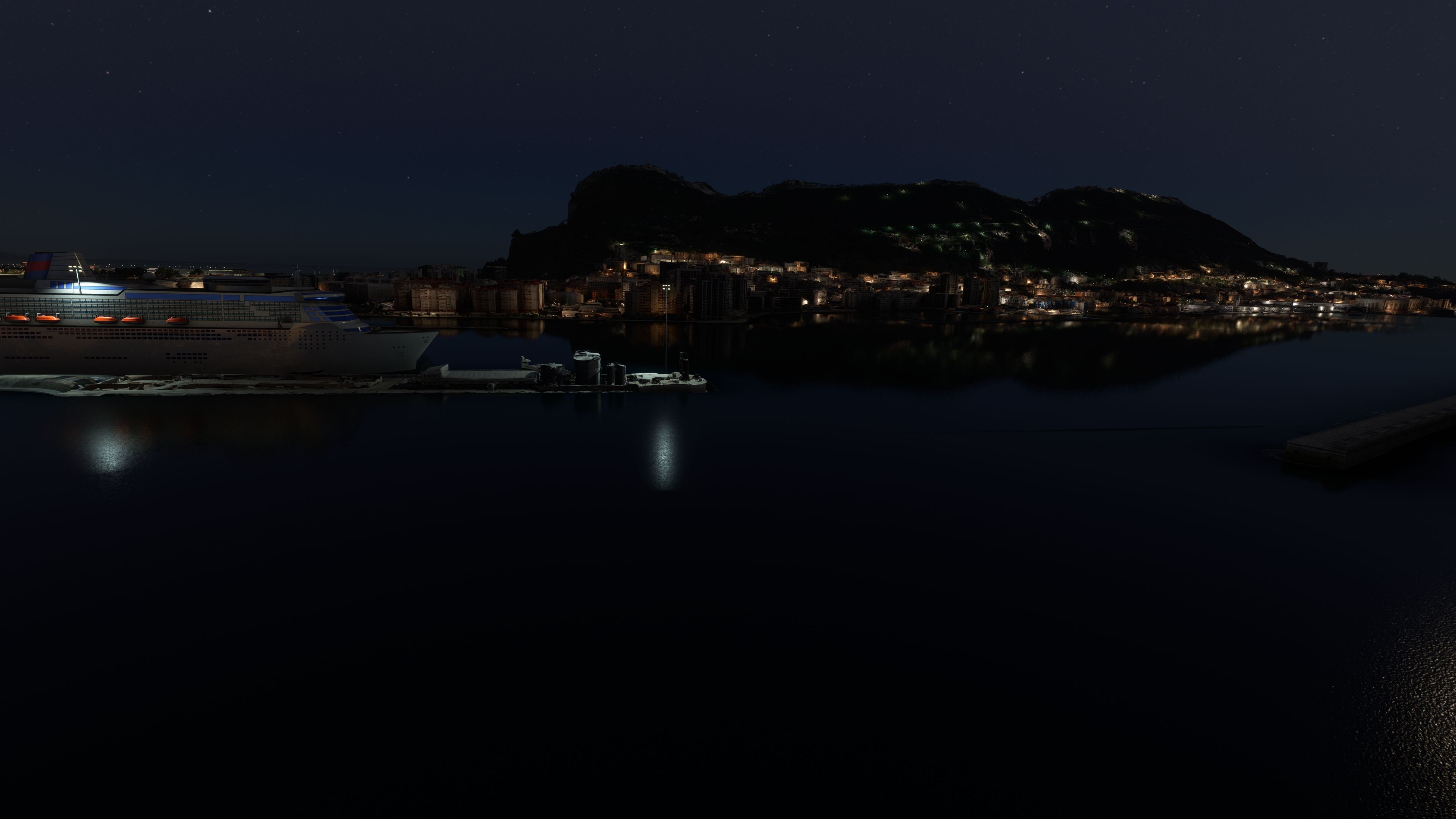
This freeware Gibraltar photogrammetry mod boosts the realism of Microsoft Flight Simulator by delivering high-resolution 3D modeling derived from accurate source imagery. The result is a remarkably immersive virtual environment, showcasing the dramatic landscape of the British Overseas Territory—including the iconic Rock of Gibraltar, bustling city streets, and meticulously recreated coastlines. With version 1.1 addressing prior terrain anomalies near the RAF base, the mod delivers smoother flight dynamics and a faithful portrayal of the region’s unique geography.

As someone with decades of flight sim experience, I appreciate how this scenery seamlessly integrates with the simulator's engine, providing fluid transitions between real-world landmarks and cockpit instrumentation. The detail is especially noticeable during low-altitude flights—with buildings, roads, and shorelines precisely matching real-world data. For sim pilots seeking a deeper connection to Gibraltar’s strategic importance and rich heritage, this mod offers an extraordinarily authentic aviation experience that elevates any MSFS journey.

This mod was installed, tested and reviewed by Adam McEnroe for Fly Away Simulation. Adam is an FS mod expert. Read his bio here.

Immerse yourself in the stunningly recreated Gibraltar region in Microsoft Flight Simulator (MSFS) 2020. This freeware photogrammetry scenery mod, meticulously designed for avid flight simulation enthusiasts, enhances the virtual experience by bringing the iconic and strategic British Overseas Territory to life with exceptional accuracy and detail.

Image shows an Icon A5 flying over Gibraltar with the airport in the background after installing this freeware scenery mod in MSFS.Key Features

  • High-Resolution Photogrammetry: Experience Gibraltar like never before, with detailed 3D models derived from high-quality Google Maps data.
  • Accurate Geographic Representation: The mod includes precise GPS coordinates (36° 8? 24? N, 5° 21? 0? W), ensuring a true-to-life navigation experience.
  • Updated Scenery: Version 1.1 addresses elevation anomalies near the RAF base, enhancing realism and flight dynamics.
  • Seamless Integration: Easy installation by extracting the content into the MSFS Community folder.

About Gibraltar in MSFS

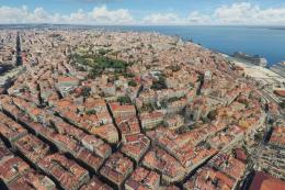
Gibraltar's rich history and unique geography are expertly captured in this scenery mod. From the imposing Rock of Gibraltar to the densely populated city area, every aspect has been replicated with precision. The region's strategic importance, evident through its control over the Strait of Gibraltar, and its vibrant economy based on tourism and financial services are subtly reflected in the scenery's layout and design.

Understanding Photogrammetry in Flight Simulation

Photogrammetry, a process where 2D images are converted into 3D models, brings unmatched realism to flight simulation. This technology allows for the creation of intricate and accurate landscapes, providing pilots with an immersive experience that closely mirrors real-world environments. In the MSFS Gibraltar Scenery mod, photogrammetry ensures that every building, terrain feature, and landmark corresponds with its real-life counterpart.

Installation Instructions

Installing the scenery is straightforward. Simply download the archive, extract it, and copy the thalixte-gibraltar folder directly into the MSFS Community folder. This process integrates the mod with the existing game setup, enabling you to experience the beauty of Gibraltar immediately after installation.

Credits and Acknowledgments

This mod is a testament to the collaboration within the flight simulation community. Credits go to Microsoft and Asobo for creating MSFS, Google Maps for the source imagery, and /u/Jonahex111 for the Google Earth Decoder tool.

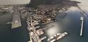
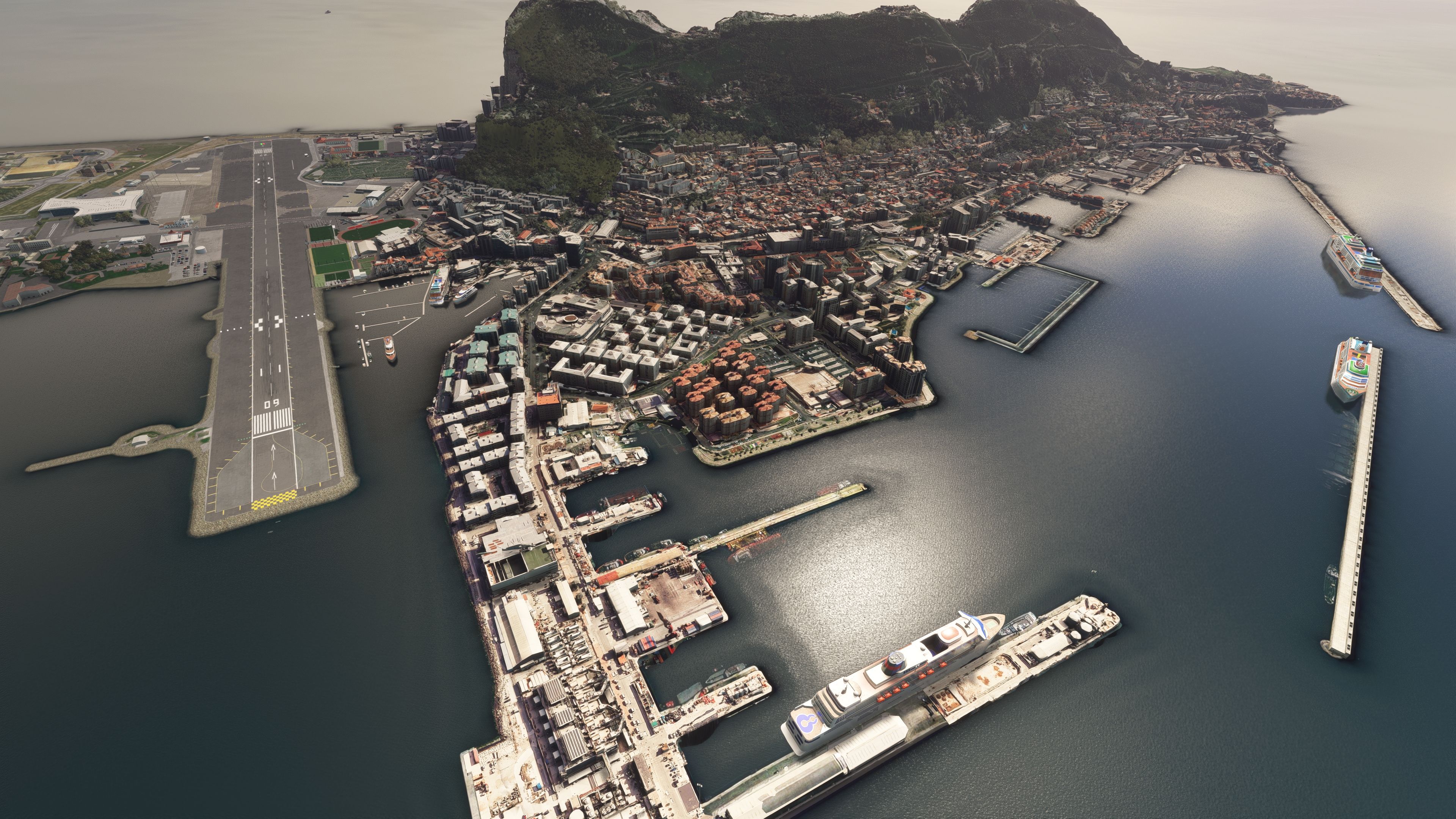
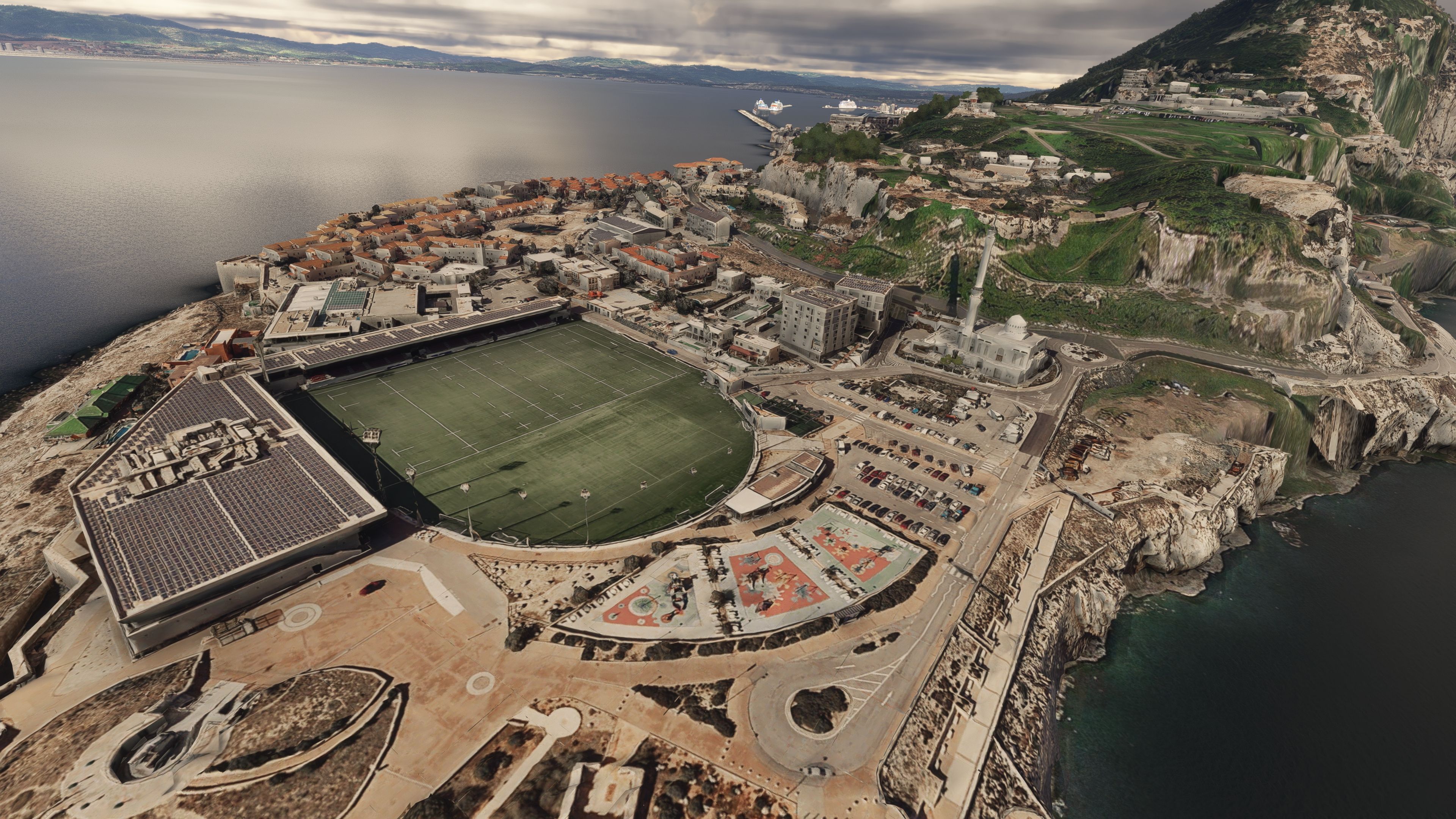
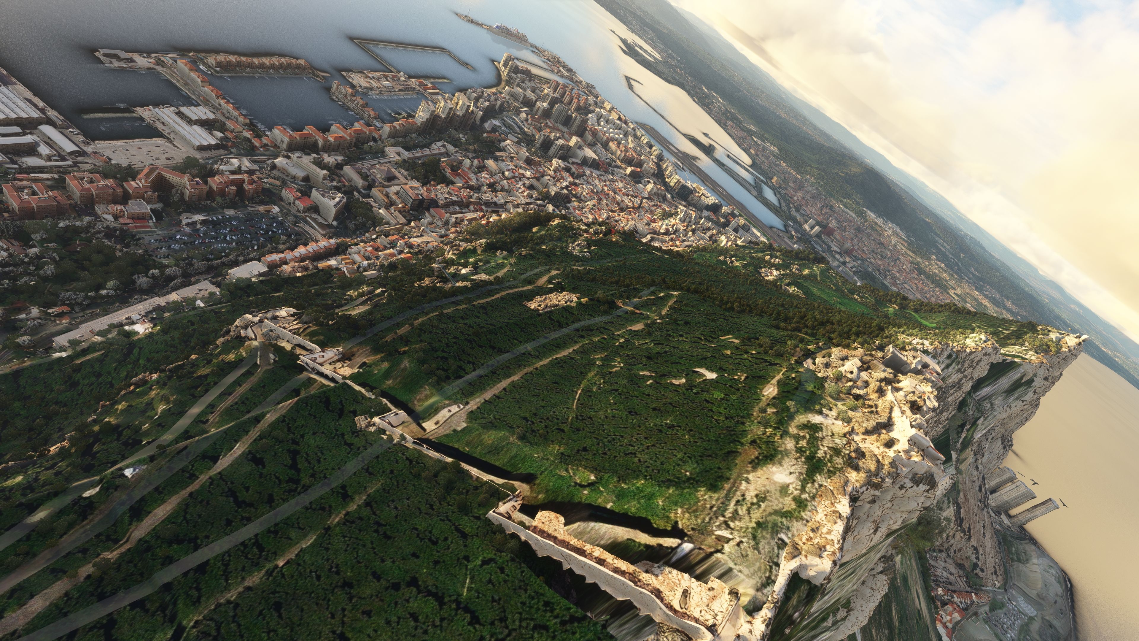
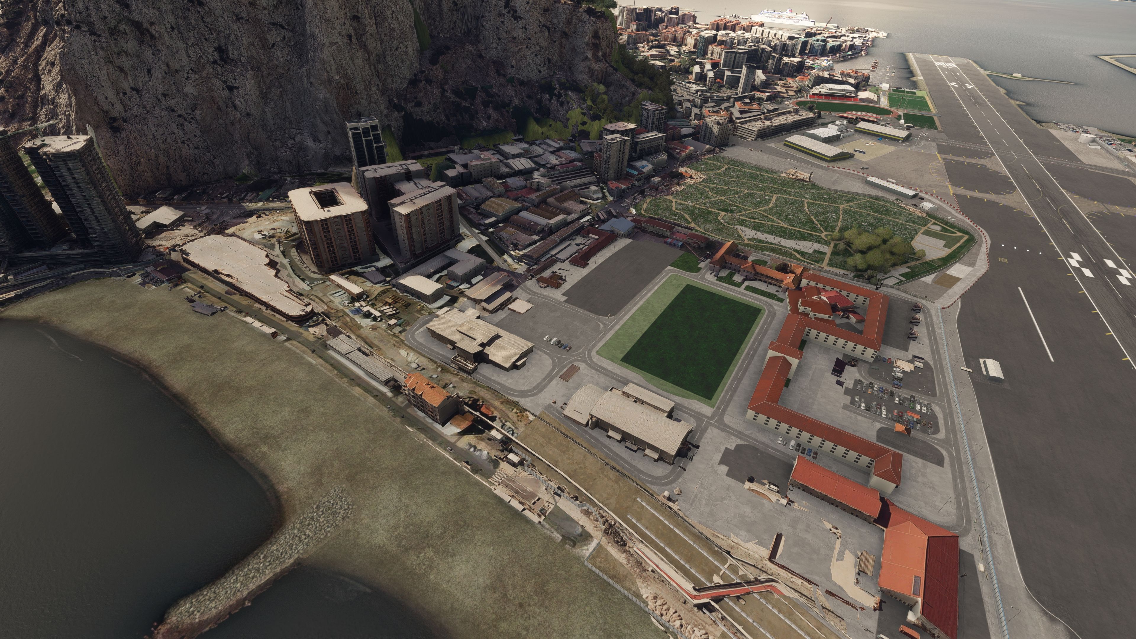
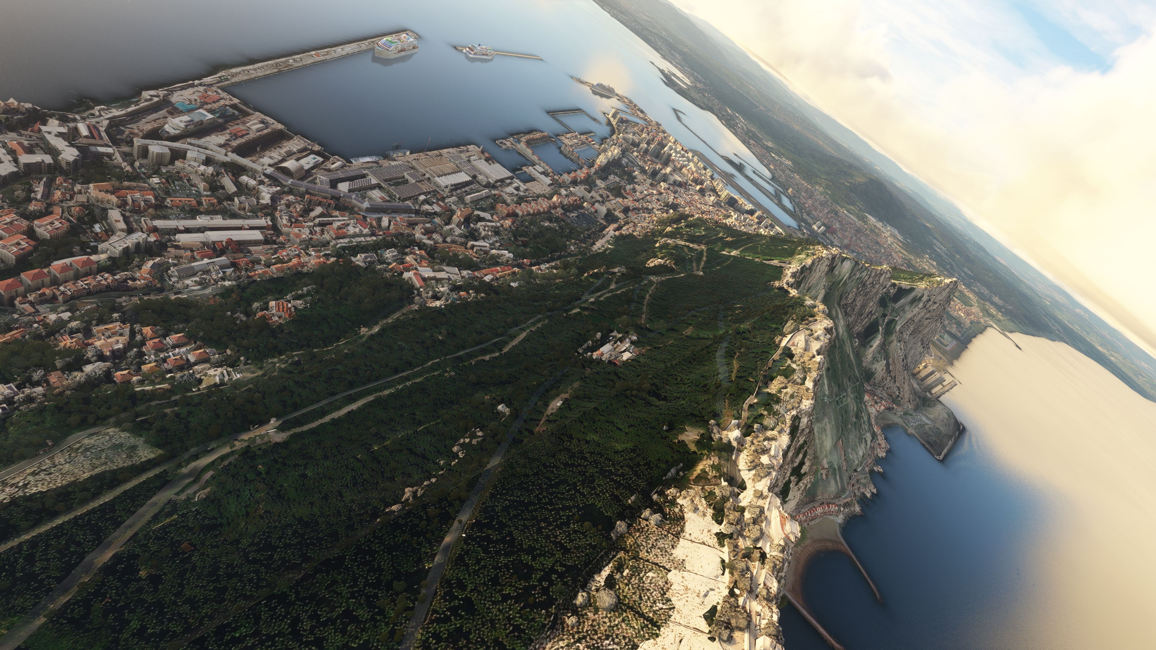
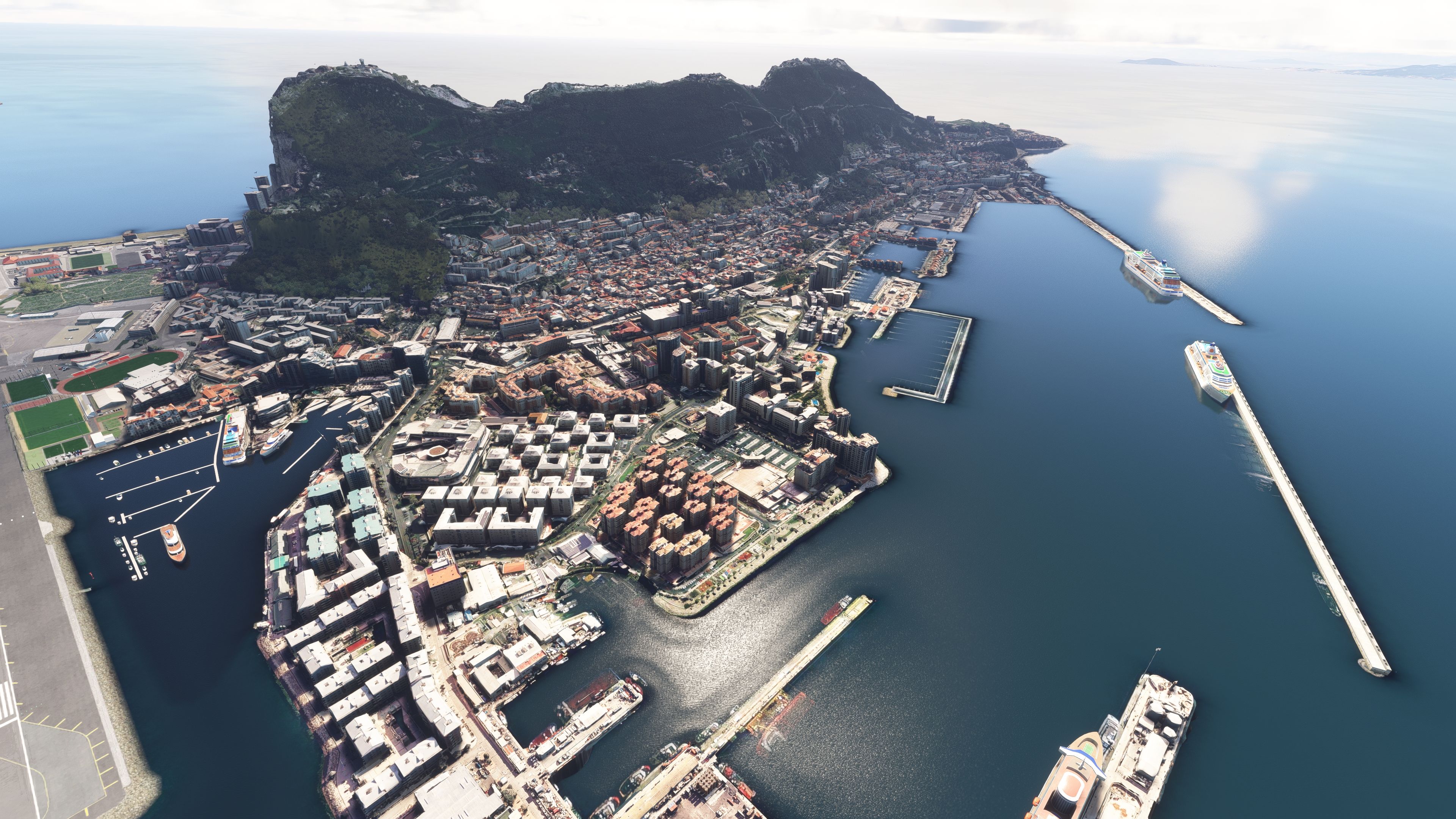
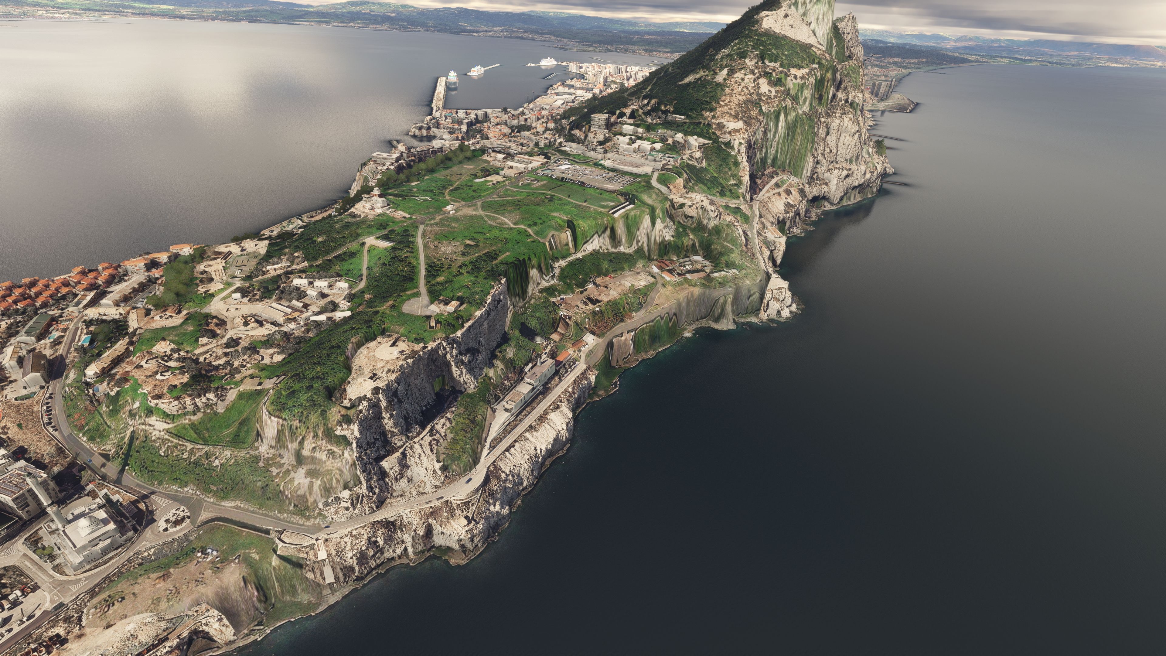
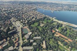
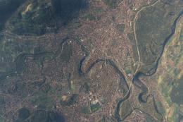
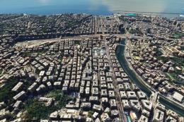
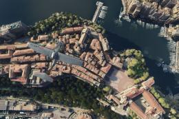
Images & Screenshots

50 total
A coastal airport runway extends into the water near a densely built city, with cruise ships docked along multiple piers.A large sports stadium with a green field is situated near a rocky coastline, with residential buildings and a mosque nearby.A tilted aerial view shows a coastal city with a harbor, dense urban buildings, and a steep green hillside leading to dramatic cliffs.A coastal city with densely packed apartment buildings, a marina with docked boats, and two large cruise ships near a breakwater.A steep rocky cliff with patches of green vegetation rises above a coastline featuring a road, a pier, and a row of buildings.A coastal city with a harbor, dense urban buildings, green park areas, and steep rocky cliffs meets calm blue water at sunset.A coastal airport runway extends toward the water, bordered by urban buildings, a green sports field, and a steep rocky cliff.A coastal city with dense urban buildings, a harbor with multiple piers, and dramatic cliffs rising above the shoreline is shown from above.A coastal city features a prominent rocky hill, dense urban buildings, marinas with docked boats, and cruise ships at long piers.A coastal peninsula with steep rocky cliffs, green hills, and a densely built urban area extends into calm water under cloudy skies.A coastal city with dense urban buildings, a prominent airport runway, and a rocky green hillside is viewed from an elevated angle.A coastal airport features a runway extending toward the sea, several hangars, parked vehicles, and a hillside city with cruise ships in the harbor.A large cruise ship is docked near a coastal city with densely packed buildings and a green, mountainous backdrop under partly cloudy skies.A coastal city with dense buildings sits at the base of a green hill, bordered by calm water and partly cloudy skies.A coastal city with dense buildings sits beside a prominent green rock formation and a single-runway airport extending toward the sea.A sports stadium with a running track and soccer fields sits adjacent to an airport apron, with city buildings and a harbor nearby.A coastal hillside features steep rocky cliffs, a row of red-roofed buildings along the shore, and dark clouds over calm water.A coastal city with densely packed buildings and industrial warehouses sits at the base of a large, forested hillside near calm water.A coastal airport runway extends into the water near a harbor with a large cruise ship and a city backed by a steep hill.A large cruise ship with a helipad is docked in a harbor near a coastal city backed by green hills and rocky cliffs.A coastal city features a mountain backdrop, cruise ships docked at piers, and a runway extending over the water.A coastal city with a prominent rocky hill, several cruise ships in the harbor, and an airport runway in the foreground.A steep rocky promontory rises above a coastal town and harbor, with overcast skies and calm water stretching into the distance.A coastal city with dense buildings sits at the base of a large, green hill under partly cloudy skies.A steep rocky promontory rises above a coastal city with a harbor, beach, and a long airport runway visible nearby.A coastal city with dense buildings sits at the base of a large green hill under partly cloudy skies near calm water.A coastal city with a prominent rocky hill features a single-runway airport, dense urban buildings, and multiple piers with docked ships.A rocky peninsula with densely packed buildings, a lighthouse, and a large green sports field extends into calm coastal waters under thick clouds.A coastal city with a harbor, cruise ships, and a runway is seen at sunset with scattered clouds and sun glare.A coastal city with clustered buildings sits atop rugged cliffs, bordered by calm water and scattered clouds in the sky.A coastal city with a prominent peninsula, visible airport runway, and several harbors extends into deep blue ocean waters.A coastal city with dense buildings and a large stadium sits on a rocky peninsula surrounded by calm blue water.A vertical top-down view shows a narrow peninsula with a prominent airport runway, dense urban areas, green hills, and several harbor docks.A coastal peninsula with a prominent rocky hill, urban buildings, a stadium, and a lighthouse extends into calm blue water.A coastal city with a prominent rocky hill rises above densely packed buildings, bordered by calm blue water under a clear sky.A rugged, green-topped rocky promontory rises from the water beneath a dramatic sky filled with thick, dark clouds.A coastal city with a prominent rocky peninsula, dense urban development, two cruise ships, and a visible airport runway extends into the sea.A coastal city with illuminated streets and buildings sits below a dark hillside at night, with a cruise ship docked in the foreground.A coastal airport runway marked 09 is illuminated at night, with city lights, a harbor, and a large rocky hill nearby.A coastal airport runway sits beside a brightly lit sports stadium and city buildings at dusk, with mountains and ships in the distance.A coastal city with illuminated buildings sits beneath a starry night sky, with a bright moon and two cruise ships visible offshore.A coastal city at night features illuminated buildings, a large cruise ship docked at a pier, and a dark mountainous backdrop.A coastal city with a prominent rocky peninsula is illuminated by streetlights at dusk, with ships docked in the harbor.A large cruise ship is docked at a harbor at night, with city lights illuminating buildings and a hillside in the background.A coastal peninsula with a brightly lit stadium and surrounding city lights extends into dark water at dusk, with mountains in the distance.A coastal city with a prominent rocky peninsula and illuminated airport runway is shown at dusk with distant city lights across the bay.A coastal airport runway with colorful approach lights sits beside a lit harbor and cruise ships under a starry night sky and moon.A coastal airport runway marked 09 extends over the water at dusk, with city lights and several cruise ships visible nearby.A coastal hillside town is illuminated by scattered building lights at night, with calm dark water in the foreground and stars above.A large cruise ship is docked at a brightly lit pier with a coastal city and hillside illuminated in the background at night.
All screenshots above have been created by Fly Away Simulation and are exclusive. For more details, see our image copyright information.
GPS Map Icon

Finding the Scenery

MSFS Format:
36.13223492,-5.35227333
You can copy and paste these coordinates into Microsoft Flight Simulator's search bar when starting a flight or the Developer Mode "Teleport" window to navigate directly to the center of this scenery area, airport, or landmark after you have installed this addon.
Decimal Degrees (DD):
Latitude: 36.132235°
Longitude: -5.352273°
Degrees, Minutes, Seconds (DMS):
Latitude: 36° 07' 56.046" N
Longitude: 5° 21' 08.184" W

Map Location


Profile image for freeware developer Thalixte

About the Developer: Thalixte

This mod was developed by Thalixte.

Thalixte is a developer that has focused on creating photogrammetry and scenery packs for the latest Microsoft Flight Simulator (MSFS) 2020 release.  All of this developer's releases have received fantastic feedback from many users on various flight sim websites including Fly Away Simulation.

Based in France, the developer tends to focus on creation of European packs however some "further afield" packs have also been created.

Donate

The developer of this mod/add-on (Thalixte) has worked hard in order to produce this freeware creation. If you enjoy and make use of this release, why not donate to the developer to help support their projects?

Installation icon.

Installation Instructions

Most of the freeware add-on aircraft and scenery packages in our file library come with easy installation instructions which you can read above in the file description. For further installation help, please see our Flight School for our full range of tutorials or view the README file contained within the download. If in doubt, you may also ask a question or view existing answers in our dedicated Q&A forum.

0 comments

Leave a Response

Leave a comment