
 MSFS Scenery
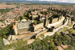
Carcassonne (Walled City) Photogrammetry
Step into a world of historical authenticity and stunning detail with the Car…
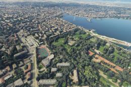
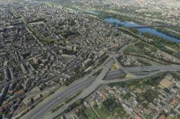
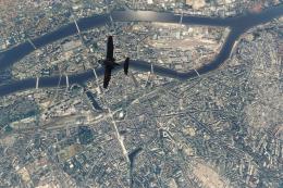
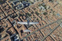
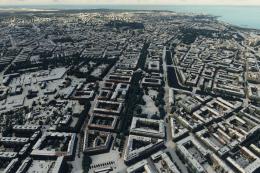
Orléans springs to life with high-detail photogrammetry that recreates the Loire River corridor, landmark bridges, and dense historic streets for convincing VFR sightseeing in Microsoft Flight Simulator. Optimized textures, smart LOD tuning, and refined road traffic blending keep the city looking sharp while maintaining smooth performance around nearby regional airports.
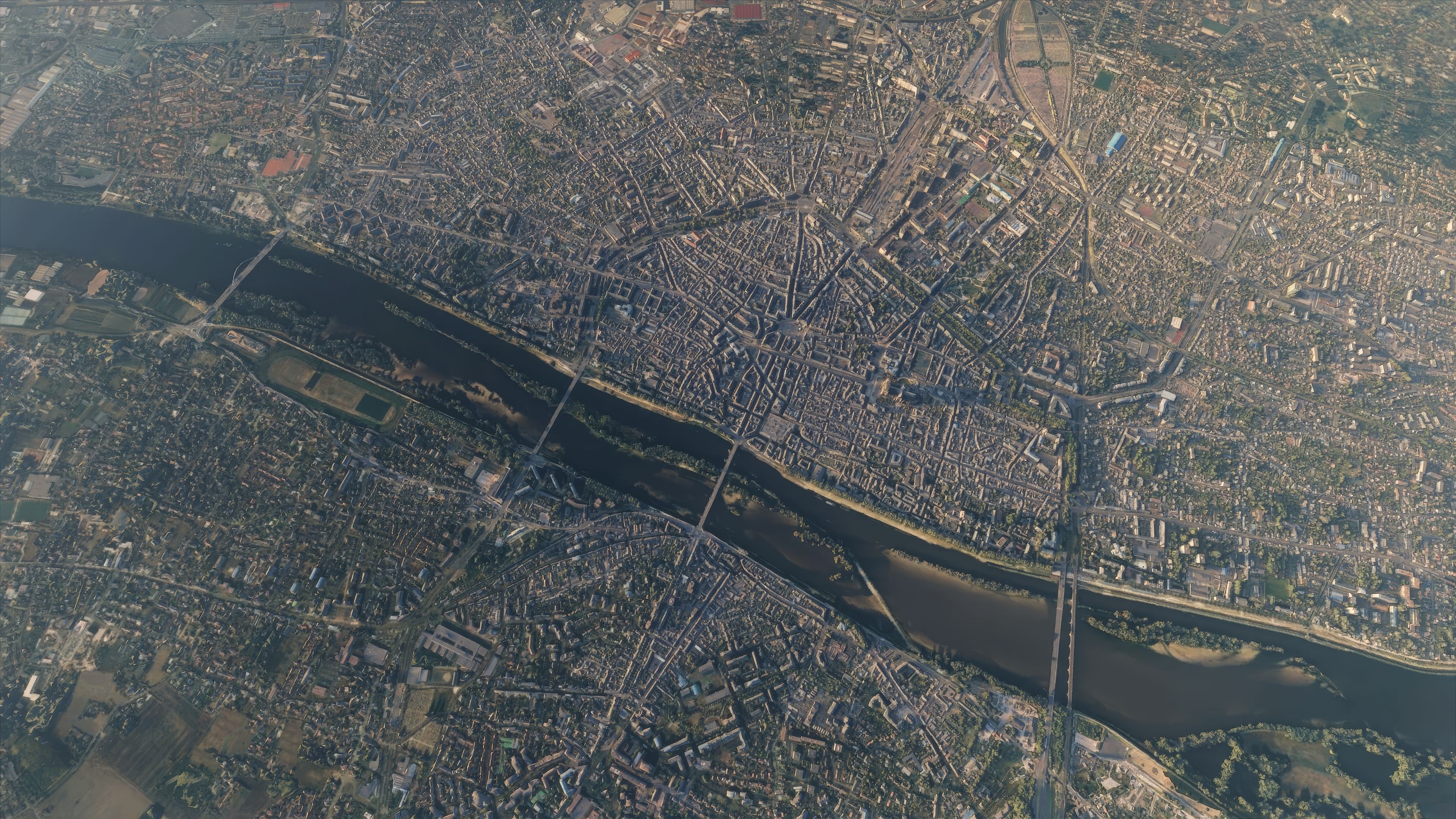


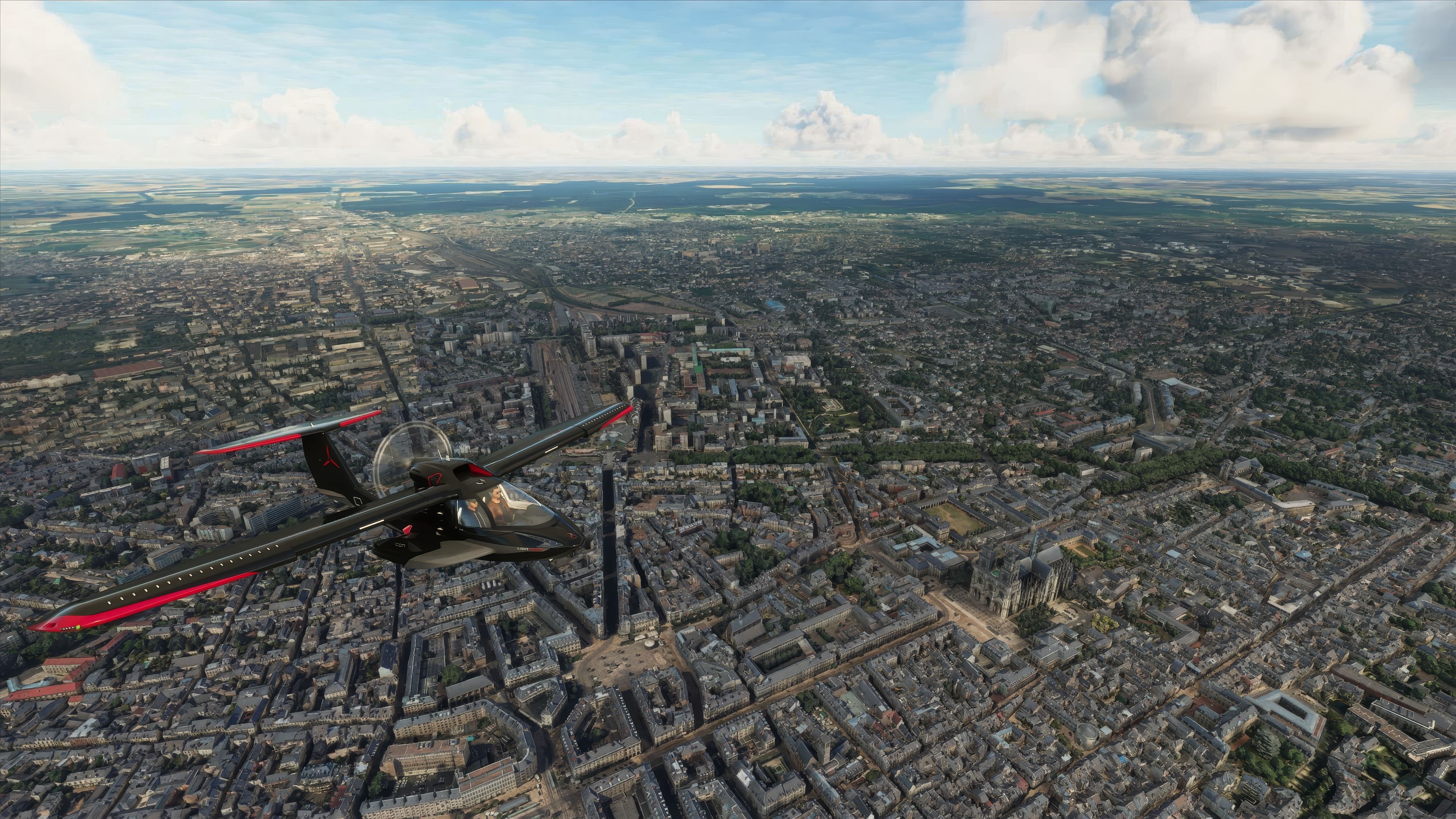

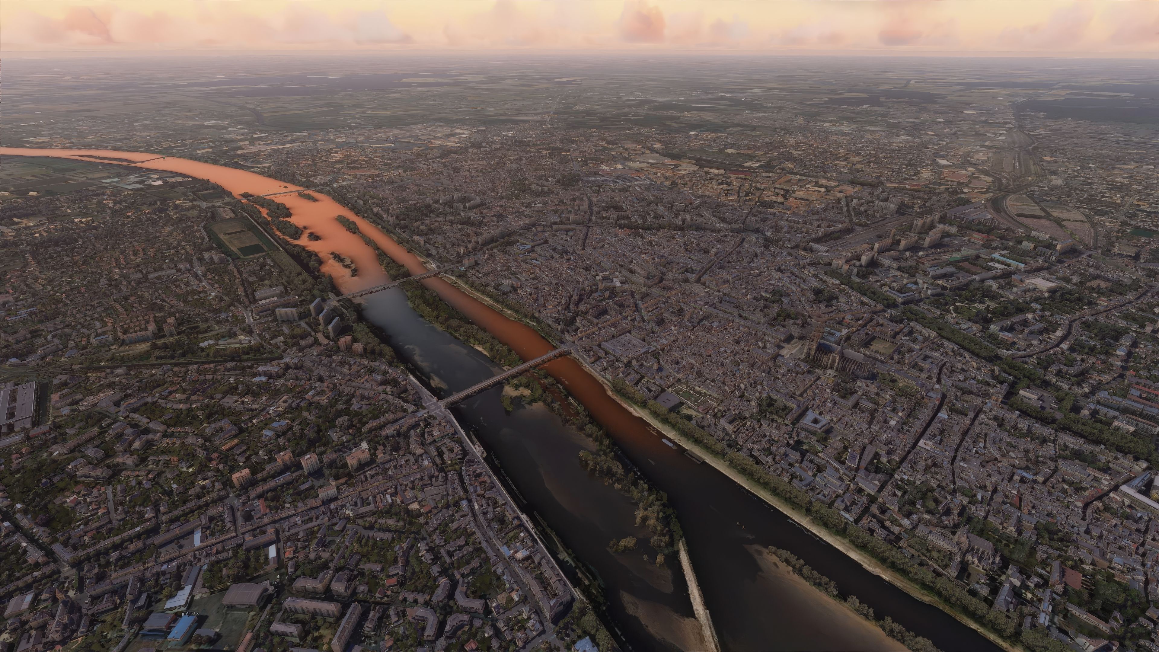

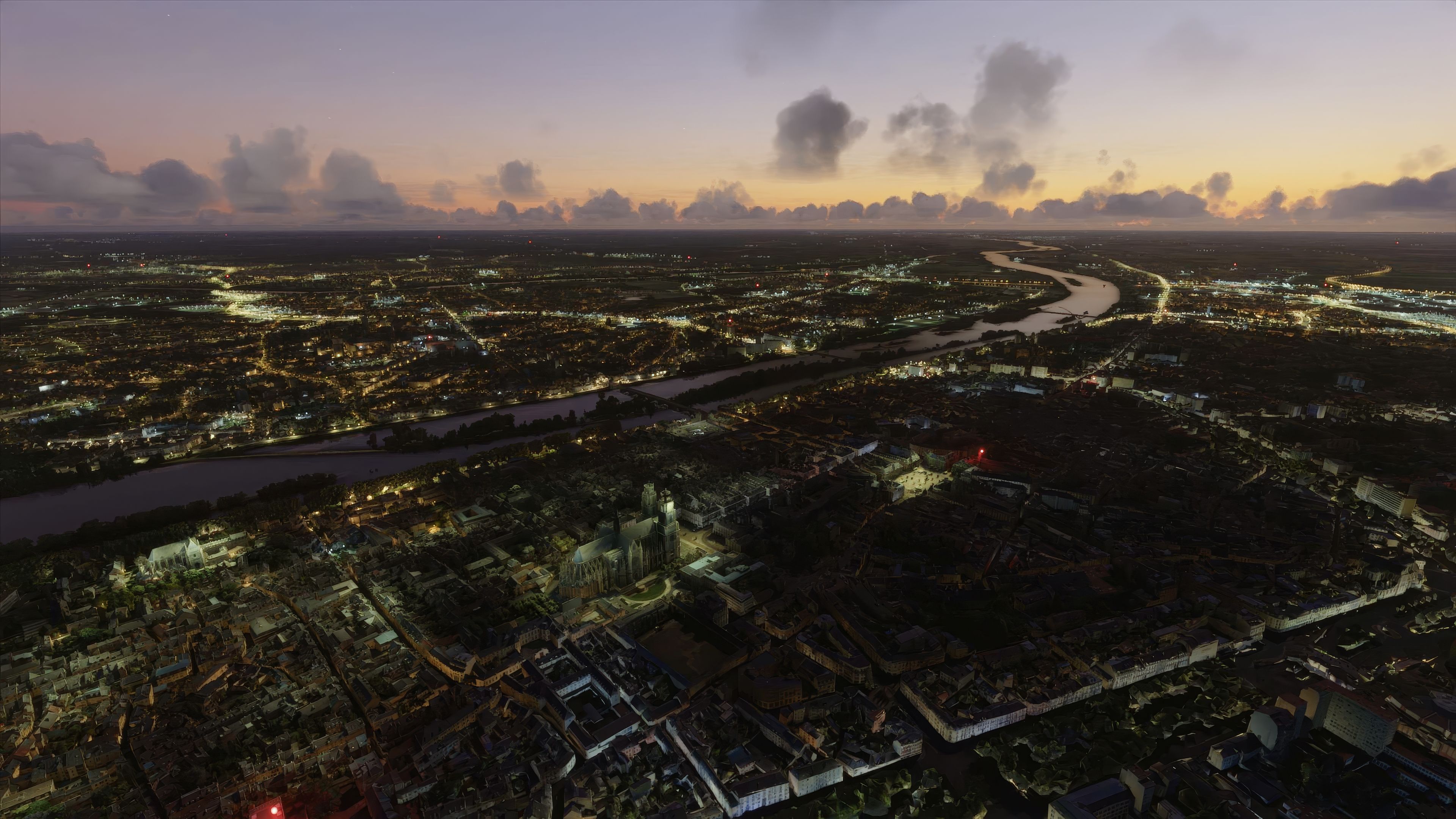

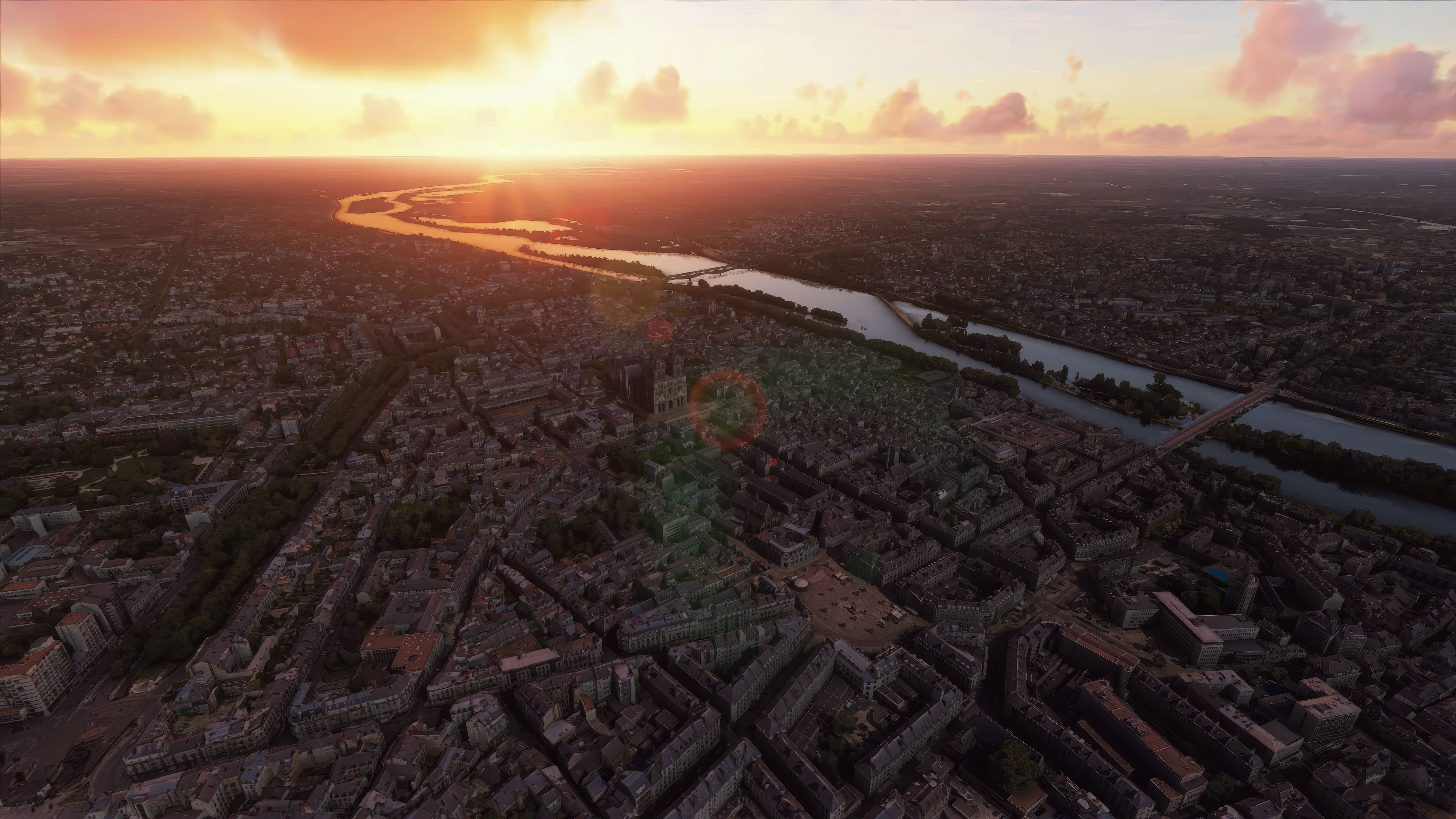
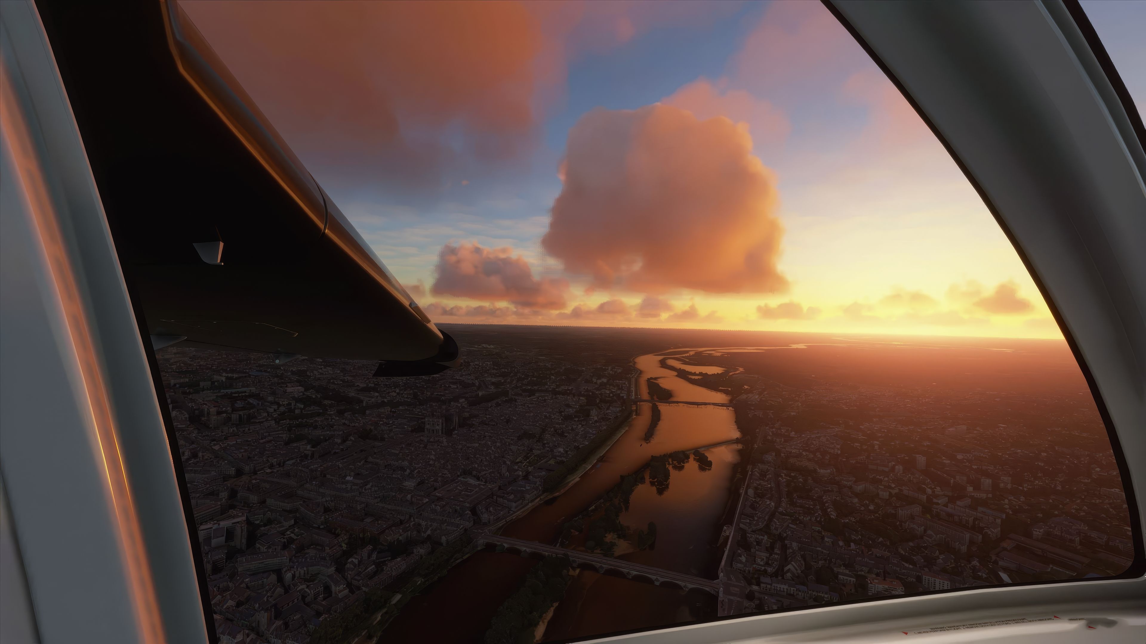

Orléans City Photogrammetry Scenery offers a breathtaking recreation of this historic French destination, showcasing authentic 3D building geometry and vivid urban landscapes derived from advanced photogrammetry. From its iconic bridges to its striking riverside vistas, every significant landmark captures the city’s character seamlessly within Microsoft Flight Simulator. Drawing on years of flight-sim experience, I found the environment impressively optimized for smooth performance, providing a unique blend of visual fidelity and reliable frame rates.
Beyond the photorealistic textures, the mod integrates a refined road traffic flow and frequent updates that consistently enhance the landscape. Nearby airports such as Orléans – Saint-Denis-de-l'Hôtel and Tours Val de Loire provide convenient gateways, adding another layer of immersion for both casual flyers and seasoned simmers. In my tests, the scenery’s realism significantly enriched each flight, delivering an outstanding balance of detail and playability that makes exploring Orléans a truly memorable experience.
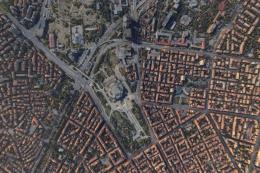
Elevate your flight simulation experience with the Orléans City Photogrammetry Scenery, a meticulously detailed representation of the historic city of Orléans, located in north-central France. This add-on leverages advanced photogrammetry to bring to life the urban texture and architectural nuance of Orléans, seamlessly integrating into Microsoft Flight Simulator 2020.
 Scenery Overview
Orléans, the vibrant capital of the Loiret department and the Centre-Val de Loire region, is celebrated for its pivotal role in French history and its picturesque setting along the Loire River. This scenery mod captures the essence of the city with high-resolution 3D mapping derived from Google Maps, providing an immersive and authentic flying experience.
Photogrammetry is the science of making measurements from photographs. In the context of flight simulation, this technology constructs the environment by stitching together numerous photographs, offering an unprecedented level of detail and realism. The result is a digital landscape that mirrors the real world, enhancing both visual fidelity and the pilot's experience in simulated flights.
Enhance your experience of the Orléans scenery by starting or concluding your flights at nearby airports. Notable airports include:
To install, simply download the package and extract the archive and copy the thalixte-orleans folder into your Microsoft Flight Simulator's Community folder. For optimal performance, ensure your simulator settings are adjusted to accommodate high-detail assets without compromising on frame rates.
Whether you're practicing VFR navigation or just enjoying a scenic flight, the Orléans City Photogrammetry Scenery adds depth and realism to your virtual flight paths, making each journey unforgettable.
Credits to Google for mapping data and to the dedicated community developers for their continuous enhancements and support.
Free for all simmers · 700.34 MB · Scanned clean
Download speed: Free tier is capped at 2 Mbps (this file takes approximately 49 mins at the cap). PRO members download at full line speed.
%LOCALAPPDATA%\Packages\Microsoft.FlightSimulator_8wekyb3d8bbwe\LocalCache\Packages\Community\. Steam version: %APPDATA%\Microsoft Flight Simulator\Packages\Community\. Tip: enable Developer Mode in MSFS to see your exact Community folder path.readme.txt or README file. It tells you exactly where files go, what dependencies are needed, and any quirks specific to this add-on.Use these coordinates to fly directly to this location once the mod is installed.
47.90250000,1.90900000
Paste these coordinates into the Microsoft Flight Simulator search bar when planning a flight, or into the Developer Mode Teleport window, to fly directly to this location.

Thalixte is a developer that has focused on creating photogrammetry and scenery packs for the latest Microsoft Flight Simulator (MSFS) 2020 release. All of this developer's releases have received fantastic feedback from many users on various flight sim websites including Fly Away Simulation.
Based in France, the developer tends to focus on creation of European packs however some "further afield" packs have also been created.
More MSFS add-ons hand-picked based on this download.
MSFS Scenery
Step into a world of historical authenticity and stunning detail with the Car…
 MSFS Scenery
Immerse yourself in the historical and architectural splendor of Valletta, th…
 MSFS Scenery
Delve into the heart of Europe with the Geneva City Photogrammetry Scenery, a…
 MSFS Scenery
Enhance your virtual flight experience with the Tours City Photogrammetry Sce…
 MSFS Scenery
Enhance your Microsoft Flight Simulator experience with the MSFS Nantes City …
 MSFS Scenery
Immerse yourself in the detailed and vibrant scenery of La Rochelle, a histor…
 MSFS Scenery
Dive into the heart of Bulgaria with the Sofia City Photogrammetry Scenery ad…
 MSFS Scenery
Embark on a visually stunning journey through the heart of Scandinavia with t…
Be the first to leave a comment on this download.
Be the first to share your thoughts on this download.