
FS2004 London Stansted Airport (EGSS) Scenery
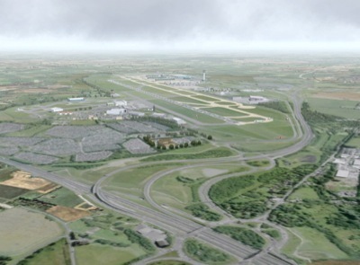
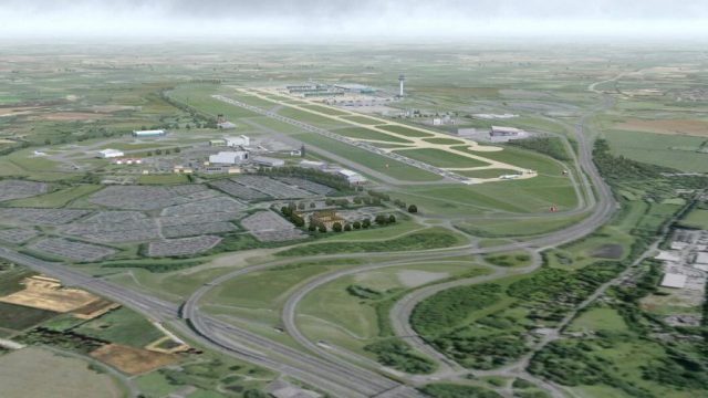
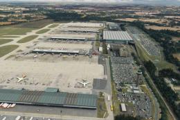
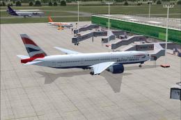
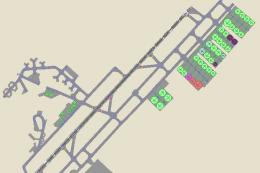
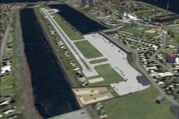
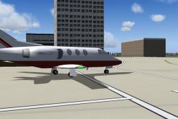
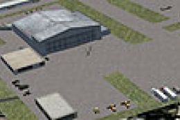
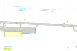
London Stansted Airport (EGSS) V7.0 brings a highly detailed FS2004 rendition with photo-based ground textures sourced from a composite aerial image, plus a full refresh of custom 3-D airport objects for a lifelike layout. It aligns with Ultimate Terrain Europe for accurate surrounding roads, while remaining compatible with the default scenery.
- File: egssjy7.zip
- Size:4.51 MB
- Scan:
Clean (16d)
- Access:Freeware
- Content:Everyone
Although the aerial photograph provides the basis of the airport 2-D layout, the scenery is also aligned to the surrounding road system provided by the "Ultimate Terrain Europe" commercial add-on from Flight 1 Software. However, the scenery can still be used with the FS2004 default though some surrounding road detail will be lacking. The scenery is demanding on processor power but omission of some detail is possible and - see below for options.
The archive egssjy7.zip has 243 files and directories contained within it.
File Contents
This list displays the first 500 files in the package. If the package has more, you will need to download it to view them.
| Filename/Directory | File Date | File Size |
|---|---|---|
| Windsock_EGSS3.BGL | 05.30.06 | 138 B |
| AF2_EGSS.bgl | 08.12.06 | 10.54 kB |
| EGSS_3D.bgl | 08.11.06 | 629.29 kB |
| EGSS_exclude.bgl | 02.13.03 | 148 B |
| EGSS_smooth2.bgl | 08.10.06 | 524 B |
| EGSS_structures_library.bgl | 07.25.06 | 367.47 kB |
| EGSS_TREES.bgl | 08.10.06 | 32.45 kB |
| EGSSdock.bgl | 04.21.03 | 54.39 kB |
| EGSSfnce.bgl | 08.08.06 | 30.44 kB |
| EGSSlayout.bgl | 08.10.06 | 727.83 kB |
| EGSSvehs.bgl | 08.08.06 | 243.29 kB |
| Stansted Ground.bgl | 08.06.06 | 1.85 kB |
| trees_jy_lib.bgl | 05.27.06 | 14.09 kB |
| Windsock_EGSS1.BGL | 05.30.06 | 138 B |
| Windsock_EGSS2.BGL | 05.30.06 | 138 B |
| YELBLACK.BMP | 08.11.06 | 2.75 kB |
| 7SP0.BMP | 08.10.06 | 42.75 kB |
| 7SP0_LM.BMP | 08.10.06 | 42.75 kB |
| 7SP1.BMP | 08.10.06 | 42.75 kB |
| 7SP1_LM.BMP | 08.10.06 | 42.75 kB |
| 7SP2.BMP | 08.10.06 | 42.75 kB |
| 7SP2_LM.BMP | 08.10.06 | 42.75 kB |
| 7SP3.BMP | 08.10.06 | 42.75 kB |
| 7SP3_LM.BMP | 08.10.06 | 42.75 kB |
| 7SP4.BMP | 08.10.06 | 42.75 kB |
| 7SP4_LM.BMP | 08.10.06 | 42.75 kB |
| 7SP5.BMP | 08.10.06 | 42.75 kB |
| 7SP5_lm.BMP | 08.10.06 | 42.75 kB |
| ABGRASS.BMP | 08.10.06 | 42.75 kB |
| Abgrass_LM.bmp | 08.10.06 | 42.75 kB |
| ASPHALTJ.BMP | 08.10.06 | 42.75 kB |
| ASPHALTJ_lm.BMP | 08.10.06 | 42.75 kB |
| BAAVAN.BMP | 08.10.06 | 42.75 kB |
| BAAVAN_LM.BMP | 08.10.06 | 42.75 kB |
| BLASTE_W.BMP | 06.24.01 | 65.05 kB |
| Blaste_w_lm.bmp | 07.18.06 | 65.05 kB |
| COACH.BMP | 04.23.03 | 65.05 kB |
| COACH_LM.BMP | 04.23.03 | 65.05 kB |
| CONCR.BMP | 08.10.06 | 42.75 kB |
| CONCR_H.BMP | 08.10.06 | 42.75 kB |
| Concr_H_lm.BMP | 08.10.06 | 42.75 kB |
| CONCR_LM.BMP | 08.10.06 | 42.75 kB |
| EGSSDK1.BMP | 08.10.06 | 42.75 kB |
| Egssdk1_lm.bmp | 08.10.06 | 42.75 kB |
| EGSSDK2.BMP | 08.10.06 | 42.75 kB |
| Egssdk2_lm.bmp | 08.10.06 | 42.75 kB |
| EGSSNOS1.BMP | 08.10.06 | 42.75 kB |
| EGSSNos1_lm.bmp | 08.10.06 | 42.75 kB |
| EGSSNOS2.BMP | 08.10.06 | 42.75 kB |
| EGSSNos2_lm.bmp | 08.10.06 | 42.75 kB |
| EGSSWWAY.BMP | 08.11.06 | 42.75 kB |
| Egsswway_lm.bmp | 08.11.06 | 42.75 kB |
| egun19.bmp | 11.22.03 | 42.75 kB |
| egun19_lm.bmp | 11.22.03 | 42.75 kB |
| EPH_TWR.bmp | 07.20.06 | 682.75 kB |
| EPH_TWR_lm.bmp | 07.29.06 | 170.75 kB |
| FEDEX1.BMP | 08.11.06 | 42.75 kB |
| Fedex1_lm.bmp | 08.11.06 | 42.75 kB |
| FEDEX2.BMP | 08.11.06 | 42.75 kB |
| Fedex2_lm.bmp | 08.11.06 | 42.75 kB |
| FEDEX3.BMP | 08.11.06 | 42.75 kB |
| Fedex3_lm.bmp | 08.11.06 | 42.75 kB |
| FENCES.bmp | 07.29.06 | 170.75 kB |
| FENCES_lm.bmp | 08.01.06 | 170.75 kB |
| FIRE2.BMP | 08.11.06 | 42.75 kB |
| Fire2_LM.bmp | 08.11.06 | 42.75 kB |
| FIRE3.BMP | 07.14.01 | 65.05 kB |
| FIRE3_LM.BMP | 07.14.01 | 65.05 kB |
| FIRETRK.BMP | 06.02.05 | 42.75 kB |
| FIRETRK_LM.BMP | 06.02.05 | 42.75 kB |
| FIRETRK_R.bmp | 06.02.05 | 42.75 kB |
| FIRETRK_R_LM.bmp | 06.02.05 | 42.75 kB |
| FIRETRNG.BMP | 08.11.06 | 42.75 kB |
| firetrng_lm.BMP | 08.11.06 | 42.75 kB |
| FLITE.BMP | 08.11.06 | 42.75 kB |
| FLITE_LM.BMP | 08.11.06 | 42.75 kB |
| FLS1.BMP | 07.13.06 | 42.75 kB |
| FLS1_LM.BMP | 08.07.06 | 42.75 kB |
| FLS2.BMP | 08.11.06 | 42.75 kB |
| FLS2_LM.BMP | 08.11.06 | 42.75 kB |
| GNOS1.BMP | 08.11.06 | 42.75 kB |
| GNOS1_LM.BMP | 08.11.06 | 42.75 kB |
| GNOS2.BMP | 08.11.06 | 42.75 kB |
| GNOS2_LM.BMP | 08.11.06 | 42.75 kB |
| GNOS3.BMP | 08.11.06 | 42.75 kB |
| GNOS3_LM.BMP | 08.11.06 | 42.75 kB |
| GRND1.BMP | 07.10.06 | 170.75 kB |
| GRND1_LM.bmp | 08.07.06 | 170.75 kB |
| GRND2.BMP | 07.08.06 | 170.75 kB |
| GRND2_LM.bmp | 08.07.06 | 170.75 kB |
| GRND3.BMP | 07.08.06 | 170.75 kB |
| GRND3_LM.bmp | 08.07.06 | 170.75 kB |
| GRND4.BMP | 07.08.06 | 42.75 kB |
| GRND4_LM.bmp | 08.07.06 | 42.75 kB |
| GRND5.BMP | 07.10.06 | 170.75 kB |
| GRND5_LM.bmp | 08.07.06 | 170.75 kB |
| GRND6.BMP | 07.08.06 | 170.75 kB |
| GRND6_LM.bmp | 08.07.06 | 170.75 kB |
| GRND7.BMP | 08.10.06 | 170.75 kB |
| GRND7_LM.bmp | 08.07.06 | 170.75 kB |
| GRND8.BMP | 07.12.06 | 170.75 kB |
| GRND8_LM.bmp | 08.07.06 | 170.75 kB |
| GRND9.BMP | 07.12.06 | 170.75 kB |
| GRND9_LM.bmp | 08.07.06 | 170.75 kB |
| GRND10.BMP | 07.07.06 | 170.75 kB |
| GRND10_lm.bmp | 08.07.06 | 170.75 kB |
| GRND11.BMP | 07.08.06 | 170.75 kB |
| GRND11_lm.bmp | 08.07.06 | 170.75 kB |
| GRND12.BMP | 08.10.06 | 170.75 kB |
| GRND12_lm.bmp | 08.07.06 | 170.75 kB |
| GRND13.BMP | 08.10.06 | 170.75 kB |
| GRND13_lm.bmp | 08.07.06 | 170.75 kB |
| GRND14.BMP | 08.10.06 | 170.75 kB |
| GRND14_lm.bmp | 08.07.06 | 170.75 kB |
| GRND15.BMP | 07.11.06 | 170.75 kB |
| GRND15_lm.bmp | 08.07.06 | 170.75 kB |
| GRND16.BMP | 07.08.06 | 170.75 kB |
| GRND16_lm.bmp | 08.07.06 | 170.75 kB |
| GRND17.BMP | 07.08.06 | 170.75 kB |
| GRND17_lm.bmp | 08.07.06 | 170.75 kB |
| GRND18.BMP | 07.08.06 | 170.75 kB |
| GRND18_lm.bmp | 08.07.06 | 170.75 kB |
| HARRODS.BMP | 08.11.06 | 170.75 kB |
| Harrods_lm.BMP | 08.11.06 | 170.75 kB |
| HOLD1.BMP | 08.11.06 | 42.75 kB |
| HOLD1_LM.BMP | 08.11.06 | 42.75 kB |
| HOLD2.BMP | 08.11.06 | 42.75 kB |
| HOLD2_LM.BMP | 08.11.06 | 42.75 kB |
| HOLD3.BMP | 08.11.06 | 42.75 kB |
| HOLD3_lm.BMP | 08.11.06 | 42.75 kB |
| HOLD4.BMP | 08.11.06 | 42.75 kB |
| HOLD4_LM.BMP | 08.11.06 | 42.75 kB |
| HOLD5.BMP | 08.11.06 | 42.75 kB |
| HOLD5_LM.BMP | 08.11.06 | 42.75 kB |
| HOLD6.BMP | 08.11.06 | 42.75 kB |
| HOLD6_LM.BMP | 08.11.06 | 42.75 kB |
| HOLD7.BMP | 08.11.06 | 42.75 kB |
| HOLD7_lm.BMP | 08.11.06 | 42.75 kB |
| HOLD8.BMP | 08.11.06 | 42.75 kB |
| HOLD8_lm.BMP | 08.11.06 | 42.75 kB |
| JY1_9.BMP | 08.11.06 | 42.75 kB |
| JY1_9_lm.BMP | 08.11.06 | 42.75 kB |
| JY10_18.BMP | 08.11.06 | 42.75 kB |
| JY10_18_lm.BMP | 08.11.06 | 42.75 kB |
| JY19_27.BMP | 08.11.06 | 42.75 kB |
| JY19_27_lm.BMP | 08.11.06 | 42.75 kB |
| JY28_36.BMP | 08.11.06 | 42.75 kB |
| JY28_36_lm.BMP | 08.11.06 | 42.75 kB |
| JY37_45.BMP | 08.11.06 | 42.75 kB |
| JY37_45_lm.BMP | 08.11.06 | 42.75 kB |
| JY46_54.BMP | 08.11.06 | 42.75 kB |
| JY46_54_lm.BMP | 08.11.06 | 42.75 kB |
| JYBLAST.BMP | 07.02.01 | 65.05 kB |
| JYBlast_LM.bmp | 07.02.01 | 65.05 kB |
| JYBLDG1.BMP | 08.11.06 | 42.75 kB |
| Jybldg1_LM.bmp | 08.11.06 | 42.75 kB |
| JYCOL1.BMP | 02.29.00 | 65.05 kB |
| JYEPH.BMP | 08.11.06 | 42.75 kB |
| JYEPH_LM.BMP | 08.11.06 | 42.75 kB |
| JYFLS2.BMP | 07.14.01 | 65.05 kB |
| JYFls2_lm.bmp | 06.19.01 | 65.05 kB |
| JYGATE1.BMP | 08.11.06 | 42.75 kB |
| JYGate1_LM.bmp | 08.11.06 | 42.75 kB |
| JYGATE2.BMP | 08.11.06 | 42.75 kB |
| JYGate2_LM.bmp | 08.11.06 | 42.75 kB |
| JYGCA.BMP | 08.11.06 | 42.75 kB |
| JYGCA_LM.BMP | 08.11.06 | 42.75 kB |
| JYTERM1.BMP | 07.15.06 | 42.75 kB |
| jyterm1_lm.BMP | 08.11.06 | 42.75 kB |
| JYTERM2.BMP | 07.23.06 | 42.75 kB |
| JYTerm2_LM.bmp | 07.17.06 | 42.75 kB |
| JYTERM3.BMP | 07.22.06 | 42.75 kB |
| Jyterm3_lm.bmp | 07.29.06 | 42.75 kB |
| JYTERM4.BMP | 08.11.06 | 42.75 kB |
| JYTerm4_LM.Bmp | 08.12.06 | 42.75 kB |
| JYTERM6.BMP | 07.22.06 | 42.75 kB |
| Jyterm6_lm.bmp | 08.11.06 | 42.75 kB |
| JYTERM7.BMP | 07.21.06 | 170.75 kB |
| Jyterm7_lm.bmp | 07.29.06 | 42.75 kB |
| JYTERM8.BMP | 07.21.06 | 42.75 kB |
| Jyterm8_lm.bmp | 07.29.06 | 42.75 kB |
| JYTERM9.BMP | 04.13.03 | 65.05 kB |
| jyterm9_lm.BMP | 04.13.03 | 65.05 kB |
| JYTRINU1.BMP | 08.11.06 | 42.75 kB |
| JYTRINU2.BMP | 08.11.06 | 42.75 kB |
| KBGR8.BMP | 08.11.06 | 42.75 kB |
| KBGR8_LM.BMP | 08.11.06 | 42.75 kB |
| KBGR9.BMP | 07.16.06 | 42.75 kB |
| KBGR9_LM.BMP | 07.17.06 | 42.75 kB |
| MALSR.BMP | 07.03.04 | 42.75 kB |
| MALSR_LM.BMP | 07.03.04 | 42.75 kB |
| METRO.BMP | 08.11.06 | 42.75 kB |
| METRO_LM.BMP | 08.11.06 | 42.75 kB |
| OTWR.BMP | 08.11.06 | 42.75 kB |
| OTWR_LM.BMP | 08.11.06 | 42.75 kB |
| RADD1.BMP | 07.02.06 | 170.75 kB |
| RADD1_lm.BMP | 07.16.06 | 170.75 kB |
| SatUpper.bmp | 08.11.06 | 42.75 kB |
| SatUpper_LM.bmp | 08.11.06 | 42.75 kB |
| SECYLAMP.BMP | 08.11.06 | 42.75 kB |
| Secylamp_lm.bmp | 08.12.06 | 42.75 kB |
| SSB1.BMP | 08.11.06 | 42.75 kB |
| SSB1_LM.BMP | 08.11.06 | 42.75 kB |
| SSB2.BMP | 08.11.06 | 42.75 kB |
| SSB2_LM.BMP | 08.11.06 | 42.75 kB |
| TERMSIDE.BMP | 07.26.06 | 170.75 kB |
| TERMSIDE_lm.bmp | 07.29.06 | 170.75 kB |
| TRAMHSE.BMP | 08.11.06 | 170.75 kB |
| TRAMHSE_lm.bmp | 07.29.06 | 170.75 kB |
| tree2_decid.bmp | 05.27.06 | 42.75 kB |
| tree2_decid_fa.bmp | 05.27.06 | 42.75 kB |
| tree2_decid_hw.bmp | 04.01.06 | 42.75 kB |
| tree2_decid_sp.bmp | 05.27.06 | 42.75 kB |
| tree2_decid_wi.bmp | 05.27.06 | 42.75 kB |
| tree3_decid.bmp | 05.27.06 | 42.75 kB |
| tree_decid.bmp | 04.01.06 | 42.75 kB |
| tree_decid_fa.bmp | 04.01.06 | 42.75 kB |
| tree_decid_HW.bmp | 04.01.06 | 42.75 kB |
| tree_decid_lm.bmp | 03.29.06 | 42.75 kB |
| tree_decid_sp.bmp | 04.01.06 | 42.75 kB |
| tree_decid_wi.bmp | 04.01.06 | 42.75 kB |
| VEH1.BMP | 04.23.03 | 65.05 kB |
| VEH1_LM.BMP | 04.23.03 | 65.05 kB |
| VEH2.BMP | 04.22.03 | 65.05 kB |
| VEH2_LM.BMP | 04.22.03 | 65.05 kB |
| VEH3.BMP | 08.11.06 | 42.75 kB |
| VEH3_LM.BMP | 08.11.06 | 42.75 kB |
| VOD00.bmp | 12.08.01 | 65.05 kB |
| WHEEL3.BMP | 08.11.06 | 42.75 kB |
| Wheel3_lm.bmp | 08.11.06 | 42.75 kB |
| WHEEL6.BMP | 08.11.06 | 2.75 kB |
| WHEEL8.BMP | 08.11.06 | 42.75 kB |
| WHEEL8_LM.BMP | 08.11.06 | 42.75 kB |
| WHEEL_R.bmp | 08.11.06 | 42.75 kB |
| WHEEL_R_LM.bmp | 08.11.06 | 42.75 kB |
| WHITE.BMP | 07.11.06 | 5.05 kB |
| Stansted_README.txt | 08.24.06 | 6.25 kB |
| EGSS7.JPG | 08.24.06 | 156.90 kB |
| EGSSJY7.gif | 08.24.06 | 18.93 kB |
| File_ID.DIZ | 08.24.06 | 312 B |
| Stansted_README.Doc | 08.24.06 | 37.00 kB |
| flyawaysimulation.txt | 10.29.13 | 959 B |
| Go to Fly Away Simulation.url | 01.22.16 | 52 B |
Installation Instructions
Most of the freeware add-on aircraft and scenery packages in our file library come with easy installation instructions which you can read above in the file description. For further installation help, please see our Flight School for our full range of tutorials or view the README file contained within the download. If in doubt, you may also ask a question or view existing answers in our dedicated Q&A forum.



2 comments
Leave a ResponseThe content of the comments below are entirely the opinions of the individual posting the comment and do not always reflect the views of Fly Away Simulation. We moderate all comments manually before they are approved.
Easy to install...very good