
FSX Amazonas Air Mission
Amazonas Air Mission drops pilots into a rain-soaked Amazon Basin career scenario, with custom scenery elements and a narrative-driven briefing that captures the pressure of mail, passenger, and supply flights along the great river. Built for FSX, it delivers jungle weather immersion, challenging approaches, and a clear PDF guide for the full experience.
 Prepar3D
- File: rioamaz.zip
- Size:14.37 MB
- Scan:
Clean (10d)
- Access:Freeware
- Content:Everyone
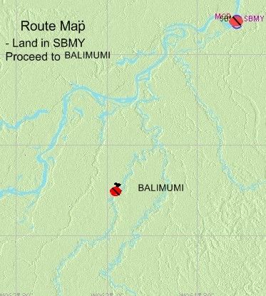
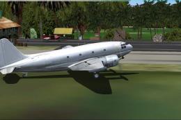
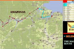
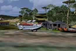
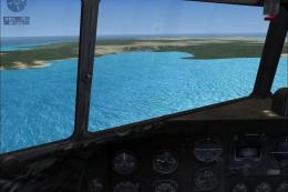
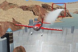
Amazonas Air. "It's raining again", said Martha as she called Tom for the third time over the radio. Thomas Ascara, chief pilot of "Amazonas Air" was to land in a few minutes. He was returning from his day-long flight over the great southern Amazon Basin where his small Air Service flew day in and day out. Flying in this territory is quite a challange for rain and fog usually is the common day to day situation for at least nine months a year. The Amazon weather never stops delivering more water to the great river and life to the inmense jungle, which sadly, is deminishing by the hour. Amazonas Air has grown a lot from its original state in 1934 when Tom's grandfather started with his lonesome pontooned Fairchild. There are three pilots waiting outside for Tom to land, for a new pilot is needed to fly daily supplies, mail and passengers to many towns along the river. You there! The second one with the stand up hair... yea you... might you be the next pilot? Feeling his way above the mighty river? Will you stand the pressure of jungle flight? Maybe... maybe not, but this is your chance to fly in the Green Jungle of the Amazon... By Gera Godoy Canova.

Amazonas Air Mission.
1) Place al .bgl files in FSX/addon scenery/scenery Directory ----(Activate Files).
2) Place the .BMP file in your FSX/addon scenery/texture Directory.
3) Read Instructions on PDF File.
That´s it.....
Enjoy.
Gera
Amazonas Air Mission.
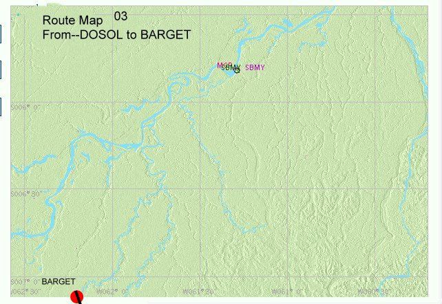
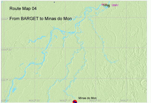
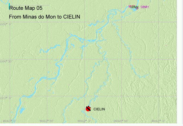
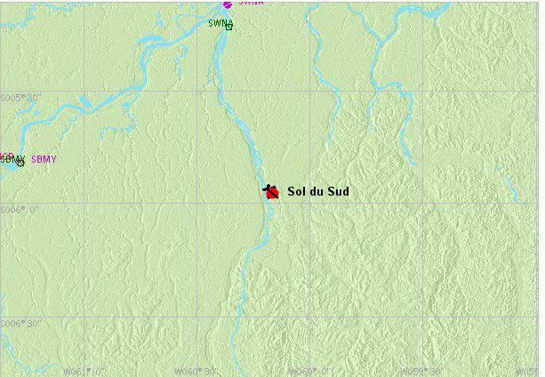
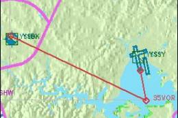
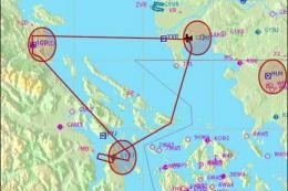
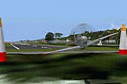
Images & Screenshots

The archive rioamaz.zip has 65 files and directories contained within it.
File Contents
This list displays the first 500 files in the package. If the package has more, you will need to download it to view them.
| Filename/Directory | File Date | File Size |
|---|---|---|
| FileID.diz | 05.21.09 | 97 B |
| amazon2portadita.gif | 05.21.09 | 10.58 kB |
| amazonas air documentation.pdf | 05.20.09 | 8.97 MB |
| READ ME FIRST.txt | 05.21.09 | 527 B |
| ROTAMAZONAS_00.bmp | 05.17.09 | 42.74 kB |
| AMAZONAS-T.bgl | 05.11.09 | 1.31 kB |
| AMAZONROTULO.bgl | 05.17.09 | 4.00 kB |
| AVIONES-PARA-ESCENAS.bgl | 05.17.09 | 1.36 MB |
| BIMOTOR-ESTATICO.bgl | 03.22.09 | 95.68 kB |
| bodega-viej-1.bgl | 01.11.09 | 165.11 kB |
| CASACHINA.bgl | 04.18.09 | 4.52 kB |
| CVX_amazona-02.BGL | 05.13.09 | 466 B |
| CVX_CITA-AMAZON-1.BGL | 05.11.09 | 258 B |
| CVX_CIUDAD44.BGL | 05.13.09 | 632 B |
| CVX_FIELD-01.BGL | 05.11.09 | 228 B |
| CVX_pista-005.BGL | 05.14.09 | 571 B |
| CVX_PISTA-2.BGL | 05.13.09 | 563 B |
| CVX_PISTA3-AA.BGL | 05.13.09 | 332 B |
| CVX_PISTA3.BGL | 05.13.09 | 299 B |
| CVX_PISTA_MAS.BGL | 05.16.09 | 446 B |
| CVX_ULTIMO.BGL | 05.18.09 | 522 B |
| ELAMAZONAS.bgl | 05.18.09 | 39.23 kB |
| EZ_Hughes_500D.BGL | 04.06.07 | 6.93 MB |
| Runway_markings.bgl | 02.16.09 | 196.58 kB |
| TRAIL-VERD.bgl | 12.27.08 | 198.79 kB |
| 212.bmp | 01.04.09 | 4.00 MB |
| 212_2.bmp | 01.04.09 | 2.00 MB |
| 412.bmp | 01.02.09 | 4.00 MB |
| 412_2.bmp | 01.02.09 | 2.00 MB |
| AIRFIELD-TARMAC.bmp | 04.18.09 | 3.00 MB |
| BeaverJaune.bmp | 12.26.08 | 682.75 kB |
| BeaverRouge.bmp | 01.24.09 | 682.75 kB |
| C130.bmp | 12.31.08 | 4.00 MB |
| c206.bmp | 10.26.08 | 4.00 MB |
| casachina1.bmp | 03.21.09 | 33.05 kB |
| DHC6-2.bmp | 01.06.09 | 341.42 kB |
| DHC6.bmp | 01.06.09 | 682.75 kB |
| fond.bmp | 12.26.08 | 682.75 kB |
| fuse.bmp | 01.25.09 | 682.75 kB |
| fuseBleu.bmp | 01.25.09 | 682.75 kB |
| GLASS-1.bmp | 12.30.08 | 65.05 kB |
| moteur.bmp | 10.23.08 | 256.90 kB |
| oldtrailer.bmp | 12.10.08 | 33.05 kB |
| planks 1.bmp | 07.21.07 | 170.75 kB |
| planks 2.bmp | 07.21.07 | 170.75 kB |
| planks 3.bmp | 07.21.07 | 170.75 kB |
| planks 4.bmp | 07.21.07 | 170.75 kB |
| planks 5.bmp | 07.21.07 | 170.75 kB |
| roue.bmp | 10.23.08 | 64.90 kB |
| tarmac.bmp | 01.08.09 | 65.05 kB |
| techo-viejo.bmp | 11.22.08 | 65.05 kB |
| Thumbs.db | 05.21.09 | 57.50 kB |
| tuyere.bmp | 12.30.08 | 64.90 kB |
| mapa-1-01.jpg | 05.18.09 | 128.45 kB |
| mapa-2-02.jpg | 05.18.09 | 208.89 kB |
| mapa-3-03.jpg | 05.18.09 | 92.53 kB |
| mapa-4-04.jpg | 05.18.09 | 90.01 kB |
| mapa-5-05.jpg | 05.18.09 | 87.09 kB |
| Mapa-6-06.jpg | 05.18.09 | 98.90 kB |
| Mapa-7-07.jpg | 05.18.09 | 100.25 kB |
| MAPA-8-LAST.jpg | 05.19.09 | 106.52 kB |
| MAPA-FINAL.jpg | 05.19.09 | 106.52 kB |
| mapa-inicio-01.jpg | 05.18.09 | 213.26 kB |
| flyawaysimulation.txt | 10.29.13 | 959 B |
| Go to Fly Away Simulation.url | 01.22.16 | 52 B |
Installation Instructions
Most of the freeware add-on aircraft and scenery packages in our file library come with easy installation instructions which you can read above in the file description. For further installation help, please see our Flight School for our full range of tutorials or view the README file contained within the download. If in doubt, you may also ask a question or view existing answers in our dedicated Q&A forum.

0 comments
Leave a Response