FSX Boundary Bay Airport Scenery
Boundary Bay Airport (CZBB) scenery brings the British Columbia training field to life with accurately repositioned buildings, flight school areas, fuel tanks, parking, GA aircraft, and maintenance hangars for more believable ground operations just 2 NM from Vancouver International. Designed for FSX, it suits light-aircraft circuits and quick hops toward Vancouver Island or Harrison Hot Springs.


 Canada
 - File: czbb-1.zip
- Size:367.56 KB
- Scan:
Clean (24d)

- Access:Freeware
- Content:Everyone
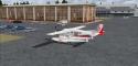
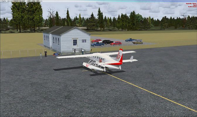
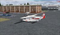
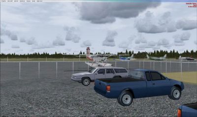
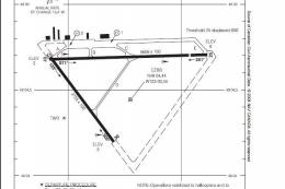
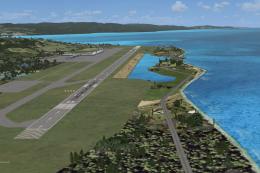
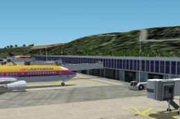
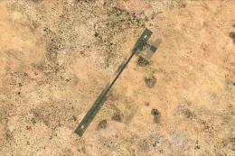
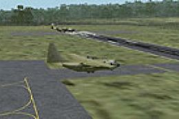
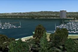
Boundary Bay Airport (CZBB), British Columbia, Canada. All buildings have been moved to their correct locations. By Daniel Louvet.
Boundary Bay Airport Scenery.
2Nm from CYVR, Boundary Bay is a training airport - Perfect for light aircrafts and perfect hop to Vancouver island or Harrison Hot spring.
I have repositioned all building, fuel tank, parking lot, Flight schools, GA aircrafts parked and maintenance hangar as it is in reality. The FSX one was not convincing enough! Hope this will make your stop-over more enjoyable!
Installation:
Drop the .bgl file in your FSX/Addon scenery/scenery folder.
ONLY!
Dan
Boundary Bay Airport Scenery.
Images & Screenshots

Finding the Scenery
- FSX/Prepar3D Coordinates:
-
49.07167000,-123.01361000
Use the downloaded flight plan file by launching FSX/P3D, selecting "Load Flight Plan" in the flight planner, and choosing the .pln file. Your aircraft will be positioned directly at the add-on’s location. - Decimal Degrees (DD):
-
Latitude: 49.071670°
Longitude: -123.013610° - Degrees, Minutes, Seconds (DMS):
-
Latitude: 49° 04' 18.012" N
Longitude: 123° 00' 48.996" W
Map Location
The archive czbb-1.zip has 9 files and directories contained within it.
File Contents
This list displays the first 500 files in the package. If the package has more, you will need to download it to view them.
| Filename/Directory | File Date | File Size |
|---|---|---|
| fsx 2009-03-04 15-38-45-60.jpg | 03.04.09 | 88.83 kB |
| fsx 2009-03-04 17-49-03-50.jpg | 03.04.09 | 95.90 kB |
| fsx 2009-03-04 17-49-31-29.jpg | 03.04.09 | 75.77 kB |
| small.gif | 03.04.09 | 8.21 kB |
| small.jpg | 03.04.09 | 92.69 kB |
| Read me.txt | 03.06.09 | 538 B |
| CZBB.BGL | 03.04.09 | 11.20 kB |
| flyawaysimulation.txt | 10.29.13 | 959 B |
| Go to Fly Away Simulation.url | 01.22.16 | 52 B |
Installation Instructions
Most of the freeware add-on aircraft and scenery packages in our file library come with easy installation instructions which you can read above in the file description. For further installation help, please see our Flight School for our full range of tutorials or view the README file contained within the download. If in doubt, you may also ask a question or view existing answers in our dedicated Q&A forum.


0 comments
Leave a Response