 FSX Scenery
NZ West Coast Photoreal
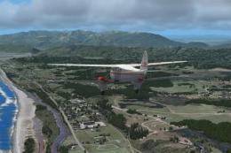
ABOUT THIS SCENERY West Coast is photo scenery that covers a large area from …
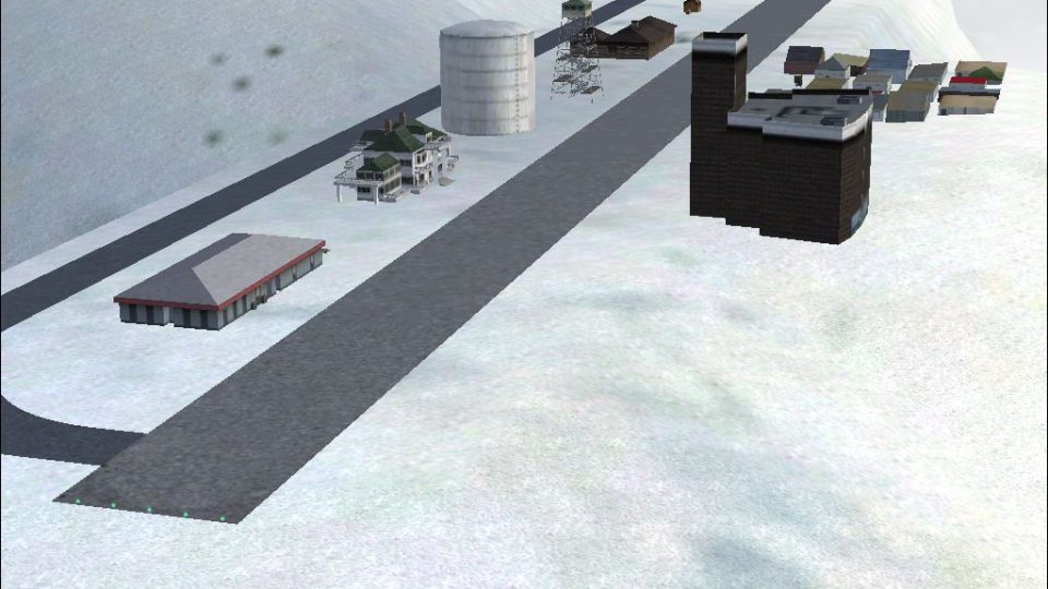
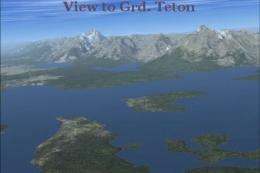
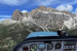
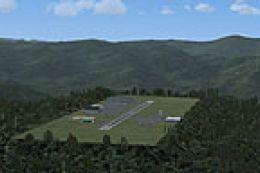
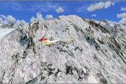
West Coast Mountains scenery brings a chain of fictional high-altitude airstrips to the summits of Glacier Peak, Mount Adams, Mount Baker, Mount McLoughlin, Mount Hood, Mount Jefferson, Pelican Butte, Mount Shasta, and Three Fingered Jack in FSX. Expect rugged peak-top approaches and fresh backcountry destinations along the US West Coast.
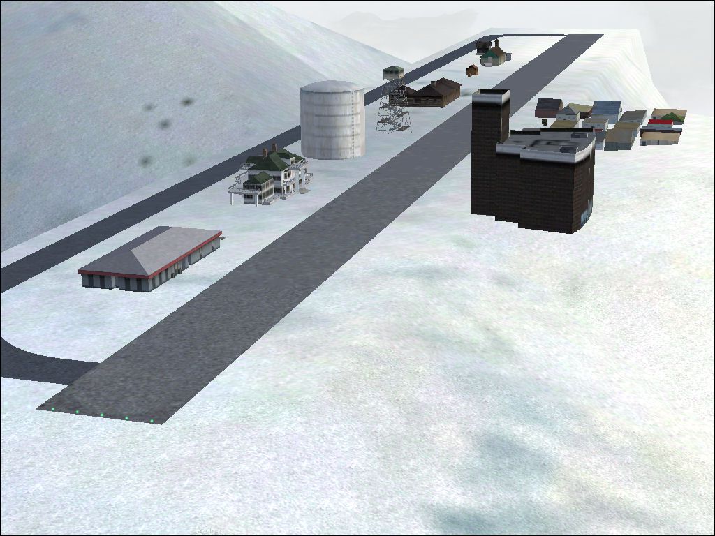
West Coast Mountains. Fictional high-altitude fields at the peaks of several mountains along the US west coast: Glacier Peak, Mount Adams, Mount Baker, Mount McLoughlin, Mount Hood, Mount Jefferson, Pelican Butte, Mount Shasta and Three Fingered Jack. By Andy Johnston.
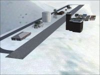
West Coast Mountains Scenery.
Free for all simmers · 158.02 KB · Scanned clean Jul 2026
Download speed: Free tier is capped at 0.5 Mbps. PRO members download at full line speed.
FSX\Addon Scenery\ containing scenery and texture sub-folders.readme.txt or README file. It tells you exactly where files go, what dependencies are needed, and any quirks specific to this add-on.Use these coordinates to fly directly to this location once the mod is installed.
44.87000000,-121.81000000
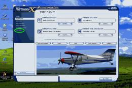
Launch FSX or Prepar3D and use Flights → Load to open the downloaded .pln file. Your aircraft will be positioned at this location.
The archive mtnaptaj.zip has 28 files and directories contained within it.
This list displays the first 500 files in the package. If the package has more, you will need to download it to view them.
| Filename/Directory | File Date | File Size |
|---|---|---|
| file_id.diz | 04.08.09 | 269 B |
| MountainAirports.jpg | 08.19.08 | 147.85 kB |
| SCENERY.dat | 05.30.07 | 2.93 kB |
| scenery | 01.10.09 | 0 B |
| AF2_KGLP.bgl | 05.30.07 | 512 B |
| AF2_KMAD.bgl | 12.31.08 | 2.51 kB |
| AF2_KMBK.bgl | 05.30.07 | 510 B |
| AF2_KMCL.bgl | 05.27.07 | 568 B |
| AF2_KMHD.bgl | 04.22.07 | 624 B |
| AF2_KMJF.bgl | 04.22.07 | 790 B |
| AF2_KPBT.bgl | 05.27.07 | 558 B |
| AF2_KSHS.bgl | 05.19.08 | 1008 B |
| AF2_KTFJ.bgl | 04.22.07 | 514 B |
| FSX | 01.10.09 | 0 B |
| KMCL_LC.inf | 05.26.07 | 503 B |
| KPBT_LC.inf | 05.26.07 | 503 B |
| KMCL_LC.bgl | 05.26.07 | 296 B |
| KMCL_LC.ezl | 05.26.07 | 112 B |
| KMCL_LC.raw | 05.26.07 | 64.50 kB |
| KMHD Scenery.bgl | 05.06.07 | 988 B |
| KPBT Scenery.bgl | 05.26.07 | 732 B |
| KPBT_LC.bgl | 05.26.07 | 299 B |
| KPBT_LC.ezl | 05.26.07 | 112 B |
| KPBT_LC.raw | 05.26.07 | 64.50 kB |
| KSHS Scenery.bgl | 05.07.07 | 1.71 kB |
| KTFJ Scenery.bgl | 04.22.07 | 412 B |
| flyawaysimulation.txt | 10.29.13 | 959 B |
| Go to Fly Away Simulation.url | 01.22.16 | 52 B |
Only PRO members can place votes.
More FSX & P3D add-ons hand-picked based on this download.
FSX Scenery
ABOUT THIS SCENERY West Coast is photo scenery that covers a large area from …
 FSX Scenery
Land's End SeaPlanes "West Coast Travel" Part III. Includes sea plane bases a…
 FSX Scenery
Rocky Mountains Landclass. The landclass file is a stand-alone scenery. You c…
 FSX Scenery
This freeware package brings an enhanced photorealistic representation of the…
 FSX Scenery
Virginia Mountains Airport Scenery. Number 5 in the series of Pro Hop fiction…
 FSX Scenery
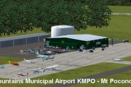
Pocono Mountains Municipal Airport (KMPO) serves Mount Pocono and Monroe Coun…
 FSX Scenery
Pocono Mountains Municipal Airport (KMPO), Pennsylvania (PA). This package co…
 FSX Scenery
30cm Generic Project Textures Rocks Mountains. All rocks mountain around the …
Be the first to leave a comment on this download.
Be the first to share your thoughts on this download.