 FSX Scenery
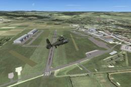
Fritzlar Military Airport
ETHF Fritzlar is an military Airport. It is the base of Heeresfligerregiment …
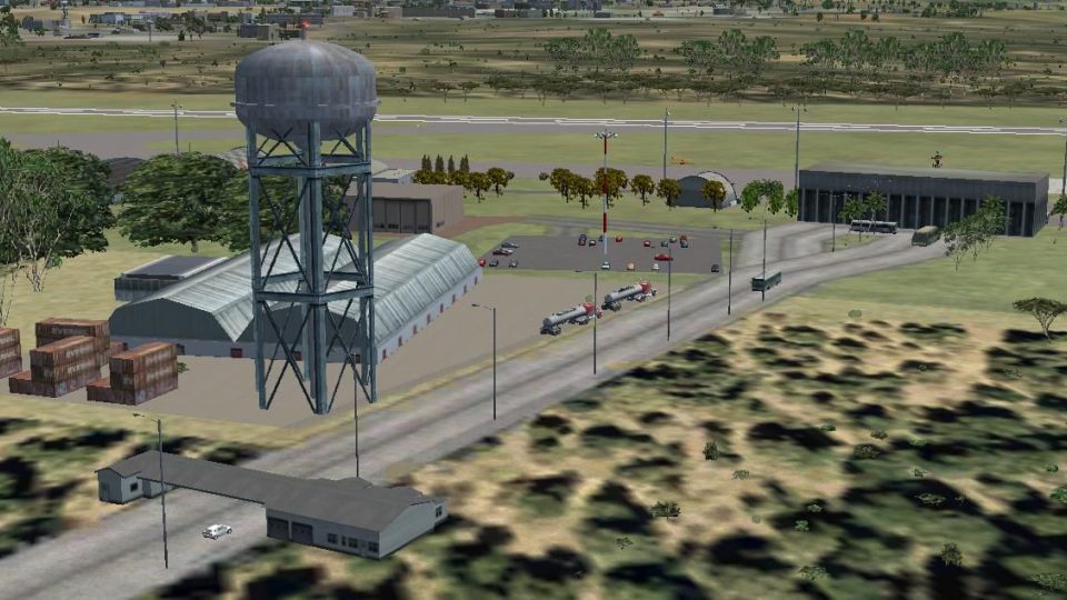
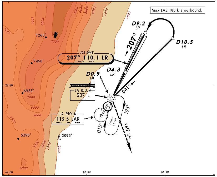
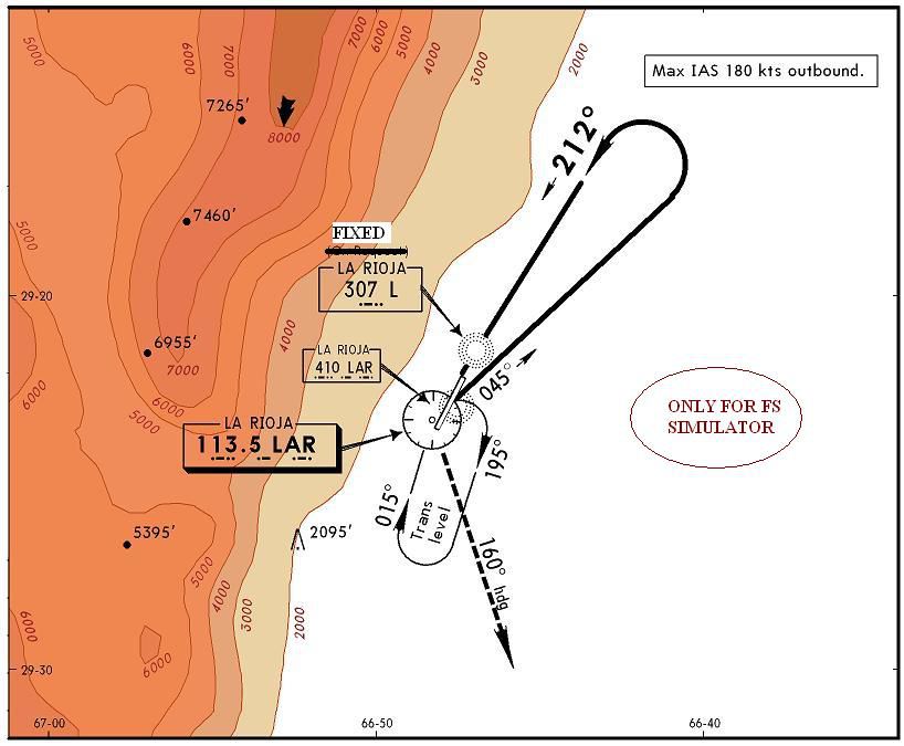
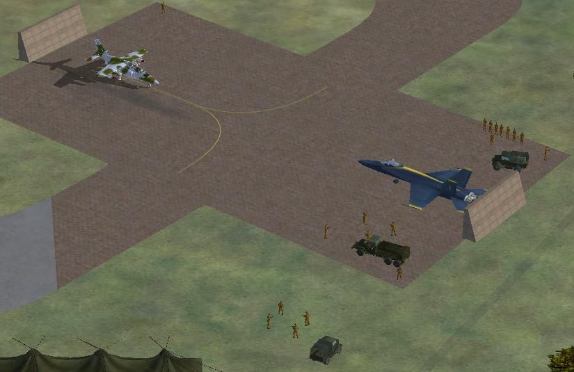
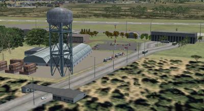
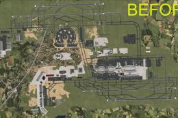
Almonacid Military Airport (SANL) in La Rioja, Argentina is recreated as a detailed military field for FSX, using Acceleration default objects to blend seamlessly with the base simulator. The package includes custom artificial lighting and provides SANL aeronautical charts for more authentic departures, arrivals, and circuit work.


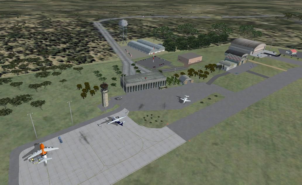
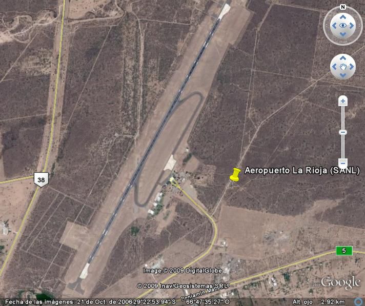


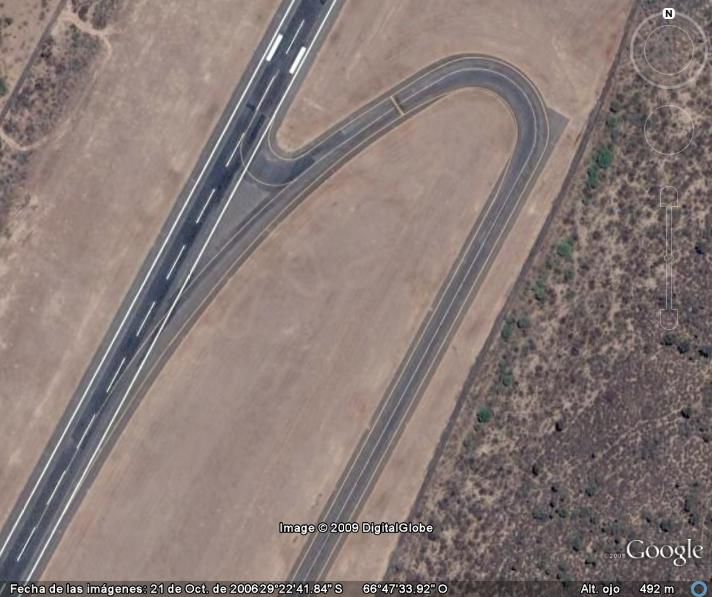
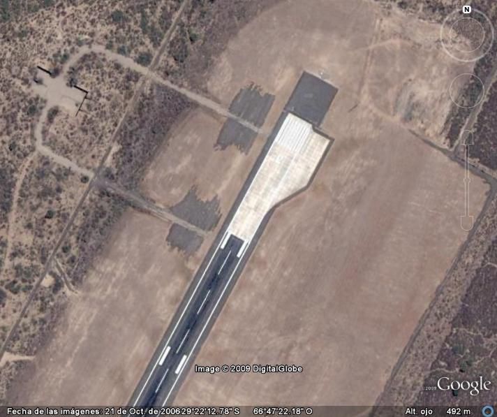
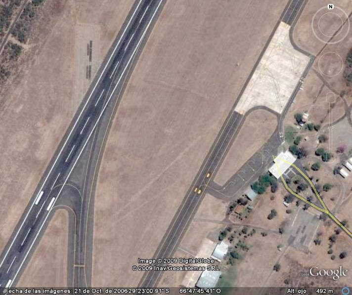
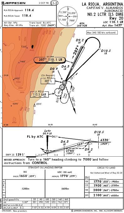

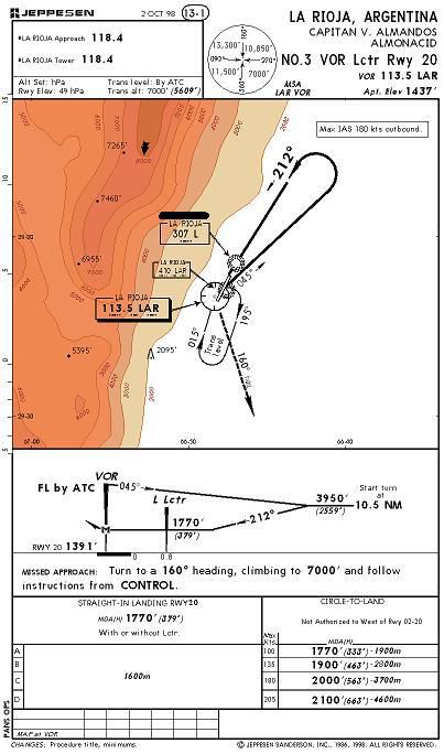

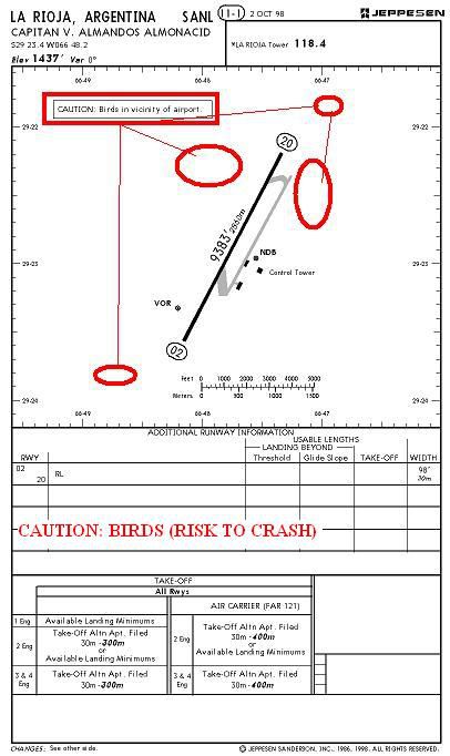

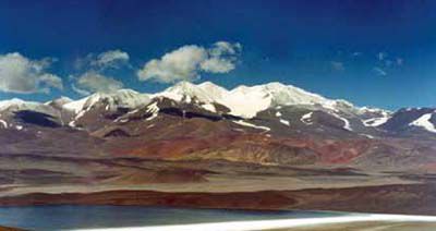
Almonacid Military Airport, La Rioja, Argentina (SANL). By Cristobal Laje.
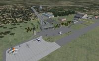
Almonacid Military Airport Scenery.
Requirements for use and you'll enjoy the scenery:
The scenario was made with default objects for Flight Simulator X (R) Acceleration (R) pack. It has not been tested with others versions of FSX! All items except the artificial lights by Jim Dhaenens (Thanks Jim!) that is attached to this folder, belong to the libraries of fsx acceleration pack.
INSTALATION:
1) Copy the SANL folder into your ADDON SCENERY of FSX.
2) Open the Settings/Scenery Library and "add Area".
3) Select the SANL folder and click "OK" for adds the new area.
Into the "SANL_charts" file are included the aeronautic charts of SANL airport.
Enjoy!
Almonacid Military Airport Scenery.
Free for all simmers · 2.07 MB · Scanned clean
Download speed: Free tier is capped at 0.5 Mbps. PRO members download at full line speed.
FSX\Addon Scenery\ containing scenery and texture sub-folders.readme.txt or README file. It tells you exactly where files go, what dependencies are needed, and any quirks specific to this add-on.Use these coordinates to fly directly to this location once the mod is installed.
-29.38160000,-66.79580000
Launch FSX or Prepar3D and use Flights → Load to open the downloaded .pln file. Your aircraft will be positioned at this location.
The archive sanl.zip has 48 files and directories contained within it.
This list displays the first 500 files in the package. If the package has more, you will need to download it to view them.
| Filename/Directory | File Date | File Size |
|---|---|---|
| FSX_PICS | 10.24.09 | 0 B |
| Airport_2.JPG | 10.23.09 | 95.35 kB |
| Airport_Back.JPG | 10.23.09 | 134.64 kB |
| Airport_Night.JPG | 10.23.09 | 40.35 kB |
| Hangars.JPG | 10.23.09 | 74.91 kB |
| Mil_Parking_1.JPG | 10.23.09 | 52.63 kB |
| Mil_Parking_2.JPG | 10.23.09 | 115.64 kB |
| Thumbs.db | 10.23.09 | 23.00 kB |
| Install.txt | 10.24.09 | 1.63 kB |
| LA_RIOJA_TYPICAL | 10.24.09 | 0 B |
| CONDOR_LEVEL.jpg | 10.23.09 | 111.48 kB |
| DAKAR_ROAD.jpg | 10.23.09 | 58.45 kB |
| FamatinaGOLD_MINES.jpg | 10.23.09 | 16.11 kB |
| Moon_Valley.jpg | 10.23.09 | 103.44 kB |
| Mt Pissis.jpg | 10.23.09 | 36.30 kB |
| Mt_Famatina.jpg | 10.24.09 | 87.37 kB |
| RISK_ADVENTURES.jpg | 10.23.09 | 74.24 kB |
| Thumbs.db | 10.24.09 | 56.50 kB |
| WINE_LAND.jpg | 10.23.09 | 54.22 kB |
| readme_lights.txt | 11.06.08 | 2.51 kB |
| SANL_CHARTS | 10.24.09 | 0 B |
| 1_AIRPORT ZOOM.JPG | 10.22.09 | 51.34 kB |
| 1_AIRPORT.JPG | 10.22.09 | 49.63 kB |
| 2_ILS DME ZOOM.JPG | 10.22.09 | 67.02 kB |
| 2_ILS DME.JPG | 10.22.09 | 61.92 kB |
| 3_VOR NDB RWY 20 ZOOM.JPG | 10.22.09 | 66.20 kB |
| 3_VOR NDB RWY 20.JPG | 10.22.09 | 55.10 kB |
| Thumbs.db | 10.22.09 | 51.50 kB |
| SANL_Info.txt | 10.24.09 | 3.67 kB |
| SATELLITE_PICS | 10.24.09 | 0 B |
| AIRPORT.jpg | 10.17.09 | 81.72 kB |
| NORTH_HEAD.jpg | 10.17.09 | 64.08 kB |
| NORTH_TAXI.jpg | 10.17.09 | 64.36 kB |
| SOUTH_HEAD.jpg | 10.17.09 | 64.70 kB |
| SOUTH_TAXI.jpg | 10.17.09 | 62.48 kB |
| Thumbs.db | 10.24.09 | 20.50 kB |
| scenery | 10.24.09 | 0 B |
| lightobj.bgl | 11.06.08 | 643.63 kB |
| lightobj.txt | 11.06.08 | 547 B |
| SANL_2.BGL | 10.24.09 | 41.95 kB |
| SANL_3_CVX.bgl | 10.24.09 | 286 B |
| SANL_T_CVX.bgl | 10.21.09 | 1.80 kB |
| texture | 10.24.09 | 0 B |
| almwht.dds | 10.16.08 | 64.12 kB |
| lights1.dds | 11.06.08 | 32.12 kB |
| SANL | 10.24.09 | 0 B |
| flyawaysimulation.txt | 10.29.13 | 959 B |
| Go to Fly Away Simulation.url | 01.22.16 | 52 B |
More FSX & P3D add-ons hand-picked based on this download.
FSX Scenery
ETHF Fritzlar is an military Airport. It is the base of Heeresfligerregiment …
 FSX Scenery
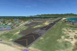
Scenery Polish Military Airport in Orneta, Poland. This is old military airpo…
 FSX Scenery
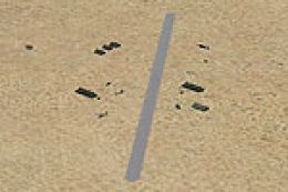
Desert Military Base. This is a small military base in the desert with a smal…
 FSX Scenery
Princess Juliana International Airport (TNCM) in Saint Marteen, Netherlands A…
 FSX Scenery
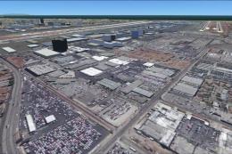
Los Angeles Airport Scenery v3, California (CA). This photoreal scenery is a …
 FSX Scenery
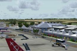
Barbados International Airport (TBPB). Grantley Adams International Airport f…
 FSX Scenery
Paris Charles de Gaulle Airport (CDG, LFPG), France. The entire airport has b…
 FSX Scenery
John F. Kennedy Airport (KJFK), New York, NYU. This is a photoreal scenery re…
Be the first to leave a comment on this download.
Be the first to share your thoughts on this download.