FS2004 East Coast Naval Air Stations
East Coast Naval Air Stations brings a set of AFCAD2 airport layouts and Navy-only AI flight plans to FS2004, covering key bases such as Jacksonville, Norfolk, New Orleans, Pax River, Pensacola, Key West, Willow Grove, and Oceana. The package includes compiled BGLs plus an editable military aircraft list for tailoring traffic to an existing hangar.
- File: ecst_nas.zip
- Size:621.54 KB
- Scan:
Clean (0d)

- Access:Freeware
- Content:Everyone
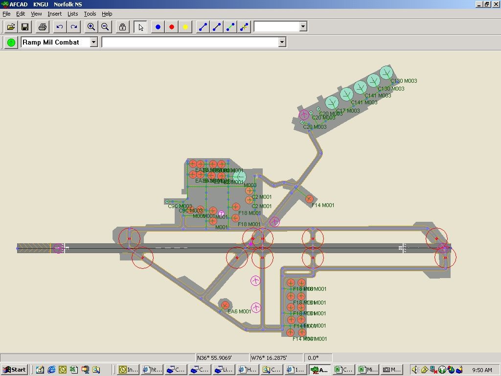
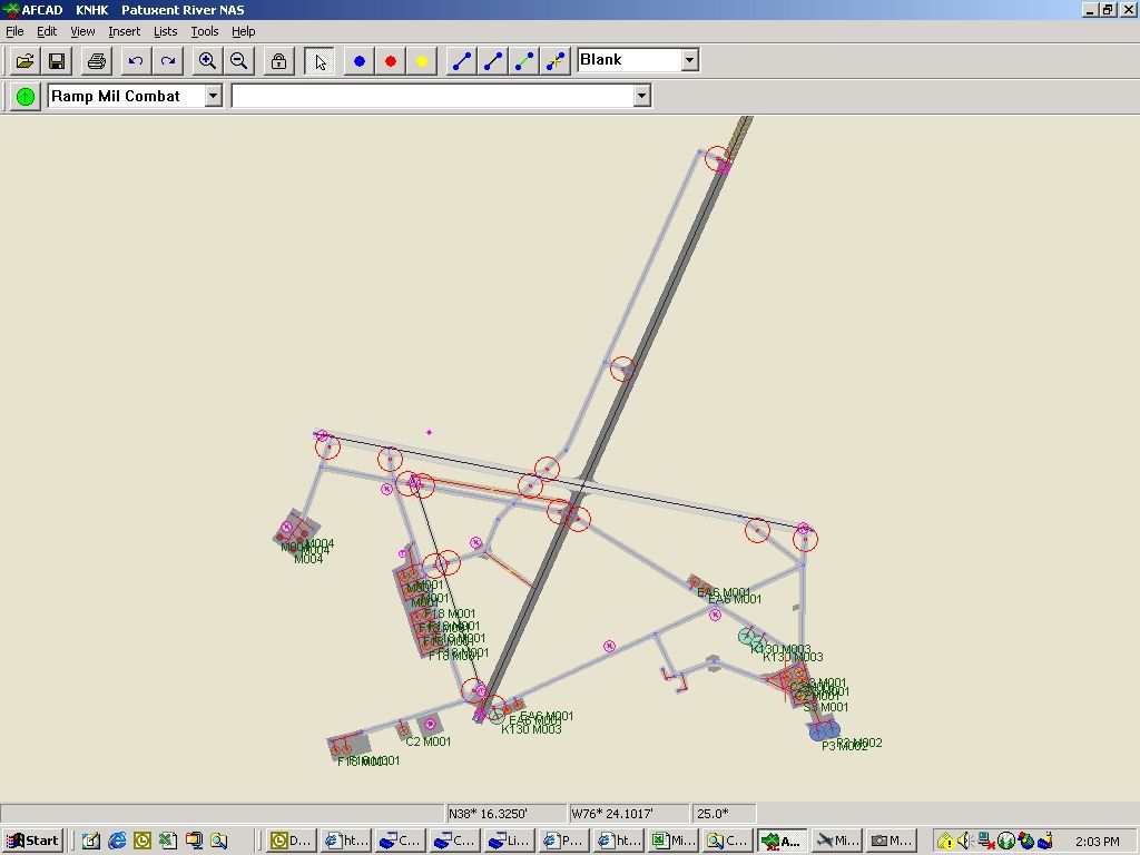
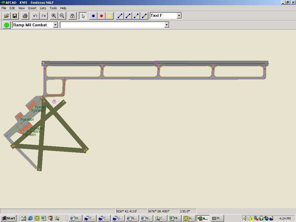
East Coast Naval Air Stations AFCAD2 files and flight plans. Flight plans are for navy aircraft only. By Dave O'Brien.
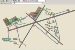
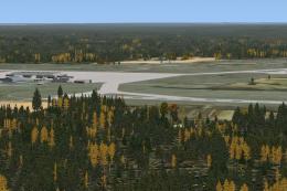
Overview of Jacksonville (KNIP).
These are some of the Naval Air Stations on the Eastern Coast. These flight plans are for Navy Aircraft only but you can change at your will. Zip includes BGL's, my whole military aircraft list which you might have to edit to fit your needs as I have some payware in mine.
Add these to your airport txt file from Ttools and recompile:
Airport Data:
KNIP,N30* 14.20',W81* 40.32',22
KNGU,N36* 56.24',W76* 17.35',15
KNBG,N29* 50.11',W90* 01.44',3
KNHK,N38* 17.25',W76* 24.36',39
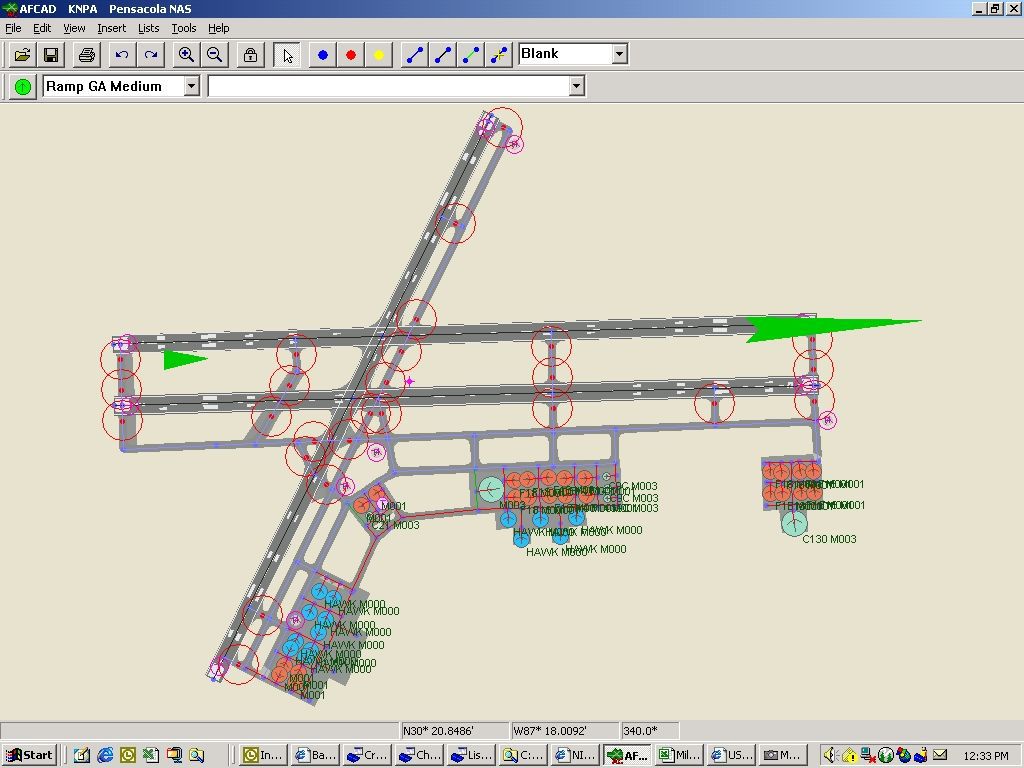
KNPA,N30* 21.18',W87* 18.98',30
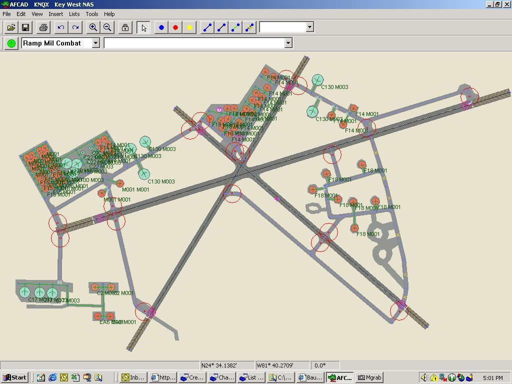
KNQX,N24* 34.58',W81* 41.14',6
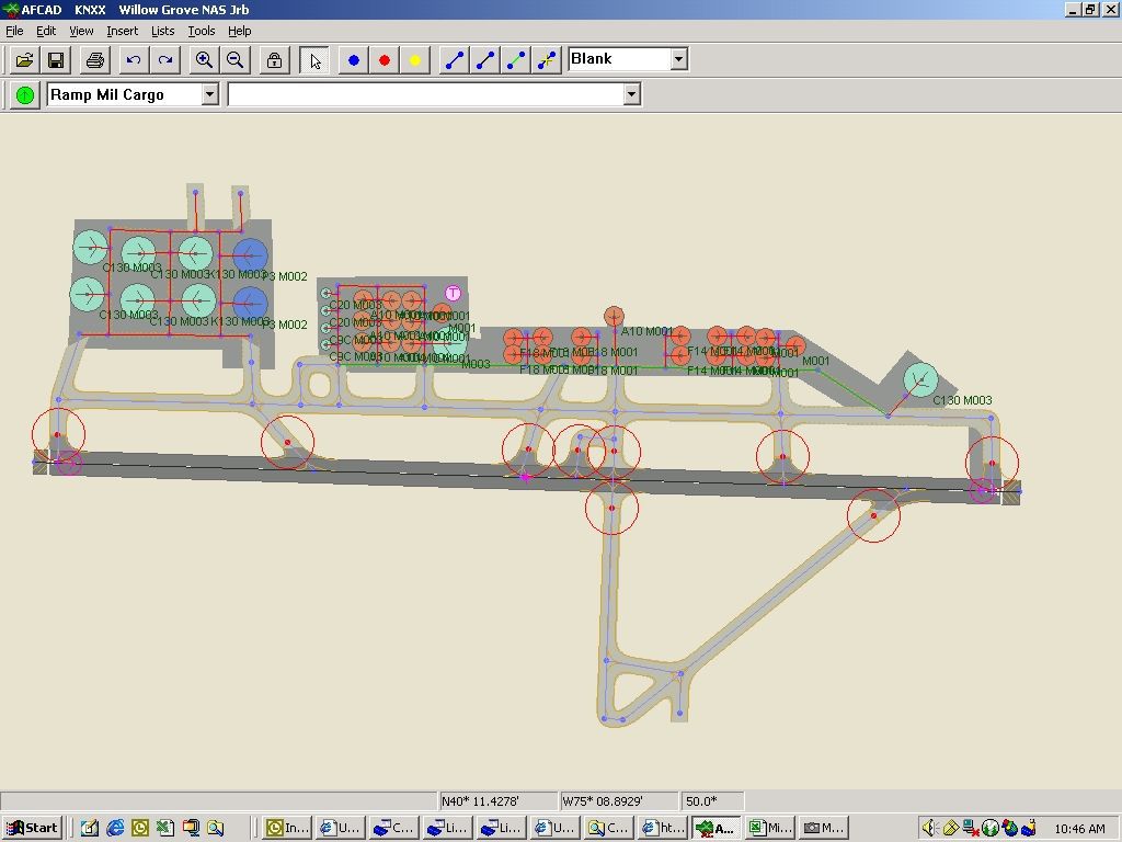
KNXX,N40* 11.99',W75* 08.89',362
KNFE,N36* 42.01',W76* 07.97',16
Images & Screenshots


The archive ecst_nas.zip has 22 files and directories contained within it.
File Contents
This list displays the first 500 files in the package. If the package has more, you will need to download it to view them.
| Filename/Directory | File Date | File Size |
|---|---|---|
| Flightplans_Military.txt | 11.14.03 | 13.29 kB |
| AF2_KNFE.bgl | 11.13.03 | 2.85 kB |
| AF2_KNGU.bgl | 11.12.03 | 10.42 kB |
| AF2_KNHK.bgl | 11.11.03 | 9.62 kB |
| AF2_KNIP.bgl | 11.12.03 | 14.47 kB |
| AF2_KNPA.bgl | 11.12.03 | 11.05 kB |
| AF2_KNQX.bgl | 11.12.03 | 18.81 kB |
| AF2_KNXX.bgl | 11.12.03 | 8.45 kB |
| KNBG New Orleans NAS.jpg | 11.11.03 | 82.51 kB |
| KNFE Fentress NALF.jpg | 11.13.03 | 66.68 kB |
| KNGU Norfolk NAS.jpg | 11.12.03 | 89.35 kB |
| KNHK Patuxent River NAS.jpg | 11.11.03 | 77.11 kB |
| KNIP Jacksonville NAS.jpg | 11.12.03 | 87.96 kB |
| KNPA Pensacola NAS.jpg | 11.12.03 | 102.88 kB |
| KNQX Key West NAS.jpg | 11.12.03 | 118.19 kB |
| KNXX Willow Grove NAS.jpg | 11.12.03 | 91.69 kB |
| Aircraft_Military.txt | 11.14.03 | 4.05 kB |
| Airports_Military.txt | 11.14.03 | 868 B |
| EC NAS Readme.txt | 11.14.03 | 7.70 kB |
| AF2_KNBG.bgl | 11.11.03 | 10.30 kB |
| flyawaysimulation.txt | 10.29.13 | 959 B |
| Go to Fly Away Simulation.url | 01.22.16 | 52 B |
Installation Instructions
Most of the freeware add-on aircraft and scenery packages in our file library come with easy installation instructions which you can read above in the file description. For further installation help, please see our Flight School for our full range of tutorials or view the README file contained within the download. If in doubt, you may also ask a question or view existing answers in our dedicated Q&A forum.


0 comments
Leave a Response