MSFS Millau Viaduct Scenery
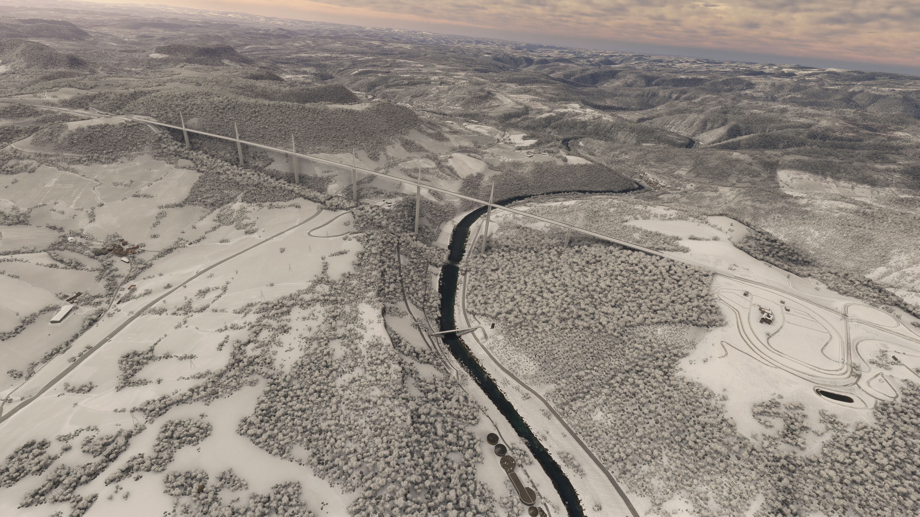
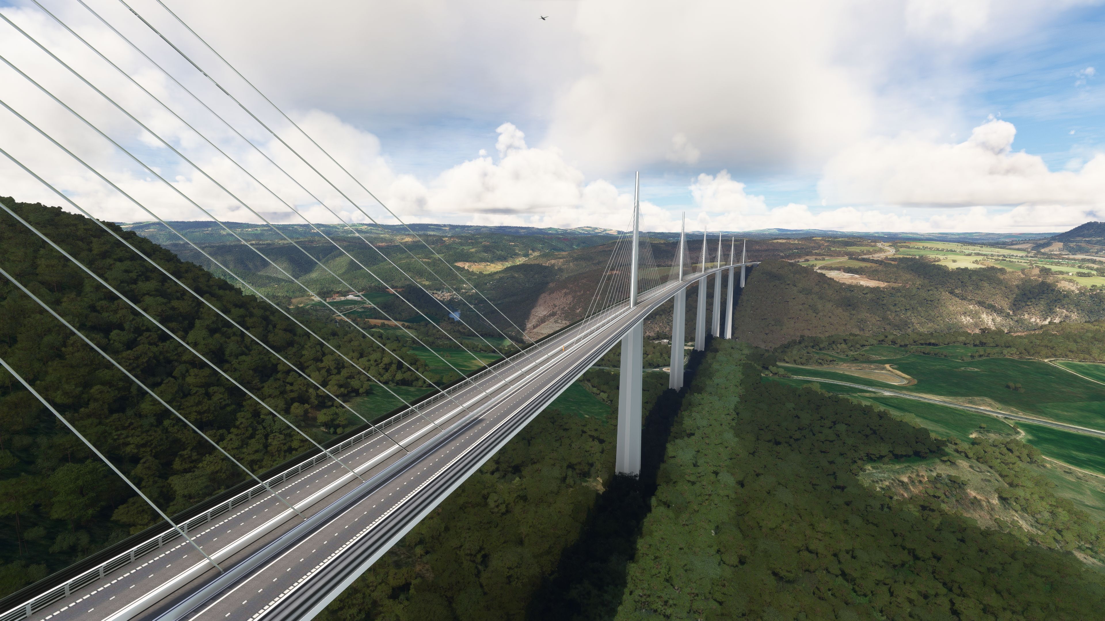
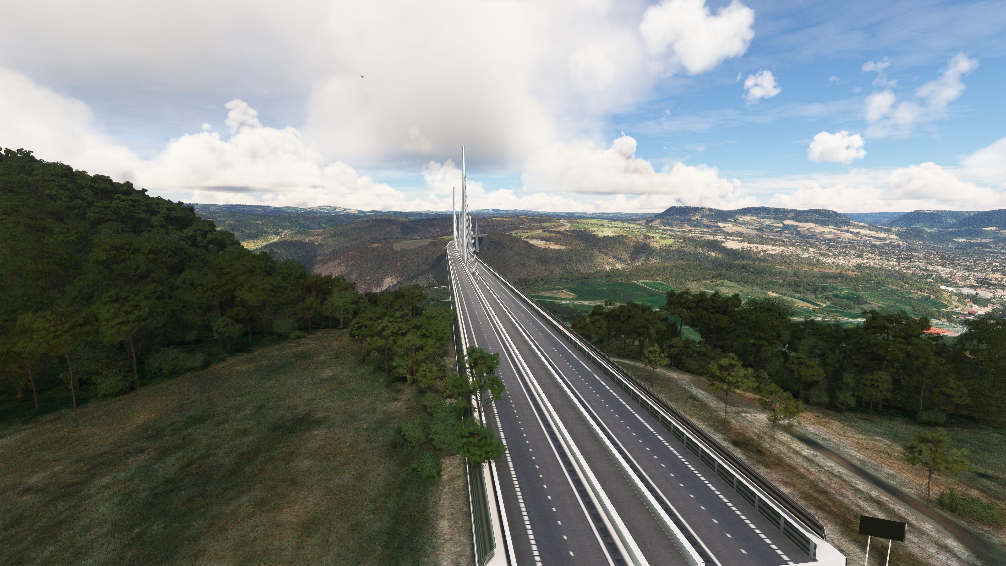
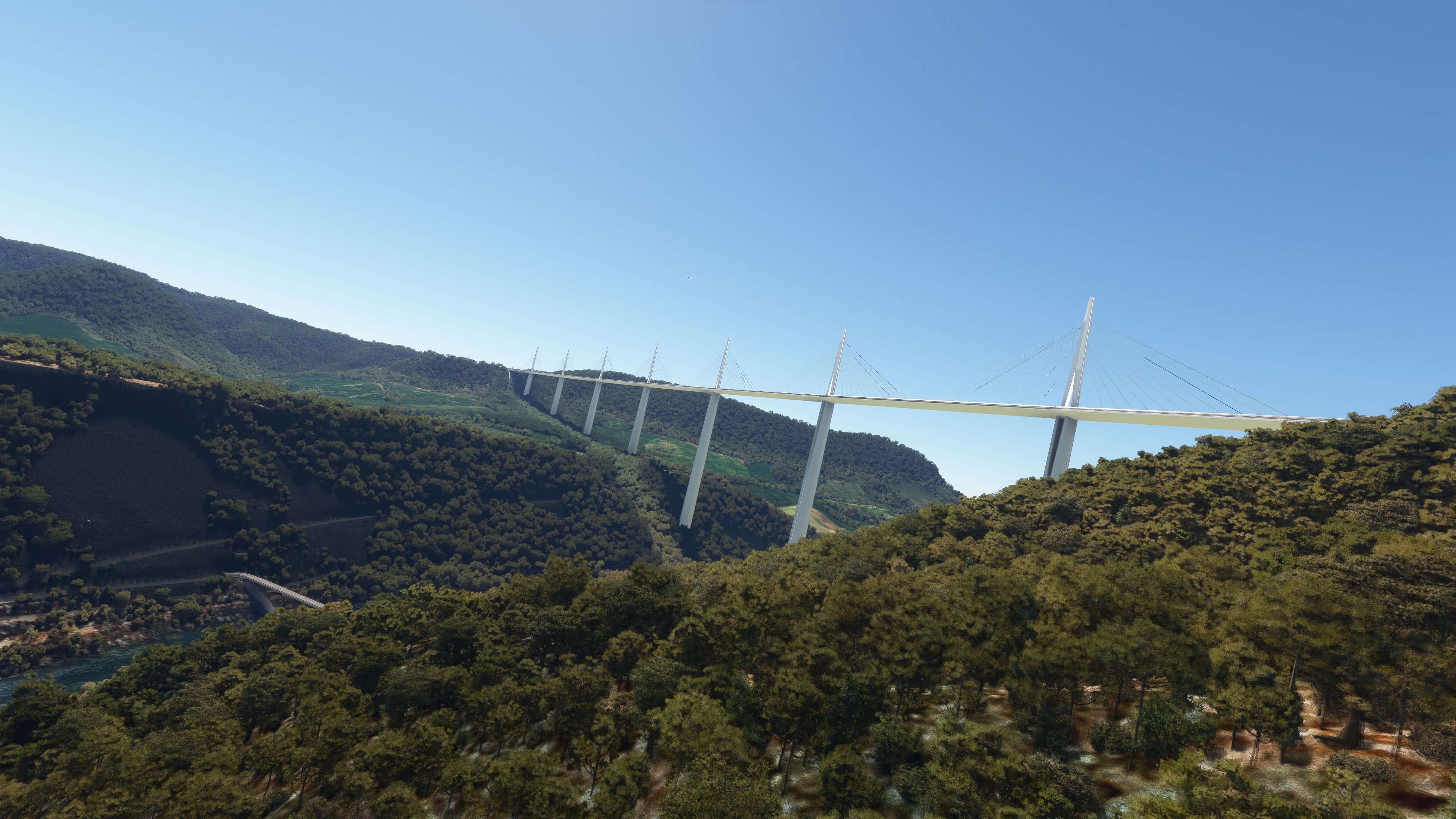
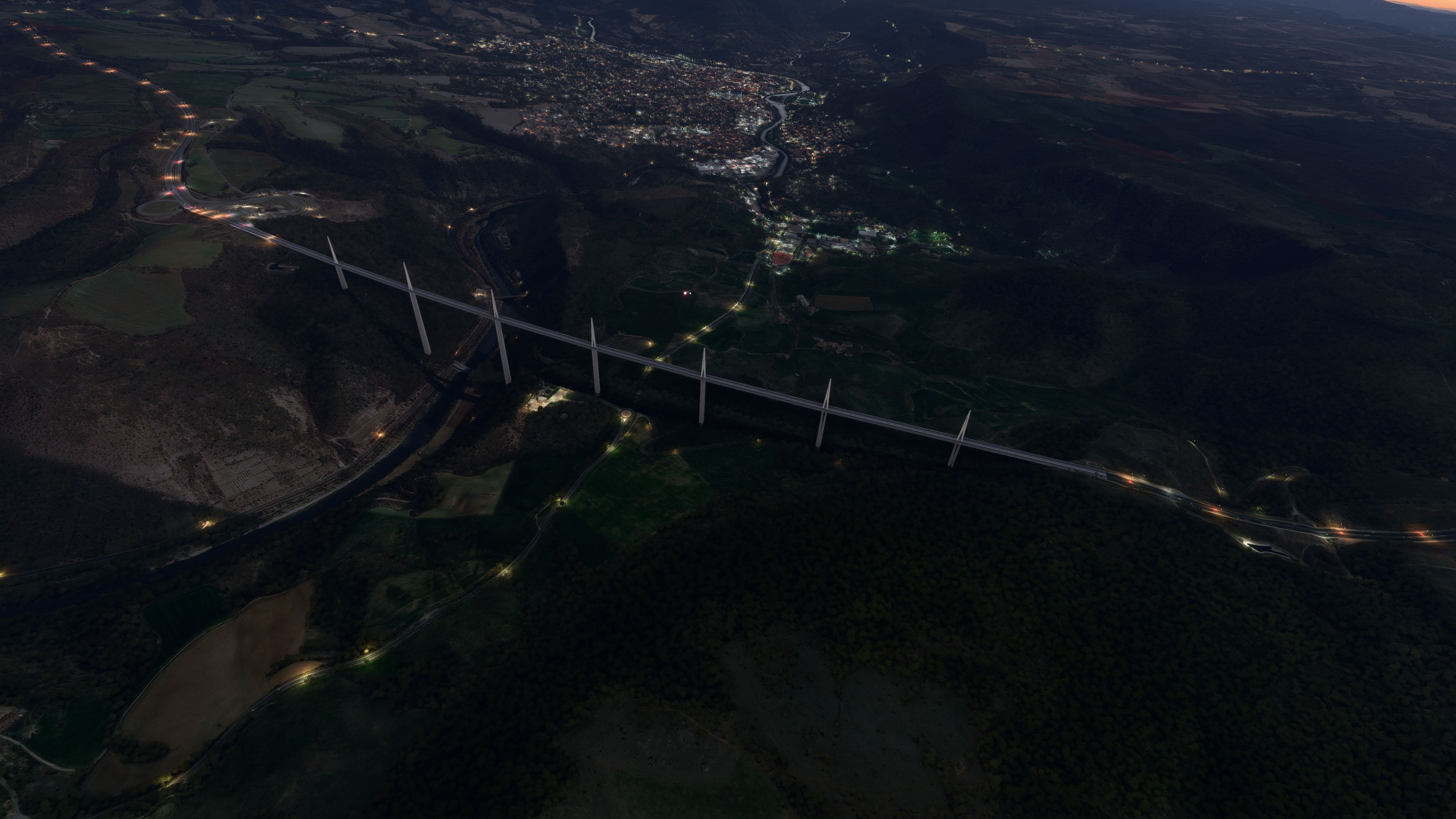
Millau Viaduct scenery recreates France’s record-setting bridge with a high-fidelity 3D model, refined Tarn gorge terrain, and improved vegetation for seamless blending in Microsoft Flight Simulator. Fixed beacon lighting adds convincing night presence, while precise GPS coordinates make the landmark easy to find for VFR sightseeing routes.
Images & Screenshots
30 total


Expert Overview
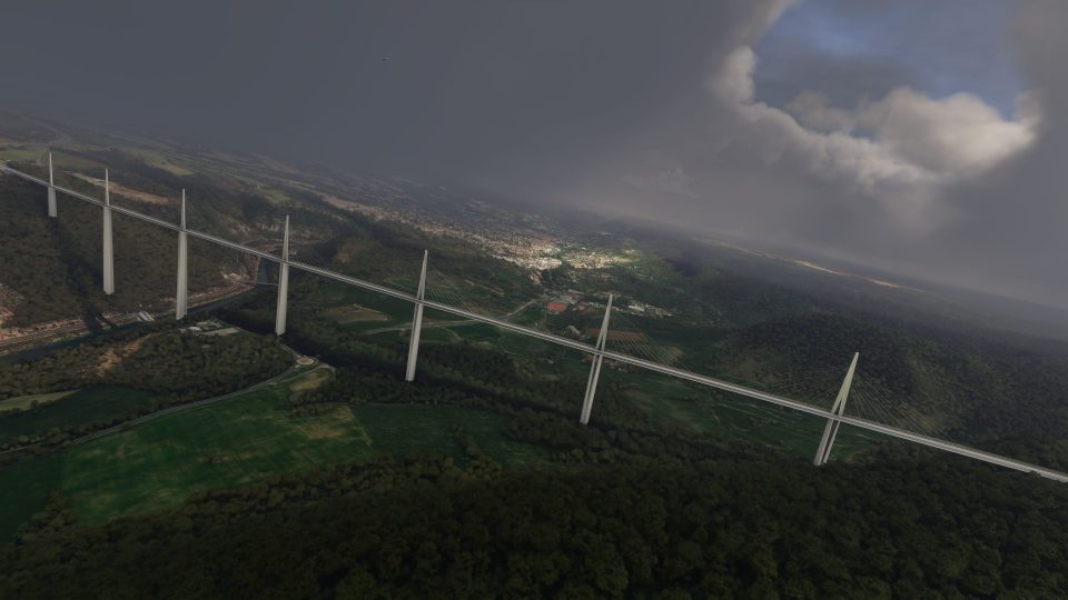
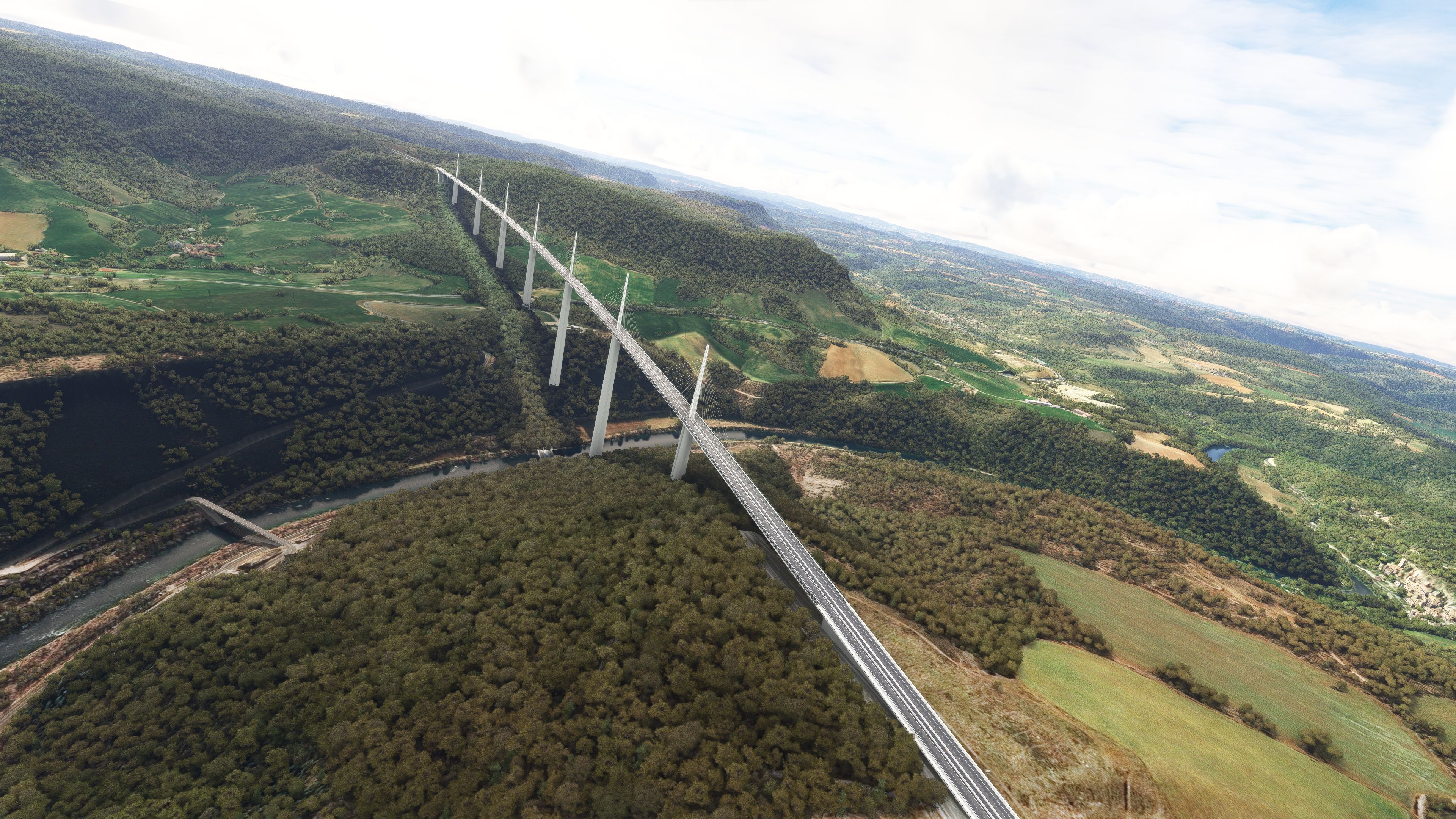
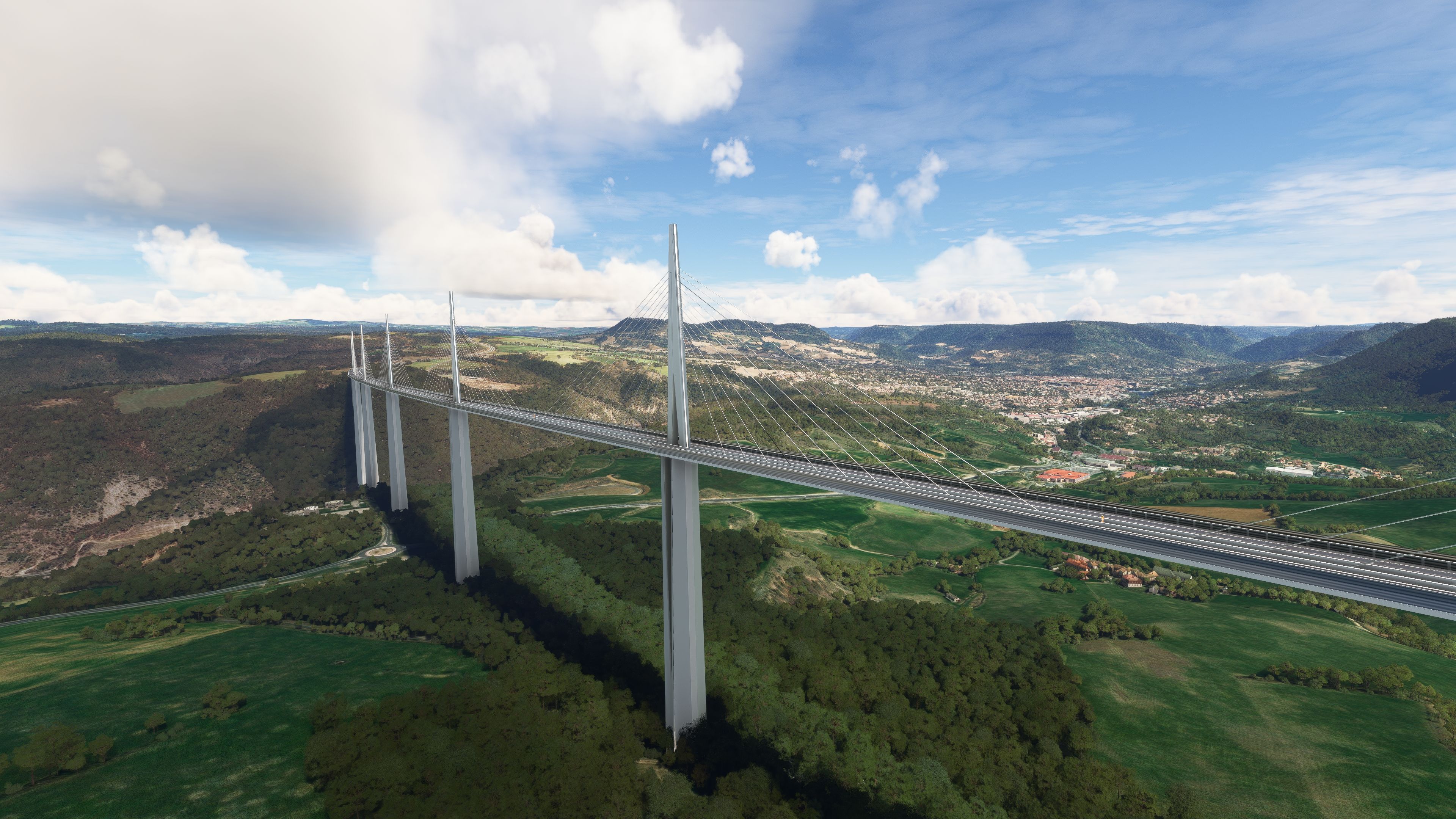
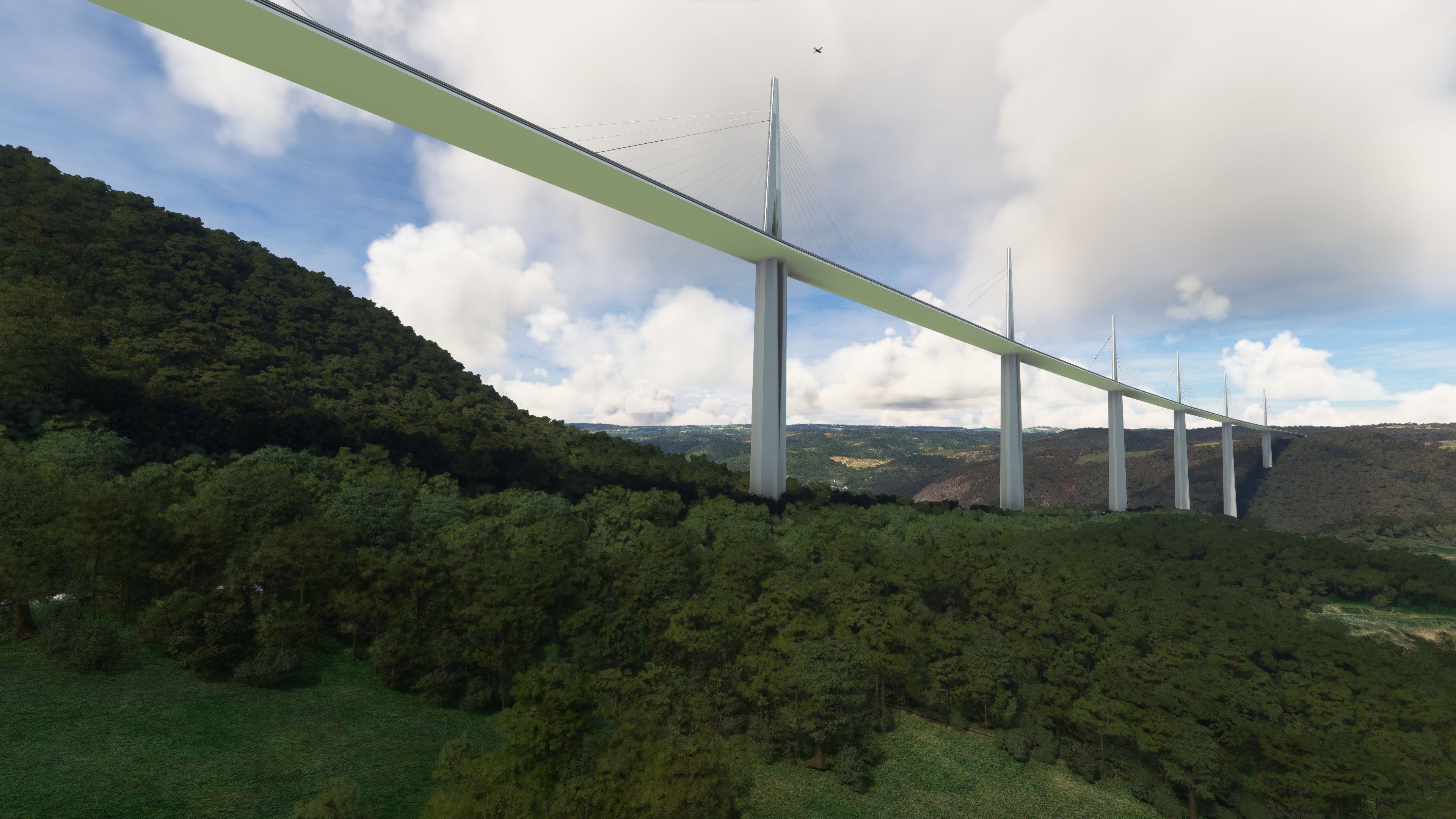
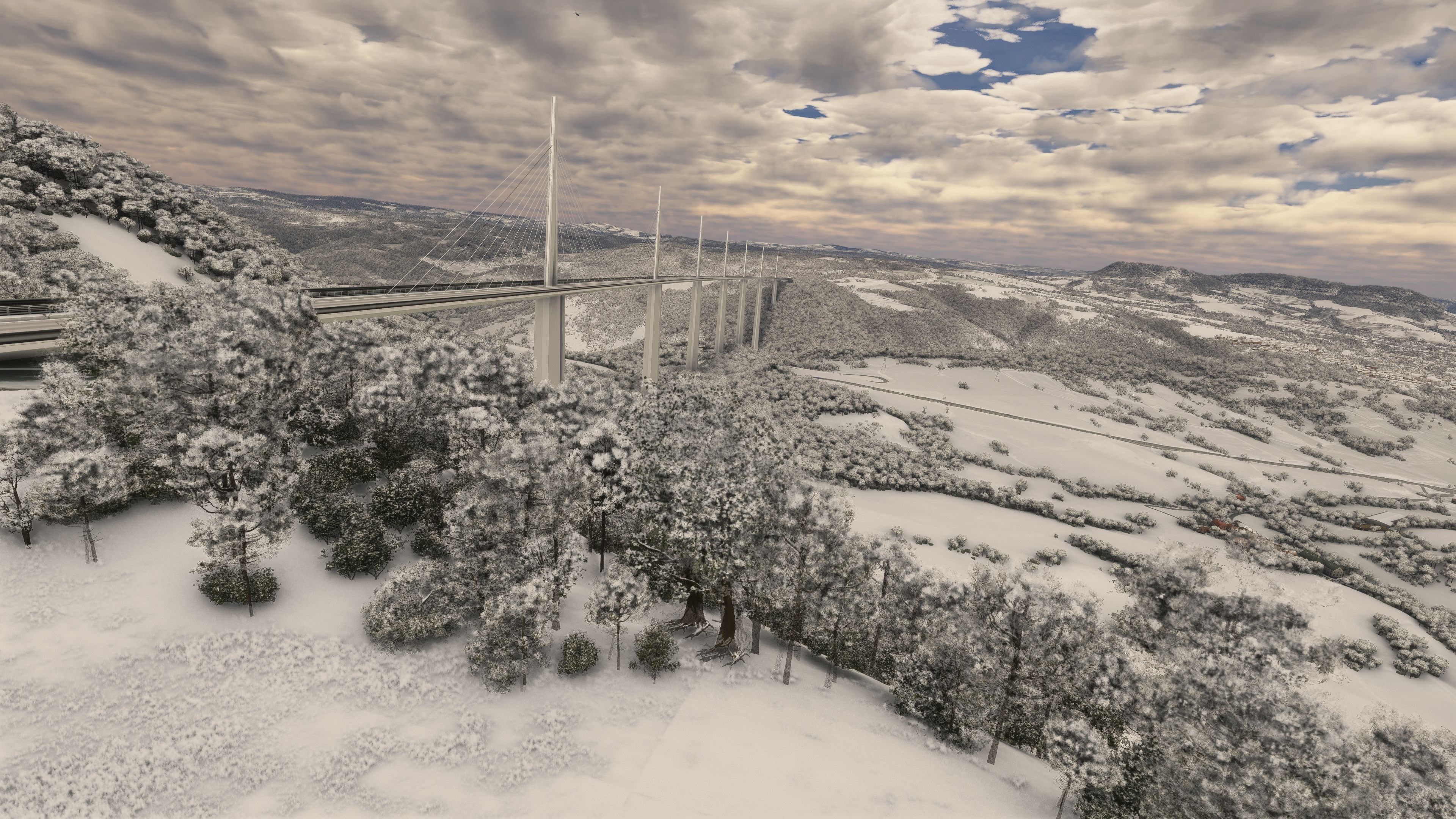
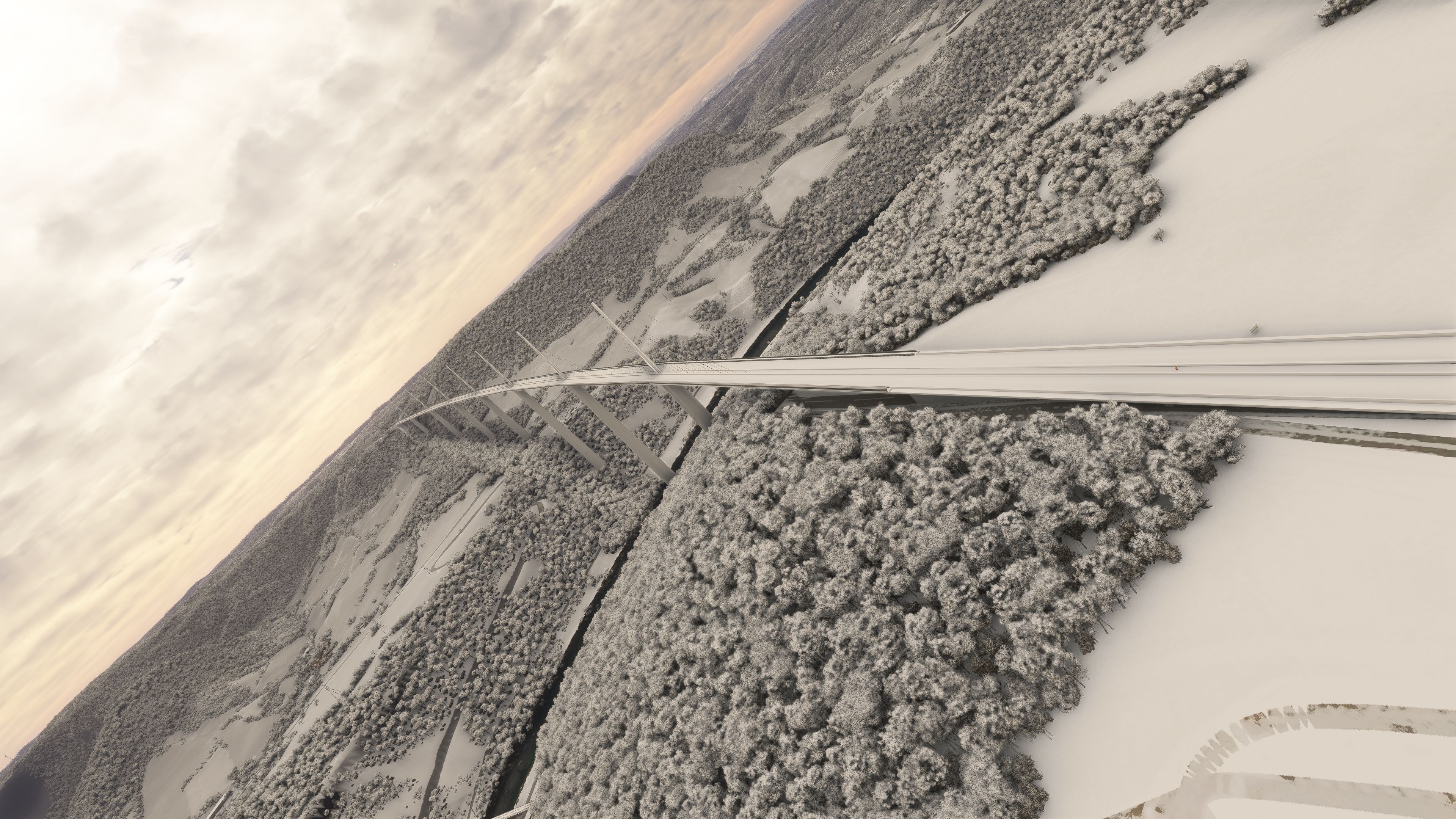
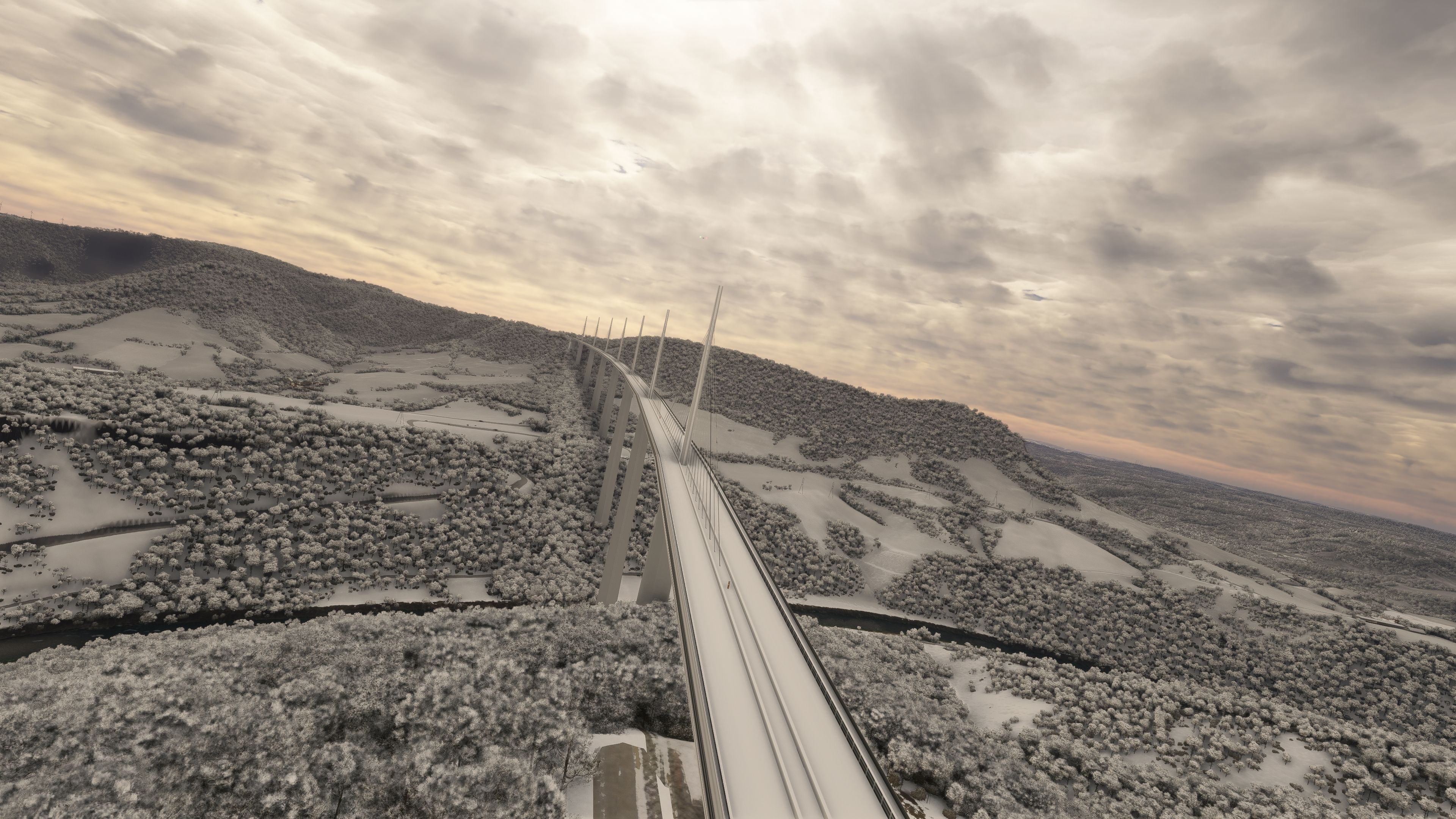
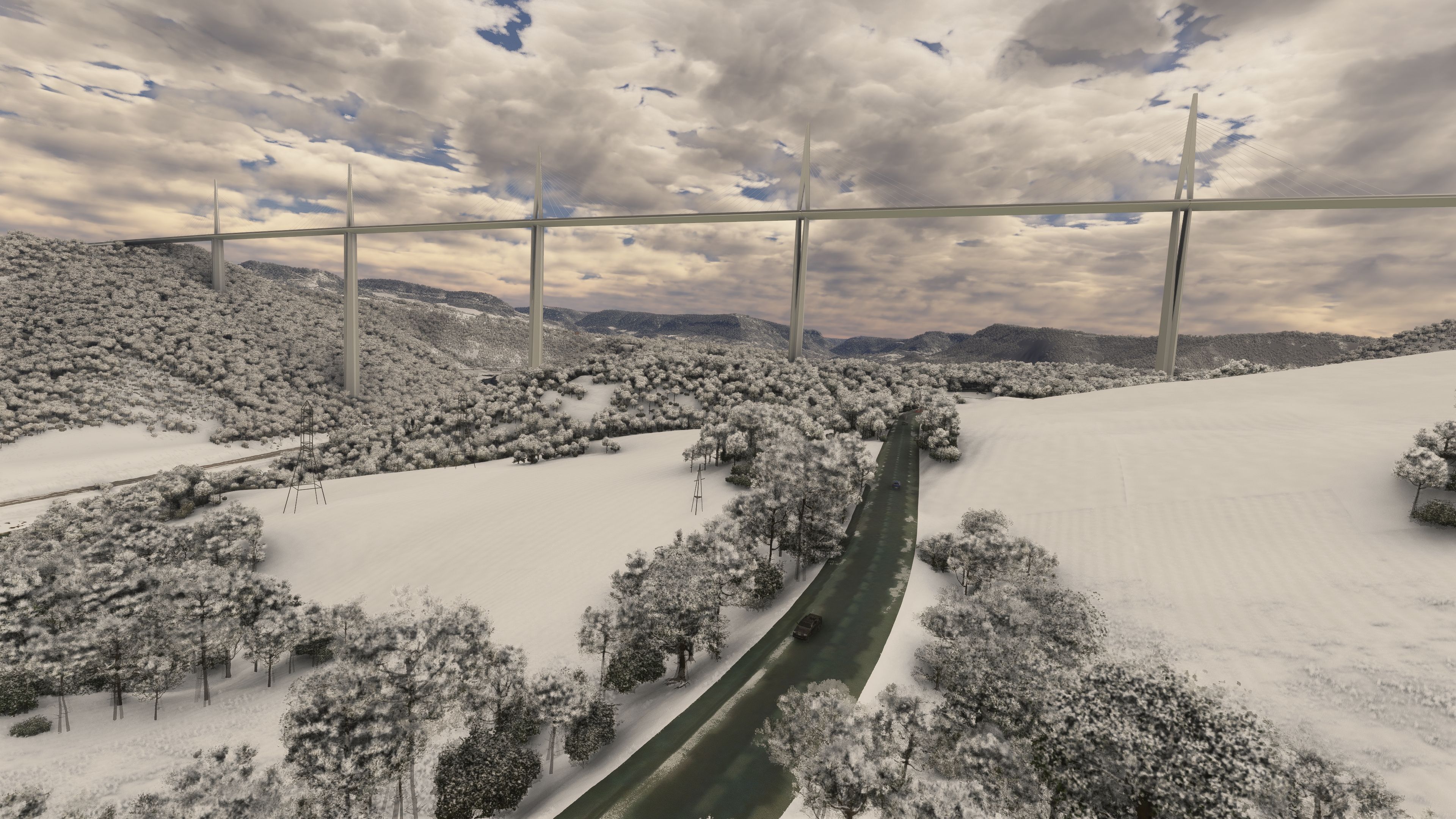
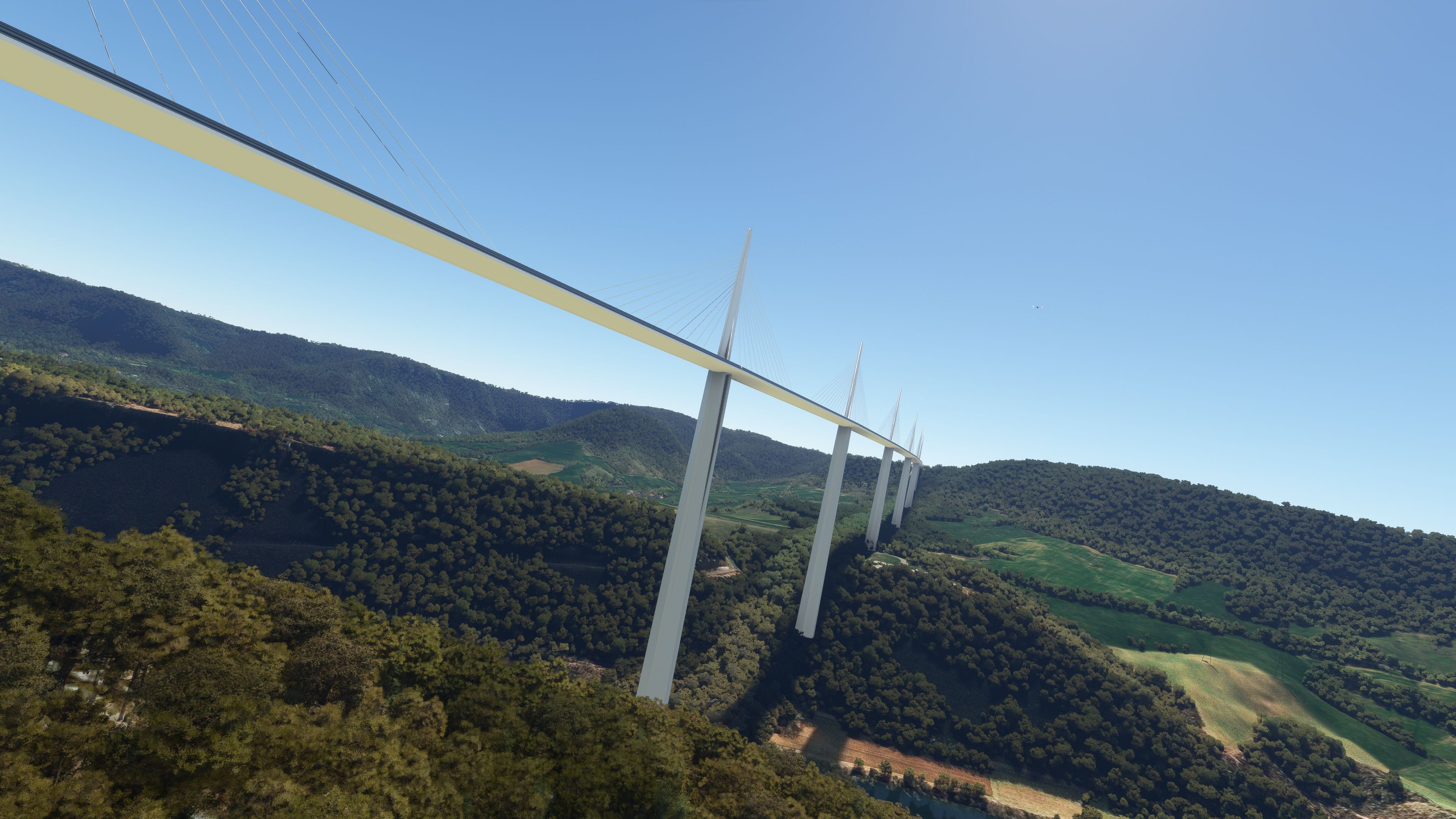
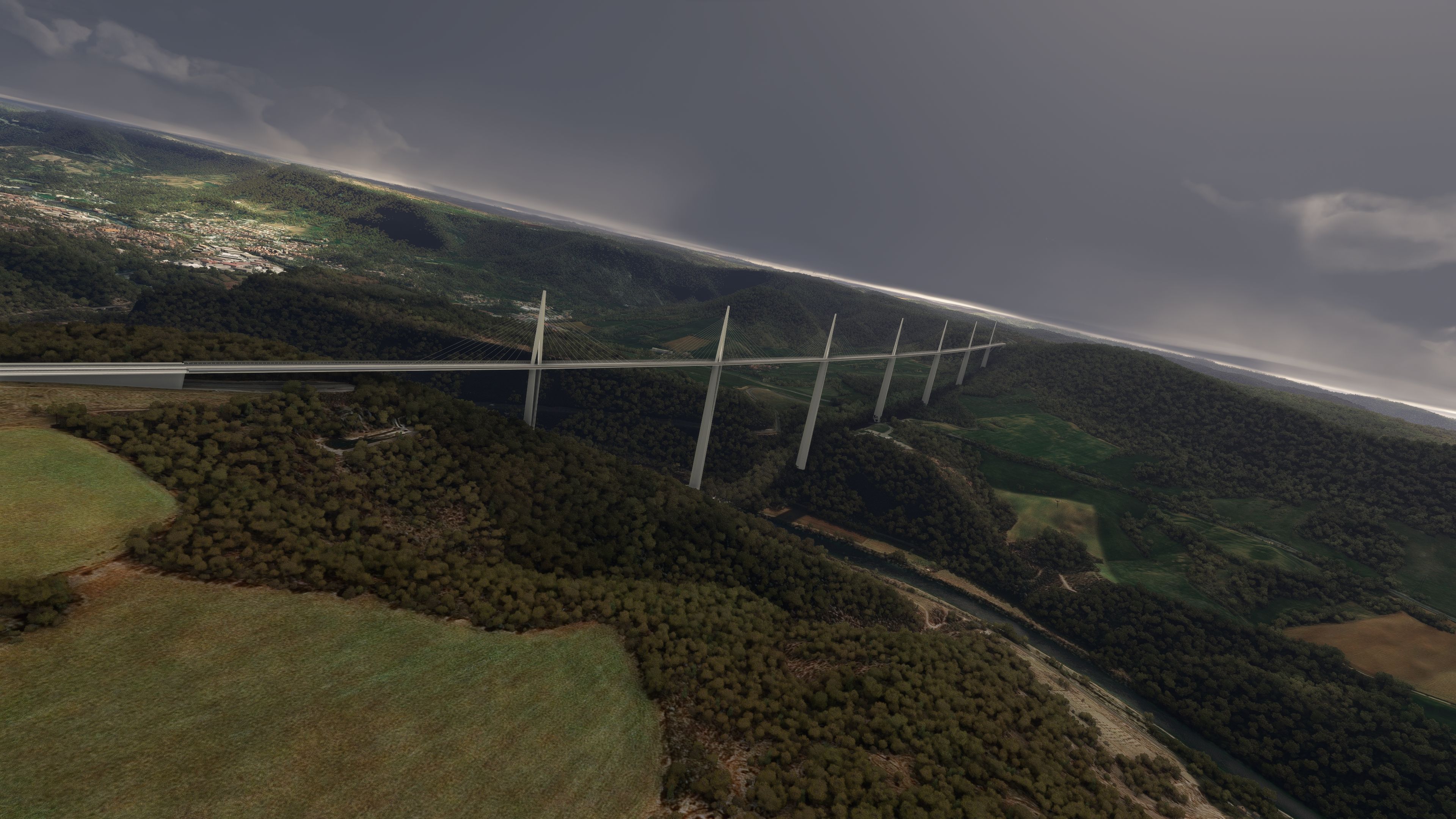
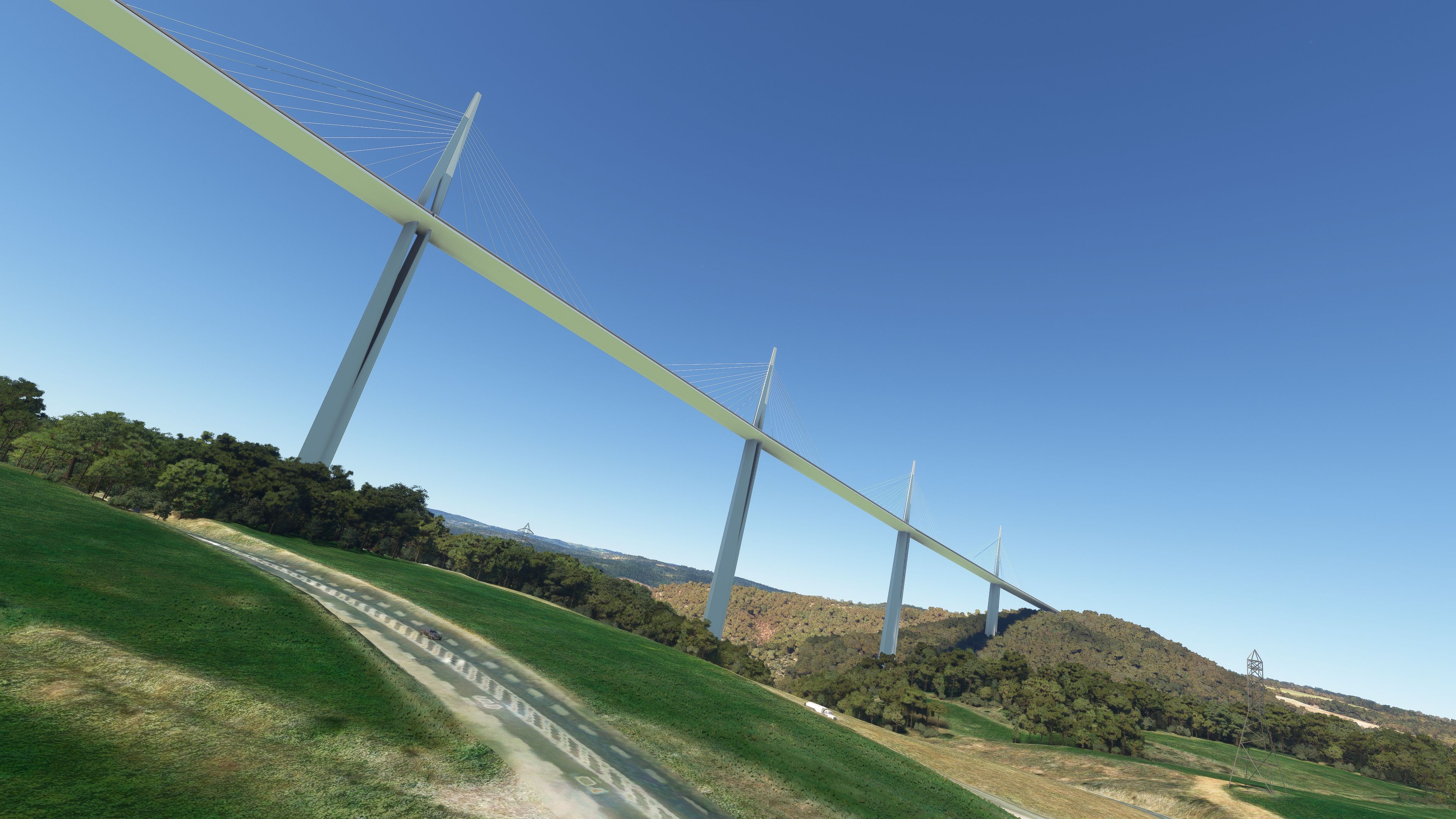
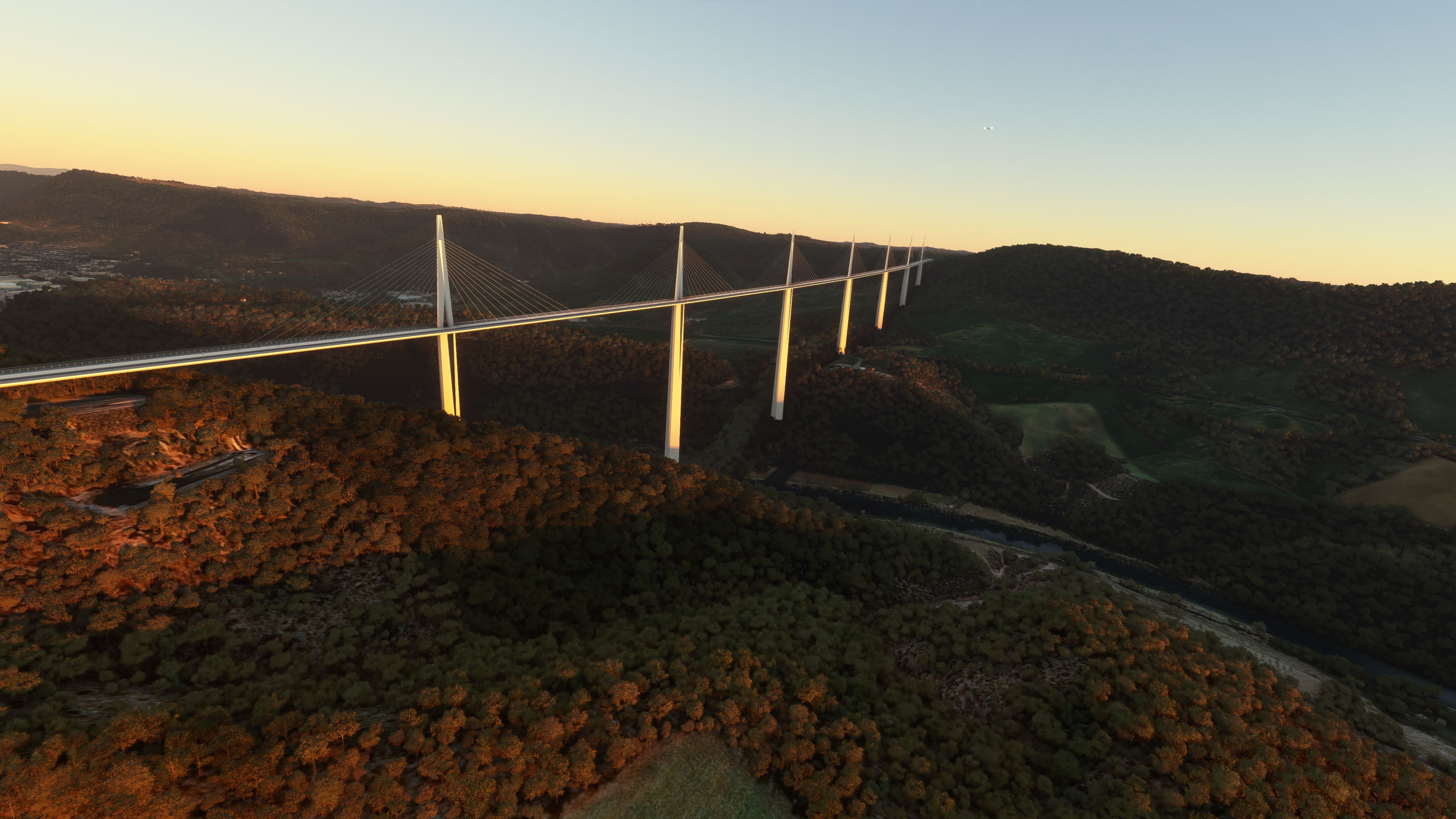
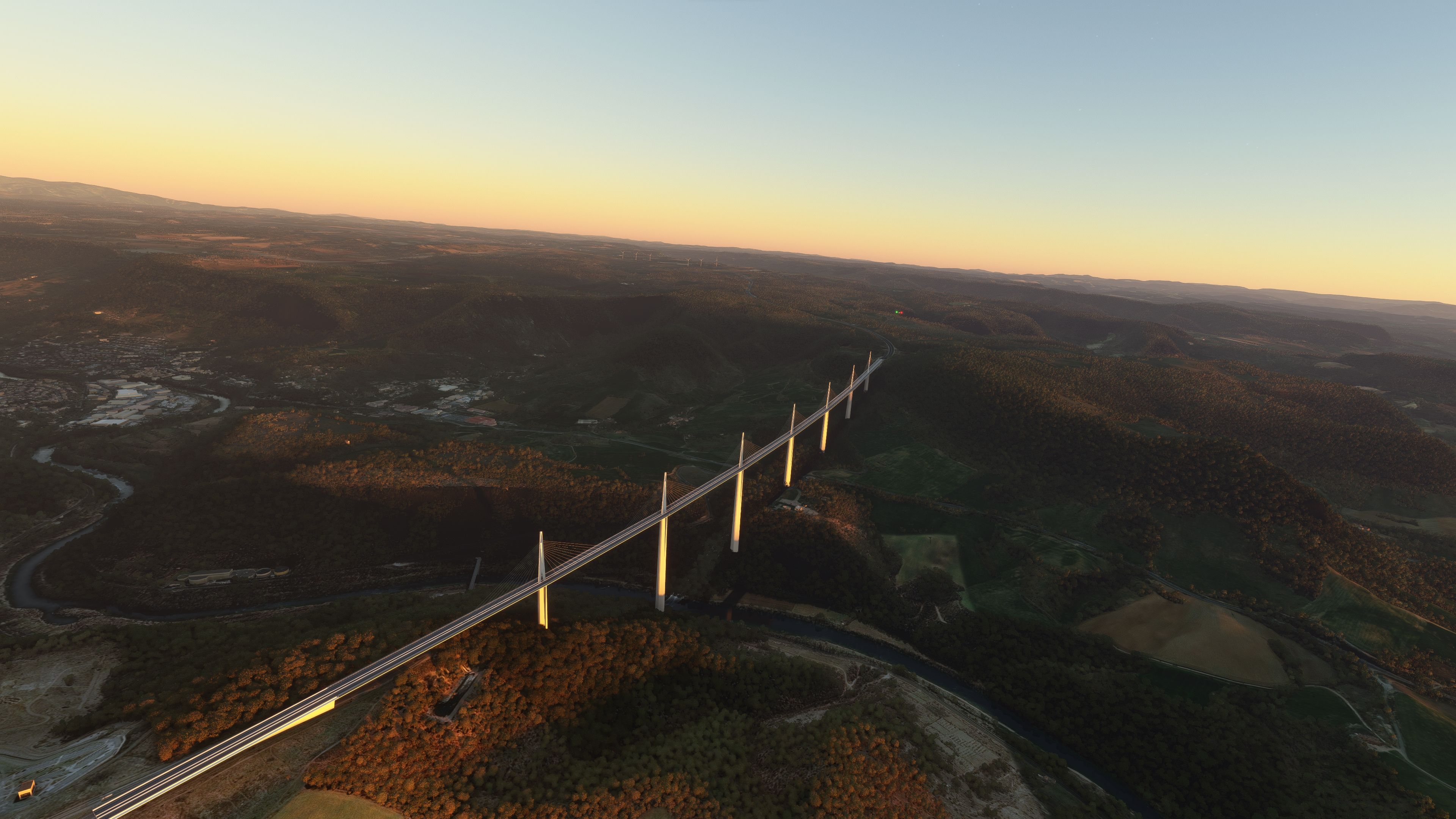
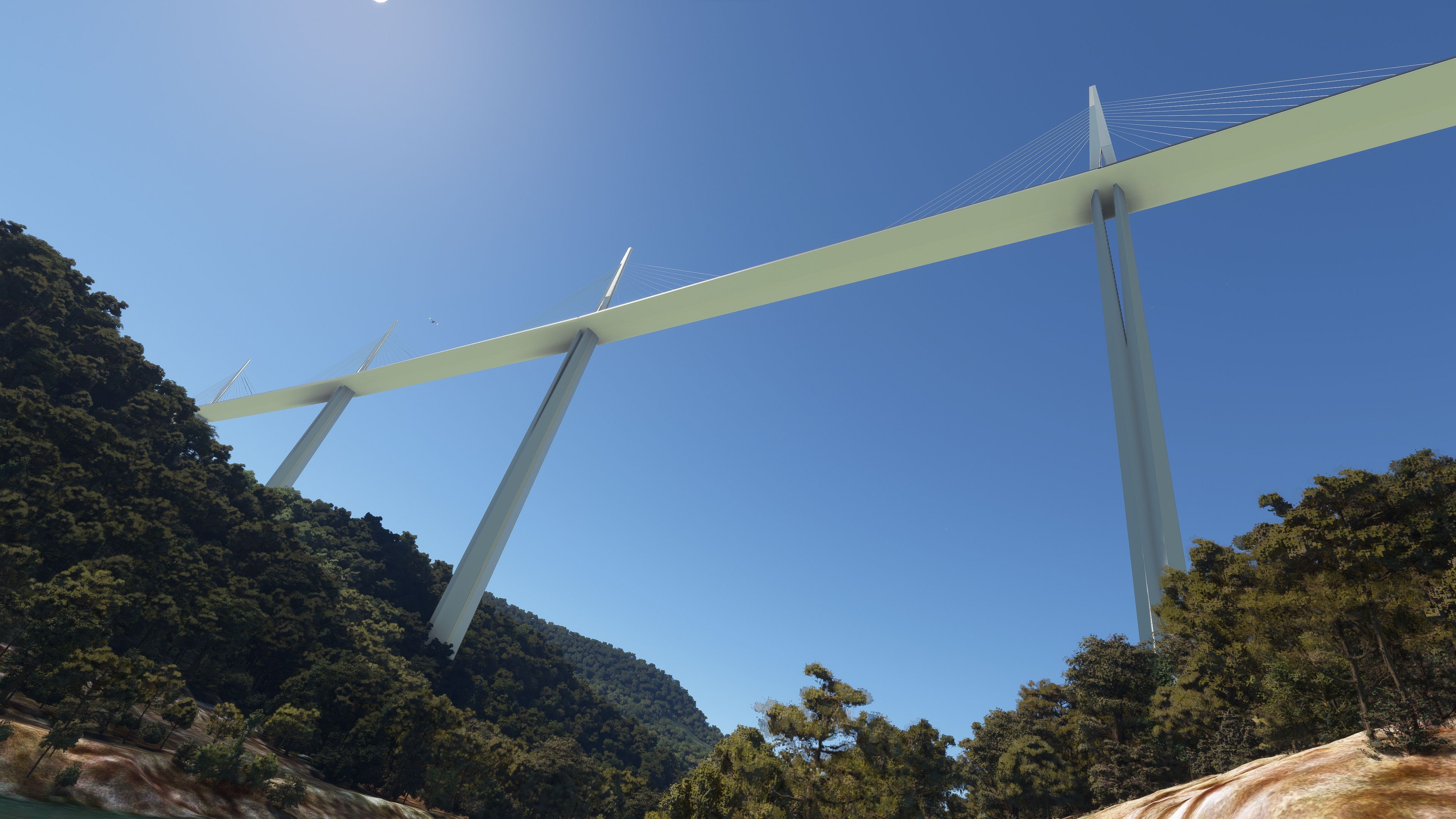
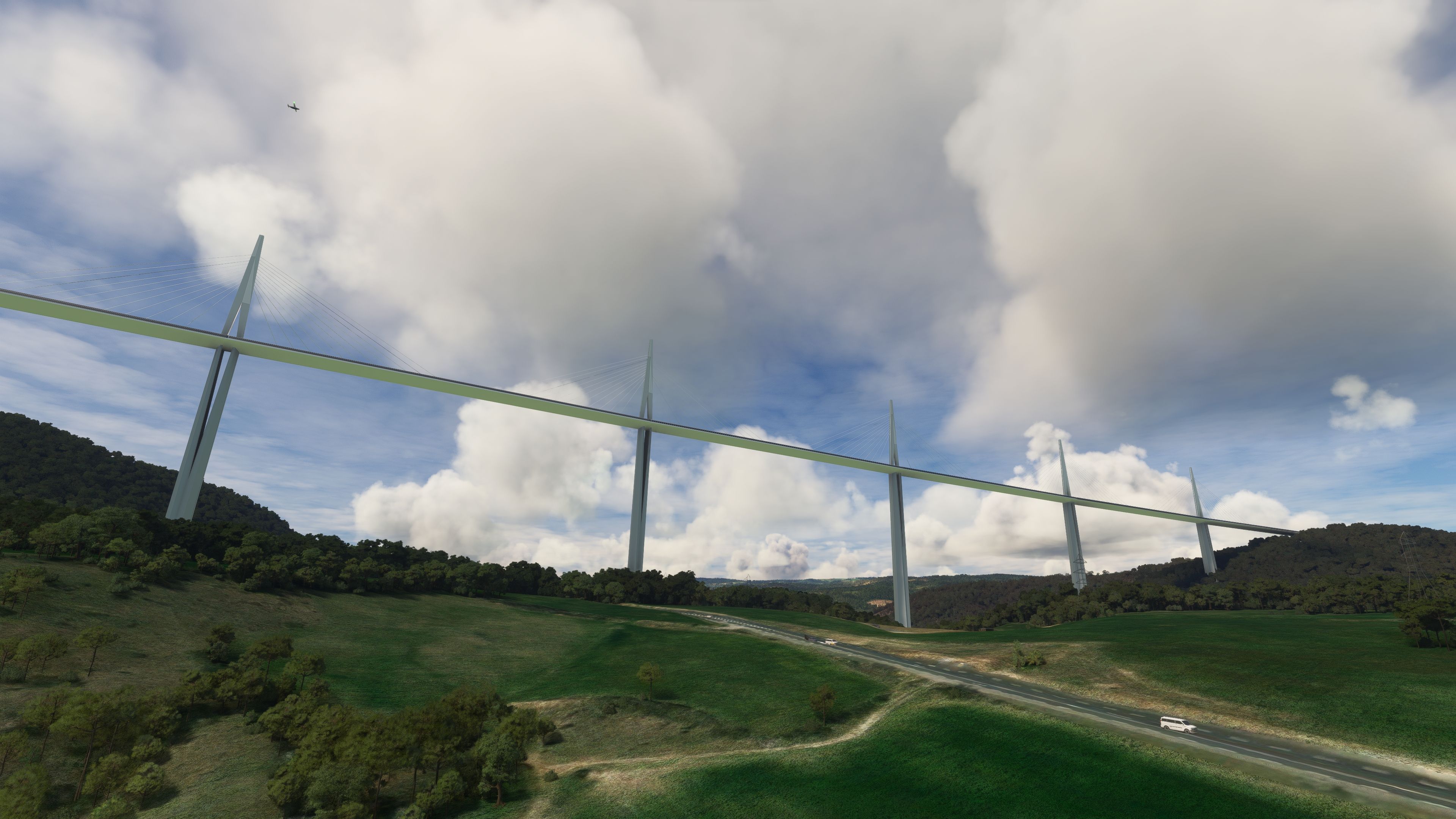
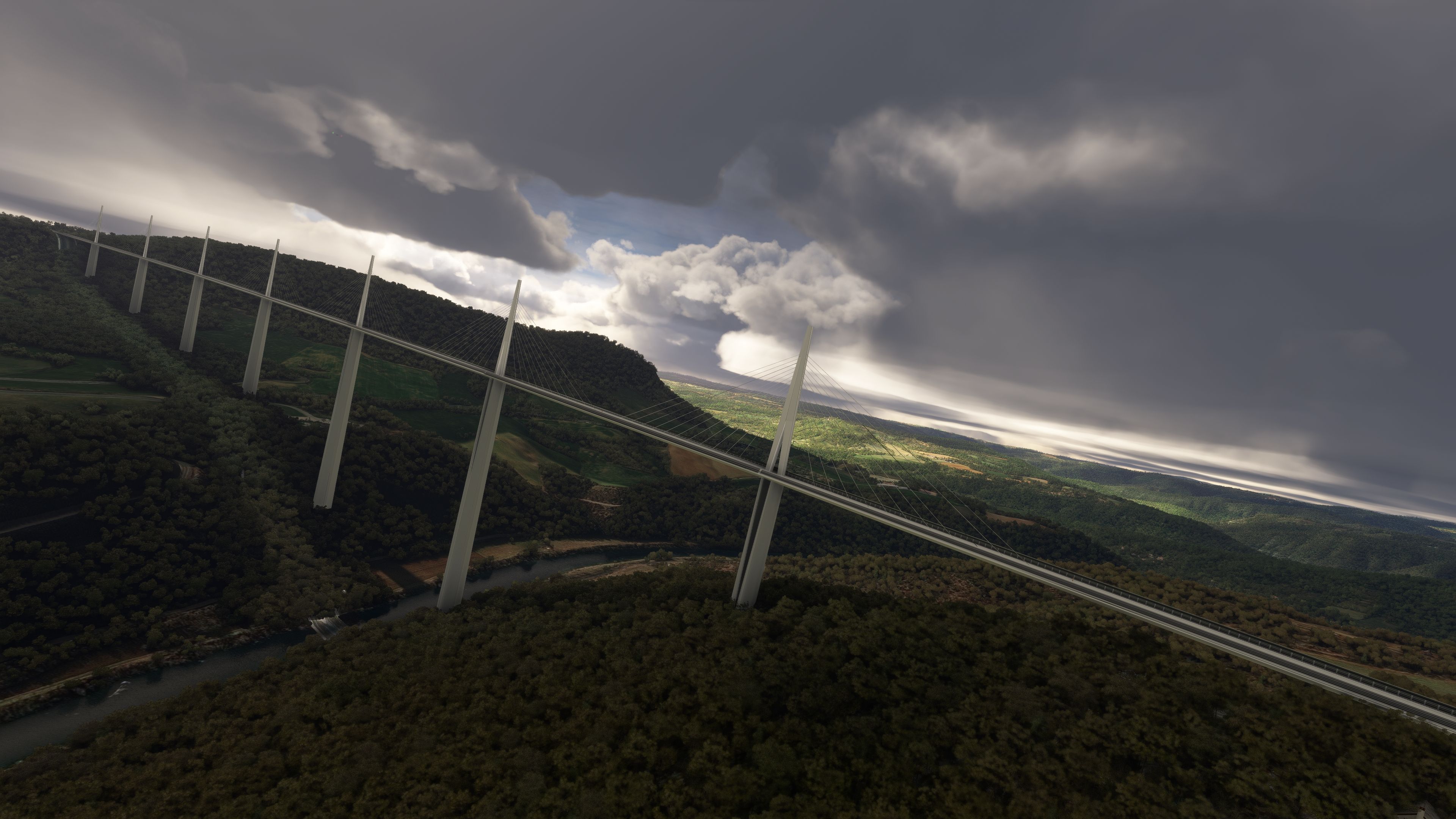
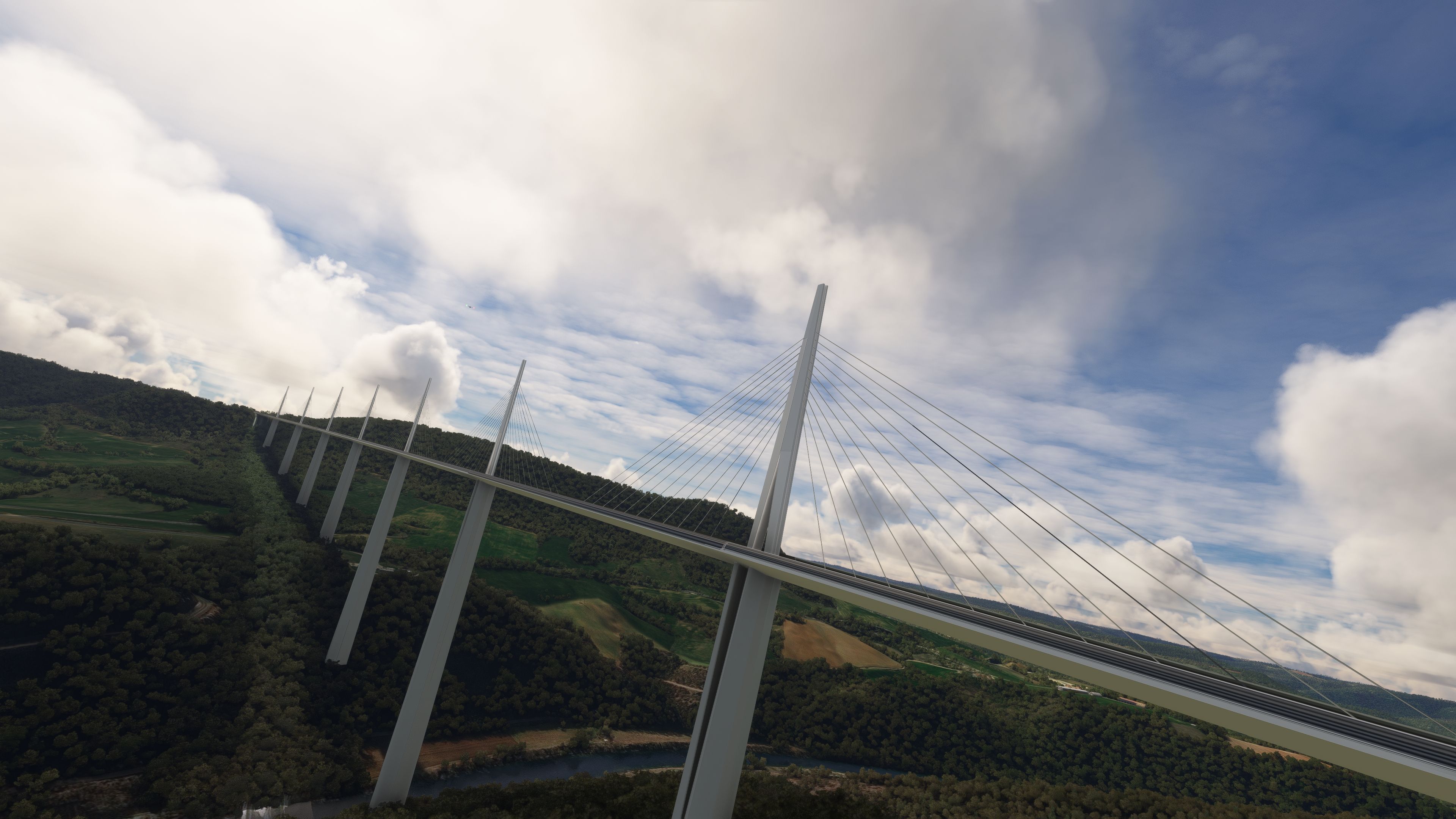
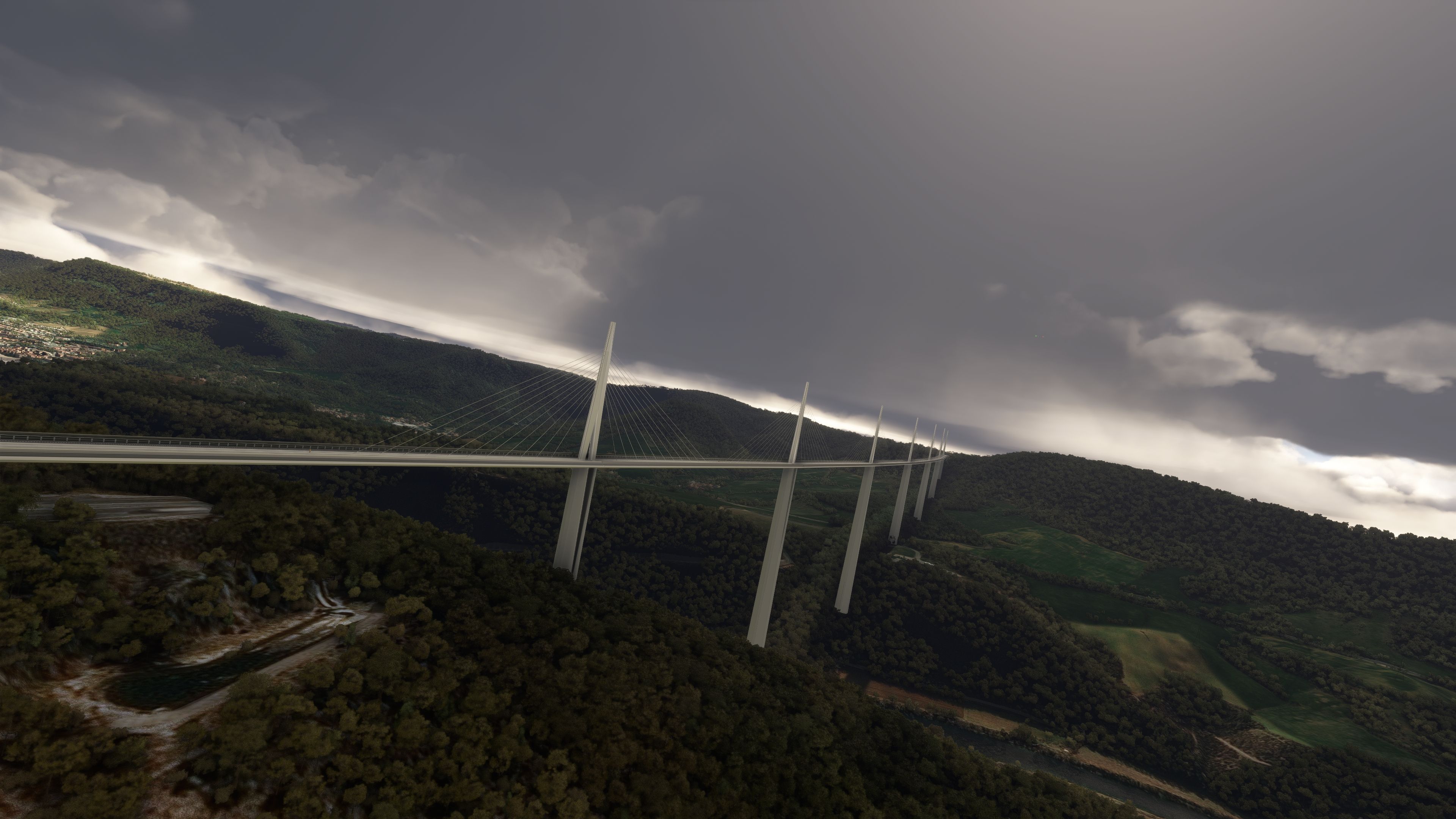
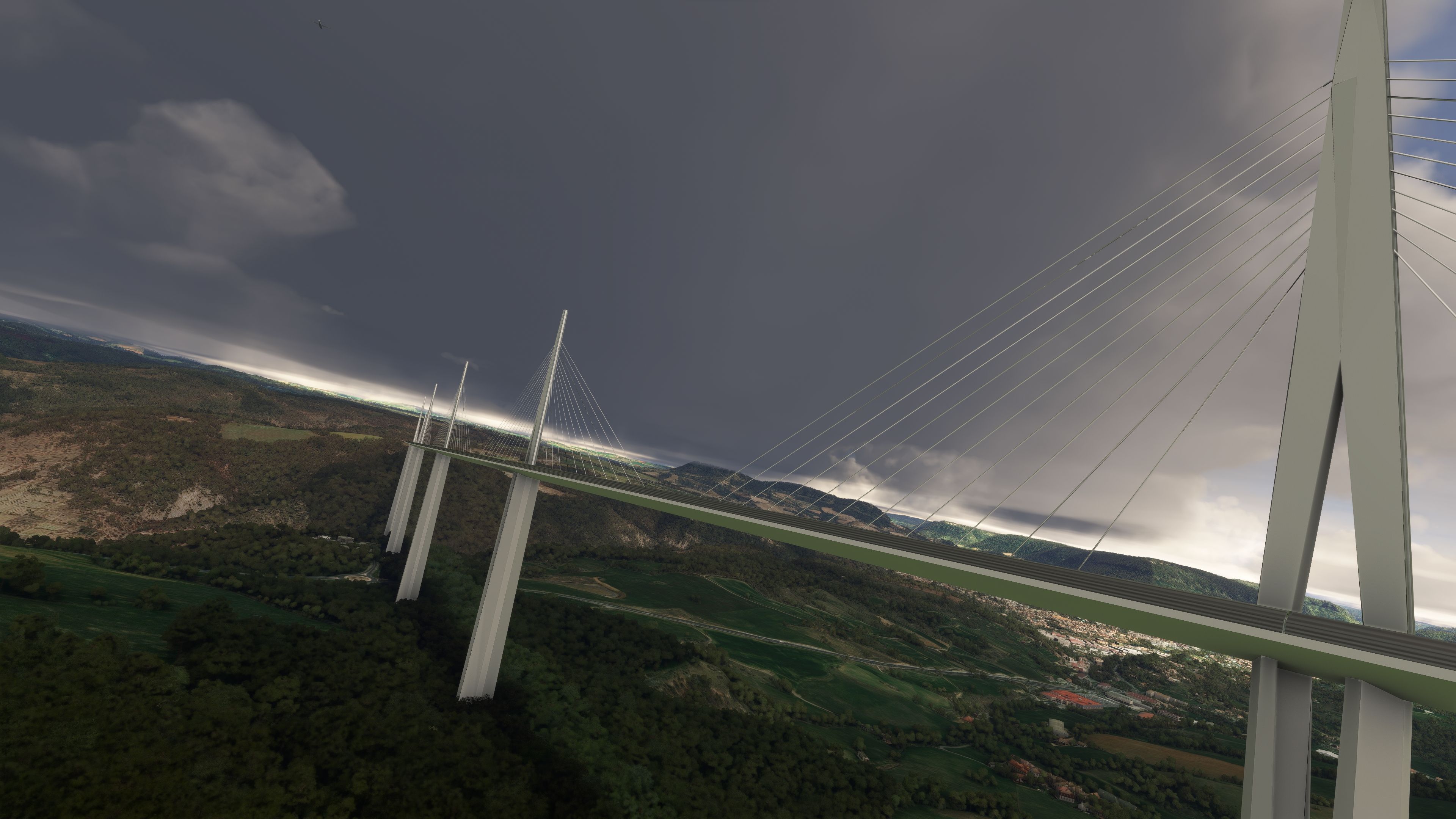
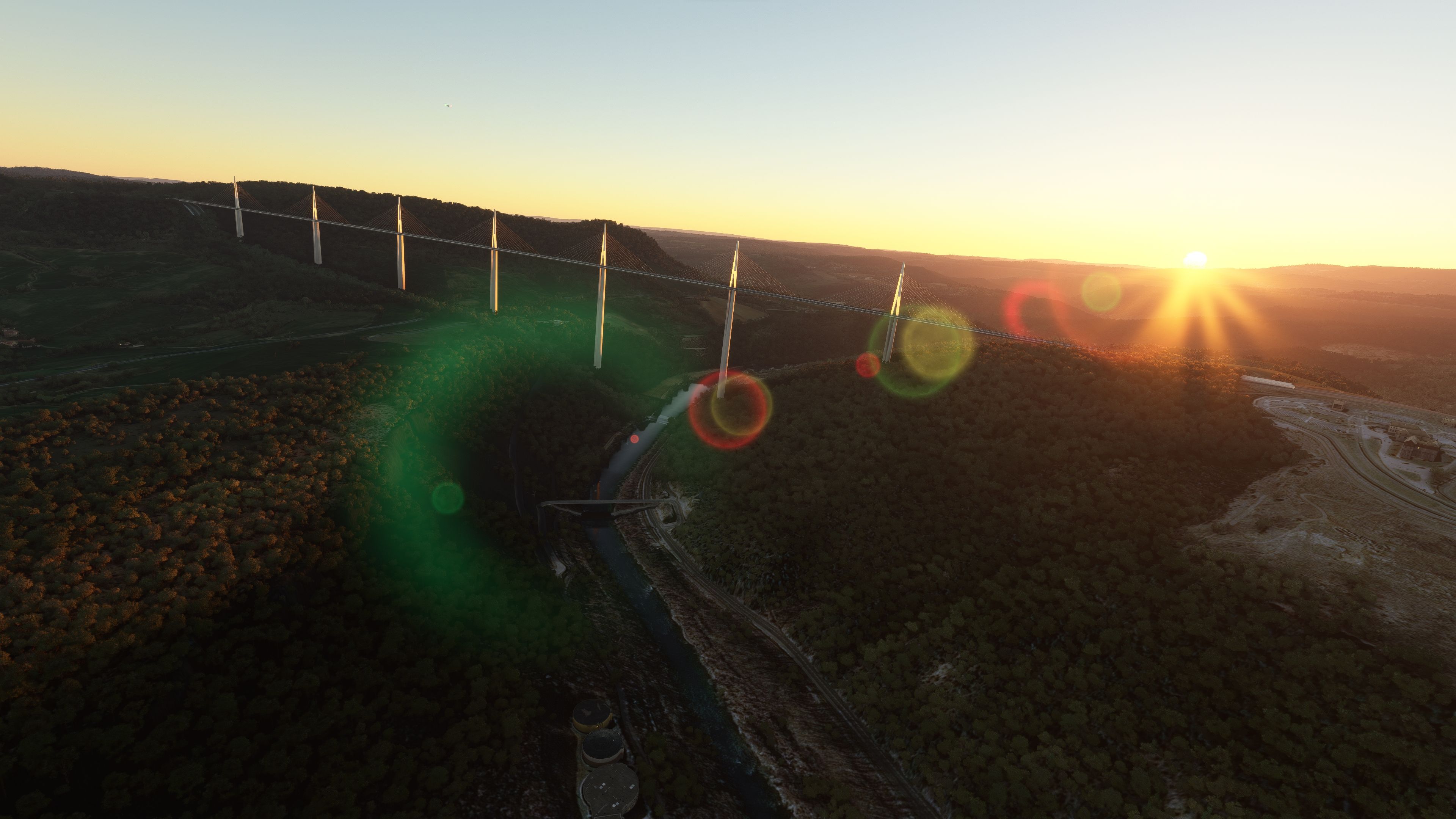
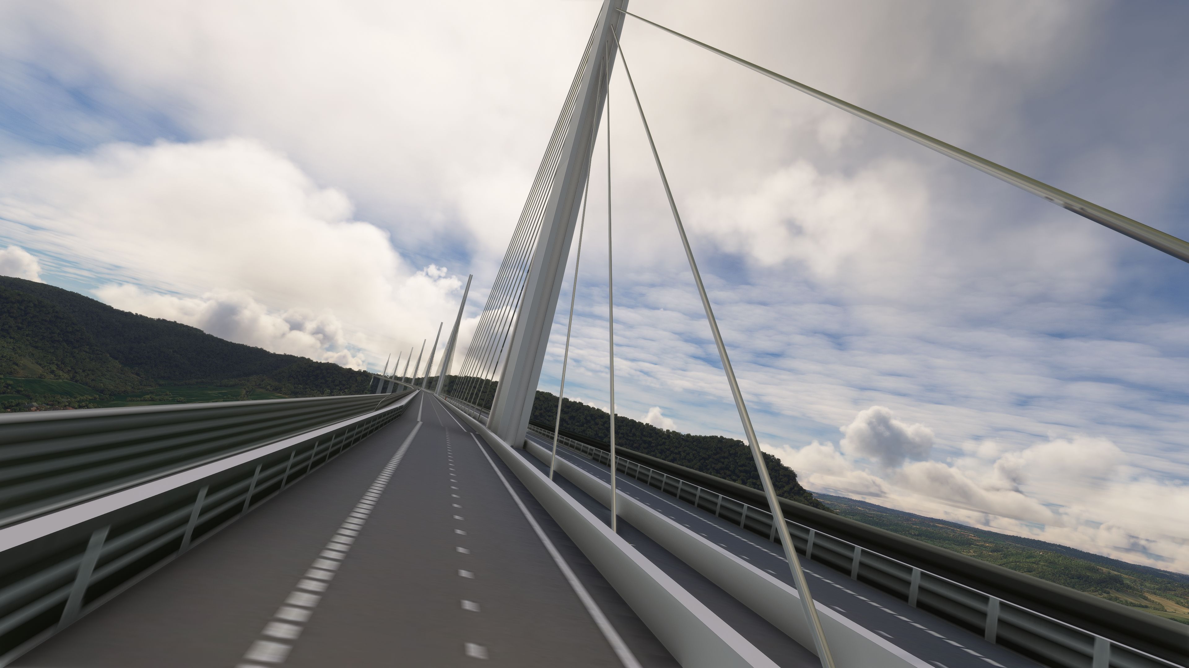
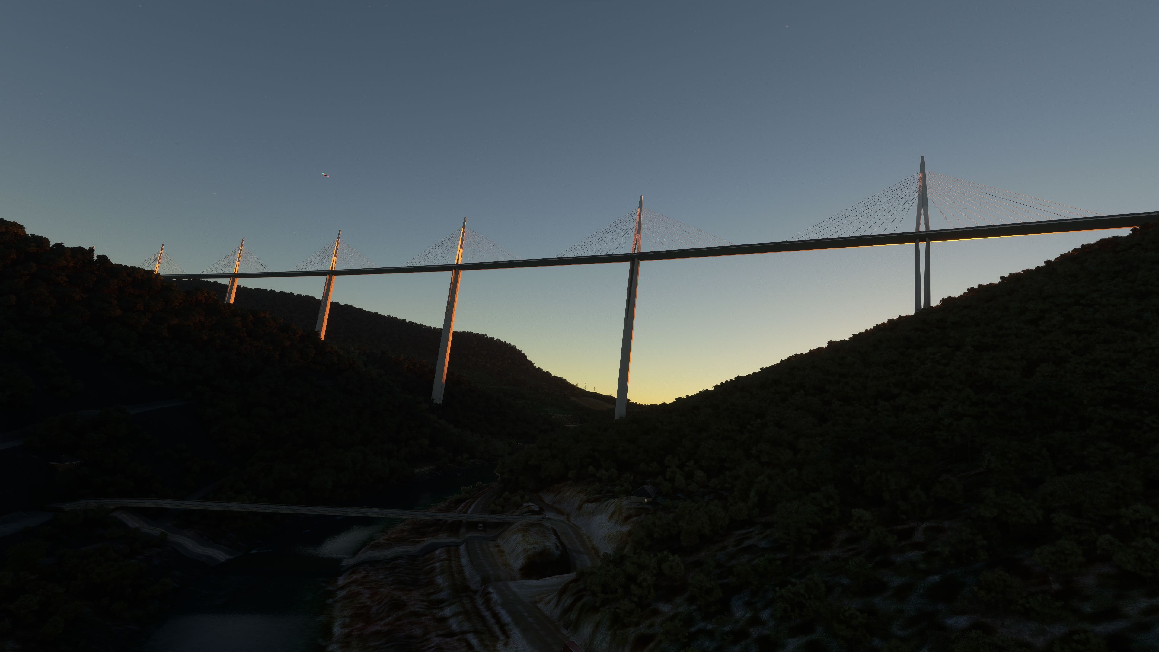
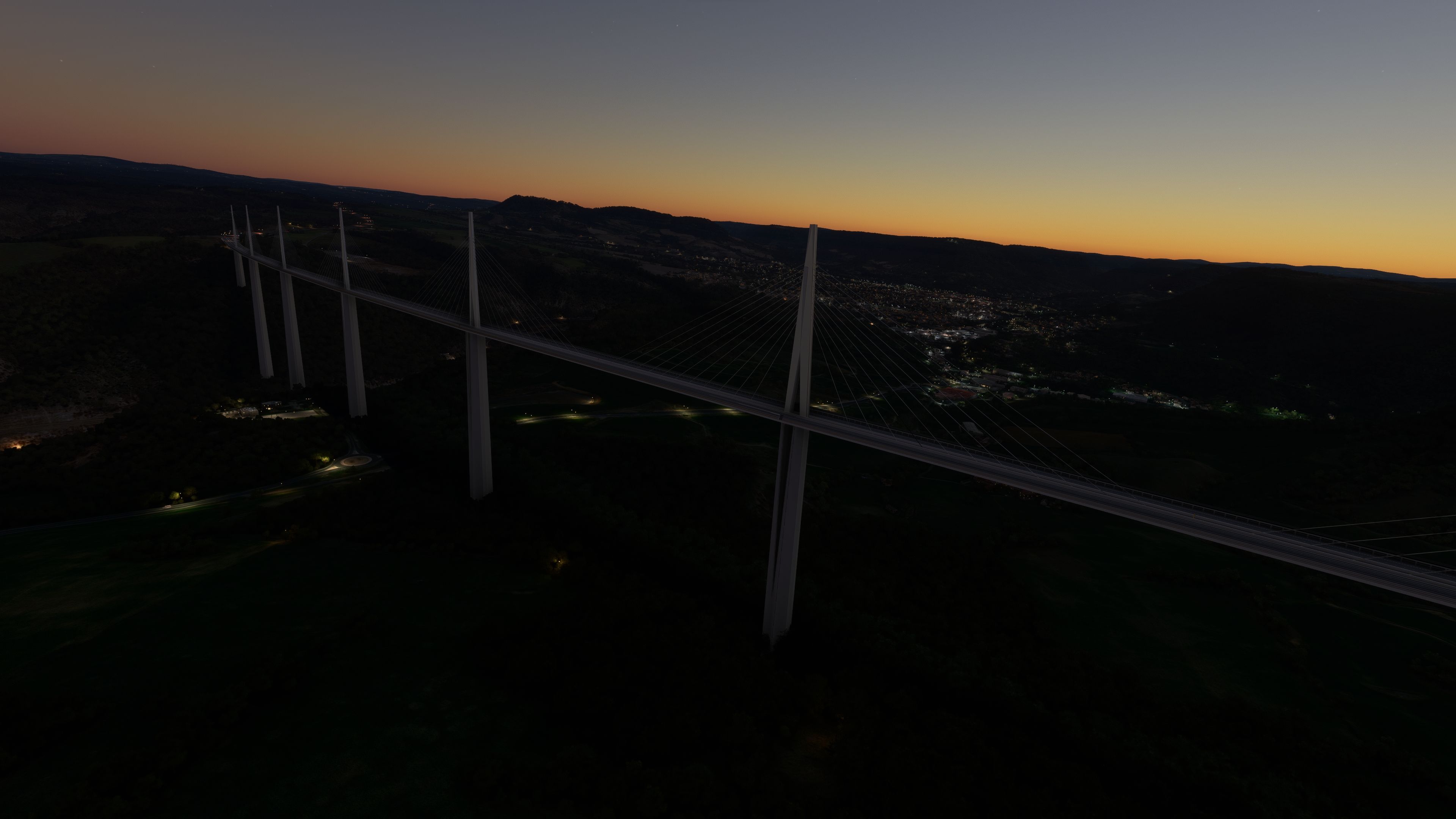
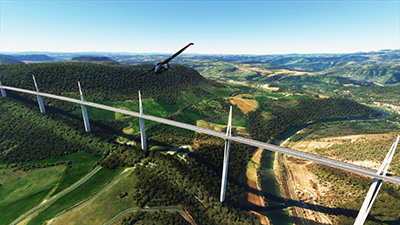
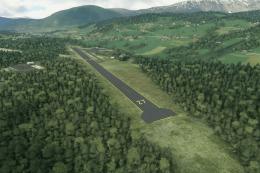
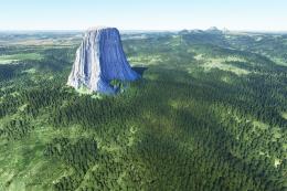
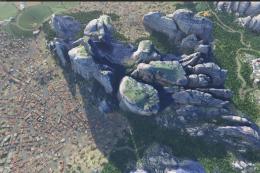
The MSFS Millau Viaduct Scenery adds a remarkably accurate rendition of the world’s tallest bridge to Microsoft Flight Simulator 2020, capturing its graceful steel spans and the dramatic Tarn gorge below. Through high-fidelity modeling and carefully refined terrain, you’ll experience flight paths that reveal the structure’s elegant lines from any angle, complete with authentic lighting and beacon effects for compelling night journeys.
In testing this add-on, I found it seamlessly integrated with the surrounding topography, making every approach feel realistic and immersive. Nearby airports like Clermont-Ferrand Auvergne, Carcassonne, and Montpellier-Méditerranée offer convenient gateways to explore the bridges of southern France and appreciate the meticulous craftsmanship of this scenery. It’s a stellar addition for virtual pilots seeking to combine engineering marvels with the thrill of authentic flights.
Enhance your virtual flight experiences in Microsoft Flight Simulator 2020 with the meticulously crafted MSFS Millau Viaduct Scenery. This add-on brings the awe-inspiring structure of the Millau Viaduct, the world's tallest bridge, into the simulator with unparalleled detail and accuracy.
 Key Features
- High-fidelity replica of the Millau Viaduct, capturing its majestic presence across the Tarn gorge valley.
- Detailed surrounding terrain, offering a true-to-life flying experience over this engineering marvel.
- Realistic lighting enhancements, including fixed beacon lights for an authentic night flying experience.
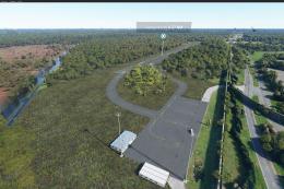
- Improved vegetation rendering around the area to ensure a seamless integration with the natural landscape.
- GPS coordinated scenery location for easy navigation and exploration: 44°04'27.60" N 3°01'12.00" E.
The development team, inspired by Quentin D's 3D model, presents an add-on that not only elevates the aesthetic appeal of the simulator but also pays homage to the engineering prowess behind the real-world structure.
Exploration Airports
To fully experience the Millau Viaduct and its surroundings, aviators are encouraged to take off or land at nearby airports, including:
- LFLC (Clermont-Ferrand Auvergne Airport) - A gateway to the central French Massif Central region, offering challenging approaches and departures.
- LFMK (Carcassonne Airport) - Experience scenic flights over the medieval city and the southern French countryside.
- LFMT (Montpellier-Méditerranée Airport) - Located near the French Riviera, it provides a perfect starting point or destination to explore the Millau Viaduct.
Add-On History
From its initial v1.0 release, the MSFS Millau Viaduct Scenery has undergone enhancements including lighting corrections and vegetation adjustments to ensure an immersive simulation experience.
Credits
The creation of this add-on was possible thanks to the foundational 3D model by Quentin D, demonstrating a collaborative effort within the flight simulation community.
Installation
Simply extract the archive and copy the viaducdemillau folder into your MSFS Community folder.
Ready to download Millau Viaduct Scenery?
Free for all simmers · 240.85 MB · Scanned clean
File information
Download speed: Free tier is capped at 2 Mbps (this file takes approximately 17 mins at the cap). PRO members download at full line speed.
How to install this mod
MSFS
scenery
How to install this mod
-
Extract the downloaded archive
Use 7-Zip (free) or WinRAR to extract the ZIP to a temporary folder. Don't install while still zipped — the simulator can't read inside ZIP files. -
Locate your MSFS Community folder
All MSFS add-ons live in the Community folder. Microsoft Store / Game Pass version:%LOCALAPPDATA%\Packages\Microsoft.FlightSimulator_8wekyb3d8bbwe\LocalCache\Packages\Community\. Steam version:%APPDATA%\Microsoft Flight Simulator\Packages\Community\. Tip: enable Developer Mode in MSFS to see your exact Community folder path. -
Copy the scenery package into Community
Drag the extracted scenery folder into your Community folder. Photogrammetry and large mesh packs can be 1GB+ — ensure you have disk space. -
Restart MSFS
Close MSFS completely and relaunch. The new content appears in the Content Manager, on the World Map, or in the aircraft/livery selector. -
Always read the included readme
Every mod ships with areadme.txtorREADMEfile. It tells you exactly where files go, what dependencies are needed, and any quirks specific to this add-on.
Finding the scenery
Use these coordinates to fly directly to this location once the mod is installed.
44.06997200,3.02432300
Paste these coordinates into the Microsoft Flight Simulator search bar when planning a flight, or into the Developer Mode Teleport window, to fly directly to this location.

Thalixte
Thalixte is a developer that has focused on creating photogrammetry and scenery packs for the latest Microsoft Flight Simulator (MSFS) 2020 release. All of this developer's releases have received fantastic feedback from many users on various flight sim websites including Fly Away Simulation.
Based in France, the developer tends to focus on creation of European packs however some "further afield" packs have also been created.

0 comments
Leave a Response