 FSX Scenery
3 GPS Oil Platforms
3 GPS Oil Platforms v2.0 with updated ships and file structures. Includes shi…
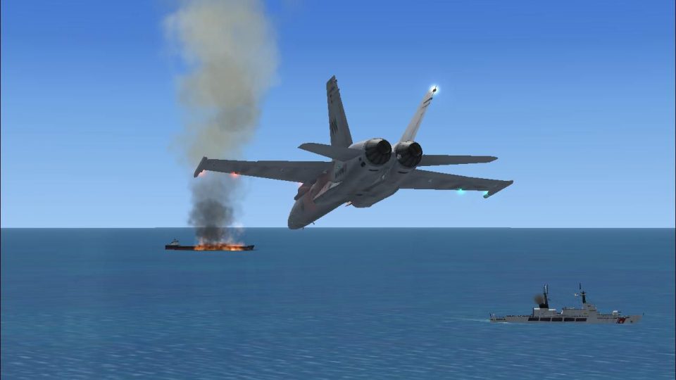
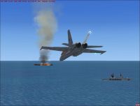
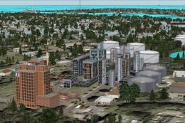
GPS Oil Platforms Scenery v5.0 expands offshore flying in FSX with updated rigs, three dedicated mission platforms, and a dramatic multiplayer rescue setup featuring a burning tanker and nearby Coast Guard cutters. Stock platforms across the United States and Mexico gain GPS tags plus NDB and VOR beacons, with helideck navigation aids for precise approaches.
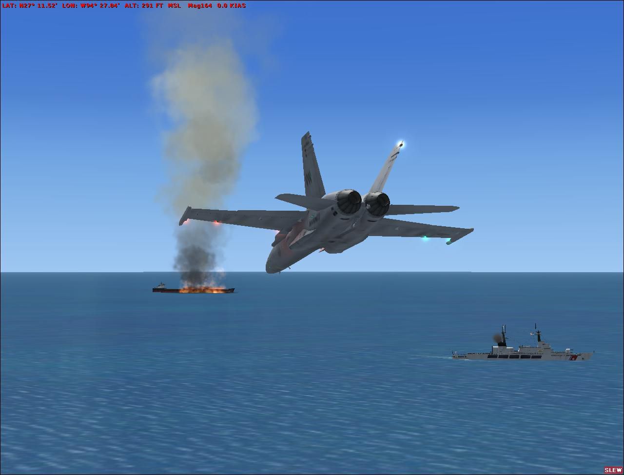
GPS Oil Platforms, v5.0. Updated scenery (three GPS oil platforms v4.0), three mission oil platforms. Includes an oil tanker ship multiplayer mission scenery; the tanker is on fire with two Coast Guard cutters near it for rescue. Open ended mission scenery for whatever scenario you come up with. The stock oil platforms around the United States and Mexico have been marked with GPS tags, NDB, and VOR for navigation. By T. Marson.
GPS Oil Platforms Scenery.
Extract To desktop, Move GPS Oil Platforms V5.0 folder out of the unziped/extracted Folder to your FSX-MAIN Directory- Addon Scenery folder. Activate through the simulators Settings-Scenary Library,> Add Area> GPS Oil Platforms V5.0 , Click ok.
Updated OLD SCENERY (3gps oil platforms V4.0) 3 mission Oil Platforms. Included a Oil tanker ship multiplayer mission scenery, the tanker is on fire with 2 Coast Guard cutters near it for rescue. Open ended mission scenery for what ever scenario you come up with, Location is in read me. And I've marked the stock Oil platforms around the United states and Mexico with GPS tags, NDB, and VOR for navigation. Going to add more countrys stock oil platforms navigation locations in updates to come. All Platforms NDB"s are on helo deck.
Mission Platform Corpus Christi, (GPS ident:KNGO), (VOR:108.20 Mhz - ident:CORP range:100.0 NM), (NDB:391.0 kHZ - ident:CORP range:100.0 NM), (Terminal Waypoint ident: OFRT).
Mission Platform Galveston , (GPS ident:KGLO), (VOR:114.70 Mhz - ident:KGOL range:100.0 NM), (NDB:396.0 Khz - ident:GOPO range:100.0 NM), (Terminal Waypoint ident: GCGP).
Mission Platform Lafayette, (GPS ident:KLFO), (vor:116.30 Mhz - ident:KLOF range:100.0 NM), (NDB:477.0 kHZ - ident:LUPO range:100.00 NM), (Terminal Waypoint ident: LUPO).
Tanker ship mission location: (No GPS location, N27 9.65 W94 27.67), (VOR:113.95 Mhz - ident:VORTF range:100.00 NM), (Coast Guard Cutter 1 NDB:426.0 Khz - ident:CUTR1 range:100.00 NM), (Coast Guard Cutter 2 NDB:220.0 Khz - ident:CUTR2 range:100.00 NM).
Stock oil platforms U.S and Mexico info below.
Rig 7 coast of Texas: (GPS ident:RIG7), (VOR:116.90 Mhz - ident:PLA77 range:27.0 NM), (NDB:598.0 Khz - ident:RIG7 range:27.0 NM).
Rig 8 coast of texas: (GPS ident:RIG8), (VOR:113.15 Mhz - ident:PLA88 range:50.0 NM), (NDB:306.0 Khz - ident:RIG8 range:50.0 NM).
Rig 9 coast of texas: (GPS ident:RIG9), (VOR:117.95 Mhz - ident:PLA99 range:80.0 NM), (NDB:274.0 Khz - ident:RIG9 range:80.0 NM).
Rig Lou1 coast of Louisana: (GPS ident: LOU1), (VOR:117.90 Mhz - ident:LOU11 range:100.00 NM), (NDB:436.0 Khz - ident:LOU1 range:100.00 NM).
Rig Lou2 coast of Louisana: (GPS ident: LOU2), (VOR:117.35 Mhz - ident:LOU22 range:100.00 NM), (NDB:398.0 Khz - ident:LOU2 range:100.00 NM).
Rig Lou3 coast of Louisana: (GPS ident: LOU3), (VOR:115.75 Mhz - ident:LOU33 range:100.00 NM), (NDB:464.3 Khz - ident:LOU3 range:100.00 NM).
Rig Lou4 coast of Louisana: (GPS ident: LOU4), (VOR:113.35 Mhz - ident:LOU44 range:100.00 NM), (NDB:287.0 Khz - ident:LOU4 range:100.00 NM).
Rig Lou5 coast of Louisana: (GPS ident: LOU5), (VOR:108.20 Mhz - ident:LOU55 range:100.00 NM), (NDB:507.0 Khz - ident:LOU5 range:100.00 NM).
Rig Lou6 coast of Louisana: (GPS ident: LOU6), (VOR:117.35 Mhz - ident:LOU66 range:100.00 NM), (NDB:567.0 Khz - ident:LOU6 range:100.00 NM).
Rig Lou7 coast of Louisana: (GPS ident: LOU7), (VOR:112.95 Mhz - ident:LOU77 range:100.00 NM), (NDB:477.5 Khz - ident:LOU7 range:100.00 NM).
Rig Lou8 coast of Louisana: (GPS ident: LOU8), (VOR:115.35 Mhz - ident:LOU88 range:100.00 NM), (NDB:637.0 Khz - ident:LOU8 range:100.00 NM).
Rig Lou9 coast of Louisana: (GPS ident: LOU9), (VOR:109.25 Mhz - ident:LOU99 range:100.00 NM), (NDB:334.0 Khz - ident:LOU9 range:100.00 NM).
Rig Lou10 coast of Louisana: (GPS ident: LO10), (VOR:117.15 Mhz - ident:LO110 range:100.00 NM), (NDB:307.0 Khz - ident:LO10 range:100.00 NM).
Rig Lou11 coast of Louisana: (GPS ident: LO11), (VOR:115.95 Mhz - ident:LO111 range:100.00 NM), (NDB:661.0 Khz - ident:LO11 range100.00 NM).
Rig Lou12 coast of Georgia: (GPS ident:GEO1), (VOR:111.45 Mhz - ident:GEO11 range:100.00 NM), (NDB:496.0 Khz - ident:GEO1 range:100.00 NM).
Rig Lou13 coast of North Carolina: (GPS ident:NCA1), (VOR:117.95 Mhz - ident:NCA11 range:100.00 NM), (NDB:384.0 Khz - ident:NCA1 range:100.00 NM).
Rig Lou14 coast of Virginia: (GPS ident:VIR1), (VOR:114.30 Mhz - ident:VIR11 range:100.00 NM), (NDB:799.0 Khz - ident:VIR1 range:100.00 NM).
Rig Lou15 coast of Alabama: (GPS ident:ALA1), (VOR:110.00 Mhz - ident:ALA11 range:100.00 NM), (NDB:889.0 Khz - ident:ALA1 range:100.00 NM).
Rig Lou16 coast of Arkansas: (GPS ident:ARK1), (VOR:117.50 Mhz - ident:ARK11 range:100.00 NM), (NDB:854.0 Khz - ident:ARK1 range:100.00 NM).
Rig Lou17 coast of Mexico: (GPS ident:MXO1), (VOR:117.45 Mhz - ident:MXO11 range:100.00 NM), (NDB:755.0 Khz - ident:MXO1 range:100.00 NM).
Special thanks for all parts of this Scenery (Microsoft), and ADE.(Airport Design Editor)
GPS Oil Platforms V5.0 from FSXFLEET.
This archive file is provided as FREEWARE and can be used in any non-profit making package. Use all files at your own risk.The author of this package is not liable for any problems caused by these files. The archive can be freely distributed.
Tim
Free for all simmers · 1.73 MB · Scanned clean Jul 2026
Download speed: Free tier is capped at 0.5 Mbps. PRO members download at full line speed.
FSX\Addon Scenery\ containing scenery and texture sub-folders.readme.txt or README file. It tells you exactly where files go, what dependencies are needed, and any quirks specific to this add-on.The archive gpsoilplatformsv50.zip has 42 files and directories contained within it.
This list displays the first 500 files in the package. If the package has more, you will need to download it to view them.
| Filename/Directory | File Date | File Size |
|---|---|---|
| Effects | 09.09.09 | 0 B |
| Cntrl_GPS_oilplatform_MOD.fx | 09.09.09 | 534 B |
| fx_G_alarm_MOD.fx | 09.09.09 | 1.43 kB |
| fx_G_explosionOil_tankerHuge_MOD.fx | 09.09.09 | 6.18 kB |
| fx_G_FireHuge_MOD.fx | 09.09.09 | 9.79 kB |
| GPS Oil Platforms V5.0 | 09.09.09 | 0 B |
| Oil Rid Information.txt | 09.09.09 | 5.07 kB |
| scenery | 09.09.09 | 0 B |
| ALA11.BGL | 09.09.09 | 4.33 kB |
| ARK11.BGL | 09.09.09 | 6.52 kB |
| Cntrl_GPS_oilplatform_MOD.BGL | 09.09.09 | 467 B |
| GEO11.BGL | 09.09.09 | 4.24 kB |
| KGLO_Galveston oil platform V5.BGL | 09.08.09 | 1.29 kB |
| KLFO_Layafette Oil platform V5.BGL | 09.09.09 | 617.89 kB |
| KNGO_Corpus Christi oil platform V5.BGL | 09.09.09 | 1.04 kB |
| LO110.BGL | 09.09.09 | 3.29 kB |
| LO111.BGL | 09.09.09 | 3.12 kB |
| LOU11.BGL | 09.09.09 | 2.42 kB |
| LOU22.BGL | 09.09.09 | 3.27 kB |
| LOU33.BGL | 09.09.09 | 2.62 kB |
| LOU44.BGL | 09.09.09 | 2.35 kB |
| LOU55.BGL | 09.09.09 | 2.37 kB |
| LOU66.BGL | 09.09.09 | 2.41 kB |
| LOU77.BGL | 09.09.09 | 3.40 kB |
| LOU88.BGL | 09.09.09 | 3.55 kB |
| LOU99.BGL | 09.09.09 | 4.25 kB |
| MXO11.BGL | 09.09.09 | 2.48 kB |
| NCA11.BGL | 09.09.09 | 2.64 kB |
| RIG77.BGL | 09.09.09 | 8.01 kB |
| Rig88.BGL | 09.09.09 | 3.80 kB |
| RIG99.BGL | 09.09.09 | 3.06 kB |
| VIR11.BGL | 09.09.09 | 5.30 kB |
| texture | 09.09.09 | 0 B |
| texture.cfg | 05.11.06 | 110 B |
| Veh_USCG_Cutter.bmp | 05.20.08 | 1.00 MB |
| Veh_USCG_Cutter_Alpha.bmp | 05.20.08 | 64.07 kB |
| Veh_USCG_Cutter_Alpha_LM.bmp | 05.20.08 | 64.07 kB |
| Veh_USCG_Cutter_LM.bmp | 05.20.08 | 1.00 MB |
| gps oil platforms v5.0(2).BMP | 09.10.09 | 4.76 MB |
| gps oil platform v5.0.jpg | 09.10.09 | 77.36 kB |
| flyawaysimulation.txt | 10.29.13 | 959 B |
| Go to Fly Away Simulation.url | 01.22.16 | 52 B |
Only PRO members can place votes.
More FSX & P3D add-ons hand-picked based on this download.
FSX Scenery
3 GPS Oil Platforms v2.0 with updated ships and file structures. Includes shi…
FSX Scenery
GPS Oil Platforms. Updated old scenery, marks the stock oil platforms around …
FSX Scenery
Oil Platforms with GPS/ADF, v4.0. Includes Lafayette oil platofrm (KLFO), Gal…
FSX Scenery
Plymouth GPS Enabled Carrier EG51, set in the bay just off shore from Plymout…
FSX Scenery
Aegean GPS Enabled Carrier. LG51 is set in the bay just off shore between Ioa…
 FSX Scenery
Dubai Oil Rigs. This scenery shows two fictional oilrigs offshore Dubai and f…
 FSX Scenery
Galveston Oil Rigs, oil company and hospital scenery, Texas (TX). Scenery inc…
 FSX Scenery
Oil Field Dubai. This scenery shows a fictional airport called Oil Field Duba…
Be the first to leave a comment on this download.
Be the first to share your thoughts on this download.