FSX Montreal VFR Scenery
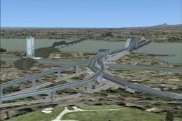
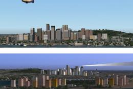
Montreal’s skyline and key landmarks gain sharper VFR reference points, including the Olympic pyramids, the cross on Mount Royal, the St-Lambert locks, and enhanced Mount Royal roads for more confident visual navigation around Quebec. Designed for FSX, the scenery helps flights over the city feel more authentic and geographically grounded.
 Canada
 - File: mont_vfr.zip
- Size:1.34 MB
- Scan:
Clean (11d)

- Access:Freeware
- Content:Everyone

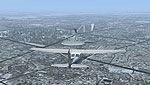
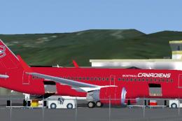
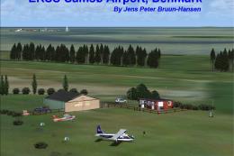
Aircraft flying over Montreal, Canada.
Montreal VFR, v1.0, Quebec, Canada. Adds Olympic pyraminds, cross on the Royal Mountain, locks of St-Lambert, roads on the Royal Mountain, and more. By Sylvain Tremblay.

Finding the Scenery
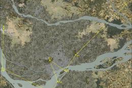
- FSX/Prepar3D Coordinates:
-
45.50170000,-73.56730000
Use the downloaded flight plan file by launching FSX/P3D, selecting "Load Flight Plan" in the flight planner, and choosing the .pln file. Your aircraft will be positioned directly at the add-on’s location. - Decimal Degrees (DD):
-
Latitude: 45.501700°
Longitude: -73.567300° - Degrees, Minutes, Seconds (DMS):
-
Latitude: 45° 30' 06.120" N
Longitude: 73° 34' 02.280" W
Map Location
The archive mont_vfr.zip has 4 files and directories contained within it.
File Contents
This list displays the first 500 files in the package. If the package has more, you will need to download it to view them.
| Filename/Directory | File Date | File Size |
|---|---|---|
| Readme.txt | 02.02.07 | 1.88 kB |
| Montreal_VFR.exe | 02.02.07 | 1.36 MB |
| flyawaysimulation.txt | 10.29.13 | 959 B |
| Go to Fly Away Simulation.url | 01.22.16 | 52 B |
Installation Instructions
Most of the freeware add-on aircraft and scenery packages in our file library come with easy installation instructions which you can read above in the file description. For further installation help, please see our Flight School for our full range of tutorials or view the README file contained within the download. If in doubt, you may also ask a question or view existing answers in our dedicated Q&A forum.
Related Add-ons
Some mods you may like


0 comments
Leave a Response