 FSX Scenery
Caribbean Seaplane Tours Caribbe East
Caribbean Seaplane Tours, part 4 - Caribbe East. Includes some twenty airport…
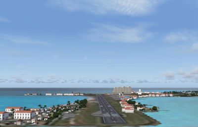
Caribbe Nord Scenery brings immersive VFR and IFR flying across the Virgin Islands and northern Leewards in FSX, covering 57 islands and cays with towns, ports, and regional installations. It reconstructs and resizes 18 airports, adds upgraded facilities and radio navigation aids, and blends communities into the surrounding relief and mesh terrain.
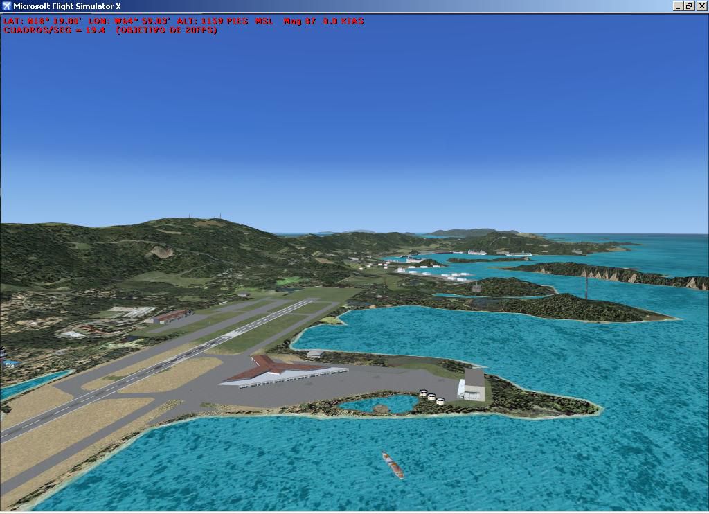
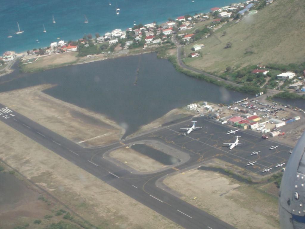
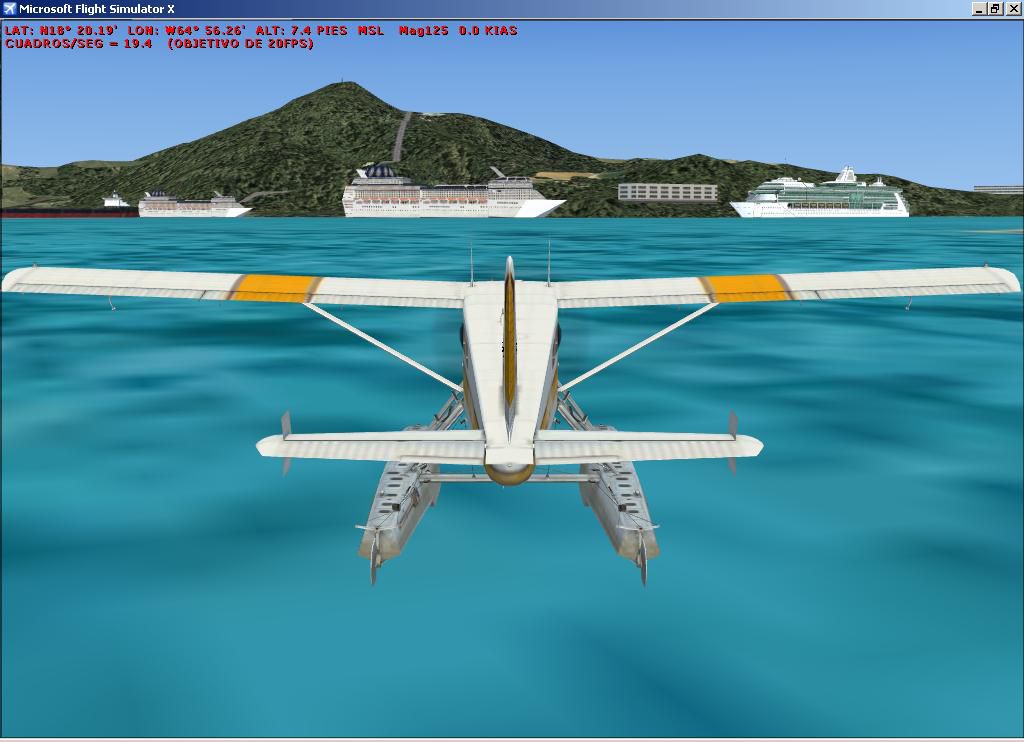
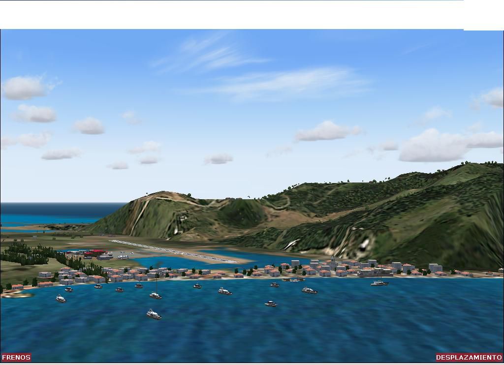
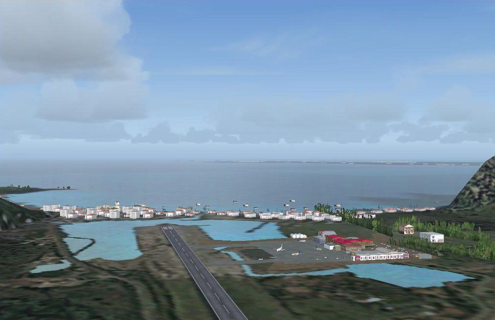

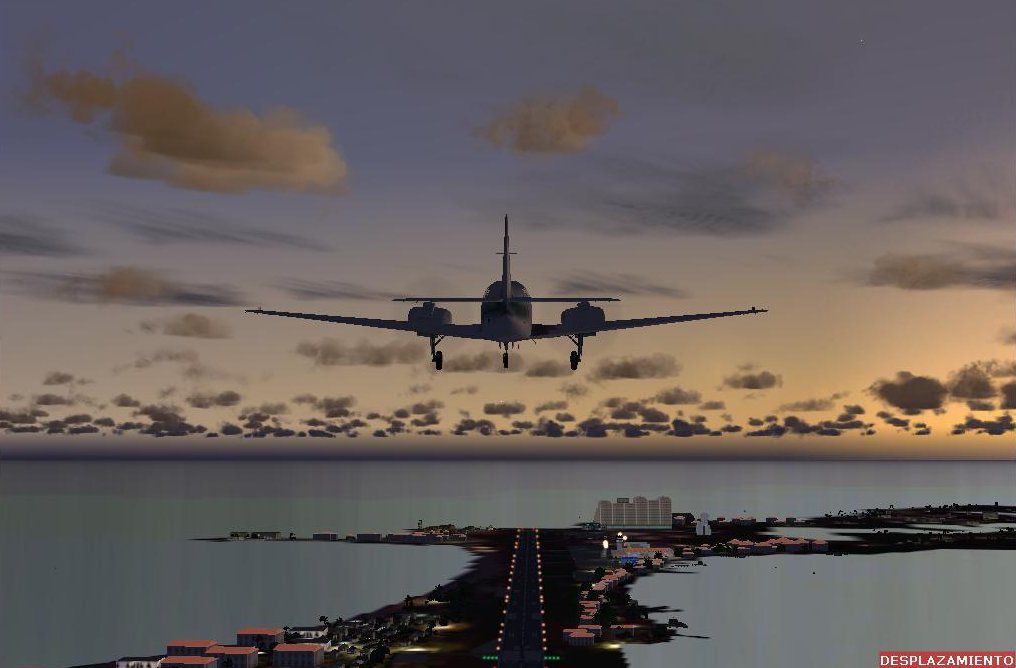
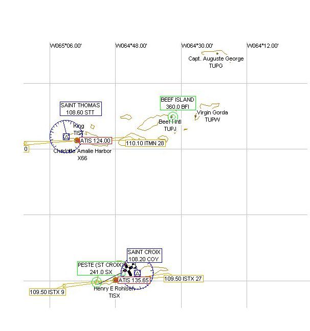
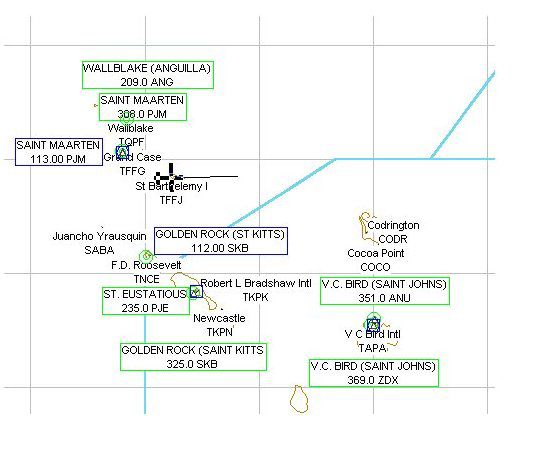
Caribbe Nord Scenery. Fully detailed scenery VFR and IFR of the Virgin Islands and the Leeward Islands in the north central Caribbean. Includes the following islands: Beef, Anegada, Gorda, Tortola, St. Johns, St. Thomas, St. Croix, Anguilla, St. Martin, Guadeloupe, St. Barthelemy, Saba, St. Eustatius, St Kitts, Nevis, Antigua and Montserrat. 57 islands and cays in total are represented with towns and installations. 18 airports reconstructed and resized and upgraded with new facilities and numerous cities to adapt them to the relief of the installed mesh terrain. By Toni Agramont.
Caribbe Nord Scenery.
Content:
18 Airports. Radionavs(see Map_navs.jpg) Numerous cities in each one of the islands. Notice: Although the aerodrome of Montserrat is closed one because of the volcano of 1997
WARNING!!!
This scenario should be configured of the following -
Density of the scenario: NORMAL (otherwise buildings will be seen in inadequate places).
Autogen: ZERO (otherwise truth hoists in the sea).
Water Effects : ZERO (I have had to locate patches in the ports because Microsofot has not been faithful with the contours of the costs, If you put any superior density stains they will be seen).
As installing it:
FsX has to directory express to install scenerys of third. It is this:
ADDON SCENERYS (1)
Scenery (1)
Texture (1)
Inside ADDON SCENERYS should open to directory for Carib_Nord with its corresponding subdirectory Scenery and Texture ADDON SCENERYS was this way you.
ADDON SCENERYS(1)
Carib_Nord
Scenery Texture
Scenery (1) Texture (1)
To open FsX, to Go to the Library of Scenerys and to add Carib_Nord like new AREA.
GRATEFULNESS
To Francesco Romeo, Jean Gabriel Laurent Pietro Mauri.
To John de Langristin for your macros and textures.
To Dany Geis, Gerrish Gray, Jim Turner for their macros.
This scenery is free commercial distribution is not allowed. Modificications is not allowed without the author's authorization. The whole mentioned software is the authors' property.
My next work: Guadeloupe, Dominica, Martinique, Sta Lucia, St Vincent, Grenada, Marguerite and much more. Happy landings.
Caribbe Nord Scenery.
Free for all simmers · 13.68 MB · Scanned clean Jul 2026
Download speed: Free tier is capped at 0.5 Mbps (this file takes approximately 4 mins at the cap). PRO members download at full line speed.
FSX\Addon Scenery\ containing scenery and texture sub-folders.readme.txt or README file. It tells you exactly where files go, what dependencies are needed, and any quirks specific to this add-on.The archive caribben.zip has 16 files and directories contained within it.
This list displays the first 500 files in the package. If the package has more, you will need to download it to view them.
| Filename/Directory | File Date | File Size |
|---|---|---|
| LeewardMap.jpg | 10.10.03 | 38.01 kB |
| Readme.txt | 04.30.07 | 3.01 kB |
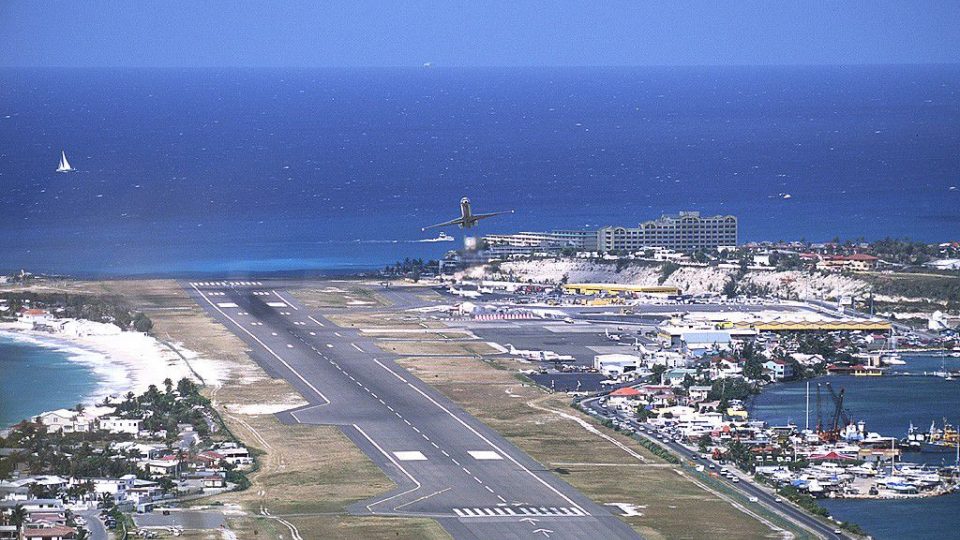
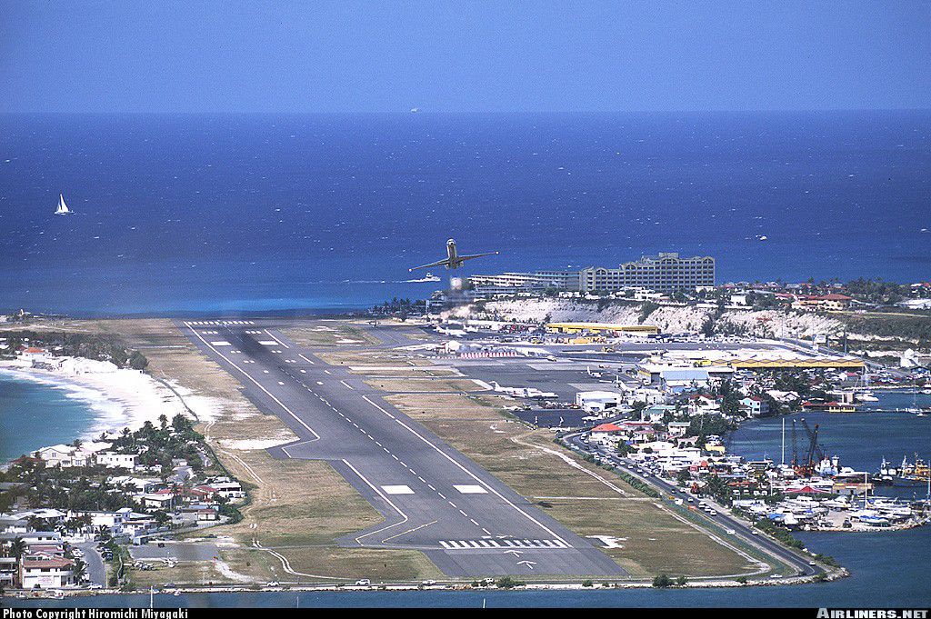
| Real Sint Maarten.jpg | 04.06.03 | 267.00 kB |
| RealGrdCase.JPG | 05.04.03 | 226.86 kB |
| Scenery.zip | 04.30.07 | 974.08 kB |
| Texture.zip | 04.30.07 | 11.73 MB |
| TFFG.JPG | 10.05.03 | 80.12 kB |
| TNCM_ngt.JPG | 10.09.03 | 67.28 kB |
| VirginMap.jpg | 10.10.03 | 37.06 kB |
| Carib.JPG | 04.30.07 | 108.61 kB |
| Carib_Nd.JPG | 10.09.03 | 70.94 kB |
| Caribb.JPG | 04.30.07 | 80.59 kB |
| File_id.diz | 04.30.07 | 631 B |
| GrandCase.JPG | 10.09.03 | 73.56 kB |
| flyawaysimulation.txt | 10.29.13 | 959 B |
| Go to Fly Away Simulation.url | 01.22.16 | 52 B |
More FSX & P3D add-ons hand-picked based on this download.
FSX Scenery
Caribbean Seaplane Tours, part 4 - Caribbe East. Includes some twenty airport…
 FSX Scenery
Skara Scenery Bonaire X. Flamingo International Airport or Bonaire Internatio…
 FSX Scenery
Iwo Jima Scenery 1945 Update. This is a complete scenery with added effects a…
FSX Scenery
Kjeller Area Scenery X, Norway. Scenery around Kjeller airport with photoreal…
 FSX Scenery
FSX Loney's Alaska For FSX. This is a compilation of the author's Alaskan sce…
 FSX Scenery
For users of Flight Simulator X (and FSX: Steam Edition) and/or Prepar3D, ter…
 FSX Scenery
This freeware release by developer Aime Leclercq introduces revised highways …
 FSX Scenery
Team GEX Enhanced Autogen World. This package upgrades 522 world wide autogen…
Be the first to leave a comment on this download.
Be the first to share your thoughts on this download.