 FSX Scenery
British Columbia Float Bases
This is a collection of coastal British Columbia float bases made with defaul…
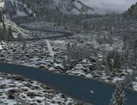
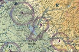
British Columbia’s north coast gets a set of remote dirt strips and seaplane docks between Prince Rupert and Nass Bay, with low-level river flying along the Kwinamass Valley and handy intermediate stops at Big Bay and Union Lake for bush and float operations. Built for FSX and requires Ultimate Terrain Canada.


British Columbia. Dirt strips and seaplane docks between Prince Rupert (CYPR) and Nass Bay along the beautiful north coast of British Columbia, Canada. For use with Ultimate Terrain Canada FSX only. By Doug Keech.
British Columbia Scenery.
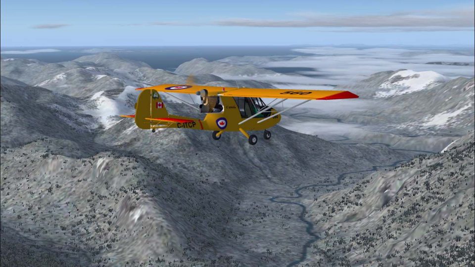
It is a fun little area to fly ultralight, or small GA bush aircraft.
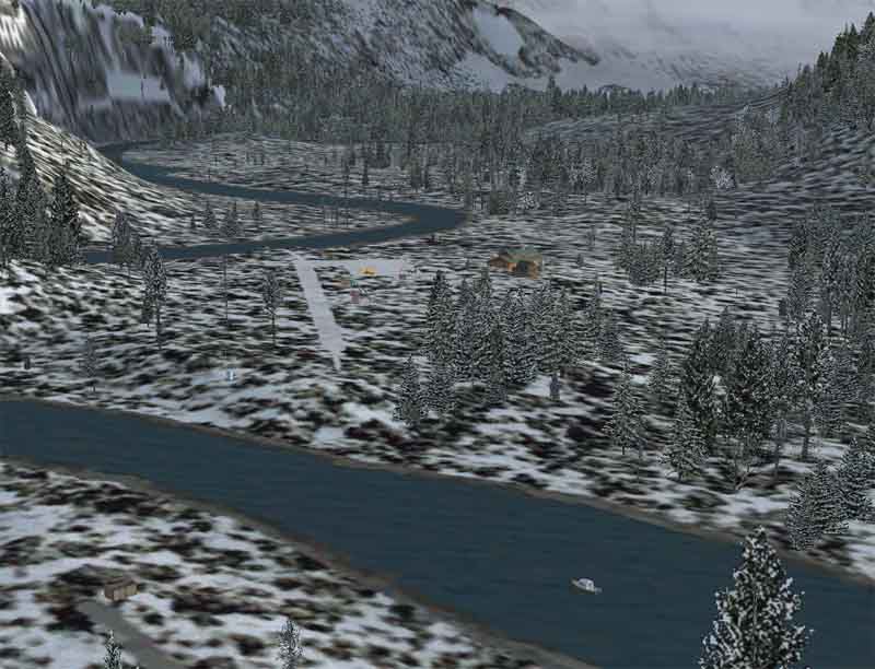
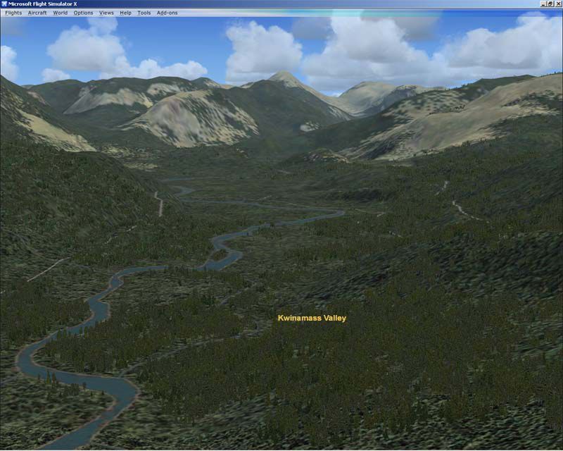
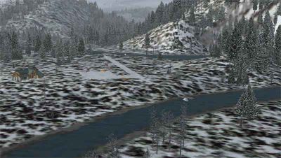
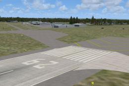
I've created two small dirt strips along the river. The first strip is located about mid-river just a few minutes flight from the mouth where the Kwinamass spills into the Portland Inlet. The second strip is farther up the Kwinamass closer to the headwaters just a few minutes flight from the lower strip. It is quite enjoyable to fly low level along the river following it's twists and turns, then practice your approaches, landings, and takeoffs at the two strips.
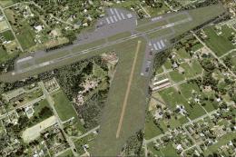
The closest airport to this area is Prince Rupert CYPR bearing about 172 degrees magnetic from the mouth of the Kwinamass at 31NM. Terrace airport CYXT is located miles to the SE bearing 83 degrees magnetic at 57NM.
The Kwinamass River is known locally for it's fantastic steelhead fishing.
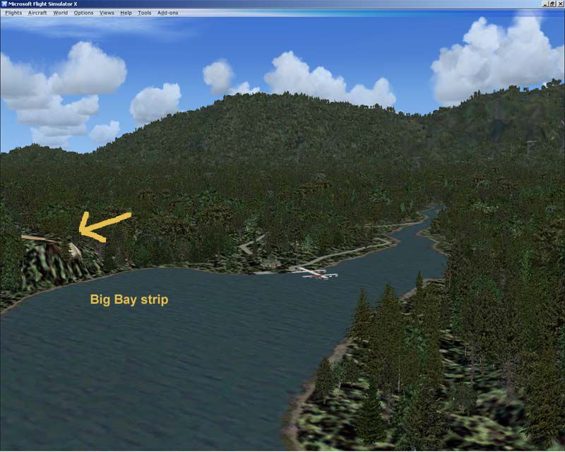
In addition, I've created a few intermediate stops between the Kwinamass and Prince Rupert. The first is Big Bay about a 7 minute flight in my challenger ultralight north of Prince Rupert. There is a seaplane dock and a dirt strip.
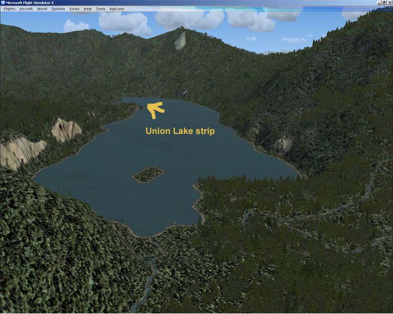
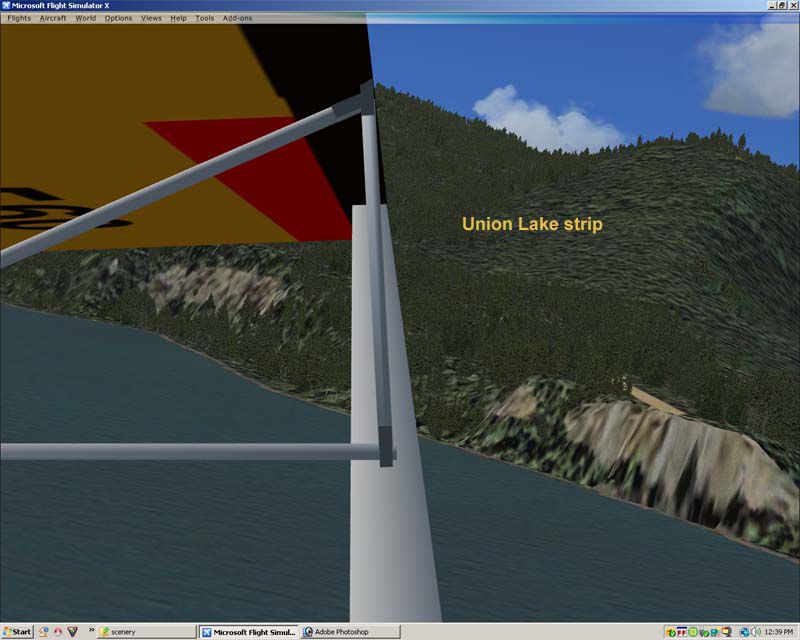
The second stop in about another 12 minutes straight north on Union Lake on the NE side of Work Channel. Again, no problem on floats, and a small dirt strip as well.
The Kwinamass valley is only about another 7 minutes north from Union Lake.
Just a few minutes flight NE of the mouth of the Kwinamass is Nass Bay........a nice little hideaway for float planes. I have also placed a small dirt strip along the shoreline there.
It is great fun to flight the challenger ultralight using real weather from Prince Rupert to Nass Bay and back!
Installation:
Place these bgl files into your addon scenery/scenery directory. Next place the 3 situation files (flt, wx, and fssave) into your documents/flight simulator X files directory. Restart FSX. Use the startup situation entitled "Kwinamass River Run". Enjoy!
Regards,
Doug
British Columbia Scenery.
Free for all simmers · 1012.43 KB · Scanned clean
Download speed: Free tier is capped at 0.5 Mbps. PRO members download at full line speed.
FSX\Addon Scenery\ containing scenery and texture sub-folders.readme.txt or README file. It tells you exactly where files go, what dependencies are needed, and any quirks specific to this add-on.Use these coordinates to fly directly to this location once the mod is installed.
54.31500000,-130.32000000
Launch FSX or Prepar3D and use Flights → Load to open the downloaded .pln file. Your aircraft will be positioned at this location.
The archive kwinamas.zip has 34 files and directories contained within it.
This list displays the first 500 files in the package. If the package has more, you will need to download it to view them.
| Filename/Directory | File Date | File Size |
|---|---|---|
| cvxKWINAMASS CC1.BGL | 11.30.08 | 253 B |
| cvxKWINAMASS CC2.BGL | 11.30.08 | 305 B |
| cvxKWINAMASS CC3.BGL | 11.30.08 | 266 B |
| cvxKWINAMASS STRIP.BGL | 11.30.08 | 506 B |
| cvxKWINAMASS UPPER STRIP.BGL | 11.30.08 | 498 B |
| kwinamass objects.bgl | 11.30.08 | 1.90 kB |
| kwinamass upper strip objects.bgl | 11.30.08 | 604 B |
| Kwinamass River run.FLT | 12.01.08 | 11.46 kB |
| Kwinamass River run.FSSAVE | 12.01.08 | 167.50 kB |
| Kwinamass River run.WX | 12.01.08 | 248.72 kB |
| readme.txt | 12.20.08 | 2.02 kB |
| lower kwinamass strip1.jpg | 11.30.08 | 73.08 kB |
| lower kwinamass strip2.jpg | 11.30.08 | 53.30 kB |
| upper kwinamass strip1.jpg | 11.30.08 | 66.20 kB |
| upper kwinamass strip2.jpg | 11.30.08 | 54.26 kB |
| Big Bay objects.bgl | 12.07.08 | 476 B |
| cvxBIG BAY STRIP.BGL | 12.07.08 | 472 B |
| cvxUNION LAKE STRIP.BGL | 12.07.08 | 524 B |
| Khutzeymateen objects.bgl | 12.07.08 | 540 B |
| Union Lake objects.bgl | 12.07.08 | 348 B |
| big bay approach.jpg | 12.07.08 | 74.36 kB |
| big bay strip.jpg | 12.07.08 | 83.36 kB |
| descent to the kwinamass.jpg | 12.06.08 | 150.92 kB |
| Kwinamass Valley.jpg | 12.07.08 | 82.47 kB |
| Union Lake1.jpg | 12.07.08 | 96.99 kB |
| Union Lake2.jpg | 12.07.08 | 93.08 kB |
| Union Lake3.jpg | 12.07.08 | 67.03 kB |
| cvxNASS BAY DIRT STRIP.BGL | 12.20.08 | 474 B |
| cvxNASS BAY TRAIL.BGL | 12.20.08 | 349 B |
| Nass Bay objects.bgl | 12.20.08 | 988 B |
| Kwinamass River.gif | 12.20.08 | 40.37 kB |
| file_ID.diz | 12.20.08 | 260 B |
| flyawaysimulation.txt | 10.29.13 | 959 B |
| Go to Fly Away Simulation.url | 01.22.16 | 52 B |
More FSX & P3D add-ons hand-picked based on this download.
FSX Scenery
This is a collection of coastal British Columbia float bases made with defaul…
 FSX Scenery
Landscape enhancements of the Bella Coola area (N51*45'-52*40' W125*35'-127*2…
 FSX Scenery
Orbx Compatible British Columbia Ferries, British Columbia, Canada, v1.0. An …
 FSX Scenery
Scenery O22 Columbia Airport. This is a small public GA airport located in Co…
 FSX Scenery
Columbia Airport (O22) Columbia, California (CA). This scenery adds static ai…
 FSX Scenery
(KCAE), South Carolina (SC), USA> The Columbia Metropolitan Airport Authority…
 FSX Scenery
Anguilla British West Indies. This scenery adds static aircraft, vehicles and…
 FSX Scenery
Skara Scenery Bonaire X. Flamingo International Airport or Bonaire Internatio…
Be the first to leave a comment on this download.
Be the first to share your thoughts on this download.