 FSX Scenery
Mashhad Photoreal V2
Mashhad Photoreal Scenery Iran version 2. Improvements include resolved disap…
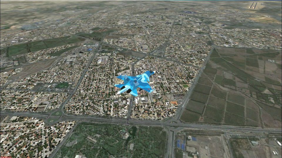
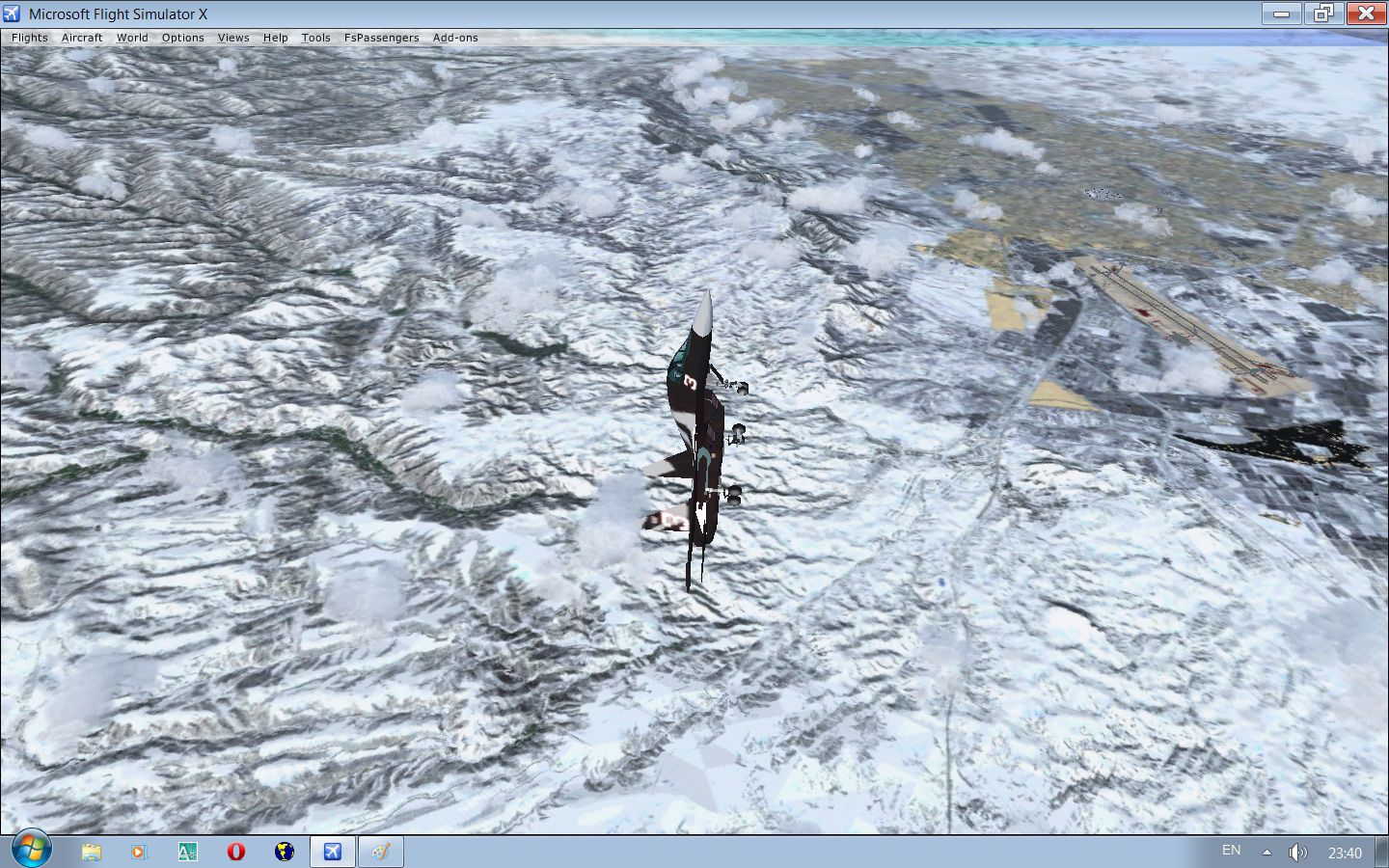
Mashhad (OIMM) photoreal scenery brings northeastern Iran to life with high-to-medium resolution ground imagery, accurate terrain mesh, and real-world elevation for more convincing approaches and VFR navigation. Seasonal variations and night lighting extend realism year-round, integrating smoothly into FSX for flights around the city and airport environment.


Mashhad Photoreal Scenery, (OIMM) Iran. High to medium photoreal scenery covering Around Mashhad. Features: real elevation, all season and night textures. By Usof Kalantari.
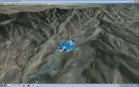
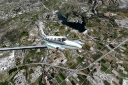
Screenshot of plane flying over mountains.
Copy both folder to "Addon Scenery" in FSX to have Mashhad in your world.
1.Real photo.
2.Real mesh.
3.All season and night.
Only mashhad but the OIMM !
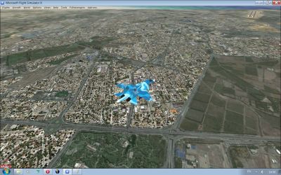
Screenshot of plane flying over towns.
Free for all simmers · 271.58 MB · Scanned clean Jul 2026
Download speed: Free tier is capped at 0.5 Mbps (this file takes approximately 1h 16m at the cap). PRO members download at full line speed.
FSX\Addon Scenery\ containing scenery and texture sub-folders.readme.txt or README file. It tells you exactly where files go, what dependencies are needed, and any quirks specific to this add-on.Use these coordinates to fly directly to this location once the mod is installed.
36.26050000,59.61680000
Launch FSX or Prepar3D and use Flights → Load to open the downloaded .pln file. Your aircraft will be positioned at this location.
The archive mashhad-iran_v1.zip has 27 files and directories contained within it.
This list displays the first 500 files in the package. If the package has more, you will need to download it to view them.
| Filename/Directory | File Date | File Size |
|---|---|---|
| scenery | 12.30.11 | 0 B |
| Haram.MDL | 12.19.11 | 1.61 MB |
| MashhadAround.bgl | 12.28.11 | 120.78 MB |
| MashhadCity.bgl | 12.27.11 | 152.96 MB |
| Mashhadelev.bgl | 12.21.11 | 449.81 kB |
| MashhadLC.bgl | 12.28.11 | 1.98 kB |
| MashhadOBJ.BGL | 12.20.11 | 1.61 MB |
| texture | 12.30.11 | 0 B |
| Haram_0.dds | 12.19.11 | 682.79 kB |
| texture0.dds | 12.19.11 | 5.45 kB |
| texture1.dds | 12.19.11 | 10.79 kB |
| texture2.dds | 12.19.11 | 10.78 kB |
| texture3.dds | 12.19.11 | 85.45 kB |
| texture4.dds | 12.19.11 | 296 B |
| texture5.dds | 12.19.11 | 21.44 kB |
| texture6.dds | 12.19.11 | 2.79 kB |
| texture7.dds | 12.19.11 | 21.38 kB |
| texture8.dds | 12.19.11 | 170.78 kB |
| texture9.dds | 12.19.11 | 85.45 kB |
| FILE_ID.DIZ | 12.30.11 | 242 B |
| haram1.jpg | 12.25.11 | 425.43 kB |
| Install.txt | 12.28.11 | 208 B |
| Land.jpg | 12.25.11 | 608.66 kB |
| mesh1.jpg | 12.26.11 | 374.75 kB |
| zemestan2.jpg | 12.27.11 | 553.53 kB |
| flyawaysimulation.txt | 10.29.13 | 959 B |
| Go to Fly Away Simulation.url | 01.22.16 | 52 B |
Only PRO members can place votes.
More FSX & P3D add-ons hand-picked based on this download.
FSX Scenery
Mashhad Photoreal Scenery Iran version 2. Improvements include resolved disap…
 FSX Scenery
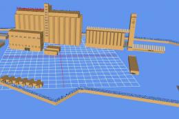
Wheat Silo, Mashhad, Iran, v1. Features wheat silo in real scale. By Usof Kal…
 FSX Scenery
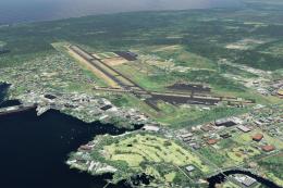
This is a complete package containing photoreal scenery for the whole state o…
 FSX Scenery
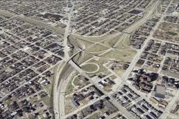
A complete and fully featured photoreal, airport, building, and autogen scene…
 FSX Scenery
St Louis PhotoReal Scenery. This is high resolution, 1 meter/pixel, terrain s…
 FSX Scenery
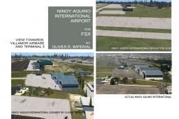
NAIA (RPLL) Photoreal Scenery. An FSX photoreal scenery package for the Ninoy…
 FSX Scenery
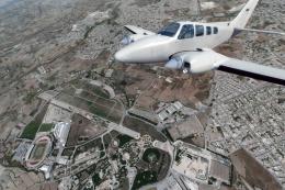
Take a trip to the small nation of Malta in any simulation package, and you w…
 FSX Scenery
A trip to the Southern European nation of Cyprus in a flight simulator should…
Be the first to leave a comment on this download.
Be the first to share your thoughts on this download.