Page 6
Searches the whole library — filter by sim & category on the results page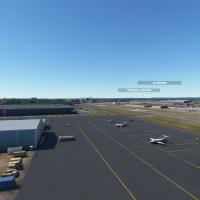
Nearby Linden Airport, designated KLDJ, receives a freeware recreation by demonicdave that reworks most of the field, adds perimeter fences, and places extra vehicles around the airfield to better …
 United States of America
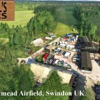
Lotmead Airstrip near Swindon, UK carries the GB085 designation as a private grass strip with no commercial traffic. The download ships with required models, and Neil Birch's other farm strips shar…
 United Kingdom
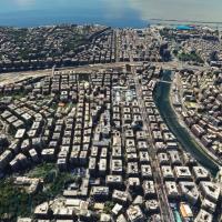
Genoa photogrammetry addon renders accurate topography and three-dimensional structures over the Ligurian city, using photographic data to capture harbor details and historic landmarks. Version 1.2…
 Italy
Italy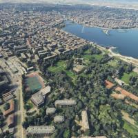
Variants include a standard edition and a REDWING HUD version compatible with Geneva Airport, identified by thalixte-geneve and thalixte-geneve-rw folders. Extensive photogrammetry renders Geneva's…
 Switzerland
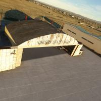
A fully custom 3D model of Gravricks Hangar at KIYK in Inyokern, CA features interior and exterior work rendered in 4K with PBR lighting. Doors are fully animated and triggerable within 250 meters …
United States of America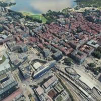
Two dedicated folders, thalixte-annecy and thalixte-menthon, deliver a photogrammetry representation of Annecy with high-resolution city details, including the basilica and palace, and integrated P…
 France
By photogrammetry, this addition renders La Défense with over 72 buildings, including 19 skyscrapers, and portrays Saint-Denis with landmarks such as the Basilica, at coordinates 48°53′30.27″ N, 2°…
France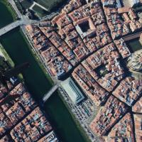
A photogrammetry project covers Bayonne and Biarritz with high-resolution Google Maps data delivering true-to-life geometry. Versioned from v1.1 to v1.5, colorimetry improvements, vegetation remova…
France
Version 1 SU7 introduces projected mesh taxiway lines for Koh Samui's VTSM layout and a refined terminal area, while 0.1.7 adds Big Buddha Pier and Haadrin Queen ferry boat, plus spawn-point correc…
 Thailand
Expanded photogrammetry, via thalixte-larochelle, covers La Rochelle with updated colorimetry, including La Pallice harbor and Les Minimes marina, while improved road traffic, procedural lighting, …
France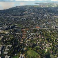
An advanced Lausanne photogrammetry asset maps the city and its surroundings with high-fidelity 3D data, adding the European Polytechnic University campus as a point of interest. It offers enhanced…
Switzerland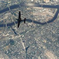
Photogrammetry data powers a high-resolution, three-dimensional rendering of Nantes and its landmarks, offering an authentic city view with surrounding roads and estuarine terrain. The thalixte-nan…
France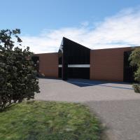
KBJC, a regional airport in Colorado's Rocky Mountain foothills, is represented with highly detailed custom models of the main terminal, control tower, and the Pilatus building, while the layout pr…
United States of America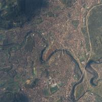
Bern photogrammetry add-on uses Google Maps data to recreate the UNESCO-listed Altstadt and the Aare river with refined elevation and vegetation blending. It evolves through four iterations (v1.0–v…
Switzerland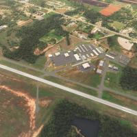
EzRyder provides a replacement for KGOK in Logan County, Oklahoma, enhancing realism by adding about 30 static objects, relocating the beacon tower into the segmented circle, and reinstating a wind…
United States of America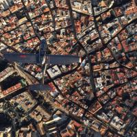
Version 1.1 adds elevation adjustments for a seamless blend with the nearby Gibraltar photogrammetry asset, while detailing the Port of Algeciras and outlining the urban layout along the Río de la …
 Spain
Spain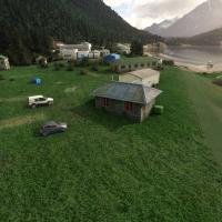
Nanwalek airfield on the Kenai Peninsula in Alaska carries IATA/FAA LID KEB and receives a freeware enhancement that redefines a gravel Runway 1/19, spanning 1,850 by 50 feet with 850 feet usable o…
United States of America
Developed by RaptrFlite, this KUNI airport enhancement presents day and night modes, functional fuel pumps with a fuel truck, and a Douglas DC-3 Gooney Bird bearing Ohio University branding. Mesh u…
United States of America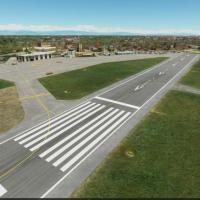
An add-on for Padova’s airfield LIPU integrates FSX-derived 3D models and adds helicopter helipad positions 30 and 31, while establishing a new ATC frequency at 123.250. The improvement focuses on …
Italy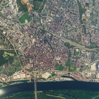
Photogrammetry drives the Worms area add-on, drawing data from a mapping service to render the city with refined elevation near the airport in Version 1.1. Landmarks such as Worms Cathedral and ShU…
 Germany