FSX Scenery

Page 83

Sort
Reset
No image available.

Oil Platforms

Three GPS/ADF oil platforms include Lafayette (KLFO), Galveston (KGLO), and Corpus Christi (KNGO) in version 4.0. Each uses non-directional beacons such as LOPU on 477.0 kHz, GOPO 396.0 kHz, and CCOP 391.0 kHz, with VOR codes LOP, GOP, and CCO and 100 NM ranges.

Country
United States of America
File Size
1.6 MB
Total Downloads
546
Preview screenshot

Banff National Park Airstrip

Rick Lackey presents a CYBA variant, relocating the runway and shaping its slope to match the terrain, with objects added. Two BGL files, CYBA_ADEX_RL.BGL and CYBA_ADEX_RL_CVX.BGL, define the layout; AI traffic fails due to the slope and lack of parking, with a helipad used as a starting point, and ADEX9 underpins development.

Country
Canada
File Size
15.37 MB
Total Downloads
545
Star Rating
1/5
Preview screenshot

Spruce Creek Fly-in Community

Set in 7FL6, Florida, near KDAB, this add-on revises the Daytona Beach area with a reworked runway and taxiways plus custom objects, drawing on regional imagery and photos. It includes the 7FL6_LANDCLASS_AP.bgl and 7FL6_ADEX_AP.BGL in the Models folder, by Art Poole.

Country
United States of America
File Size
5.31 MB
Total Downloads
544
Screenshots
8
Preview screenshot

Wilmington International

Dusty Bizub revises the KILM file for Wilmington International Airport, refining runway identifiers to current magnetic headings and implementing custom AI parking codes. This marks the author's 17th airport improvement, and the change requires no external 3D decor or custom structures.

Country
United States of America
File Size
31.14 KB
Total Downloads
543
Star Rating
3/5
Preview screenshot

Invercargill Airport

Craig Darrall delivers Invercargill airport (NZNV), replacing all default buildings with accurate replacements and adding roads and vehicle parking based on Google Earth, while implementing tarmac lighting and offering an optional Traffic Invercargill_fsx.bgl file for AI.

Country
New Zealand
File Size
16.63 MB
Total Downloads
542
Star Rating
1/5
Preview screenshot

Lexington Blue Grass Airport

By Rob Touchtone, the airport serving Lexington, Kentucky (KLEX) gains a complete terminal and control tower, along with adjusted gates to reflect Allegiant, US Airways, Delta, American, United, and Air Tran. Jetways are visible and operable, and can be summoned to the aircraft via CNTRL-J, with layout crafted using ADE.

Country
United States of America
File Size
154.93 KB
Total Downloads
542
Preview screenshot

Ghost Airports - Maryland - KBMA

Construction begins in 1929 and the field is dedicated in November 1941, later known as Harbor Field after 1950. Its biggest prewar use is as a seaplane terminal, with Pan Am Clipper service between Baltimore and Bermuda; two .bgl files carry Harbor Field data, tower 119.9, ground 121.7, and no instrument approaches.

Country
United States of America
File Size
701.01 KB
Total Downloads
541
Screenshots
4
Preview screenshot

Amazonia Air Scenery Part 1

From Pucalpa to Iquitos up the river, Amazonia Air operates with stops at Contamana, Aguantan, Selvas and Nauta, flying twin Senecas, 206s, 208s, and a DC-3. By Gera Godoy Canova, it remains freeware and cannot be used commercially, with Jim Dhaenens providing airfield lights via fsx_lts.zip.

Country
Peru
File Size
4.63 MB
Total Downloads
541
Screenshots
6
Preview screenshot

Floyd Bennett Field (CGAS)

Version 1.0 centers the field at Floyd Bennett and Coast Guard Air Station Brooklyn, depicting the 1938–1941 transition with runways modeled at maximum lengths and the terminal rendered in a 1931–1938 vintage. Original models cover the hangars, the admin building, and the sign out front, with a night option noted.

Country
United States of America
File Size
5.48 MB
Total Downloads
537
Star Rating
5/5
Screenshots
6
Preview screenshot

Selcuk-Efes Airport

Located on the Turkish coast near the sea, Selcuk-Efes airfield (LTFB) presents coordinates N 37.57'08", E 27.20'00", elevation 15 ft, with NDB 424.00 and Tower 131.00. By Dominique M. L. Donzelot, this addon uses existing elements, keeps FPS impact low, and is not compatible with earlier simulator versions.

Country
Turkey
File Size
906.33 KB
Total Downloads
537
Screenshots
8
Preview screenshot

Nova Scotia

John Perkins presents a Nova Scotia mesh terrain for Canada, focusing on the region’s geographic features and coastal contours, with attention to elevation detail, shoreline accuracy, and terrain variation. It notes two image references illustrating the terrain, offering concrete visuals for the area.

Country
Canada
File Size
67.81 MB
Total Downloads
537
Screenshots
1
Preview screenshot

Disneyland CA Monorail

Kevin R Wynn presents a non-animated 3D depiction of the Disneyland monorail in California, drawing on a model provided by Peter Olsen and credited to both Olsen and Wynn for the Disneyland monorail project effort.

Country
United States of America
File Size
828.54 KB
Total Downloads
536
Star Rating
2/5
Screenshots
1
No image available.

Charleston AFB/International

Charleston-area airfield (KCHS) in South Carolina, by Ryan Cobb, receives a complete rework featuring new hangars, a fire department facility, a Boeing plant, runway distance remaining signs, and assigned gates with cargo ramps, plus a hazardous cargo area to the southwest.

Country
United States of America
File Size
24.24 KB
Total Downloads
536
Star Rating
1/5
Preview screenshot

Parafield Airport

Crafted by Roger Leupold, Parafield aerodrome aligns runway layouts and adjacent structures using Google Earth references to mirror airport geometry, with hangars and terminal areas distributed to resemble real ground operations. Parafield sits about 18 kilometers north of Adelaide in South Australia and handles extensive general aviation training traffic.

Country
Australia
File Size
347.46 KB
Total Downloads
534
Star Rating
2/5
Screenshots
1
Preview screenshot

San Isidro Air Base

San Isidro base carries IATA ZXD and ICAO MDSI and appears as Vol. 1, locating about 25 miles east of Santo Domingo. Origin traces to 1953, when it operated under the name Trujillo until 1961, with design work attributed to Luis Bobea.

Country
Dominican Republic
File Size
17.14 MB
Total Downloads
534
Screenshots
2
Preview screenshot

Zakopane Airport

Zakopane Airport (EPZN) in southern Poland remains a fictional facility outside Zakopane, featuring three runaways and an ILS. Two BGL files carry the addition, EPZN_ADEX_AW_CVX.BGL and EPZN_ADEX_AW.bgl, with credits to Paradyski and Arkadiusz Wieczorek, aligned to EPZN.

Country
Poland
File Size
7.62 MB
Total Downloads
534
Star Rating
1/5
Preview screenshot

Scenery Enhancement For Stock ELLX

Terminal A adds five jetway-equipped gates and thirteen off-gate ramps, while Terminal B receives updated assignments and an expanded Luxair Cargo Center with eight Z ramps. Taxiway D1 and D2 replace the abandoned D, vehicle paths and fuel trucks are reworked, and ADE9X V1.45.6 guides changes, by Kambiz Agazi.

Country
Luxembourg
File Size
1.71 MB
Total Downloads
534
Screenshots
6
Preview screenshot

Fairchild AFB

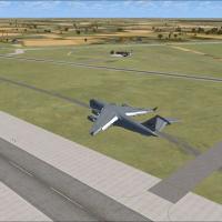
Jim Cook delivers a freeware improvement for Fairchild AFB at KSKA, refining taxiways, expanding aprons, and adding Military_Cargo parking positions to support wide transports. Two files, AFX_KSKA_JC.bgl and KSKA_JC.bgl, modify runways, aprons, and taxi links, drawing data from AirNav and satellite imagery.

Country
United States of America
File Size
19.29 KB
Total Downloads
534
Star Rating
1/5
No image available.

Millau Viaduct

Jean-Claude Irle develops a Millau Viaduct scene using SDK-SP2 and GMAX, with three dedicated folders PontMillau_Routes, PontMillauExclude_Trafic, PontMillauViaduc and an Effects directory. Optimized with mesh from France VFR and UTX Europe, it notes potential traffic issues when SP1 is used and remains available free of charge.

Country
France
File Size
236.75 KB
Total Downloads
533
Preview screenshot

Curacavi Valley

Marcos Grinstein features a terrain setup around Curacavi Valley in central Chile, with 1.2 meter satellite imagery, autogen objects, and mesh terrain surrounding SCCV. Two accompanying image assets illustrate the area’s layout and landscape, capturing surrounding terrain and valley contours.

Country
Chile
File Size
77.66 MB
Total Downloads
533
Screenshots
2