Page 149
Searches the whole library — filter by sim & category on the results page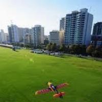
Langley Airpark, WA, Australia, presents realistic lengths and buildings and carries credit to Nicholas Cole, who is based in Brisbane, Australia, reflecting a locally produced contribution in the …
 Australia
Developed by Richard Kittredege, AmherstMA.bgl places campus structures and surrounding town footprints to match real-world references, highlighting the UMass campus neighborhood in western Massach…
 United States of America
Bob Caparoula delivers a custom upgrade for Questa’s N24 airport, preserving the main runway layout while adding residential structures, foliage clusters, and ground markings amid the northern New …
United States of America
An airfield on Potronia Island extends its runway to 85,000 feet, enabling A330-200 operations without weight restrictions. The creator, Orlandy Perez, signs the creation, linking the island locati…
 Global (World)
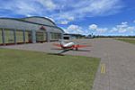
Marc Ulm designs a small Missouri airfield revision, featuring a single runway at 755 feet (1200 meters) and corrected width, with extra parking and a new lot, while night lighting and multiple str…
United States of AmericaBuck's Airport (OON) sits three miles northeast of Bridgeton on 63 acres in New Jersey. The field supports eight parking spots for small GA aircraft on the grass north of the greenhouses, with a wi…
United States of AmericaBy Bruno M. B. Lelievre du Broeuille, this Aldabra Island model places a main airfield FBLB with ILS and a water runway on the same axis as a harbor, refinery, and town, set in the west Indian Ocea…
 Seychelles
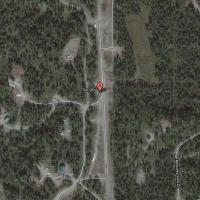
Airport ID 3AK3, Alaska, anchors a setup built around 3.bgl files that guide the layout and expose six additional spawn gates. The approach remains concise and field-focused, avoiding platform refe…
United States of America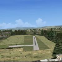
Belize’s Dangriga airport carries the IATA code DGA and hosts service from two airlines, while lacking an ICAO designation. The designer assigns the unique designator MZ57 to this airfield, and Alf…
 Belize
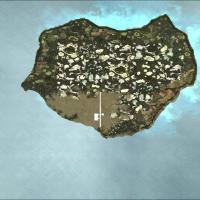
By Orlandy Perez, this MDOP enhancement for a country’s island airport uses BGL files to add more buildings, expanding the built environment and making the island appear more populated, with the au…
 Dominican Republic
Mock Airport (3NJ5) in Flemington, New Jersey stands as a closed airstrip removed from aviation databases. The file removes the grass strip to prevent it from protruding above the ground; it is int…
United States of America12N identifies Aeroflex-Andover Airport in Andover, New Jersey, and Curtis Weeman delivers an updated field layout. The modification relies on a tool from Flight One to enhance the airfield’s appea…
United States of AmericaNewdegate Airport, code YNDG, remains a small wheat belt dirt strip located to the west of Perth in Western Australia, by Frank Salter, which clearly designates it as the home of the Newdegate fiel…
Australia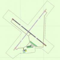
The airport in New York with code 5B2 gains parking spaces, a fuel truck, and a hangar. Brandon Valvo designs it and compiles data in ADE from the original stock facility, credited to Brandon Valvo…
United States of AmericaJenkins Field carries the designation 0OH2 as a private grass-strip airfield in North Hampton, Ohio and remains freeware. Files within 0OH2.zip relocate the runway, correct its heading, build a cus…
United States of America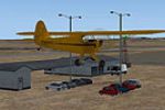
EMKU stands as a fictional UK aerodrome, anchoring a compact addon project with 19 parking slots and a single gravel runway; the 18/36 designation anchors the field’s basic alignment, reflecting a …
 United Kingdom
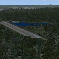
Birchwood-Pocono is created by John "Sharkey" Hawranick, Jr., the owner behind Pocono Airlines, as part of a grand resort concept whose airstrip and resort closed in the mid-1990s. AFX_02PN_ALT.bgl…
United States of America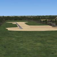
The airstrip at El Ranchito, Corozal, Belize, measures about 600 yards long and 12 yards wide, with cleared ends and nearby brush. Designator MZ60 has no official ICAO code, but IATA CZH designates…
BelizeThe Aldabra Island model for SP2-Acceleration presents a main airfield coded FBLB with ILS and a water runway aligned with a harbor and refinery, plus a town and multiple helipads. Aldabra-Island.z…
Seychelles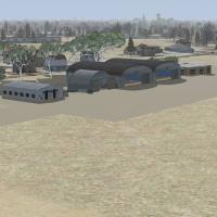
Public-domain depiction by Agustin Guirao bases its layout on real coordinates and visual cues for a rural Lincoln-area airfield. It includes three AI parking spots, two runways, and marks version …
 Argentina