Preview

MSFS RAF Lossiemouth (EGQS) Scenery

RAF Lossiemouth (EGQS) for Microsoft Flight Simulator 2024 and 2020 depicts the current airbase with proximity-triggered HAS doors, bespoke landmarks and squadron buildings, accurate ILS alignment, and performance-conscious statics, while preserving AI and multiplayer flow. Requires UK2000 Common Library for runway guard lights; some optional objects need community libraries.

221 downloads Flight Simulator 2020 CompatibleFlight Simulator 2024 Compatible United Kingdom
  • File: EGQS-RAF-Lossiemouth-MSFS.zip
  • Size:1.1 GB
  • Scan: Clean (6d) Verified clean
  • Access:Freeware
  • Content:Everyone

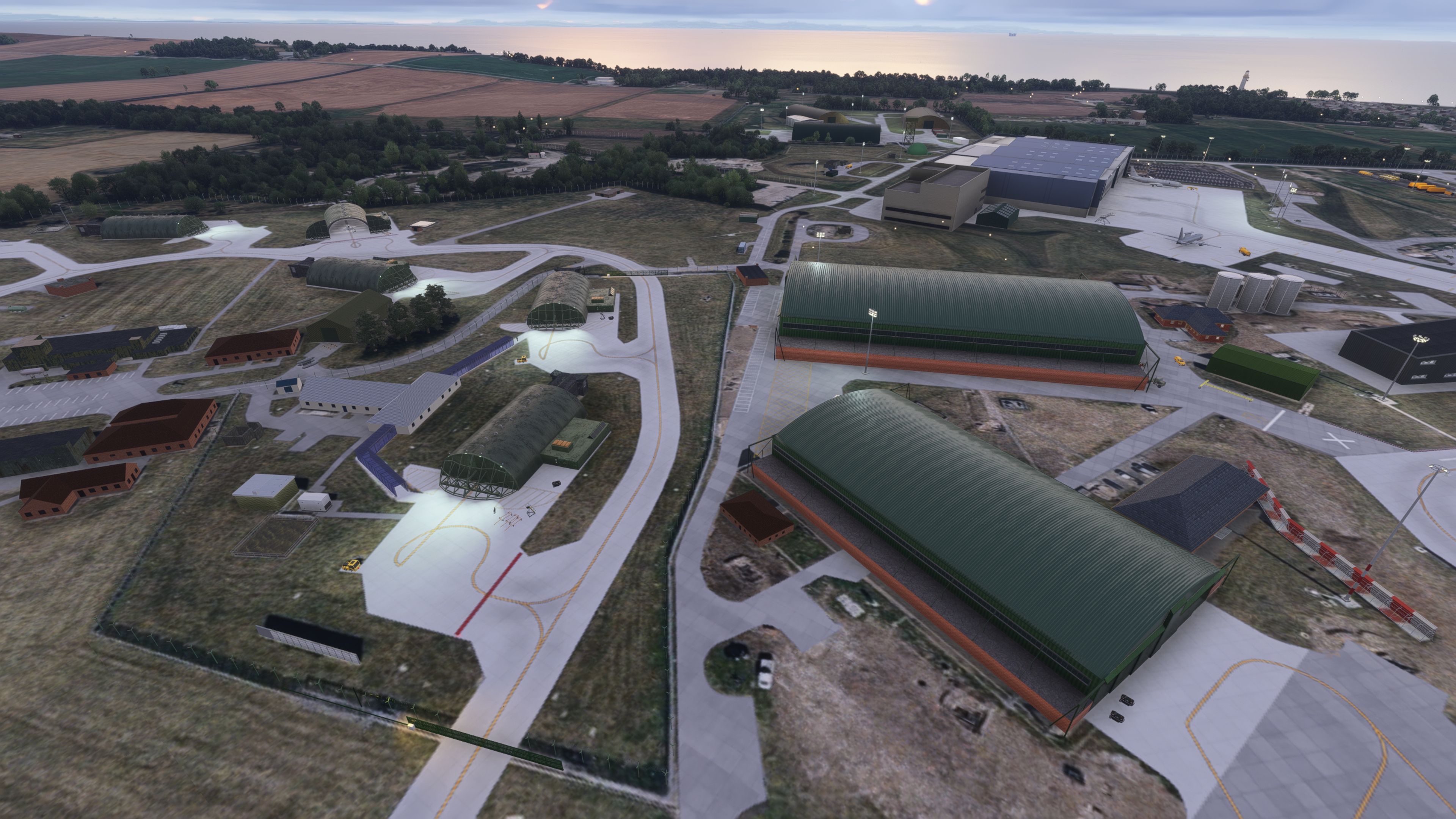
This freeware rebuild of RAF Lossiemouth (EGQS) for Microsoft Flight Simulator 2024 and the earlier 2020 release delivers a faithful, performance-conscious rendition of the Moray fast-jet and maritime patrol base. Created by nickb007, it blends proximity-triggered Hardened Aircraft Shelter animations, correctly aligned ILS data, and a broad set of bespoke structures—while remaining light enough for regular online ops and AI activity.

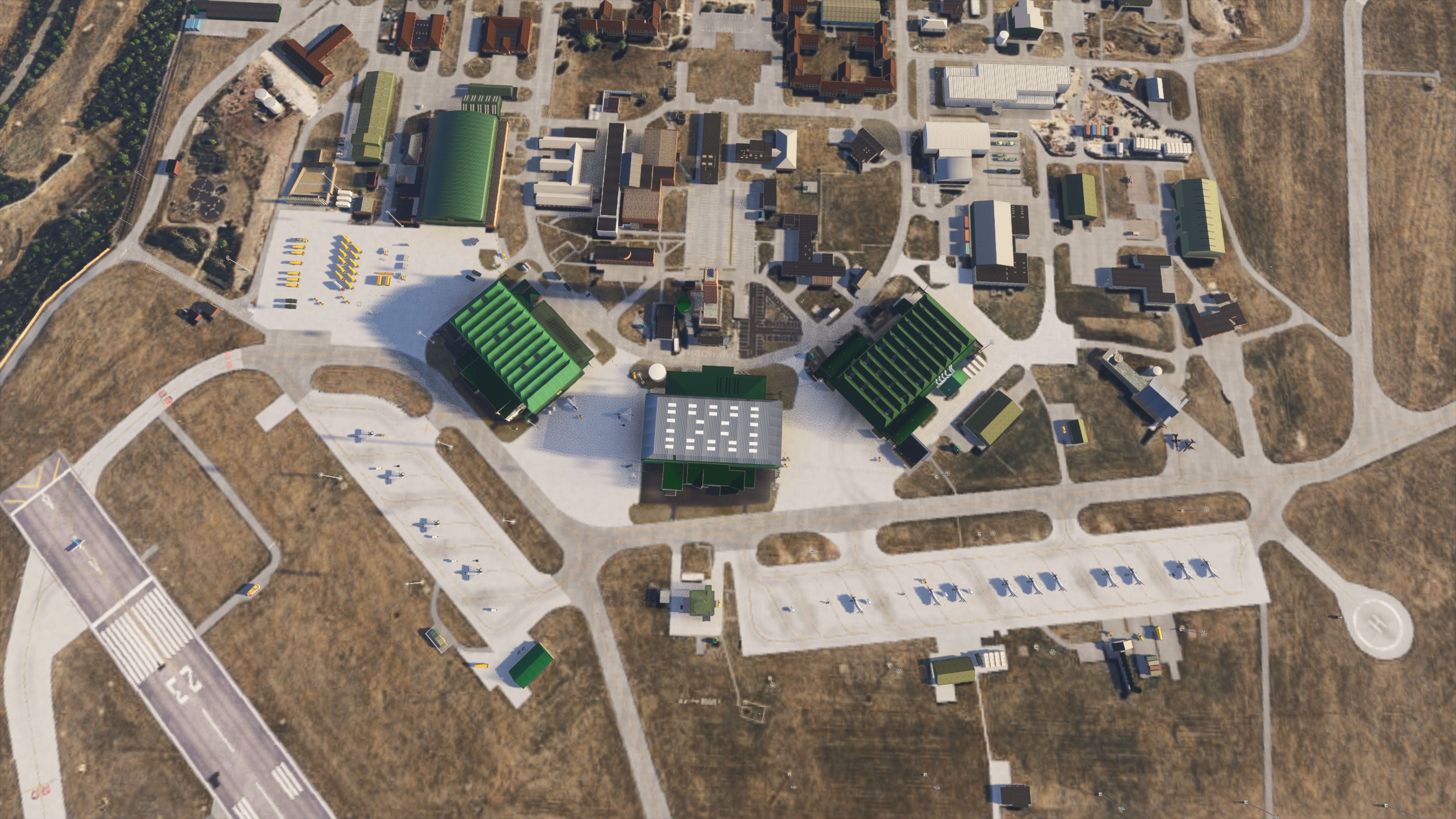
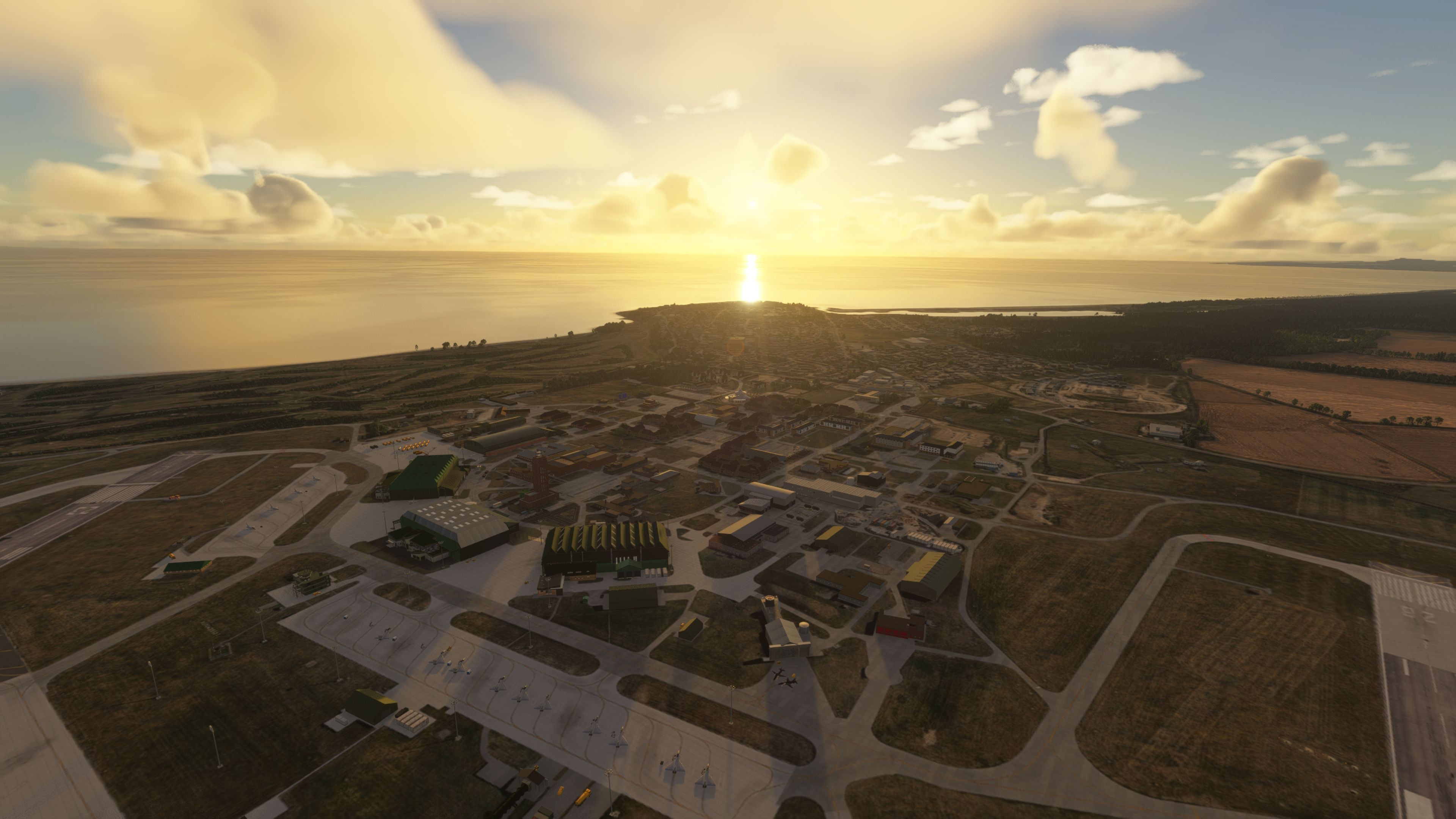
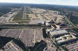
Operational Airbase Brought Up to Current Layout

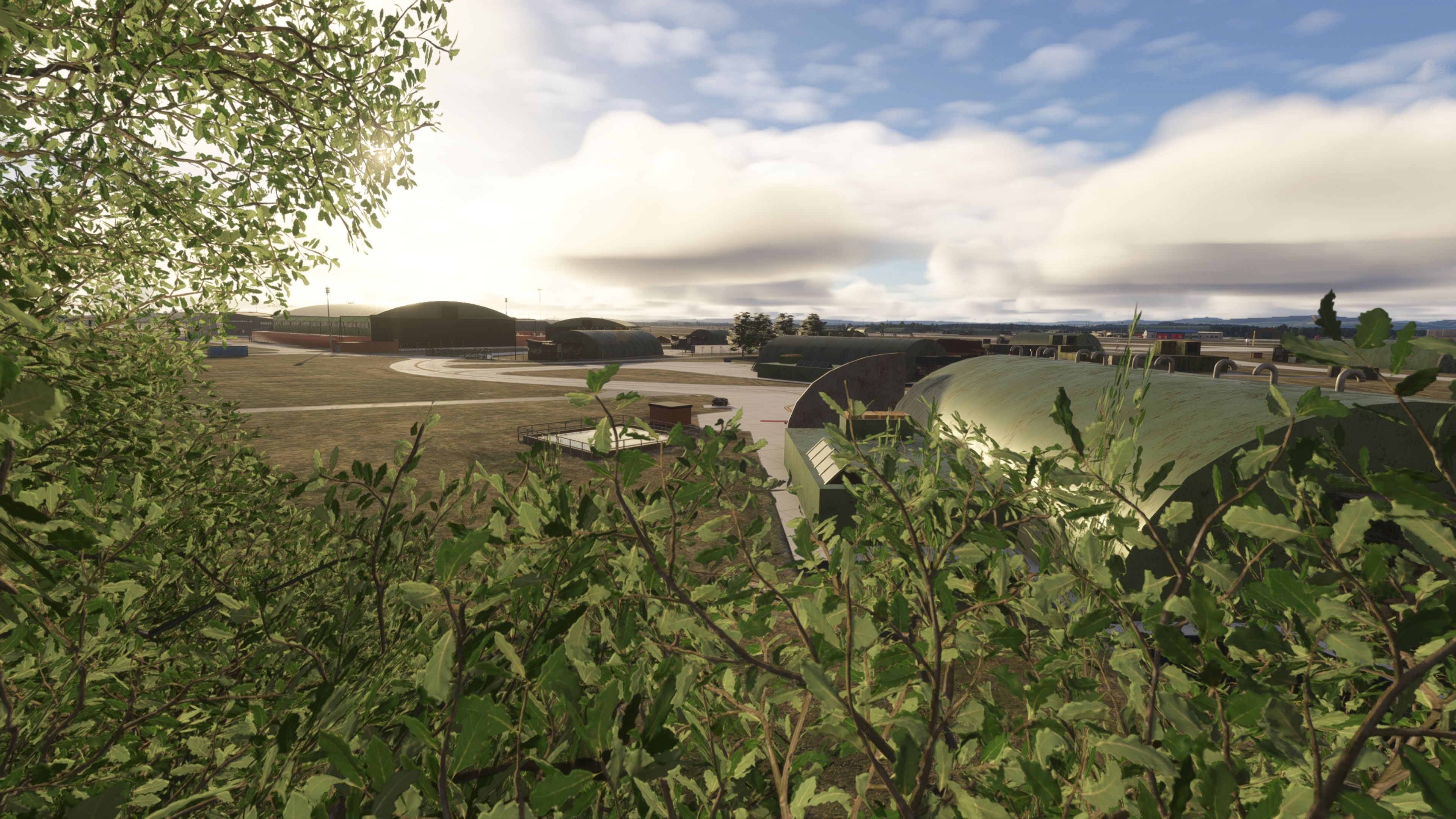
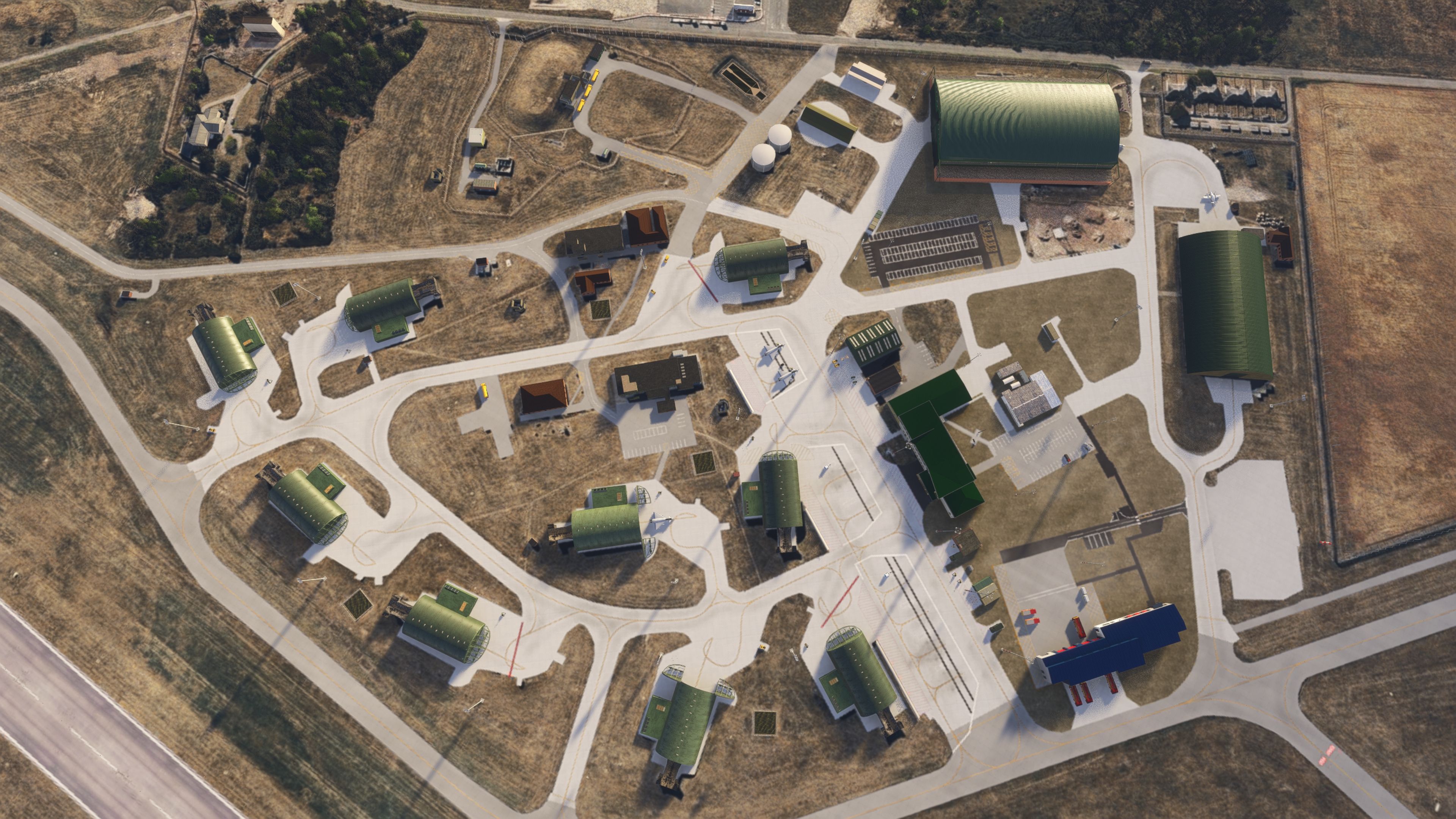
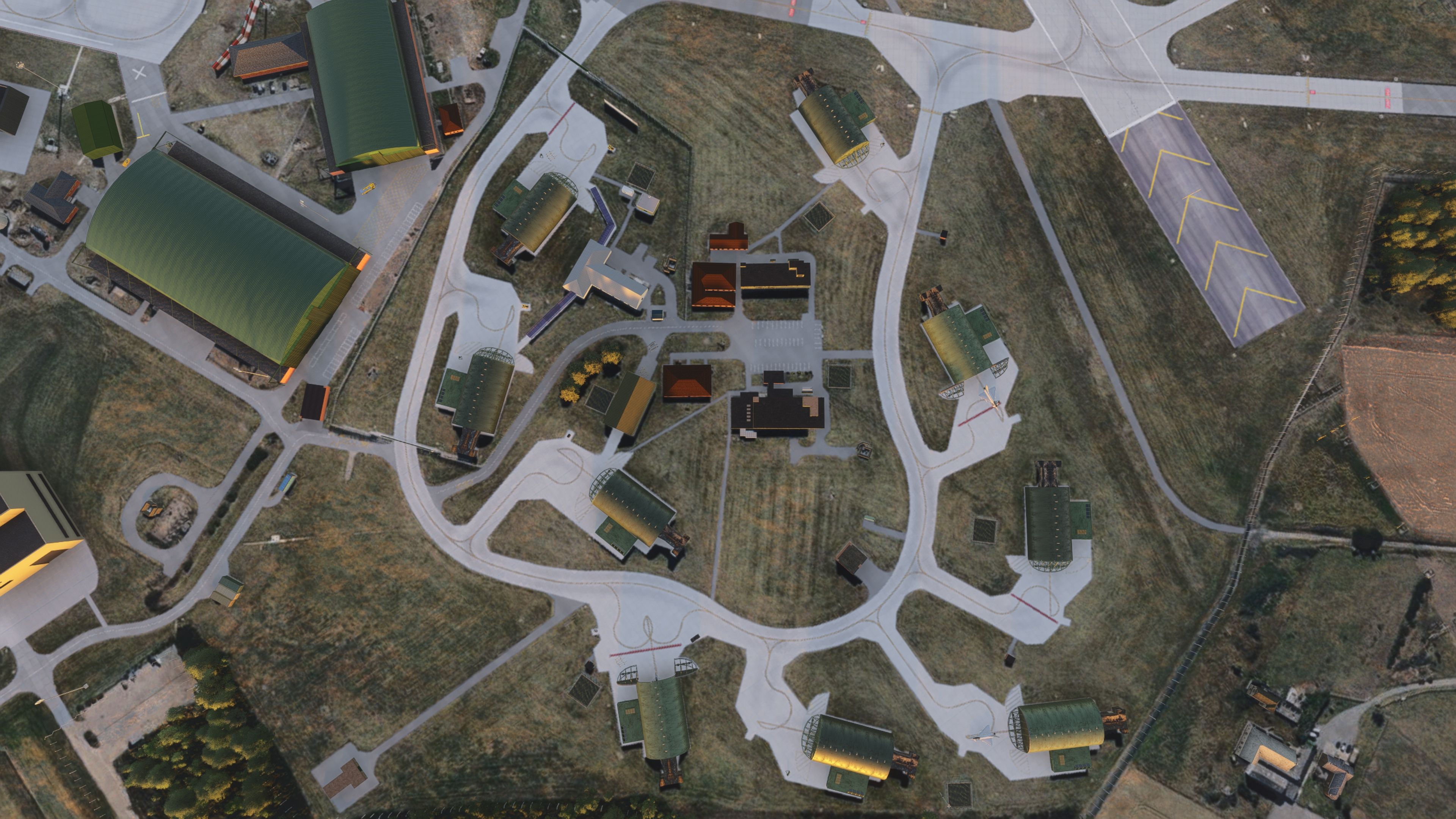
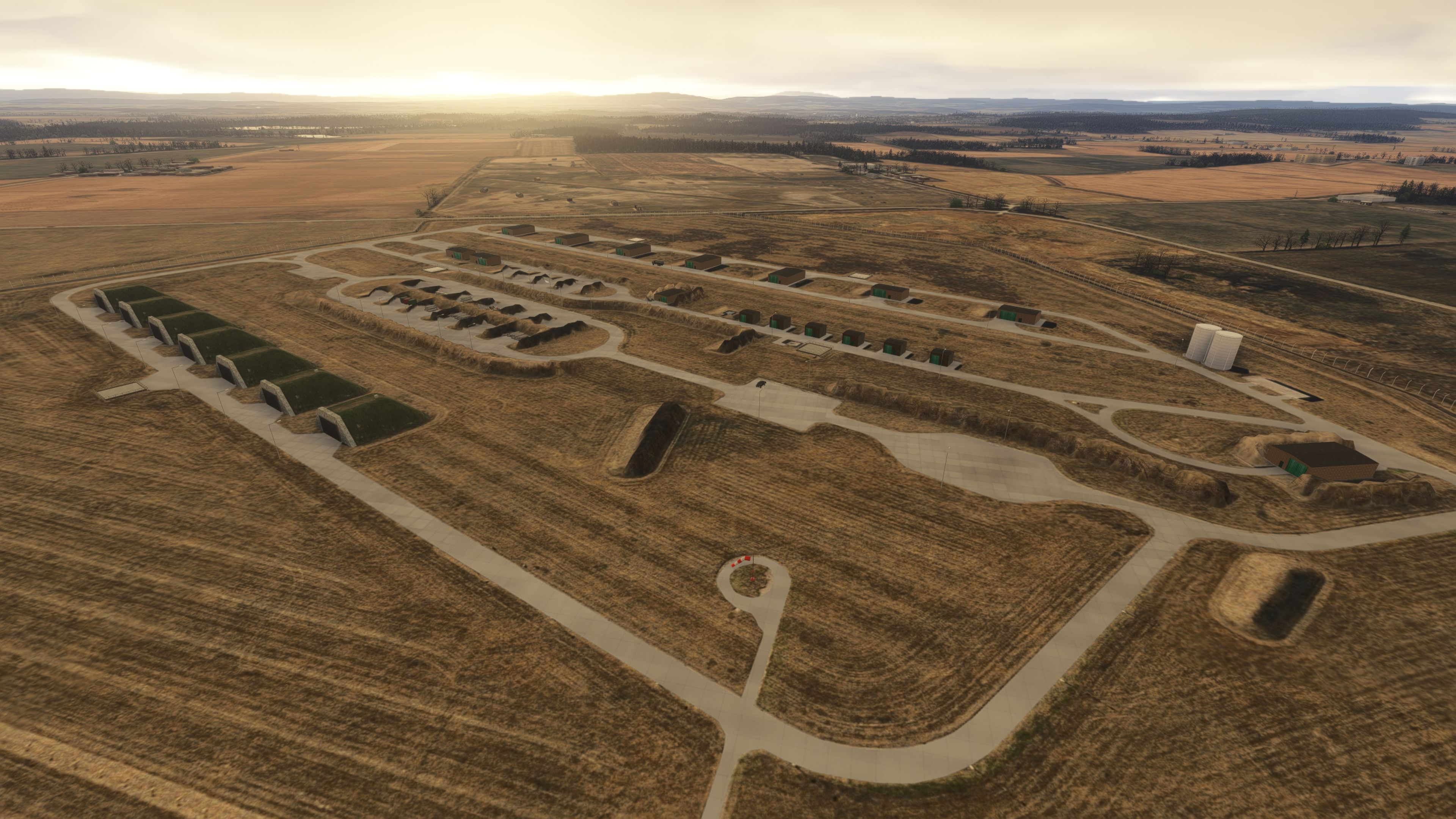
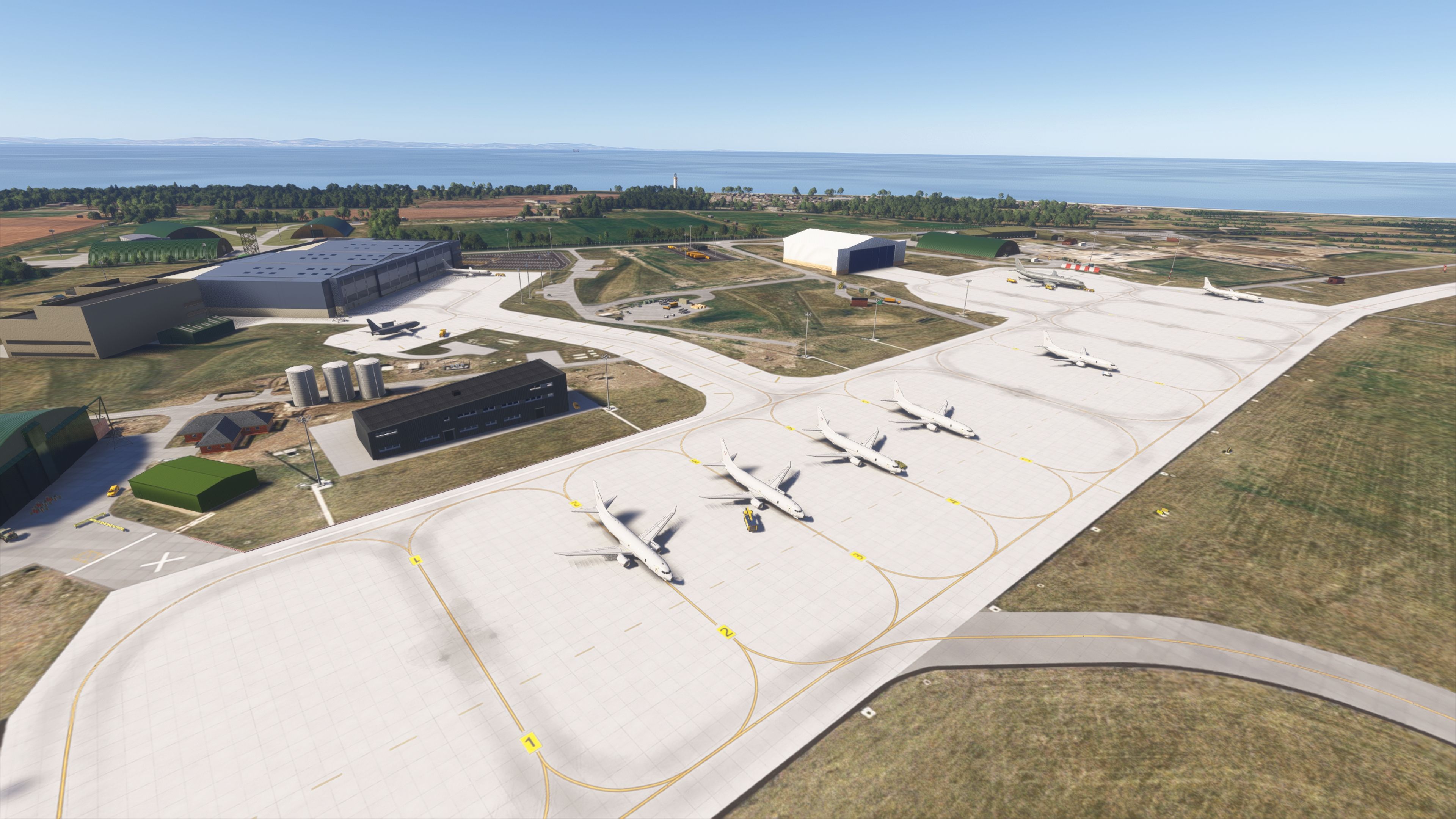
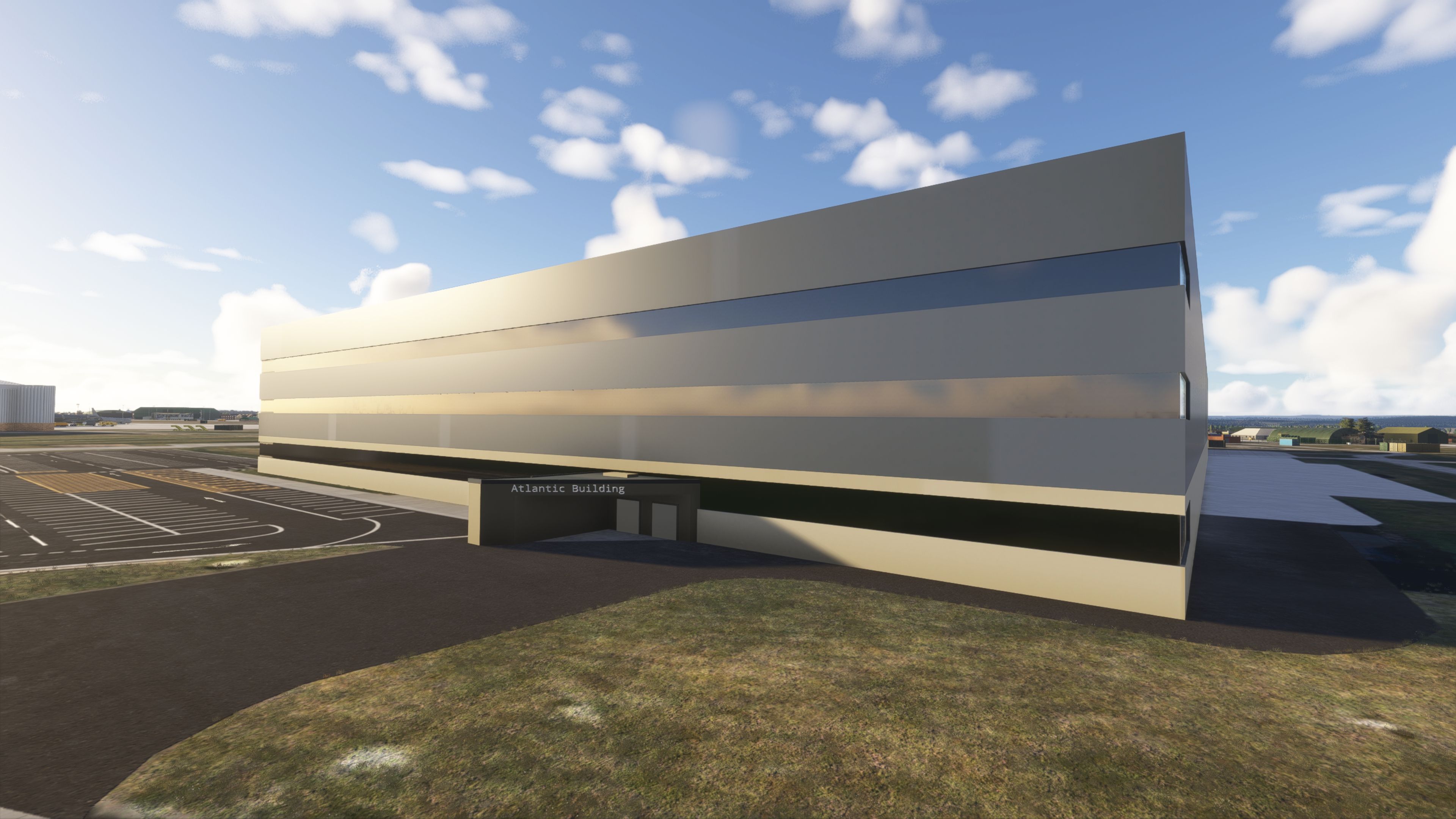
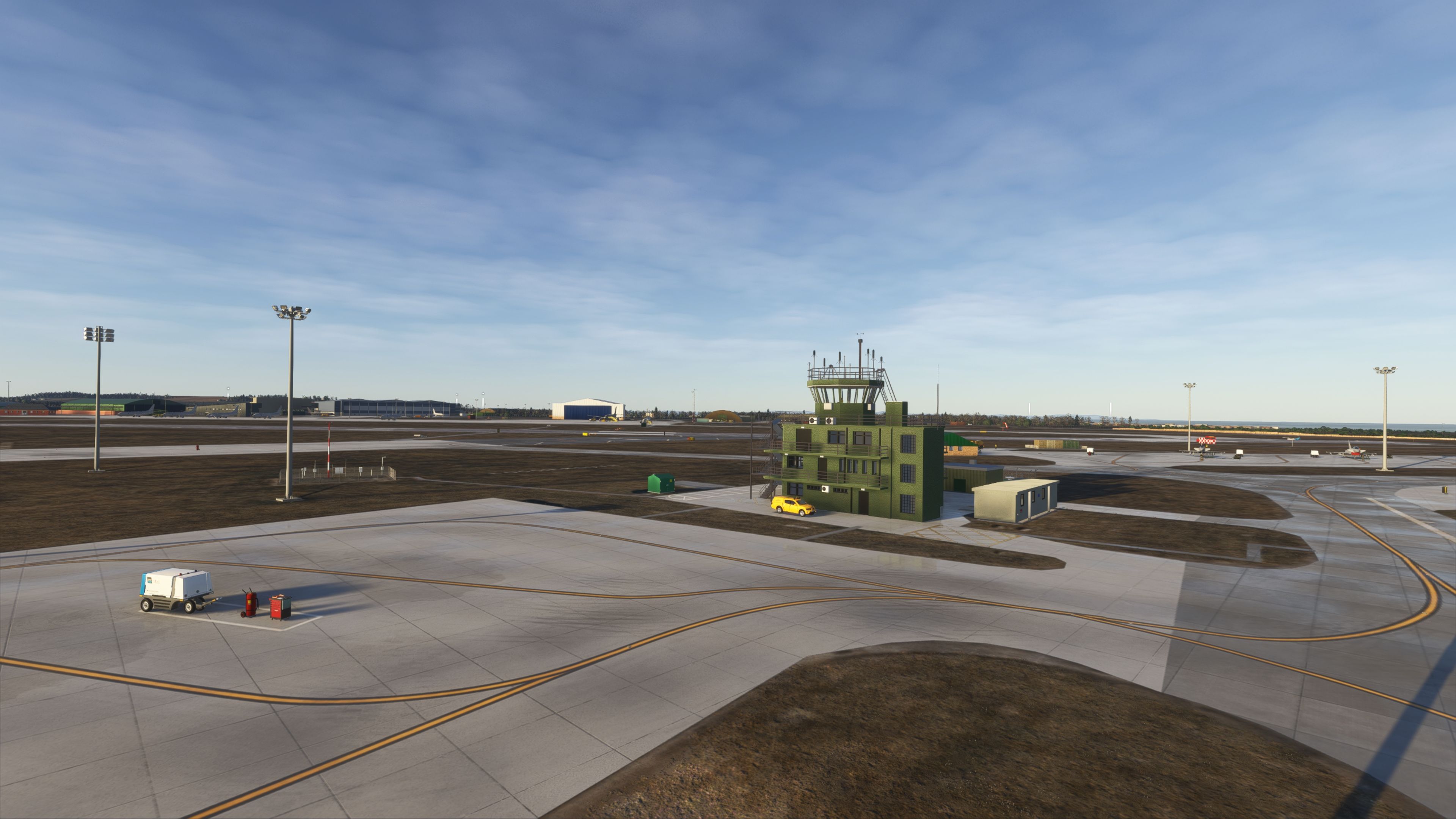
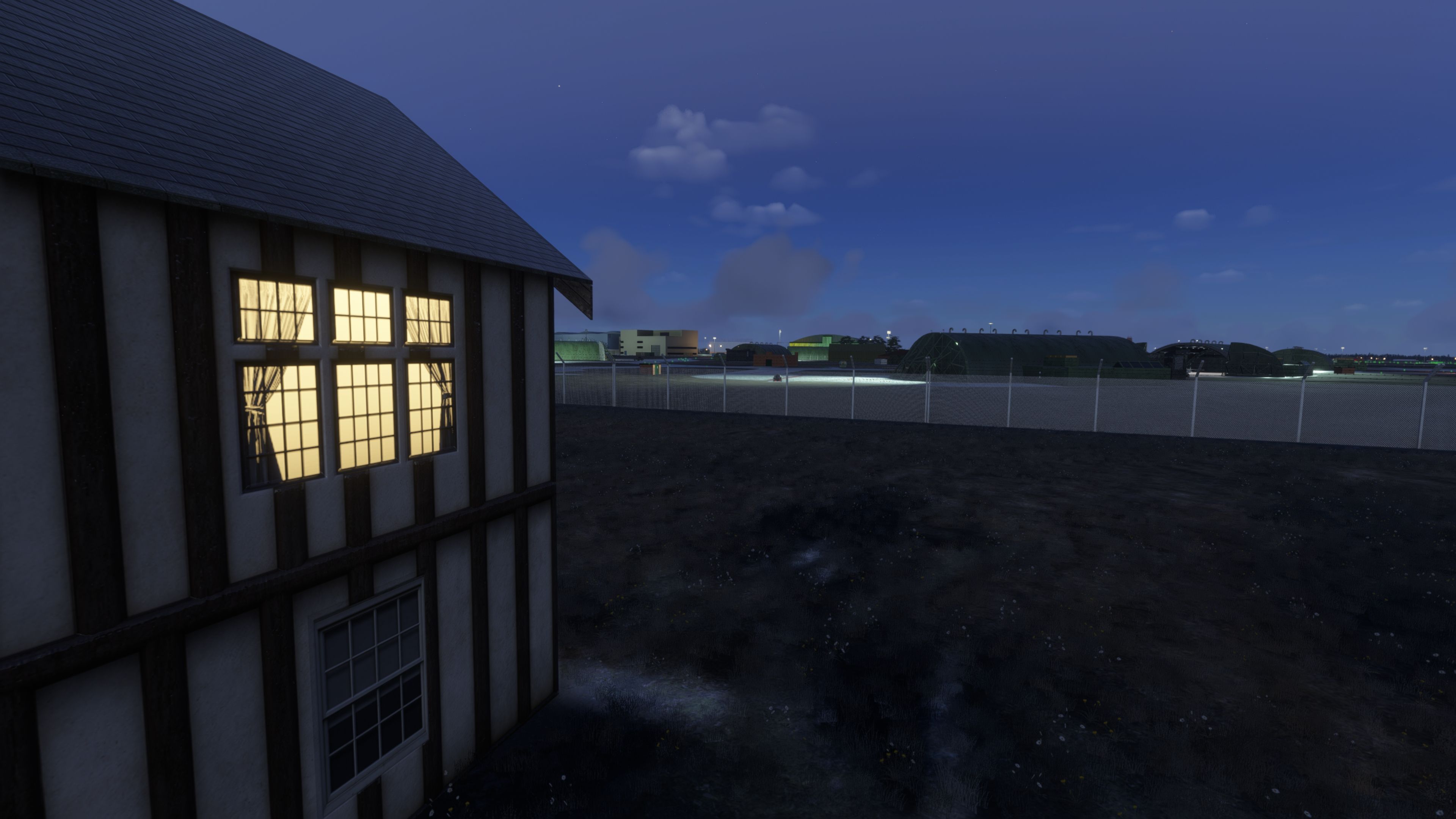
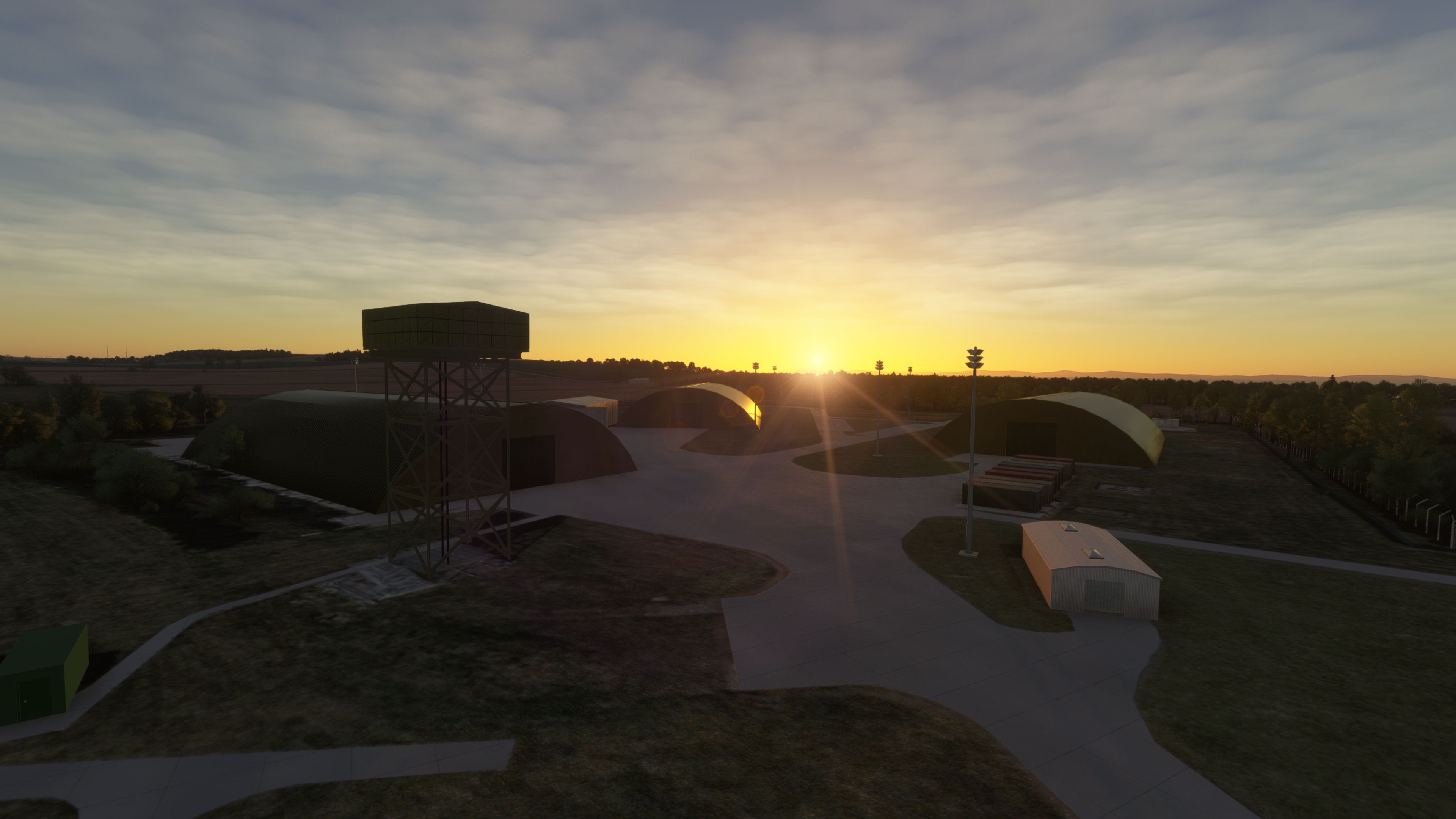
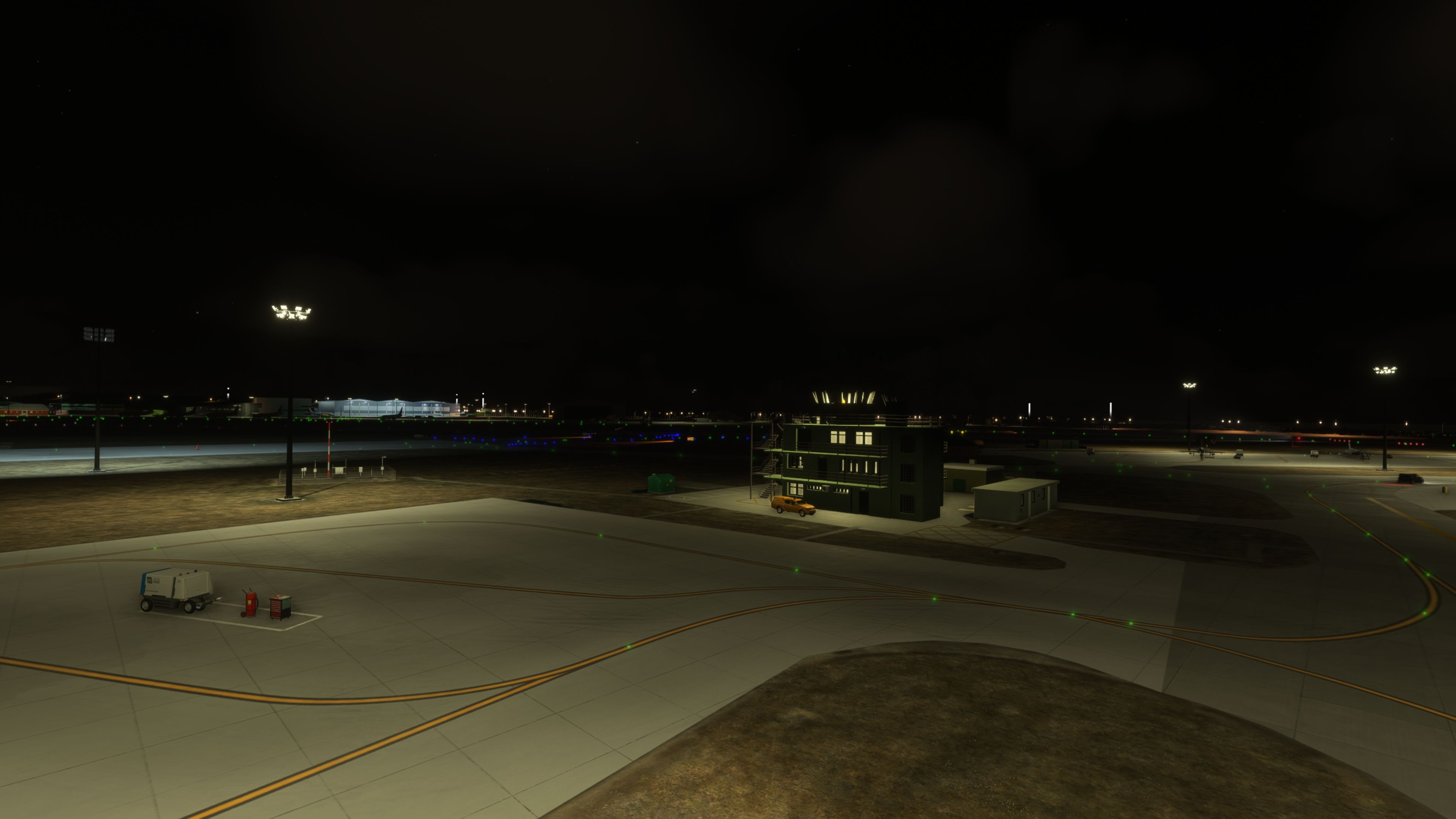
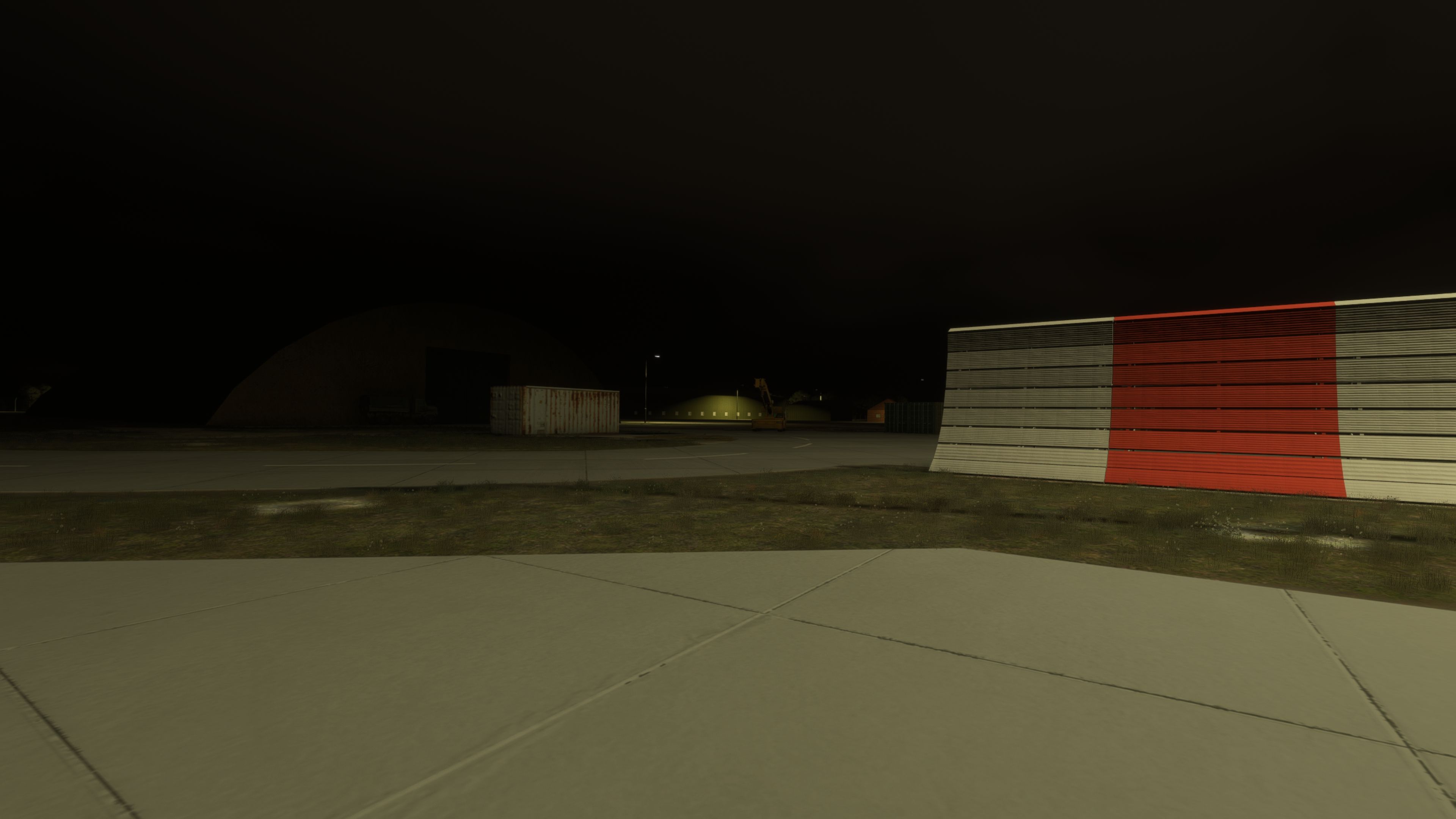
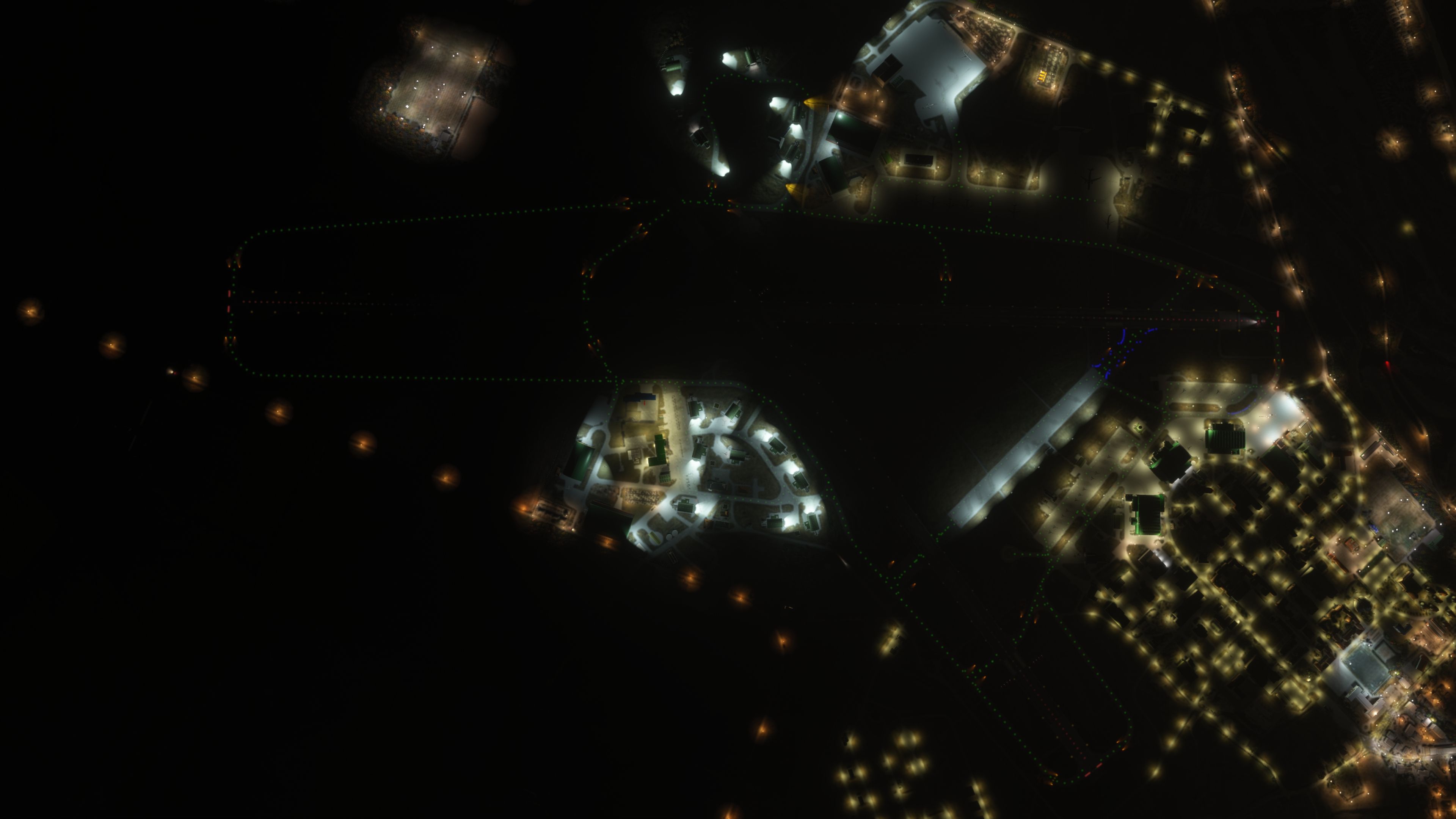
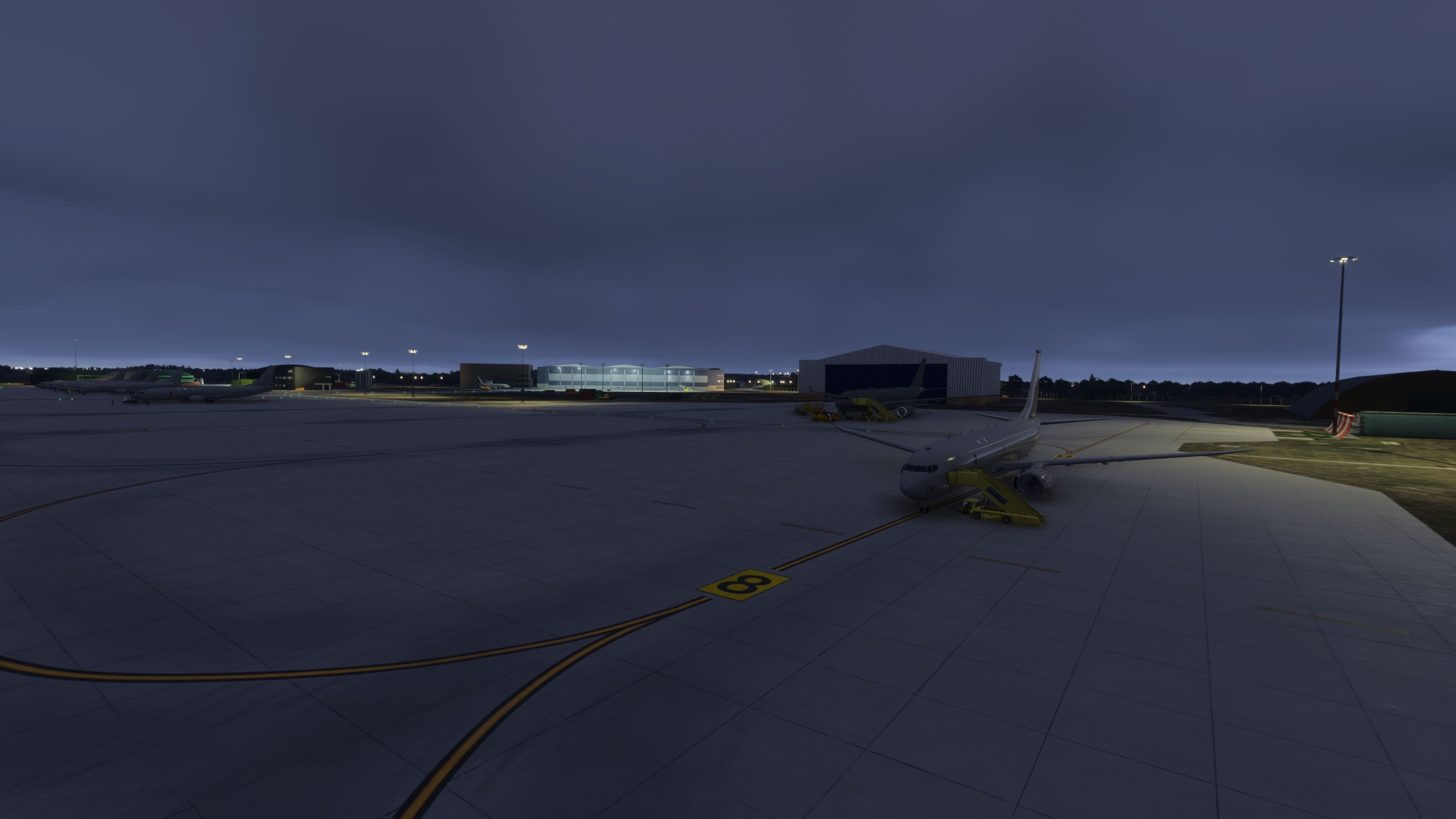
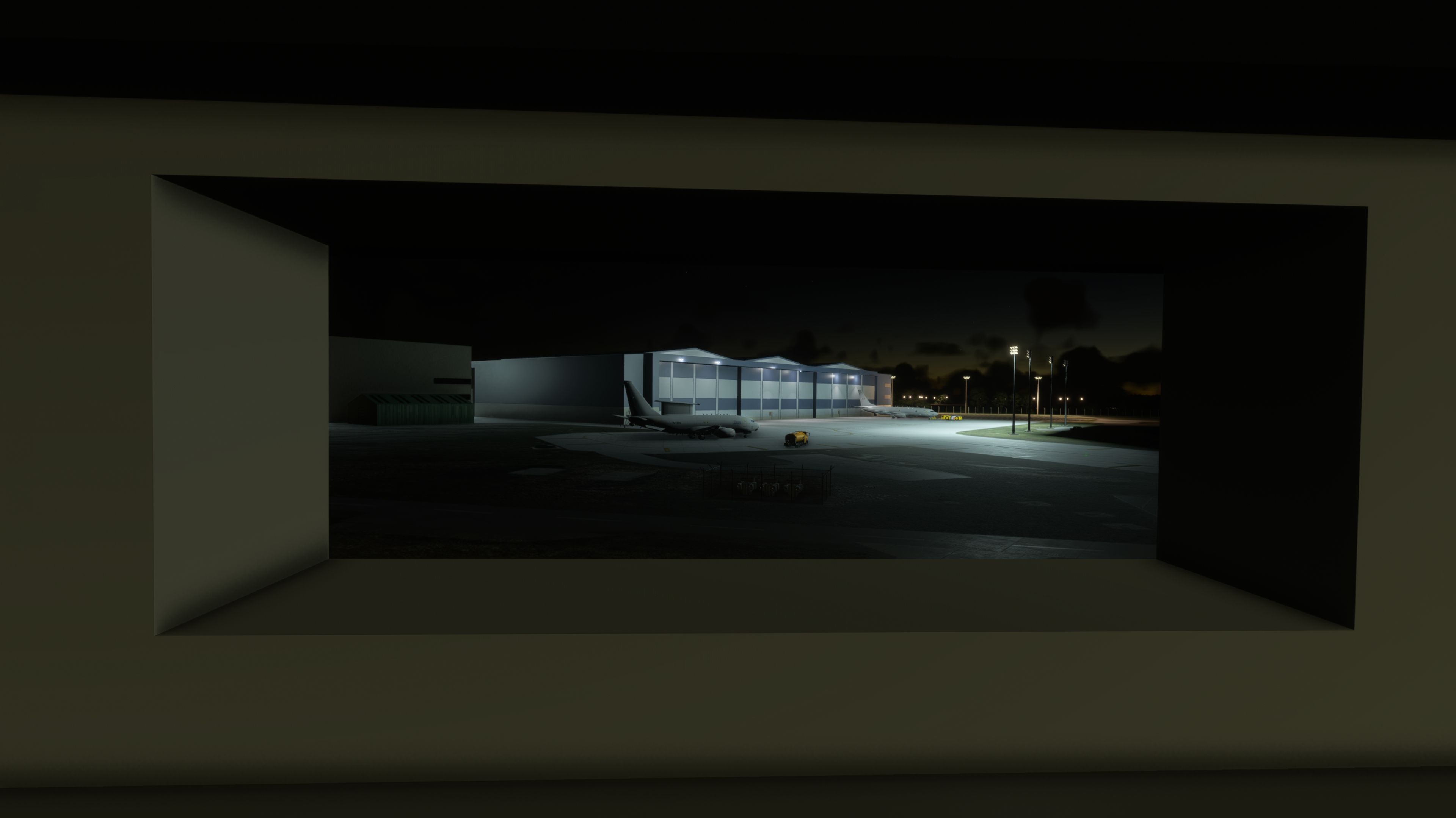
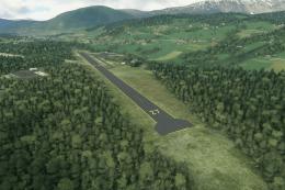
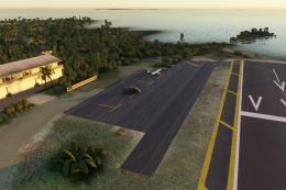
Situated on Scotland’s north-east coast, RAF Lossiemouth supports Quick Reaction Alert and North Atlantic maritime patrol. The scenery reflects the contemporary station arrangement across both principal runways (05/23 and 10/28), incorporating the Poseidon MRA1 facilities on the south side and newly modeled squadron areas. Landmark structures—the church beyond the perimeter, the water tower, and the ATC—anchor VFR orientation in the circuit when coastal weather rolls in off the Moray Firth.

Notable Enhancements and Technical Detail

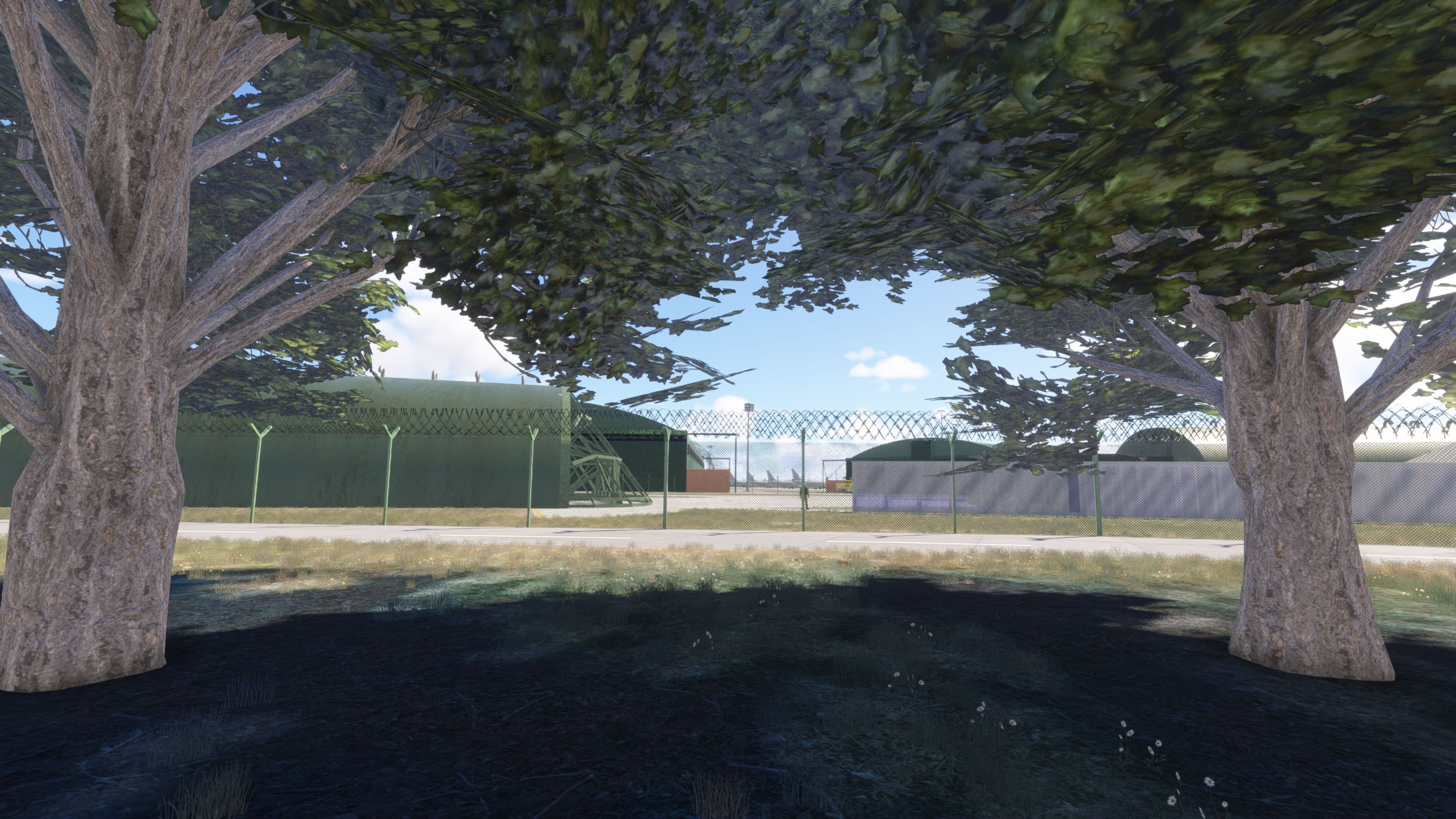
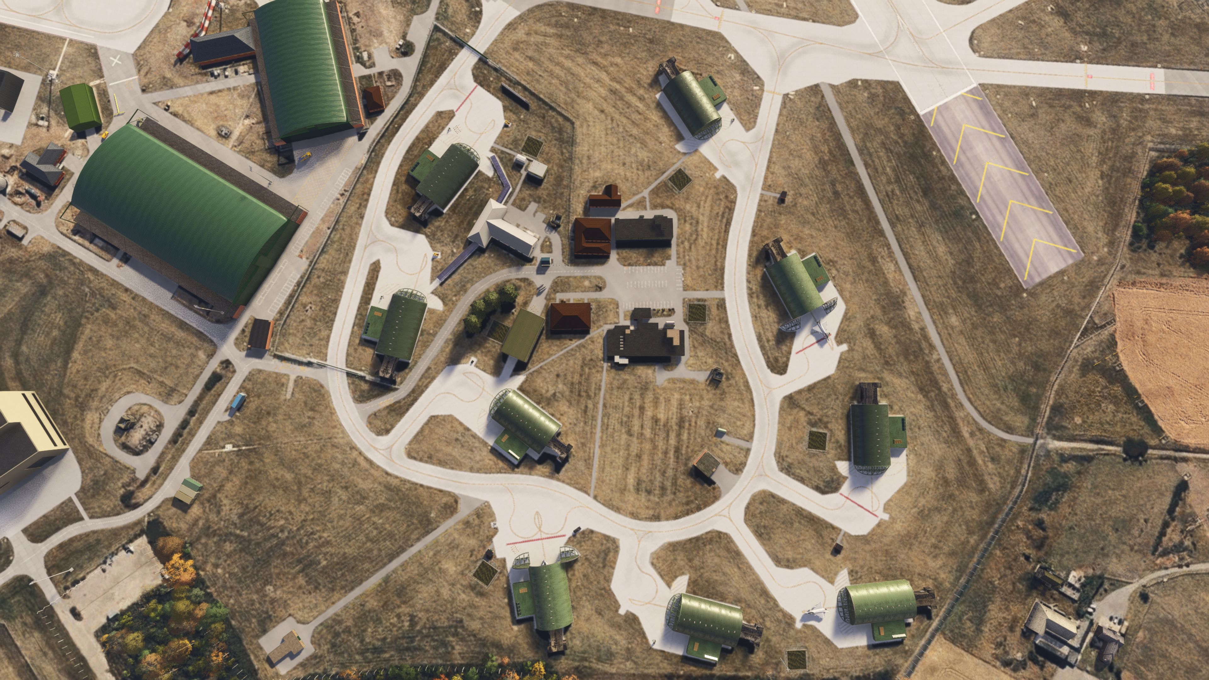
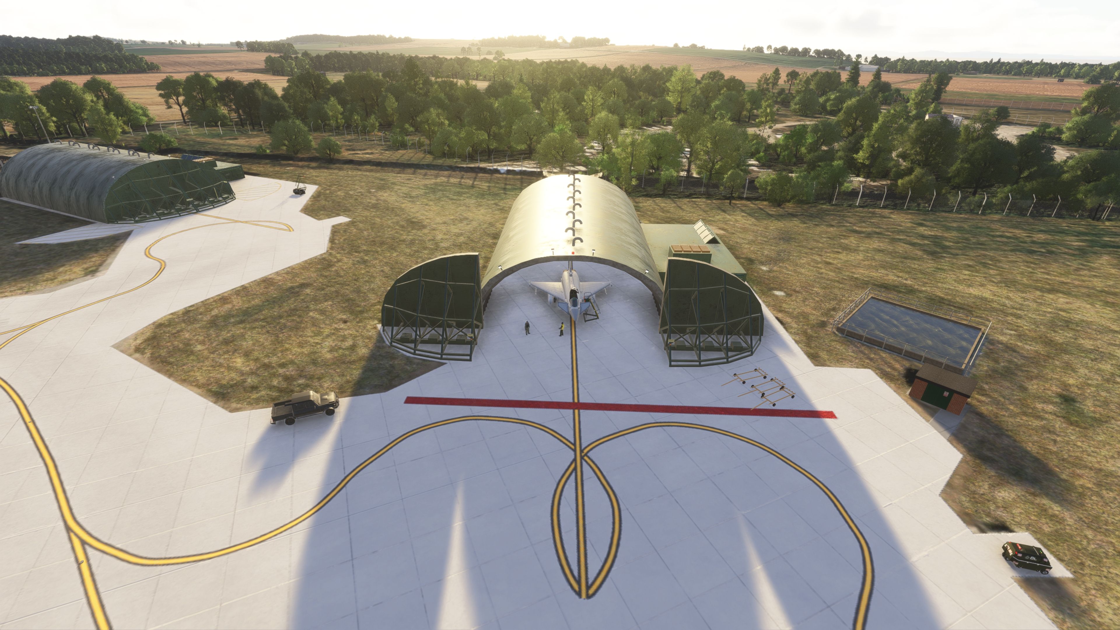
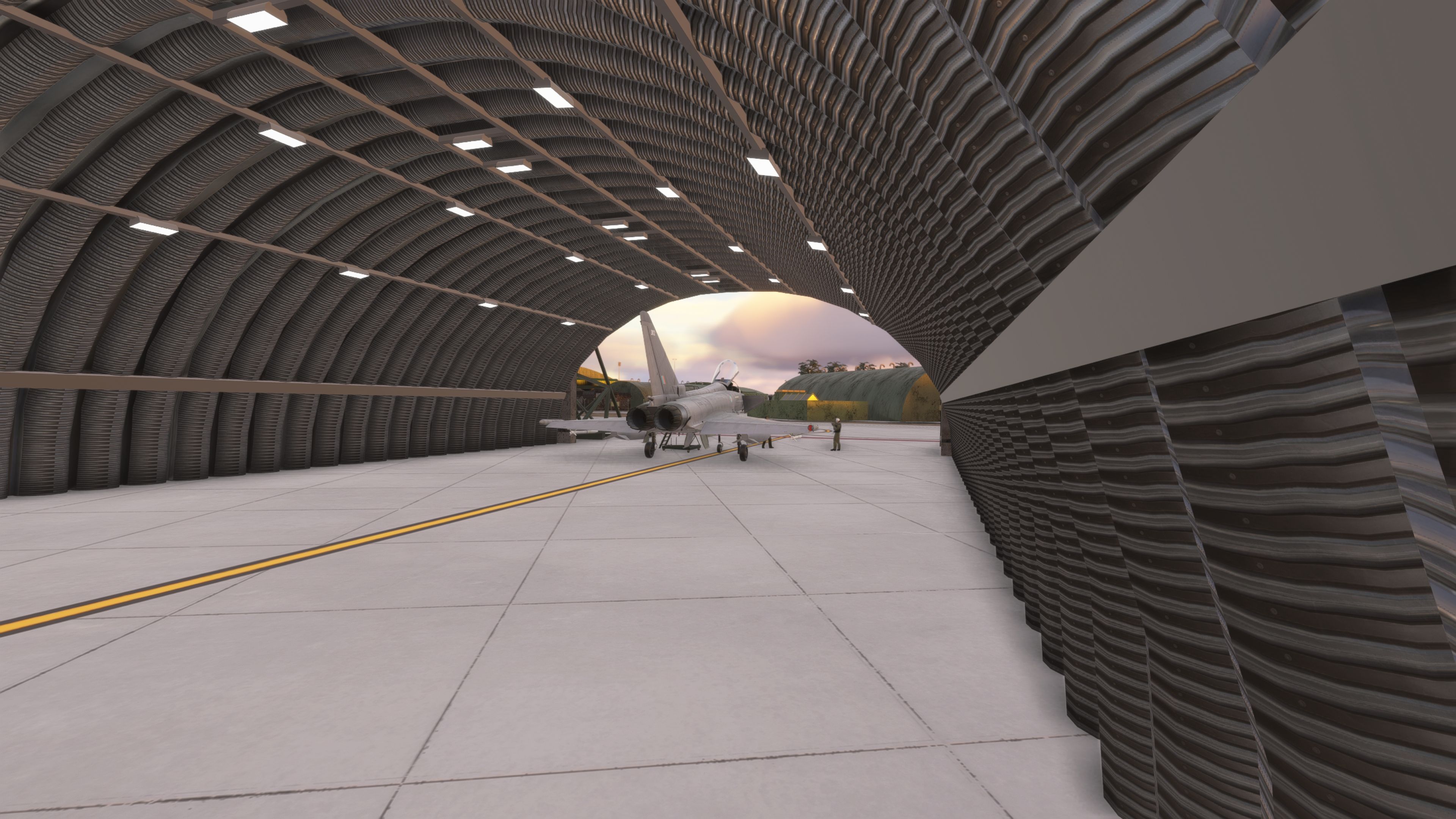
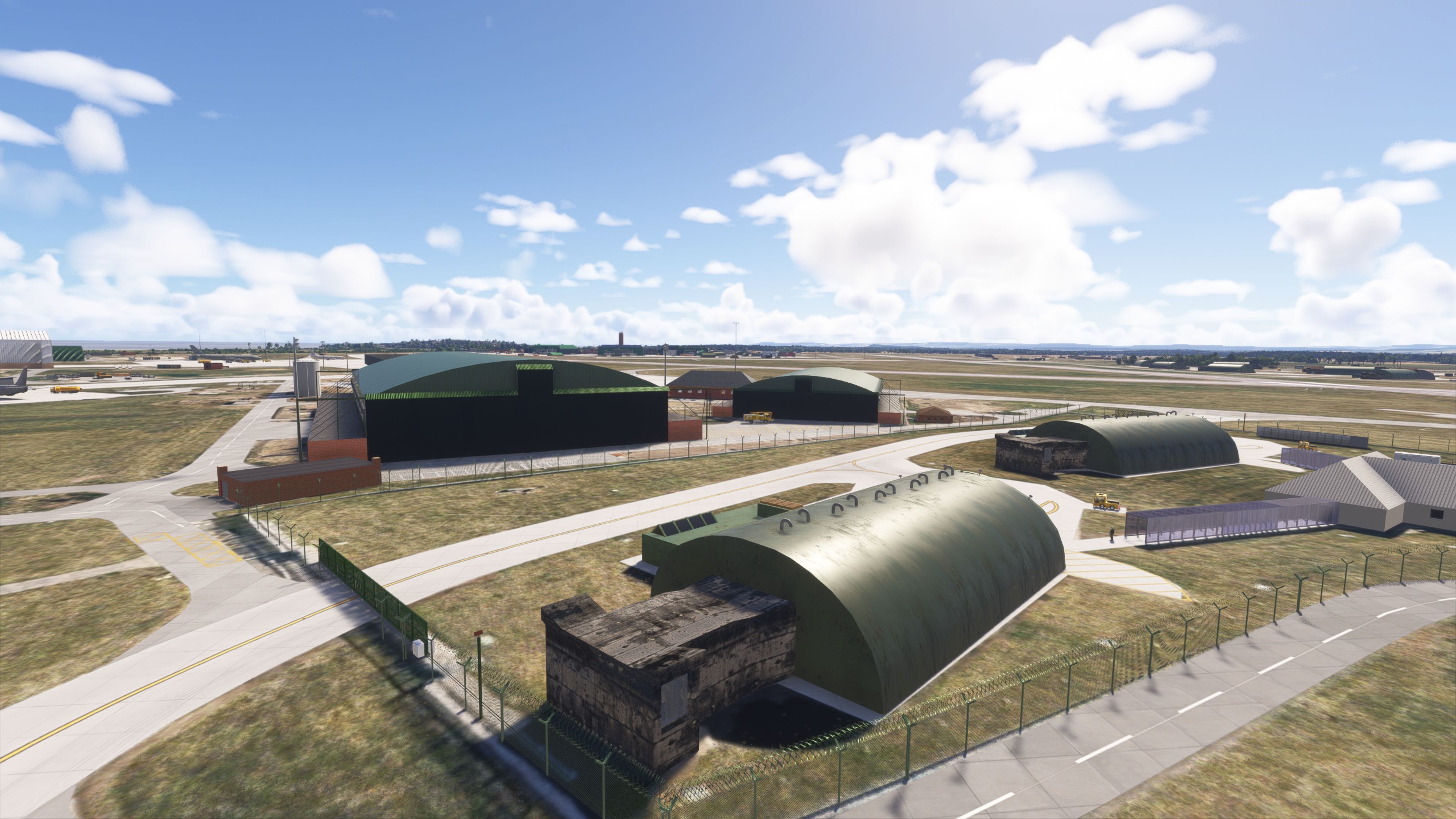
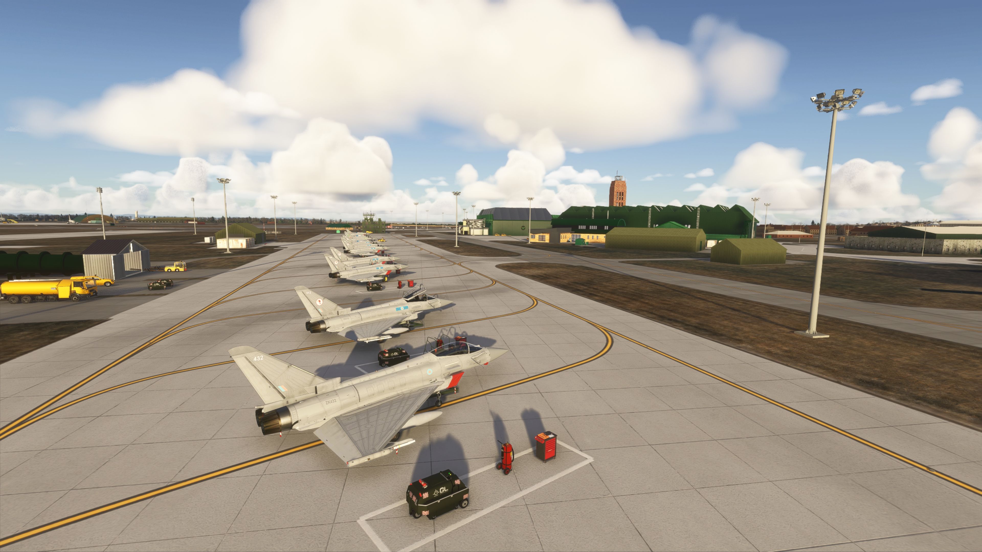
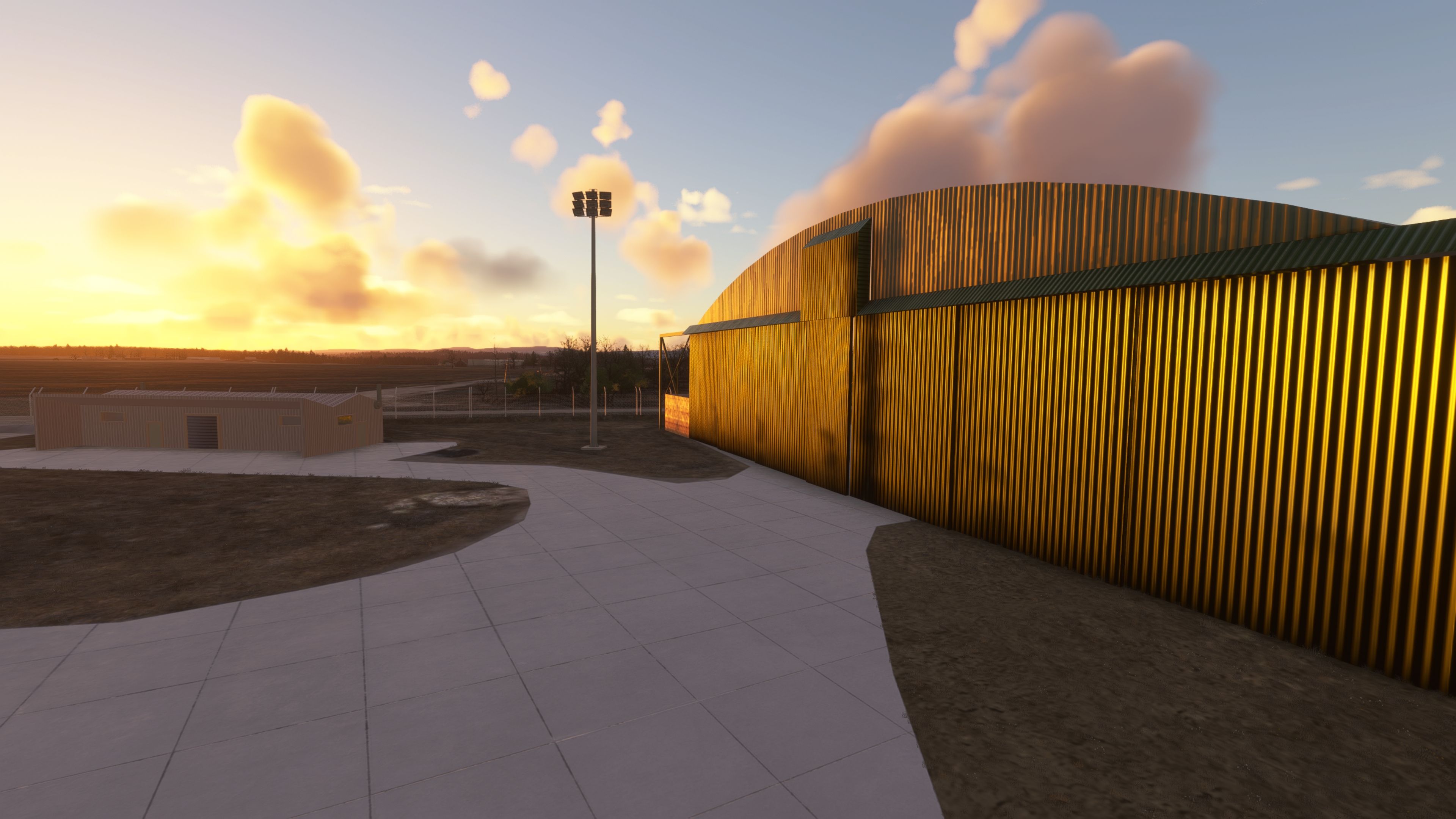
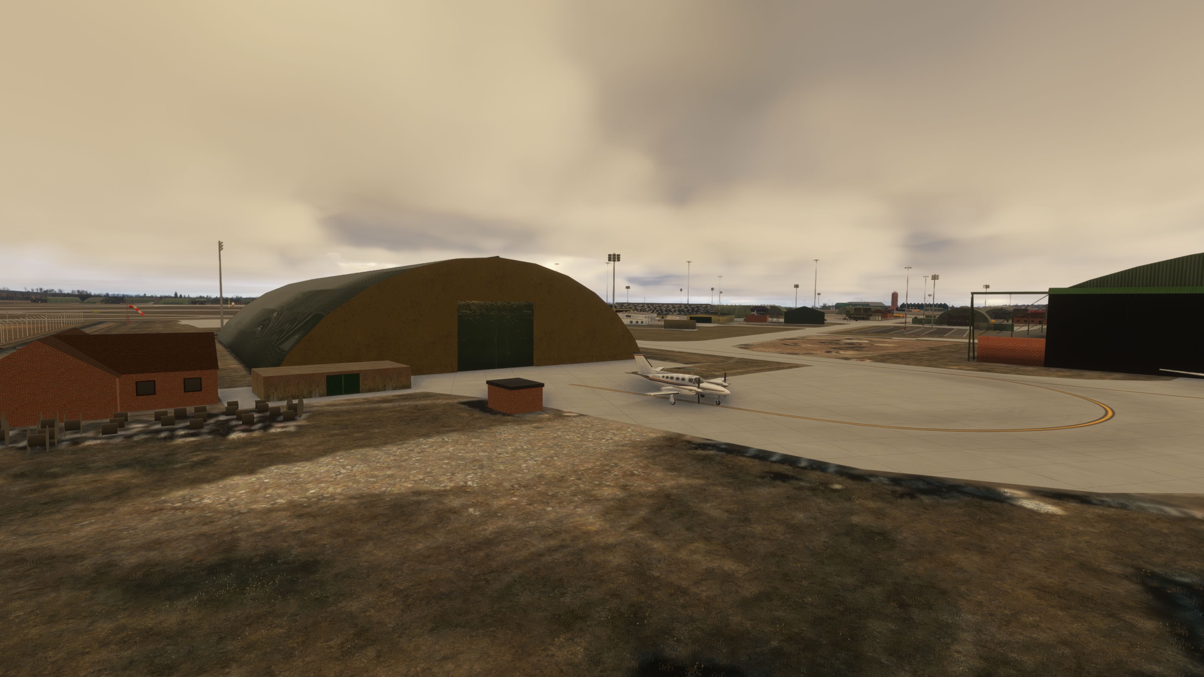
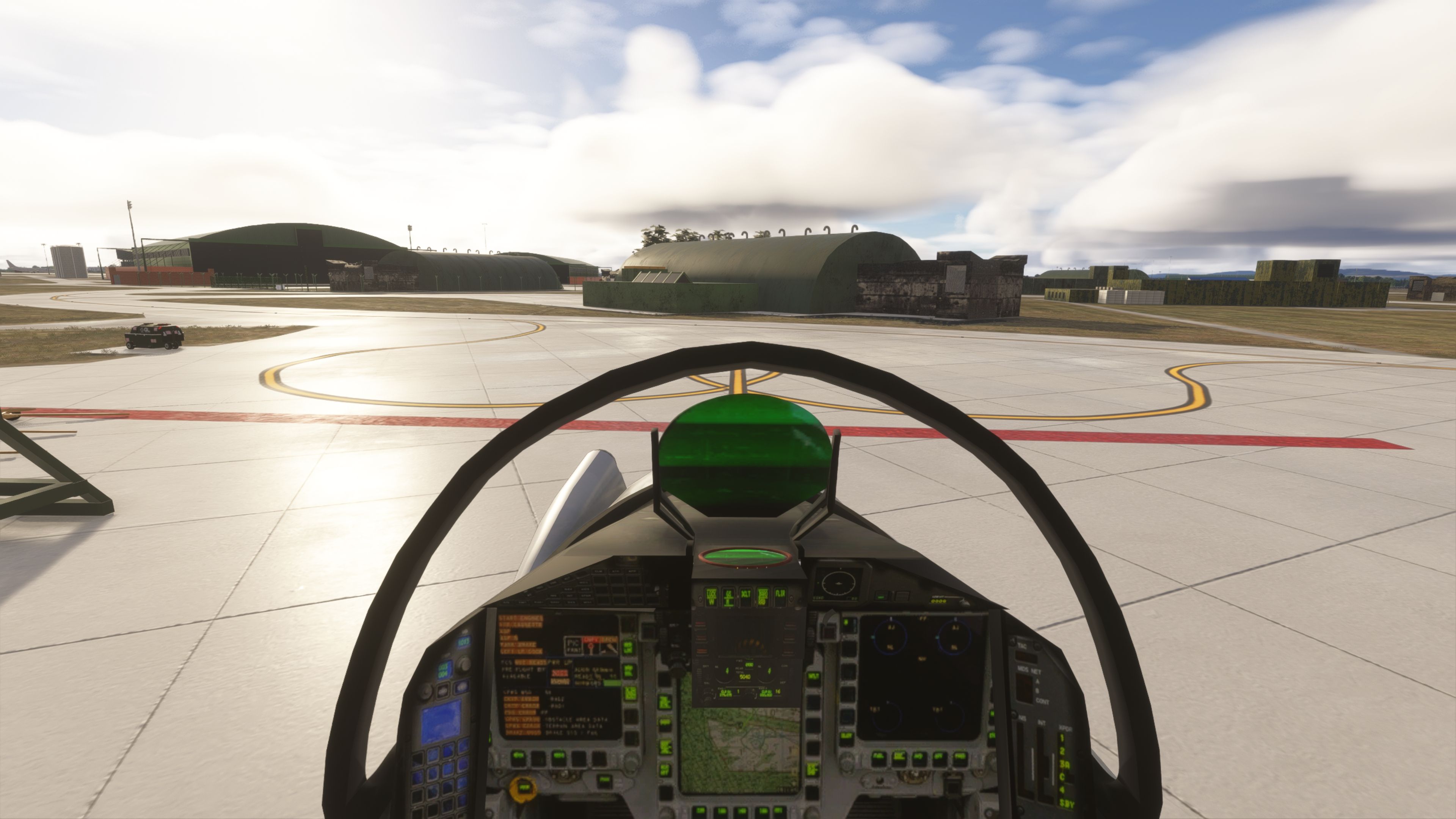
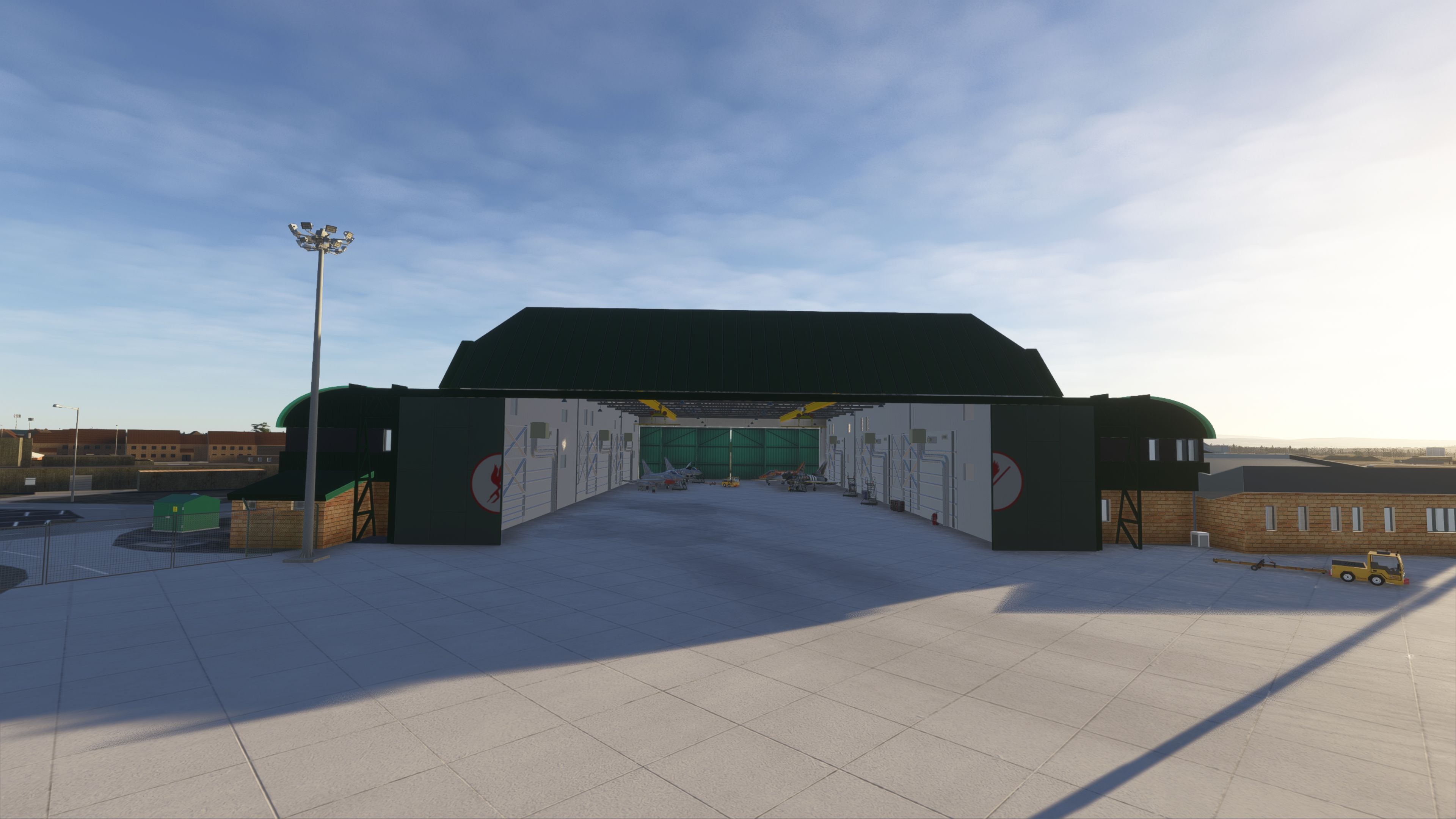
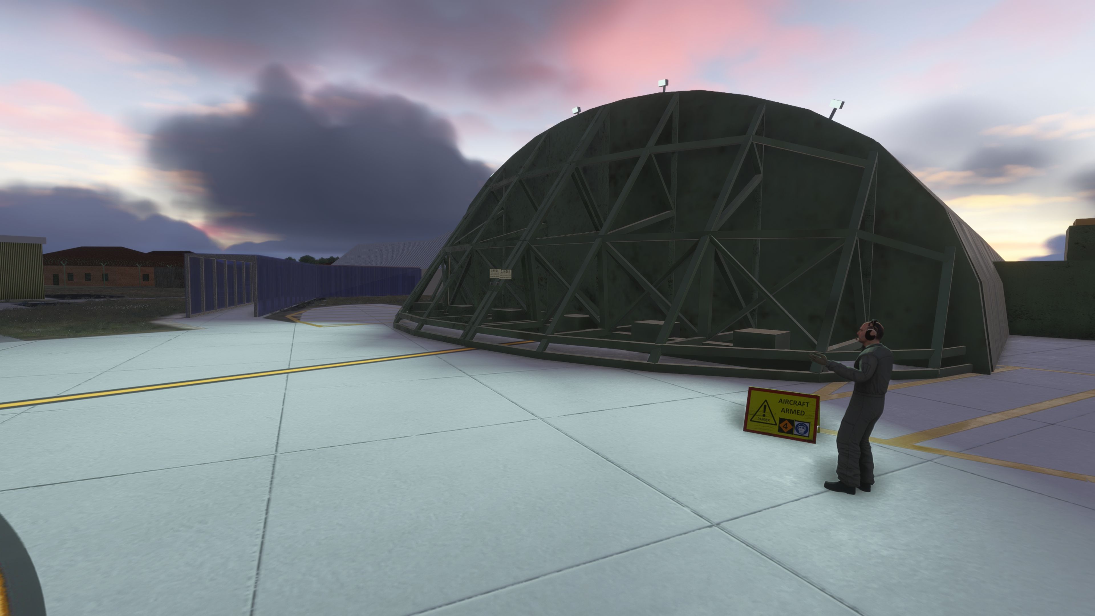
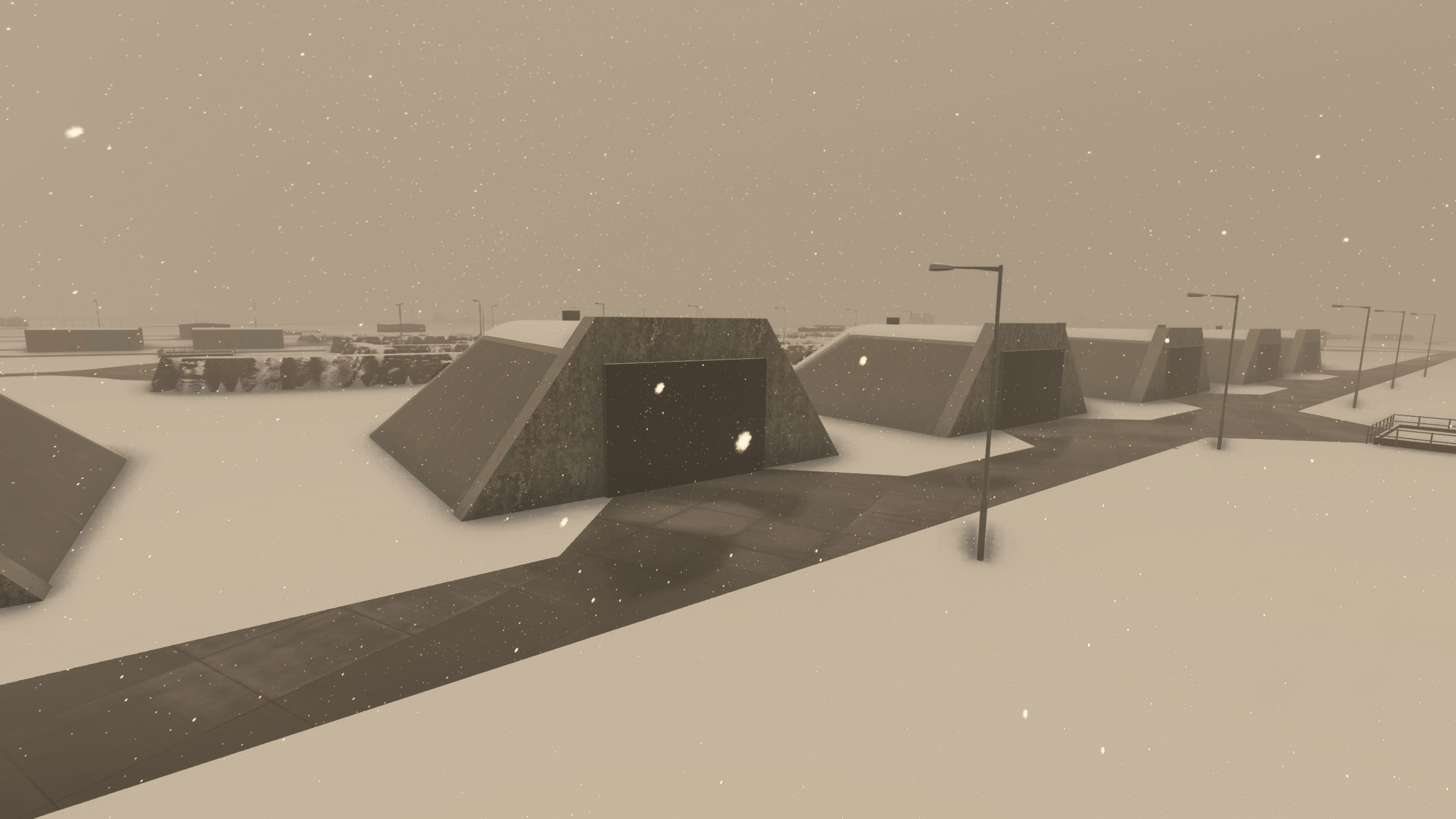
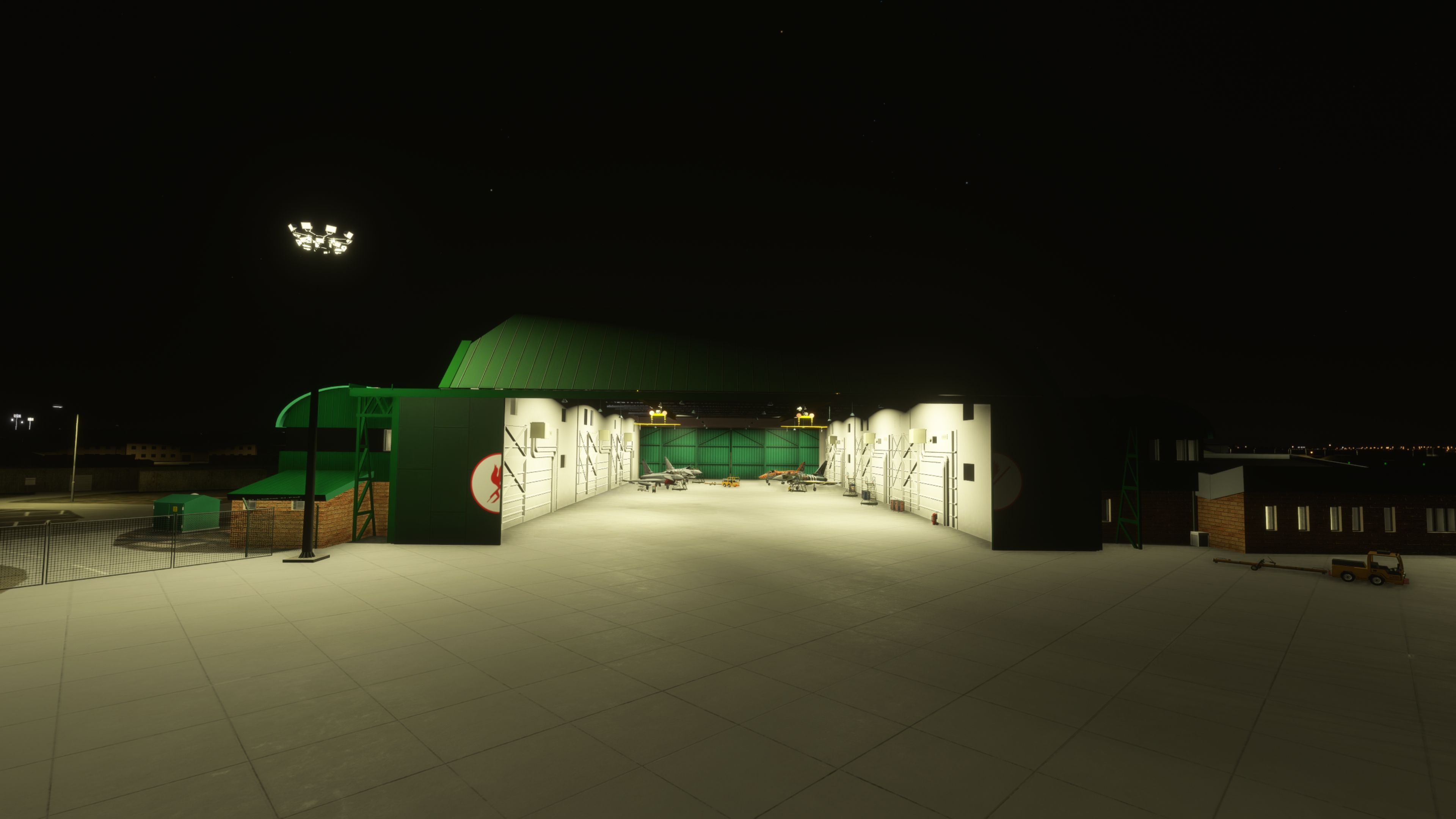
Animated HAS and Gate Logic

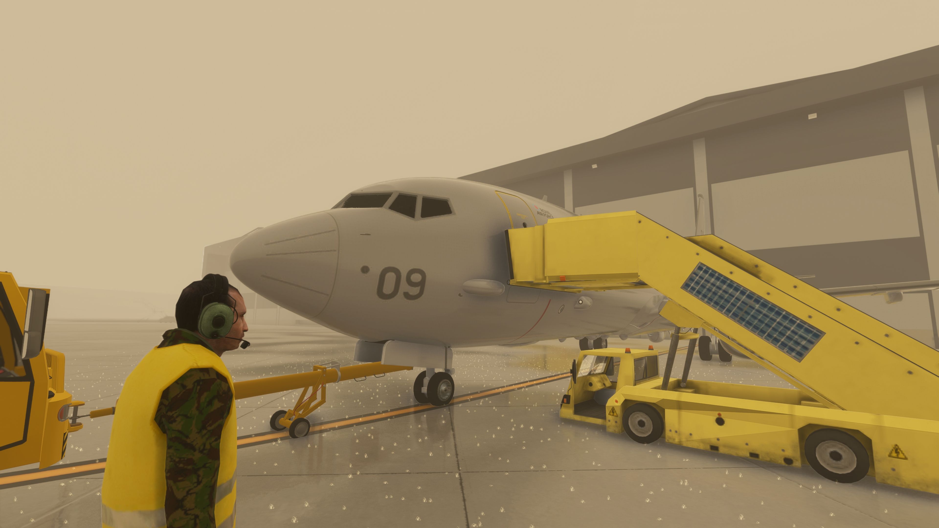
  • Proximity-based HAS [Hardened Aircraft Shelter] and gate animations authored by Sperx on base models from Nattani. Doors respond as you approach, allowing realistic shelter operations without menu-driven triggers.
  • World settings tuned to mitigate object “float” after platform updates, ensuring doors and shelters remain tied to the ground mesh.

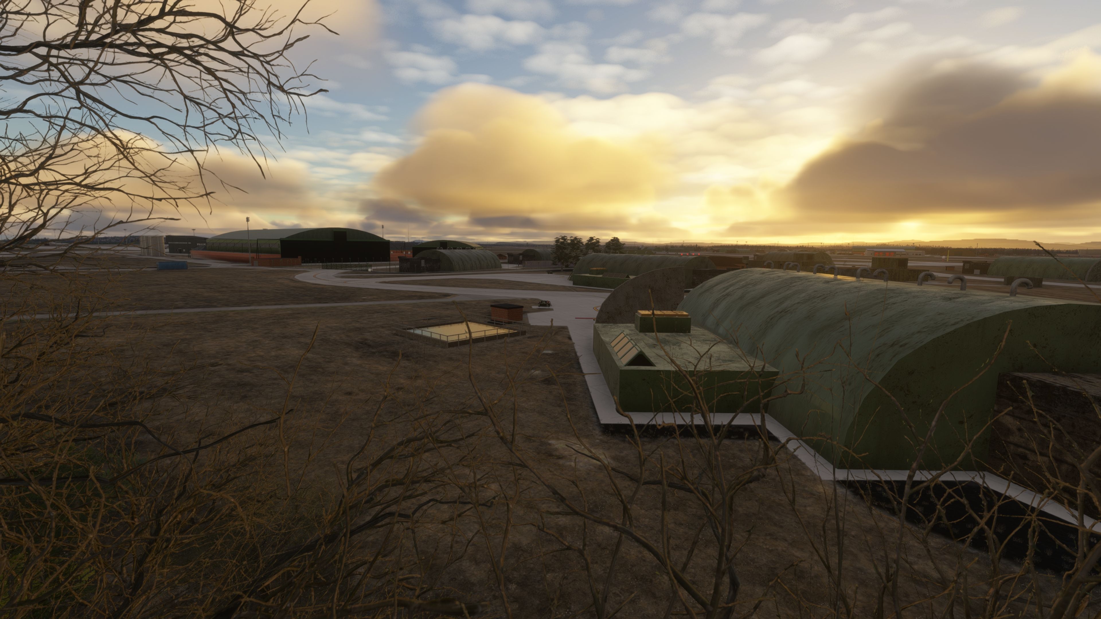
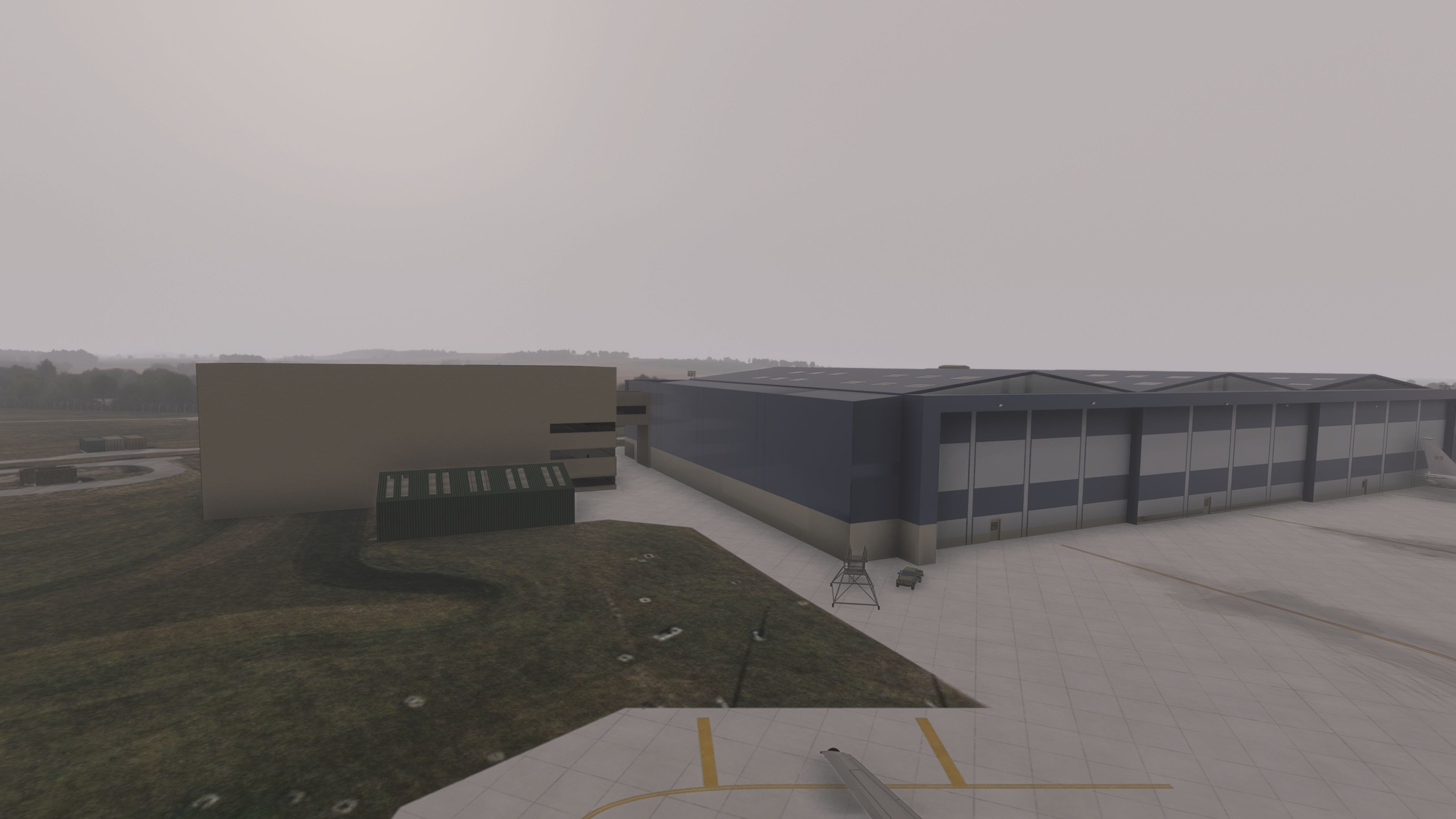
Custom Structures and Accurate Placements

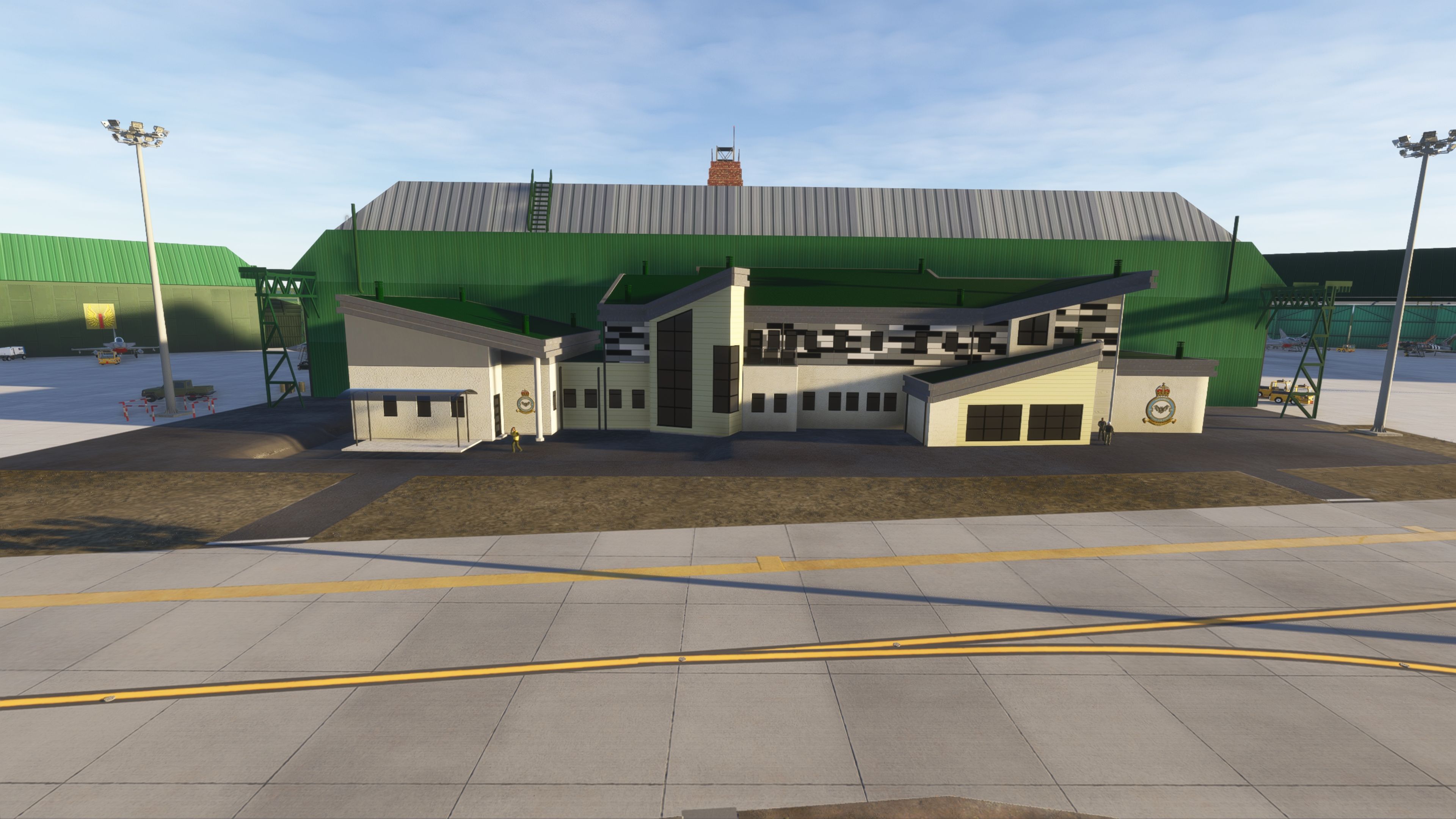
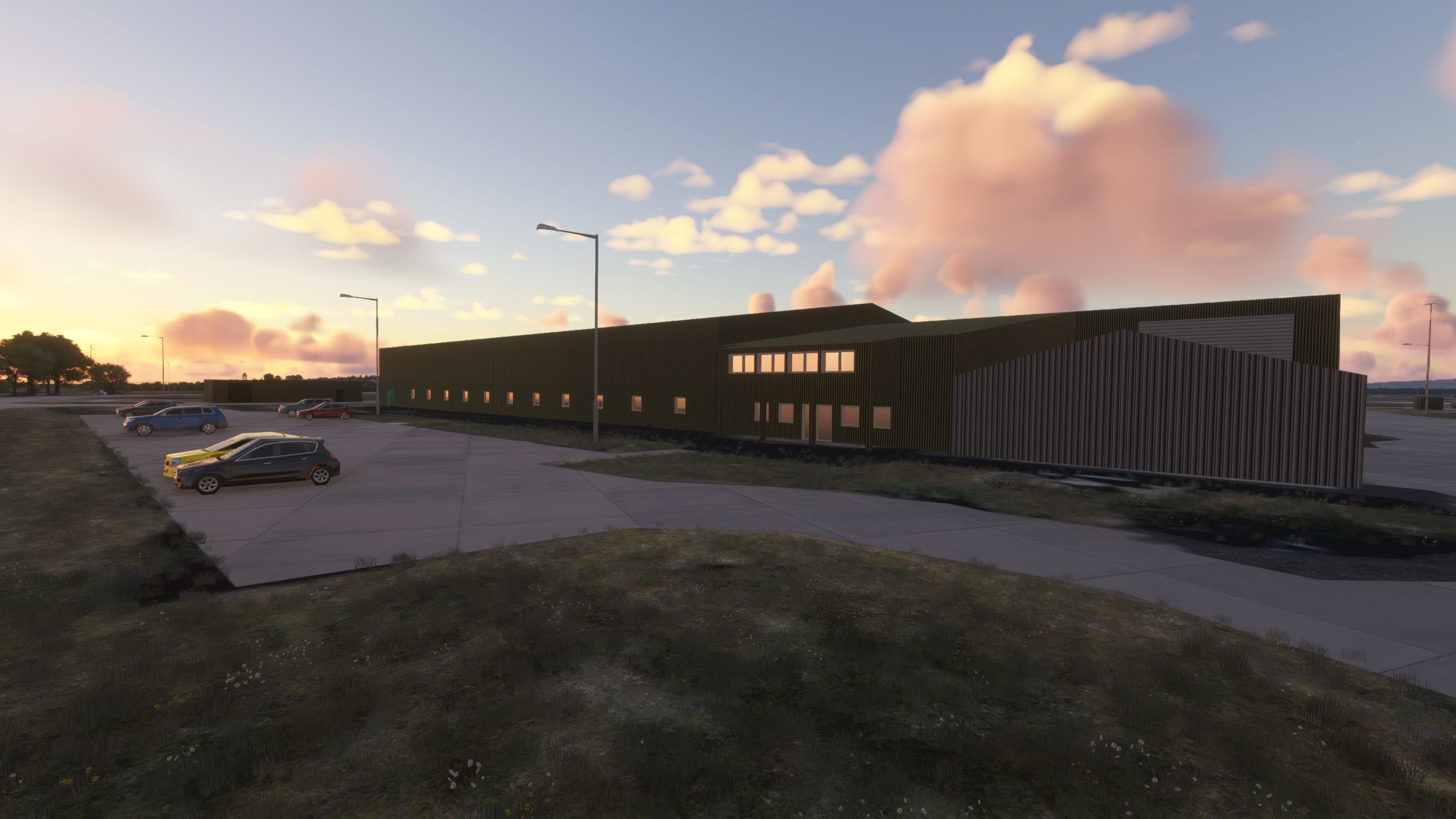
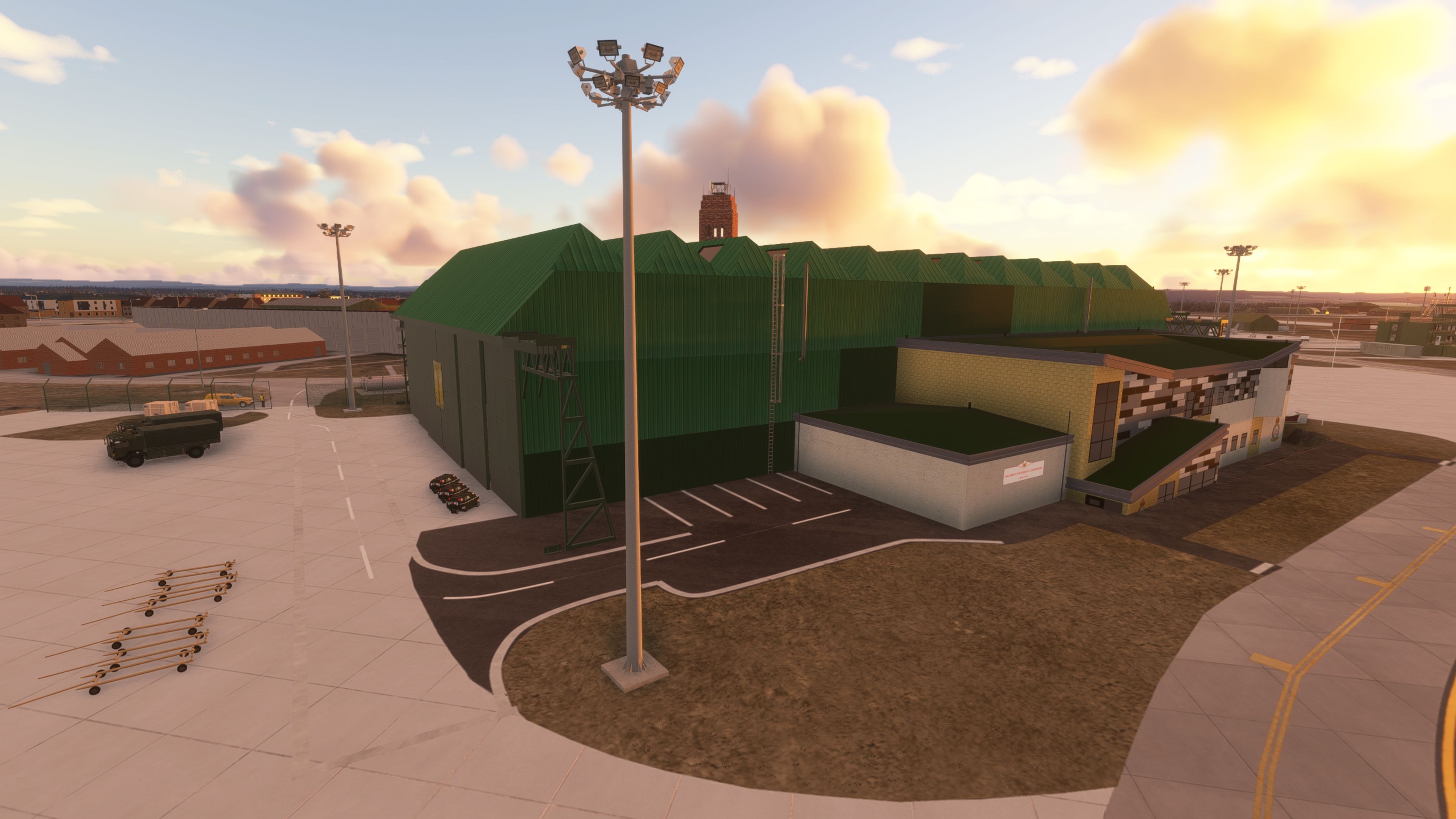
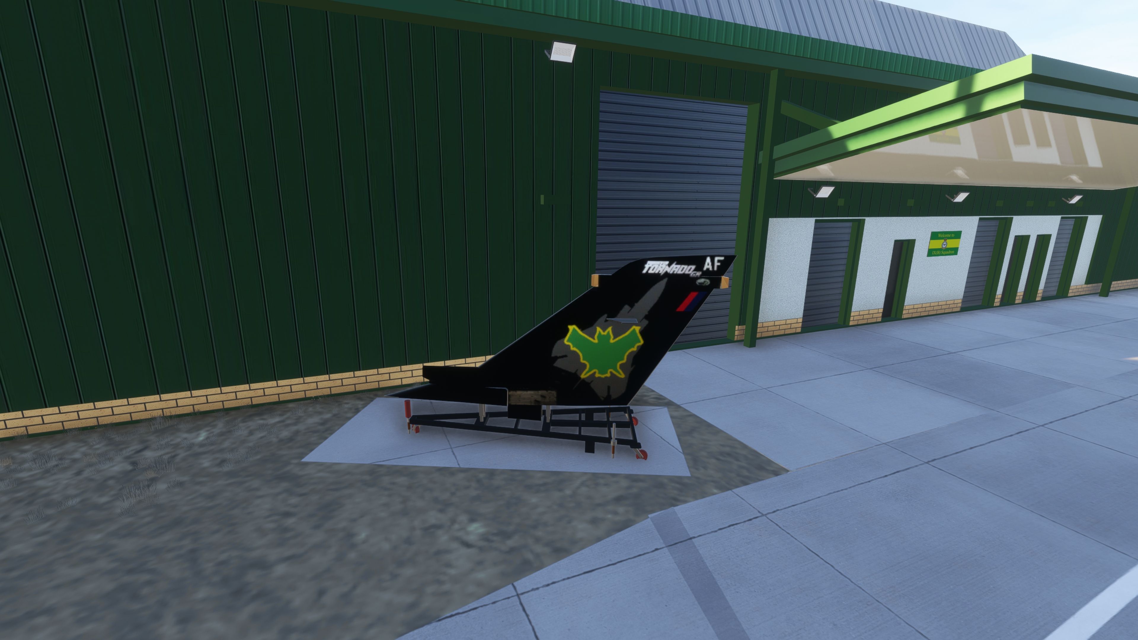
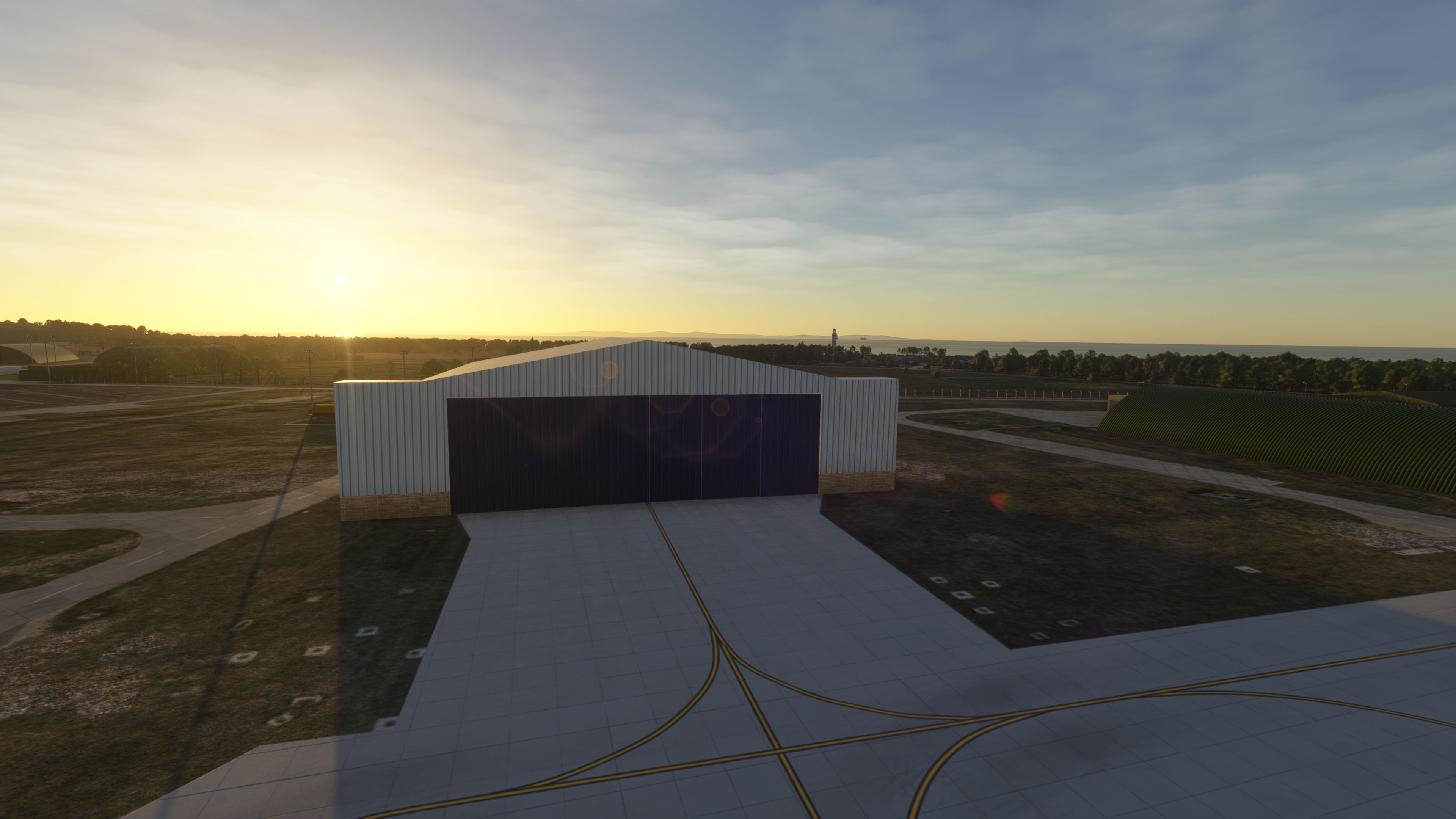
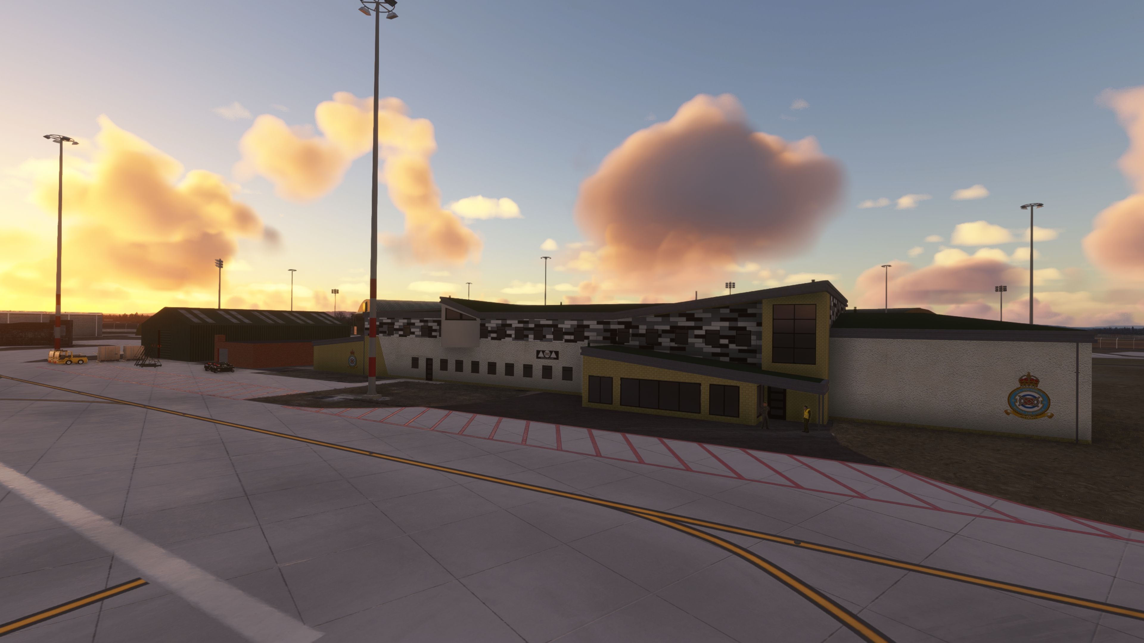
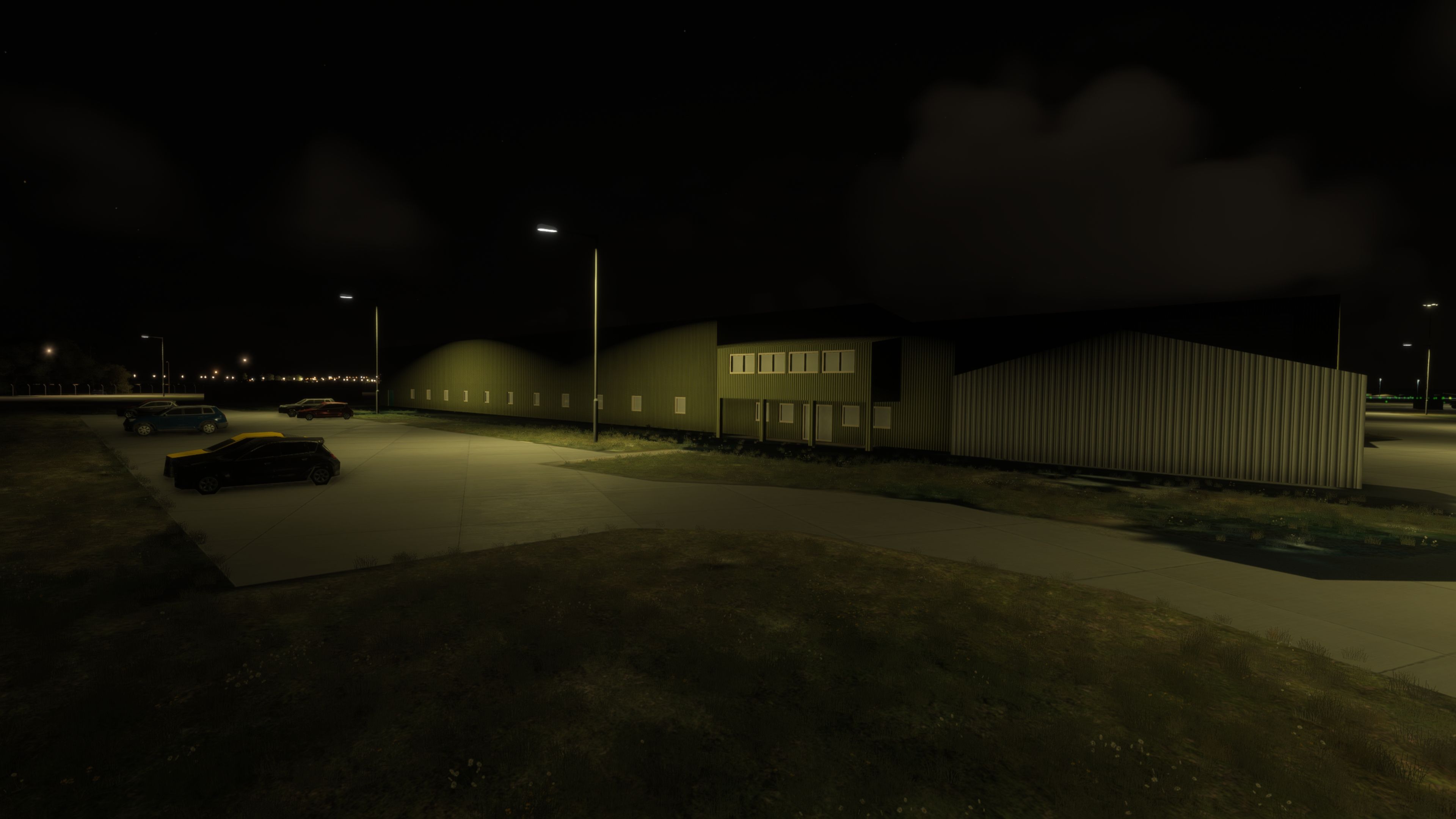
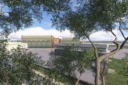
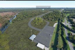
  • New squadron buildings crafted by Glynn (callsign OldFart) to reflect recent base developments.
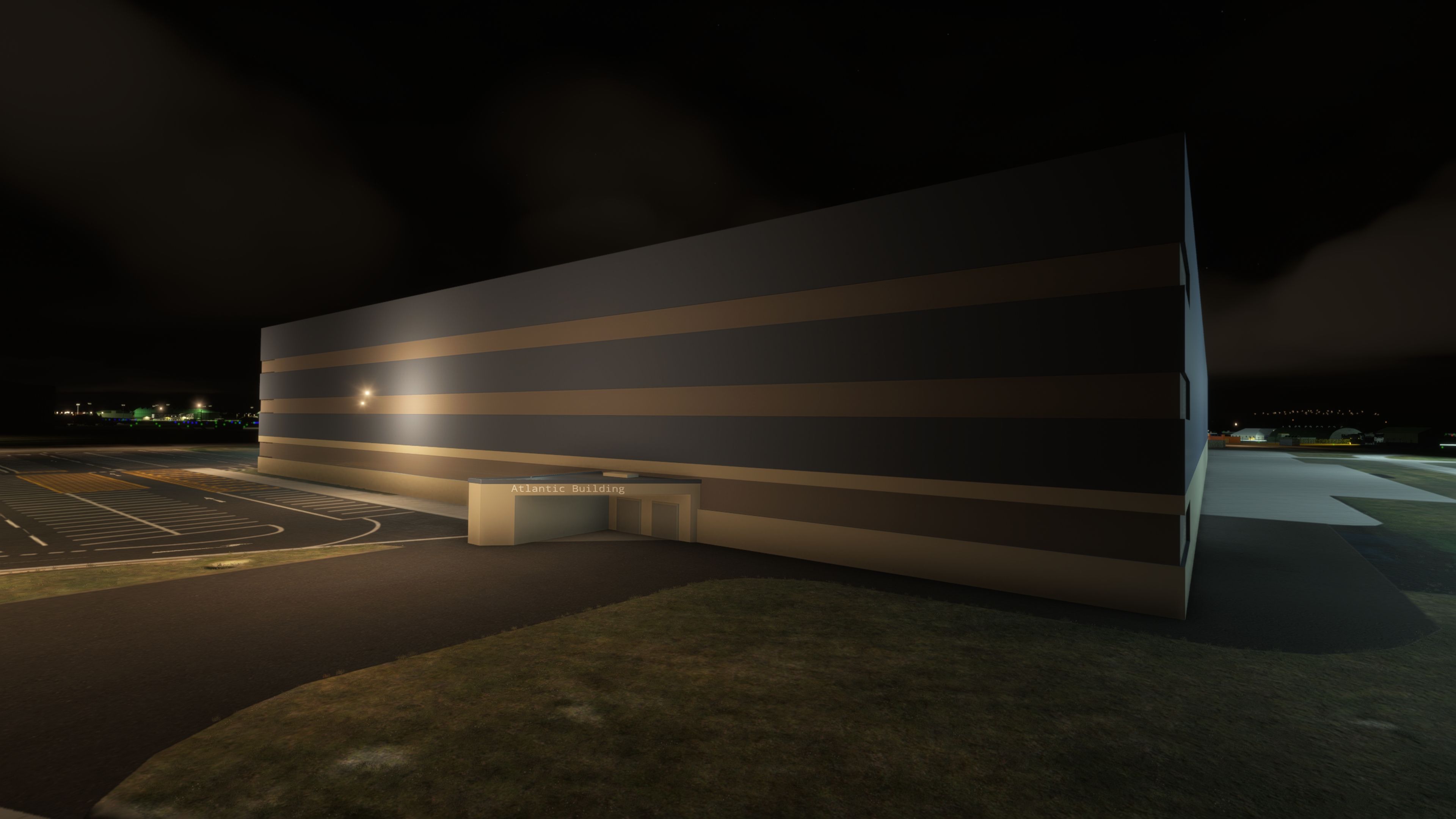
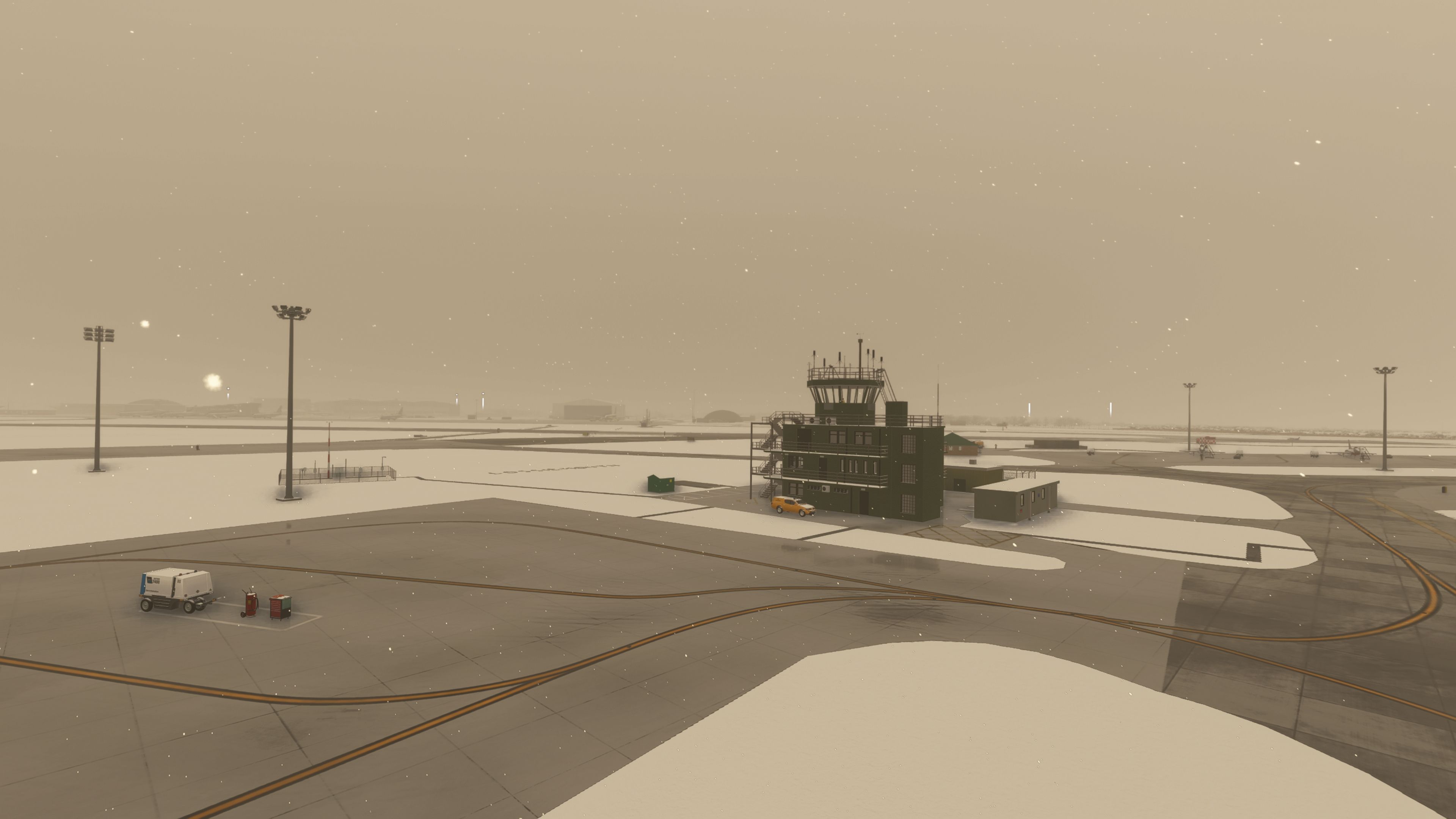
  • Extensive bespoke modeling by DeadJen, including the church, ATC tower, and water tower, delivering recognizable silhouettes for pattern work and low-vis arrivals.
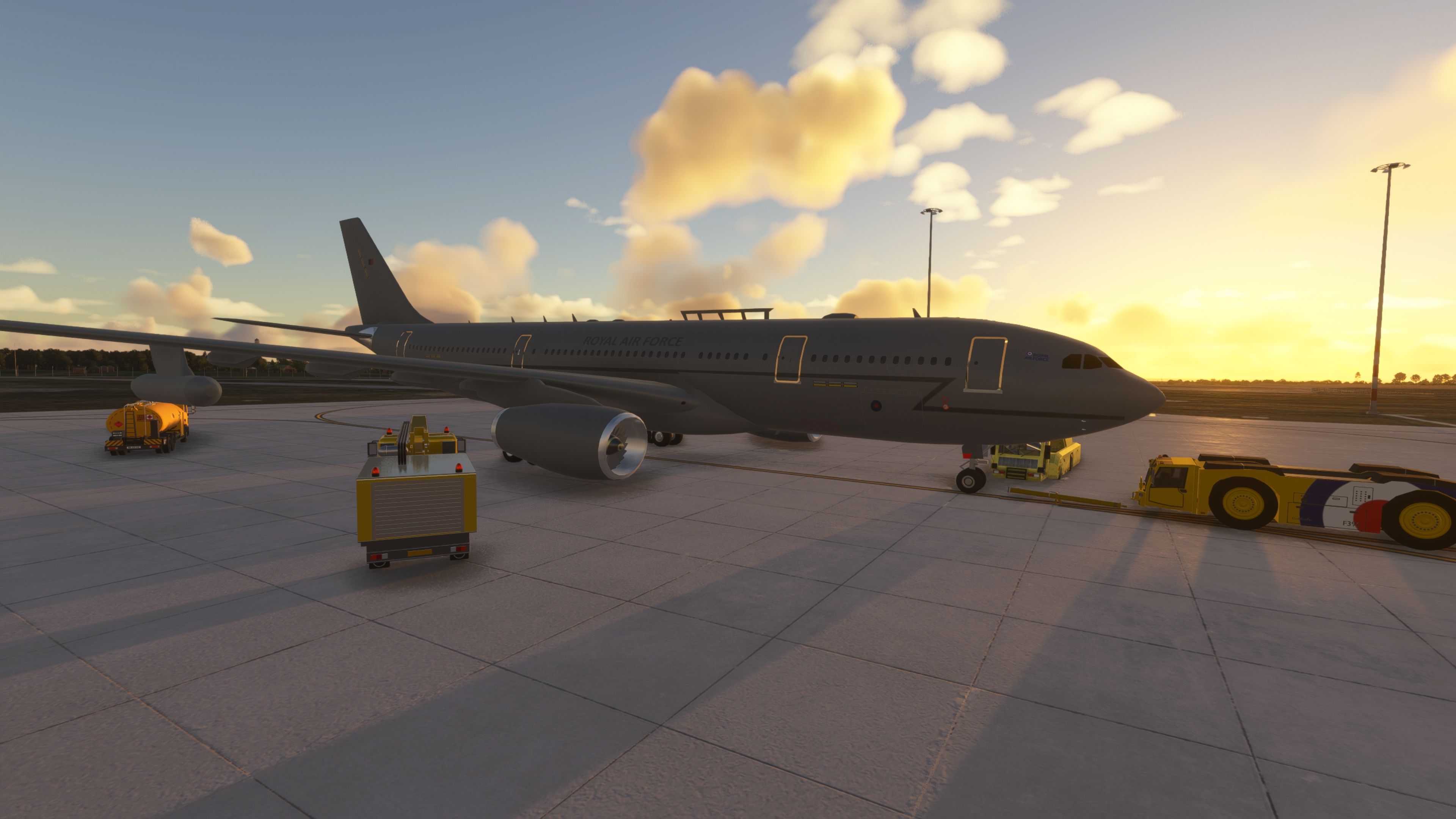
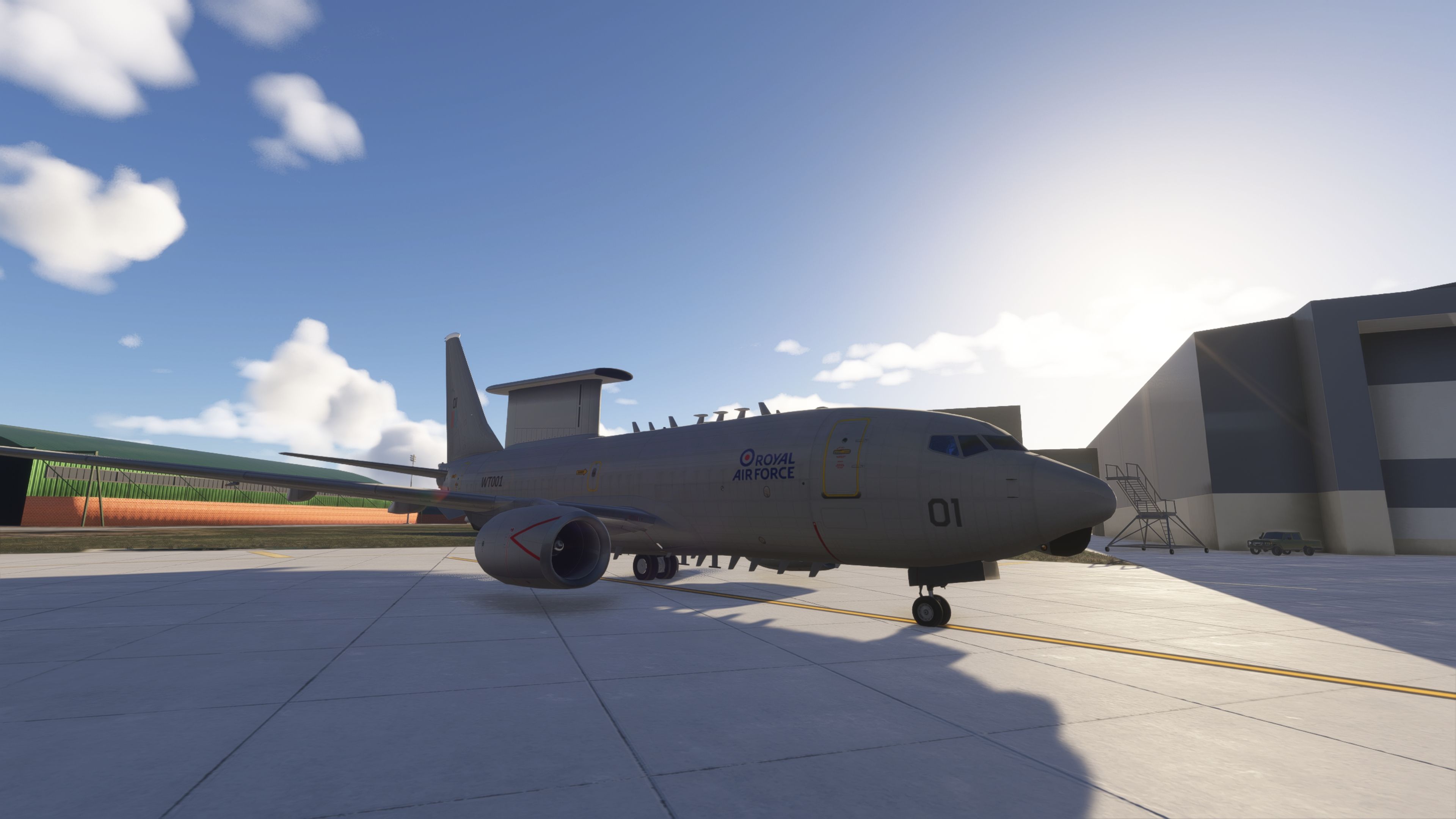
  • Childcare facility positioned just outside the wire; Wedgetail maintenance building placed to current site coordinates to support the RAF’s E-7 AEW transition.

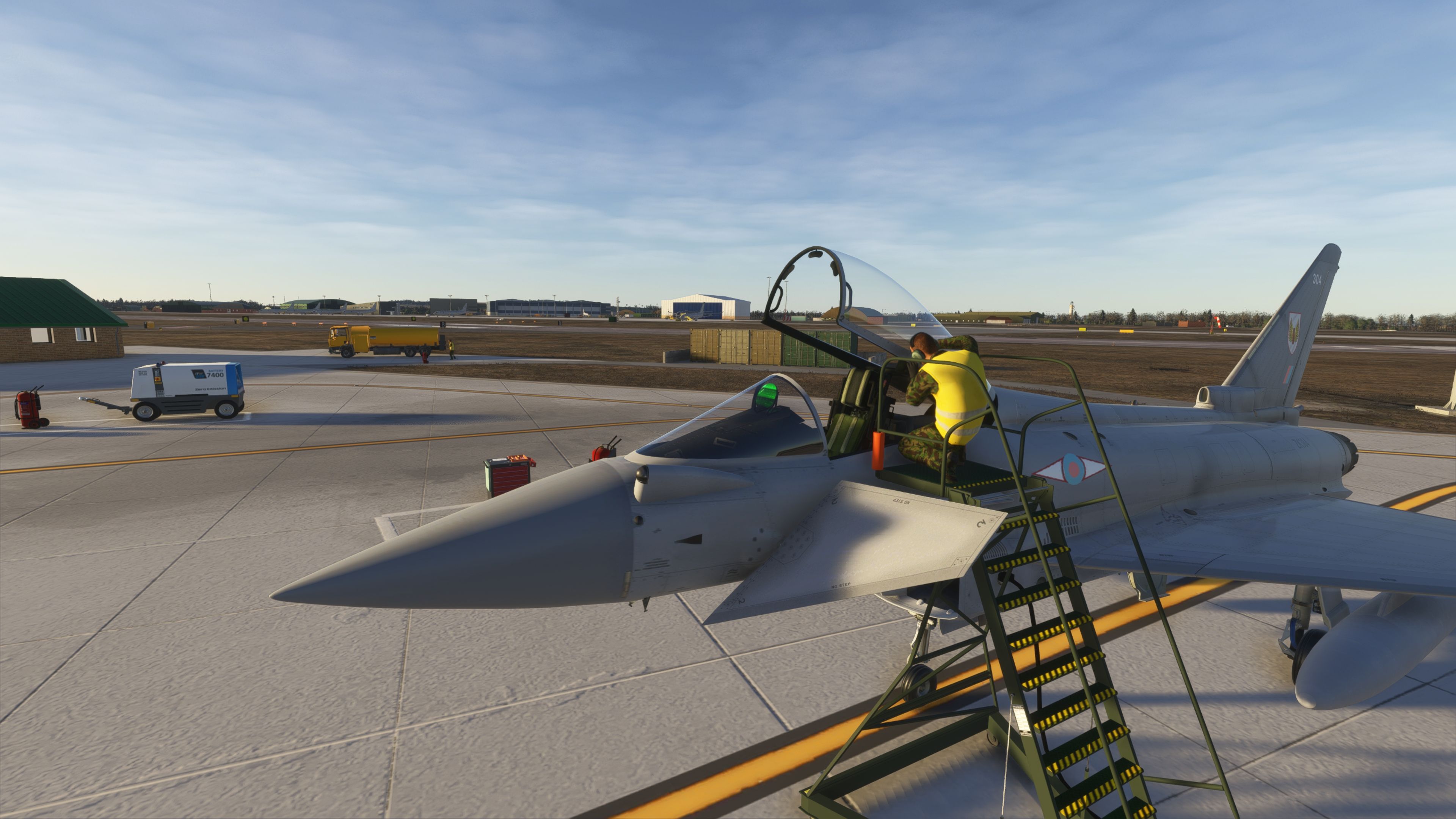
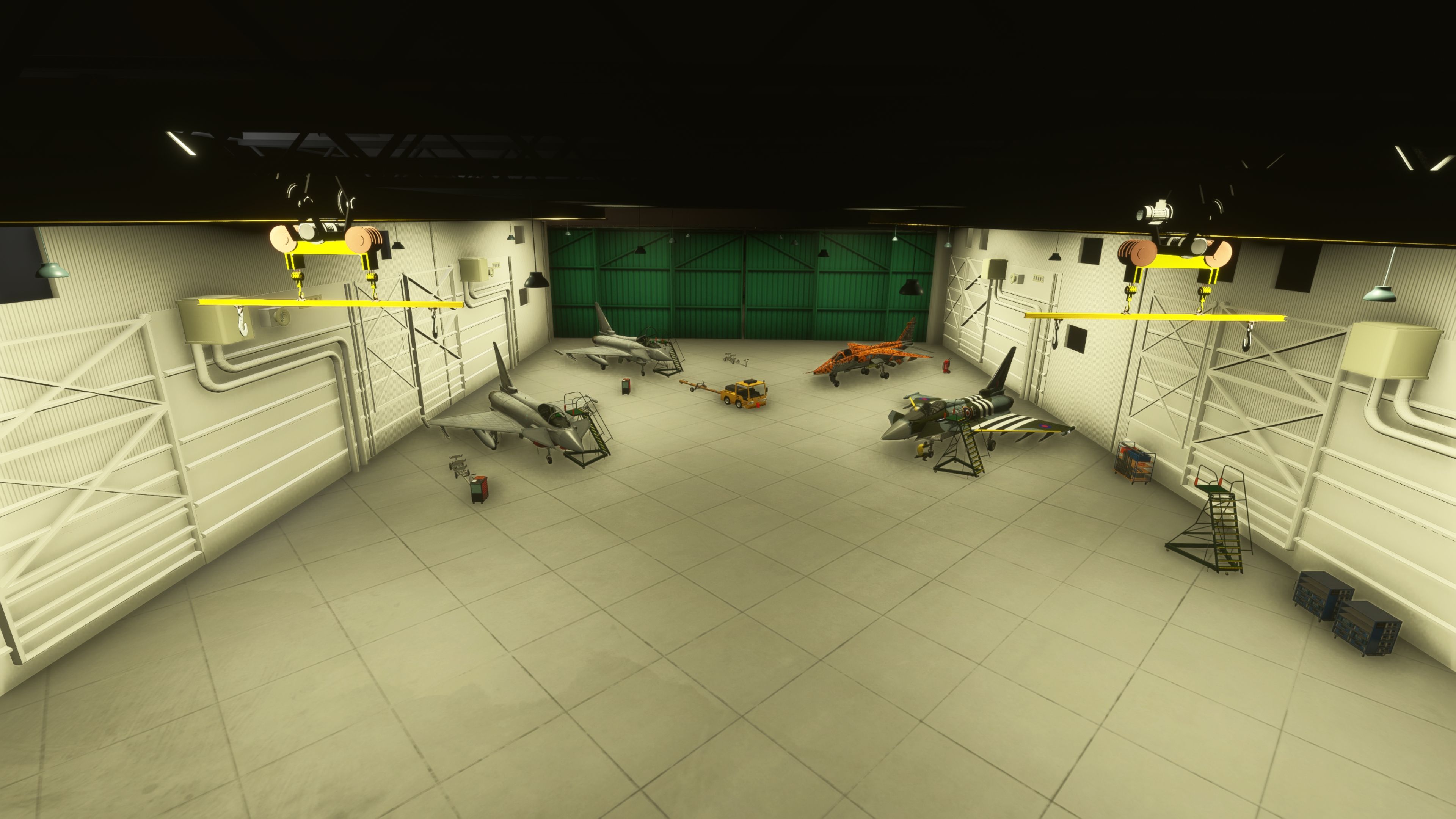
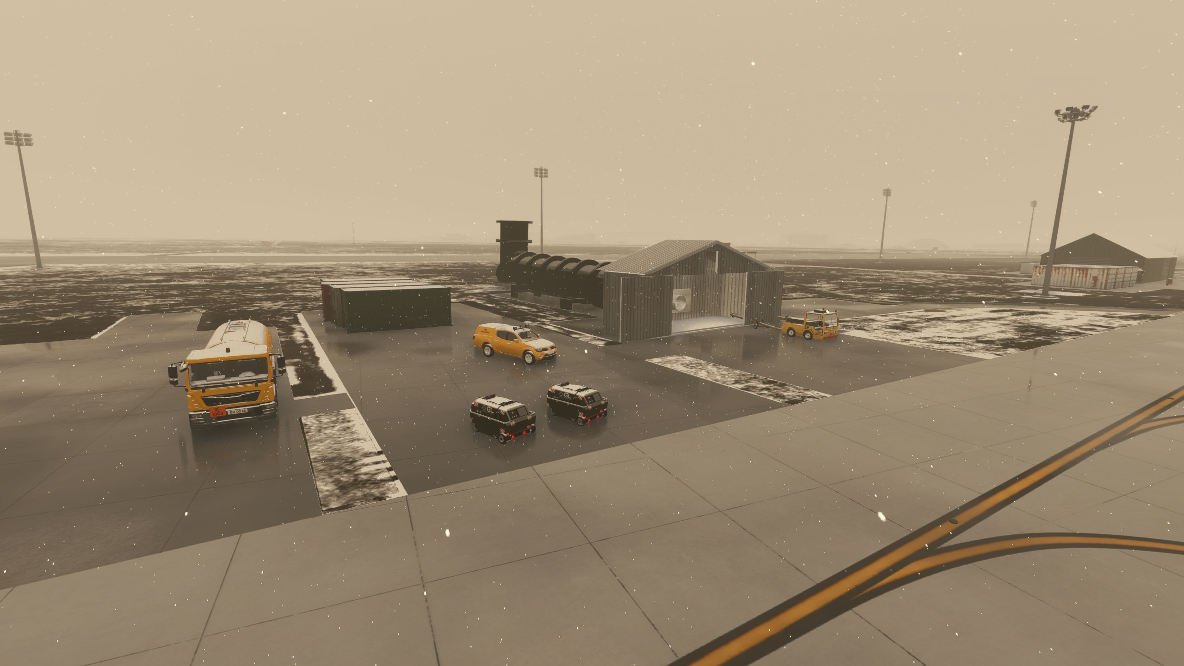
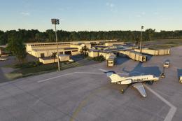
Aircraft, Ground Assets, and Maritime Set Dressing

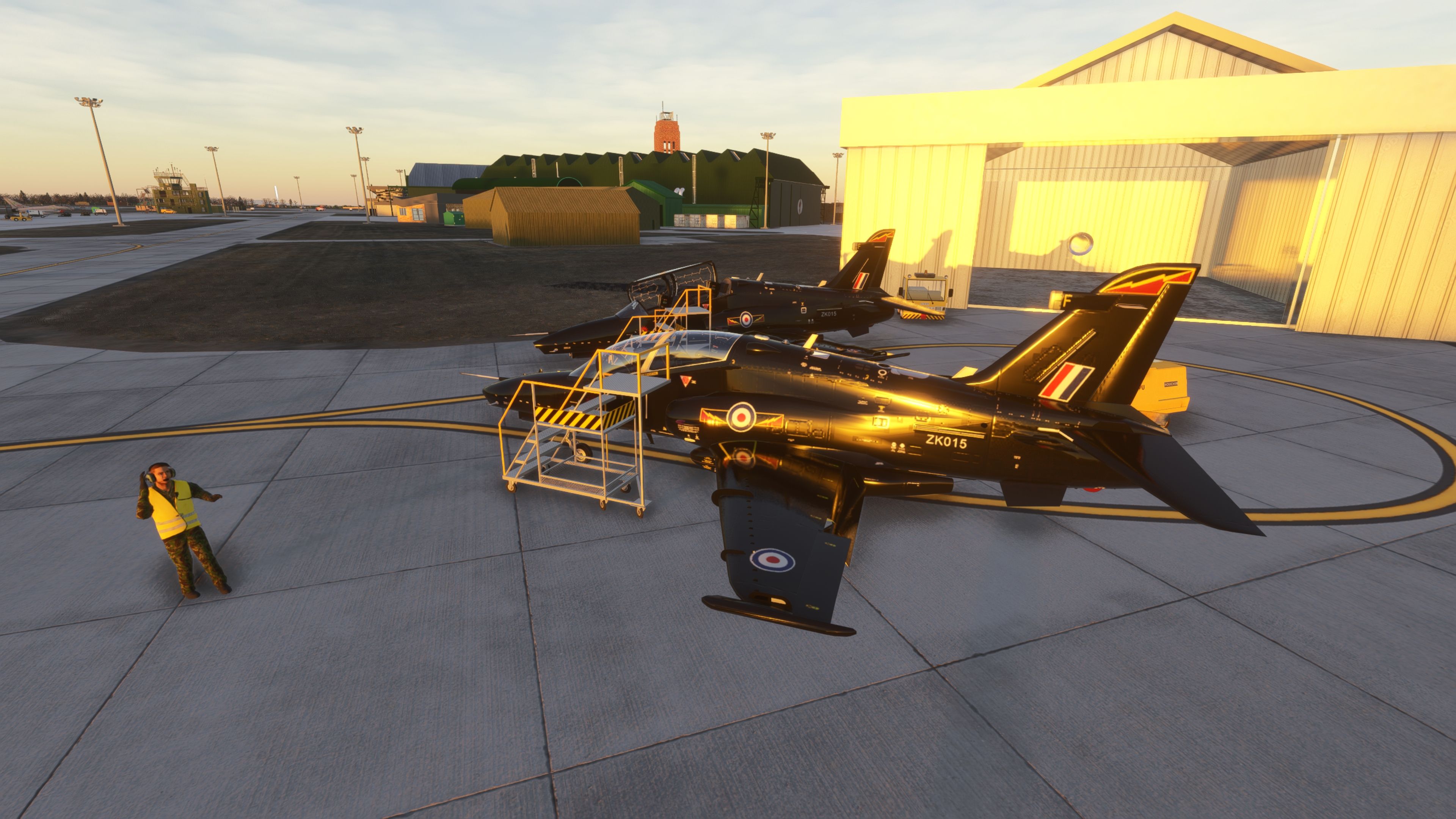
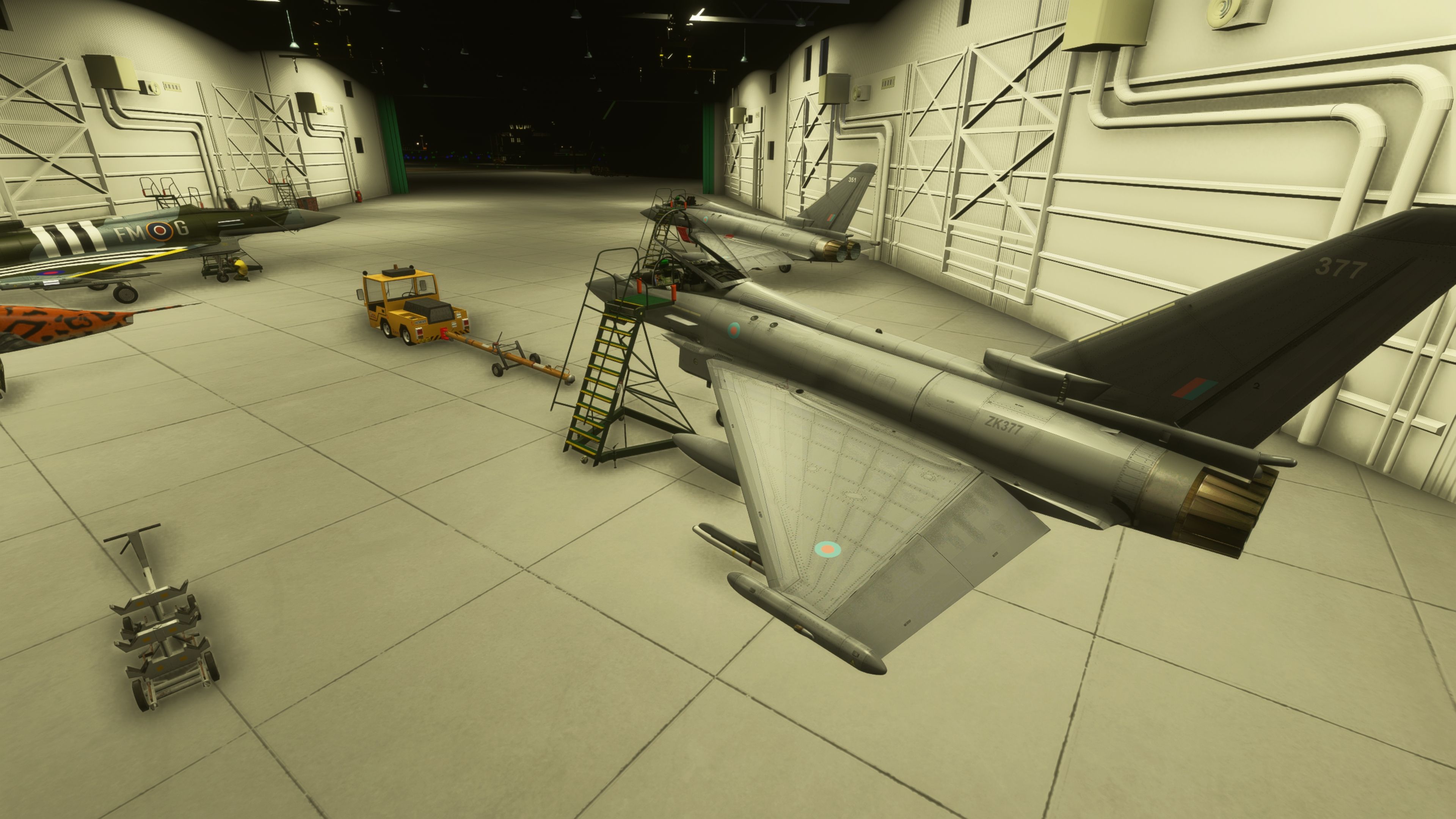
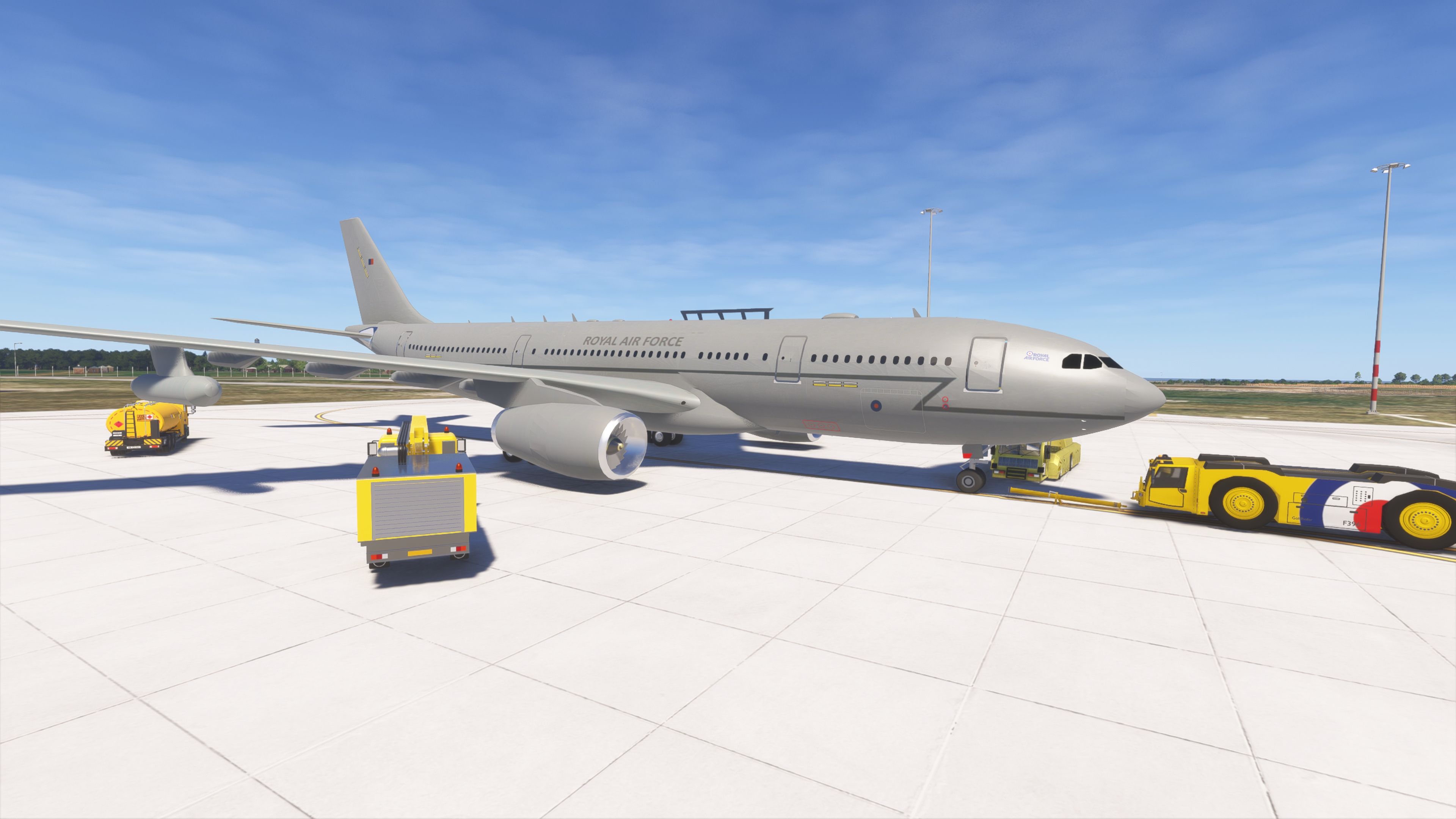
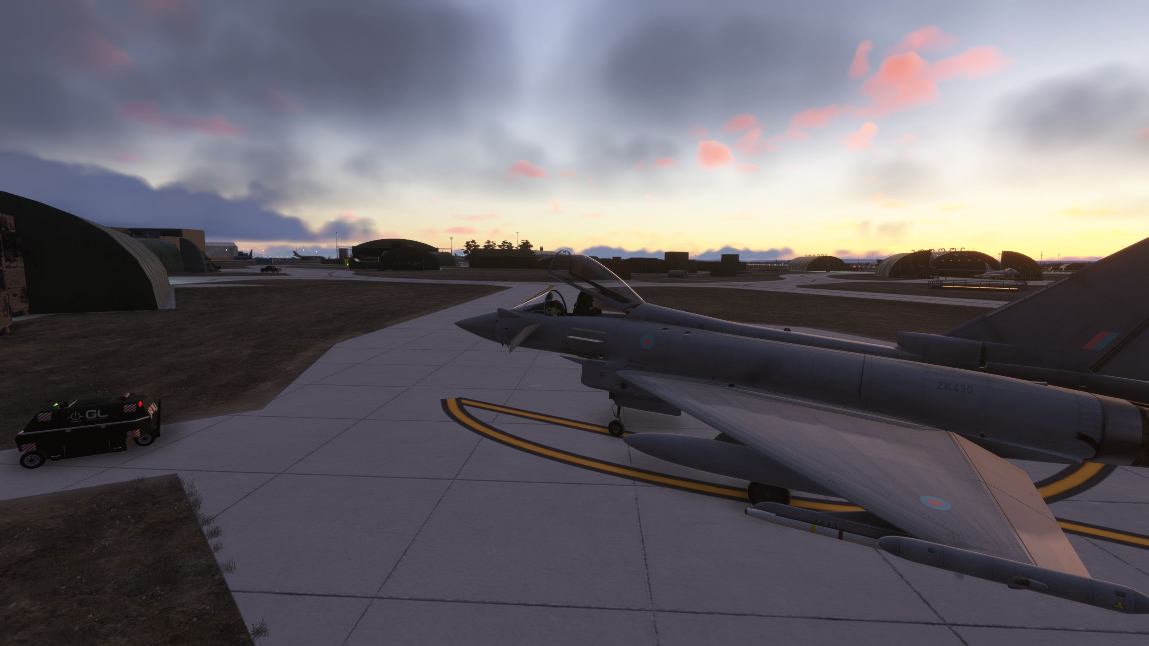
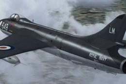
  • High-quality static Typhoon FGR4 and P-8A Poseidon objects by Nattani provide context without excessive draw calls.
  • A carrier group anchored off the north coast adds maritime focus appropriate to the base’s MPA mission set.
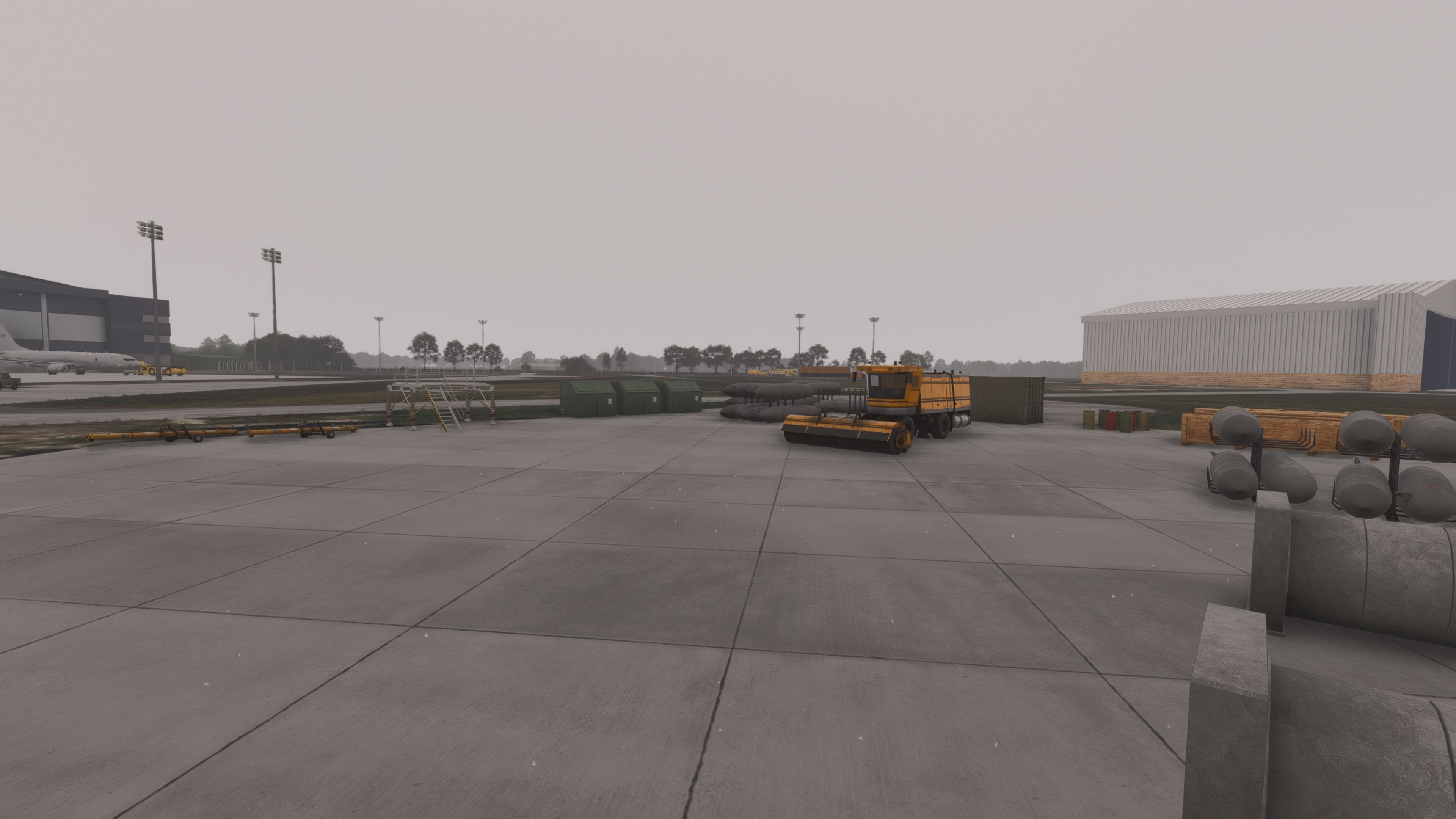
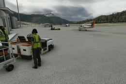
  • On-base support includes a fire appliance courtesy of Gary (UK2000), apron GPU units [Ground Power Units], windsocks, and ground clutter tuned to remain performant.

Navaids, Surface Markings, and Ground Services

  • Custom ILS data—carefully aligned and validated—added with stop bars/stop signage thanks to Biscuit, improving precision approaches in marginal weather.
  • All parking stands are correctly linked to taxiways and runways, re-enabling default airport services; this also makes the field friendly to community-made GSX profiles.
  • Runway guard lights (wig-wags) appear when the UK2000 Common Library is installed from the Microsoft Marketplace.

Performance Tuning and Content Refresh

  • Package size reduction from approximately 3.6 GB to about 2.4 GB through texture optimization and consolidation.
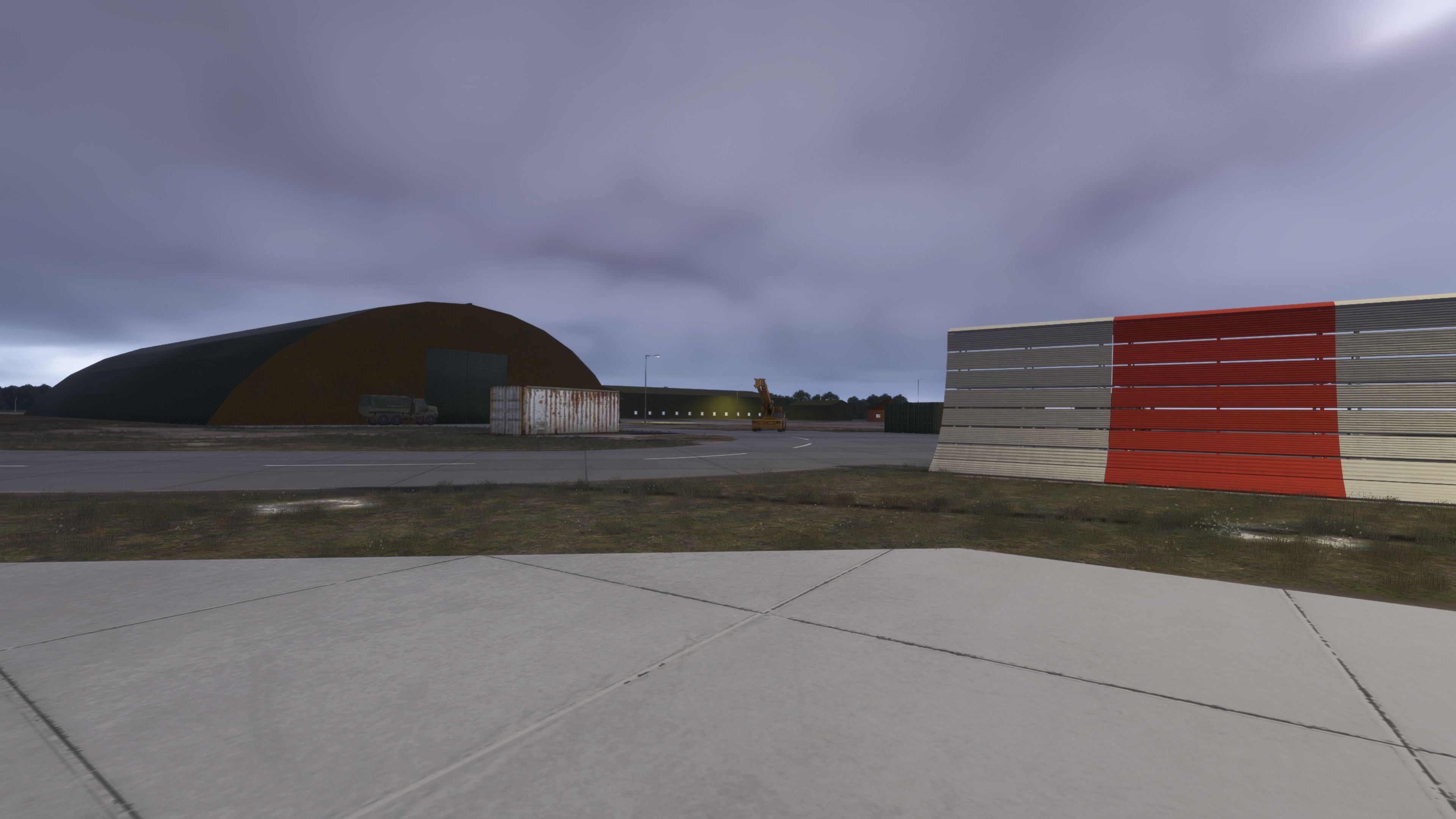
  • Removal of unintended auto-generated buildings following sim updates, restoring sightlines on final and along the movement areas.
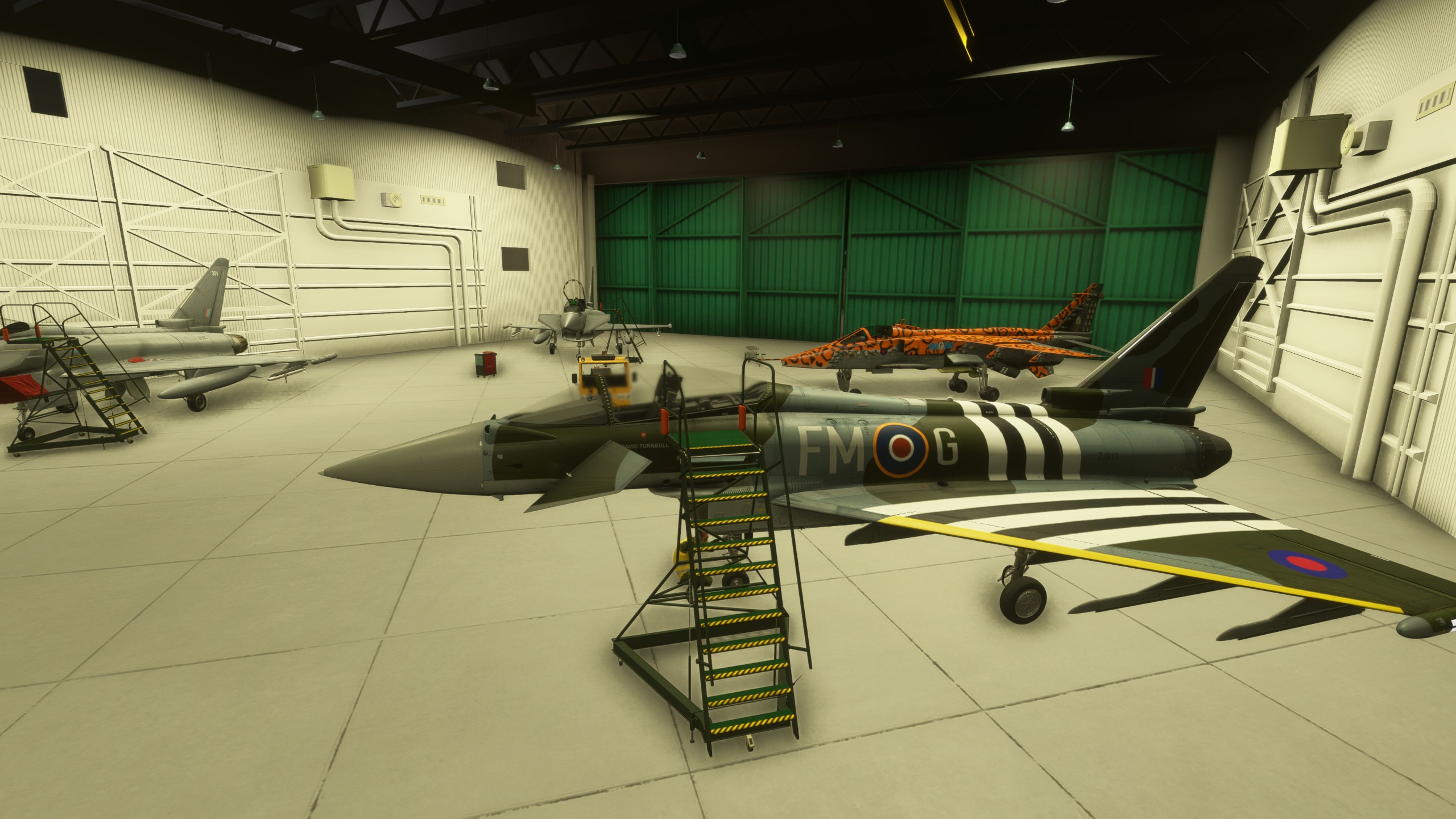
  • Legacy Tornado statics removed; these will be offered separately for those who wish to populate heritage flight lines.

Real-World Context Folded Into the Build

Lossiemouth’s mix of Typhoon QRA, Poseidon MRA1 anti-submarine operations, and future E-7 AEW activity is mirrored in the scenery’s asset choices and apron use. The nearby coastline—often dotted with naval traffic during exercises—has been represented with a carrier off the Moray Firth, giving low-level egresses and maritime holds visual references that align with published training areas.

Installation Notes and Library Dependencies

This scenery references several widely used freeware asset libraries for vehicles, animated personnel, and environmental items. For full fidelity:

  • Install the UK2000 Common Library via the Microsoft Marketplace to enable items such as wig-wag runway guard lights.
  • Common community libraries for cars, UK emergency vehicles, animated humans (by superspud), and dynamic flags are required to display all placed content. Ensure these are present in your Community folder.

The core airport functions and layout will load without these extras; however, some objects will not appear unless the respective libraries are installed.

Credits and Acknowledgments

Project Lead
nickb007 — complete rework and integration for Microsoft Flight Simulator and Microsoft Flight Simulator 2024.
Animations and HAS
Sperx — proximity-based door logic on Nattani’s HAS models.
Static Aircraft and HAS Models
Nattani — Typhoon, P-8, and HAS assets.
Buildings and Landmarks
DeadJen — church, ATC, water tower; Glynn “OldFart” — squadron buildings.
Navaid Alignment
Biscuit — custom ILS and stop bars/signage alignment.
Airfield Vehicles
Gary (UK2000) — fire truck model.
Animated People
superspud — animated human figures library used on stands and around hangars.

Additional Guidance

  • Optional taxiway marking enhancements from community packs are compatible and can improve line clarity across all airports.
  • Because this is a living airbase, the design intentionally avoids excessive statics on operational taxiways and QRA areas to preserve AI and multiplayer flow.
  • GSX users: the airport is fully connected; obtain or create a profile to align handlers and pushback logic with the modeled stands.

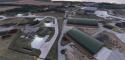
Images & Screenshots

60 total
Aerial view shows a military airfield with multiple green hangars, scattered support buildings, and illuminated taxiways surrounded by fields and trees.A concrete helipad marked with a large white H sits in the center of a dry, brown grassy field.A large airport with two intersecting runways, multiple taxiways, apron areas, and clusters of buildings is surrounded by fields and roads.Two large trees frame a view of green military-style hangars and a barbed-wire fence beside a grassy area under a blue sky.A cluster of green-roofed hangars and support buildings is arranged around winding taxiways on a grassy airfield.Several large green military-style hangars and support buildings are visible beyond leafy bushes under a partly cloudy sky at sunrise or sunset.Aerial view shows a cluster of green-roofed hangars, taxiways, and service buildings surrounded by dry grass and a nearby runway.Aerial view shows multiple green-roofed hangars, taxiways, and small aircraft arranged around a central parking area on grassy terrain.Aerial view shows a military-style facility with multiple earth-covered bunkers, concrete taxiways, and scattered small green buildings on dry grassland.Aerial view shows an airfield with multiple green-roofed hangars, several small aircraft parked on ramps, and a single runway marked E2.A small military jet is parked inside an open-ended hangar with two people nearby, surrounded by trees and service vehicles.A military jet is parked inside a large arched hangar with two people standing near its tail at sunset.Several white commercial jets are parked on a large concrete apron near hangars and support buildings, with a coastline visible in the background.Several large green military-style hangars and bunkers sit beside taxiways and fenced areas under a partly cloudy sky.Two black military trainer jets are parked on the ramp near a hangar at sunset, with a marshaller and maintenance stairs nearby.Several green military-style hangars and utility buildings sit on a concrete apron under a cloudy sunset sky with bare branches in the foreground.Two military jets are parked inside a large hangar, with maintenance stairs positioned at one aircraft and a yellow tow tractor nearby.A modern beige and black building with large windows stands in front of a green hangar, with two people nearby and floodlights overhead.A row of military fighter jets is parked on a concrete apron with ground support vehicles and green hangars in the background.Four military jet aircraft with various paint schemes are parked inside a large hangar with green doors and maintenance stairs nearby.A large, modern building labeled Atlantic Building stands next to a parking lot under a blue sky with scattered clouds.A large corrugated metal hangar reflects the golden light of sunset beside a smaller utility building and a tall floodlight.A ground crew member in a yellow vest works in the open cockpit of a gray military jet parked on the apron.Three military jet aircraft are parked inside a large hangar with green doors, surrounded by maintenance equipment and lighting fixtures.A coastal airport complex with multiple taxiways, hangars, and parked aircraft is shown at sunset with scattered clouds overhead.A small green control tower with a yellow car parked beside it stands near taxiways and apron lighting at a quiet airport.A small twin-engine aircraft is parked on a concrete ramp near a large green hangar and several brick utility buildings under overcast skies.Several parked cars sit on a paved lot beside a long, modern industrial building at sunset under scattered pink clouds.A large green hangar and adjacent building sit beside a ramp area with light poles, a military truck, and scattered ground equipment.A black aircraft tail with a yellow and green emblem stands on a wheeled frame beside a green hangar building.A modern fighter jet cockpit with digital displays is parked on a sunlit military apron near several green hangars and taxiway markings.A half-timbered building with illuminated windows stands near a fenced airfield with hangars and floodlights under a twilight sky.A jet with an orange leopard-print livery and shark mouth design is parked inside a hangar next to ground equipment.A large open aircraft hangar with green doors contains several parked jets and ground equipment, with a yellow tug vehicle outside.A concrete airport ramp area features an orange maintenance vehicle, scattered equipment, storage containers, and a large hangar under an overcast sky.A large airport parking lot and terminal building are covered in snow, with falling snowflakes and low visibility obscuring distant structures.Snow falls over a series of taxiways and revetments lined with snow-covered earth walls and scattered utility sheds.A snowy airport apron features several service vehicles, a yellow truck, two black vans, and a metal utility building with scattered snow patches.A grey Royal Air Force jet is parked on the ramp at sunrise, surrounded by yellow ground service vehicles and a tug.A large hangar with closed doors sits beside taxiway markings at an airfield during a low sunrise with scattered clouds.A large arched hangar, a weathered shipping container, and a red-and-white blast wall stand under overcast skies near a taxiway.A modern airport building with a checkered facade and large windows stands beside a ramp at sunset under scattered clouds.A grey Royal Air Force jet is parked on the ramp with ground service vehicles, including a pushback tug and fuel truck, nearby.A person wearing a headset stands beside a yellow "Aircraft Armed" warning sign in front of a large military-style hangar at dusk.A modern military jet with an open canopy is parked on a taxiway at sunset near several camouflaged hangars.A radar tower and several hangars are visible near a tree line at sunrise, with long shadows cast across the ground.A Royal Air Force surveillance aircraft with a prominent radar dome is parked on a ramp near a hangar under a partly cloudy sky.A green electrical box with a high voltage warning sign stands near a brick utility building beside an airport apron and hangar.Several parked cars sit under streetlights beside a large, windowed industrial building at night with distant airport lights visible.A large, striped rectangular building labeled Atlantic Building stands beside an empty parking lot under night lighting with distant airport lights visible.A ground crew member stands beside a yellow tug and mobile stairway near the nose of a grey aircraft marked 09.A small airport control tower and adjacent service vehicle are illuminated by ramp lights at night, with taxiway lights visible in the background.A large blue and gray hangar stands beside a beige building on a misty airport apron with grassy areas and scattered equipment.A taxiway at night features a red and white blast shield, a rusted shipping container, and a dimly lit hangar in the background.Aerial night view shows an airport with illuminated taxiways, runway edge lights, and clusters of brightly lit terminal and support buildings.A small airport control tower stands beside a snow-covered apron, with light snow falling and a yellow vehicle parked nearby.Several concrete aircraft shelters line a snow-covered taxiway under falling snow, with streetlights and distant buildings barely visible in the background.A brightly lit hangar at night contains several small military jets, with green roofing and brick buildings visible on either side.A commercial jet stands parked at a dimly lit airport apron at dusk, with terminal buildings and hangars visible in the background.A large hangar and a parked jet are illuminated by floodlights at night, viewed through a rectangular window frame.
All screenshots above have been created by Fly Away Simulation and are exclusive. For more details, see our image copyright information.
GPS Map Icon

Finding the Scenery

MSFS Format:
57.70400000,-3.34300000
You can copy and paste these coordinates into Microsoft Flight Simulator's search bar when starting a flight or the Developer Mode "Teleport" window to navigate directly to the center of this scenery area, airport, or landmark after you have installed this addon.
Decimal Degrees (DD):
Latitude: 57.704000°
Longitude: -3.343000°
Degrees, Minutes, Seconds (DMS):
Latitude: 57° 42' 14.400" N
Longitude: 3° 20' 34.800" W

Map Location


Installation icon.

Installation Instructions

Most of the freeware add-on aircraft and scenery packages in our file library come with easy installation instructions which you can read above in the file description. For further installation help, please see our Flight School for our full range of tutorials or view the README file contained within the download. If in doubt, you may also ask a question or view existing answers in our dedicated Q&A forum.

0 comments

Leave a Response

Leave a comment