 FSX Scenery
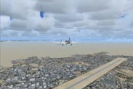
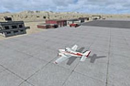
Tonopah Test Range
Tonopah Test Range (TNX), Nevada (NV). Enhances the default scenery with ramp…
Tonopah Test Range (TNX) gets a more complete ground layout with restored road data that fills in missing routes around the Nevada range area, improving VFR navigation and low-level immersion. Designed for FSX, it requires TONO_TNX.ZIP and blends cleanly with the existing Tonopah Test Range scenery.
Tonopah Test Range Fix, for use with TONO_TNX.ZIP, (TNX), Nevada (NV). Includes missing roads. By Paul Strogen.
Tonopah Test Range Scenery.
This upload contains the file necessary to add the missing roads for my previous "Tonopah Test Range - TNX" files.
Free for all simmers · 2.65 KB · Scanned clean Jul 2026
Download speed: Free tier is capped at 0.5 Mbps. PRO members download at full line speed.
This add-on may require the following files to function properly. If this is a repaint, the dependency below is likely the base aircraft package.
FSX\Addon Scenery\ containing scenery and texture sub-folders.readme.txt or README file. It tells you exactly where files go, what dependencies are needed, and any quirks specific to this add-on.Use these coordinates to fly directly to this location once the mod is installed.
37.80000000,-116.78000000
Launch FSX or Prepar3D and use Flights → Load to open the downloaded .pln file. Your aircraft will be positioned at this location.
The archive tnxmisrd.zip has 4 files and directories contained within it.
This list displays the first 500 files in the package. If the package has more, you will need to download it to view them.
| Filename/Directory | File Date | File Size |
|---|---|---|
| Readme.txt | 12.23.07 | 188 B |
| TNX_roads.zip | 12.23.07 | 1.45 kB |
| flyawaysimulation.txt | 10.29.13 | 959 B |
| Go to Fly Away Simulation.url | 01.22.16 | 52 B |
Only PRO members can place votes.
More FSX & P3D add-ons hand-picked based on this download.
FSX Scenery
Tonopah Test Range (TNX), Nevada (NV). Enhances the default scenery with ramp…
 FSX Scenery
TNX Tonopah Test Range, NV. TNX, the Tonopah Test Range, is a remote base in …
 FSX Scenery
(KTNX), Tonopha, Nevada (NV), USA. Tonopah Test Range Airport is located near…
 FSX Scenery
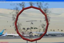
Tonopah Air Show. This scenery shows a fictional air show in Tonopah (KTPH), …
 FSX Scenery
Tonopah Airport (KTPH), Nevada (NV). Enhances the default airport with ramp p…
 FSX Scenery
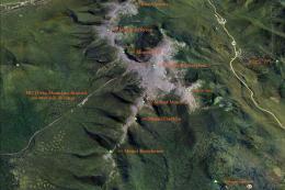
Mt Washington And The Presidential Range, NH. Welcome to the Presidential Ran…
 FSX Scenery
YWDF - RAAF Delamere Weapons Range, Northern Territories, Australia. Delamere…
 FSX Scenery
Scenery Fix--Madeira LPMA, Porto Santo LPPS, Portugal. The default scenery di…
Be the first to leave a comment on this download.
Be the first to share your thoughts on this download.