FSX Harbours for Southern Africa Scenery
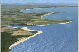
Southern Africa’s coastlines gain richer detail with upgraded harbors, corrected waterways, and standout landmarks including the Darling windfarm, Bloukrans and Stormsriver bridges, Hartebeespoortdam, and the Bloemfontein Waterfront. Built for Microsoft Flight Simulator X, it uses integrated terrain data and requires Aeroworx mesh for the most accurate elevations and shorelines.


 Global (World)
 - File: fsxworx18.zip
- Size:17.49 MB
- Scan:
Clean (5d)

- Access:Freeware
- Content:Everyone
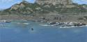
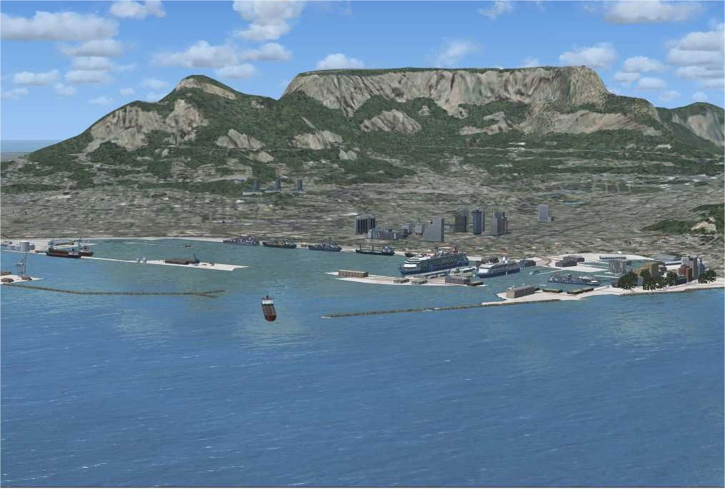
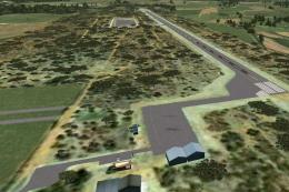
This comprehensive scenery enhancement introduces detailed harbors and prominent landmarks across Southern Africa. Designed specifically for Microsoft Flight Simulator X, it refines coastal environments, bridges, and inland features through integrated terrain data. Developed by Hannes Steyn, Martin du Preez, and Aeroworx, this package covers the Darling windfarm, Bloukransbridge, Stormsriverbridge, the Hartebeespoortdam bridge, the railroad bridge near Tzaneen, Ruacana in Namibia, Navilhill, the Bloemfontein Waterfront, and Spitskop. These updates collectively enhance both VFR and IFR flights, ensuring better immersion for virtual pilots exploring the region.
Harbours for Southern Africa Scenery.
Key Integrated Elements
- Harbors Across Southern Africa: Adds detailed port structures, improving the authenticity of maritime areas throughout the subcontinent.
- Bridge Enhancements: Includes iconic structures such as Bloukransbridge, Stormsriverbridge, and others that add visual interest near coastal routes and canyons.
- Water Features and Elevation Tweaks: Aligns dams and waterways with recommended mesh data for greater topographic accuracy.
- Landmarks at Various Locations: Covers notable points like the Windfarm at Darling and the Tzaneen railroad bridge, as well as the Bloemfontein Waterfront and Spitskop.
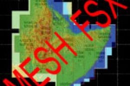
Optimal Requirements for High-Detail Mesh
To achieve precise elevations around dams and other terrain, this scenery is tailored to work with the Aeroworx mesh packages (FSXMesh0604 Part 1–4 and FSXMesh0704 Part 1–3). Using an alternate mesh may cause water levels to appear above or below the intended elevations, leading to visual discrepancies. Running 1m resolution in your settings is also recommended.
Installation and Folder Structure
- Extraction: Unzip the “fsxWorx18.zip” archive into a temporary location. Storing Aeroworx downloads in a dedicated folder is strongly advised.
- Running the Auto Installer: Launch “fsxWorx18.exe”, which should detect your core FSX path. Follow the prompt sequence to streamline the process.
- Added Directories: The installer creates two new directories within the primary FSX Scenery folder named “SASceneryFSX” and “AeroworxLC”. Future Aeroworx updates will populate these same folders.
- Optional Manual Copy: Alternatively, install to a separate temp folder, then move the newly extracted content into “SASceneryFSX” and “AeroworxLC.” Avoid altering directory paths if you plan on receiving future automated updates.
- First-Time Setup: When adding Aeroworx scenery for the first time, open the Scenery Library in FSX, then select “Add Area” to target “SASceneryFSX” and “AeroworxLC”. After confirmation, restart FSX to finalize activation.
Limitations in Current Build
- Roads Over Water: Some roads may still cross over bodies of water with no bridge elements at certain points.
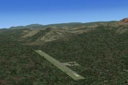
- Airfield Intersections: Default airports might cause roads, streams, or rivers to intersect runways due to incomplete or misaligned data.
- Dam Water Levels: With a 76m mesh, some dams do not precisely match the surrounding terrain. Maintaining 1m resolution mitigates these issues.
Technical Tools and Editing Software
The design process made use of Microsoft Scenery SDK SP2, Scenery Builder by Luis Sá, Airport Design Editor by ScruffyDuck Software, Whisplacer 0.9, and other digitizing applications. These utilities allowed the developers to integrate vector data, reshape coastlines, and add photorealistic details for improved regional fidelity.
Credits to the Creators
This freeware package reflects the teamwork of Hannes Steyn and Martin du Preez, with support from Aeroworx members including Johan van Wyk. Each contributor applied advanced scenery editing techniques to ensure a cohesive and thoroughly tested add-on for flight simulation enthusiasts across Southern Africa.
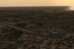
Images & Screenshots

Finding the Scenery
- FSX/Prepar3D Coordinates:
-
-29.11830000,26.22940000
Use the downloaded flight plan file by launching FSX/P3D, selecting "Load Flight Plan" in the flight planner, and choosing the .pln file. Your aircraft will be positioned directly at the add-on’s location. - Decimal Degrees (DD):
-
Latitude: -29.118300°
Longitude: 26.229400° - Degrees, Minutes, Seconds (DMS):
-
Latitude: 29° 07' 05.880" S
Longitude: 26° 13' 45.840" E
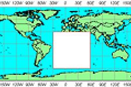
Map Location
The archive fsxworx18.zip has 9 files and directories contained within it.
File Contents
This list displays the first 500 files in the package. If the package has more, you will need to download it to view them.
| Filename/Directory | File Date | File Size |
|---|---|---|
| Aeroworx_License_Agreement.PDF | 04.29.08 | 66.69 kB |
| FILE_ID.DIZ | 08.22.09 | 367 B |
| fsxWorx18.exe | 08.22.09 | 17.24 MB |
| fsxWorx18.jpg | 08.20.09 | 215.05 kB |
| license.txt | 04.04.09 | 7.38 kB |
| ReadmefsxWorx18.txt | 08.21.09 | 3.84 kB |
| fsxWorx18 | 08.22.09 | 0 B |
| flyawaysimulation.txt | 10.29.13 | 959 B |
| Go to Fly Away Simulation.url | 01.22.16 | 52 B |
Complementing Files & Dependencies
This add-on mentions the following files below in its description. It may be dependent on these files in order to function properly. It's possible that this is a repaint and the dependency below is the base package.
You may also need to download the following files:
Installation Instructions
Most of the freeware add-on aircraft and scenery packages in our file library come with easy installation instructions which you can read above in the file description. For further installation help, please see our Flight School for our full range of tutorials or view the README file contained within the download. If in doubt, you may also ask a question or view existing answers in our dedicated Q&A forum.


2 comments
Leave a ResponseThe content of the comments below are entirely the opinions of the individual posting the comment and do not always reflect the views of Fly Away Simulation. We moderate all comments manually before they are approved.
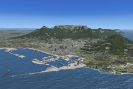
Wow, guys! This photograph of Cape Town harbour and surrounds must be at least 30 years old, and is so out-of-date!
John in beautiful Cape Town, South Africa.
Will this work if I have loaded NMG FACT?