 FSX Scenery
Saratoga County Airport V2
Saratoga County Airport, New York (5B2) v2.0 for FSX Acceleration. Located in…
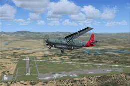
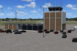
Flagler County Airport (KXFL) scenery brings Florida’s busy general aviation field to life in FSX, with accurate ATIS and tower data, an updated ground frequency, and improved runway and approach lighting for easier night identification. The airport may appear as X47 on the map while operating with KXFL communications.

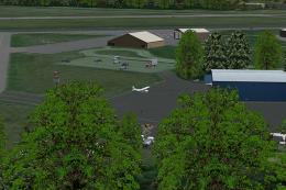
Flagler County Airport Florida. The 4th busiest general aviation airport (KXFL) in FL with over 500 T/O and landings per day. Control tower operates 7am-9pm all year long. By Jimmy R. Martin.

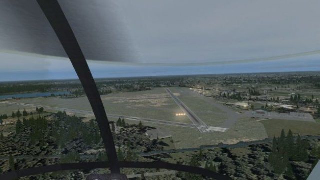
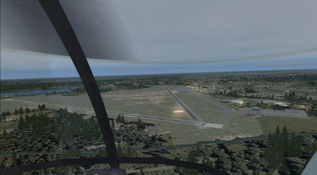
Aerial view of Flagler County Airport during the day.
The airport shows on your map as the old X47. However the ATIS & tower frequencies are accurate and are identified as KXFL.
HOWEVER...KXFL uses the tower frequency for air and ground so I changed the ground control frequency.
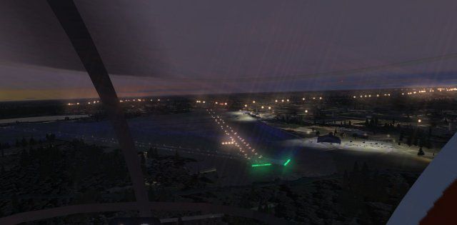
Runway lighting is brighter than the actual airport along with the approach lighting to make it easier to find on FSX especially if you are using Ultimate Terrain and a night lighting addon program.
Screen shots scenery utilizes:
Ultimate Terrain X and road textures.
Active Sky X.
Real Environment Extreme textures.
Ground Environment X ground textures.
PLACE all files into your ADDON SCENERY/SCENERY folder.

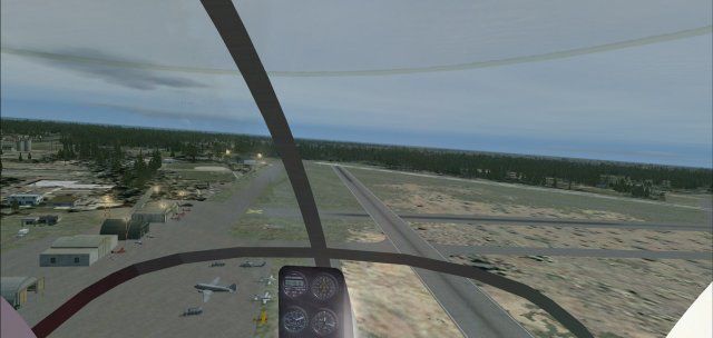
Aerial view of Flagler County Airport at night.
Free for all simmers · 420.5 KB · Scanned clean Jul 2026
Download speed: Free tier is capped at 0.5 Mbps. PRO members download at full line speed.
FSX\Addon Scenery\ containing scenery and texture sub-folders.readme.txt or README file. It tells you exactly where files go, what dependencies are needed, and any quirks specific to this add-on.Use these coordinates to fly directly to this location once the mod is installed.
29.46740000,-81.20600000
Launch FSX or Prepar3D and use Flights → Load to open the downloaded .pln file. Your aircraft will be positioned at this location.
The archive kxfl.zip has 19 files and directories contained within it.
This list displays the first 500 files in the package. If the package has more, you will need to download it to view them.
| Filename/Directory | File Date | File Size |
|---|---|---|
| AirNav KXFL - Flagler County Airport.url | 12.13.10 | 180 B |
| AirNav photo.jpg | 12.13.10 | 19.43 kB |
| file_id.diz | 12.14.10 | 191 B |
| PS0299.jpg | 12.14.10 | 30.45 kB |
| PS0301.jpg | 12.14.10 | 37.31 kB |
| PS0302.jpg | 12.14.10 | 21.87 kB |
| PS0303.jpg | 12.14.10 | 21.59 kB |
| pspbrwse.jbf | 12.13.10 | 7.51 kB |
| README.txt | 12.14.10 | 882 B |
| scenery | 12.14.10 | 0 B |
| X47_ADEX_JRM.ad2.ad2 | 12.13.10 | 262.18 kB |
| X47_ADEX_JRM.BGL | 12.13.10 | 18.56 kB |
| X47_ADEX_JRM_CVX.bgl | 12.13.10 | 276 B |
| X47_jRm_objs.bgl | 12.13.10 | 8.34 kB |
| Thumbs.db | 05.27.08 | 5.50 kB |
| web.gif | 12.14.10 | 9.79 kB |
| KXFL | 12.14.10 | 0 B |
| flyawaysimulation.txt | 10.29.13 | 959 B |
| Go to Fly Away Simulation.url | 01.22.16 | 52 B |
Only PRO members can place votes.
More FSX & P3D add-ons hand-picked based on this download.
FSX Scenery
Saratoga County Airport, New York (5B2) v2.0 for FSX Acceleration. Located in…
 FSX Scenery
Aspen-Pitkin County Airport Scenery (KASE), Colorado (CO). This scenery adds …
 FSX Scenery
Westchester County Airport (KPHN), White Plains, New York (NY). An improved v…
 FSX Scenery
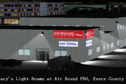
Essex County Airport NJ (IATA: CDW, ICAO: KCDW, FAA LID: CDW) is a public air…
 FSX Scenery
Charles M. Schulz - Sonoma County Airport (KSTS), Santa Rosa, California (CA)…
 FSX Scenery
Ithaca-Tomkins County Airport (KITH), New York (NY). Here is an improved vers…
 FSX Scenery
Napa County Airport (KAPC), Napa, California (CA). A scenery update for Napa …
 FSX Scenery
(KJXN), Michigan (MI), USA. Update of the stock Jackson County-Reynolds Field…
Be the first to leave a comment on this download.
Be the first to share your thoughts on this download.