 FSX Scenery
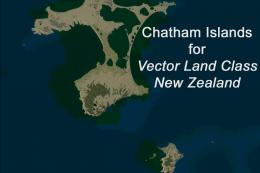
Chatham Islands New Zealand
Chatham Islands New Zealand. This is a basic photoreal upgrade to default NZC…
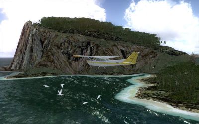
Chatham Islands terrain and airport upgrades refine the New Zealand archipelago in Microsoft Flight Simulator X with corrected coastlines, landclass, lakes, roads, and rivers matched to satellite imagery. It modernizes Chatham Islands/Tuuta (NZCI), adds Pitt Island (NZPI), and refreshes Napier (NZNR) aprons and terminal using enhanced stock objects for authentic Air Chathams operations.
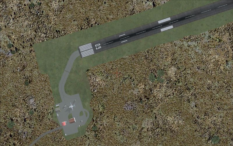
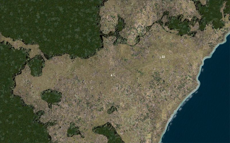
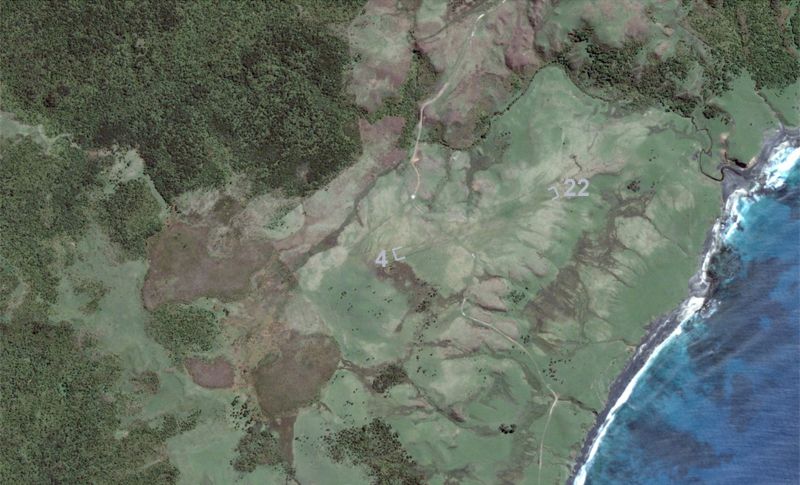
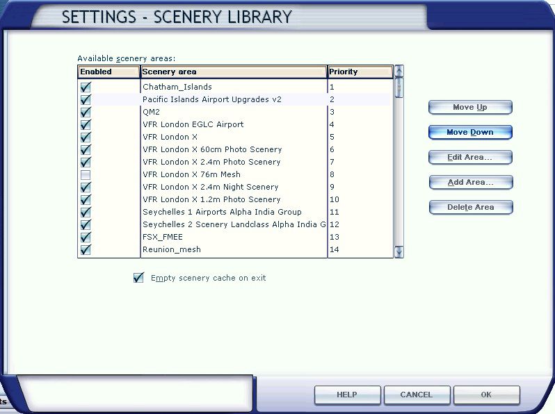
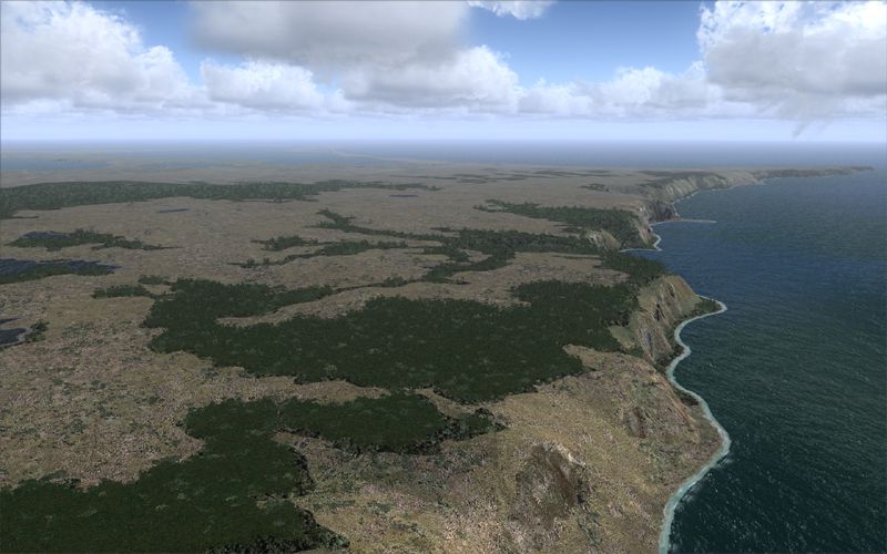
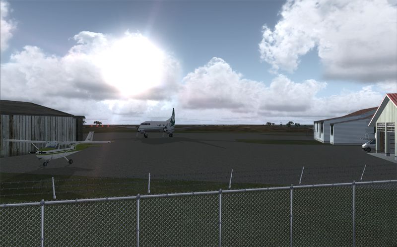
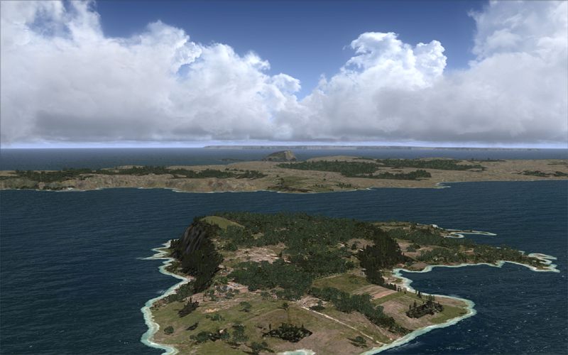
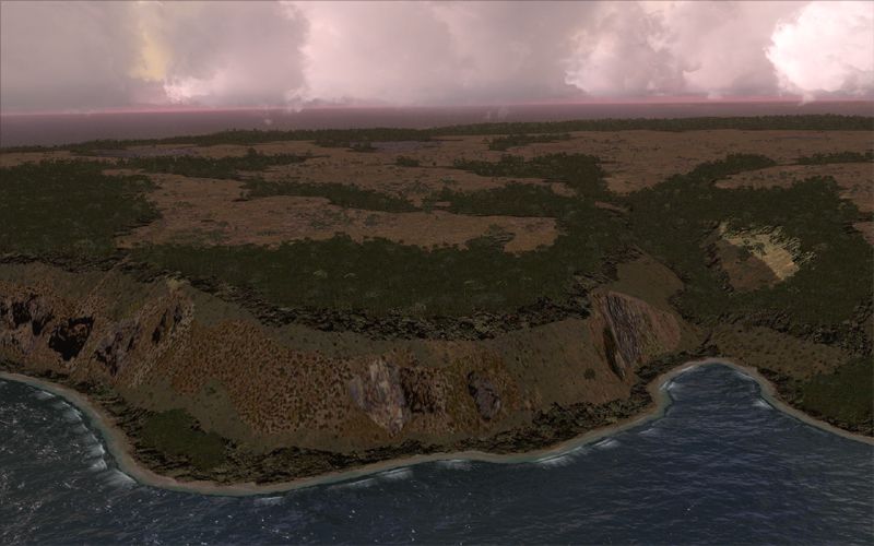
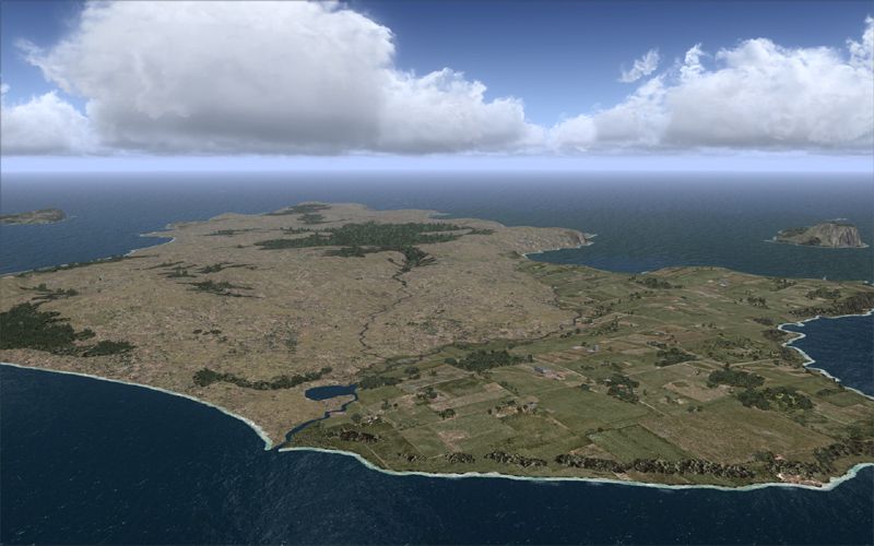
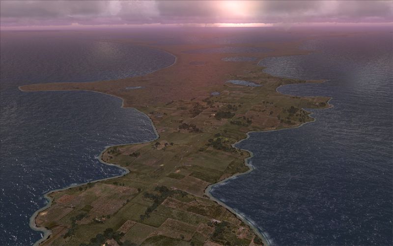
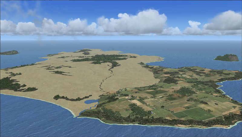
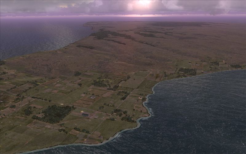
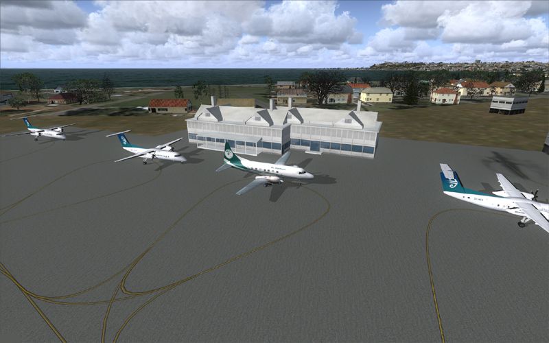
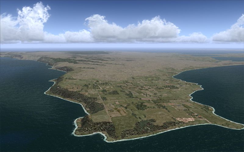
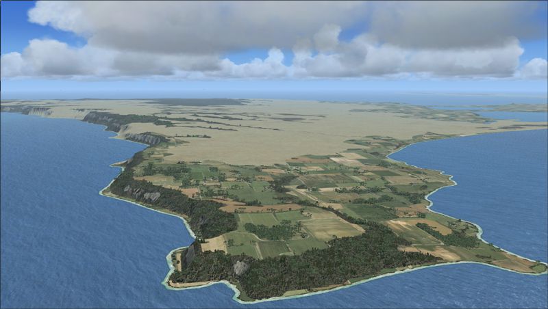
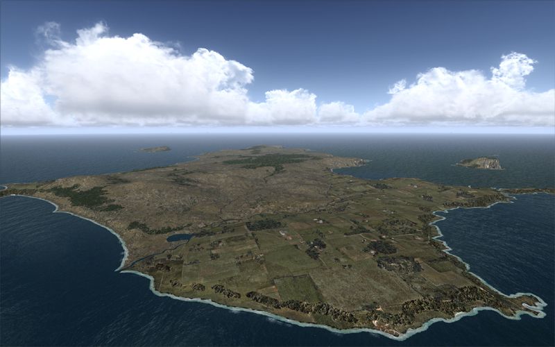
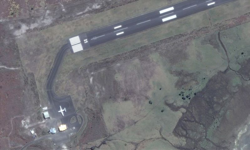
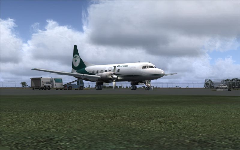
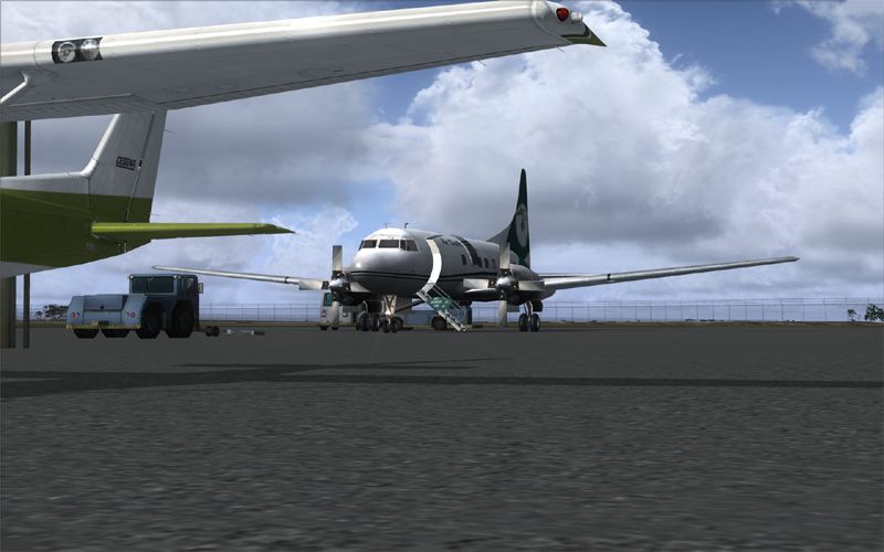
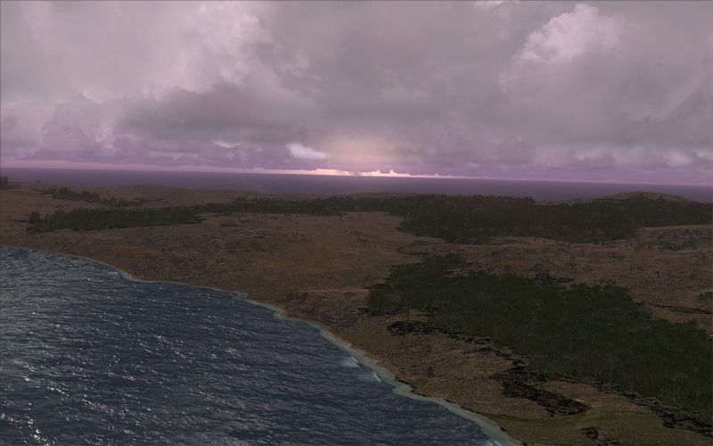
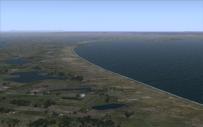
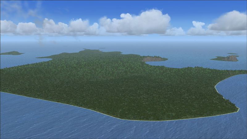

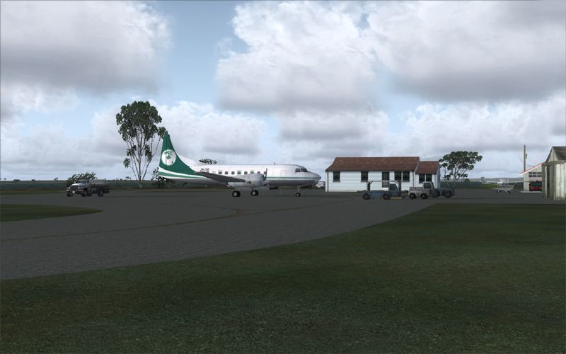
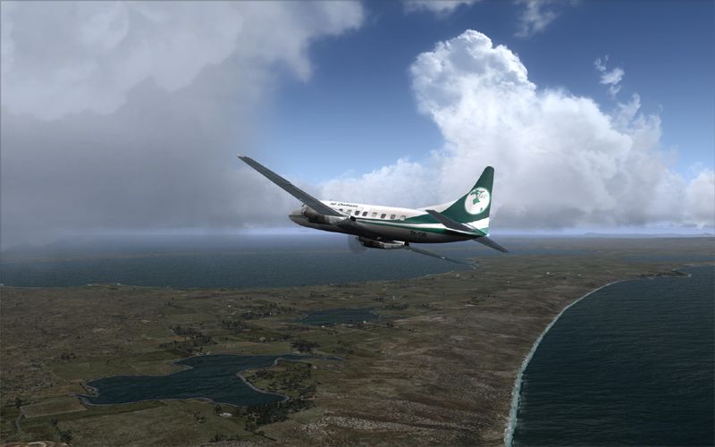
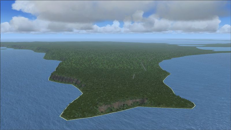
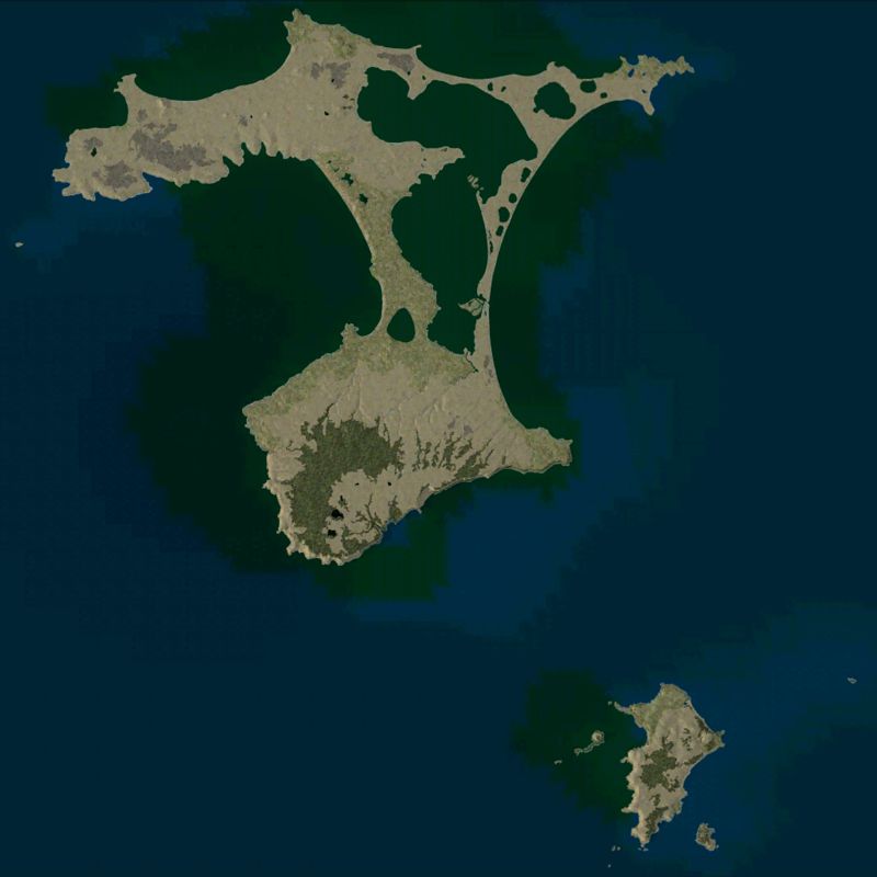
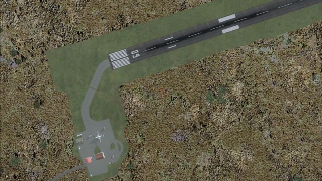
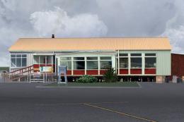
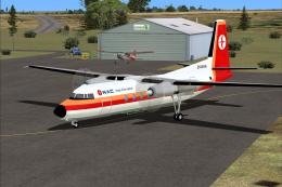
This project significantly updates New Zealand's Chatham Islands and includes more accurate coastlines, lakes, road and river data, as well as corrected landclass and a fully updated Chatham Islands/Tuuta Airport (NZCI). Napier (NZNR) aprons and terminal are also updated to more closely reflect the actual airport and accommodate Air Chathams, and the Pitt Island Airstrip (NZPI) is added to FSX. All updates were done in a manner which carefully aligned airport data with current satellite imagery. These airports are served by Air Chathams. Scenery was created using Airport Design Editor X v1.47.07, SBuilderX 3.13, and the FSX Object Placement Tool. Scenery objects were added and modified from stock FSX scenery to resemble as closely as possible the actual airports. By Carlyle Sharpe.
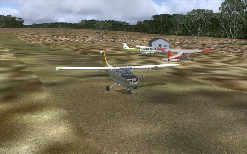
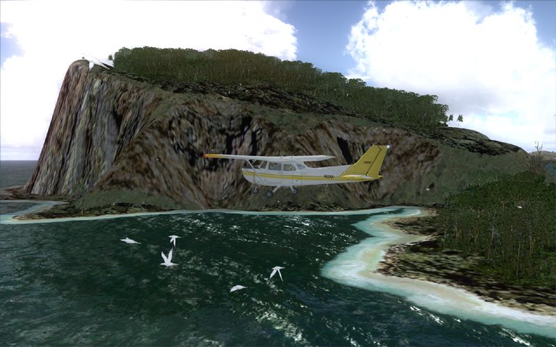
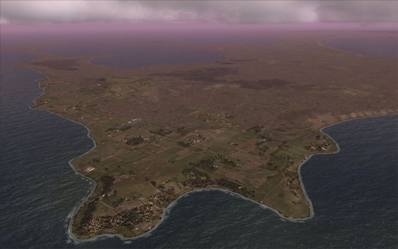
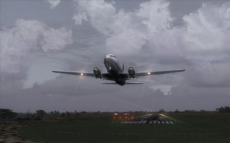
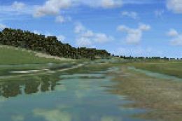
Screenshot of Chatham Islands Scenery.
Simply import the file with UT2 Power Pack, and install in UT2. Remember to assign a Cessna light aircraft (CNA) in UT2 after the import is complete.
Screenshot of Chatham Islands Scenery.
Free for all simmers · 17.53 MB · Scanned clean
Download speed: Free tier is capped at 0.5 Mbps (this file takes approximately 5 mins at the cap). PRO members download at full line speed.
FSX\Addon Scenery\ containing scenery and texture sub-folders.readme.txt or README file. It tells you exactly where files go, what dependencies are needed, and any quirks specific to this add-on.Use these coordinates to fly directly to this location once the mod is installed.
-43.81140000,-176.45700000
Launch FSX or Prepar3D and use Flights → Load to open the downloaded .pln file. Your aircraft will be positioned at this location.
The archive chatham_islands.zip has 107 files and directories contained within it.
This list displays the first 500 files in the package. If the package has more, you will need to download it to view them.
| Filename/Directory | File Date | File Size |
|---|---|---|
| Air Chathams Charter flight plans | 06.24.11 | 0 B |
| Ttools format | 06.24.11 | 0 B |
| Air_Chatham_Charter | 06.24.11 | 0 B |
| Aircraft_.txt | 06.17.11 | 40 B |
| Airports_.txt | 06.17.11 | 780.02 kB |
| Flightplans_.txt | 06.19.11 | 223 B |
| UT2 | 06.24.11 | 0 B |
| Readme.txt | 06.24.11 | 150 B |
| UT2Daily_Air_Chathams_Charter.dbi | 06.19.11 | 160.00 kB |
| CI_thumbnail2.gif | 07.04.11 | 10.36 kB |
| Place in Documents-Flight Simulator X Files | 07.08.11 | 0 B |
| Chatham Islands - Chatham Dusk.FLT | 07.08.11 | 8.99 kB |
| Chatham Islands - Chatham Dusk.FSSAVE | 07.08.11 | 193.51 kB |
| Chatham Islands - Chatham Dusk.WX | 07.08.11 | 3.28 MB |
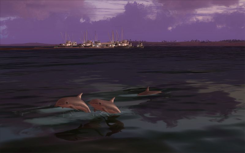
| Chatham Islands - Dolphin watching near the marina.FLT | 07.08.11 | 9.36 kB |
| Chatham Islands - Dolphin watching near the marina.FSSAVE | 07.08.11 | 127.33 kB |
| Chatham Islands - Dolphin watching near the marina.WX | 07.08.11 | 166.86 kB |
| Chatham Islands - Mangere Island.FLT | 07.08.11 | 9.03 kB |
| Chatham Islands - Mangere Island.FSSAVE | 07.08.11 | 212.59 kB |
| Chatham Islands - Mangere Island.WX | 07.08.11 | 3.28 MB |
| Chatham Islands - Napier NZNR update.FLT | 07.08.11 | 9.71 kB |
| Chatham Islands - Napier NZNR update.FSSAVE | 07.08.11 | 165.48 kB |
| Chatham Islands - Napier NZNR update.WX | 07.08.11 | 3.28 MB |
| Chatham Islands - NZCI.FLT | 07.08.11 | 8.94 kB |
| Chatham Islands - NZCI.FSSAVE | 07.08.11 | 187.87 kB |
| Chatham Islands - NZCI.WX | 07.08.11 | 3.29 MB |
| Chatham Islands - Pitt Island Aerial.FLT | 07.08.11 | 8.98 kB |
| Chatham Islands - Pitt Island Aerial.FSSAVE | 07.08.11 | 205.68 kB |
| Chatham Islands - Pitt Island Aerial.WX | 07.08.11 | 113.86 kB |
| Chatham Islands - Pitt Island Airstrip.FLT | 07.08.11 | 9.08 kB |
| Chatham Islands - Pitt Island Airstrip.FSSAVE | 07.08.11 | 205.18 kB |
| Chatham Islands - Pitt Island Airstrip.WX | 07.08.11 | 3.29 MB |
| Chatham Islands - Pitt Island dusk.FLT | 07.08.11 | 8.97 kB |
| Chatham Islands - Pitt Island dusk.FSSAVE | 07.08.11 | 198.62 kB |
| Chatham Islands - Pitt Island dusk.WX | 07.08.11 | 3.28 MB |
| Chatham Islands - Pitt Island RWY 22 approach at dusk.FLT | 07.08.11 | 9.02 kB |
| Chatham Islands - Pitt Island RWY 22 approach at dusk.FSSAVE | 07.08.11 | 192.30 kB |
| Chatham Islands - Pitt Island RWY 22 approach at dusk.WX | 07.08.11 | 3.28 MB |
| Chatham Islands - Rangatira Island.FLT | 07.08.11 | 9.09 kB |
| Chatham Islands - Rangatira Island.FSSAVE | 07.08.11 | 166.71 kB |
| Chatham Islands - Rangatira Island.WX | 07.08.11 | 3.28 MB |
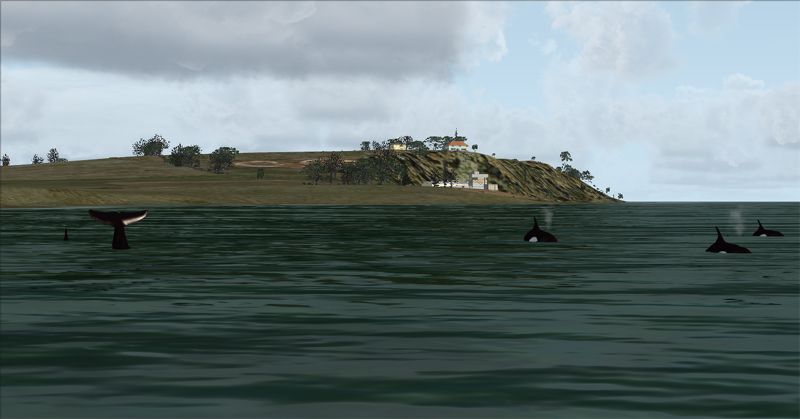
| Chatham Islands - Whale watching.FLT | 07.08.11 | 9.46 kB |
| Chatham Islands - Whale watching.FSSAVE | 07.08.11 | 142.84 kB |
| Chatham Islands - Whale watching.WX | 07.08.11 | 3.28 MB |
| Prop fix for Convair 580 AI | 06.26.11 | 0 B |
| PROP-HS.bmp | 06.10.11 | 85.43 kB |
| Readme.txt | 06.26.11 | 227 B |
| Readme | 07.08.11 | 0 B |
| Readme.htm | 07.08.11 | 19.57 kB |
| Readme.txt | 07.08.11 | 319 B |
| Add.jpg | 07.08.11 | 112.11 kB |
| Air Chathams 1.jpg | 07.07.11 | 219.99 kB |
| Air Chathams 2.jpg | 07.07.11 | 238.01 kB |
| Air Chathams.pdf | 06.19.11 | 86.43 kB |
| Chatham Before-after | 07.06.11 | 0 B |
| 1 CI-SE-default FSX.jpg | 07.06.11 | 254.28 kB |
| 2 CI-SE-Addon with default FSX textures.jpg | 07.06.11 | 270.82 kB |
| 3 CI-SE-Addon with enhanced FSX textures.jpg | 07.06.11 | 284.71 kB |
| 4 PI-default FSX.jpg | 07.06.11 | 276.13 kB |
| 5 PI-Addon with default FSX textures.jpg | 07.06.11 | 282.54 kB |
| 6 PI-Addon with enhanced FSX textures.jpg | 07.06.11 | 297.71 kB |
| CI_10.jpg | 07.05.11 | 232.74 kB |
| CI_12.jpg | 06.23.11 | 242.44 kB |
| CI_15cropped.jpg | 07.05.11 | 286.37 kB |
| CI_17.jpg | 07.05.11 | 206.45 kB |
| CI_18.jpg | 07.05.11 | 233.66 kB |
| CI_3a-800.jpg | 06.23.11 | 243.18 kB |
| CI_3b-800.jpg | 06.23.11 | 460.65 kB |
| CI_Beach.jpg | 07.05.11 | 252.80 kB |
| CI_large2.jpg | 07.04.11 | 233.70 kB |
| CI_NC-Coast.jpg | 07.05.11 | 291.51 kB |
| CI_NE-Coast.jpg | 07.05.11 | 313.19 kB |
| CI_SE-Coast.jpg | 07.05.11 | 317.00 kB |
| CI_Southern_coast.jpg | 07.05.11 | 330.31 kB |
| CI_SW-Coast.JPG | 07.05.11 | 333.25 kB |
| CI_thumbnail2.gif | 07.04.11 | 10.36 kB |
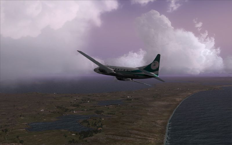
| Dawn takeoff.jpg | 07.08.11 | 172.74 kB |
| Dolphins near Marina.jpg | 07.07.11 | 167.44 kB |
| Dolphins near Marina2.jpg | 07.07.11 | 174.40 kB |
| Flying with the seagulls at Mangere Island.jpg | 07.08.11 | 330.37 kB |
| NZNR_Napier replacement.jpg | 06.24.11 | 290.36 kB |
| NZPI with default terrain mesh.jpg | 06.24.11 | 435.57 kB |
| Pitt Island 22 approach at dusk.jpg | 07.04.11 | 270.27 kB |
| Pitt Island Airstrip FSX.jpg | 07.04.11 | 488.57 kB |
| Pitt Island Airstrip Satellite.jpg | 06.23.11 | 350.75 kB |
| Pitt Island with AI.jpg | 06.23.11 | 402.90 kB |
| PI_Pitt.jpg | 07.05.11 | 278.60 kB |
| Rangatira Is with Pitt in background and Chatham in the far distance.jpg | 07.08.11 | 294.49 kB |
| Thumbs.db | 08.04.10 | 69.00 kB |
| Whale watching on northern shore.jpg | 07.08.11 | 175.59 kB |
| scenery | 07.08.11 | 0 B |
| 000_CVX_Chatham_terrain_exc.BGL | 07.04.11 | 7.04 kB |
| 001_CVX_Chatham_water-coasts_v2.BGL | 07.06.11 | 95.00 kB |
| 1_CVX_Chatham_Island_1_base_LC.BGL | 07.06.11 | 97.54 kB |
| 2_CVX_Chatham_Island_2_multi_LC.BGL | 07.06.11 | 77.41 kB |
| 3_CVX_Chatham_Island_3_more_Pitt_trees.BGL | 07.04.11 | 1.06 kB |
| 4_CVX_Chatham_Island_4_volcanics.BGL | 07.04.11 | 22.52 kB |
| 5_CVX_Chatham_Island_5_beaches.BGL | 07.04.11 | 2.92 kB |
| Chatham_Island_Fishing_Marina_obj.BGL | 07.07.11 | 156 B |
| Chatham_wildlife_ani.BGL | 07.08.11 | 4.28 kB |
| NZCI_ADEX_CS.BGL | 06.21.11 | 6.12 kB |
| NZNR_ADEX_CS.BGL | 06.21.11 | 11.94 kB |
| NZNR_terminal_building.BGL | 06.18.11 | 220 B |
| NZPI_ADEX_CS.BGL | 06.19.11 | 833 B |
| Pitt_Island_Airstrip_Objects.BGL | 06.17.11 | 220 B |
| flyawaysimulation.txt | 10.29.13 | 959 B |
| Go to Fly Away Simulation.url | 01.22.16 | 52 B |
More FSX & P3D add-ons hand-picked based on this download.
FSX Scenery
Chatham Islands New Zealand. This is a basic photoreal upgrade to default NZC…
 FSX Scenery
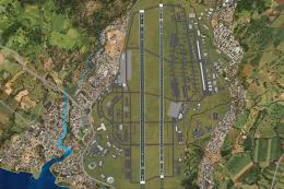
(Tuuta) Airport (NZCI). Welcome to Chatham Islands Airport (Tuuta), located 1…
 FSX Scenery
Chatham Islands For Vector Land Class NZ. This project is a modified version …
 FSX Scenery
Enhance your virtual flights across the Netherlands with the FSX NL200 V4 Tre…
 FSX Scenery
Scenery Greek Islands. This pack contains LGHI Chios, LGKO Kos, LGMK Mikonos,…
FSX Scenery
Scenery Greek Islands Vol. 2. This pack contains LGKR Kerkyra, LGKF Kefalloni…
 FSX Scenery
Kadena AB And Okinawa Islands airstrips, southern Japan. This package contain…
FSX Scenery
Midway Atoll (Midway Islands) Photoreal Scenery. Midway Atoll - or Midway Isl…
Be the first to leave a comment on this download.
Be the first to share your thoughts on this download.