New Zealand

Page 3

Preview screenshot

Godzone Taranaki

Covering 30 × 40 km around Mt Taranaki / Mt Egmont, this FSX photoreal scenery applies 2.5 m-per-pixel LINZ imagery, subtle blend-mask transitions and adapted autogen vegetation and buildings, aligning accurately with Geographx 20 m or 75 m meshes and complementing the separate Taranaki Region landclass.

File Size
28.32 MB
Total Downloads
243
Star Rating
2/5
Preview screenshot

Alexandra

Covering Alexandra and Clyde in Central Otago, this Vector Land Class–compatible photo-real add-on for Flight Simulator X (FSX) offers high-resolution orthoimagery, dense autogen, refined terrain mesh and landclass layers sourced from LINZ, supplying VFR pilots a realistic rendition of New Zealand’s semi-arid inland basin.

File Size
19.43 MB
Total Downloads
239
Screenshots
1
Preview screenshot

Omarama Airfield

Omarama Airfield (NZOA) supplies FSX SP2 users with a technically faithful glider hub in New Zealand’s McKenzie Basin, combining high-resolution VLC landclass, bespoke clubrooms, triple-row hangars and realistic signage with an exact AFX layout, flattens and excludes calibrated for seamless soaring just west of Benmore Dam.

File Size
2.87 MB
Total Downloads
238
Screenshots
15
Preview screenshot

Contact Energy Gas Plant And Airstrip

Contact Energy’s NZVM Rimu Gas Plant scenery positions a functional 1 000 m strip beside the live production complex at Mokoia, offering FSX SP2 pilots a dependable Taranaki coastal fix; features purpose-built structures, exact AFCAD, terrain flattens and seamless Vector Landclass alignment for low-level VFR or utility flights.

File Size
5.14 MB
Total Downloads
236
Screenshots
9
Preview screenshot

Tokoroa Aerodrome

Tokoroa Aerodrome (NZTO) for FSX SP2 refreshes this southern Waikato airfield with an 850-metre sealed strip, reworked AFCAD, precise mesh elevations and VLC library objects, giving GA pilots accurate taxiways, club hangars and nearby kart-track references that settle naturally into Microsoft Flight Simulator X terrain.

File Size
1.35 MB
Total Downloads
208
Star Rating
1/5
Screenshots
8
Preview screenshot

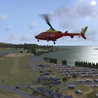
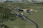
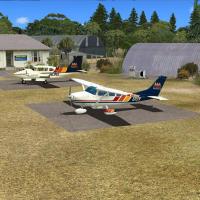
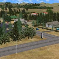
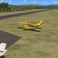
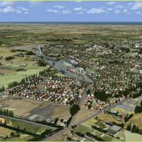
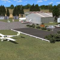
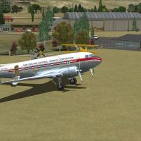
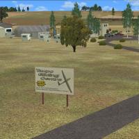
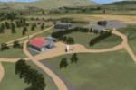
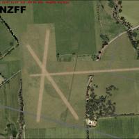
Christchurch Small Airfields

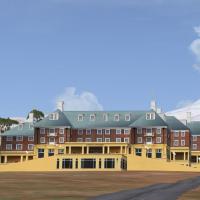
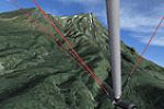
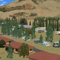
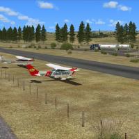
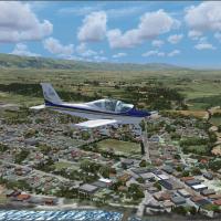
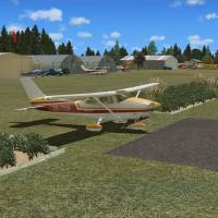
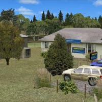
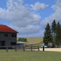
Targeted at FSX pilots exploring South Island, this flight-sim scenery add-on refreshes Canterbury’s general-aviation zone with detailed versions of West Melton NZWL, an enhanced Rangiora NZRT and compact Forest Field NZFF near Christchurch Intl, supplying new photoreal ground polys, revised AFCAD data, club hangars, parking spots and accurate runway markings for authentic VFR circuits and bush-flying practice.

File Size
2.4 MB
Total Downloads
206
Screenshots
3
Preview screenshot

Greymouth Airport (NZGM)

Greymouth Airport NZGM for FSX introduces a revised layout on New Zealand’s rugged West Coast, adding real-world taxiway geometry, relocated fuel bay, accurate windsocks and club parking for GA traffic and helipad sorties; built with ADE 1.37 and relying solely on default library assets, this freeware neatly complements South Island VFR flying.

File Size
2.39 MB
Total Downloads
203
Screenshots
3
Preview screenshot

Turangi Airfield

Turangi Airfield (NZTN) scenery brings FSX pilots to the southern rim of Lake Taupo with a freeware package tuned for SP2; accurate AFD files, VLC-compatible landclass, custom vegetation and signage replicate Mountain Air’s tour base and the Turangi Aero Club grass strip, enabling demanding short-field VFR and GA circuits within New Zealand’s volcanic basin.

File Size
1.79 MB
Total Downloads
203
Star Rating
1/5
Screenshots
8
Preview screenshot

NZPM

FSX fliers seeking a tidy update for Palmerston North (NZPM) will find this AFCAD by Kai P. Kamjunke useful; revised gate codes, corrected runway 07/25 dimensions, accurate taxiway links, ATC parking logic and compliant ILS data align AI traffic and flight-planning with present-day New Zealand AIP charts.

File Size
5.46 KB
Total Downloads
203
Screenshots
8
Preview screenshot

Te Kuiti New Zealand

Covering NZTT Te Kuiti on New Zealand’s North Island, this FSX add-on replaces default assets with photoreal ground imagery and refined elevation data tuned for the VLC 20 m mesh, bringing sharper runway markings, township autogen and more faithful terrain cues useful for VFR circuits and regional GA traffic.

File Size
695.58 KB
Total Downloads
196
Star Rating
1/5
Screenshots
1
Preview screenshot

Ryans Creek Airfield

Covering ICAO NZRC on Stewart Island, this FSX SP2 scenery add-on rebuilds Ryans Creek Airfield with photo-matched terrain, accurate coastlines, dense bush autogen and VLC library objects, capturing the short sloping runway, variable winds and hilly approach profiles familiar to New Zealand GA and commuter pilots.

File Size
1.94 MB
Total Downloads
196
Screenshots
6
Preview screenshot

Ashburton

Covering Ashburton township and its rural Canterbury surrounds, this FSX-compatible photoreal package layers high-resolution LINZ orthoimagery with dense autogen, refined Vector Landclass data, and a reworked NZAS airfield, giving VFR pilots realistic farm blocks, irrigation patterns, and accurate runway geometry between Christchurch and Timaru.

File Size
4.86 MB
Total Downloads
194
Screenshots
1
Preview screenshot

Stratford Aerodrome

Stratford Aerodrome NZSD scenery for FSX SP2 aligns with Vector Landclass terrain, bringing the Taranaki grass strip, club hangars, racecourse backdrop and glider facilities into accurate AFCAD layout, compiled with Flight1 Instant Scenery and AFX, ideal for short GA hops from New Plymouth or training circuits across New Zealand’s West Coast.

File Size
2.98 MB
Total Downloads
188
Screenshots
9
Preview screenshot

Mandeville Aerodrome

Mandeville Aerodrome (NZVL) for FSX SP2 depicts the grass strip near Gore in Southland with photoreal orthoimagery, corrected AFCAD data, VLC-compatible flattens, custom Croydon Aviation Heritage Trust hangars, and period De Havilland restoration workshops; produced via Instant Scenery and AFX, this freeware integrates cleanly with Vector Landclass and national New Zealand mesh.

File Size
2.21 MB
Total Downloads
187
Screenshots
12
Preview screenshot

Alexandra Airport

FSX fliers will find this Alexandra Airport (NZLX) add-on for Otago, New Zealand, refreshes the regional aerodrome with reworked apron markings, adjusted runway data and a revised AFCAD compiled via ADE 1.45, all utilising stock library objects for seamless compatibility with default or NZ landclass terrain.

File Size
15.64 MB
Total Downloads
186
Screenshots
12
Preview screenshot

Centennial Park Airfield

Covering Centennial Park Airfield (NZCG) near Taupo, this FSX SP2 scenery injects accurate glider-field detail, custom hangars, racetrack and motorsport park models from Godfrey Tier, with Lawrie Roache’s AFCAD, flattens and VLC libraries ensuring seamless integration with Vector Landclass for Microsoft Flight Simulator X general aviation operations.

File Size
3.89 MB
Total Downloads
183
Screenshots
12
Preview screenshot

Rangitata Island Aerodrome

Adds Rangitata Island Aerodrome (NZRI) to FSX, supplying custom AFCAD, grass strip geometry, local farm buildings and photoreal ground poly for the South Canterbury plain. Useful for VFR circuits, training hops and light GA traffic, the package substitutes the absent default field and is incompatible with VLC New Zealand scenery.

File Size
15.46 MB
Total Downloads
181
Star Rating
3/5
Screenshots
12
Preview screenshot

Chatham Islands For Vector Land Class NZ

Covering the remote Chatham archipelago 800 km east of mainland New Zealand, this FSX scenery aligns Vector Land Class data with revamped landclass, 15 m mesh and stock-tuned objects at NZCI, NZNR and NZPI, adds an AI-ready Pitt Island strip, and allows seamless toggling between VLC and standalone layouts for tidy VFR or AI routing.

File Size
3.77 MB
Total Downloads
178
Screenshots
19
Preview screenshot

Adams Island DeLuxe

FSX Adams Island DeLuxe renders the sub-Antarctic corner of New Zealand in Microsoft Flight Simulator X with refined land-class data, photoreal textures and mesh shaping Mount Dick, Carnley Harbour caldera and the surrounding volcanic rim; includes a lighted dirt strip at Penship Bay for STOL work or Embraer 120 shuttle legs on remote archipelago freight runs from Invercargill.

File Size
1.93 MB
Total Downloads
178
Star Rating
2/5
Screenshots
6
Preview screenshot

Hanmer Springs Airfield

NZHR Hanmer Springs Airfield scenery for FSX SP2 integrates smoothly with VectorLandClass terrain, rendering the compact alpine strip two nautical miles south of Hanmer Springs village in Northern Canterbury on New Zealand’s South Island. Custom signage, fertilizer bins, flattens, excludes and a refined AFCAD facilitate bush flying, GA circuits and helicopter work among spa resorts and ski-field foothills.

File Size
3.8 MB
Total Downloads
178
Screenshots
10

4 pages with 73 downloads.

previous1234next