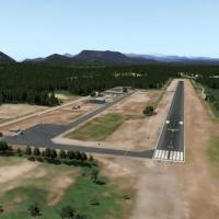
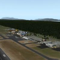
Dr Leite Lopes State Airport (RAO/SBRP) near Ribeirão Preto, Brazil, is enhanced with corrected aprons, ramps, gates, taxiways, and lighting plus ortho-photo coverage of the airfield area. Two inst…
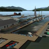
Sechelt Aerodrome sits 1.3 nautical miles south southeast of Sechelt-Gibsons, British Columbia, with both the airfield and the harbour modelled and the nearby mine also depicted. By Canada4XPlane, …
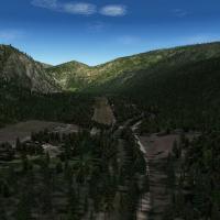
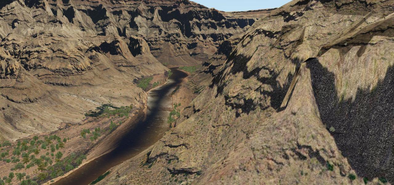
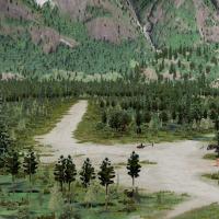
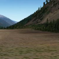
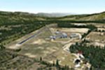
Grass airstrip sits in Central Idaho, three miles south of Yellow Pine in Valley County, offering access to the surrounding rugged terrain and nearby small strips. It requires libraries including 3…
Nakusp Airport sits 1.3 nautical miles NNW of Nakusp, British Columbia, Canada. The installation requires CDB_LIBRARY.ZIP, THE_HANDY_OBJECTS_LIBRARY.ZIP, JB_LIBRARY.ZIP, MISTERX_LIBRARY.ZIP, OPENSC…
Canada4XPlane delivers an Alberni Valley Regional Airport enhancement, located 6 nautical miles northwest of Port Alberni, British Columbia. It requires CDB_LIBRARY.ZIP, JB_LIBRARY.ZIP, FF_LIBRARY_…
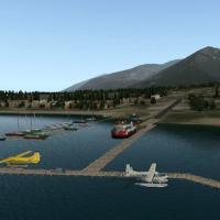
Campbell River Airport sits 4.5 nautical miles south of Campbell River, British Columbia, and operates as an airport of entry staffed by the Canada Border Services Agency. It requires a set of libr…
Canada4XPlane catalogs a Pemberton Regional Airport installation, a registered aerodrome located 5 nm south-southeast of Pemberton, British Columbia. It relies on CDB_LIBRARY.ZIP, JB_LIBRARY.ZIP, R…
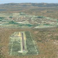
Quixada Airport SNQX in Ceara, Brazil serves general aviation and features corrected aprons, ramps, gates, taxiways, lighting, city buildings, and ortho-photo coverage for the airfield area. Two va…

Petrolina Senador Nilo Coelho International-Cargo Airport (PNZ, SBPL) is operated by Infraero and features corrected aprons, ramps, gates, taxiways, lighting, and ortho-photo coverage. Two installa…
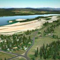
An abandoned airfield sits at the north end of Stave Lake, 24 nautical miles northeast of Pitt Meadows near Vancouver, Canada. It supports Ortho4XP mesh and orthophotos from Bing, and requires libr…
Fraser Valley, British Columbia, Canada, near Boston Bar, hosts an abandoned emergency strip designed to work with Ortho4XP mesh and Bing-sourced orthophotos. It requires the 3D People Library, The…
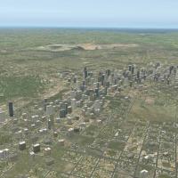
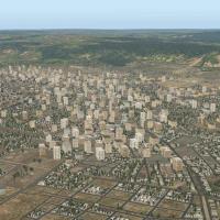
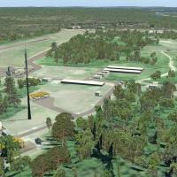
The city-owned airfield sits 2 nautical miles east of Aberdeen's central business district in Brown County, South Dakota, United States. Its WWII history centers on a contract glider training airfi…

Barcelos SWBC aerodrome (IATA BAZ, ICAO SWBC) in Amazonas, Brazil, offers ortho-photo visuals, corrected aprons and taxiways, and cityscape, with ground services in the variant. Two versions exist,…
CKY8 airstrip sits off Ghost Lake near Arkayla Springs in Alberta, a short hop from Banff, Calgary, and Springbank. It is not in the default database and requires latest versions of 3D People Libra…
An aerodrome sits 2.0 nautical miles southeast of Salmon Arm, British Columbia, Canada. It requires the latest versions of several libraries, including 3D People Library, CDB Library, Handy Object …
Adalberto Mendes da Silva Airport (CAC, SBCA) serves Cascavel, Paraná, and CETTRANS operates it under SEIL, featuring corrected aprons, ramps, gates, taxiways, lighting, and ortho-photo airfield co…
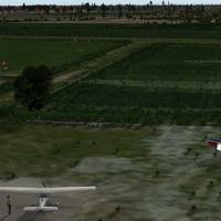
Zuienkerke functions as a tiny ULM strip near the Belgian west coast, set in a rural landscape suitable for short hops. The work uses mostly library objects and restricts helicopters and legacy air…
Montes Claros/Mario Ribeiro Airport (IATA MOC, ICAO SBMK) features corrected aprons, ramps, gates, taxiways, lighting, and ortho-photo airfield coverage with city buildings; PDF charts updated May …

Two variants carry the v1.0.0 label for the Manaus area airfield in the Amazonas region. The addon corrects aprons, ramps, gates, taxiways and includes a lighting system, and uses only default libr…
Jacareacanga-Rio Tapajos Municipal Airport, IATA JCR and ICAO SBEK, features corrected aprons, ramps, gates, taxiways, and lighting, along with an ortho-photo airfield area and surrounding city bui…