Page 3
Searches the whole library — filter by sim & category on the results page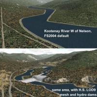
Coordinates N49-53, W116-120 anchor a regional mesh that adjusts lake elevations for best fit and adds new shorelines, transportation network, and landclass between Nelson and the U.S. border. Some…

Part 1 of Realitypack 1.2, by Sascha Rieger, reissues grass, cliff and forest imagery among other elements. The realeurope graphics remain experimental and controversial, and are not recommended if…
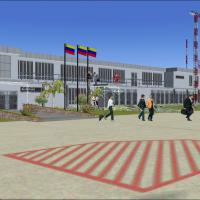
Cumana, Venezuela (SVCU) hosts an airport in the northwest quadrant of the state at N10 27.2 W064 07.8 and features a 3100 m by 45 m asphalt runway dating from 1990 to replace San Luis. The facilit…
This patch comprises all stars visible for the naked eye, drawn from the Bright Star Catalogue, 4th Edition, by Wayne H. Warren Jr., May 1982 (BSC4). Users can access the original catalogue freely …
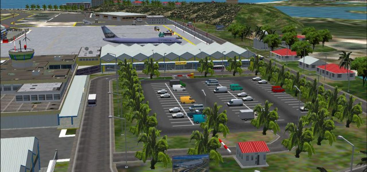
Robert L. Bradshaw International airport on St. Kitts lies in a valley between mountain ranges at the island’s southern end, featuring a modern terminal, distinctive green glass tower, and outer bu…
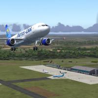
Bremen airport (EDDW) presents a realistic layout with dynamic operation featuring wind-sensitive aircraft, passenger gates, catering and fuel trucks, and follow-me cars. The dynamic objects animat…
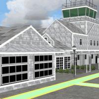
At KACK, the memorial facility on Nantucket depicts the terminal, GA building, Firehouse, hangar, and a perimeter fence, while a Cape Cod style shingle siding and white fencing with streetside curb…
Designed with srtm waterbodies data, it adds Ireland-wide water features including rivers, lakes, and shorelines for the entire island, all derived from the srtm waterbodies data source, and uses d…
Covering coordinates N32°-40°, E70°-76°, the LOD9 base mesh blends Shuttle Radar (SRTM) data with map-derived elevations to produce a more accurate topography. Holger Sandmann compiles the data whi…
V3 for the EGCN airfield restores autogen around the airfield perimeter, includes a Landclass file that creates wooded areas and surrounding villages, and fixes the ATIS identity, and aligns with d…
A complete remake of the islands of Mauritius and Rodrigues includes mesh, landclass and coastlines, offering a consolidated landscape together for both islands. A gmax designed international airpo…
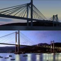
Rubén Castiñeiras delivers Version 1.1 in October 2003. It places the Rande Bridge over the Bay of Vigo near Vigo airport LEVX at roughly 42°18'N 8°38'W in Galicia, Spain, and removes the original …
The second version for Meyenheim base in Alsace updates the area around two French air force squadrons, adding a helipad, rebuilding roads, and introducing 3D trees. A major effort raises frame rat…

Located in the Western Province of Papua New Guinea, the canyons present a great flying challenge to all flight simmers. Credit goes to David Ricketts, and concan_approach.JPG appears as a visual r…
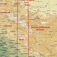
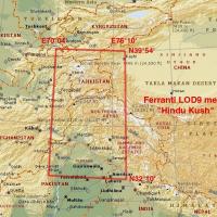
Enhanced terrain mesh concentrates on the Himalayas near Kashmir, spanning coordinates N30–39, E76–78, and delivers LOD9 coverage that blends with the LOD10 Himalayan Peaks series. Holger Sandmann …
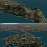
The coastal strip of Queensland receives a revamp that spans from the Burdekin River south of Townsville to the Cairns area near Babinda in North Queensland, reshaping coastlines, towns, islands, r…
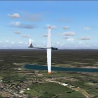
The files add thermals to the Queensland Region’s default airport network in Australia, spanning 27 aerodromes with ICAO codes such as YBMC, YGYW, YGLA and YBWP. Three intermediate reference points…
This photo depiction covers areas around Lake Chuzenji and highlights Nikko’s sightseeing spots. Nikko lies 43 km northwest of Utsunomiya Air Base RJTU, and the file nikko_ph.jpg accompanies the de…
An enhanced depiction of the Wismar airfield refines the former release, presenting a detailed view of the Mecklenburg/Germany site on the Baltic. A file named edcw_2k4.jpg is included, anchoring t…
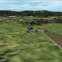
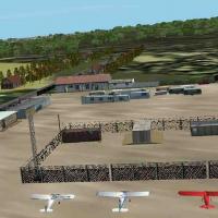
By HAUGER Fredo, the Vieux-Ferette airfield in Alsace, northeast France, includes hangars, a club house, and static ultralights. An image named LF6822_5.jpg accompanies the site and it invites VFR …