Page 77
Searches the whole library — filter by sim & category on the results page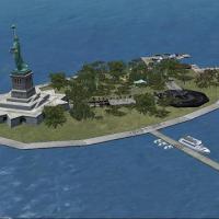
A fictional makeover reshapes the flat Liberty Island within the simulation, now featuring the Statue of Libery and a variety of other objects for visual interest. By Alan D. Griswold, the work nam…
 United States of America
Sylvain Tremblay designs optimized .bgl files covering the Montreal area in Quebec, Canada, to boost frame rates for VFR operations. The approach centers on delivering smoother performance through …
 Canada
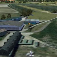
Alf Denham presents Volume 21, upgrading three small UK airfields—Crowfield EGSO, Draycot X2DR, and Linley Hill EGNY—using Google Earth imagery and Pooleys UK Flight Guide as references. The work e…
 United Kingdom
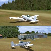
Foxpine Airfield sits on the northwest border of Foxton, New Zealand, tucked beside a pine plantation and flanked by Palmerston North to the east and Paraumumu to the south. Jarred Yates, Michael A…
 New Zealand
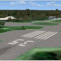
Skukuza Airport, registered FASZ in South Africa, lies about 5 kilometers northeast of Skukuza Restkamp in the Kruger National Park. It is SP2 compatible and pairs best with the Aeroworx mesh, by H…
 South Africa
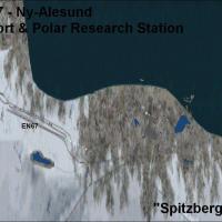
Two airports on the Svalbard archipelago, ENSB (Longyear) and EN67 (Broggerhalvoya), lie near the North Pole in Norway. ENSB offers one asphalt runway 10-28 and a heliport, while EN67 has one aspha…
 Norway
Verdun-Le Rozelier presents a photoreal ground layout with seasonal and night variants, and adds Verdun city and surrounding forests. The airfield features two parallel runways, asphalt and grass, …
 France
By Daniel Louvet, Abbotsford International, registered as CYXX, sits in the Fraser Valley of British Columbia and expands cargo, a military base, and a heli base with a heli school, while accommoda…
Canada
Registered as KSEZ in Arizona, this airfield sits on a mesa above the City of Sedona with geographic prominence. It is nicknamed the USS Sedona and enables take-off and landing on a land-locked air…
United States of America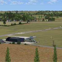
Alf Denham provides three UK airfields—Old Buckenham EGSV, Conington EGSF, and Sturgate EGCS—anchoring the Conington site with the Conington_EGSF file, while circuits run at 1000 ft QFE for referen…
United KingdomDurban Harbor in South Africa advances to version 2.0, introducing buildings along the beachfront to heighten realism. By Frits Beyer, the update focuses on enhancing coastal detail and adds struct…
South Africa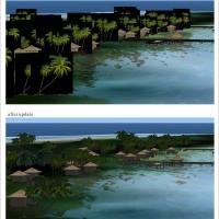
Two components, Tuamotu-X_A and Tuamotu-X_B, are required, with file names FPTA-XA.ZIP and FPTA-XB.ZIP, to fix transparency of 3D objects and runway flattening across Tuamotu installations. Tuamotu…
 French Polynesia
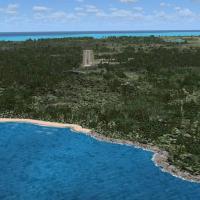
By Art Poole, the MYCB project updates Cat Island with runway, taxi paths, and parking, based on Google Earth imagery and Harrington Mallory’s photos and optimized for UTX-TAC. The Models folder ho…
 Bahamas
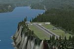
The Pro Hops lineup includes eight airports across a British Columbia and Alaska corridor, marking the third installment by J. D. Starseed, positioned within a broader regional series. It does not …
 Global (World)
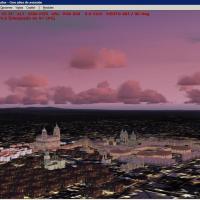
Two files split the Iberian Peninsula night visuals from the main project due to size, with contributions from NOVA and other authors, compiled by Toni Agramont. The night visuals align with penins…
 Spain
Spain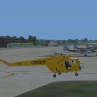
RAF Tangmere airfield (EGUT) is shown in its final postwar form, with upgraded tarmac runways and concrete blast shelters. Trevor Clark handles airfield representation, with Ted Harrison contributi…
United Kingdom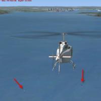
Ralph Eisenegger depicts an AI traffic file for a humpback whale, detailing two whales and a tourist boat near Halifax, Nova Scotia. It uses coordinates N44°31' W63°27' and begins at 14:45 local ti…
Canada
By FCD, KGSP in the Upstate South Carolina area receives an overhaul that realigns terminal buildings, aprons, and gate labeling, while jetways become fully visible and operable via CTRL+J to accom…
United States of America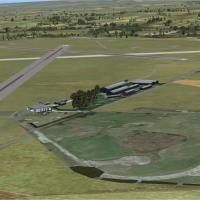
Three UK airfields receive targeted enhancements with Bourne Park (X2BP), Stoke Golding (X3NN), and Tatenhill (EGBM), featuring precise object placements and refined runways, ramps, and nearby poin…
United Kingdom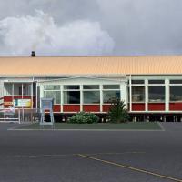
Custom 3D buildings accompany NZCI at the Chatham Islands and rely on CGTextures-created textures; the work sits best with a 20 meter mesh add-on. By Michael Allen-Andrews, it is freeware, and its …
New Zealand