Preview

MSFS Inverness Airport (EGPE) Scenery

Inverness Airport (EGPE) recreated as a freeware, full replacement for Microsoft Flight Simulator (2020 and 2024), featuring bespoke terminal, tower, and cargo models, accurate landside transport links, and coherent night lighting that preserves apron readability and context. Includes believable operator presence; avoid other Inverness mods to prevent conflicts.

42 downloads Flight Simulator 2020 CompatibleFlight Simulator 2024 Compatible United Kingdom
  • File: egpe-inverness-msfs-universal.zip
  • Size:365.38 MB
  • Scan: Clean (11d) Verified clean
  • Access:Freeware
  • Content:Everyone

Scotflight’s freeware remake of Inverness Airport (EGPE) delivers a full, drop-in replacement for Microsoft Flight Simulator—covering both the 2020 release and the new Microsoft Flight Simulator 2024. Built with permission to appear on Fly Away Simulation, this update supersedes the earlier v2.0 and brings bespoke models, carefully mapped landside detail, and a coherent night environment across the whole airfield.

Highlands Gateway Recreated with Real-World Context

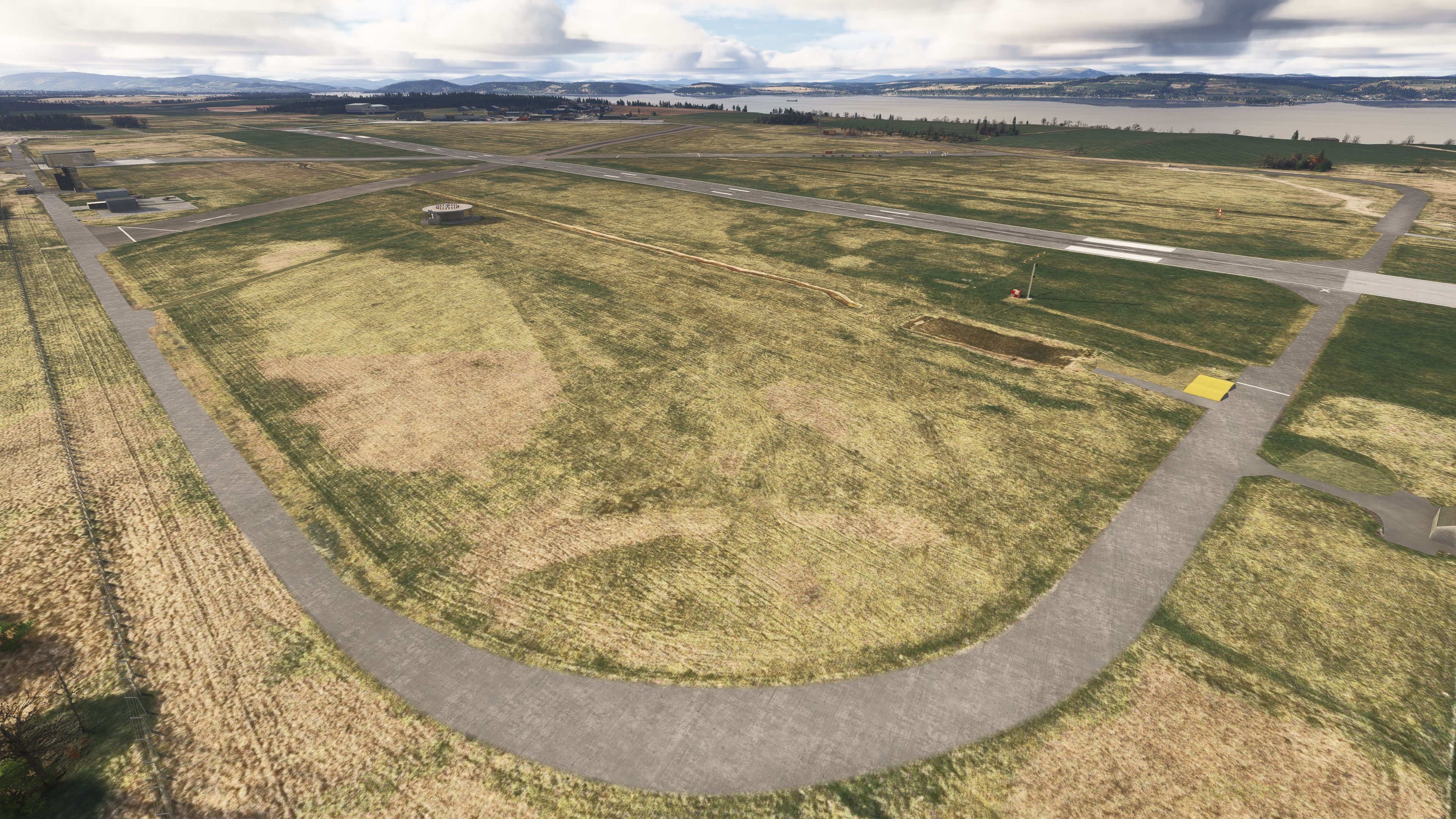
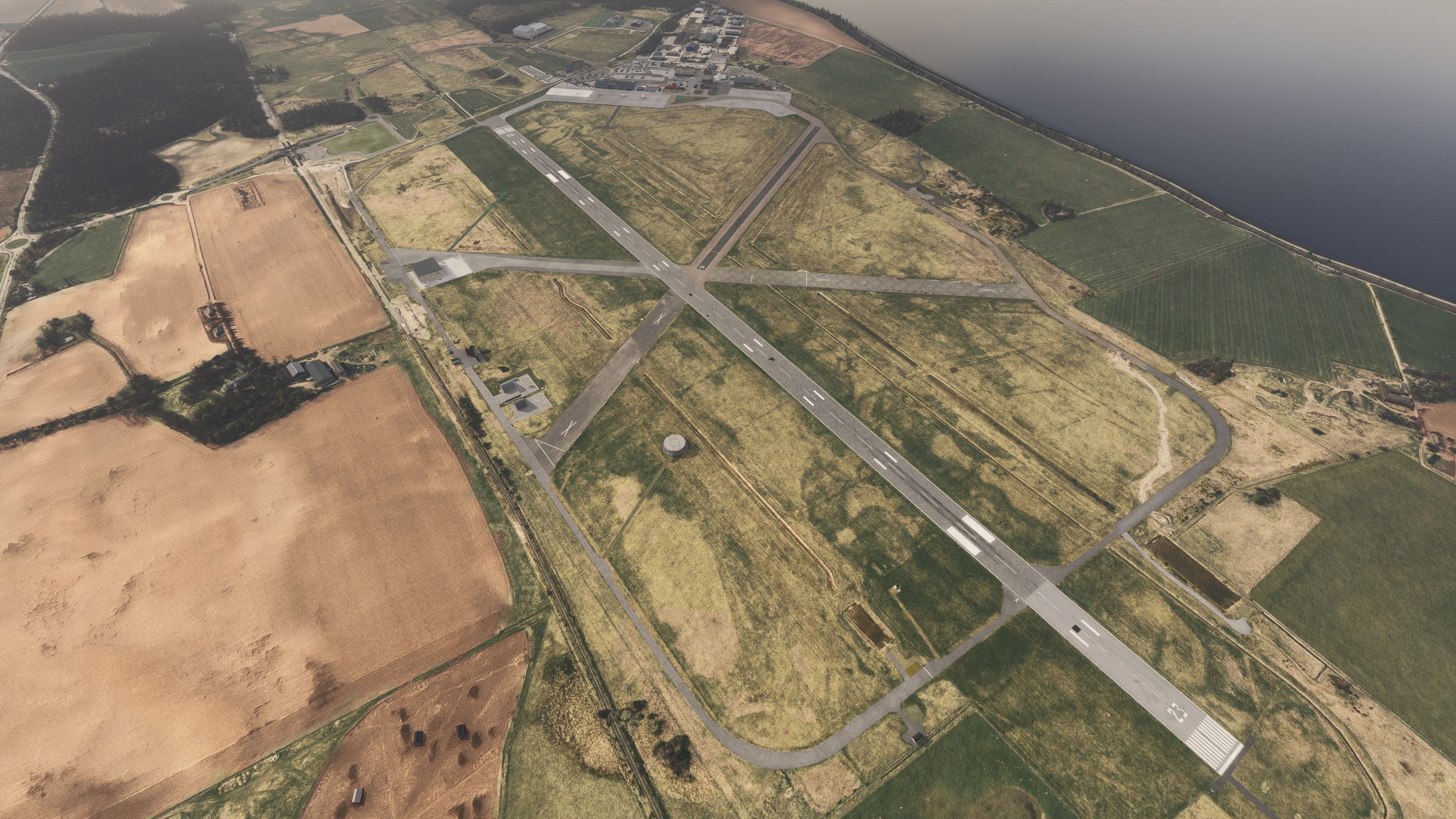
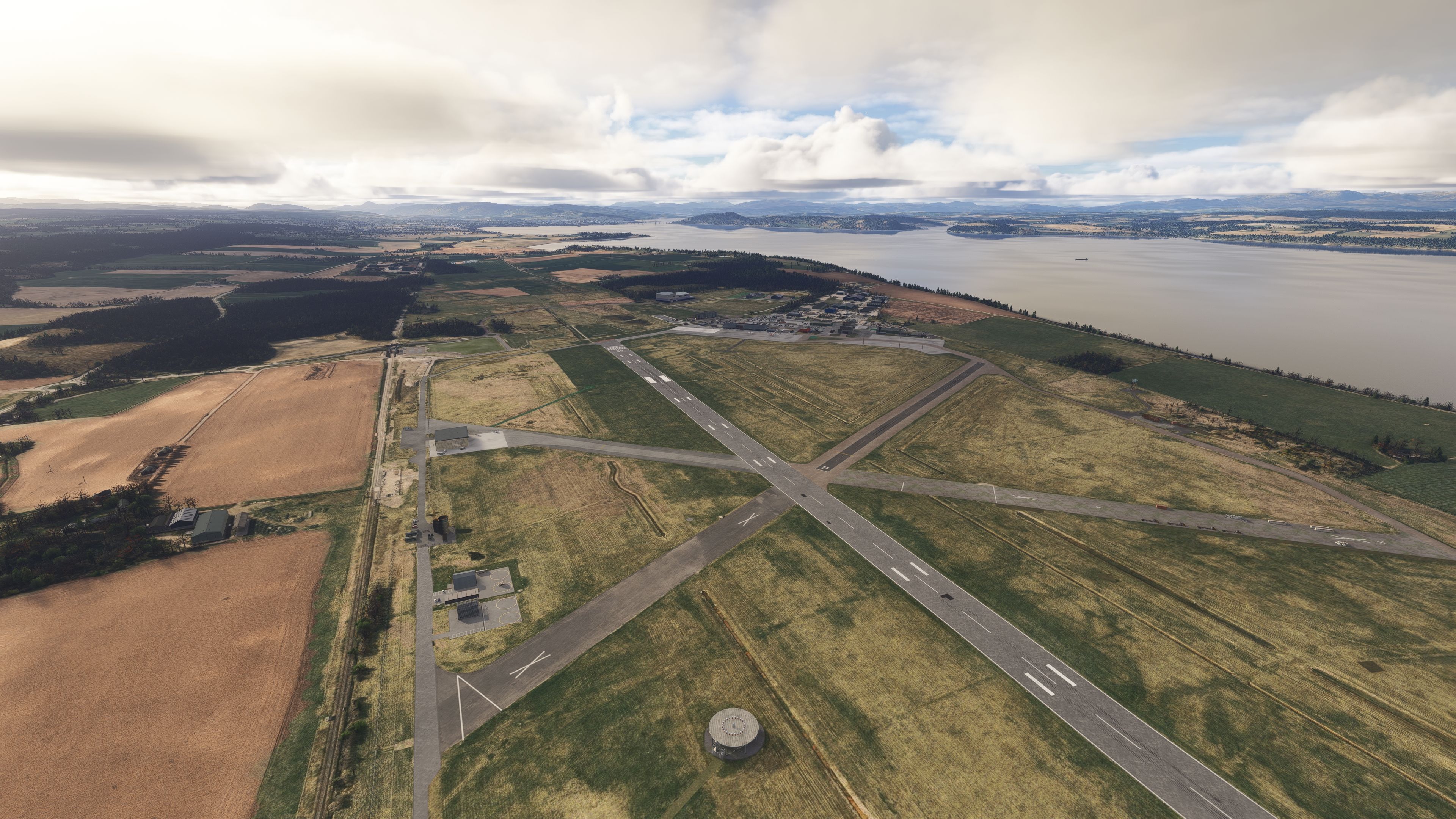
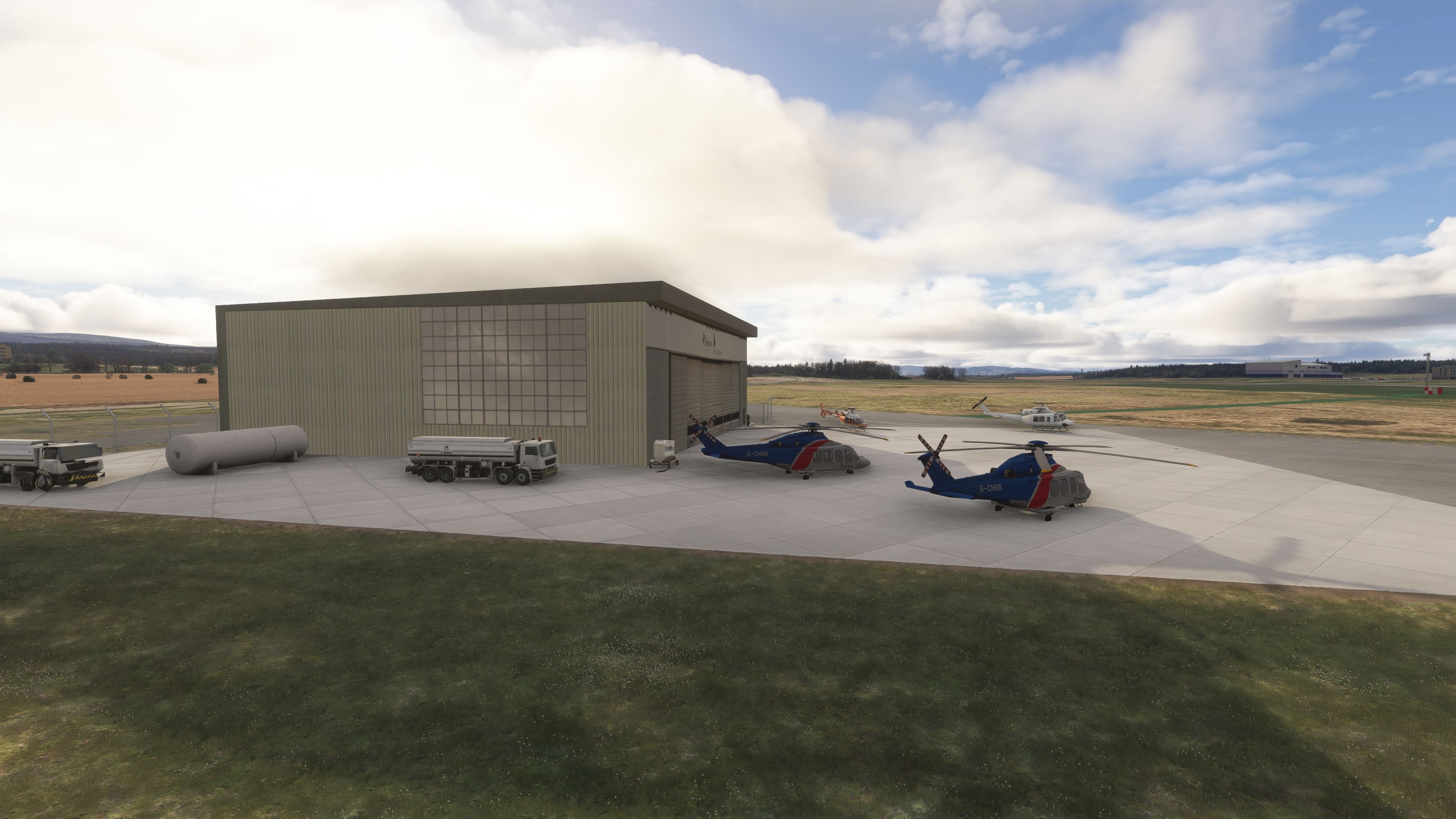
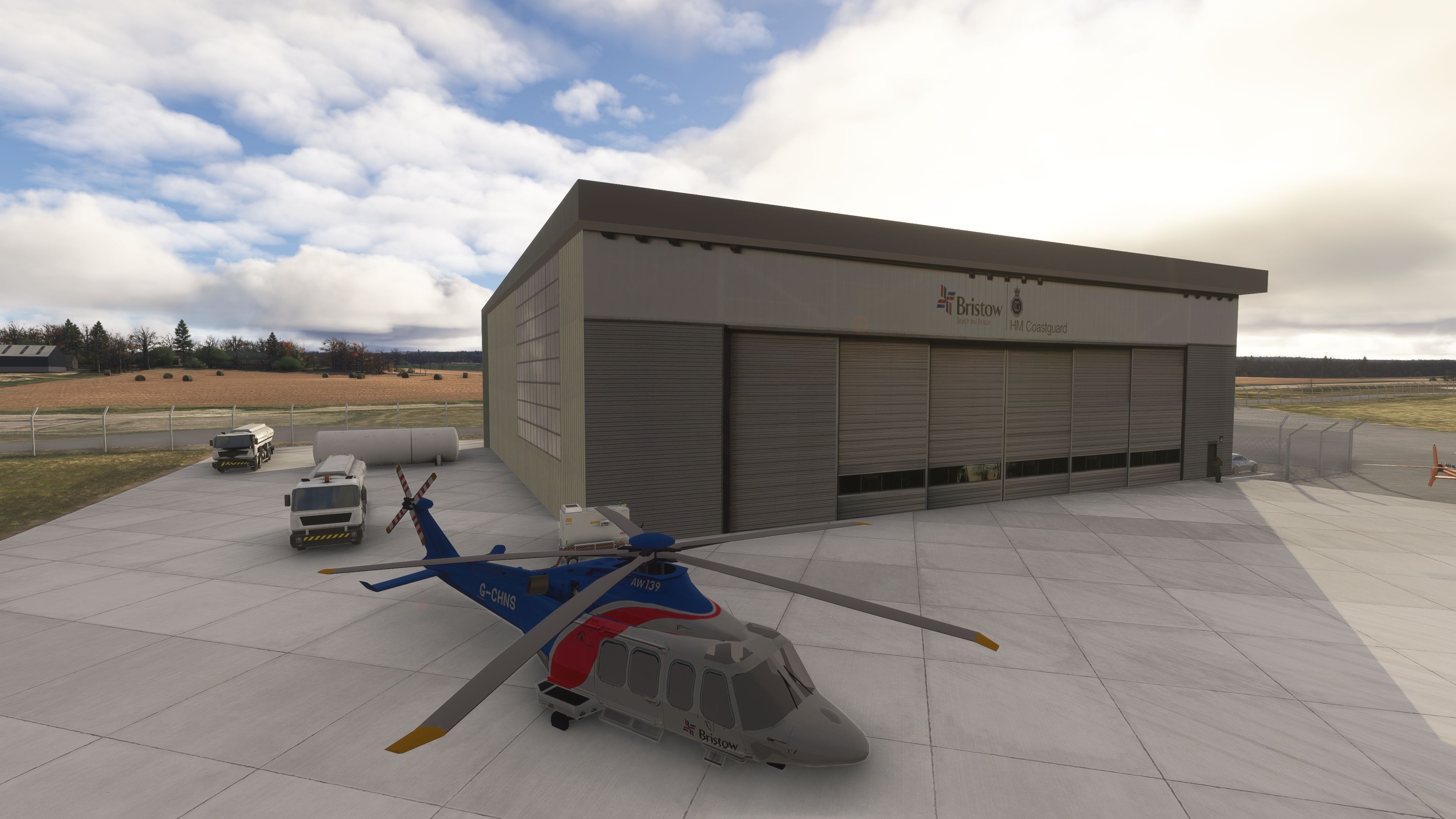
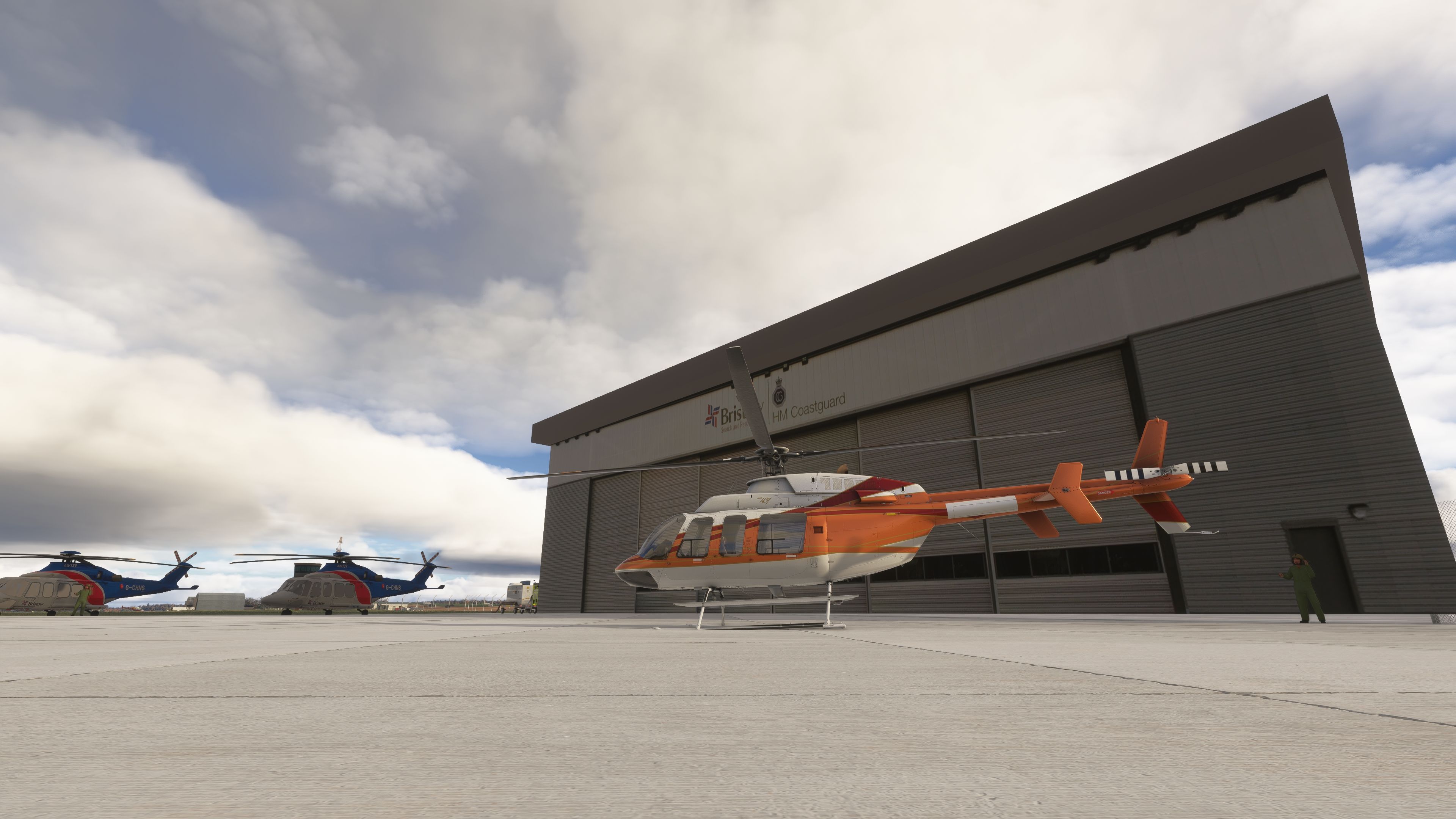
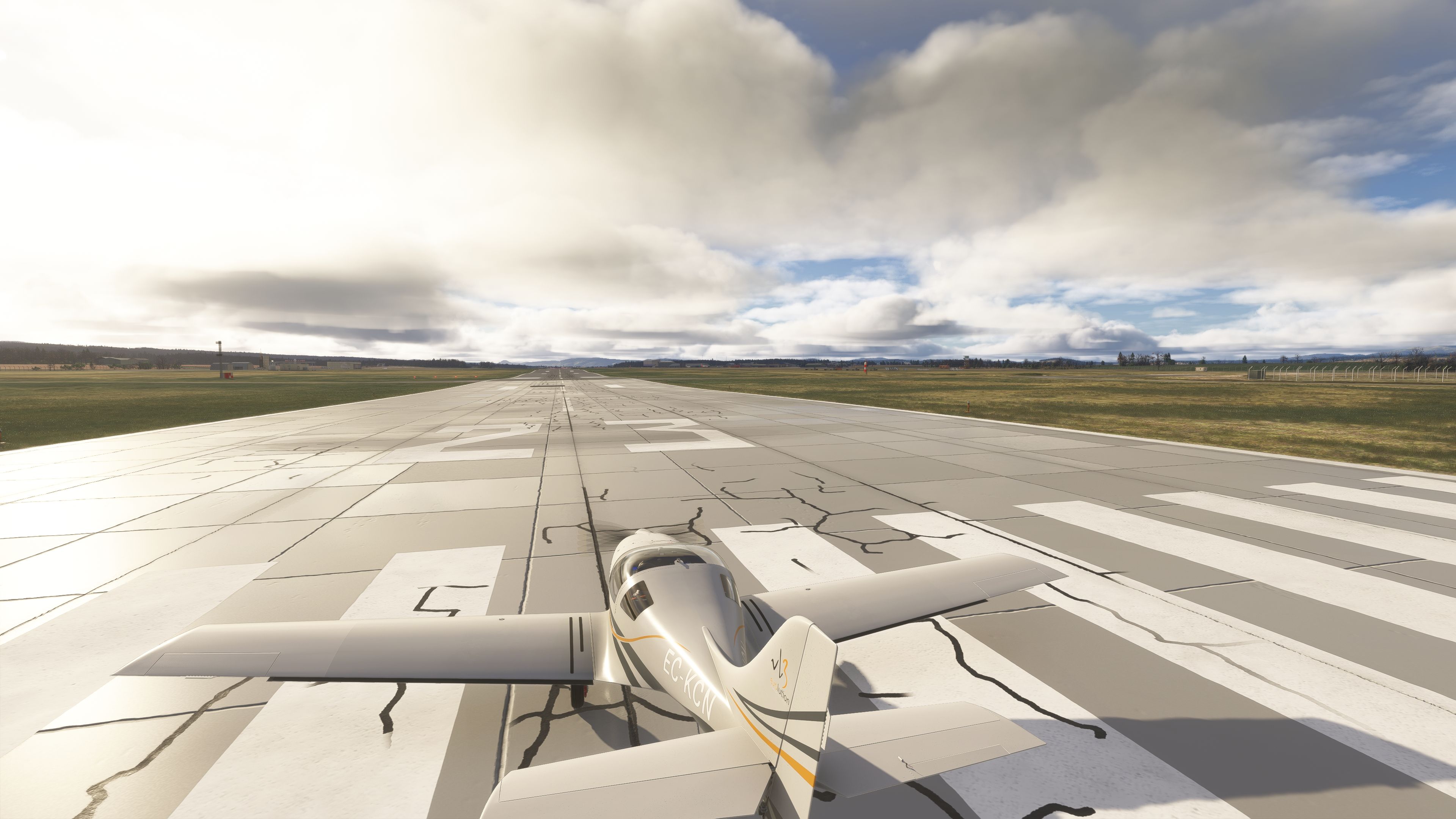
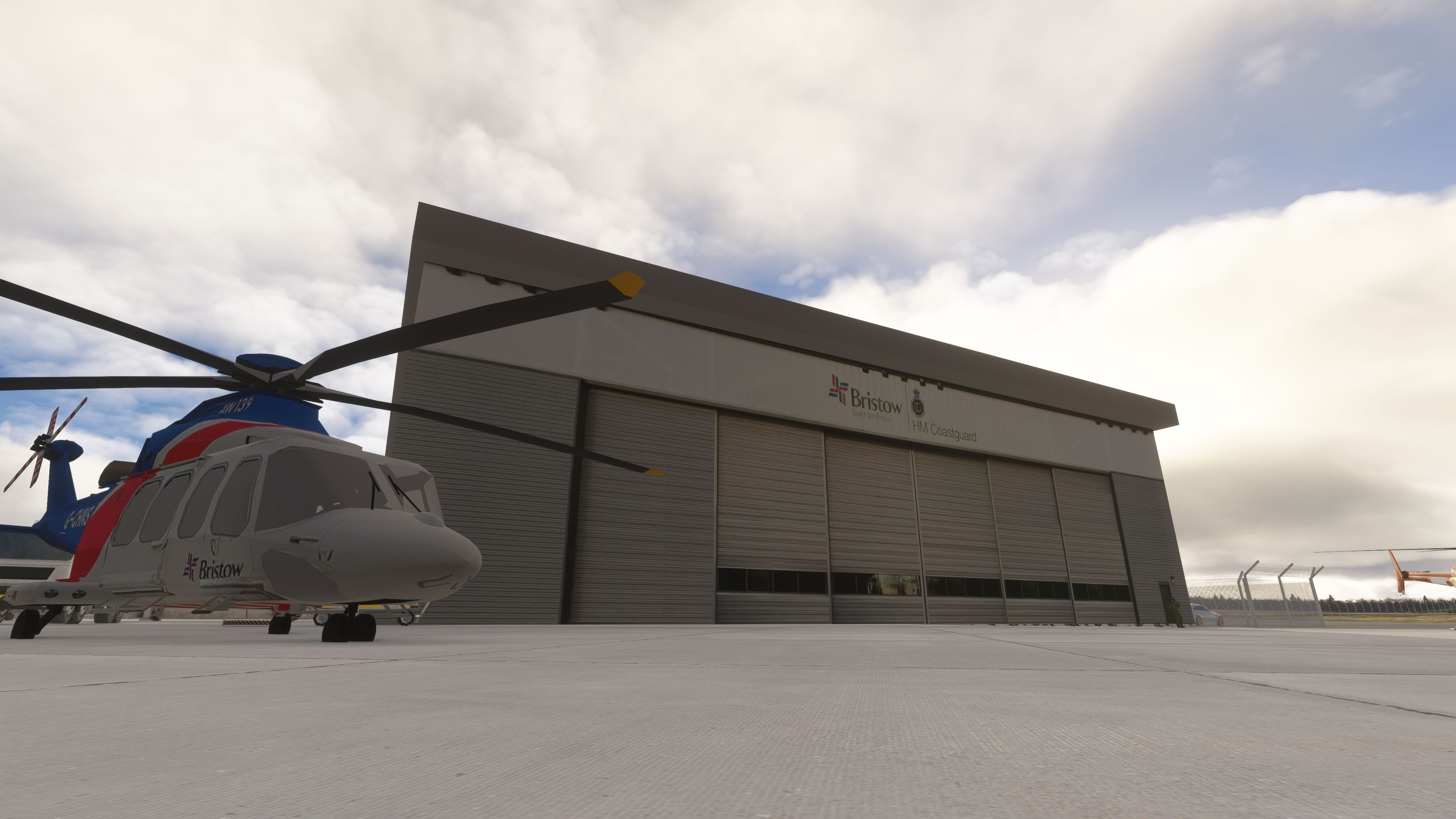
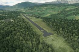
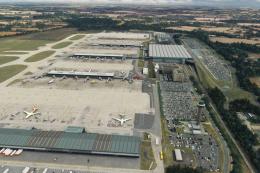
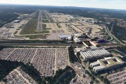
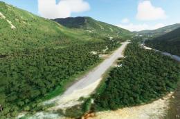
Situated at Dalcross, to the northeast of Inverness alongside the Moray Firth, EGPE is operated by Highlands and Islands Airports and supports a mix of regional, domestic, and seasonal leisure traffic. Typical scheduled services are flown by Loganair, easyJet, KLM, and British Airways, with additional holiday charters, an on-site flying club, and an active search-and-rescue presence. The scenery aligns the airfield’s operational layout and landside amenities with their real-world counterparts, providing a reliable base for IFR sectors or VFR tours into the Highlands.

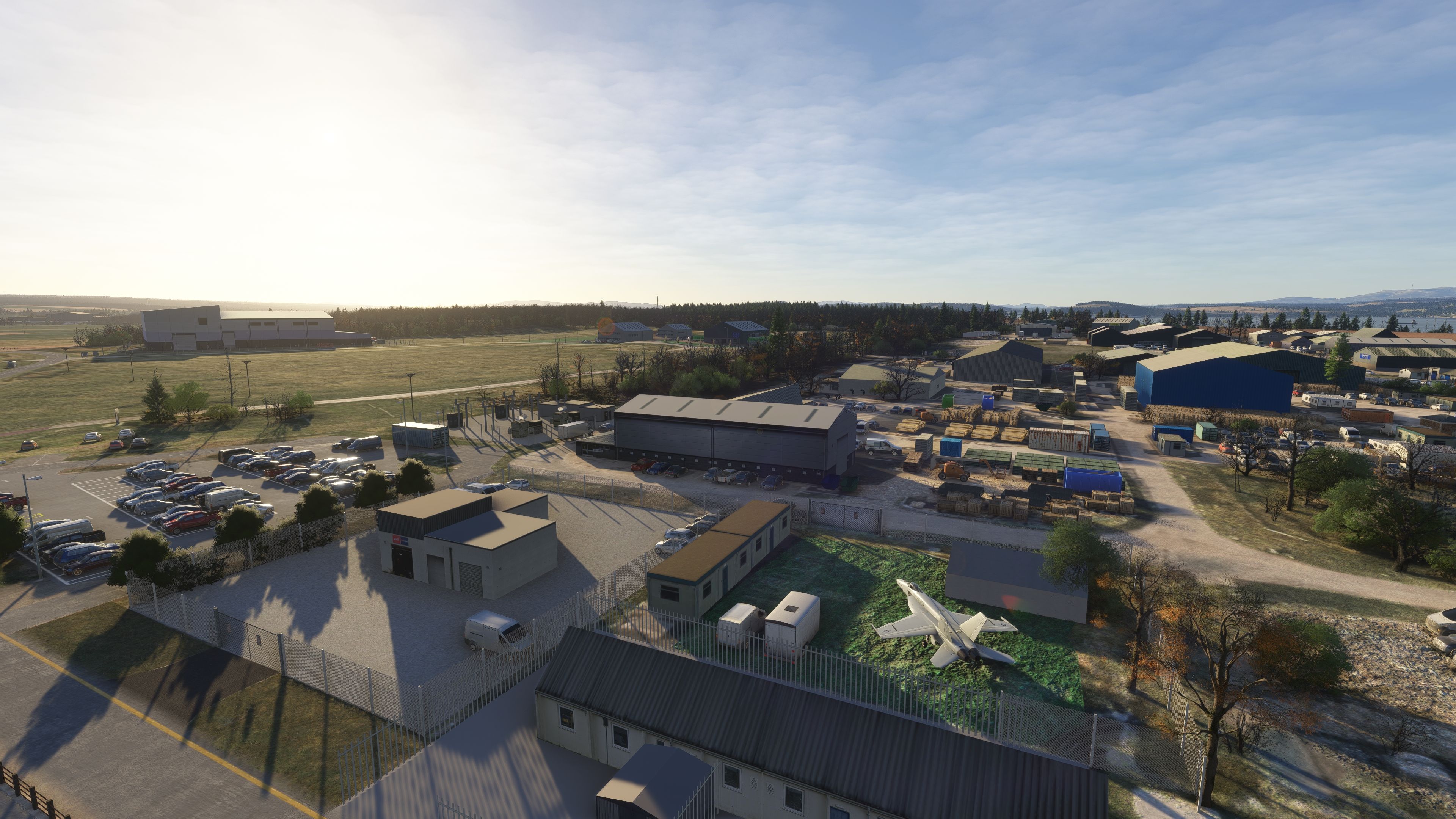
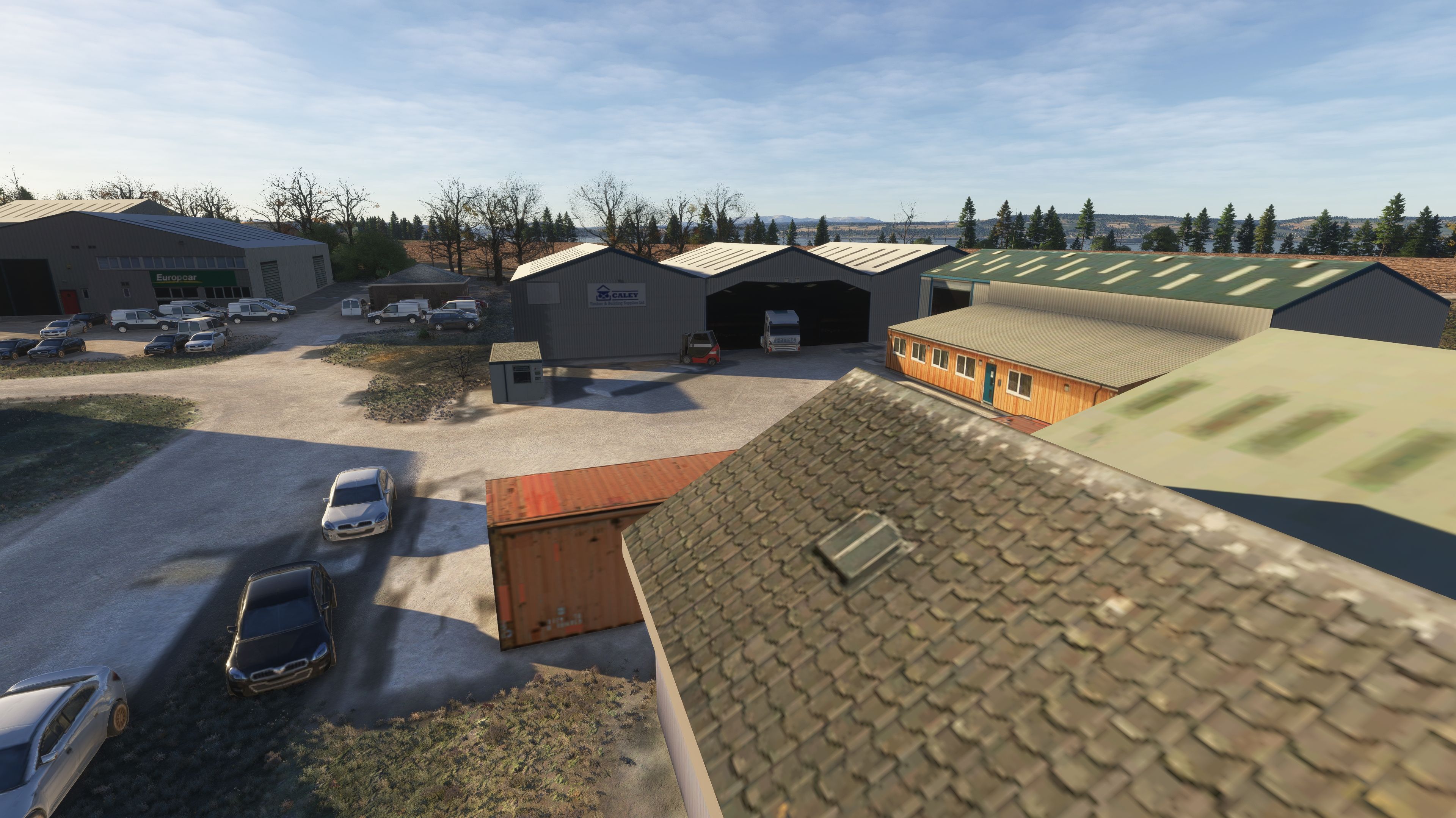
Custom Assets and Accurate Landside Layout

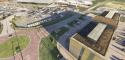
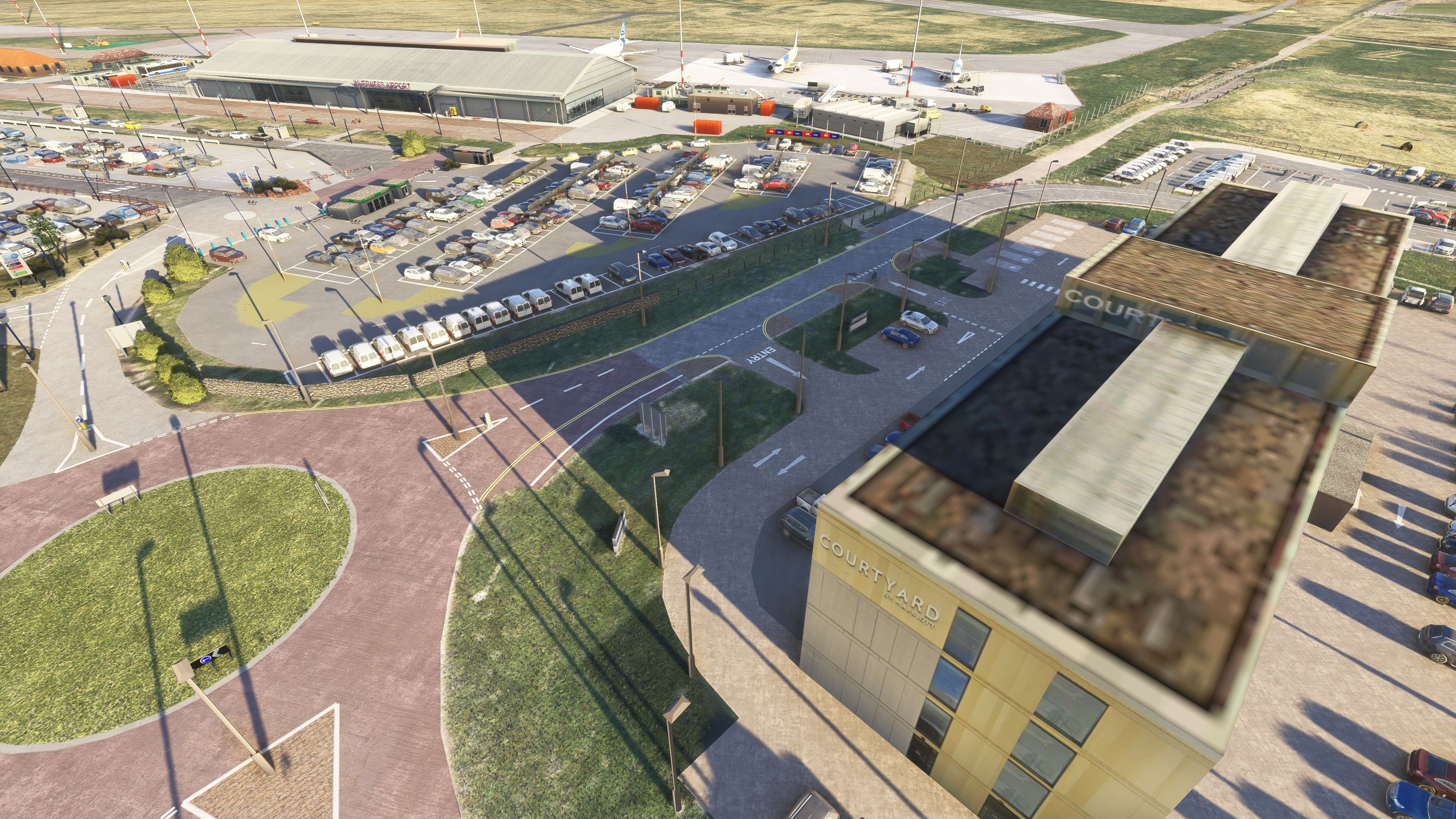
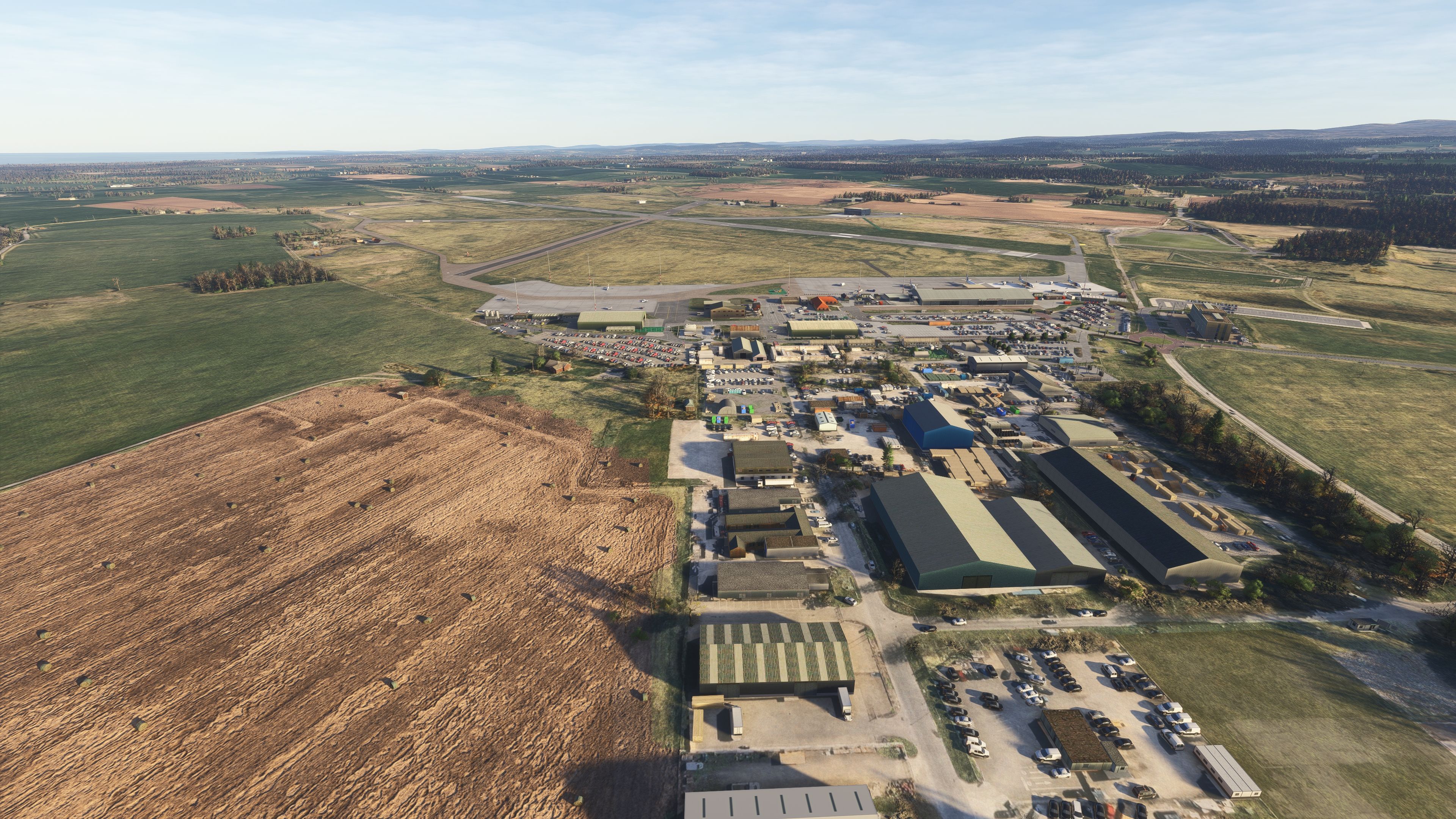
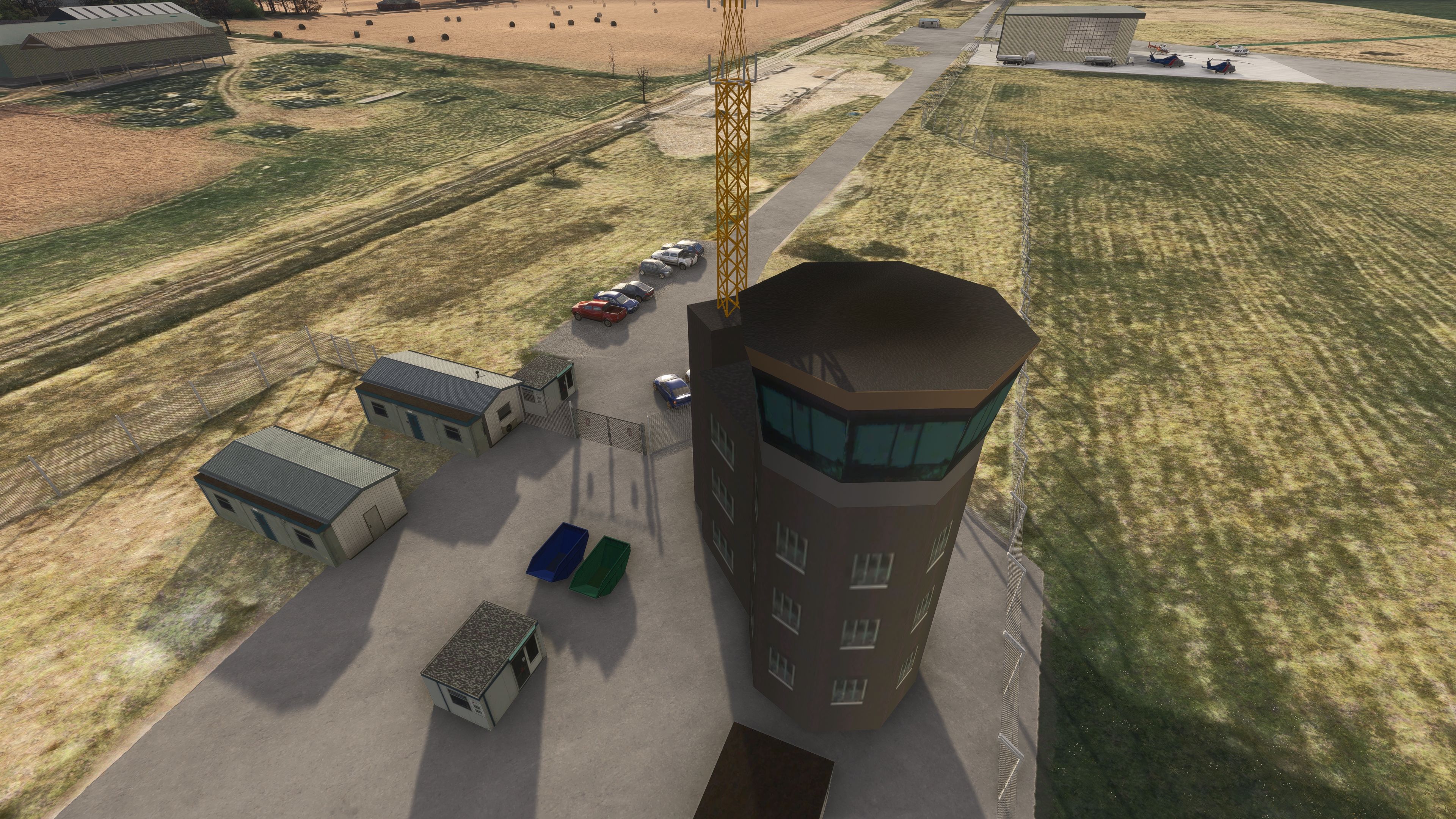
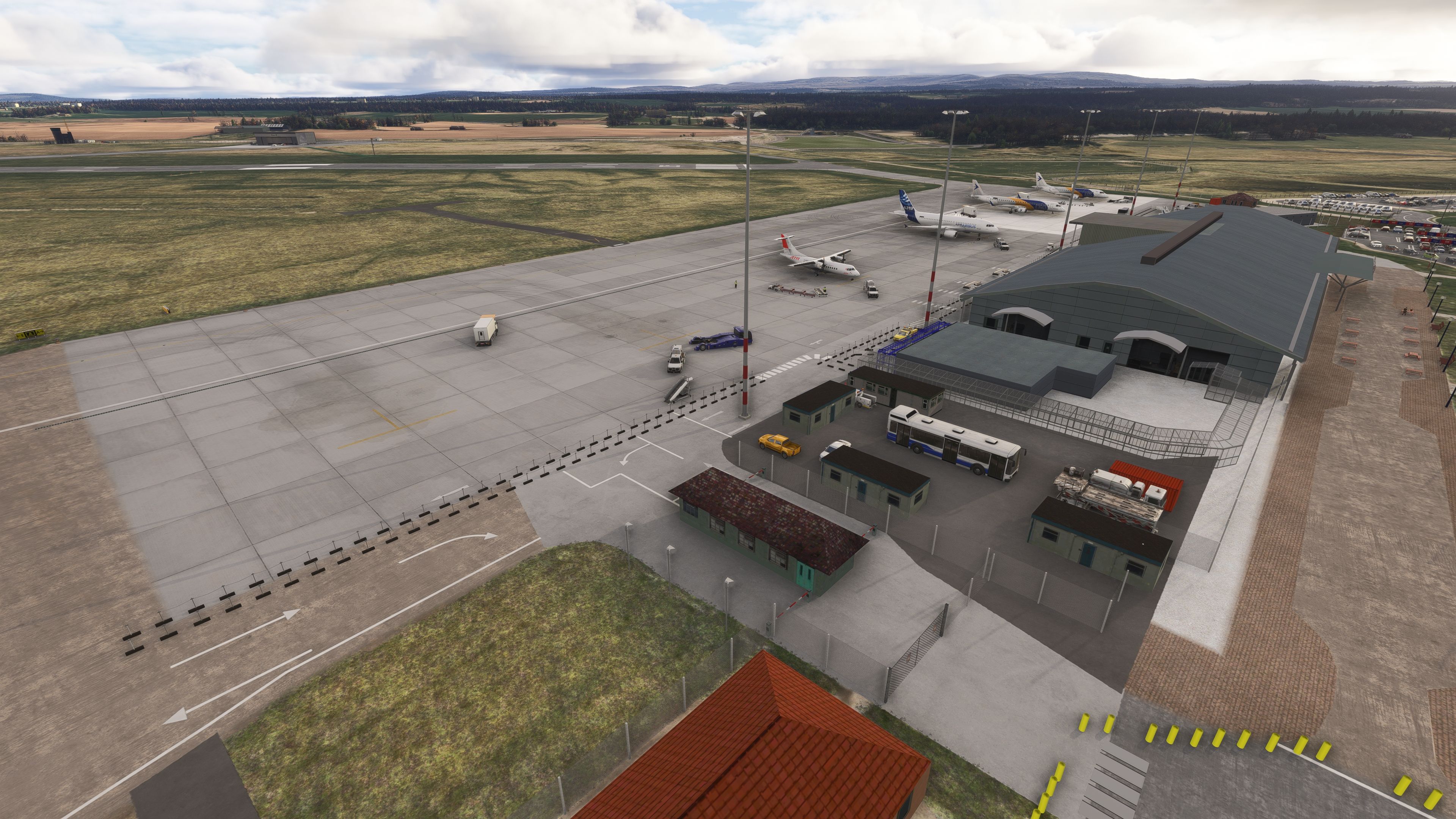
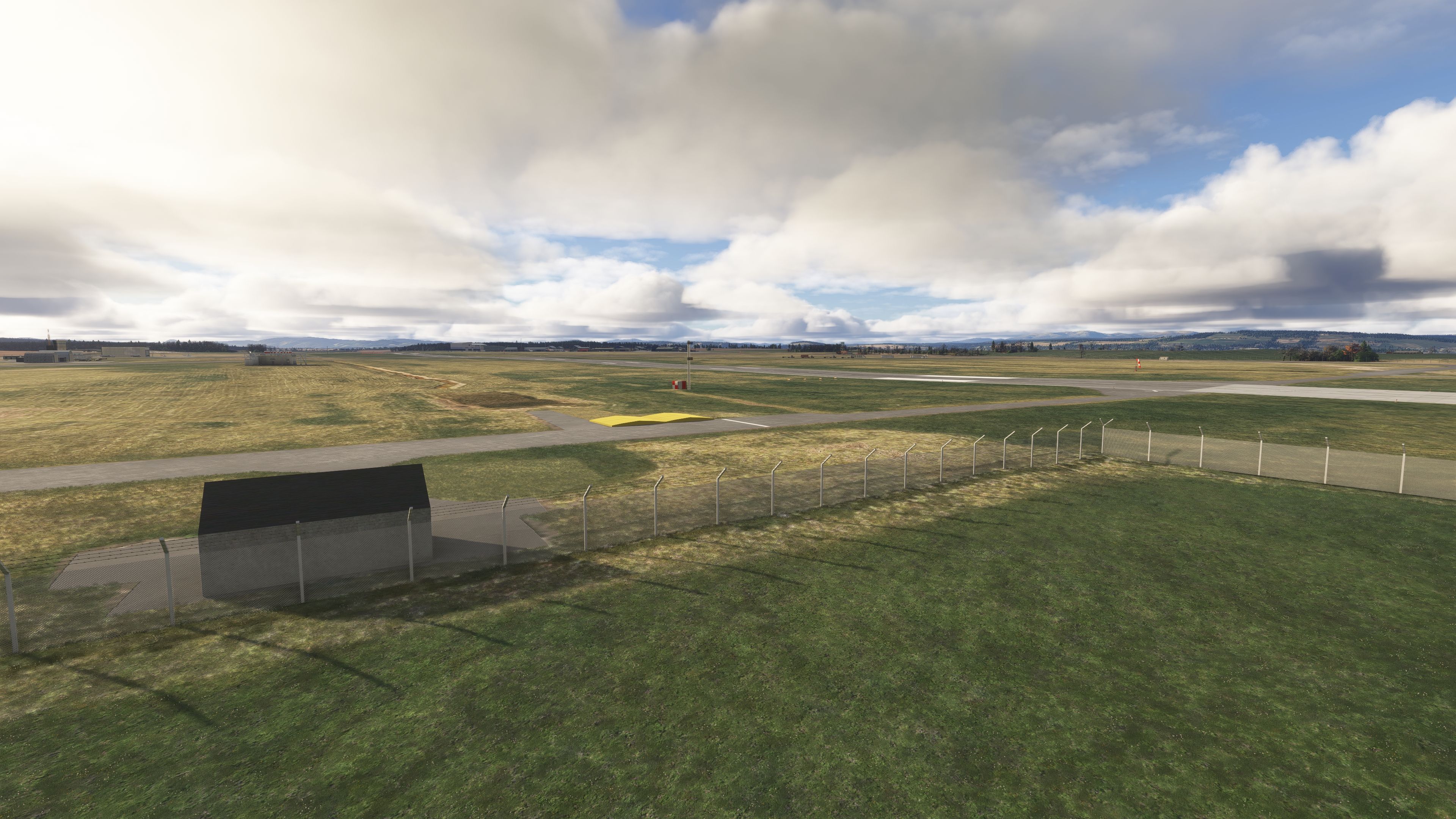
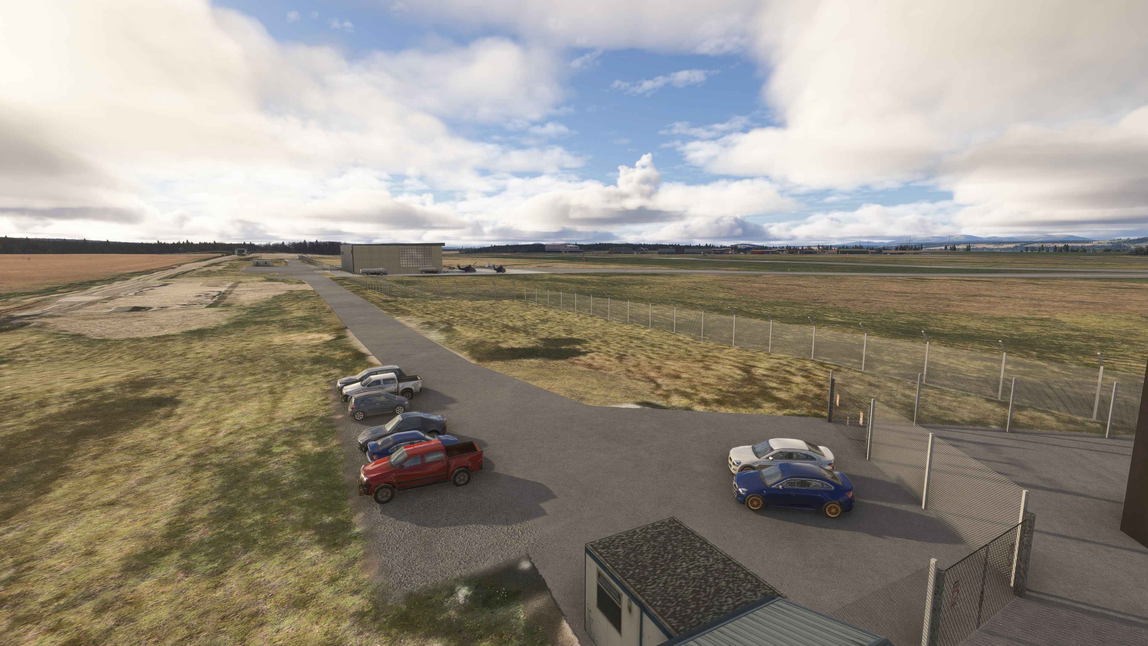
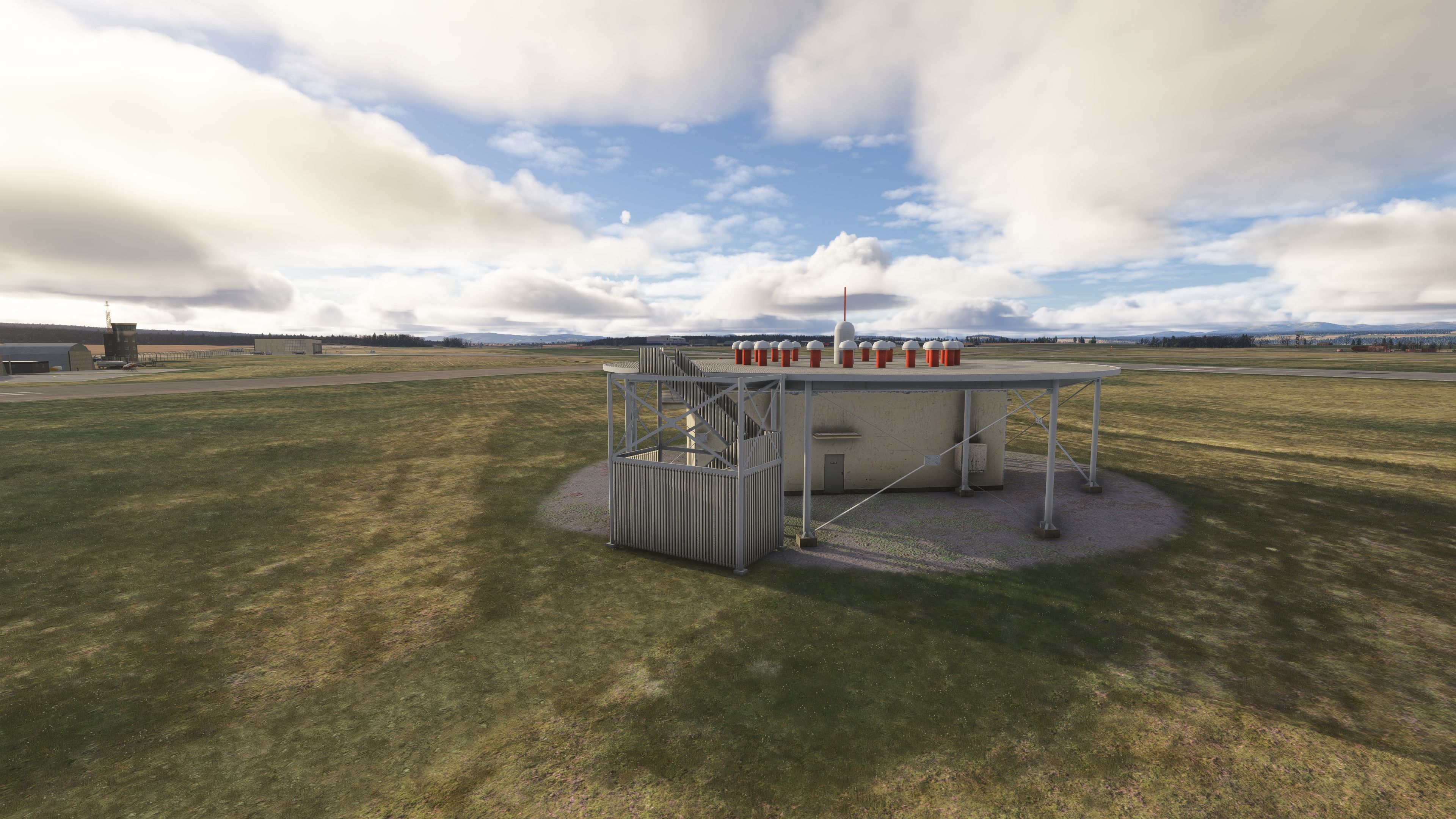
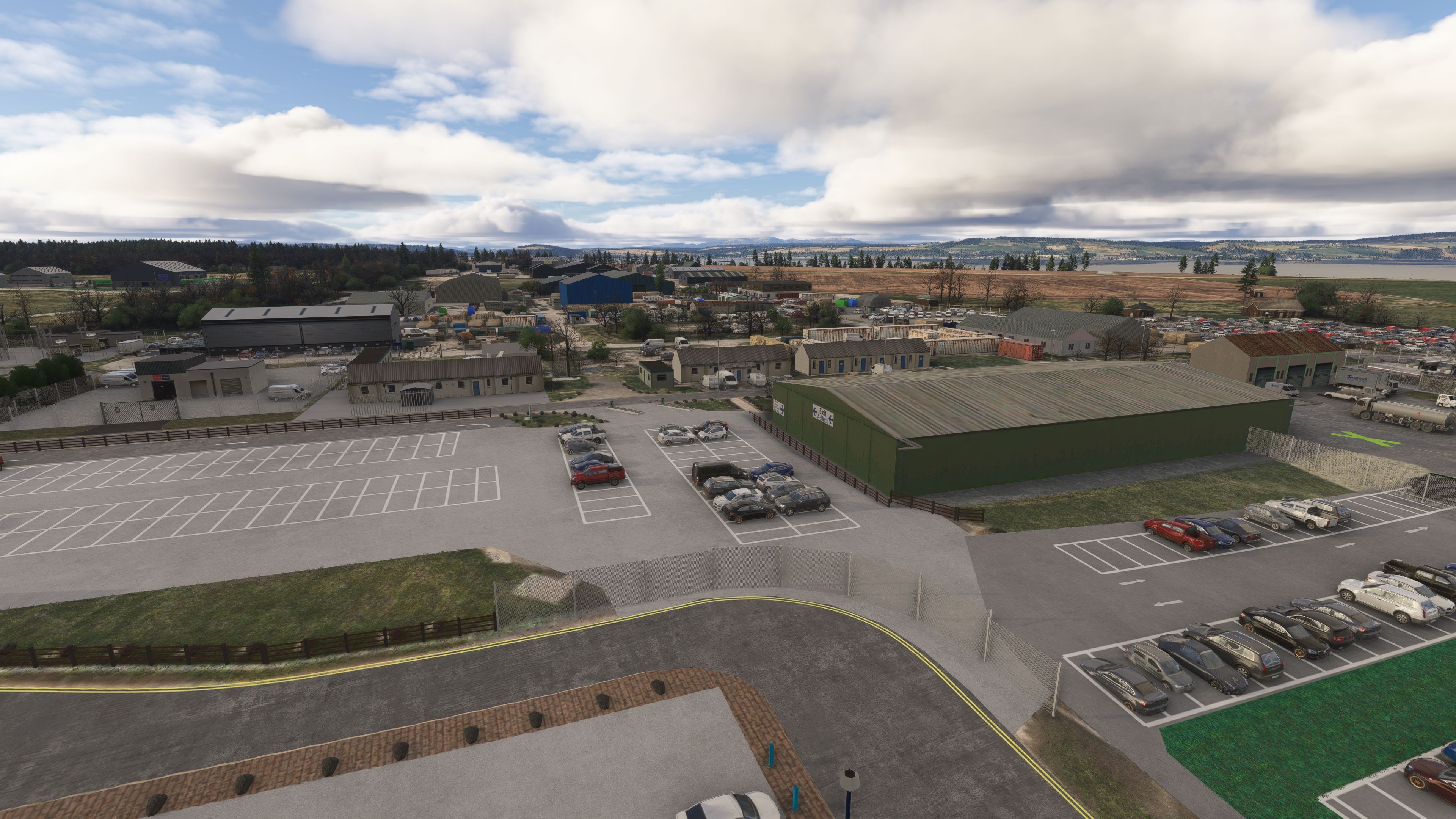
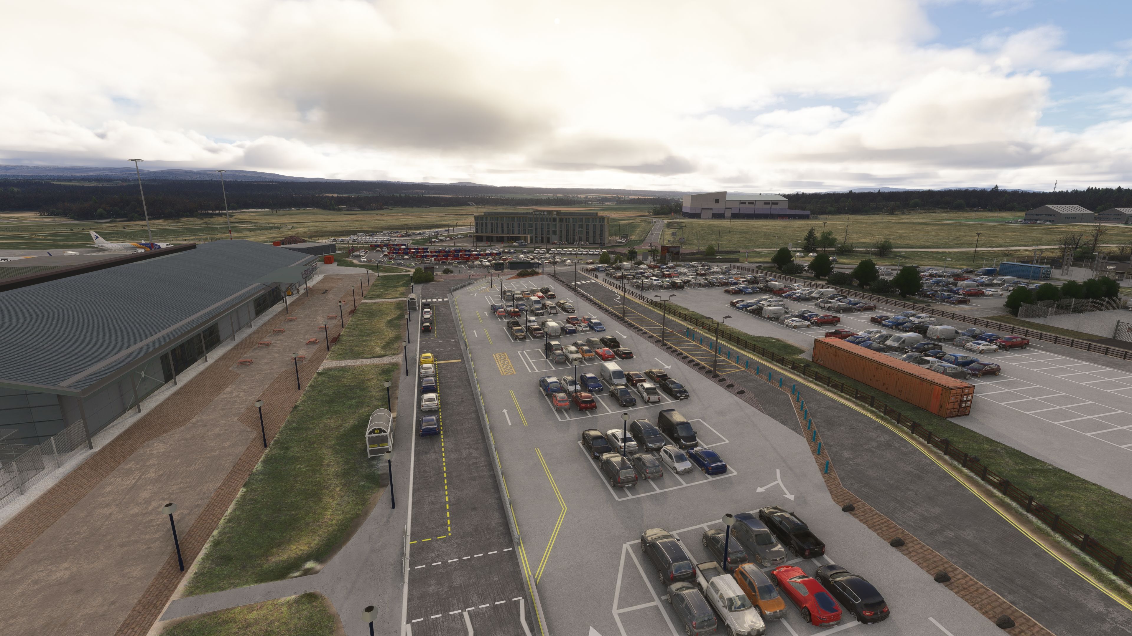
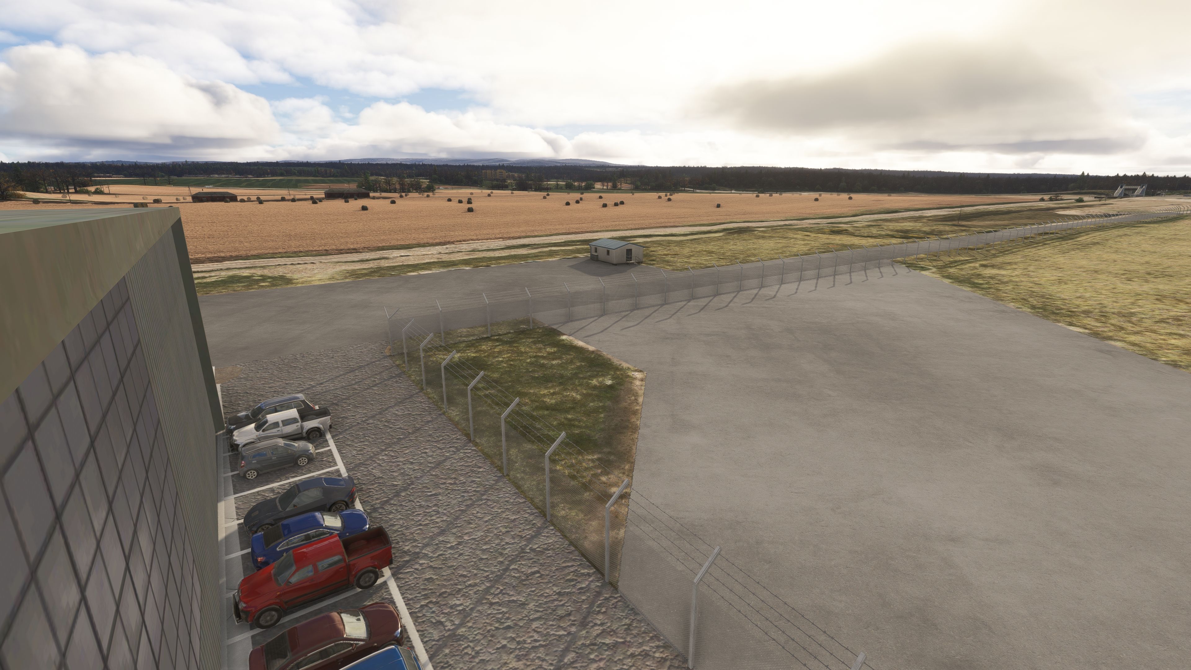
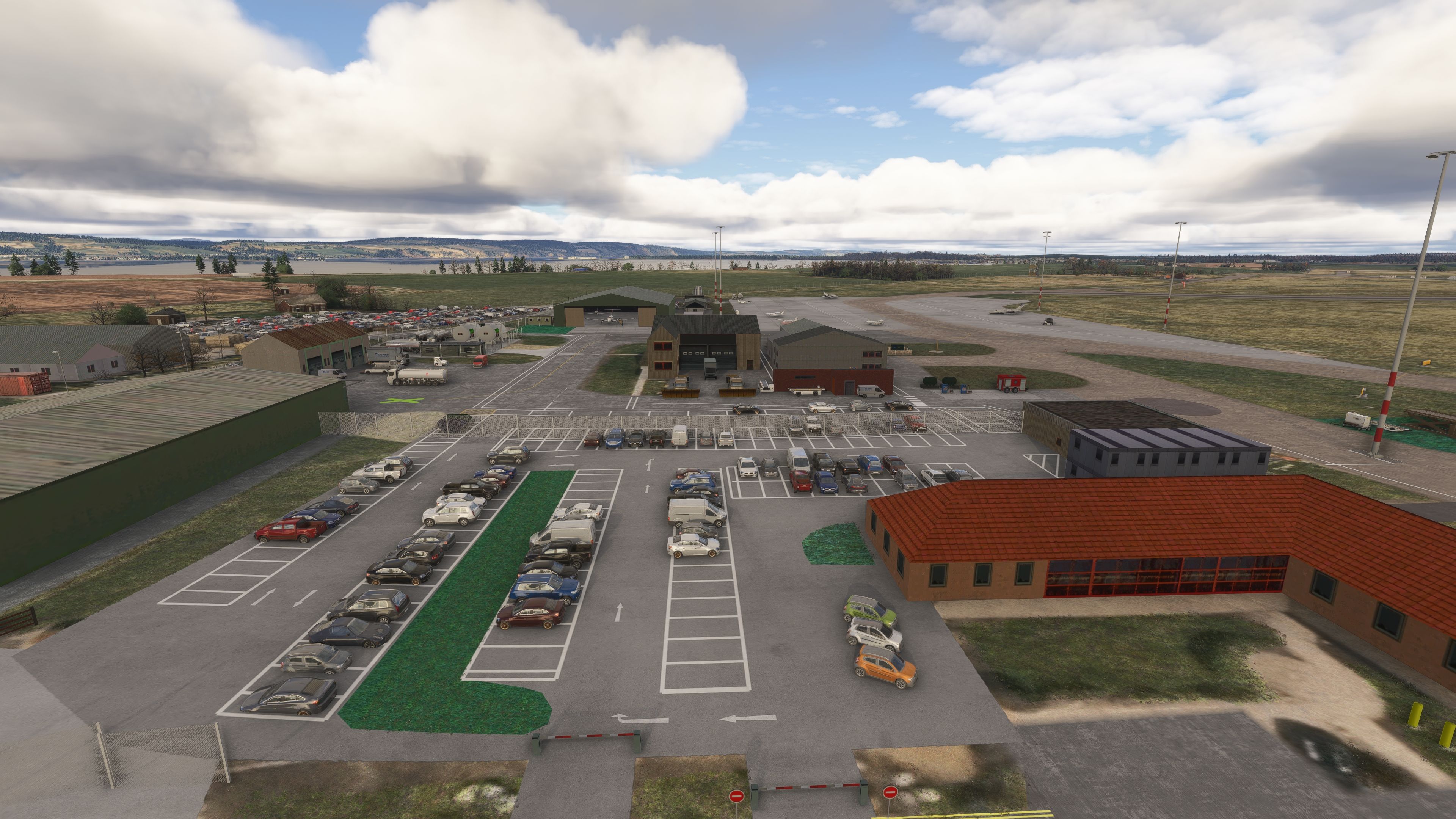
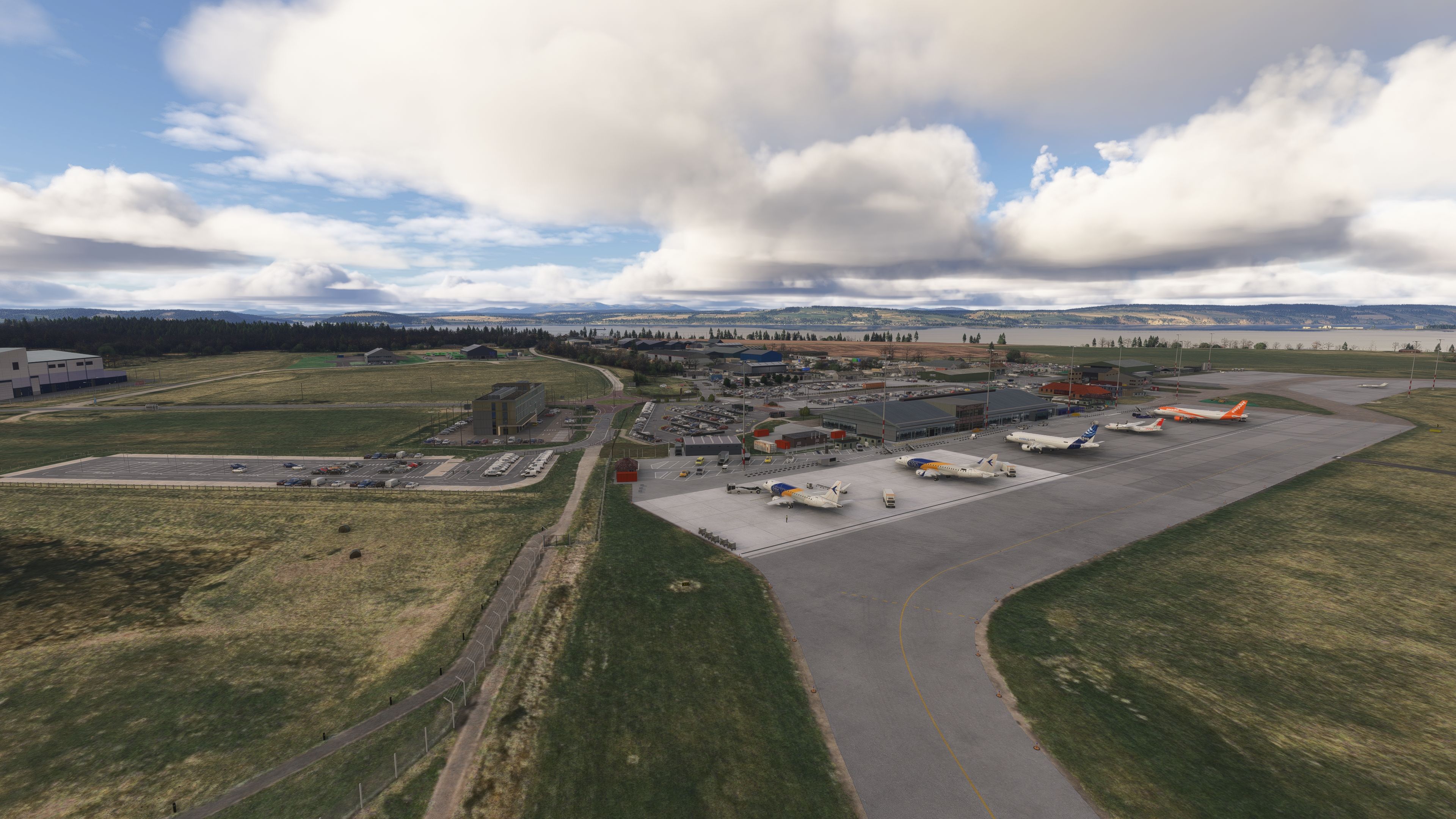
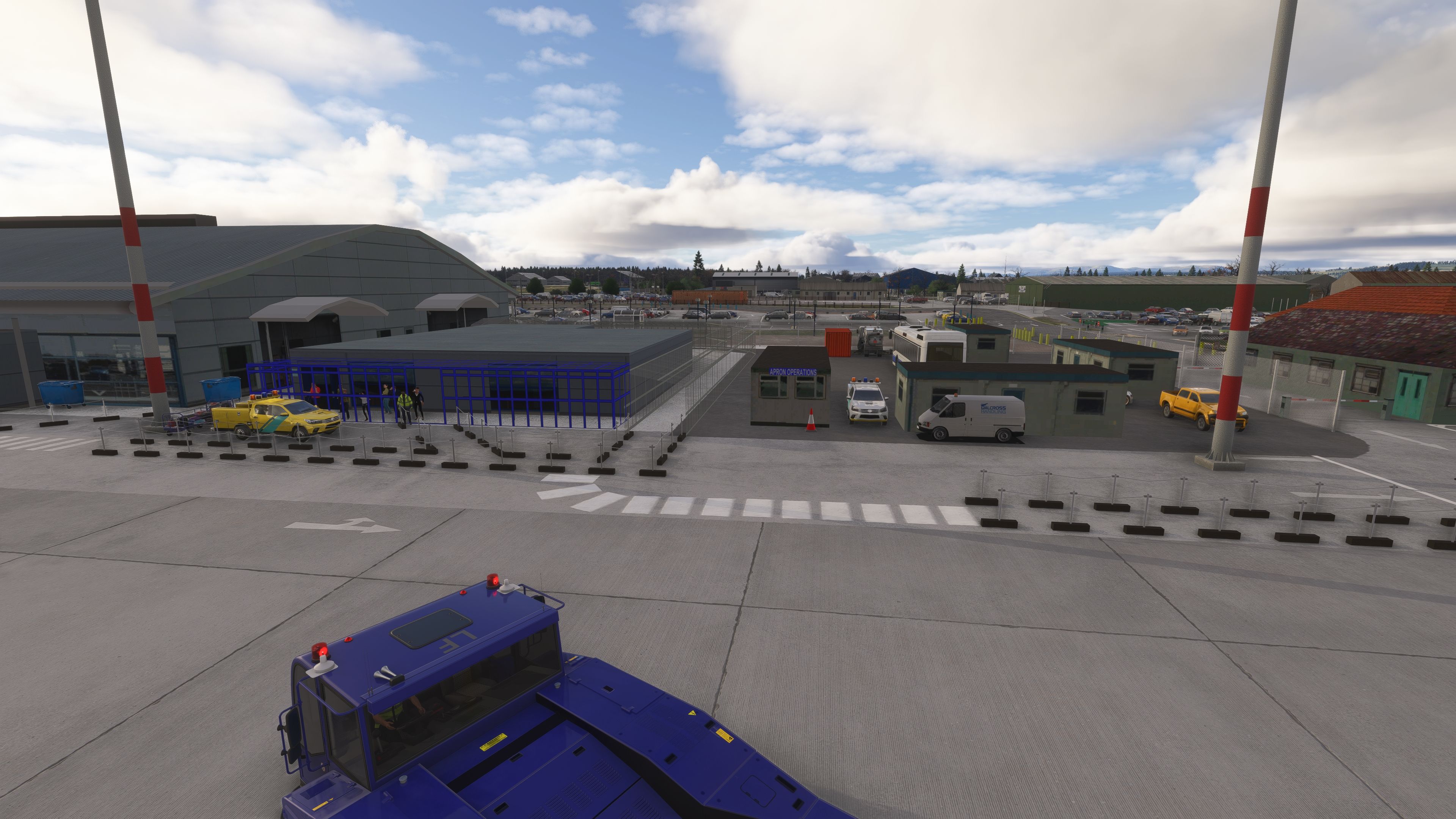
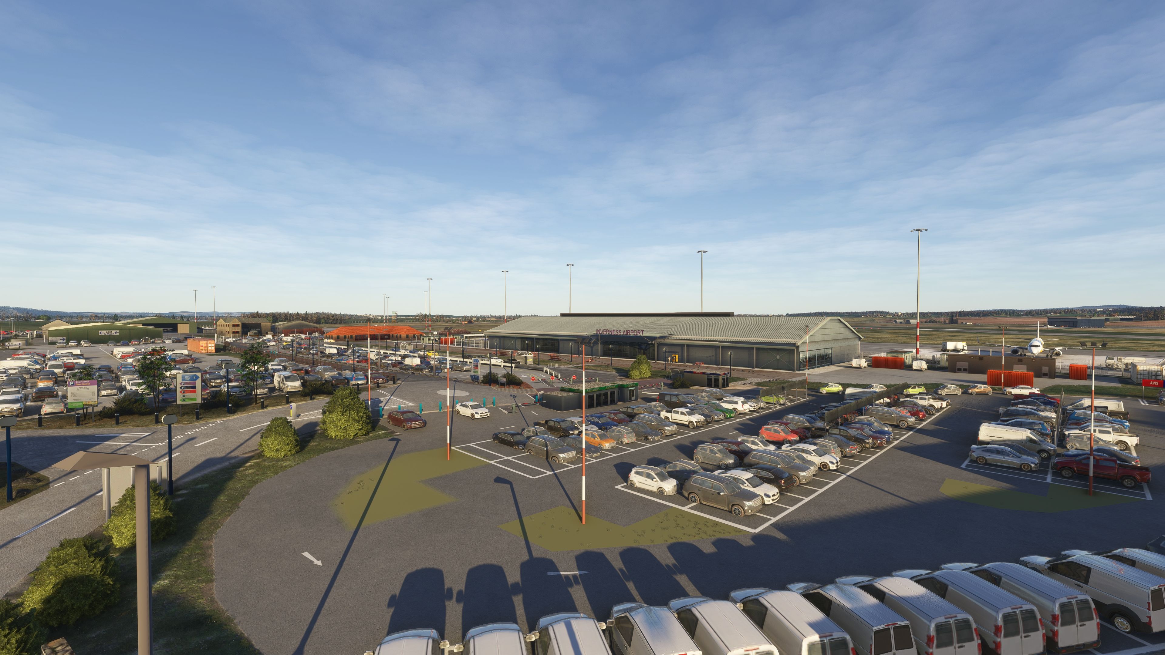
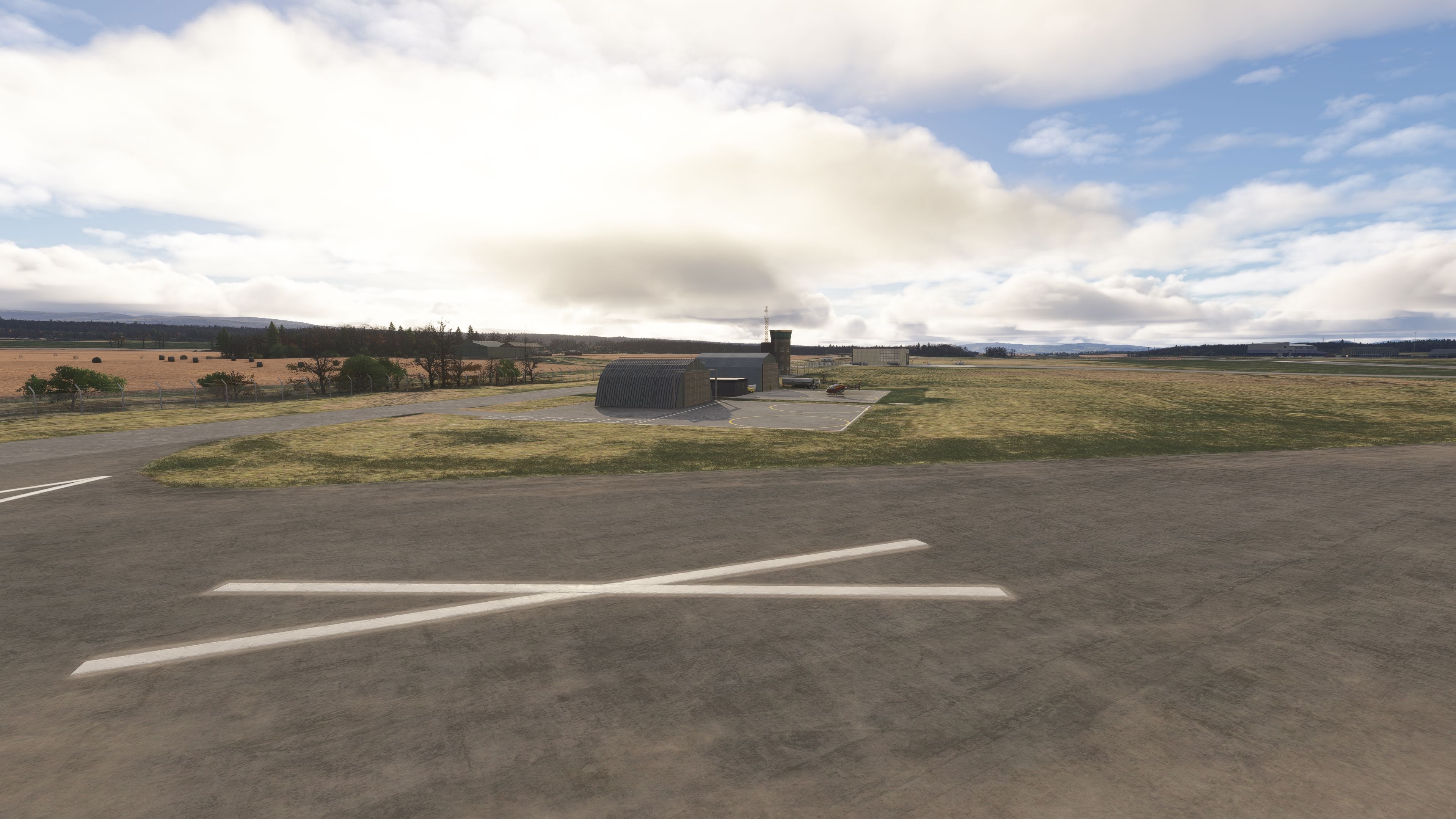
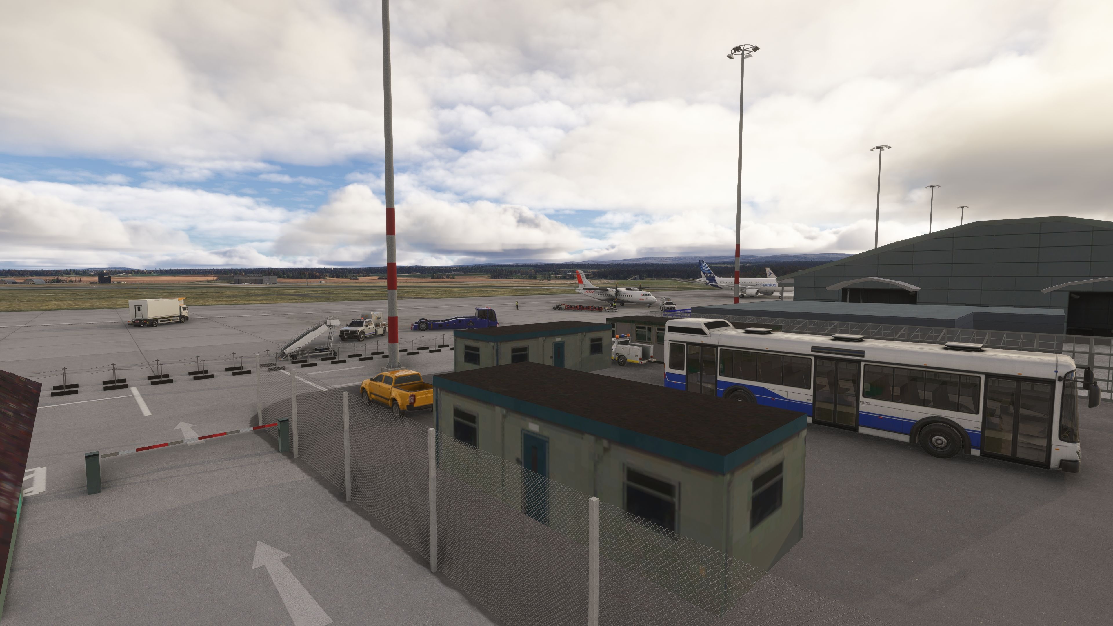
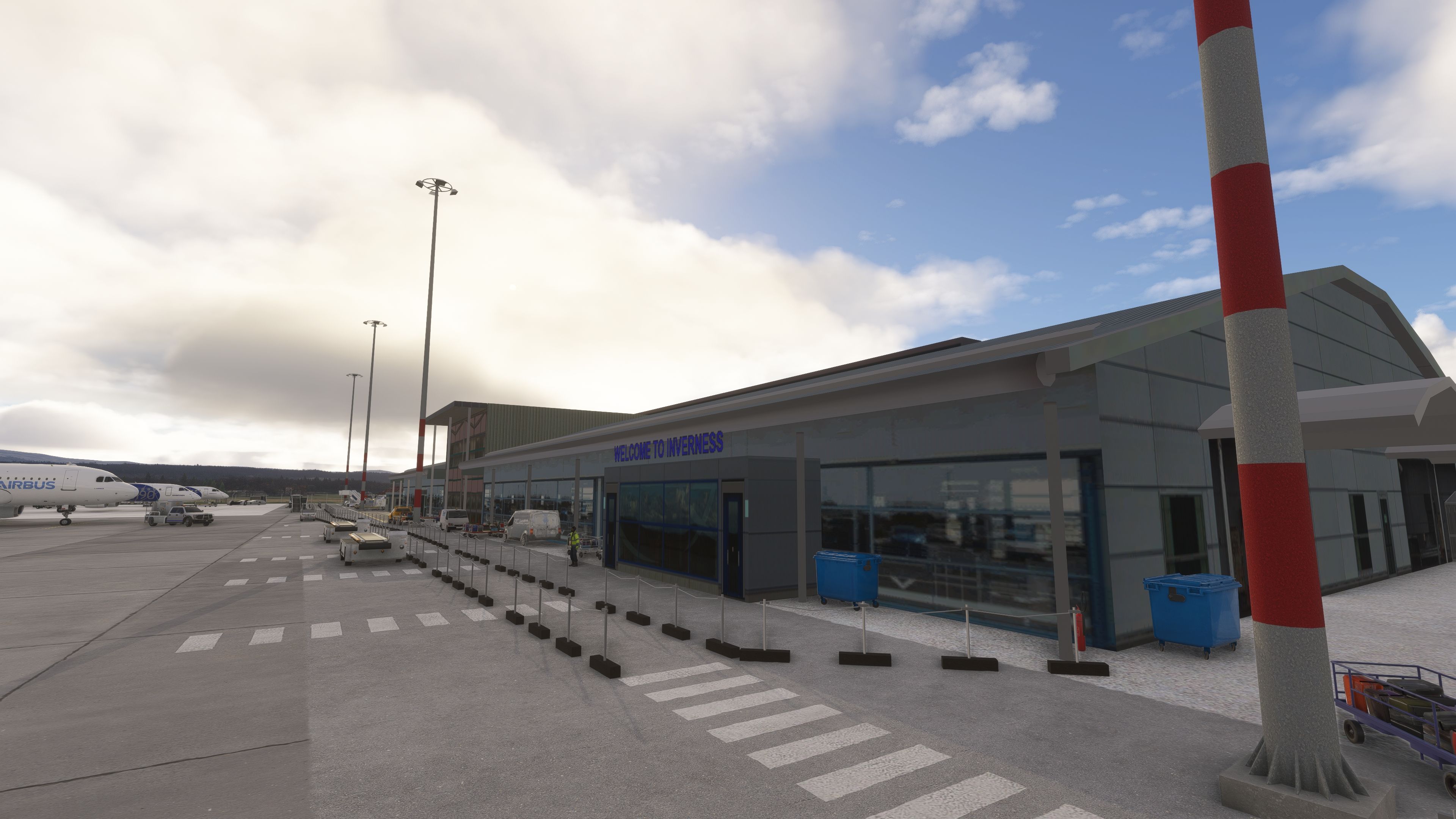
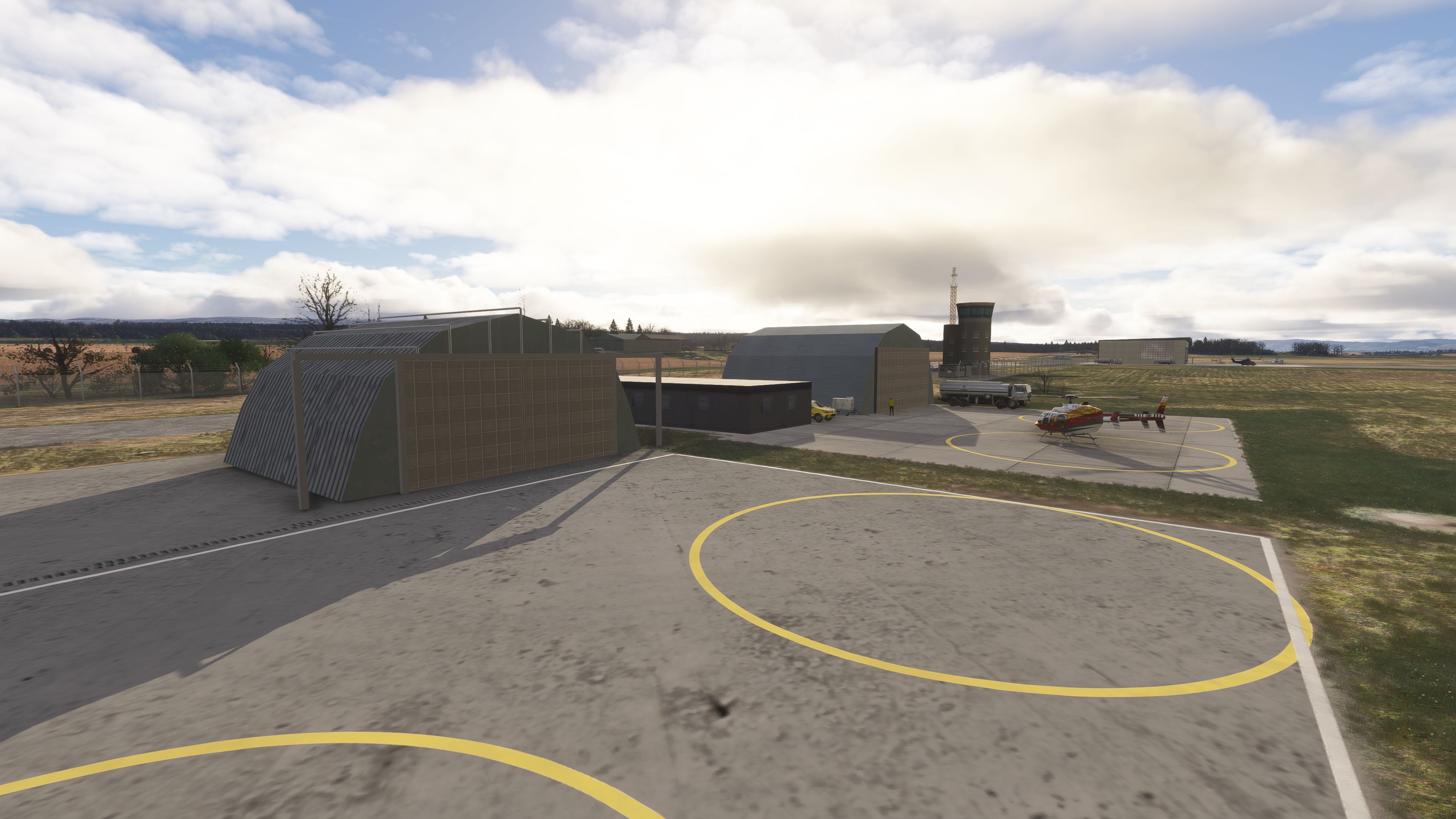
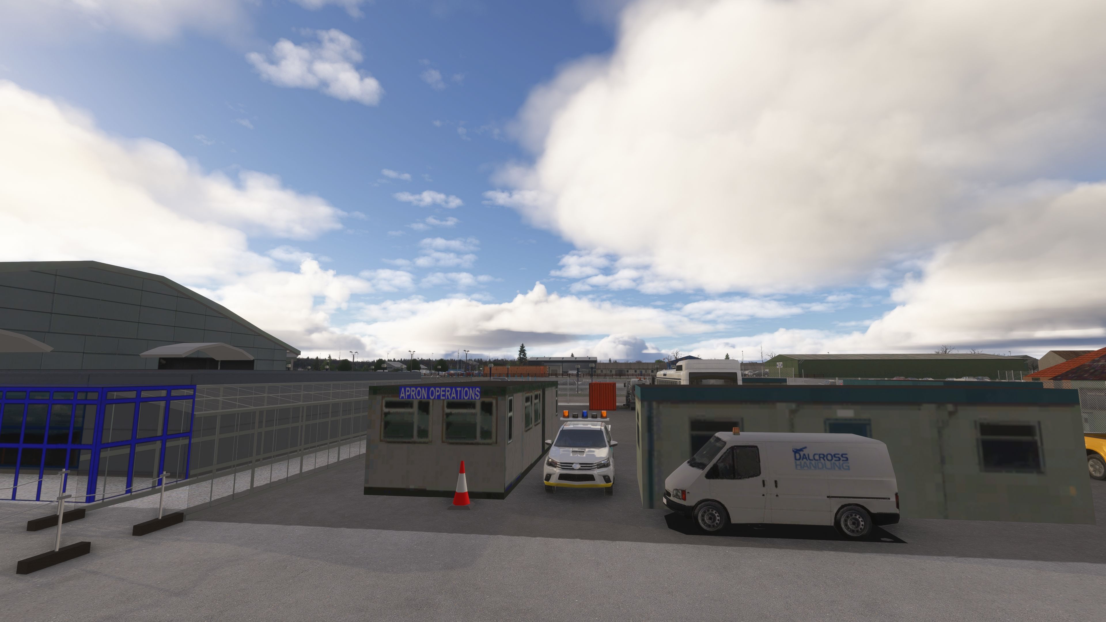
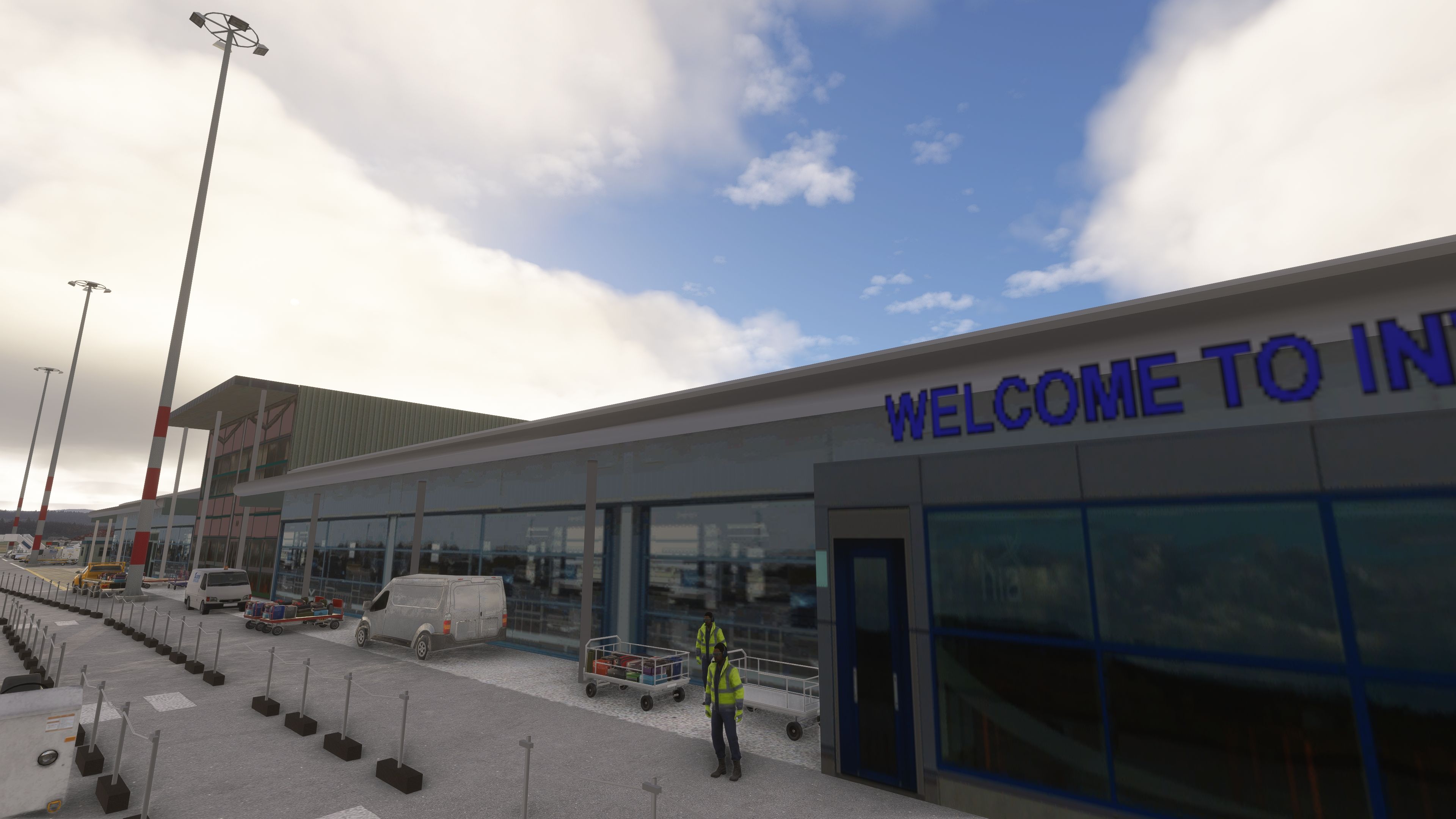
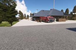
This rendition focuses on authentic placement and geometry, swapping generic assets for custom-made structures across the campus. The developer has modeled and positioned core facilities as they appear on the ground, including the terminal and apron environment as well as the newer public transport links.

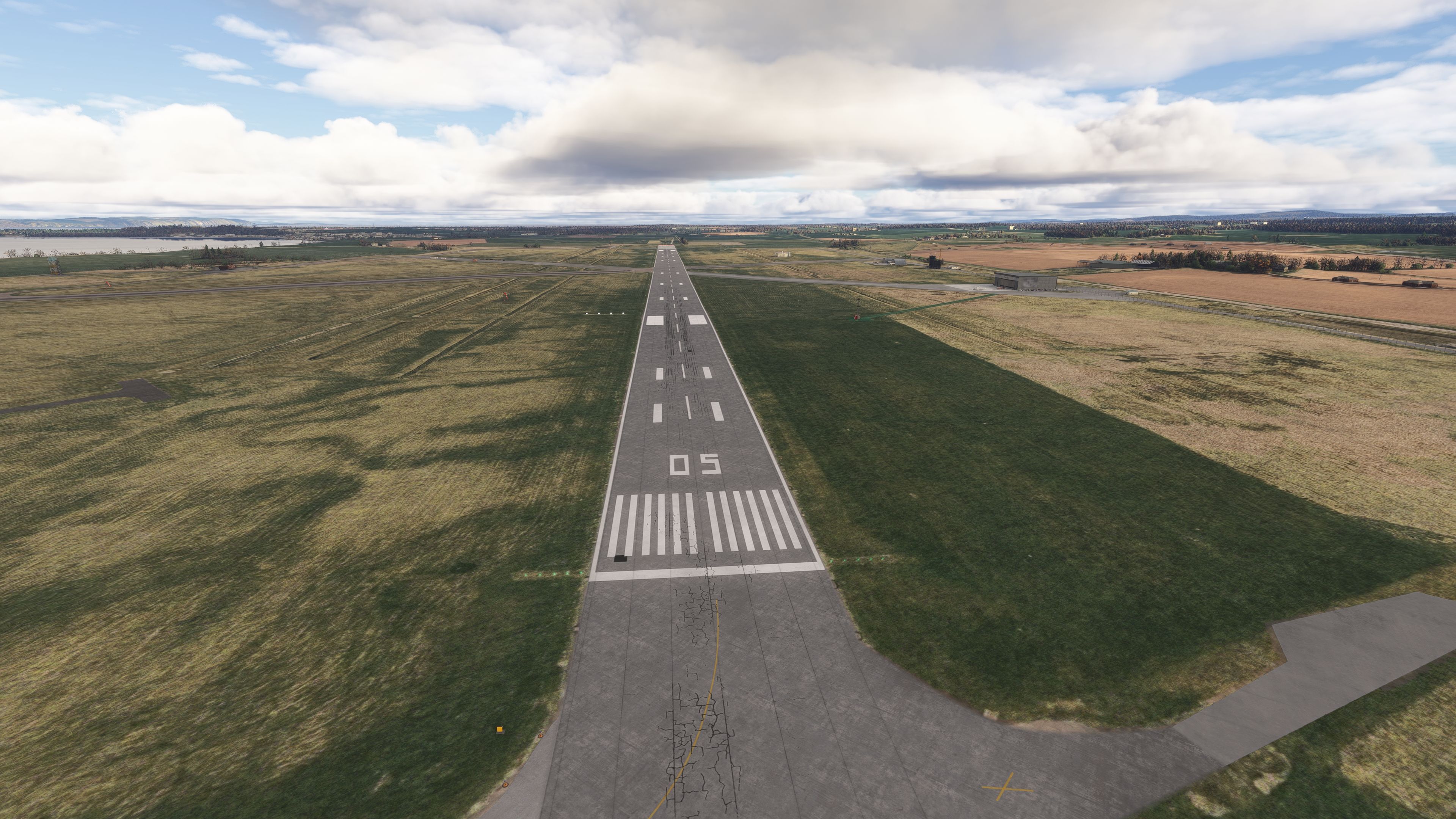
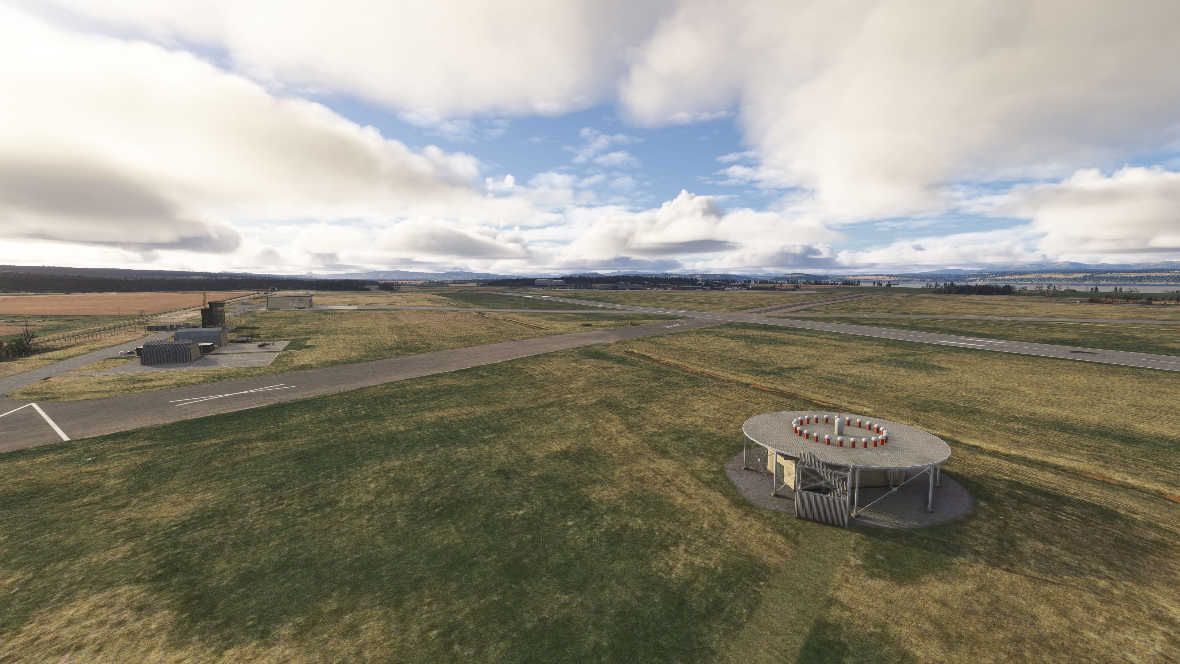
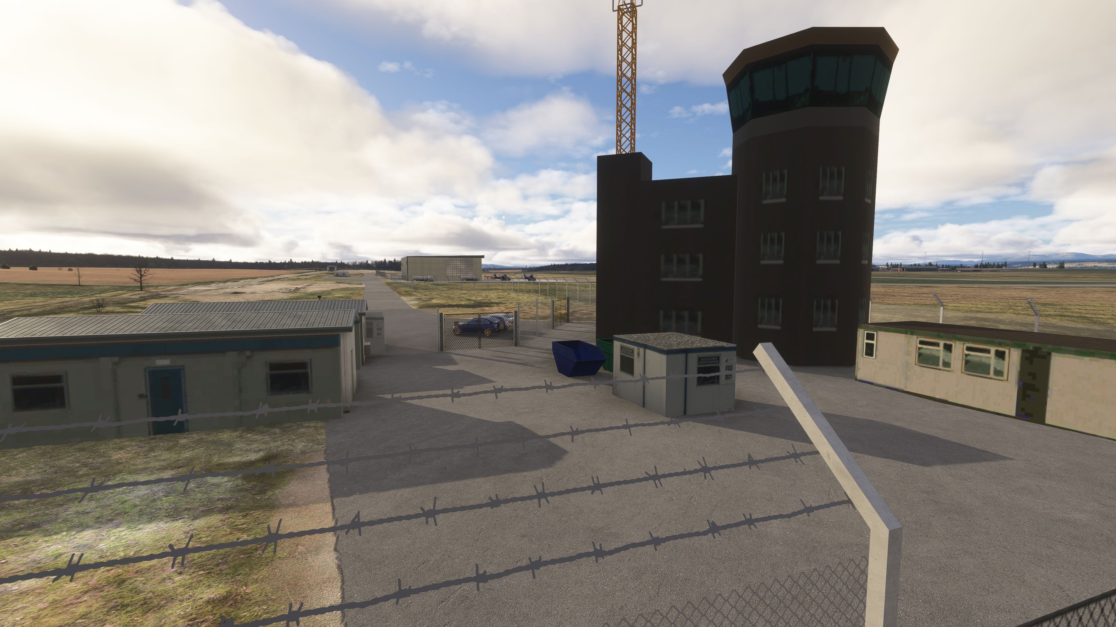
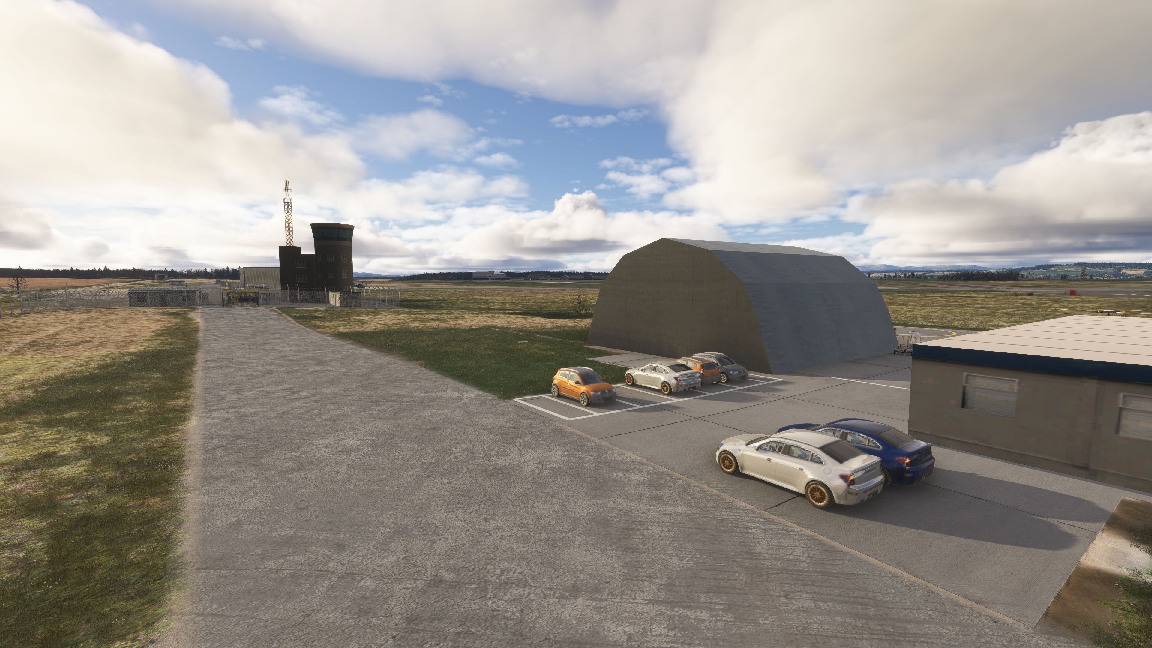
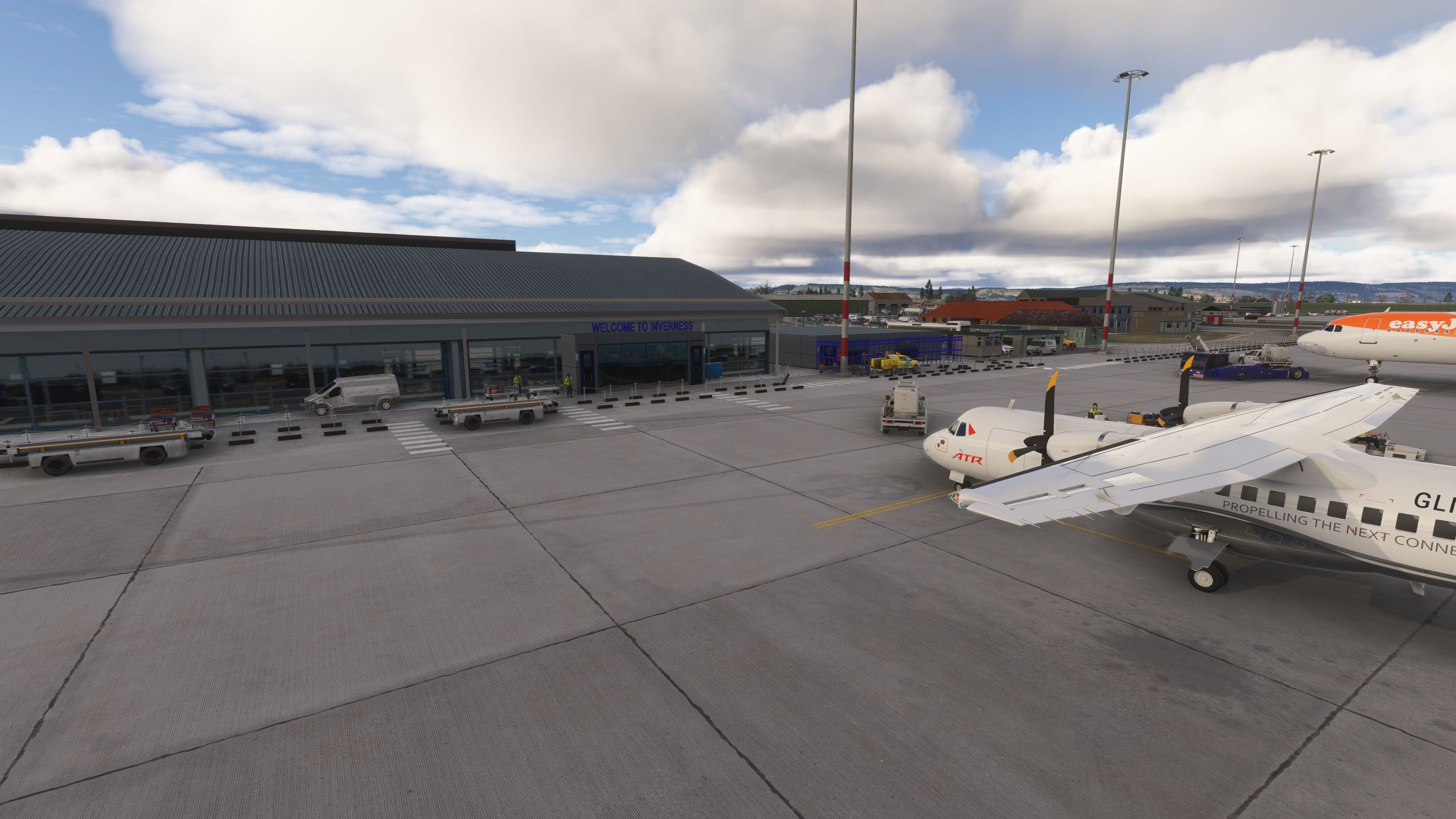
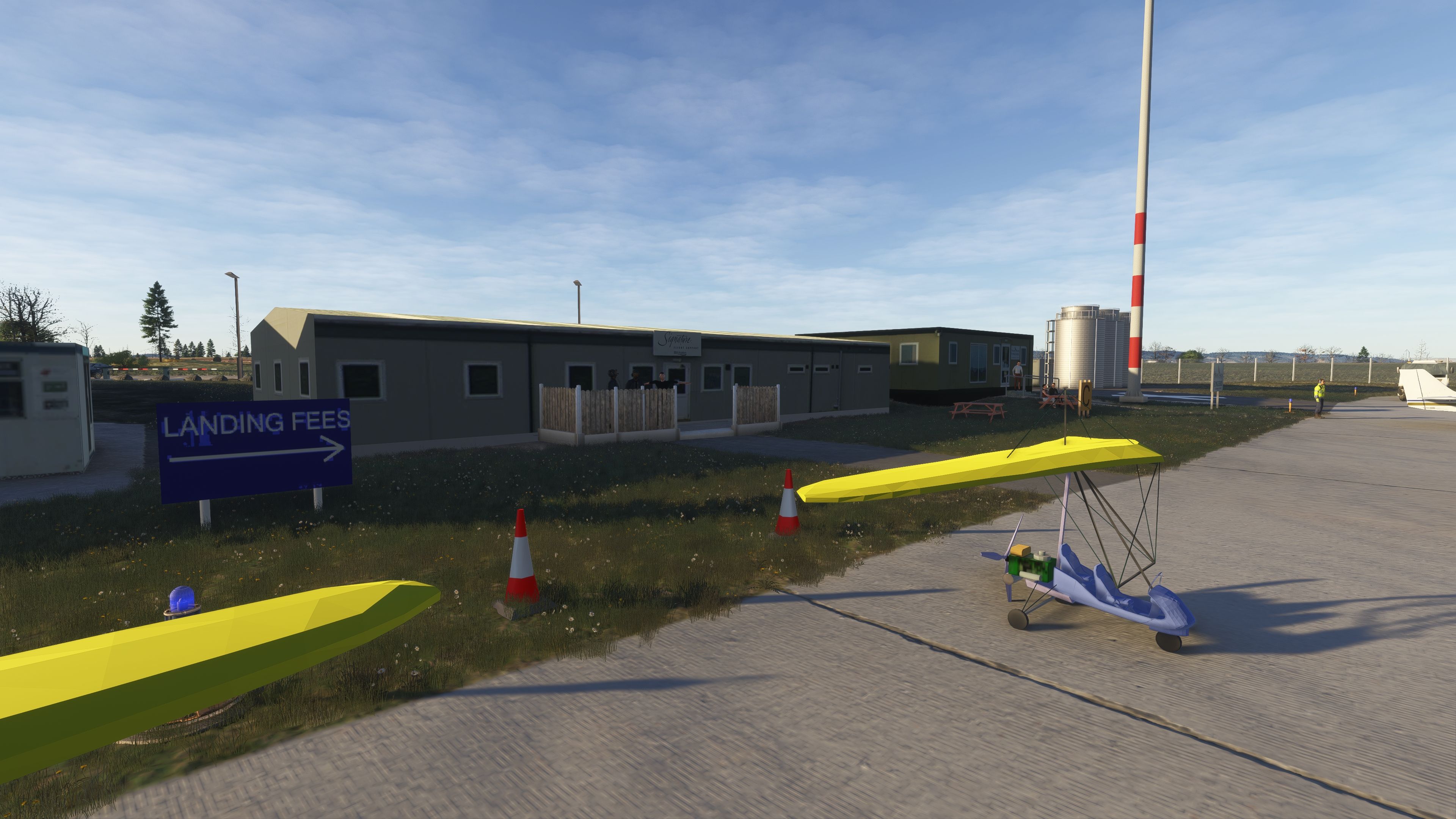
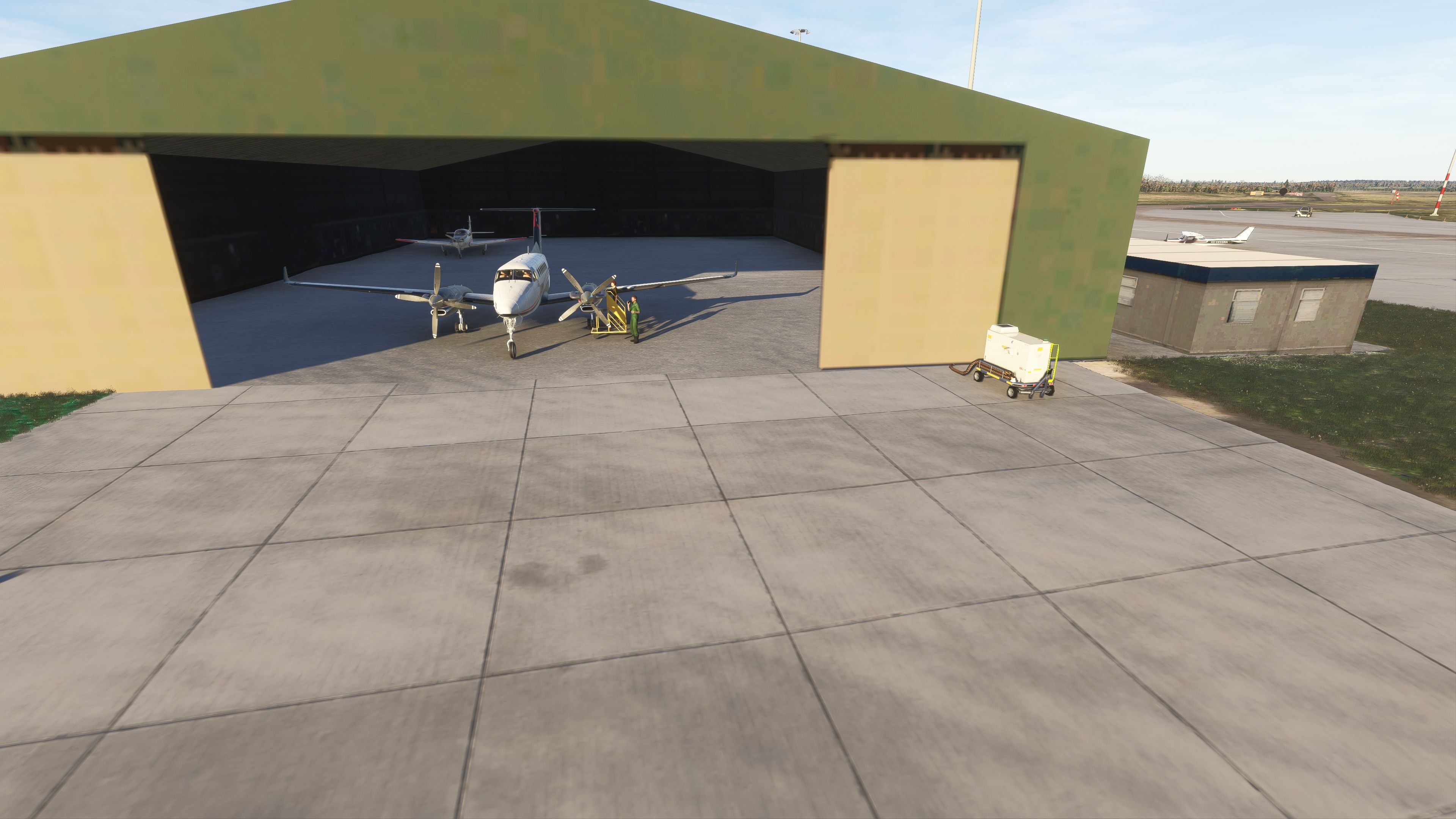
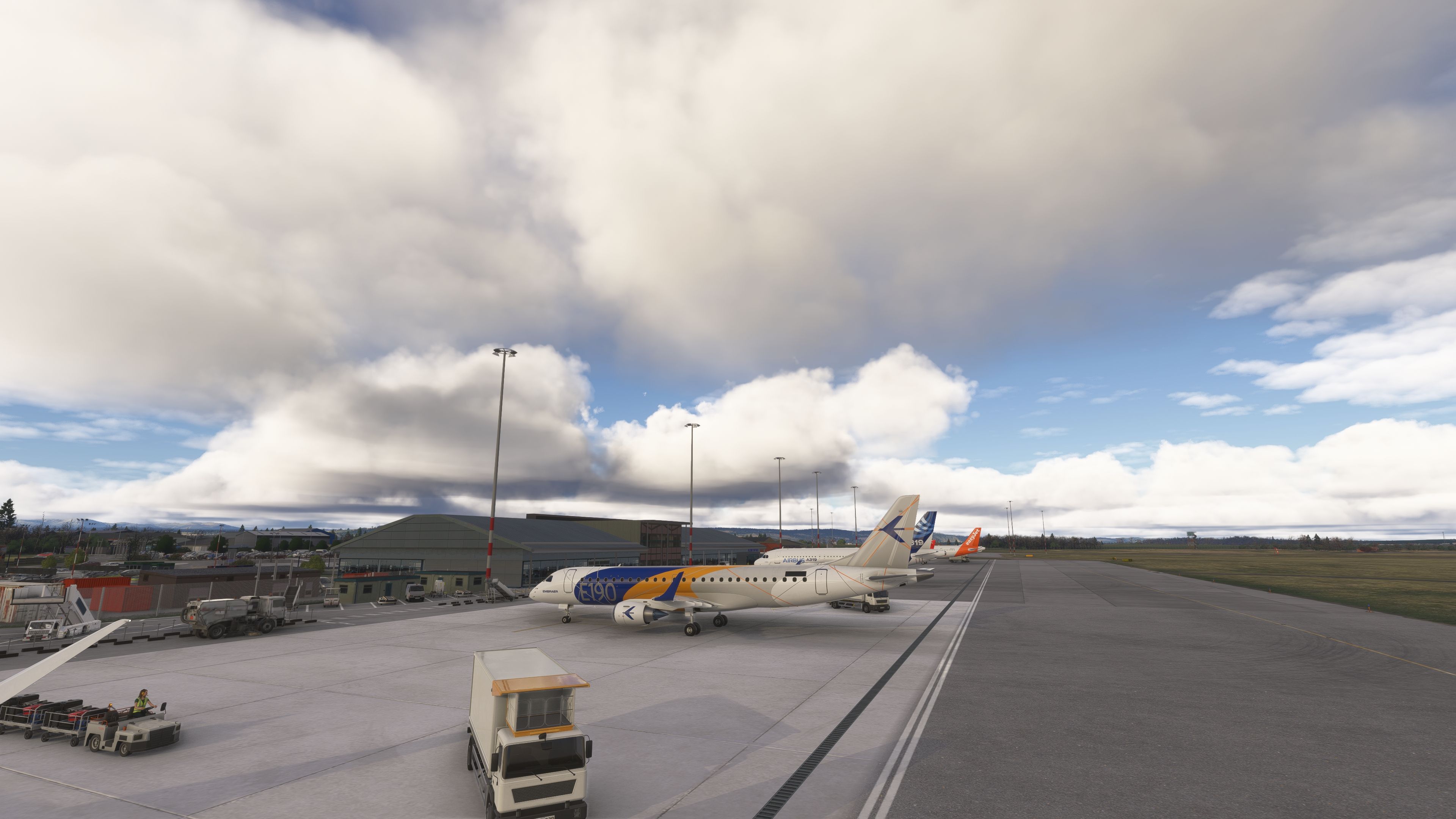
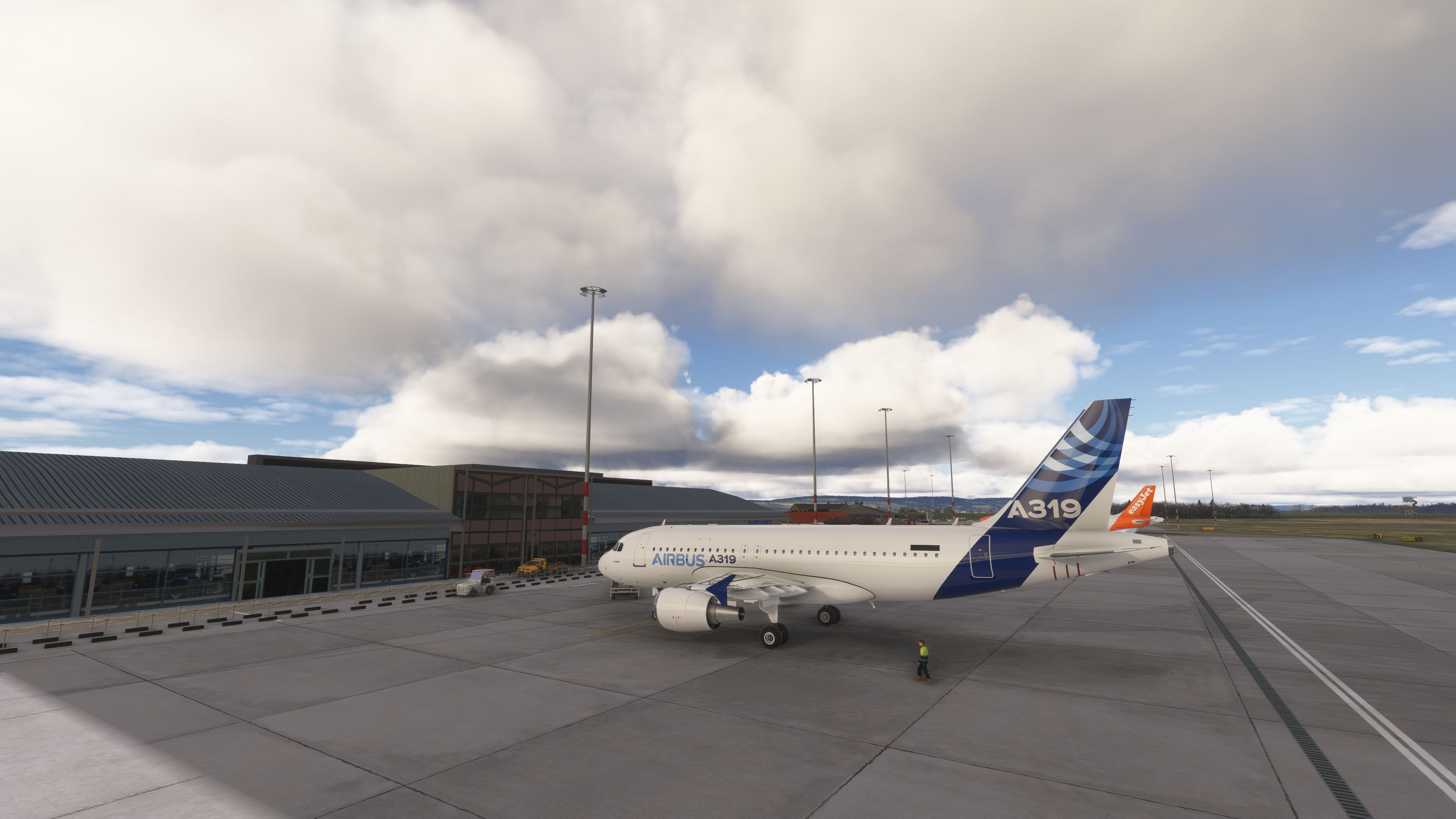
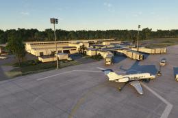
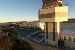
Terminal and Airside Core
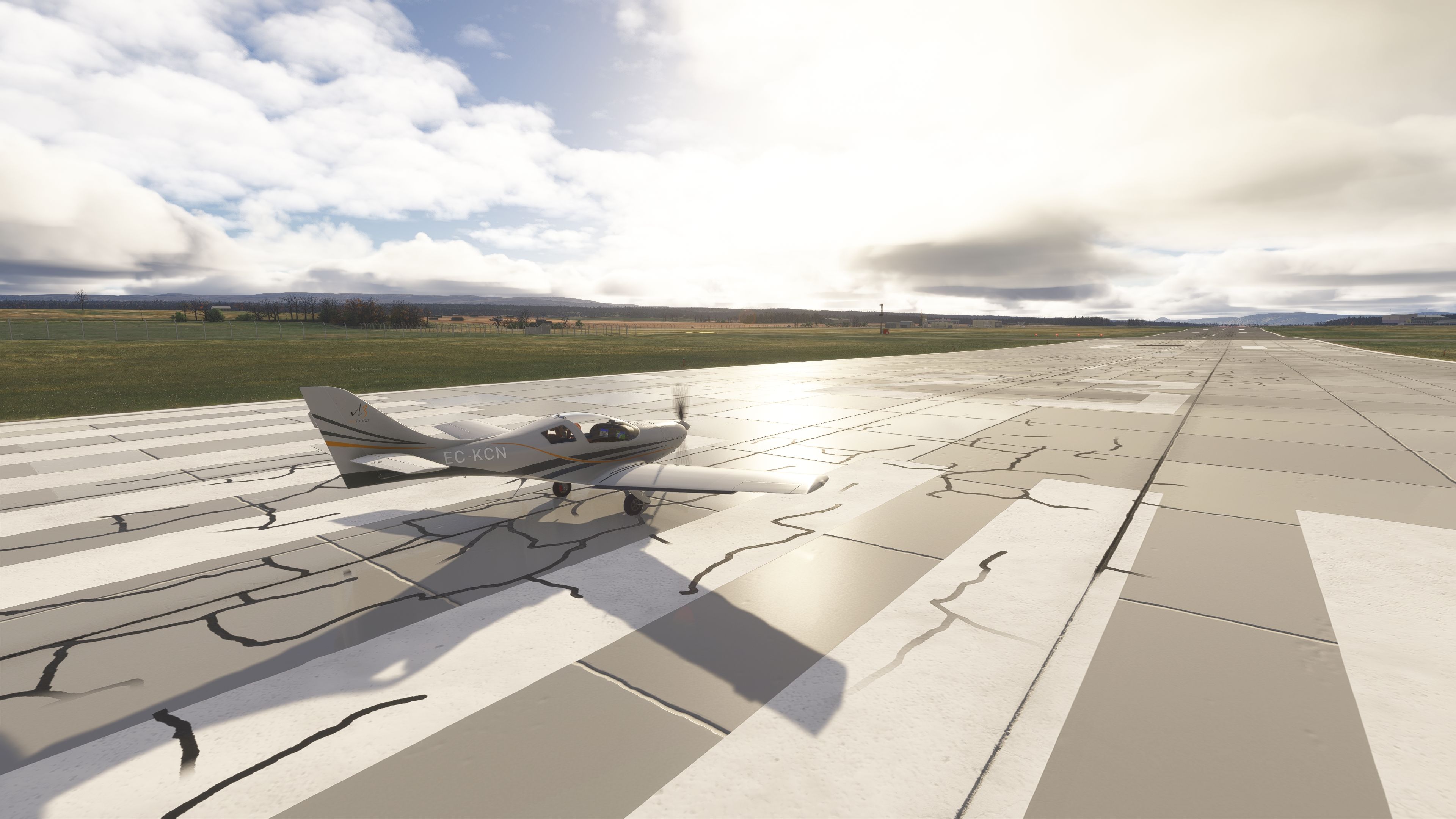
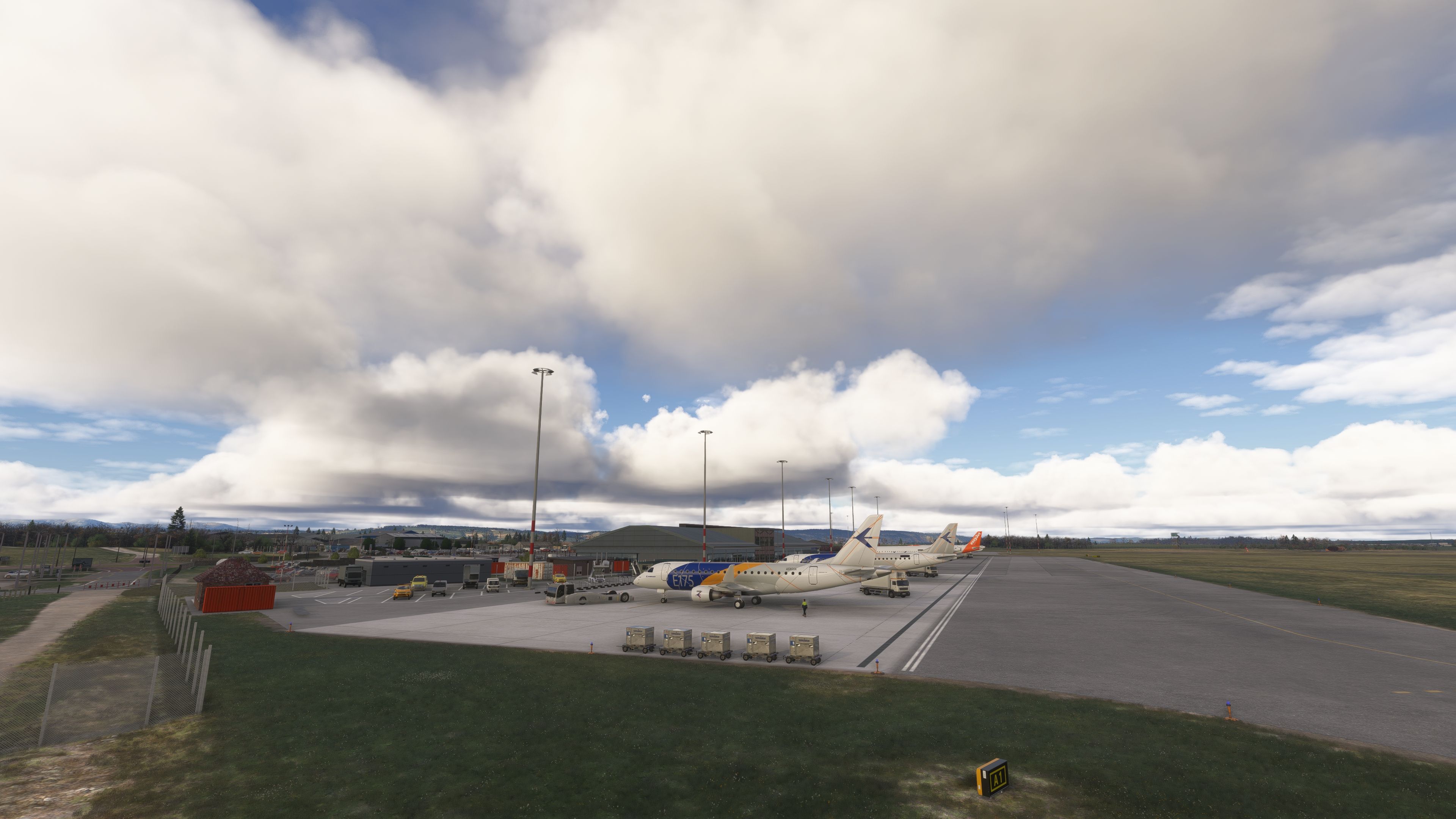
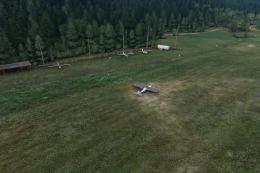
Accurate terminal building, true-to-form control tower, fuel areas, and the general aviation apron and club spaces rendered with precise footprints and clear sightlines.
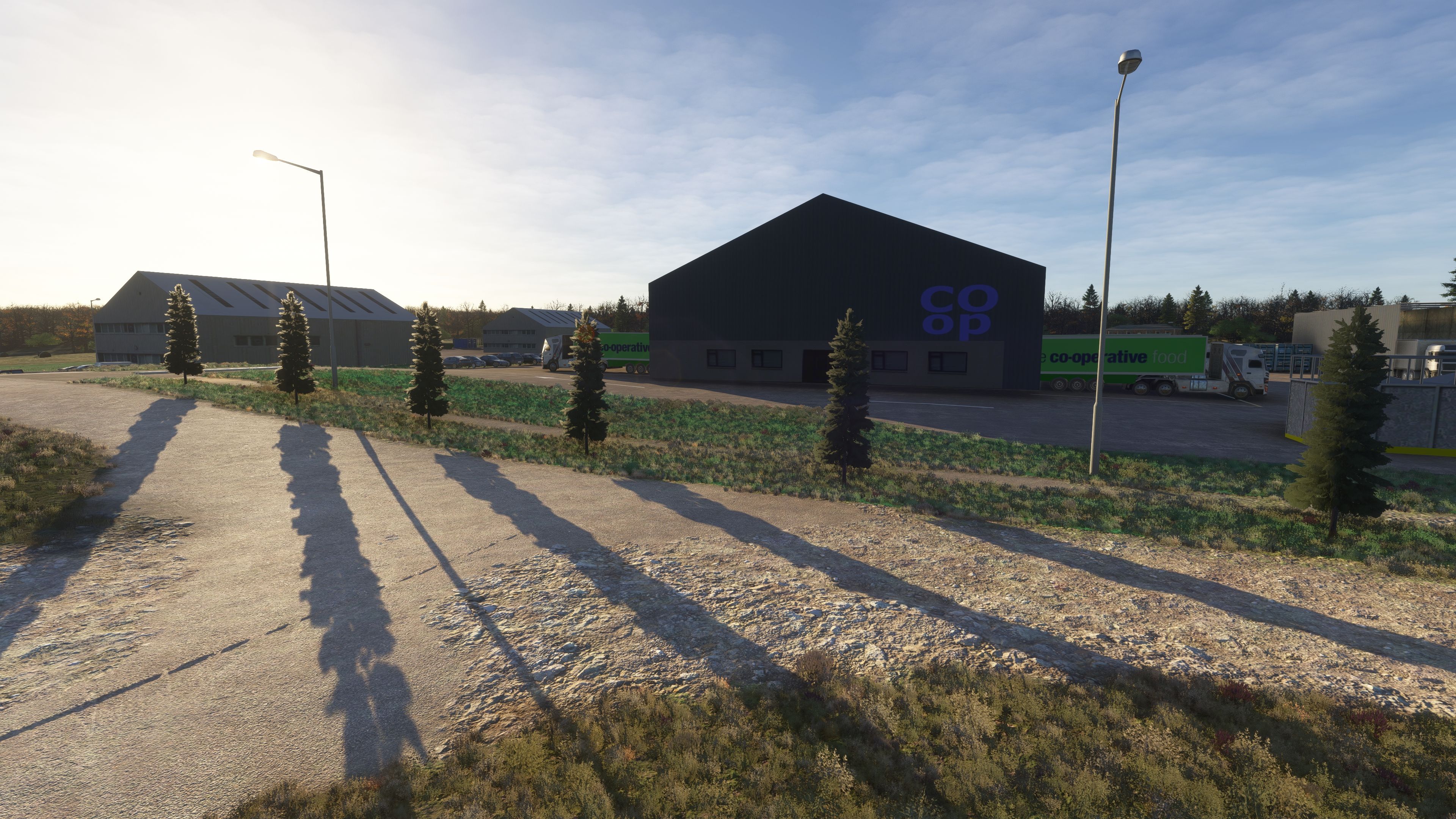
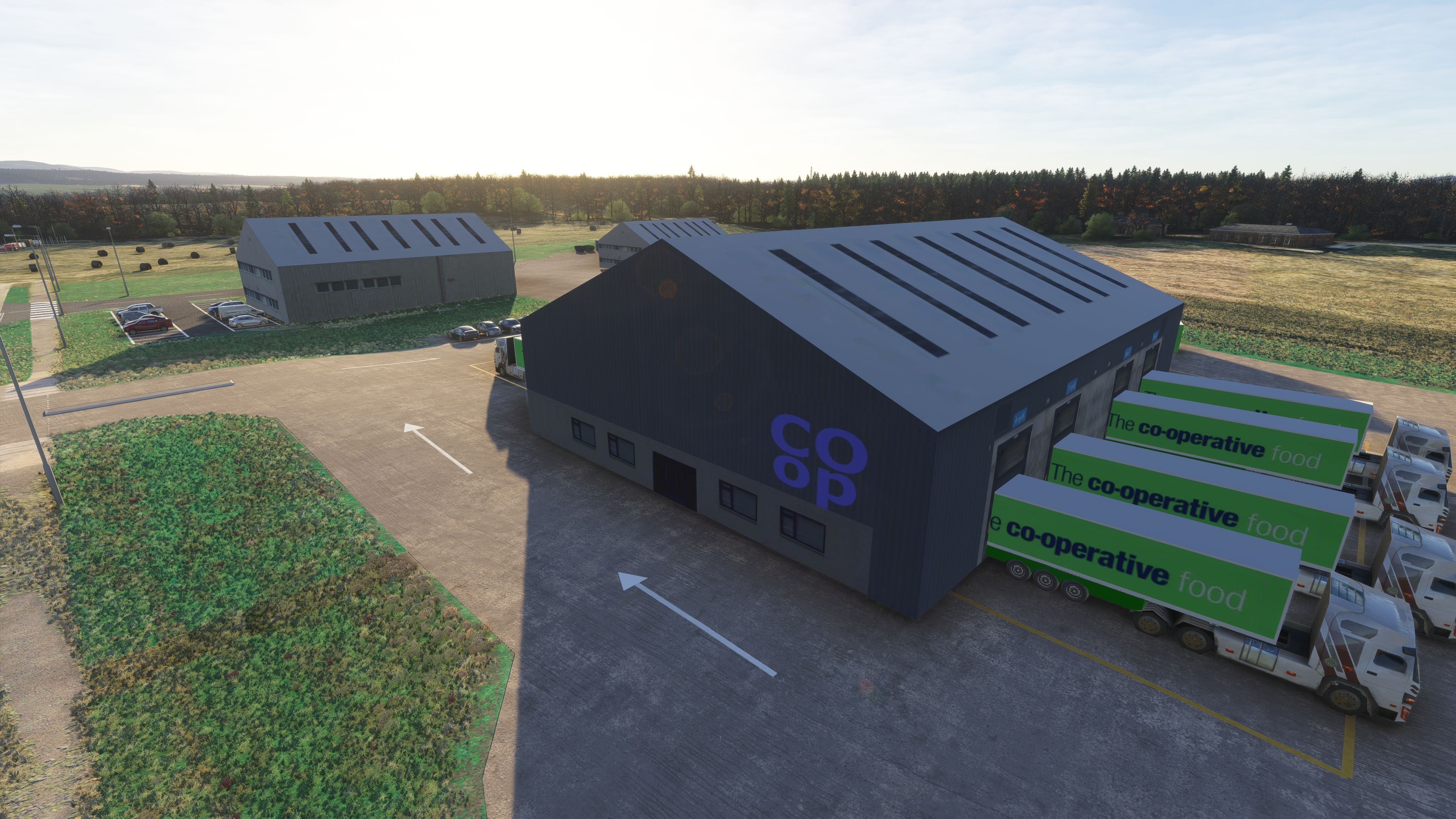
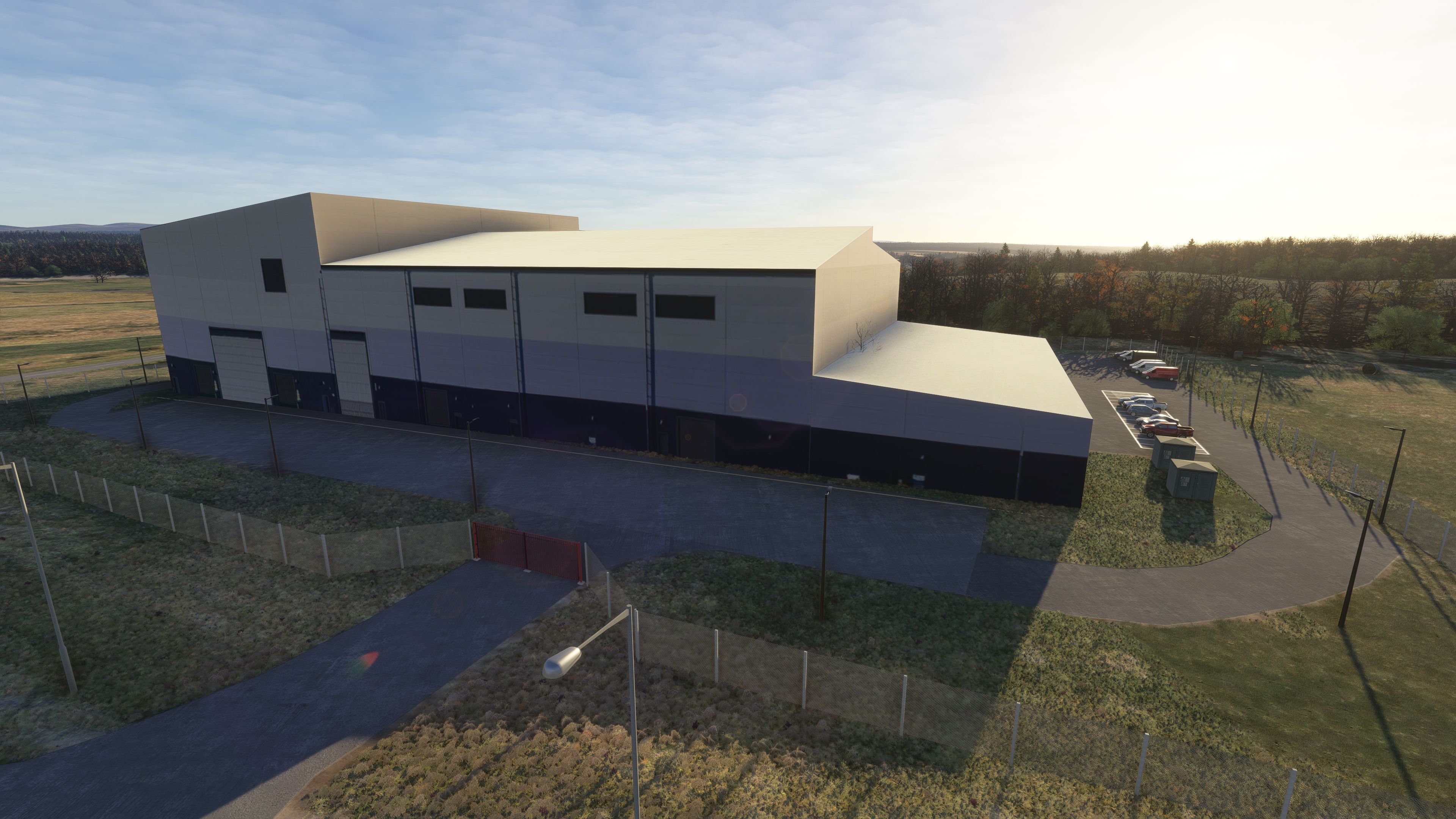
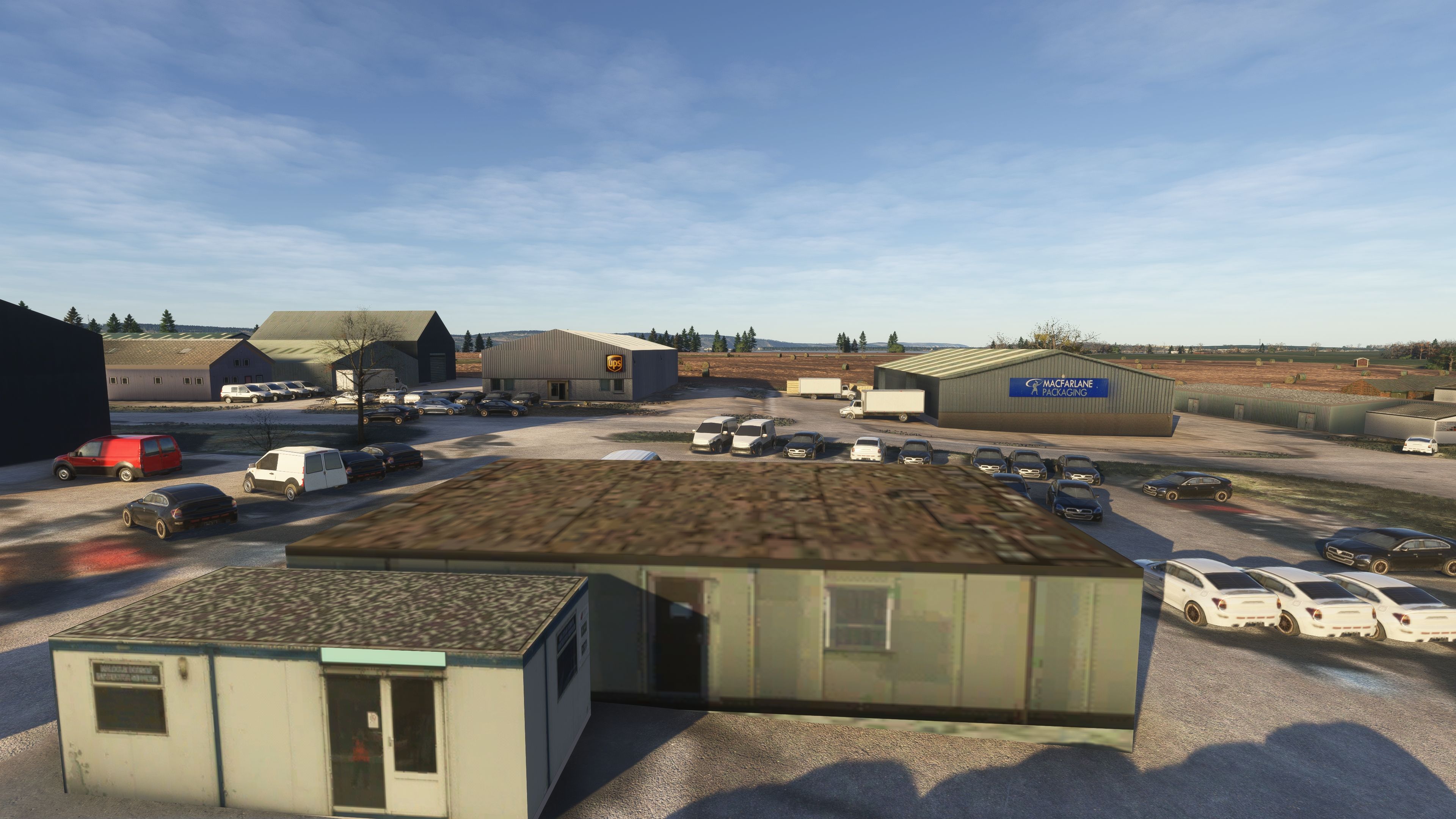
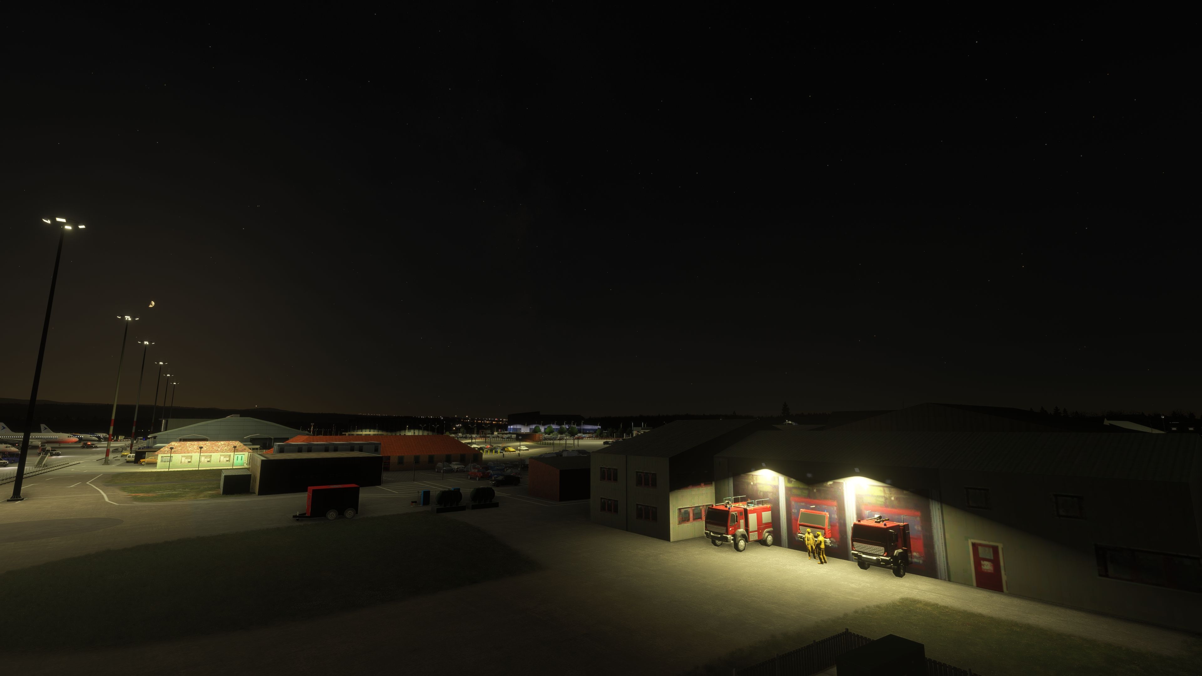
Cargo and Support
Co-op freight and UPS buildings included, reflecting the airport’s modest but active cargo handling capability.
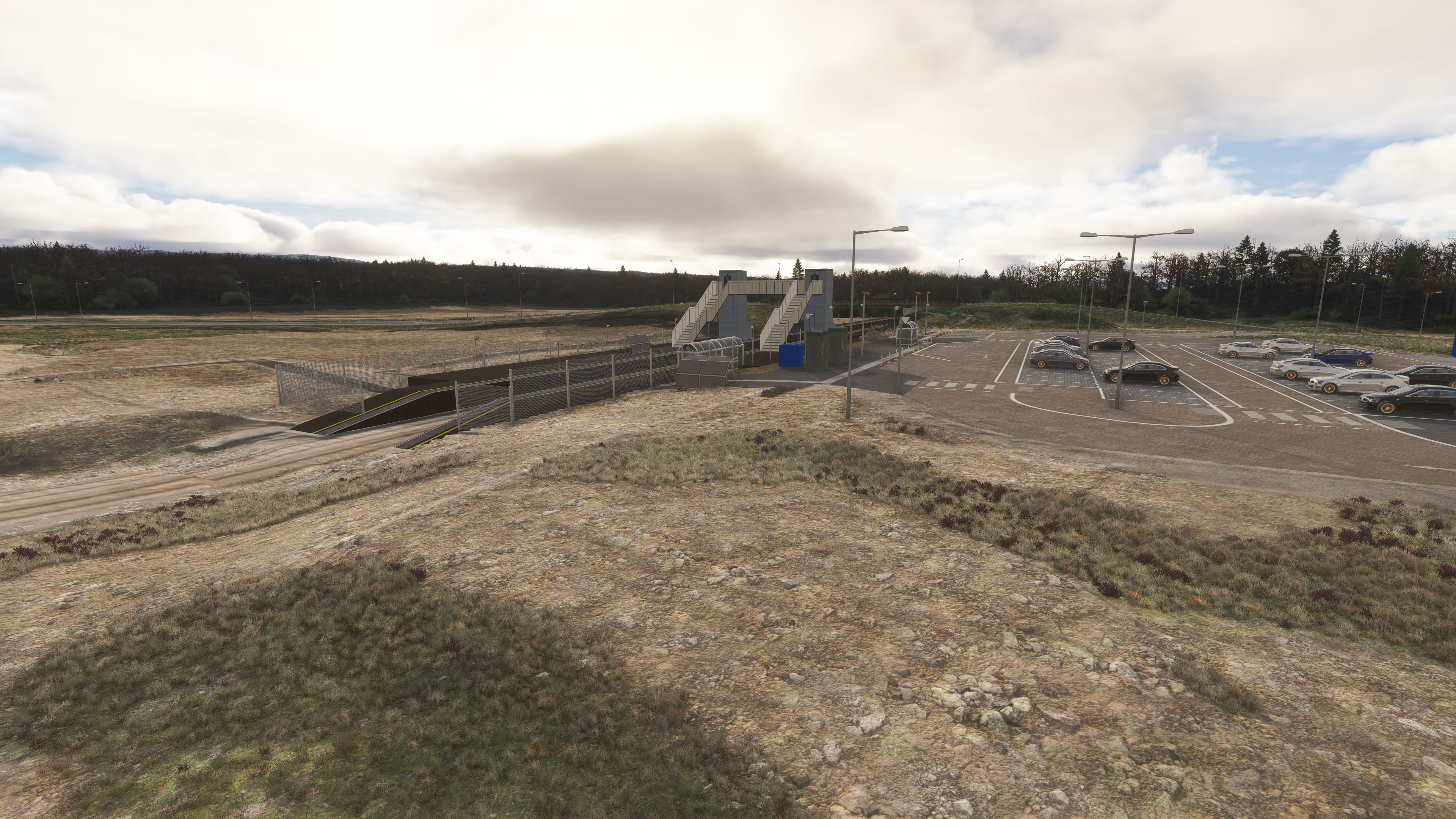
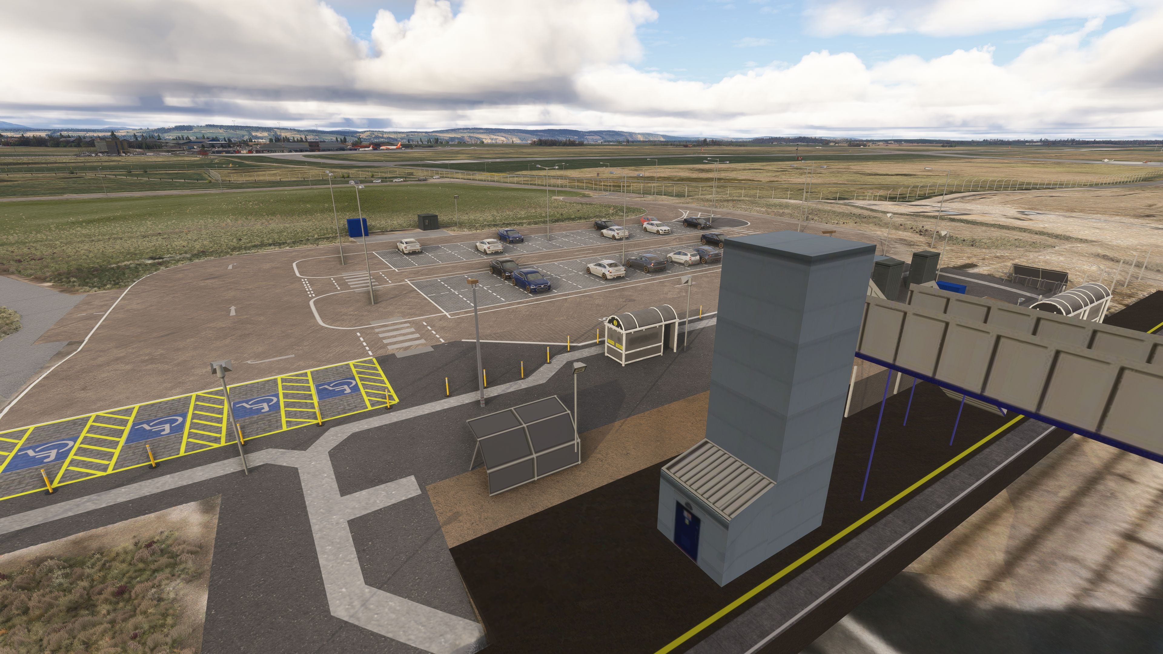
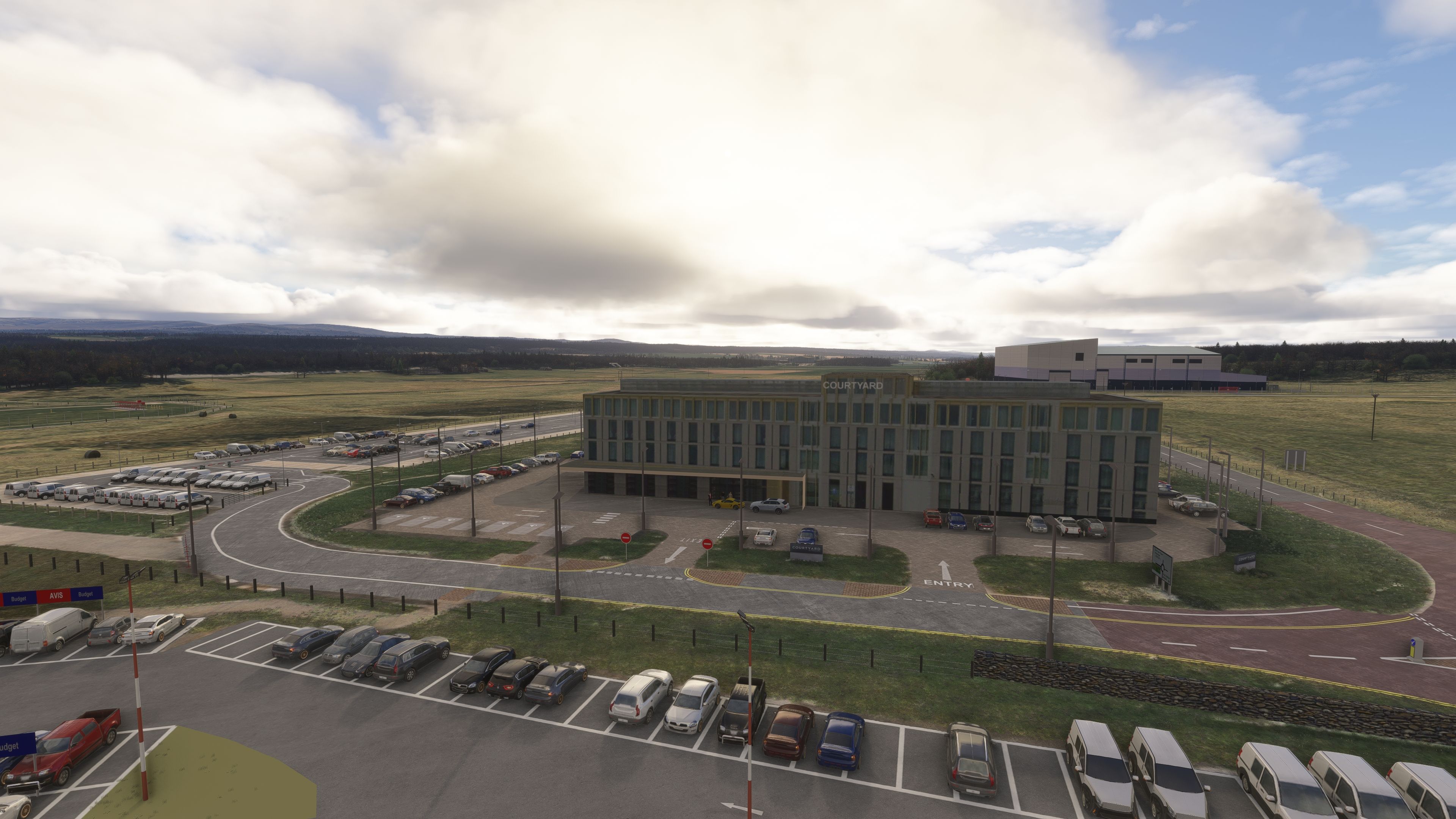
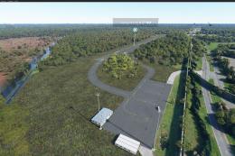
Landside and Transport Connectivity
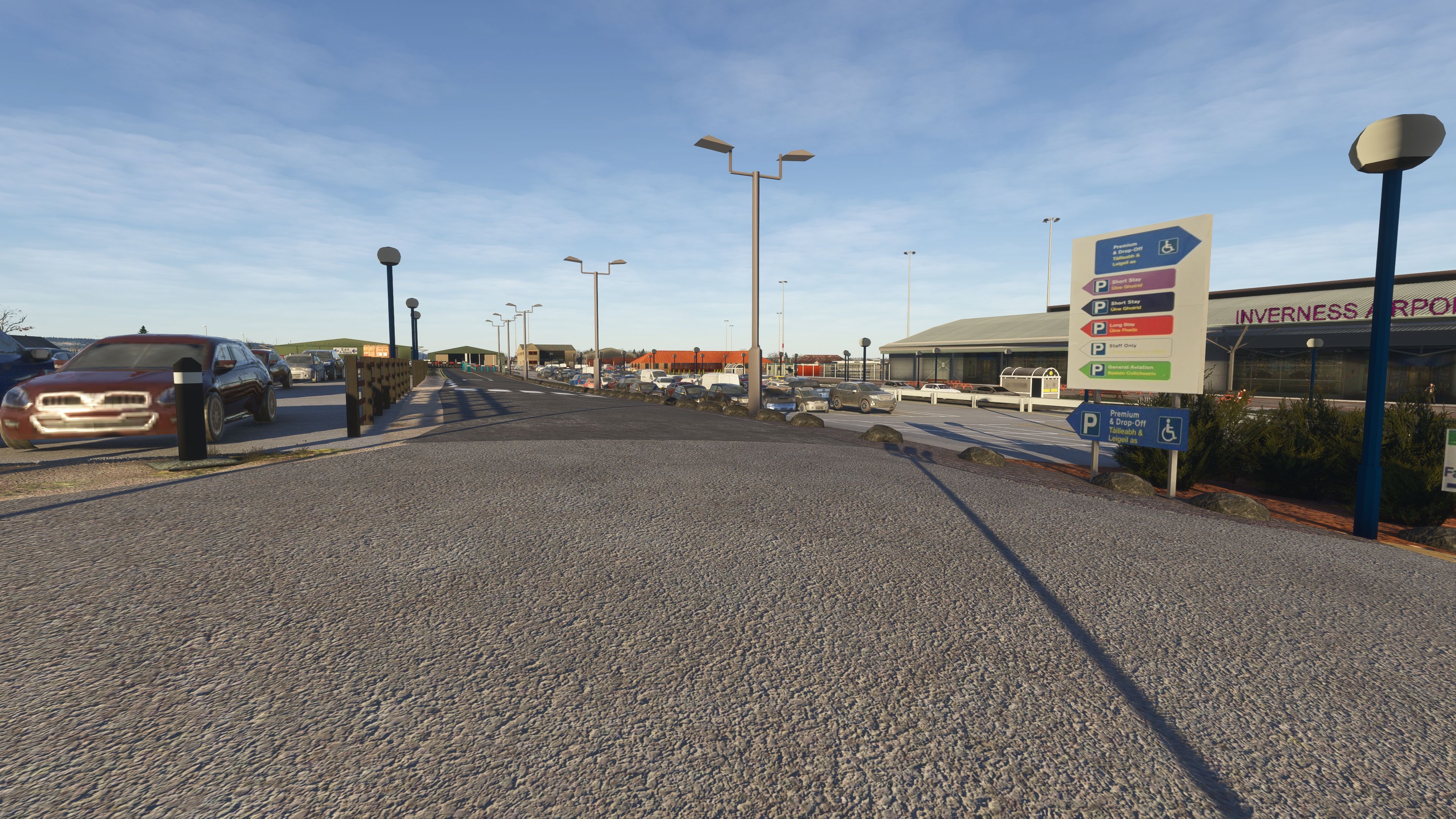
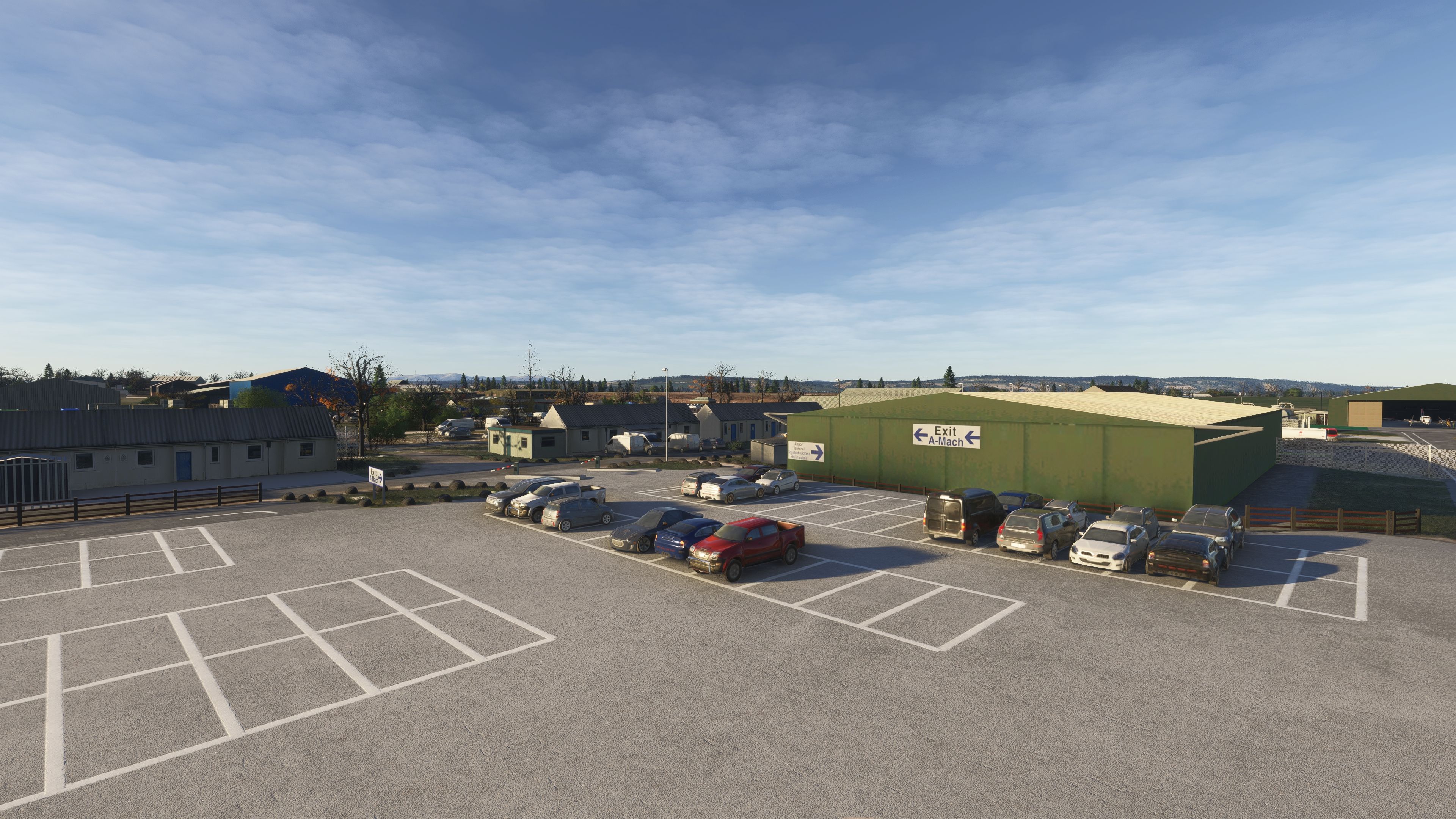
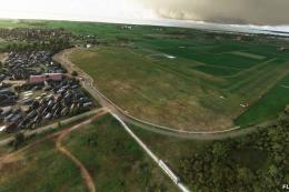
The nearby railway station is represented, complete with car park layouts, designated disabled bays, and bus stops that serve both the rail link and the main parking area.
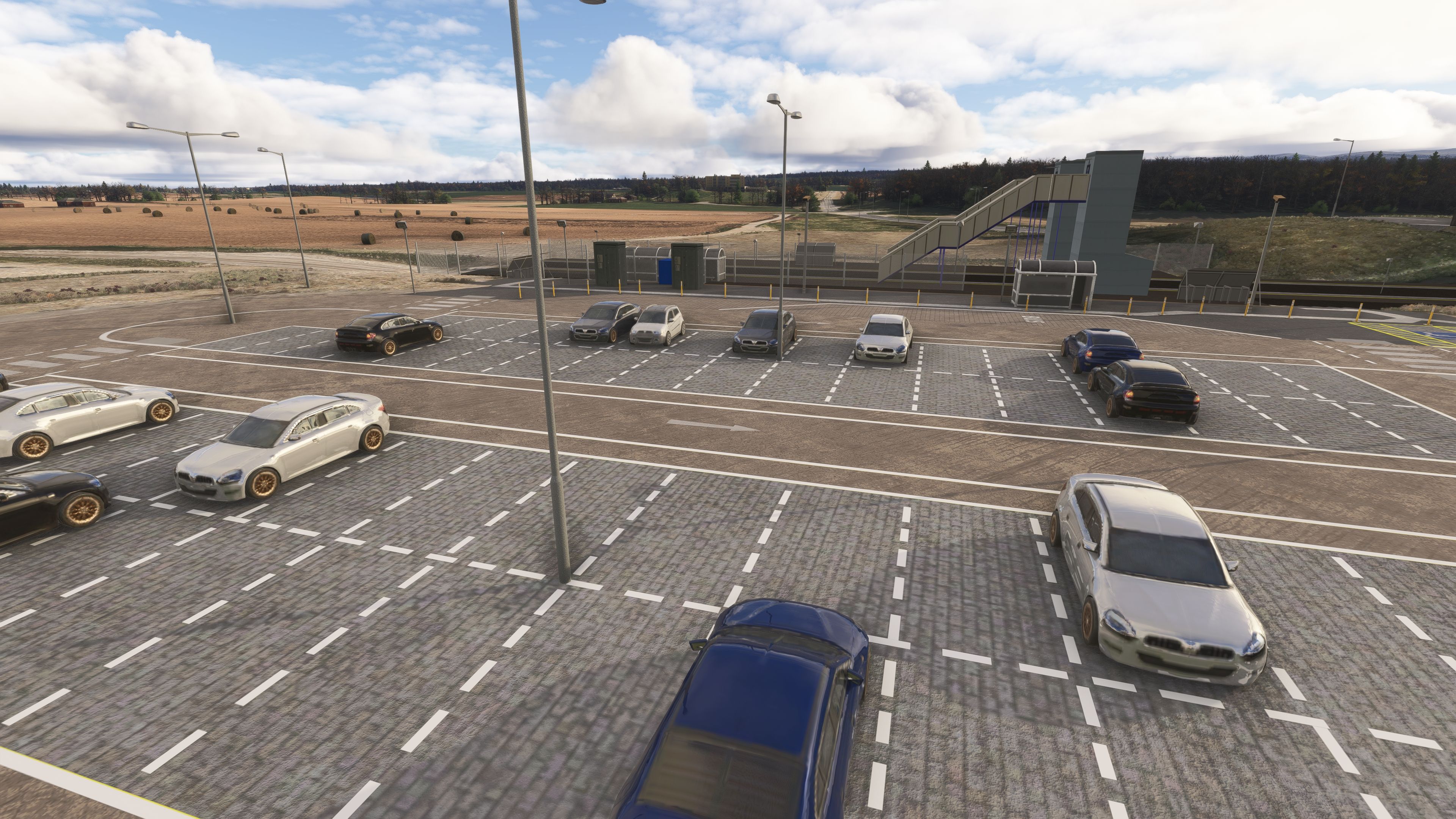
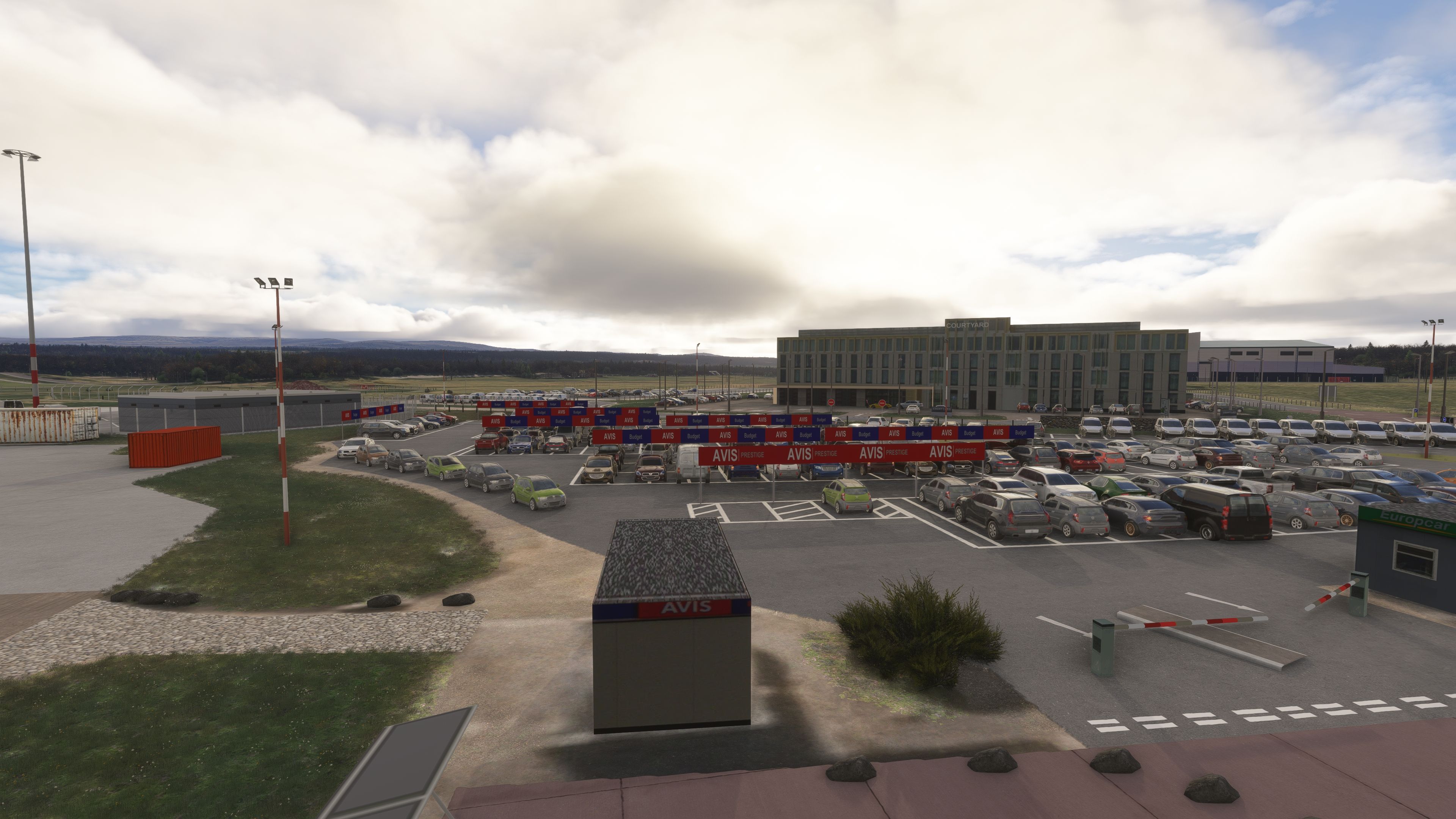
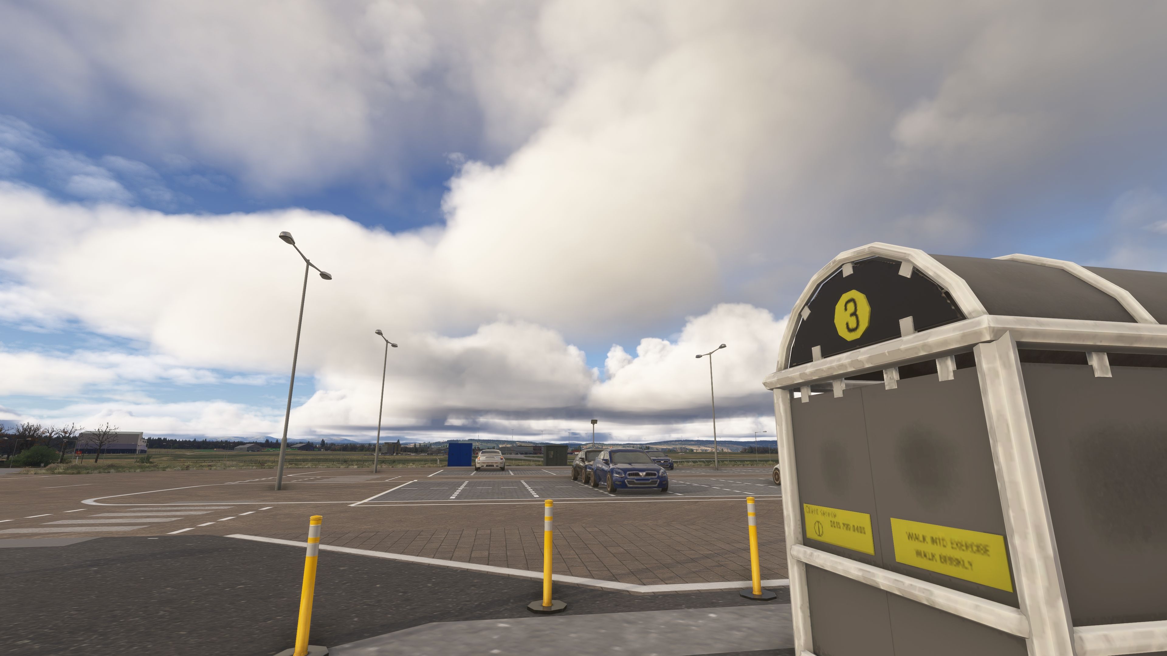
Parking and Access
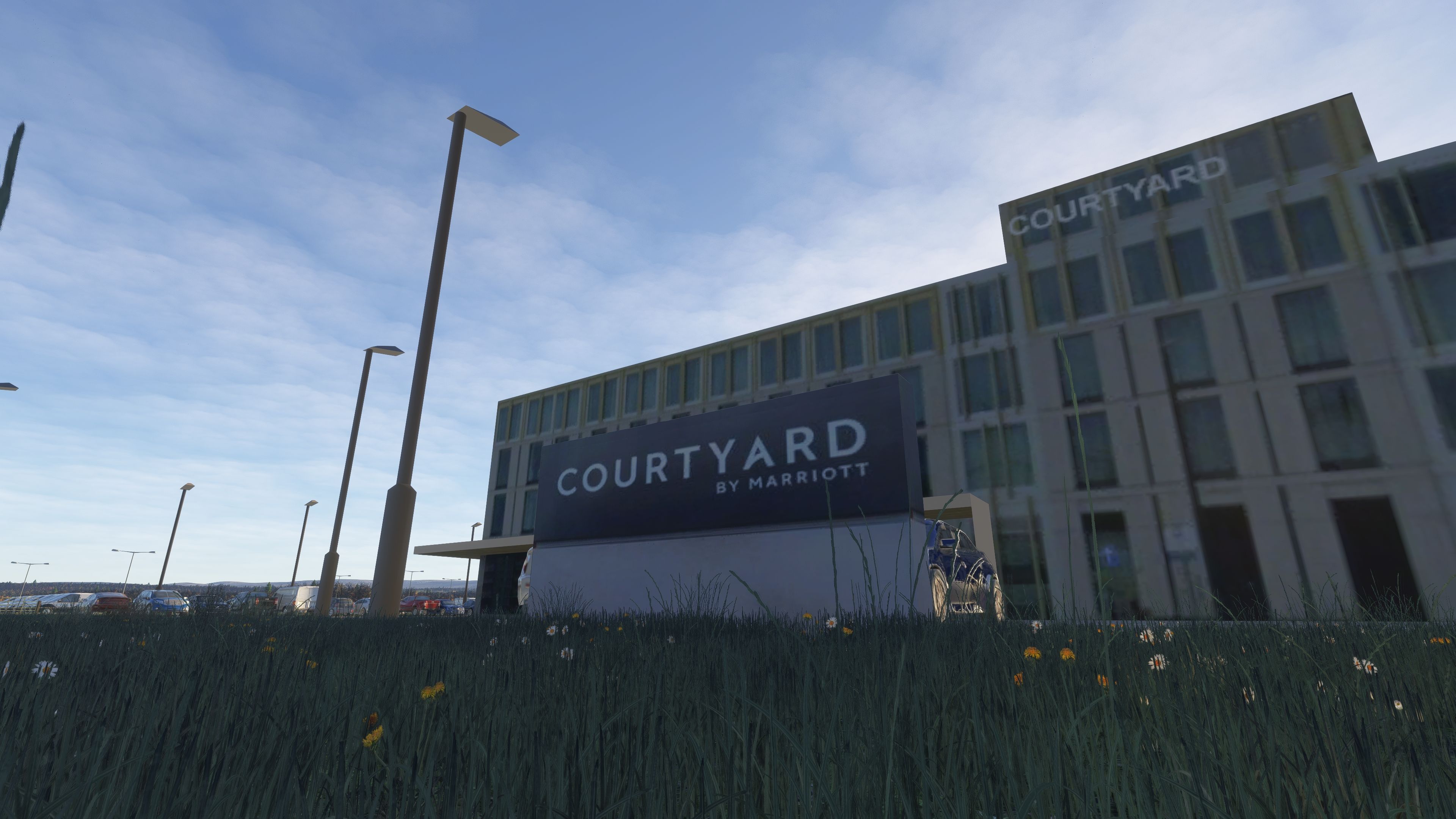
Car parks and rental areas are laid out to match the real airport, and road networks feature accurate exit and directional signage for visual cues when taxiing past the landside perimeter.
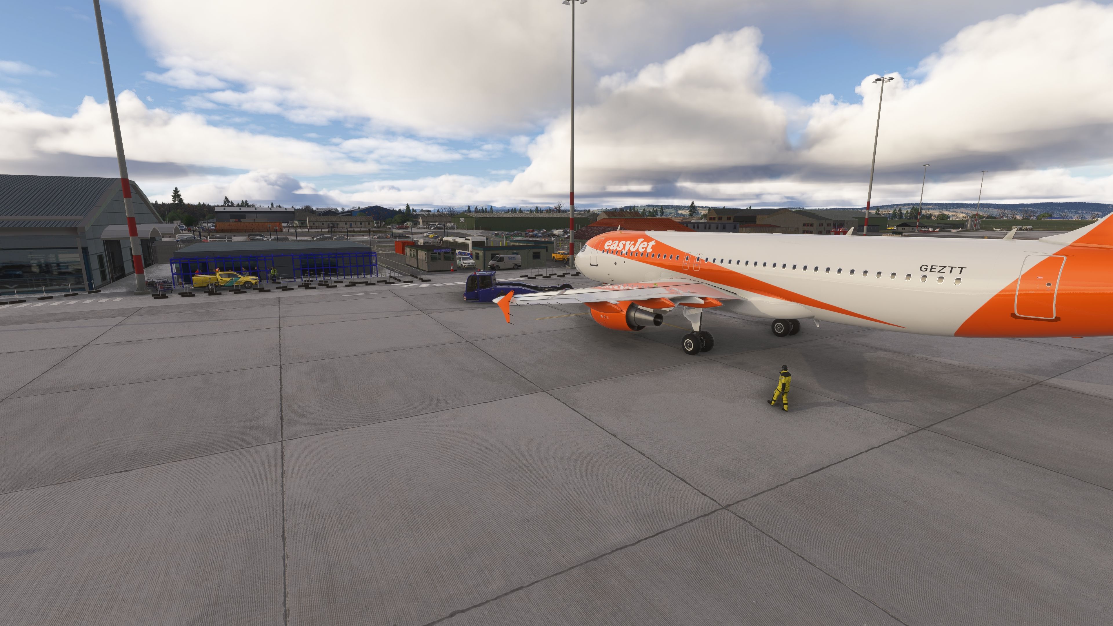
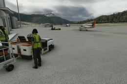
Dynamic Aircraft Representation
Dynamic aircraft are placed to mirror typical operator presence—such as easyJet rotations—adding believable apron activity without obstructing user operations.

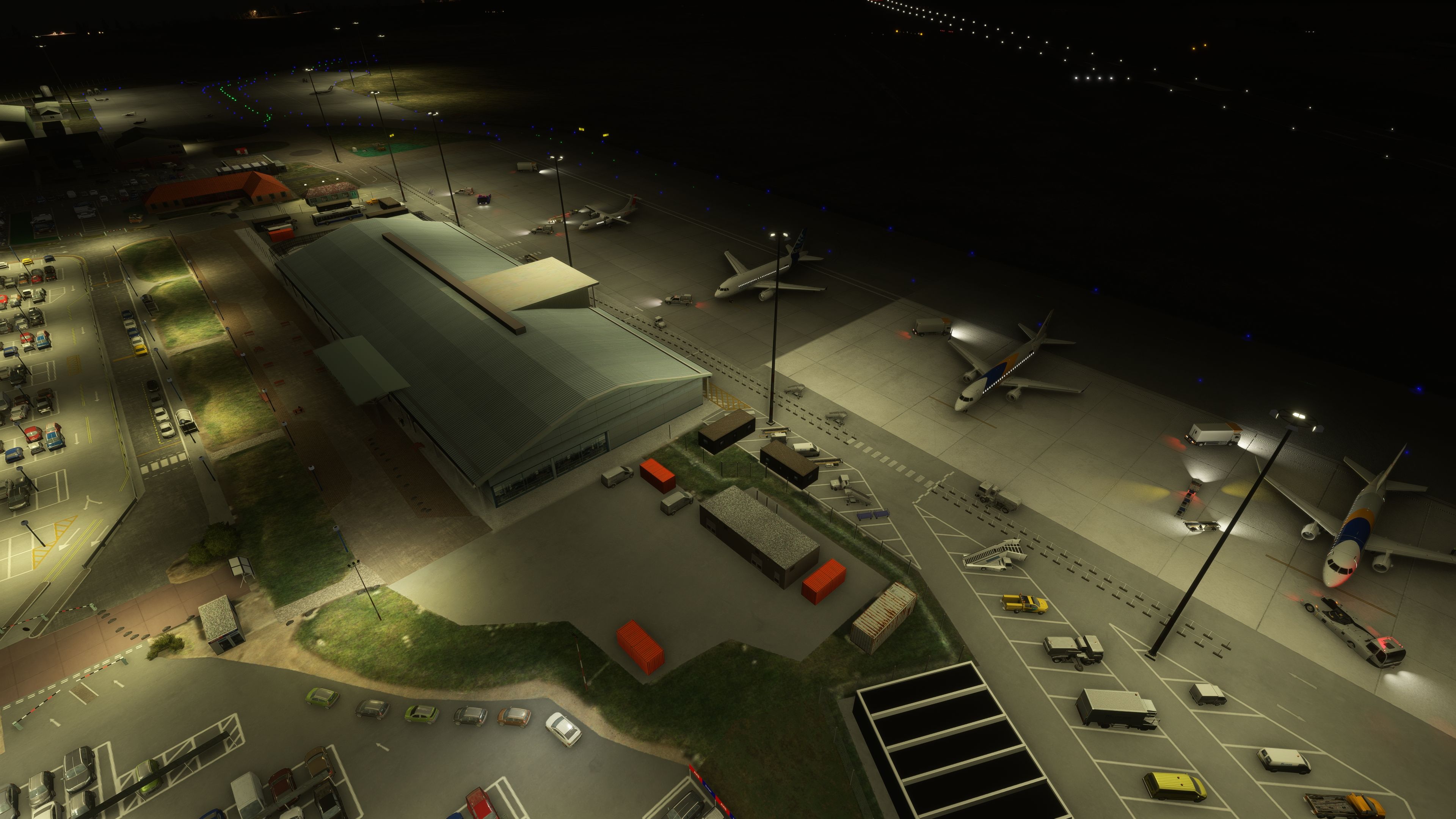
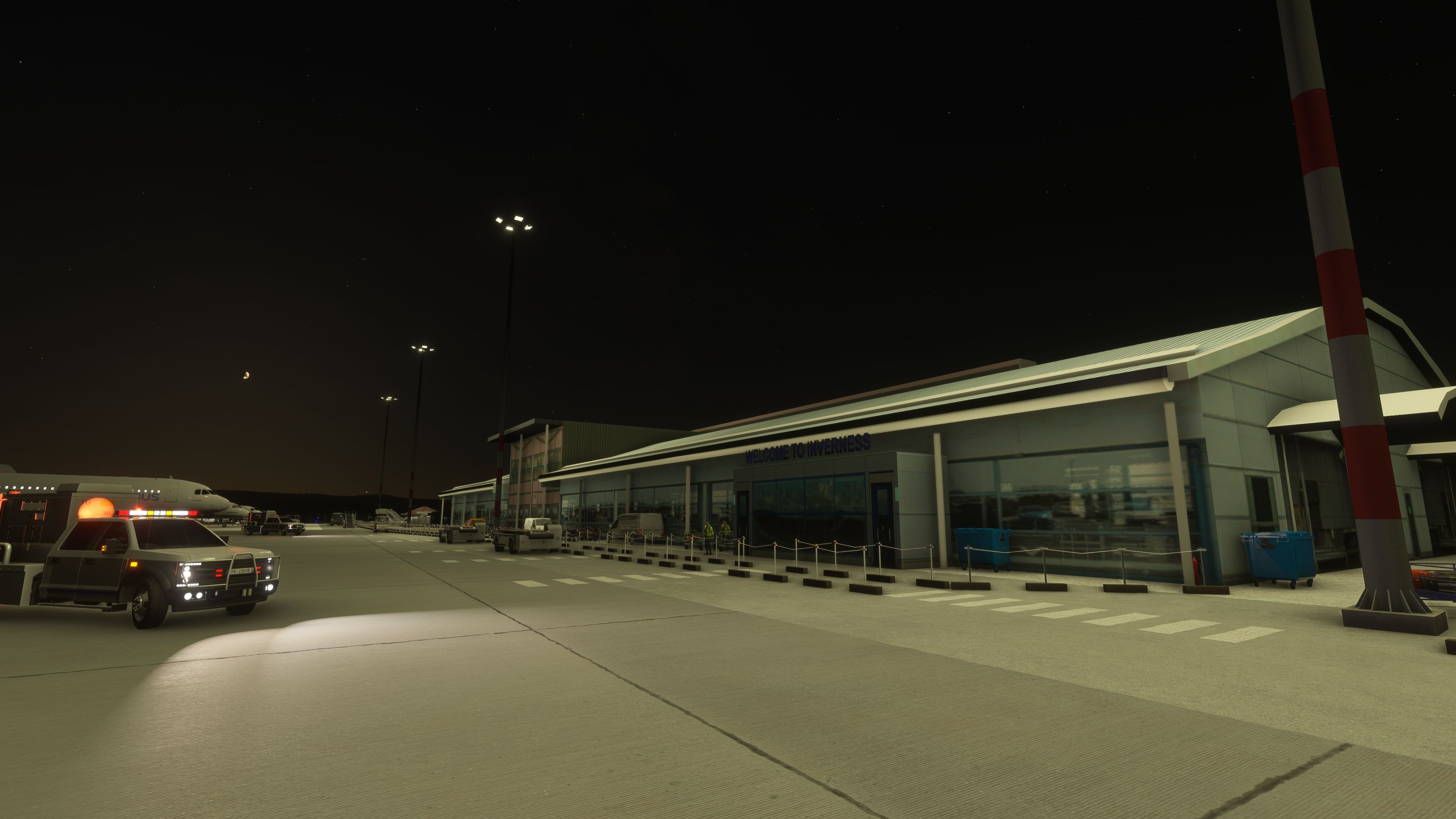
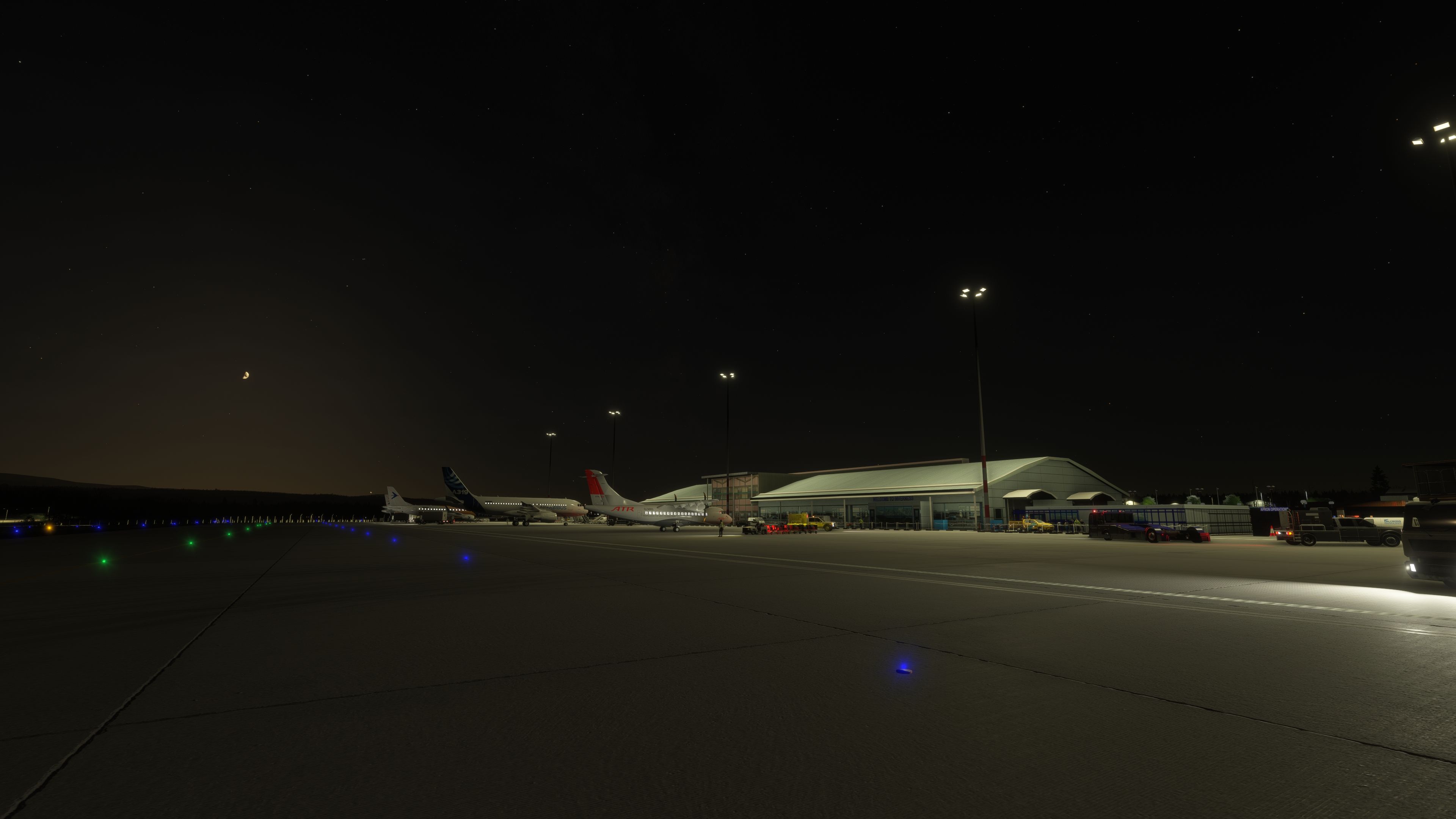
Night Environment and Airfield Lighting

Full-field night lighting increases legibility after dark. The terminal and ancillary buildings carry suitable emissive effects, while apron and road lighting are tuned for practical visibility rather than excess brightness. The result is a usable nocturnal scene—ideal for winter timetables and early morning departures—without sacrificing performance.

Designed for Microsoft Flight Simulator (2020 and 2024)

The package includes dedicated builds for both simulator generations, ensuring compatibility with each platform’s asset pipeline and lighting model. As a complete overhaul, it is intended to replace prior iterations, including Scotflight’s previous v2.0 release. The developer has granted explicit permission for distribution here on Fly Away Simulation.

What Stands Out in Practice

  • Hand-crafted buildings and site-specific objects replace default assets across terminal, cargo, GA, and support zones.
  • Landside connectivity represented, including the local rail station and bus stops, which neatly tie into the airport’s modern access plan.
  • Airline presence and apron feel aligned with real-world operations in the Highlands, supporting both IFR scheduling and local VFR flying.
  • Consistent night lighting across airside and landside for predictable visual cues during low-light operations.

Installation Steps

The archive contains separate versions for each simulator. Install only the version that matches your platform.

  1. Extract the downloaded archive to a temporary location.
  2. For Microsoft Flight Simulator 2024, copy the folder named egpe-inverness_MSFS2024 into your Community folder.
  3. For Microsoft Flight Simulator (2020), copy the folder named egpe-inverness_MSFS2020 into your Community folder.
  4. If you have an older Inverness package installed, remove or disable it to prevent duplication and exclusion conflicts.
  5. Launch the simulator and allow the scenery index to rebuild.

Notes on Use

Because this scenery replaces stock EGPE assets, it is best used without other Inverness modifications active. The developer, Scotflight, has prioritized faithful building footprints, realistic traffic staging, and lighting behavior so that instrument procedures and apron operations feel consistent with the real airport environment.

Images & Screenshots

60 total
An aerial view shows an airport terminal with parked airliners, multiple parking lots filled with cars, and a nearby hotel labeled Courtyard.A rural airport features intersecting runways, multiple taxiways, scattered small buildings, and grassy fields with distant water and hills.A small airport with a single runway is surrounded by industrial buildings, parking lots, open fields, and distant forested hills.A rural airport features three intersecting runways surrounded by farmland, with taxiways leading to a cluster of buildings near the water.A control tower with tinted windows stands near several small utility buildings, parked cars, and a fenced grassy airfield.A paved airport parking area features several parked cars, directional signs, lamp posts, and a terminal building labeled Inverness Airport.A warehouse with large "COOP" signage stands beside a parking lot, with several trees casting long shadows across a gravel road.A small parking lot with several cars sits beside a pedestrian overpass and fenced pathway on a grassy, rocky terrain.Several parked cars occupy a mostly empty lot with streetlights, while a pedestrian bridge and rural landscape appear in the background.A small airfield with intersecting runways sits beside a large body of water, surrounded by fields and scattered buildings.Several commercial aircraft are parked at terminal gates beside a large airport building, with service vehicles and buses positioned nearby on the apron.A grassy airfield features a perimeter fence, a small utility shed, taxiways, and distant low clouds over rolling hills.Several parked cars sit near a fenced entrance beside a small building, with a taxiway, hangar, and grassy airfield in the background.Several cars are parked in a lot beside a green hangar with an "Exit A-Mach" sign and nearby low buildings.A ground-based navigational facility with orange and white antenna structures stands on a grassy field under a mostly cloudy sky.A single runway marked 05 stretches across a grassy airfield, with cracked pavement and scattered clouds overhead.A warehouse building with COOP signage has several co-operative food delivery trucks backed into loading bays and cars parked nearby.A large open airfield features intersecting runways, a circular navigational aid structure, and several small utility buildings under a mostly cloudy sky.A small airport parking lot with several cars, accessible parking spaces, and covered walkways sits beside grassy fields and distant runways.A large parking lot with numerous parked cars sits beside a green hangar and several low industrial buildings under a cloudy sky.A terminal building with a covered walkway is adjacent to several busy parking lots and a long orange shipping container under cloudy skies.Several parked cars line the side of a building next to a fenced area, with open fields and hay bales in the background.A small airport terminal complex features multiple parking lots filled with cars, several low buildings, and a large apron with taxiways in the background.A control tower stands behind barbed wire fencing, surrounded by portable buildings, a blue dumpster, and a parked car on a cloudy day.Several commercial jets are parked at terminal gates beside a main airport building, with parking lots and grassy fields surrounding the area.A fenced area with parked cars, several industrial buildings, and a small white aircraft on grass is shown under a partly cloudy sky.An EasyJet-branded aircraft is parked at a terminal gate with ground vehicles, airport staff, and cloudy skies in the background.A blue airport tug is parked in the foreground near apron operations buildings, with several service vehicles and staff visible nearby.A large industrial-style building with multiple garage doors sits behind a fence, with several parked cars and trees in the background.Several parked cars sit beside a curved hangar and a small building, with an airport control tower visible in the background.A turboprop aircraft and an orange jet are parked on the apron outside Inverness terminal, with ground vehicles and cloudy skies overhead.Several parked cars and utility vehicles surround multiple metal hangars and a wooden office building on a rural airfield under clear skies.A large airport terminal with glass facades is surrounded by multiple parking lots filled with cars and several green landscaped areas.Several parked cars and vans surround portable office buildings and warehouses, with clear company signage and open countryside in the background.Two blue helicopters are parked on a concrete apron beside a beige hangar, with fuel trucks and a storage tank nearby.A small airfield features a taxiway with a white X marking, a hangar, a control tower, and open grassy surroundings.A modern four-story hotel labeled "Courtyard" stands beside multiple parking lots with numerous cars, surrounded by grassy fields under a cloudy sky.A large airport car rental lot with numerous parked vehicles sits in front of a multi-story hotel building under a cloudy sky.Two fuel tanker trucks are parked beside a large white storage tank near a green hangar and a fenced parking lot.A small yellow ultralight aircraft is parked near orange cones and a blue landing fees sign, with modular buildings in the background.A fenced airport service area contains a bus, a yellow vehicle, and portable buildings, with two commercial aircraft parked in the background.Several commercial jet airliners are parked at a well-lit airport terminal at night, with various ground vehicles and equipment positioned nearby.A blue and red AW139 helicopter sits on a concrete apron outside a Bristow Coastguard hangar, with two fuel trucks nearby.A modern airport terminal with a "Welcome to Inverness" sign stands beside an apron with parked aircraft and ground service vehicles.A small airfield features several hangars, a control tower, marked helipads, a yellow helicopter, and two figures standing nearby.An orange and white helicopter is parked on a concrete apron in front of a large hangar with two blue helicopters nearby.A small white aircraft sits at the threshold of a cracked runway under a partly cloudy sky with sunlight breaking through.A nighttime airport ramp scene shows a terminal labeled "Welcome to Inverness," a parked aircraft, and a flashing airport vehicle.A small single-engine aircraft with registration EC-KCN sits on a cracked runway under a cloudy sky with sunlight reflecting off the pavement.A Courtyard by Marriott hotel stands behind tall grass and wildflowers, with several streetlights and parked cars visible in the background.Two regional jets are parked at an airport apron near the terminal building, with ground vehicles and baggage carts positioned nearby.A Bristow-liveried helicopter is parked on a concrete apron in front of a large HM Coastguard hangar under cloudy skies.A twin-engine turboprop aircraft sits partially inside a green hangar with ground crew nearby and another small plane in the background.A regional jet with blue and orange livery is parked at an airport gate, surrounded by ground vehicles and cloudy skies.Two portable buildings labeled Apron Operations and Dalcross Handling stand beside a security fence, with two service vehicles parked in front.An Airbus A319 aircraft is parked at an airport gate near a terminal building with cloudy skies and ground crew nearby.A parking lot with several cars and tall streetlights sits under a sky filled with large, low-hanging clouds.Two ground crew members in high-visibility jackets stand near baggage carts and vans outside a terminal with a "WELCOME TO" sign.Several commercial aircraft are parked at a terminal under floodlights at night, with ground vehicles and blue taxiway lights visible nearby.A fire station with three fire trucks is illuminated at night, with two firefighters standing outside under bright exterior lights.
All screenshots above have been created by Fly Away Simulation and are exclusive. For more details, see our image copyright information.
GPS Map Icon

Finding the Scenery

MSFS Format:
57.54200000,-4.04700000
You can copy and paste these coordinates into Microsoft Flight Simulator's search bar when starting a flight or the Developer Mode "Teleport" window to navigate directly to the center of this scenery area, airport, or landmark after you have installed this addon.
Decimal Degrees (DD):
Latitude: 57.542000°
Longitude: -4.047000°
Degrees, Minutes, Seconds (DMS):
Latitude: 57° 32' 31.200" N
Longitude: 4° 02' 49.200" W

Map Location


Installation icon.

Installation Instructions

Most of the freeware add-on aircraft and scenery packages in our file library come with easy installation instructions which you can read above in the file description. For further installation help, please see our Flight School for our full range of tutorials or view the README file contained within the download. If in doubt, you may also ask a question or view existing answers in our dedicated Q&A forum.

0 comments

Leave a Response

Leave a comment