 FSX Scenery
Doha Qatar
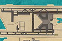
Scenery Doha Qatar as it will look in 2011. The old OTBD airport has been rem…
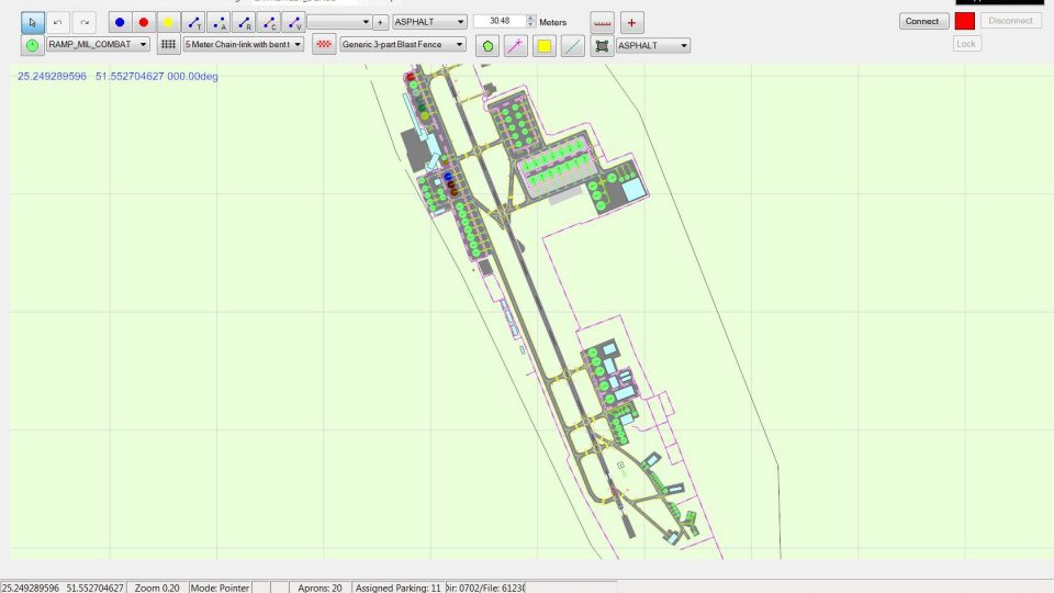
Doha International Airport (OTBD) gets a chart-accurate refresh for Microsoft Flight Simulator X, featuring a carefully rebuilt AFCAD with the Eastern Apron, updated terminal footprint, and corrected taxiway geometry. Added hangars, vehicle routes, military, cargo and general aviation parking, plus realistic gate coding, improve ground flow and airline-style operations.
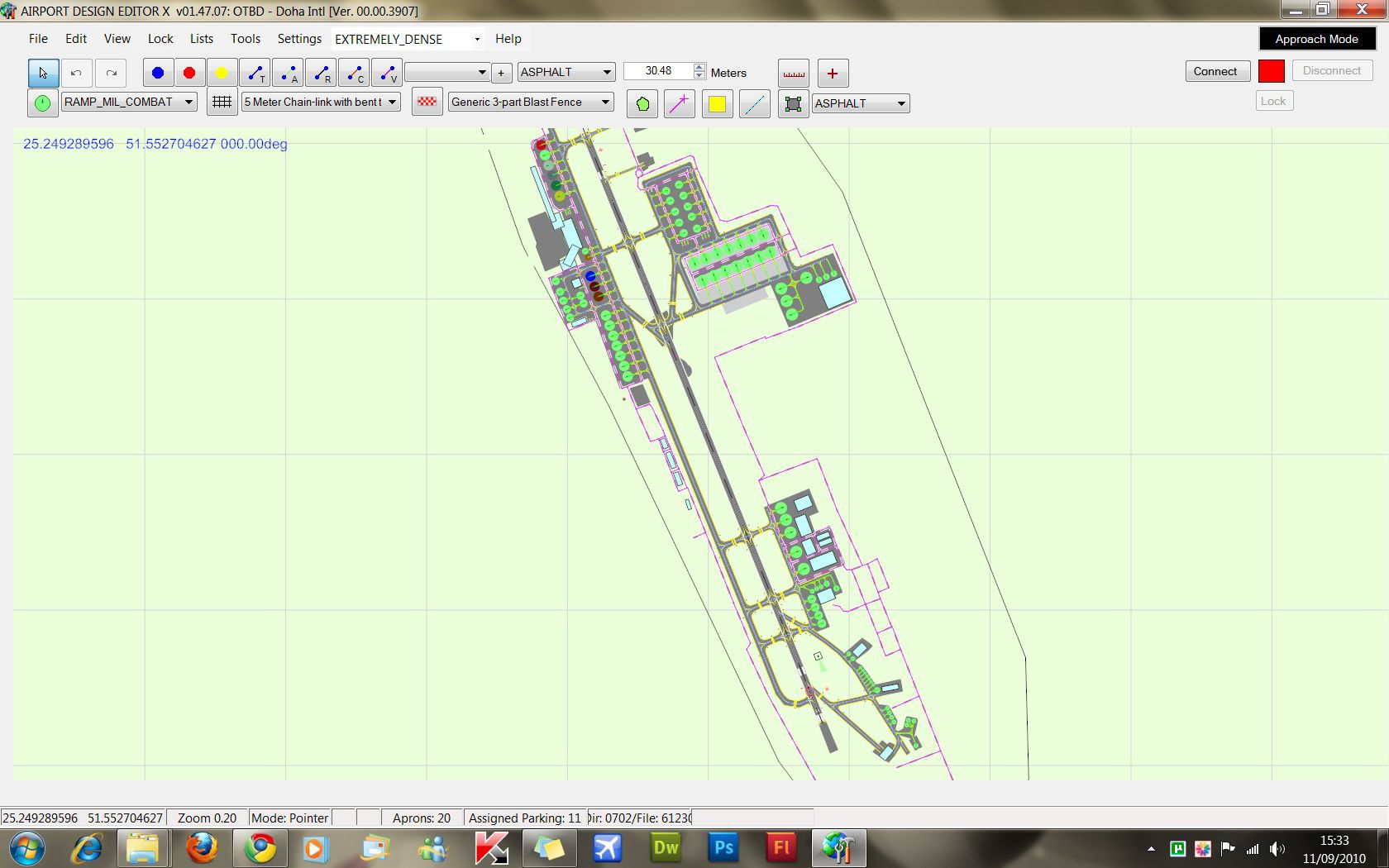
Scenery Doha International Airport (OTBD), Qatar. A beautifully mastered AFCAD for the current Doha Int'l for the default FSX Airport. Built using Google Maps and Jeppesen charts. Includes the new Eastern Apron and a remastered terminal area. Hangars, aprons, vehicle paths, military parking, cargo area and general aviation areas added. Taxiways have been re-aligned and added where needed. All terminal area gates have been coded as per real life Airline operations and schedules. By Tom Kellock.
Overview of Doha International Airport Scenery.
*****INSTALLATION******
1) Copy the 2 .BGL files from this folder and place them in Program Files (or Program Files x86)/Microsoft Games/Microsoft Flight Simulator X/Addon Scenery/Scenery.
2) Load FSX and allow for the Database to be re-done.
3) Select OTBD Doha Intl.
4) Have fun flying!
*****UNINSTALLATION******
1) Go to Program Files (x86)/Microsoft Games/Flight Simulator X/Addon Scenery/Scenery.
2) Delete the files called OTBD_ADE_TK_Default and the OTBD_ADE_TK_CVX BGL files.
3) Reload FSX.
4) Job Done!
******IMPROVEMENTS******
The Terminal area has had some new aprons added to it, as per charts and Google Maps.
The Terminal itself has been created using ADE Generic Buildings.
Parking Spots aligned, assigned and numbered correctly.
Eastern Aprons 1 & 2 added, with correct Parking Spots, etc.
Taxiways B1, C, E1, S, R and E2 re-aligned per Google Maps and Charts.
Military, Cargo, and General Aviation Parking Spots added.
Hangars and Generic Buildings added per Google Maps.
Vehicle Roads and Parking added around the Airport and the Aprons.
Taxiway Signs Re-aligned and named.
******AUTHOR DETAILS******
Author: Tom Kellock
Free for all simmers · 2.46 MB · Scanned clean
Download speed: Free tier is capped at 0.5 Mbps. PRO members download at full line speed.
FSX\Addon Scenery\ containing scenery and texture sub-folders.readme.txt or README file. It tells you exactly where files go, what dependencies are needed, and any quirks specific to this add-on.Use these coordinates to fly directly to this location once the mod is installed.
25.26110000,51.56500000
Launch FSX or Prepar3D and use Flights → Load to open the downloaded .pln file. Your aircraft will be positioned at this location.
The archive doh_otbd_dohaintl.zip has 8 files and directories contained within it.
This list displays the first 500 files in the package. If the package has more, you will need to download it to view them.
| Filename/Directory | File Date | File Size |
|---|---|---|
| Readme.txt | 09.11.10 | 1.55 kB |
| OTBD_ADEX_TK.BGL | 09.14.10 | 33.66 kB |
| OTBD_ADEX_TK_OBJ.BGL | 09.14.10 | 5.34 kB |
| afcad_ade_screen.jpg | 09.11.10 | 288.05 kB |
| Screen1.BMP | 09.11.10 | 6.25 MB |
| FILE_ID.DIZ | 09.14.10 | 497 B |
| flyawaysimulation.txt | 10.29.13 | 959 B |
| Go to Fly Away Simulation.url | 01.22.16 | 52 B |
More FSX & P3D add-ons hand-picked based on this download.
FSX Scenery
Scenery Doha Qatar as it will look in 2011. The old OTBD airport has been rem…
 FSX Scenery
Scenery Doha Qatar Update, for use with QATAR_2011.ZIP. Adds shorelines to th…
 FSX Scenery
Princess Juliana International Airport (TNCM) in Saint Marteen, Netherlands A…
 FSX Scenery
Barbados International Airport (TBPB). Grantley Adams International Airport f…
 FSX Scenery
Dubai International Airport (OMDB), Dubai. Includes a new passenger terminal …
 FSX Scenery
Soekarno-Hatta International Airport (WIII), Jakarta, Indonesia. An update to…
 FSX Scenery
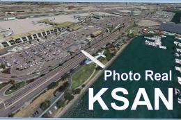
San Diego International Airport, California (CA), USA. This photoreal scenery…
 FSX Scenery
Suvarnabhumi International Airport (VTBS), Bangkok, Thailand, v1.1. Includes …
Be the first to leave a comment on this download.
Be the first to share your thoughts on this download.