 FSX Scenery
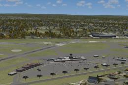
Tumbler Ridge
Tumbler Ridge, British Columbia, Canada (CBX7). By Bob Caparoula. Tumbler Rid…
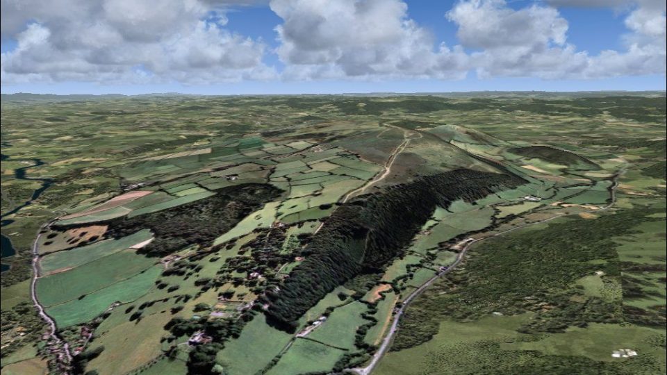
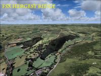
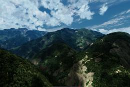
Hergest Ridge brings the England–Wales border hillscape to life with photoreal ground textures around Kington and Gladestry, accurately capturing the 1,397‑foot summit and surrounding countryside. Built for FSX, it matches UTX Europe alignment yet blends cleanly with default scenery for convincing low-level VFR flights, especially in summer.
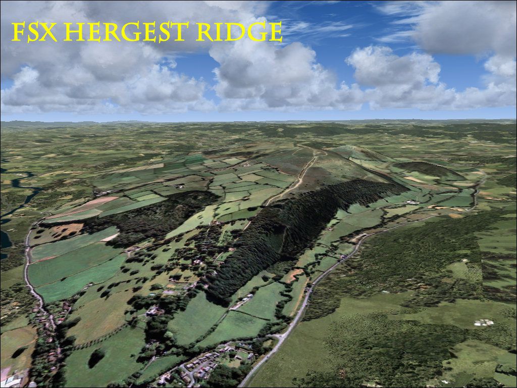
Hergest Ridge, UK. Hergest Ridge is a large elongated hill which traverses the border between England and Wales between the town of Kington in Herefordshire and the village of Gladestry in Powys. Its highest point, which is in England, is 1397 feet high. The scenery is photoreal and has been aligned with UTX Europe, although it will work with default scenery. By Pips Perez.
Screenshot of Hergest Ridge Scenery.
This scenery Has been tested In FSX only. It has been aligned with UTX Europe, although it will work with Fsx default Scenery. The Scenery looks best in Summer.
To install copy the whole folder into your fsx addon scenery folder and activate using the scenery library.
Free for all simmers · 42.67 MB · Scanned clean Jul 2026
Download speed: Free tier is capped at 0.5 Mbps (this file takes approximately 12 mins at the cap). PRO members download at full line speed.
FSX\Addon Scenery\ containing scenery and texture sub-folders.readme.txt or README file. It tells you exactly where files go, what dependencies are needed, and any quirks specific to this add-on.Use these coordinates to fly directly to this location once the mod is installed.
52.21000000,-3.07000000
Launch FSX or Prepar3D and use Flights → Load to open the downloaded .pln file. Your aircraft will be positioned at this location.
The archive hergest.zip has 7 files and directories contained within it.
This list displays the first 500 files in the package. If the package has more, you will need to download it to view them.
| Filename/Directory | File Date | File Size |
|---|---|---|
| hergest.jpg | 03.13.11 | 234.68 kB |
| readme.txt | 03.13.11 | 563 B |
| scenery | 03.13.11 | 0 B |
| hergest.bgl | 03.13.11 | 44.80 MB |
| texture | 03.13.11 | 0 B |
| flyawaysimulation.txt | 10.29.13 | 959 B |
| Go to Fly Away Simulation.url | 01.22.16 | 52 B |
Only PRO members can place votes.
More FSX & P3D add-ons hand-picked based on this download.
FSX Scenery
Tumbler Ridge, British Columbia, Canada (CBX7). By Bob Caparoula. Tumbler Rid…
 FSX Scenery
Pennsylvania (PA), USA. This update to the KERI 2012 runway extension project…
 FSX Scenery
Skara Scenery Bonaire X. Flamingo International Airport or Bonaire Internatio…
 FSX Scenery
Iwo Jima Scenery 1945 Update. This is a complete scenery with added effects a…
FSX Scenery
Kjeller Area Scenery X, Norway. Scenery around Kjeller airport with photoreal…
 FSX Scenery
FSX Loney's Alaska For FSX. This is a compilation of the author's Alaskan sce…
 FSX Scenery
For users of Flight Simulator X (and FSX: Steam Edition) and/or Prepar3D, ter…
 FSX Scenery
This freeware release by developer Aime Leclercq introduces revised highways …
Be the first to leave a comment on this download.
Be the first to share your thoughts on this download.