MSFS Scenery

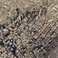
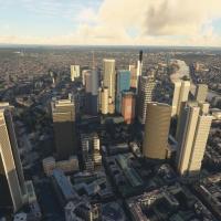
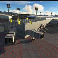
Included in this category are all of the freeware-released scenery add-on files available on Fly Away Simulation that are compatible with the brand-new Microsoft Flight Simulator (MSFS) 2024 and 2020 release.

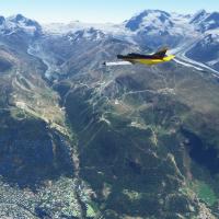
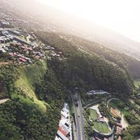
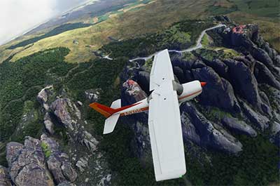
Cessna 152 flying over Meteora Valley scenery in MSFS 2020.

The image shows a Cessna 152 flying over Meteora Valley in MSFS.

This section is proving to be most abundant in terms of quantity of mods released so far, mainly due to the fact that scenery generation is a lot easier to work with than designing something such as an aircraft model.  The SDK for MSFS is easy to work with and the creation process is very similar to previous versions of Microsoft's simulator packages.  Also, there is an abundance of stock 3D buildings, objects, textures, and items that can be used around airfields, airports, and regions.

Some of the files covered in this section;

  • Airport upgrades, expansions, and corrections
  • Entire new airports, airfields, and grass strips missing in the stock install
  • Corrections and additions of towns and cities
  • Missing landmarks and objects
  • Ground terrain enhancements and photoreal replacements

The add-ons are listed in order of date with the newest at the top of the page - however, you may change the order displayed by using the "Sort by" options below.

The file library is growing daily as new releases are announced for this brand-new simulator.  Stay up to date by visiting this page often - it's updated regularly so it would be wise to bookmark it. 

All of the files covered in this section are completely free to download and use.
Sort
Reset
Preview screenshot

AI Ships, Boats & Global Traffic

GAIST Ultra Version 6 broadens global maritime traffic with around 1,000 unique ship models and nearly 2,000 appearances, and expands routes to raise density across coastal and intercontinental lanes. Version 6.1 adds MSC Meravigilia with four sisters and MSC Fantasia with three sisters, while including global routes; file names gaist-ultra-v6 and gaist-ship-routes_v1_2.

Country
Global (World)
File Size
3.05 GB
Total Downloads
41.1K
Star Rating
5/5
Screenshots
60+
Has Video
1
Preview screenshot

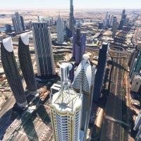
Dubai, UAE City Building & Scenery Pack

Risuali presents a freeware content enhancement that reworks Dubai and Jebel Ali Port, replacing more than 250 buildings and landmarks such as Burj Khalifa, Burj Al Arab, Dubai Frame, Stargate, and the JW Marriott Marquis along Sheikh Zayed Road. Night lighting and reflective glass textures exist for about 30–40 buildings.

Country
United Arab Emirates
File Size
769.33 MB
Total Downloads
6.6K
Star Rating
5/5
Screenshots
60+
Has Video
1
Preview screenshot

Twin Towers Mod: The Original World Trade Center Complex

A faithful recreation captures the seven-building historic complex over Manhattan, with the Twin Towers and their plaza meticulously modeled. It uses COMP maps to control shine and reflectivity, delivers high-quality surface definition, provides landable helipads on both towers, and adds custom night lighting.

Country
United States of America
File Size
413.61 MB
Total Downloads
1.3K
Star Rating
5/5
Screenshots
60
Has Video
1
Preview screenshot

City of Dallas, Texas (Enhanced) Scenery Pack

Thalixte implements an enhanced Dallas area upgrade, incorporating more autogen and a Globe Life Field 3D model near the AT&T Stadium, with 5m height maps for precision. The scope encompasses airports such as KDFW, KDAL, KRBD, KADS, KHQZ, and KTRL, centered around 32.7767 N, 96.7970 W.

Country
United States of America
File Size
2.92 GB
Total Downloads
955
Screenshots
18
Preview screenshot

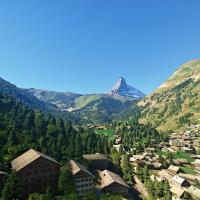
Switzerland Scenery Packs

Haydn94 (Haydn Jones) delivers a Swiss-focused enhancement covering Bern, Geneva, Lausanne, Lucerne, Sion, and Zermatt, with new 3D building shapes and upgraded ground surfaces across these cities; the Matterhorn appears with enhanced detail, while the developer notes data quantities stay reasonably small to keep stability.

Country
Switzerland
File Size
2.99 GB
Total Downloads
6.6K
Star Rating
5/5
Screenshots
40
Has Video
1
Preview screenshot

Paris Scenery Pack

Thalixte includes five directories named thalixte-paris1 through thalixte-paris5, containing Paris area data from Google Maps and 3D elements credited to Google, generated via the Google Earth Decoder tool. Coverage spans Paris area, including La Défense and Saint-Denis, and remains compatible with 2020 edition; holes appear where photogrammetry data is missing.

Country
France
File Size
4.8 GB
Total Downloads
3.7K
Star Rating
5/5
Screenshots
43
Has Video
1
Preview screenshot

Padua "Gino Allegri" Airport (LIPU)

An add-on for Padova’s airfield LIPU integrates FSX-derived 3D models and adds helicopter helipad positions 30 and 31, while establishing a new ATC frequency at 123.250. The improvement focuses on smoother ground movements and clearer taxiway signage cues.

Country
Italy
File Size
54.53 MB
Total Downloads
155
Star Rating
4/5
Screenshots
4
Preview screenshot

Downtown Los Angeles Missing Buildings & Landmarks

The add-on reintroduces Wilshire Grand Center and Metropolis Towers, restoring prominent downtown skyline elements. It adds authentic night lighting and introduces multiple helipads at the Ritz Carlton DTLA and Westin Bonaventure Hotel, designed for performance with optimized levels of detail to maintain frame rates.

Country
United States of America
File Size
677.95 MB
Total Downloads
4.8K
Star Rating
4/5
Screenshots
40
Preview screenshot

Gibraltar

A photogrammetry-based representation of Gibraltar uses high-resolution imagery from Google Maps to create precise 3D models with GPS coordinates 36° 8? 24? N, 5° 21? 0? W. Version 1.1 addresses elevation anomalies near the RAF base, and the material includes a thalixte-gibraltar folder.

Country
Gibraltar
File Size
1.38 GB
Total Downloads
888
Star Rating
5/5
Screenshots
50
Preview screenshot

Italy 20 M Terrain Mesh (DEM)

The 20-meter resolution DEM upgrade covers the entire country of Italy, including Sicily and Sardinia, with the ItalyDEM folder serving as the deployment container. Credits include DEM10 by TINITALY and EU-DEM v1.1 under CC BY-NC-SA 4.0, while the notes warn of edges not blending with the default DEM and occasional peak spikes.

Country
Italy
File Size
797.92 MB
Total Downloads
4.8K
Star Rating
5/5
Screenshots
60+
Has Video
1
Preview screenshot

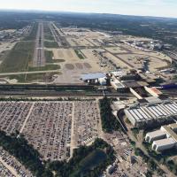
Gatwick Airport (EGKK)

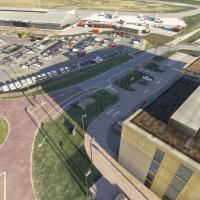
An add-on for flight simulation transforms Gatwick Airport (EGKK) by remodeling North and South Terminals and Pier 1, with high-resolution detailing and dynamic lighting, while adding enhanced ground details, AI taxi routing, an overhauled ATC tower, and GSX profiles for A320, B737-600, B747-800, B787-10 (one active at a time).

Country
United Kingdom
File Size
900.96 MB
Total Downloads
1.5K
Star Rating
5/5
Screenshots
59
Preview screenshot

London Stansted Airport (EGSS)

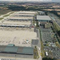
Stansted EGSS gains detailed 3D models of the main and satellite terminals, ATC tower interiors, moving ramps, and animated ground vehicles, while the V2 iteration adds richer apron markings, larger taxiway signs, updated night lighting, and 2020 constructions including Apron E and a Multi-Story car park, plus Ryanair 737-800 and Jet2 aircraft.

Country
United Kingdom
File Size
367.36 MB
Total Downloads
1K
Star Rating
5/5
Screenshots
24
Preview screenshot

Charlotte, North Carolina Complete

By Thalixte, a drop-in replacement for the Charlotte area provides photogrammetry and detailed 3D models of buildings and landmarks. It partitions the region into five named zones—Downtown, East, North, South, and West Charlotte—with folders such as thalixte-charlottedowntown, thalixte-charlotteeast, thalixte-charlottenorth, thalixte-charlottesouth, thalixte-charlottewest, and thalixte-charlottespeedway.

Country
United States of America
File Size
4.43 GB
Total Downloads
861
Screenshots
14
Preview screenshot

Monaco

A Monaco photogrammetry project centers on a 2.1 square kilometer area, delivering highly accurate 3D representations of Monaco's urban cores and the Monte Carlo Casino. The archive thalixte-monaco.zip packages a thalixte-monaco folder for access, and preserves compatibility with varied system configurations.

Country
Monaco
File Size
1.98 GB
Total Downloads
535
Star Rating
5/5
Screenshots
18
Preview screenshot

Naval Air Station Joint Reserve Base New Orleans (KNBG)

The project models Naval Air Station Joint Reserve Base New Orleans at Belle Chasse, exposing IATA NBG and ICAO KNBG identifiers, plus the Alvin Callender Field name, with 24/7 operations and Coast Guard search-and-rescue activity.

Country
United States of America
File Size
393.02 MB
Total Downloads
144
Star Rating
5/5
Screenshots
60
Preview screenshot

Highland Papua Bush Strip Collection, Indonesia

Using a custom object library pbk-huts-n-stuff, 88 airstrips in Highland Papua, Indonesia receive updates, while 20 additional strips stay not included in the base lineup. Google Earth and OurAirports verify names and locations, and an LNM user-point CSV is included for mapping; Kronsky add-on does not work with it.

Country
Papua New Guinea
File Size
353.51 MB
Total Downloads
574
Star Rating
4/5
Screenshots
3
Preview screenshot

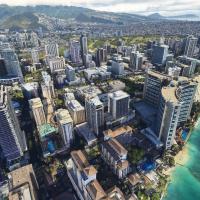
Honolulu, Hawaii & Surrounding Area

By steveli, this freeware area enhancement replaces the base representation for Honolulu and its surroundings with six parts, all included in one download, labeled Part 1 through Part 6. Honolulu and Pearl Harbour sit at LOD19, while downtown segments reach LOD20, with GPS coordinates 21.3099° N, 157.8581° W.

Country
United States of America
File Size
16.56 GB
Total Downloads
3.2K
Star Rating
4/5
Screenshots
60+
Has Video
1
Preview screenshot

Geneva, Switzerland Scenery Complete

AdrianLscenery combines all parts of a Geneva area enhancement into a single archive, including the airport and Annemasse, plus northeast, southeast, and west sections. It uses photogrammetric ground data with 3D buildings, relies on Google Maps data, and 38 cm tiles for central Geneva, 19 cm for the airport, and 9 cm for HUG.

Country
Switzerland
File Size
10.21 GB
Total Downloads
1.4K
Star Rating
5/5
Screenshots
53
Has Video
1
Preview screenshot

Tromsø Airport (ENTC)

by artogsta, ENTC Langnes Airport spans both 2020 and 2024 iterations, adds animated jetways at gates 18–20, and introduces Parking 55–57 aligned to AIRAC data. The 3D model emphasizes improved terrain and updated exterior elements, with the folder togstad-airport-entc-tromso housing the files.

Country
Norway
File Size
554.74 MB
Total Downloads
309
Star Rating
5/5
Screenshots
60
Preview screenshot

UK Missing Piers

Keith Hackett and Kevin Base lead a hand-crafted, manually placed series of UK piers, created without AI or automation. Saltburn pier features animations and night lighting and overrides the ORBX Great Britain Central addon, while other entries like Bournemouth and Cromer include night lighting and enhanced siting for seamless integration.

Country
United Kingdom
File Size
749.53 MB
Total Downloads
2.3K
Star Rating
5/5
Screenshots
60+
Has Video
1

7 pages with 125 downloads.

1234567next