Page 7
Searches the whole library — filter by sim & category on the results page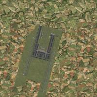
Ray Smith models a Suvarnabhumi International Airport project with four BGL files enabling two- or three-runway configurations. VTBS_ADE_RS.BGL enables the two-runway option, VTBS_ADE_RS_rwy3.BGL a…
 Thailand
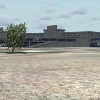
LTBA2009.zip, authored by Serdar Nuzhet, models Istanbul Ataturk International Airport from scratch using 3ds Max and contains LTBA-Ataturk 2009 folders, static aircraft and boats, animations, and …
 Turkey
An airport complex update adds Terminal 5A, 5B, and 5C alongside a newly modeled control tower, with HSBC jetway components. It pairs with Project Airbus A32X series aircraft and World Of AI Britis…
 United Kingdom
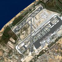
By Miguel A. Perez Soria, this compact enhancement targets LEBL in Spain, delivering a modest boost to default visuals and including an AFX file. The addon remains small in scope, focusing on airpo…
 Spain
Spain
Honolulu International (PHNL) area receives high-resolution ground data at 1.2 meters per pixel, with 4.7 meters per pixel as standard, by Gottfried Razek. The coverage spans about 12 by 12 kilomet…
 United States of America
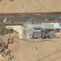
LEAL 2007 final edition updates Alicante’s airfield layout with a new Terminal 2 building and reworked taxiways, signs, and taxi lights, while including Muchamiel airfield (LEMU). This standalone, …
Spain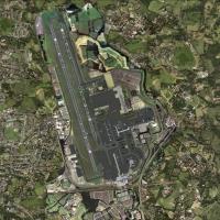
Gatwick Free project covers Gatwick International Airport (EGKK) in the United Kingdom, by Gary Summons for UK2000, designed for users with slower PCs. It includes many objects, detailed buildings,…
United Kingdom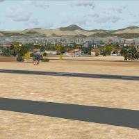
A single bgl file for LEPA exists, credited to Harry Patten, and it centers on Palma airport on Mallorca, Spain, depicting a military base, static aircraft, and animated people, as described by Har…
Spain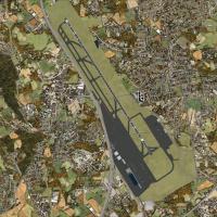
A simple Gmax model renders Terminals 1–3 at EDDS Stuttgart, with other buildings drawn from a library, and VOR DME STG 116,85 added while old SGD 115,45 remains in the data. Gates 09-19 show gate …
 Germany
Version I by Toni Agramont covers the Iberian Peninsula excluding Portugal, reworking the coasts, sea ports, and cities across the region. It adapts an existing Iberian project to a newer simulatio…
Spain
By FTXDes, this Cyprus coverage spans 9,251 square kilometers, uses 1m-pixel imagery, and delivers 6GB+ of new data with a Cyprus-coverage-map-small.jpg. Key locations across the island, including …
 Cyprus
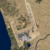
Powered by ADE v1.37 for the Rome site, two BGL variants, LIRF_ADE_RS.BGL and LIRF_ADE_CW_RS.BGL, provide distinct runway behavior, with the CW version activating crosswind operations and the RS fi…
 Italy
Italy
At Taoyuan Airport (ICAO RCTP, IATA TPE), Formosa X updates the layout with runways, taxiways, and aprons repositioned from satellite data, plus animated radars and people movers. Part 1 covers the…
 Taiwan, Province of China
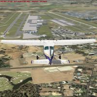
Malaga AGP/LEMG in Spain is represented with two variants, north and south configurations, and features the runway 12/30 entering service on May 3, 2012. The project uses ADE and relies on AENA cha…
Spain
Coastlines around Greece expand to cover the mainland and all islands, and shores along western Turkey appear among them. This revision broadens geographic scope and strengthens coastal detail acro…
 Global (World)
BlueSkyScenery delivers extensive Colorado coverage, spanning most of the state and including Aspen, Boulder, Fort Collins, and Baggs. The offering carries 1m-per-pixel detail and a 10m elevation m…
United States of America
A geographic layout maps 22 airports and 416 population centers across Egypt, spanning the Nile delta to the Suez Canal and highlighting sites such as the Pyramids of Giza, Karnak, Luxor, and Edfu.…
 Egypt
Egypt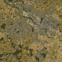
Created by Markus Freyt, this freeware project uses OpenStreetMap data, open-source and community-sourced, to depict Germany’s landscape, including land-use, roads, waterways, railways, natural reg…
Germany
BlueSkyScenery delivers statewide Oregon coverage, rendering almost the entire state with major landmarks and cities, using 1m/pixel imagery and 10m elevation meshing across the region. The add-on …
United States of America
At NAS Pensacola (KNPA) a project replaces every default building, adds Military_Cargo and Military_Combat parking spaces, relocates the control tower, and introduces a fire station with fire truck…
United States of America