Page 3
Searches the whole library — filter by sim & category on the results page
Version 0.2 beta of the logbook editor enables decoding and editing of the logbook file format. The current format is binary and undocumented, supplanting earlier editable text files, and the proje…
Demo version runs with the Cessna 172, while the full edition supports most standard aircraft and many add-ons. It presents events such as vacuum failure and engine fire, includes a Timed Event opt…
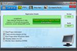
The app works with games using DirectX or OpenGL, displaying FPS in a corner and enabling benchmarks that measure frame rate between two points. It saves statistics to disk, captures screenshots wi…

TMLE increases the maximum image resolution from the standard 1024x1024 to 2048x2048 or 4096x4096, enabling higher-quality assets. Credits go to Steve Frost with additional support from Brandon Fil…
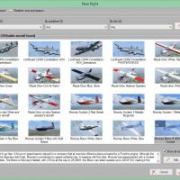
Maarten Boelens presents a launcher that supports two flight simulators, allowing flights to load before launch or while the sim runs. Users select an installed aircraft and a start location, then …
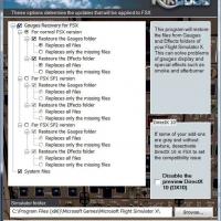
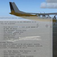
A free utility, Gauges Recovery restores original gauge and effect files in less than 10 seconds to fix black screens and missing afterburner or condensation effects caused by deleted or uninstalle…
Efficiently, the tool converts legacy simulator files and enables their use in a later environment. The download includes a small batch file to automate the conversion, and Ian Thatcher is credited…
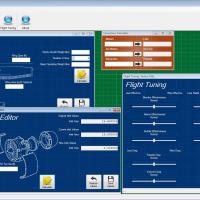
The program computes inertia and jet inlet values for an aircraft and saves them to the aircraft.cfg file by entering basic dimensions, supporting quick tuning of basic performance parameters. A fl…
Living World v1.1 functions as an animation tool that leverages Animal and GroundVehicle SimObjects and, via the SimConnect SDK, follows a predefined list of lat/long points in LivingWorld.cfg. Liv…
Lamont Clark's AI Carriers lets you place and command single ships or fleets within the sim, with cable and catapult-enabled carriers and the option to insert at the current location or a set dista…
FSXPilot functions as a session-limited shareware with 30 activations, while navigation, EFIS, and autopilot functions remain usable, and it accepts second-party FSP flight plans. The program runs …
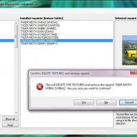
This version fixes a startup crash reported in v1.0, and enables quick handling of visual changes by dragging a zip onto the aircraft to apply them efficiently. It also manages aircraft.cfg files, …
Operating as a LAN-ready tool, it connects a moving map to the program using an included SimConnect.dll and supports JPG maps only. It offers an on-the-fly position fix for non-orthogonal maps and …
A utility converts .pln flight plans into Carousel Inertial Navigation System IV/a (CIVA). Users drag and drop a .pln file onto the icon to trigger conversion, or open the program and select Conver…

Soft Horizons, created by John Cillis, smooths the sky-ground transition using 110 daytime bitmaps and preserves 30 nighttime bitmaps, converted to the required format, and may not work with other …
Aimed at flightsim enthusiasts, this tool links to real-world air traffic control through a database of live feeds accessed over the Internet and interacts with simulation software. The current ver…
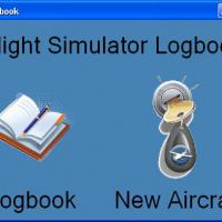
Danilo Cesar Munis develops the FS Logbook, a straightforward tool to reliably record flight logs and track hours across sessions. A screenshot depicts the FS Logbook main screen, illustrating a si…
Four utilities by Michael Heise drive AI traffic tasks: aitchk.exe scans for missing aircraft data, aitmod.exe updates configurations to current standards, ait2x.exe converts an older traffic forma…
This tool generates 4-digit squawk numbers by random selection, excluding 8 and 9, with a maximum of 7777. Version 1.12, issued as SquawkCodev1.12, includes a code guide and an updated method, and …
Developed by Timo Hollwedel, this freeware utility links eight dedicated switches on the G940 throttle to real-time, color-coded indicators synchronized with your virtual cockpit. It offers 28 even…