Page 70
Searches the whole library — filter by sim & category on the results page
Five carriers with support sit about 80 nm north of McMurdo Station, awaiting arrival with rescuees on board. A refuel point exists at McMurdo, but pilots must locate it themselves, and three evacu…
 Antarctica
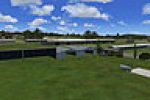
Anthony Lynch documents five airfields in and around the Snowy Mountains, including Cooma-Snowy Mountains YCOM, Polo Flat YPFT, Tumut YTMU, Khancoban YKHA, and Geehi, which has no ICAO. Most sites …
 Australia
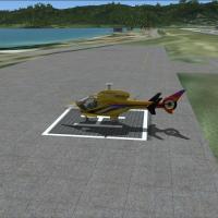
For the TNCM airport in the Netherlands Antilles, the add-on includes an ILS for runway 9, two helipads, an FBO building, and an enlarged turning point for runway 27. A single bgl file supports the…
 Sint Maarten (Dutch part)
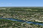
Photo imagery of Venlo presents high-resolution data for the city and the Glider Field at the German border, offering 30 cm per pixel (LOD 17) detail and day–night coverage from Spring to Summer 20…
 Netherlands
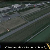
Beta development for EDCJ Chemnitz Jahnsdorf by Sierra.Foxtrot-Design introduces licensed 40cm per-pixel ground surfaces with night and seasonal variants and a lighting overhaul realized with 3D ob…
 Germany
Chile v4a updates runways and places Parque Intercomunal La Reina in SCTB as a visual reference for pilots approaching Tobalaba, while Panguilemo SCTL (Talca) gains a hangar and a road is removed f…
 Chile
Chile
Stewart Haworth designs an elevated bridge over the Manchester Ship Canal near Barton Airport in the United Kingdom. It remains compatible with default and Horizon configurations for VFR use and im…
 United Kingdom
In northern France at LFQJ Maubeuge, a concrete runway sits beside two grass strips and a large parachutists field, while an air club, a para club, and a flying models group nearby. Creator Dominiq…
 France
By S. Bruyere, this revision concerns the Cayo Coco International Airport at Jardines Del Ray, Cuba, offering a refined depiction of the aerodrome for that location and preserving its Cuban geograp…
 Cuba
CubaTwo Bahia airports include taxiways and a terminal area to park, SBTC at Una and SNZP at Pocoes in Brazil, enhancing basic airfield layouts for hands-on visitors. By Andrew Barter, this freeware, n…
 Brazil
Lahr Air Base in southern Germany (EDTL) anchors the V1 edition honoring Royal Canadian Air Force operations, built with ADE X 1.50 and stock objects. Two BGL files, EDTL_ADEX_US_V-1.BGL and EDTL_A…
Germany
This entry places the Nancy-Ochey military airbase in the north-east of France (department 54), including BA133 at Nancy-Ochey and BA136 at Toul-rosieres closed since 1994, plus Pont Saint Vincent …
France
The airfield at Mackall (KHFF) gains enhancements with custom models for airport objects, high-detail ground poly, and color-corrected satellite imagery. Luzon Drop Zone lies about 1 NM southeast w…
 United States of America
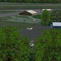
By Ed Cox, the 5B2 project advances to version 2.0 with a GMAX rebuild and photoreal imagery, plus an ADE file and 5B2_X_FIX.ZIP. Field spans 300 acres, with two runways 5/23 at 4,700 by 100 feet a…
United States of America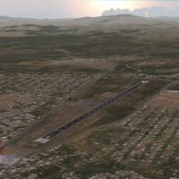
By David Maldonado, Carora Airport (SVCO) in Venezuela is depicted with photo-terrain visuals derived from satellite imagery and realistic terminal and hangar facades based on online images. Geogra…
 Venezuela (Bolivarian Republic of)
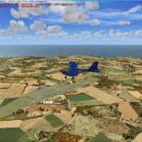
Two installation folders exist for the LFEA Belle Ile airfield on Belle Ile, France, in the Atlantic near Quiberon, with the LFEA xclud and LFEA Belle ile folders. Not compatible with earlier versi…
France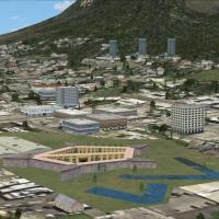
Castle X centers on the Cape Town area and is credited to Frits Beyer, presenting a named variant linked to that locale. The entry specifies a Cape Town focus and names Beyer as the creator, establ…
 South Africa
At the Chambley-Bussieres area base, now LFJY after LF52, a ground texture with seasonal effects exists, by Didier Bur. The asset comprises 80 custom models and 500 library objects, with static pla…
FranceAn Aspen-area airfield modification for KASE in Colorado adds a 1000-foot extension to runway 15/33, with completion noted on 11/30/2011 to support SkyWest, Republic, and American Eagle flights at …
United States of America
By P. Nigel Grant in collaboration with Shehryar Ansari, this patch adapts the John Wayne Airport KSNA, California layout originally released as SNA2004.ZIP for use with newer formats; the kit refe…
United States of America