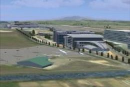
 FSX Scenery
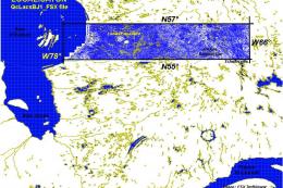
Province Of Quebec Lakes
Province Of Quebec Lakes, Shorelines And Rivers, Canada. Includes territory b…
Quebec’s lakes, rivers, and shorelines gain sharper definition with this province-wide scenery package for FSX, covering Parts 1 through 5 for consistent water placement across varied terrain. It also includes effect files and corrected airport elevation data, and requires a Quebec LOD10 38 m terrain mesh for the cleanest rendering.
Lakes, shorelines and rivers of the province of Quebec, Canada (for FSX only). For best rendering, use terrain mesh of the province of Quebec (Canada) in LOD10 (38m). Part 1 to 5.
Installation:
1) Extract the zipped files to a temporary directory, making sure that the "use folder names" option is
enabled.
When the files are unzipped to the temporary directory you should see a folder, called "Quebec_Lacs_FSX", with
three subfolders : "Scenery", "Correction_APX_0301 Base" et "Effets".
-"Quebec_Lacs_FSX" contains this readme file and images.
-"Scenery" contains BGL files. Labeled by NW corner coordinates or name.
-"Effets" contains the effect files
-"Correction_APX_0301 Base" contains corrected elevation airport files.
2) Move the three files in "Effets" subfolder in the FSX "Effects" subfolder.
3) Move the "Quebec_Lacs_FSX" folder wherever you keep your add-on sceneries.
4) Activate the "Quebec_Lacs_FSX" scenery in Flight Simulator X Scenery Library.
5) Activate also "Correction_APX_0301 Base" scenery in FSX Scenery Library and moves it before "0301 Base" scenery.
Don't forget to delete this scenery ("Correction_APX_0301 Base") if you uninstall this lakes, shorelines and rivers scenery.
Remarks
The lakes in "_Lacs_" files have not an fixed elevation. And then, their edge can lightly climb along the sides. To minimize this
effect, use my FSX 38m (Lod10) terrain mesh files of the province of Quebec. They come from the same source of data.
To improve the look of lake and river shorelines, you can reduce (optional) their width in the FSX "Terrain.cfg" file. Don't forget to
make a copy of this file before to process.
Three lines must be added :
in [Texture.22], add StripWidthMeters=40 at the end of the section.
in [Texture.58], add StripWidthMeters=20 at the end of the section.
in [Texture.67], add StripWidthMeters=20 at the end of the section.
Source Data:
1/50 000 topographic sheets of province of Quebec from
http://toporama.cits.rncan.gc.ca/toporama_en.html
© Her Majesty the Queen in Right of Canada, Department of Natural Resources. All rights reserved.
Software Used and General Procedures:
1- Downloading topographic maps and some orthoimages (1/50 000) from TOPORAMA
2- Processing the sheets with Gimp2 (http://www.gimp.org/) to produce new images according to format used in Slartibartfast.
3- Processing the new images with Jim Kerr's Slartibartfast program (http://www.jimkeir.co.uk/FlightSim/).
This program produces directly the bgl files with MSFS2004 resample program
(http://www.microsoft.com/games/flightsimulator/fs2004_downloads_sdk.asp#terrain).
4- Using LWMViewer (V1.3) (Jim Keir) to check new bgl (available at www.avsim.com).
5- Creating the Exclude files with FSX_KML (version 1.03beta) d'Innova Software (http://www.fsdeveloper.com/wiki/index.php?title=FSX_KML)
6- Extracting the airport data with Winfried Orthmann's BglAnalyze X for FS X (available at www.avsim.com).
7- Compiling XML with MS FSX Deluxe Edition SDK tools
8- Correcting new BGL files with SBuilder 2.05 (Revision 06) and SBuilderX (Version 3.0.0.0) (available at www.ptsim.com).
9- In-flight screenshots with JabScreen (Jacky Brouse (c)2005 - http://jacky.brouze.ch/jab/programmes/jabscreen/index.asp)
10- Animated images - Jasc Animation Shop version 3.10
Acknowledgments :
Thanks to Guy Jutras, Denis Brown, Gilles Boily and Jean St-Cyr for their comments. Special thanks to Jean-Pierre Fillion for his help to create Anticosti Island scenery.
Free for all simmers · 114.34 MB · Scanned clean Aug 2026
Download speed: Free tier is capped at 0.5 Mbps (this file takes approximately 32 mins at the cap). PRO members download at full line speed.
FSX\Addon Scenery\ containing scenery and texture sub-folders.readme.txt or README file. It tells you exactly where files go, what dependencies are needed, and any quirks specific to this add-on.Use these coordinates to fly directly to this location once the mod is installed.
46.81390000,-71.20800000
Launch FSX or Prepar3D and use Flights → Load to open the downloaded .pln file. Your aircraft will be positioned at this location.
The archive qcla.zip has 13 files and directories contained within it.
This list displays the first 500 files in the package. If the package has more, you will need to download it to view them.
| Filename/Directory | File Date | File Size |
|---|---|---|
| qcla1de5.zip | 04.14.12 | 14.95 MB |
| __MACOSX | 04.14.12 | 0 B |
| qcla2de5.zip | 04.14.12 | 22.82 MB |
| qcla3de5.zip | 04.14.12 | 23.87 MB |
| qcla4de5.zip | 04.14.12 | 24.18 MB |
| qcla5de5.zip | 04.14.12 | 28.51 MB |
| flyawaysimulation.txt | 10.29.13 | 959 B |
| Go to Fly Away Simulation.url | 01.22.16 | 52 B |
Only PRO members can place votes.
More FSX & P3D add-ons hand-picked based on this download.
FSX Scenery
Province Of Quebec Lakes, Shorelines And Rivers, Canada. Includes territory b…
 FSX Scenery
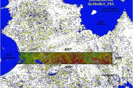
Province Of Quebec, Canada, 38m (LOD10) terrain mesh between N56-N57 and W66-…
 FSX Scenery
FSX World Wide Coverage SRTM 3, version 2, mesh of Europe. Includes the compl…
 FSX Scenery
Oceania - Asia SRTM Terrain Mesh. Covers Australia, New Zealand (including Au…
 FSX Scenery
Formosa X, RCTP Taiwan Taoyuan Int'l Airport 1. This project improves the def…
 FSX Scenery
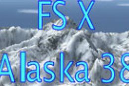
Alaska 38 Terrain Mesh Part 1 & 2. FSX Alaska 38 Terrain Mesh Replacement ter…
 FSX Scenery
FSX World Wide Coverage SRTM 3, version 2, mesh of Africa. Includes the compl…
 FSX Scenery
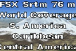
FSX SRTM 76 m South America, Central America and the Caribbean. Designed with…
Be the first to leave a comment on this download.
Be the first to share your thoughts on this download.