Page 79
Searches the whole library — filter by sim & category on the results page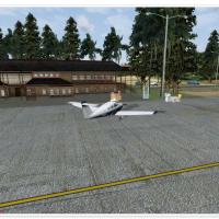
By Daniel Louvet, the Mustique Island addition supports VFR-only operations due to the absence of radio navigation, includes an apron and parking for up to five small aircraft, and no charts are av…
 Saint Vincent and the Grenadines
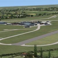
A work by Alf Denham includes Brimpton (Wasing Lower Farm) X2BM, Enstone EGTN, and Wickenby EGNW, featuring one grass runway 07/25 with circuits at 800 ft QFE, patterns LH on 07 and RH on 25, Brimp…
 United Kingdom
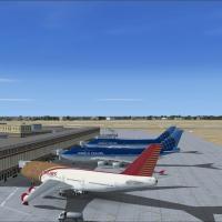
At VIDP in India, seven new taxiways E2, E5, F, U, V, B, and D1 join bays for both international and domestic flights. The changes overall improve ground movements and aircraft routing, by Himanshu…
 India
India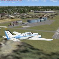
Two small sites in East Thuringia, Germany, Gera (EDAJ) feature a hard-surface runway. Greiz-Obergrochlitz (EDOT) presents a grass sailplane airstrip, and sites sit near the Elster river; Michael S…
 Germany
Vedat Sencan provides a fix for Damascus International Airport (OSDI) in Syria, addressing crash and layout-data problems. The patch bears the name OSDI_fix.zip to accompany a Damascus package and …
 Syrian Arab Republic
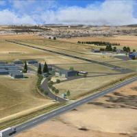
By Frits Beyer and Jacques Botha, Bethlehem Airport FABM in South Africa’s Free State appears in X V2.0, with Bethlehem_FABM and AFX_FABM_ALT.bgl as core elements, capturing taxiways, ramps, and ap…
 South Africa
Pease AFB in New Hampshire appears in version 2.0, with FB-111A, KC-135, and T-37 based aircraft documented. Credits go to Steve Hess and Guy Diotte, and a known issue notes potential instability o…
 United States of America
By Jimmy R. Martin, it includes a complete objects library and relies on Real Environment Extreme to provide detailed autogen buildings, forming a compact, content-rich setup that reflects the Yell…
United States of America
Manuel Seiwald delivers an enhanced representation of Astypalaia Airport on the Greek island, identified as version 1.0 by the creator. The revision revises runways, adds turning bays, expands park…
 Greece
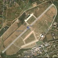
Haluk Alpat presents a representation of Malatya Tulga Airport (LTAO) in Turkey, linked to the folder named LTAO_TULGA_FSX. The creator and the airport code anchor geographic scope, while the folde…
 Turkey
Freeware installment covers Ergo Slimes dam south of Benoni and the South African Reserve Bank tower in Pretoria, focusing on important VFR waypoints across South Africa. It relies on custom design…
South Africa
By Leslie Luna Cepeda and Fernando Rodriguez, Riviera Maya appears as a photorealistic depiction of the region. The duo receives explicit attribution for the design, and the focus centers on accura…
 Mexico
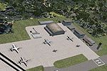
Leeward Point Field at Guantanamo Bay, Cuba (MUGM) receives moved and replaced stock buildings, a relocated control tower, added parking, and multiple static vehicles, enhancing the field from stoc…
 Cuba
Cuba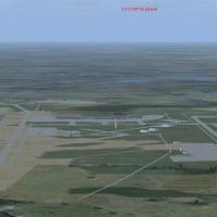
KAUS receives substantial layout enhancements, including added gates and significantly altered taxiways, along with fuel trucks at terminal and cargo areas and a replaced control tower to resemble …
United States of America
Two folders document the canal route with and without Occitania, containing a BGL and LC_CanalMidi.bgl alongside an optional Canal_objets.bgl. Land classes shift to towns along the course, with Lak…
 France
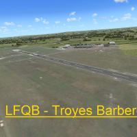
Stéphane Gouzon presents version 1.0 of an airfield enhancement for LFQB, Troyes Barberey, built with ADE, SbuilderX and Whisplacer. The folder bears LFQB - Troyes Barberey and anchors the scene to…
France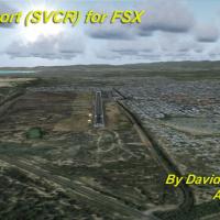
Coro Airport (SVCR) in Venezuela sits in the city of Coro, the capital of Falcon state in western Venezuela. It uses photo-terrain visuals sourced from satellite imagery and shows terminal building…
 Venezuela (Bolivarian Republic of)
City of Birmingham, AL appears in version 1.0, with the named folder TalonSim Birmingham 1.0. By Dexter Pierre Gray, the work depicts key architectural structures from the Magic City skyline, with …
United States of America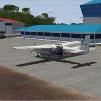
Version 1.0 covers the airport located 6nm east of Georgetown, Guyana. Historical data from 2003 show the facility handling about 50,000 passengers and 1,800 tons of cargo annually, and the new run…
 Guyana
An airfield in Normandy near Le Havre harbor (LFOY) hosts gliding and piston-engine training, reflecting its 1944 American army origins. A simili Pont de Normandie spans the Seine estuary south of …
France