Page 97
Searches the whole library — filter by sim & category on the results page
A landclass modification brings roads, trails, and other objects to Lanai and Kahoolawe while correcting Lanai city layout and adding a heliport with no runway. Three components—Hawaiian_Islands_Se…
 United States of America
Kasos Airport on Kasos Island in southeastern Greece receives fixes that correct the Airport Reference Point and runway dimensions and markings, adds a small eastern parking area, and resolves a fl…
 Greece
Yangon Mingaladon airport shows version 3.0, featuring a runway that extends from 8,100 to 11,200 feet and upgraded taxiways with new taxi signs. The work corrects the location to the real site and…
 Myanmar
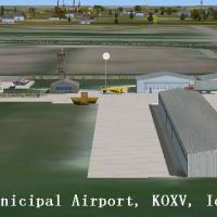
KOXV, known as Jim Bellamy Field, sits on 120 acres near the southern edge of Knoxville, Iowa, with a 4000 by 75 foot concrete runway and a parallel taxiway. The field sits at 928 feet elevation, a…
United States of America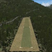
Located at 3U2 in Johnson Creek, Idaho, this file uses shape polygens for the airport area, runways, taxiways, and aprons, with static planes along the runway and a nearby cabin in the woods. Parki…
United States of America
Marinilla VOR operates at 113.0 and remains absent from the default dataset, marking a missing navigation aid for Colombia, with the author behind this addition being Juan Carlos Cancelado R. That …
 Colombia
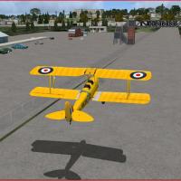
Inside the banked racing circuit, Brooklands 1938 recreates the airfield with a grass 01/19 runway and the adjacent Vickers factory amid real water features and trees. The configuration lists NDB L…
 United Kingdom
Ralph M. Calhoun Memorial Airport (IATA TAL, ICAO PATA, FAA LID TAL) sits near Tanana, Alaska. The gravel runway 7/25 measures 4,400 by 150 feet, and stock Navaids include NDB 212 BCC (75 nm) and V…
United States of America
Two water ports in Seattle Bay operate as water plane hubs, connected by marinas with ramps leading to the nearby airfield and fitted with water ILS runways plus docks for aircraft. The installatio…
United States of America
Version 4 of the Malibu project places Aeroworks Flight Center 2 on a 1400-foot hill above Malibu, California, with a 4000-foot runway and multiple helipads. Malibu MotorSports adds a 2000-foot run…
United States of America
Elizabeth City CGAS (KECG) in North Carolina receives an enhanced layout with adjusted aprons, roads, and taxiways, and nearly every default building is replaced with additional structures, parking…
United States of America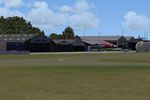
The modular NL2000 v4.0.20 framework faithfully recreates Teuge Airport (EHTE), detailing runway layout, taxiways, and aprons, with authentic hangars and club facilities. By The Netherlands 2000 De…
 Netherlands
Two files for KGRK in Texas are AFX_KGRK.BGL and kgrk.bgl, by John Patterson: AFX_KGRK.BGL adds the civilian parking apron, jetways and parking spots, while kgrk.bgl adds the terminal itself. Displ…
United States of AmericaBy Harry Patten, the EGHK_ADEX_HP BGL file represents a Penzance heliport in the UK. It includes a hangar and terminal building, places an oilrig in Mounts Bay, and adds a static helicopter and a c…
United KingdomTracey Thatcher delivers a photo-realistic Invercargill area enhancement spanning about 1,100 square kilometres along the southern coast of the South Island, New Zealand, with autogen omitted. The …
 New Zealand
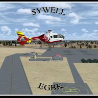
Sywell, identified by IATA ORM and ICAO EGBK, serves Northamptonshire with a 1928-origin history and flight training facilities. Two BGL files, EGBK_ADEX_GB.BGL and EGBK_ADEX_GB_CVX.bgl, are includ…
United Kingdom
Two add-on components, EIWF and Waterford City and EIWF, accompany Waterford Airport in Ireland, with two runways 03 and 21. EIWF may impact frame rates on slower machines, while Waterford City and…
 Ireland
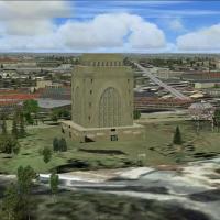
Frits Beyer crafts a custom representation of the Voortrekker Monument from online photographs, noting its location behind Swartskops AFB and that it is not the real structure, a clear distinction …
 South Africa
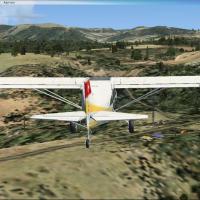
By Dominique M. L. Donzelot, this ultralight airstrip sits near the Bridge of Millau in central France, with a hilltop, north–south landing orientation. It uses mostly existing elements to keep fra…
 France
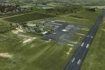
A patch addresses two issues in Bundaberg (YBUD) and Lady Elliot Island (YLTT) by correcting Bundaberg runway lighting and preventing sinking at Lady Elliot Island, restoring landability for all in…
 Australia