 FSX Scenery
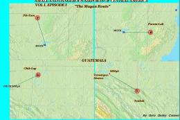
Small And Dangerous Airfields
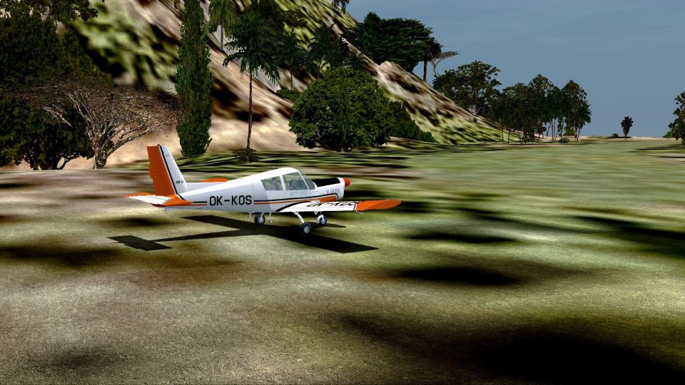
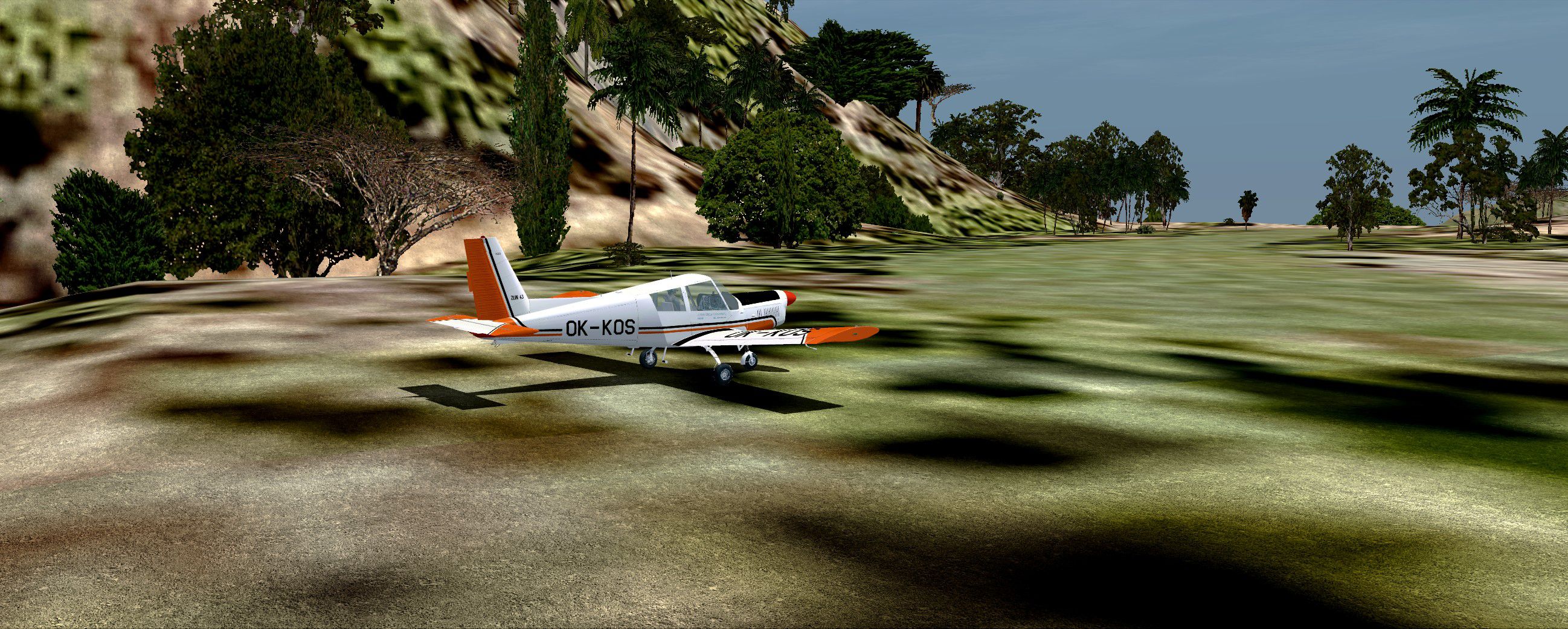
Small And Dangerous Airfields In Central America Part I (with a touch of salt…
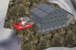
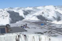
Dangerous Airfields of the Andes Mountain scenery drops four high-altitude strips into remote Andean terrain, recreating the tight valleys and steep approaches that defined early bush flying. Built for FSX, it adds rugged airfield environments and challenging routes that reward precise energy management and careful planning in demanding weather and terrain.
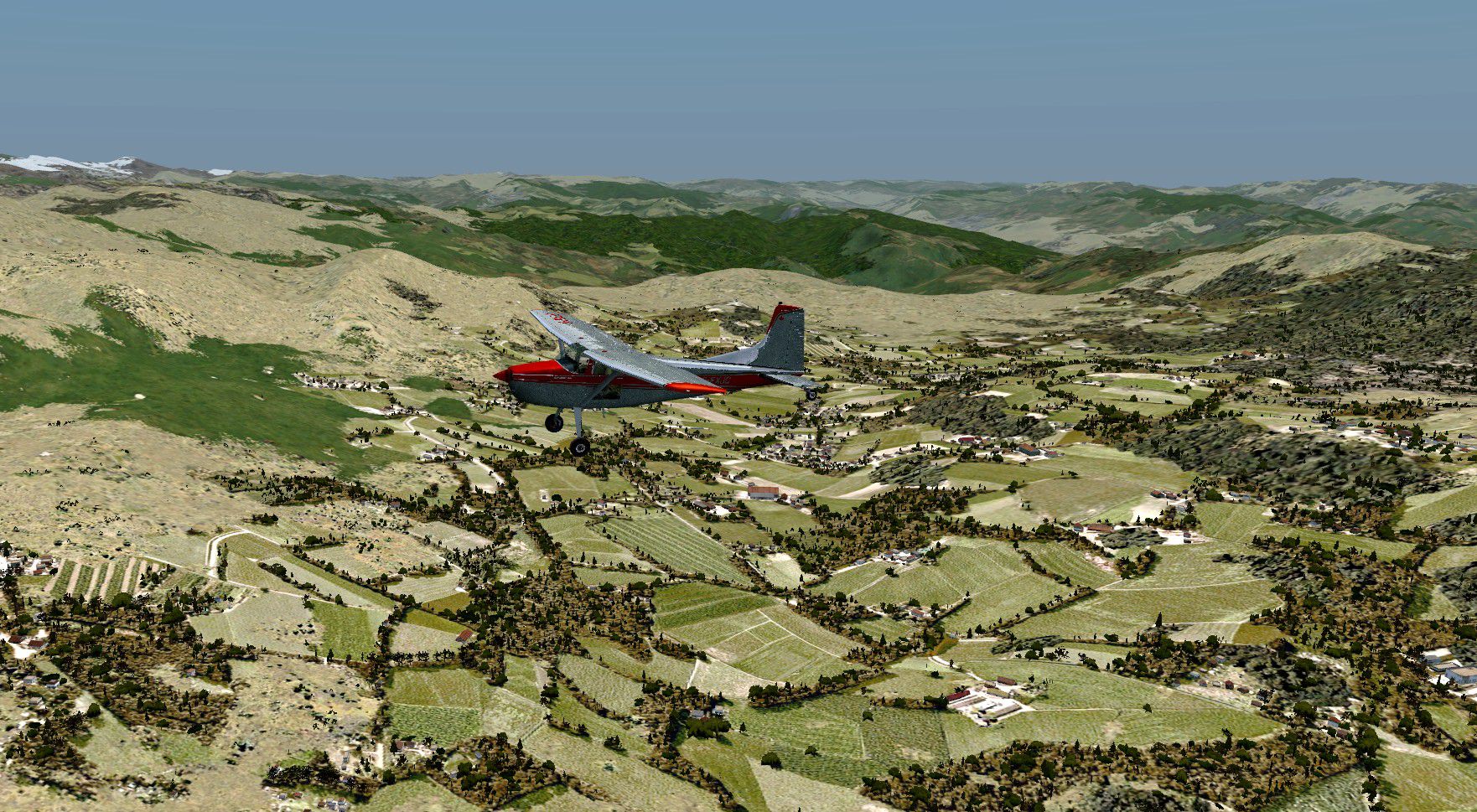


Dangerous Airfields Of The Andes Mountain. An FSX FSadventureSky Flight. Aviation around and in the Andes Mountains has been going on since the early 1900s. Many small airfields have been built for emergency purposes as well as private ones which are still open, many are closed and even banned and some have been dstroyed through the years. This first part of "Dangerous Airfields of the Andes" brings you four very dangerous ones for your enjoyment and will place you in very dire surroundings that bush pilots in many places of the world face every day. Make no mistake, getting in and out of these fields will make you sweat, give you a high and they might contribute to you having some nightmares! By Gera Godoy Canova.

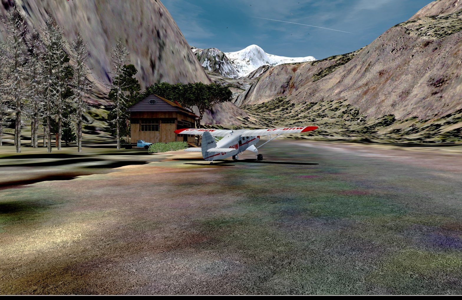
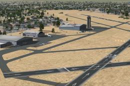
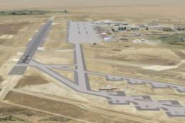
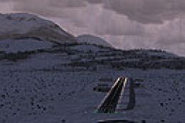
Screenshot of La Rinconada Scenery.
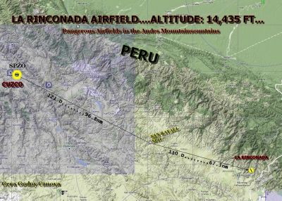
La Rinconada route map.
Free for all simmers · 4.71 MB · Scanned clean Jul 2026
Download speed: Free tier is capped at 0.5 Mbps (this file takes approximately 1 min at the cap). PRO members download at full line speed.
FSX\Addon Scenery\ containing scenery and texture sub-folders.readme.txt or README file. It tells you exactly where files go, what dependencies are needed, and any quirks specific to this add-on.Use these coordinates to fly directly to this location once the mod is installed.
-14.62720000,-69.44610000
Launch FSX or Prepar3D and use Flights → Load to open the downloaded .pln file. Your aircraft will be positioned at this location.
The archive dainand.zip has 39 files and directories contained within it.
This list displays the first 500 files in the package. If the package has more, you will need to download it to view them.
| Filename/Directory | File Date | File Size |
|---|---|---|
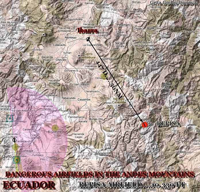
| REPISA ROUTE MAP.jpg | 01.17.11 | 638.99 kB |
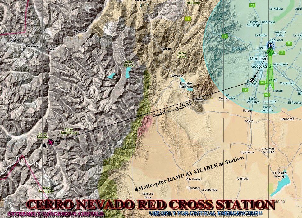
| CERRO NEVADO ROUTE MAP.jpg | 01.20.11 | 341.24 kB |
| GARGANTA DEL DIABLO ROUTE MAP.jpg | 01.20.11 | 370.07 kB |
| LA RINCONADA ROUTE MAP.jpg | 01.20.11 | 469.17 kB |
| LA RINCONADA 01.jpg | 01.17.11 | 622.22 kB |
| REPISA 02.jpg | 01.17.11 | 934.96 kB |
| TO GARGANTA.jpg | 01.18.11 | 641.45 kB |
| ANDES MOUNTAINS....TO GARGANTA DEL DIABLO FLIGHT.WX | 01.20.11 | 113.72 kB |
| ANDES MOUNTAINS....TO REPISA FLIGHT.FLT | 01.20.11 | 15.52 kB |
| ANDES MOUNTAINS....TO REPISA FLIGHT.FSSAVE | 01.20.11 | 169.62 kB |
| ANDES MOUNTAINS....TO REPISA FLIGHT.WX | 01.20.11 | 159.19 kB |
| ANDES MOUNTAINS....LA RINCONADA FLIGHT.FLT | 01.20.11 | 15.46 kB |
| ANDES MOUNTAINS....LA RINCONADA FLIGHT.FSSAVE | 01.20.11 | 158.10 kB |
| ANDES MOUNTAINS....LA RINCONADA FLIGHT.WX | 01.20.11 | 155.91 kB |
| ANDES MOUNTAINS....TO CERRO NEVADO RED CROSS STATION.FLT | 01.21.11 | 17.34 kB |
| ANDES MOUNTAINS....TO CERRO NEVADO RED CROSS STATION.FSSAVE | 01.21.11 | 116.30 kB |
| ANDES MOUNTAINS....TO CERRO NEVADO RED CROSS STATION.WX | 01.21.11 | 111.62 kB |
| ANDES MOUNTAINS....TO GARGANTA DEL DIABLO FLIGHT.FLT | 01.20.11 | 15.58 kB |
| ANDES MOUNTAINS....TO GARGANTA DEL DIABLO FLIGHT.FSSAVE | 01.20.11 | 165.12 kB |
| los andes.jpg | 01.21.11 | 68.61 kB |
| READ_ME_FIRST_ANDES.htm | 01.21.11 | 8.04 kB |
| 4CAMPOS-ANDES.bgl | 01.20.11 | 16.64 kB |
| CRUZ ROJA STATION.bgl | 01.20.11 | 22.74 kB |
| CVX_BAMBOLA2.BGL | 01.17.11 | 239 B |
| CVX_HIELOLOCO.BGL | 01.19.11 | 227 B |
| CVX_PISTA01.BGL | 01.17.11 | 343 B |
| CVX_PROJECT.BGL | 01.18.11 | 655 B |
| DIABLOPEDRA.bgl | 01.18.11 | 3.33 kB |
| HOTELSELVA.bgl | 01.14.11 | 11.71 kB |
| LC_2829.bgl | 01.18.11 | 320 B |
| LC_PUEBLO01.bgl | 01.17.11 | 299 B |
| DIABLO_00.bmp | 01.18.11 | 85.40 kB |
| LODGE.bmp | 01.11.11 | 33.05 kB |
| frenteverdesito.bmp | 08.23.10 | 65.05 kB |
| techolamina.bmp | 08.23.10 | 3.05 kB |
| frente.bmp | 08.23.10 | 129.05 kB |
| file_id.txt | 01.21.11 | 103 B |
| flyawaysimulation.txt | 10.29.13 | 959 B |
| Go to Fly Away Simulation.url | 01.22.16 | 52 B |
Only PRO members can place votes.
More FSX & P3D add-ons hand-picked based on this download.
FSX Scenery
Small And Dangerous Airfields In Central America Part I (with a touch of salt…
 FSX Scenery
Western Kansas Airfields. Includes over 133 smaller Kansas (KS) airfields, ac…
 FSX Scenery
This freeware upgrade refines the iconic shape of Table Mountain in Cape Town…
 FSX Scenery
Mountain Home AFB (KMUO), Idaho (ID). The Air Force has been consolidating ai…
 FSX Scenery
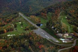
Scenery Mountain Air (2NC0), NC. Nestled away in the Appalachian Mountains of…
 FSX Scenery
Alaska Mountain Scenery. Alaska scenery (AK) for your hops through the great …
 FSX Scenery
Vignettes And Trient Mountain Hut. Two mountain huts of the Swiss Alps with p…
 FSX Scenery
Mountain Top (CYMN) is a fictional, high-altitude airport located on the bord…
Be the first to leave a comment on this download.
Be the first to share your thoughts on this download.