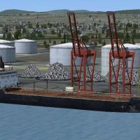
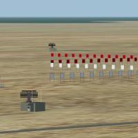
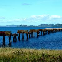
Handling the industrial shoreline of Battures de Beauport, this FSX scenery add-on lays photoreal ground textures with day/night and winter variants across Quebec City’s eastern port in Canada, ins…
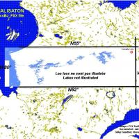
Covering the Québec–Baie-James hydro scheme zone, this FSX water upgrade redraws coastlines, lakes and river polygons with precise BGL vector data, aligning with 38 m LOD10 mesh for accurate elevat…

CYFJ Mont-Tremblant International scenery refresh for Microsoft Flight Simulator X brings the Laurentides airfield into current specs: revised ADE layout, corrected runway 02/20 geometry, re-charte…
Microsoft Flight Simulator X pilots charting Canada can add modest realism to British Columbia’s Saltspring Island with this Ganges Harbour package, refreshing shorelines, landclass and road vector…
CFB North Star V5 plants a fictional CYNS hub in Canada’s high Arctic, bringing four scenery variants, updated landclass, seasonal AI flight plans, LOD-efficient geometry, refined ramp markings, a …
Avian traffic comes to Canada’s rugged Bella Coola corridor with FSX “Birds Volume 7: The Gold Valley,” adding animated flocks, custom bird calls and seasonal AI behaviors to British Columbia’s for…
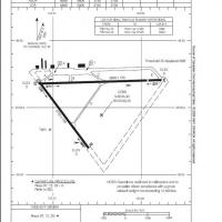
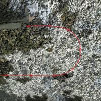
CYRV Revelstoke Airport in British Columbia, Canada—this Flight Simulator X scenery update corrects the pre-2006 heading data, sets runway 12/30 at 138° true, introduces medium edge lighting and ac…
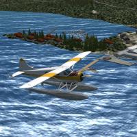
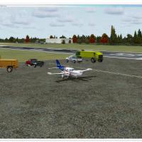
Manitoba Floatplane Bases adds 55 bush-flying destinations to FSX’s Canadian wilderness, delivering 36 water runways with dock starts, six heli pads and 13 gravel strips, plus fifteen bundled missi…
This Canada scenery plug-in for Microsoft Flight Simulator X (FSX) replicates Quebec’s Gaspé Peninsula with animated wind-power sites, detailed Percé Rock, Cap Gaspé lighthouse, and Mont Castor and…
CAT4 Qualicum Beach Airport scenery for Microsoft Flight Simulator X recreates this Vancouver Island BC coastal strip with custom landclass, updated forest-to-logging transitions, accurate runway a…

Comox Valley CYQQ for Microsoft Flight Simulator X refines the Vancouver Island hub with rebuilt taxiway signage, corrected and recentred ILS, accurate runway geometry and a consolidated .bgl packa…
Fraser Canyon’s rugged rim now sits under upgraded FSX autogen with this freeware depiction of Lillooet Airport (CAR3), bringing corrected runway thresholds, custom structures, tweaked landclass an…
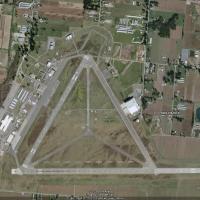
Canadian flyer package for CYRC Chicoutimi Airport drops a refined FSX / P3D scenery, adding the delta-pattern three-runway layout, functional NDB procedure, corrected apron geometry, parking stand…
FSX and Microsoft Flight Simulator X users planning domestic or trans-border sorties into British Columbia will find Abbotsford International CYXX in this scenery add-on quietly re-engineered with …
Covering Bathurst Airport CZBF in northern New Brunswick, this FSX scenery plug-in refreshes the 5,772-ft asphalt strip, updated taxiway layout, small GA apron with three stands, photoreal ground p…
Focusing on the former U.S. Naval Air Station Argentia (CWAR) in Newfoundland, this Microsoft Flight Simulator X scenery add-on rebuilds the twin-runway field, adjacent docks and Cold War support b…
Updated FSX rendition of Canada’s CZBB Boundary Bay Airport brings a repositioned control tower, extended 07/25 runway to 5,606 ft, added taxiway E, accurate VASI, crosswind support, revised aprons…
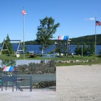
Lewisporte CYLE introduces a compact turf strip and sheltered waterway near Newfoundland’s Gander Bay, replacing default shorelines and adding previously missing lakes to Microsoft Flight Simulator…
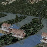
Covering Gouin Dam (CTP3) and the adjacent reservoir north of La Tuque, this FSX scenery add-on renders the hydroelectric structure, connected docks, sand strips, private chalets, Hydro-Québec faci…
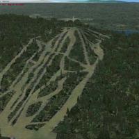
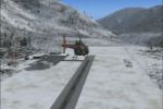
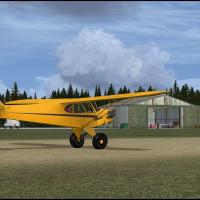
Tipella Lookout Station introduces a high-elevation STOL backcountry strip above Harrison Lake in British Columbia, offering a grass, uphill runway at 4,844 ft, custom Unicom 124.325, an unmarked h…