Courtenay’s CCS6 Smit Field scenery for FSX inserts a modest Vancouver Island grass strip with corrected coordinates, sloped terrain mesh, custom vegetation, optimized night lighting and parking fo…
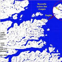
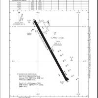
Saglek Airport CYSV for Microsoft Flight Simulator X depicts the sparse gravel strip on Labrador’s northern shore, featuring Cold-War radar relics, 279-foot elevation, 5 000-ft runway 17/35, ILS 11…
Freeware scenery download brings Prince Rupert Airport CYPR in British Columbia to FSX with satellite-aligned AFCAD, corrected runway geometry, re-surveyed aprons and parking, plus low-poly static …
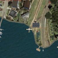
Indian Arm Day Park inserts a fictional floatplane facility into Vancouver’s coastal inlet, supplying a GPS-charted water runway, 225 kHz NDB, boat ramps, docks and shoreline structures for bush fl…
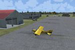
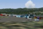
Covering the previously absent CSK8 King George Airpark in Surrey, British Columbia, this FSX (Microsoft Flight Simulator X) scenery add-on supplies a photoreal grass strip aligned with Fraser Rive…
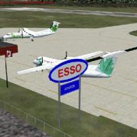
Bathurst’s CZBF airfield in northern New Brunswick gains an FSX-focused refresh, adding a linked fuel-truck route to the main stands, a widened apron sized for twin Air Canada Jazz Dash-8s, relocat…

This Microsoft Flight Simulator X (FSX) freeware add-on models the Davie Shipbuilding Yard at Lauzon, east of Quebec City, furnishing a distinctive VFR waypoint on the St. Lawrence River with custo…
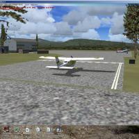
Covering Delta Heritage Airpark CAK3 just south of Vancouver, this FSX scenery add-on refreshes the 2,600-ft grass strip with accurate clubhouse, hangars, roundabout access and farmyard objects, al…
Addressing the tricky terrain of British Columbia’s Columbia Valley, this FSX scenery enhancement updates Vern Opperman’s CYCG Castlegar Airport add-on with corrected runway numbers, revised AFCAD …
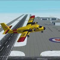
FSX CFB North Star V4 installs a fictional Arctic forces-civilian field at CYNS, adding crossed ILS runways, resized static objects, seasonal aurora lighting, snow-grade textures and coordinated AI…
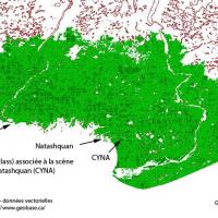
CYNA Natashquan for FSX refreshes this remote Québec coastal aerodrome with custom buildings drawn from 2009 on-site photos, photoreal ground textures, a functional rotating beacon and seamless ali…
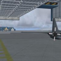
Built for Microsoft Flight Simulator X, CFB North Star (CYNS) introduces a fictional RCAF base to Canada’s high Arctic, with dual 12,500-ft concrete runways, bespoke hangars, service aprons and sta…
Anahim Lake CAJ4 scenery add-on for Microsoft Flight Simulator X refreshes this remote British Columbia bush aerodrome with custom timber hangars, static GA aircraft, forestry service assets, hand-…
Bush flyers navigating British Columbia’s northeastern ranges can slot this freeware FSX / FSX:Steam Edition upgrade of CBX7 Tumbler Ridge by Bob Caparoula into their scenery library; the package a…
Subtle upgrade for Microsoft Flight Simulator X pilots touring Canada’s CFB North Star (CYNS); this v7.1 detail patch refreshes hangar interiors, doubles open bays on A and B ramps, and reshapes mi…
Set down at Ranger 6000 ft Training Camp (SRTC), an austere bush strip carved into British Columbia’s spruce highlands, 65 NM east of Port Hardy CYZT and 164 NM north-west of Vancouver Intl CYVR; t…
Pilots exploring Canada’s Pacific Northwest can test STOL skills on eleven rough-hewn dirt strips threaded along the Kwinamass and Khutzeymateen valleys north of Prince Rupert; this FSX scenery tie…
Covering Cranbrook Airport CYXC in British Columbia, this quiet FSX scenery patch reworks Vern Opperman’s legacy FS2004 airfield with the latest runway extensions, updated ADE layout, corrected tax…
Serving bush pilots and VFR flyers, this freeware Les Grandes Bergeronnes CTH3 package for FSX and FS2004 adds a modest Quebec coastal airstrip with photoreal ground poly, two custom hangar structu…
FSX upgrade brings Boundary Airport (CZBB), British Columbia, into current charts with real-world runway 07/25 stretched to 5,606 ft, relocated tower viewpoint, new taxiway E, corrected signage, X-…