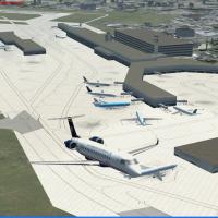
CYQB Jean-Lesage International for Microsoft Flight Simulator X brings Quebec’s primary airport up to date via a custom AFCAD, photoreal ground layer, detailed terminal, assorted FBO hangars, cargo…
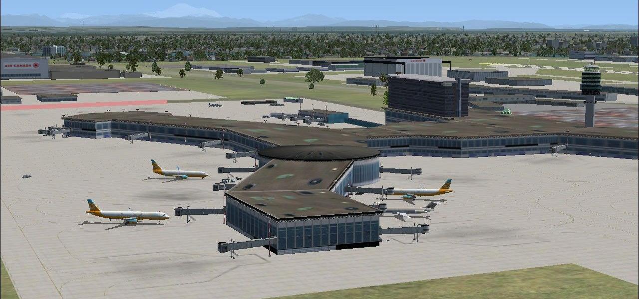
CYVR Vancouver International Airport AFCAD enhancement for FSX refines the default Canadian hub with current taxiway geometry, refreshed signage, realistic stands including an A380-sized gate, opti…
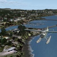
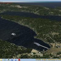
Serving British Columbia’s rugged coast, this FSX float-plane scenery refreshes over fifty coastal, inlet and river water aerodromes, calibrated to Ultimate Terrain Canada and SRTM mesh; pilots gai…
Covering Halifax Stanfield (CYHZ) in Microsoft Flight Simulator X, this reworked Nova Scotia package updates runway IDs 05/23 and 14/32, refines orientation, adds DME, custom FSX-SDK terminal, relo…
This regional package covers Victoria BC, the adjacent Southern Gulf Islands and the U.S. San Juan chain, delivering refined landclass, high-resolution mesh, custom autogen, detailed airports, floa…
Freeware FSX/FSX:Steam Edition add-on introduces AI whale animation along the Atlantic coast of Nova Scotia, Canada, positioning Microsoft default cetaceans on a SimConnect-driven loop from Halifax…
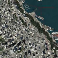
Covering Quebec City’s urban core, this FSX add-on layers 135 custom structures, CTJ2/CTJ5 heliports, CYQB-aligned objects, photoreal bridges such as Pierre-Laporte, an animated Montmorency cable c…
FSX AFCAD update for CYUL Pierre-Elliott-Trudeau, Quebec, refines gate coding, AI flow logic and runway usage, adds accurate ILS, RNAV and DME arcs, revised taxiway lighting and vehicle paths, expa…
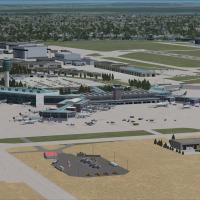
An updated AFCAD for Vancouver International Airport CYVR refines gate allocations and parking stands, aligns taxiway signage, extends Terminal D, inserts helipad starts, and offers optional cross-…

Refines default FSX parking with 15 AFX layout files covering Toronto Pearson CYYZ, Montreal CYUL, Halifax CYHZ and additional civil-military Canadian fields; accurate gate georeference, airline p…
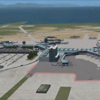
For Canada-bound flyers, this FSX rendition of Victoria International Airport (CYYJ) refreshes the British Columbia hub with photoreal ground poly, aligned taxiways, dual jetways at the main concou…
Adding animated and static BC Ferries to FSX along the rugged Canadian British Columbia coast, this Orbx-ready add-on complements PNW or PFJ regions with five accurately scaled vessels, 47 terminal…
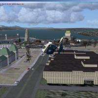
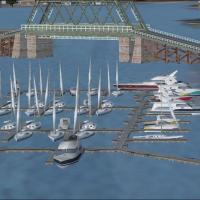
Covering Metro Vancouver, this FSX-native ‘Vancouver Extras’ scenery adds rooftop and dockside helipads, cargo traffic, escort-flanked carrier groups, cruise liners, and northern marinas, all geore…
Covering Deline, Tulita, Norman Wells and Fort Good Hope in Canada’s Northwest Territories, this FSX scenery package rebuilds each gravel strip with custom 3-D structures and photoreal textures, al…
Covering urban Montreal in FSX, this VFR package by Sylvain Tremblay introduces custom Olympic pyramid models, the Mount Royal cross, St-Lambert lock structures and refined roadway vectors atop the…
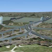
Covering Montreal’s south-shore corridor, this FSX VFR add-on brings the Champlain and Honoré-Mercier spans, St-Lambert locks, Olympic Pyramid, and the Mount Royal beacon cross into sharp focus, al…
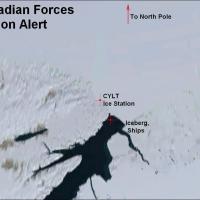
This Canada-category scenery mod overhauls Canadian Forces Station Alert (CYLT) for FSX, refining coordinates, gravel runway 05/31 profiles, NAVAIDs, and helipad spots while adding ice-station buil…
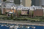
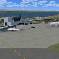
Detailed FSX scenery download re-creates Victoria Inner Harbor Water Airport (CYWH) on Canada’s Pacific coast, adding accurate floatplane docks, water runways, start points, static DHC-3/DHC-6 mode…
Covering Quebec’s vast hydrological network, this FSX-only package layers re-drawn lakes, rivers and coastal lines across five BGL sets, built around 38 m LOD10 mesh for precise shore alignment; op…

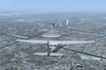
Covering the rugged shoreline of Quebec’s Gaspé Peninsula, this FSX package recreates Sea Lion Air Service’s post-war routes from Sainte-Anne-des-Monts in a vintage C-47, adding bush strips, tide-l…