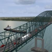
Covering the St. Lawrence River crossing between Trois-Rivières and Bécancour, this FSX scenery by Gilles Boily injects a photo-real Laviolette Bridge landmark via 10 custom BGL objects and 17 text…
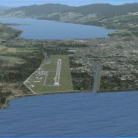
CYXS Prince George for FSX offers a revamped aerodrome built from current satellite data: the 11,450-ft runway 15/33 with dual ILS and LED centerline lighting, corrected AFCAD geometry, new aprons,…
Rough-cut strips and floatplane docks line the Kwinamass River valley and Pacific inlets north of Prince Rupert, built for FSX with Ultimate Terrain Canada. Suited to VFR bush hops in ultralights, …
Gatineau Airport CYND for FSX SP2 delivers a freeware Canadian scenery update with photoreal ground polys, refined AFCAD parking, accurate NAV aids, seasonal texture sets and subdued dynamic lighti…
This FSX / Microsoft Flight Simulator X add-on, compiled in ADEX and supplied as BGL files, updates CYYG Charlottetown Airport, Prince Edward Island, with corrected runway alignment, custom termina…

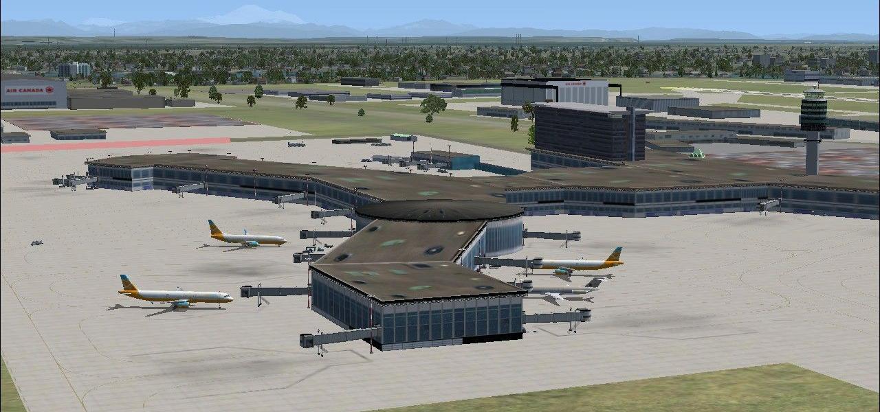
Targeted at Microsoft Flight Simulator X users, this CYXD addon reflects Edmonton City Center Airport’s current single-runway layout, closing 12/30, redrawing taxi links, adding east-apron parking,…
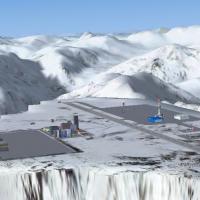
CYCG Castlegar for Microsoft Flight Simulator X converts Vern Opperman’s earlier FS2004 build, reshaping terrain meshes, realigning ground polygons and AFCAD data for steady performance within Brit…
CYSN Niagara District Airport for Microsoft Flight Simulator X recreates the St. Catharines field on the Canadian side of Niagara Falls with an overhauled AFCAD file, accurate taxiway geometry, cor…

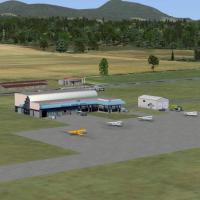
This FSX scenery for CAM3 Duncan, British Columbia inserts the gravel-plateau strip, adjacent quarry operations and Cowichan Valley context into Orbx PNW, supplying café, extra hangars, apron light…
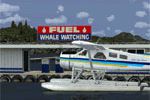
Port McNeill for FSX inserts a photoreal CAM8 seaplane aerodrome and CBM9 hospital helipad along British Columbia’s Vancouver Island coast, aligned to Orbx FTX Pacific Northwest terrain; custom pie…
Adapted by P. Nigel Grant, this FSX conversion of John Stinstrom and Ray Lunning’s FS2004 Penticton Airport (CYYF) replaces outdated AFCADs with ADE-recompiled layouts, corrects landclass bleed via…
Blending a 6,800 ft alpine strip and adjacent urban textures on the Alaska–British Columbia frontier, this FSX add-on positions the fictitious CYMN “Mountain Top” airfield amid custom terrain mesh,…

Red Bull Air Race Windsor adds a geo-accurate pylon course and revised AFCAD data along the Detroit River opposite CYQG, giving FSX pilots a realistic low-altitude aerobatic circuit. Siscot Yves’ f…

This FSX Canada Day Fireworks Project injects timed pyrotechnic FX at over thirty co-ordinates nationwide—Victoria harbour, Vancouver inlet, Parliament Hill, Niagara Gorge and other British Columbi…
Covering CYGR Iles-de-la-Madeleine Airport in FSX, this Canadian add-on refines the Havre-aux-Maisons apron, five GA stands and adjoining vehicle lot, aligning layout with current NAV Canada data a…
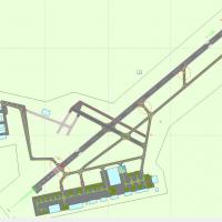
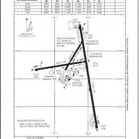
Updated CYTR layout for FSX / Microsoft Flight Simulator X aligns runways and taxi routes to current satellite data, closes 13/31 per NOTAM, removes Quinte Terminal civil stands, adds RCAF spots fo…
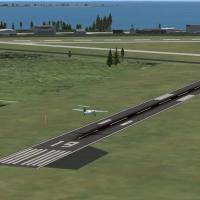
Covering CYCD, this Microsoft Flight Simulator X add-on re-creates Nanaimo-Collishaw Airport with precise terminal geometry, custom ground polygon work, revised landclass for Vancouver Island's for…
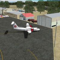
FSX pilots needing a lightweight freeware add-on will appreciate this Kingston Airport (CYGK) enhancement for Ontario: default-library assets refresh apron markings, generic hangars, taxiway signs,…
Covering St-Hyacinthe Aerodrome (CRM3) in southern Québec, this FSX/Acceleration scenery refreshes apron geometry with a revised AFCAD, default-library hangars, photoreal vegetation and the signatu…
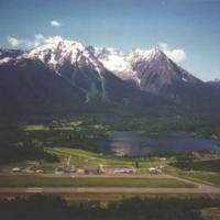
Smithers Regional Airport (CYYD) scenery for FSX recreates the British Columbia gateway with accurate apron geometry, object-placement-tool buildings, aligned navaids and compatible AFCAD, pairing …