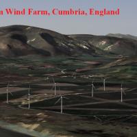
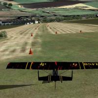
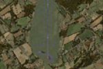
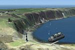
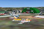
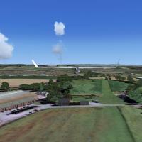
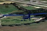
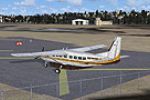
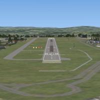
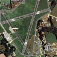
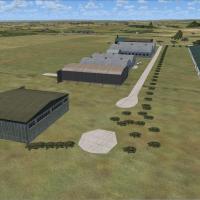
United Kingdom

Page 14

Preview screenshot

Falgunzeon For Neil's Microlights

South-west Scotland’s Falgunzeon strip depicts the Dumfries and District Gliding Club in FSX; tailored to Playsim Scottish Scenery, it provides a short grass runway, rural autogen, photoreal terrain, accurate elevations, recognisable VFR reference points and seamless integration with UKVFR, Acceleration and all four Neil’s Microlights volumes.

File Size
4.75 MB
Total Downloads
149
Star Rating
1/5
Preview screenshot

Fishburn Airfield

Fishburn Airfield (ICAO XFSH) introduces a compact general-aviation strip to County Durham, supplying photoreal grass runway textures, bespoke hangars, perimeter scenery, and corrected elevation data for Microsoft Flight Simulator X pilots charting VFR circuits across North-East England; useful as a light-aircraft staging post, microlight practice base, or helicopter training node.

File Size
3.62 MB
Total Downloads
146
Star Rating
2/5
Screenshots
1
Preview screenshot

EGCW Welshpool Airport

Welshpool’s EGCW airfield for Microsoft Flight Simulator X marries Horizon GenX photoreal terrain and mesh with a refreshed AFD, bespoke hangars, apron detail and optional tree autogen, creating a low-level VFR waypoint for Mid-Wales general aviation; scenery relies on Runway12 and UK VFR object libraries and should replace any UK2000 flatten.

File Size
482.56 KB
Total Downloads
145
Star Rating
1/5
Screenshots
1
Preview screenshot

Walney Island

FSX rendition of Barrow/Walney Island Airport (EGNL/BWF) in Cumbria brings a correct triangular runway grid, Google-Earth-aligned taxiways, custom AFCAD, and accurately placed hangars reflecting BAE Systems operations and Lakes Gliding Club soaring sorties; ideal for short-field practice over Morecambe Bay within Microsoft Flight Simulator X UK scenery libraries.

File Size
297.71 KB
Total Downloads
143
Star Rating
1/5
Screenshots
1
Preview screenshot

Stoke EG93

Stoke EG93 microlight strip for Microsoft Flight Simulator X renders the Kent hillside aerodrome with its curved, sloping grass runway, adjacent power lines and rail track, static GA aircraft, animated windsock and active CTAF, authored in Gmax; a compact VFR short-field challenge for bush pilots touring England’s South-East.

File Size
4.53 MB
Total Downloads
142
Screenshots
1
No image available.

St. Kilda

Restores the remote St Kilda islands to FSX, inserting detailed coastlines, landclass, and elevation data via CVX polygons, plus a custom AFD-defined strip (EGSZ) and library object placement for basic infrastructure; ideal for GA sightseeing legs and VFR navigation along Scotland’s Outer Hebrides Atlantic approaches in this freeware add-on.

File Size
6.57 KB
Total Downloads
139
Screenshots
1
Preview screenshot

Cheshire Microlight School

Arclid’s grass strip, base of Cheshire Microlight School in rural Cheshire, is reproduced for FSX in this freeware scenery add-on, blending photoreal ground textures, custom autogen, hand-placed hangars, accurate 02/20 turf runway markings and nearby A50 traffic, giving UK VFR pilots a solid navigation reference when flying ultralight circuits or cross-country legs in Microsoft Flight Simulator X.

File Size
3.37 MB
Total Downloads
138
Screenshots
1
Preview screenshot

Linley Hill

Linley Hill for FSX pairs neatly with Horizon GenX Vol 3, dropping a detailed rendition of the Hull Aero Club’s grass strip north-east of Beverley into your UK VFR library. Animated ground traffic, bespoke hedgerows, season-aware autogen and accurate AFCAD give light-GA and microlight flyers precise circuit references.

File Size
649.68 KB
Total Downloads
137
Screenshots
2
Preview screenshot

Forwood Farm For Neil's Microlights

Forwood Farm, a compact Nottinghamshire grass strip (alignment 02/20, 500 × 27 m), offers a subtle VFR testbed for Microsoft Flight Simulator X microlight and light-GA flyers, using Neil’s Microlights object library to inject farm buildings, hedgerows and British countryside cues atop default ground polys.

File Size
13.3 MB
Total Downloads
135
Star Rating
1/5
Screenshots
1
No image available.

Lumb In Rossendale Private Strip

Lumb in Rossendale Private Strip drops a windswept, 900-ft-elevation Pennine grass runway into your Flight Simulator X or Prepar3D map, complete with custom farm outbuildings, detailed topography, Peel Tower landmark and a 200.10 kHz NDB to aid UK VFR approaches, offering short-field, bumpy-turf practice for light GA aircraft.

File Size
15.66 MB
Total Downloads
132
Screenshots
1
Preview screenshot

Nostell Priory

FSX Nostell Priory Scenery places the National Trust estate near Wakefield into Microsoft Flight Simulator X, aligned for Horizon VFR Photographic Scenery Generation X Vol 3 with 2.4 m orthoimagery and 5 m mesh, depicting the Georgian house, stables, menagerie and pyramid gatehouse; also functions in FS2004 for pilots refining low-level UK VFR skills across West Yorkshire.

File Size
2.11 MB
Total Downloads
132
Screenshots
2
Preview screenshot

Manpubx

This FSX-only Manpubx scenery plants the famed pub beside Manchester International’s runway 23R (EGCC), giving virtual aviators a realistic reference point for final approach, spotter-area detail, outdoor tables, night lighting and accurate geolocation—ideal for VFR circuits, screenshot sessions or traffic pattern practice across northwest England.

File Size
12.13 MB
Total Downloads
130
Screenshots
1
Preview screenshot

Freshwater Microlight Strip

Freshwater Microlight Strip brings a modest yet accurate grass airfield to Microsoft Flight Simulator X, utilising Neil’s Microlights South-East object library and UK VFR data to anchor hangars, windsock, and coastline autogen to real-world coordinates; a compact BGL scenery ideal for ultralight circuits, short-field GA practice, and low-level sightseeing around the Isle of Wight.

File Size
8.9 MB
Total Downloads
127
Screenshots
1
No image available.

ADE File For EGLC

This UK scenery enhancement supplies an updated ADE file for London-City Airport (EGLC), reshaping taxiway geometry, runway links and apron surfacing to match current Google Earth data; it also introduces custom landclass, photo-real ground compatibility and additional static ramp objects for a sharper FSX airfield depiction.

File Size
7.38 KB
Total Downloads
126
Screenshots
1
Preview screenshot

Traffic Files For The OS Enhancement Pack

Augments United Kingdom VFR Generation X photoreal coverage by reinstating the AI traffic component omitted from the original O&S Enhancement Pack; Norman Dean’s compiled BGLs inject scheduled airline legs, GA circuits and realistic traffic density across British aerodromes in Microsoft Flight Simulator X or FSX: Steam Edition, aligning perfectly with existing scenery library coordinates.

File Size
12.08 KB
Total Downloads
125
Screenshots
1
Preview screenshot

Breighton AB

Breighton Airfield scenery add-on for FSX SP1 positions the former RAF strip (EGNY) near York, UK with default-library assets, authentic runway profiles, hangar rows, grass hardstand and rural VFR context for the flight simulator. Lightweight EXE installer and matching uninstaller streamline management.

File Size
1.81 MB
Total Downloads
123
Screenshots
2
Preview screenshot

Oxenhope Grass Strip

Oxenhope Grass Strip recreates the high-moor microlight site above West Yorkshire at roughly 1,100 ft AMSL, offering FSX users two grass runways—06/25 (250 m) and 11/29 (450 m)—both uphill, uneven and bordered by dry-stone walls. Custom terrain mesh, the Ovenden Moor wind-farm array and NDB 200.1 round out a realistic short-field GA and bush-flying training venue.

File Size
1.57 MB
Total Downloads
123
Screenshots
2
No image available.

Orwell Bridge

Adds a custom 3-D model of Orwell Bridge spanning the River Orwell outside Ipswich, Suffolk, giving FSX pilots a recognizable waypoint for VFR routing across eastern England. The lightweight object integrates seamlessly with default terrain, requiring no extra libraries, and enhances UK scenery accuracy without impacting frame rates.

File Size
11.98 MB
Total Downloads
122
Screenshots
2
Preview screenshot

London/Halton

FSX London/Halton scenery transforms RAF Halton (EGWN) on London’s north-west fringe into a small executive hub, adding twin asphalt runways (02/20 4,500 ft ILS 110.55; 08/26 2,800 ft plus 800 ft over-run), parallel grass strips, extra stands, wooded perimeters and static GA traffic for low-level VFR sorties.

File Size
1.87 MB
Total Downloads
118
Screenshots
2
Preview screenshot

Lower Upham

Covering Hampshire’s rural Lower Upham airfield, this FSX scenery add-on slots neatly into Neil’s Microlights South-East package, adding a photoreal grass runway, accurate threshold markers and bespoke hangars for realistic microlight and GA circuits. Designed for Microsoft Flight Simulator X with UK VFR data, it enriches south-coast navigation and short-field training hops north of the Isle of Wight.

File Size
6.01 MB
Total Downloads
117
Star Rating
1/5
Screenshots
1

16 pages with 309 downloads.

previous12345678910111213141516next